piper01
Member
- Joined
- Oct 27, 2013
- Messages
- 182
April 12-13, 2015
Part 4 of 4 of the New Mexico portion of my roadtrip last spring
****
I had debated whether to visit Chaco NHP, since I had seen it before (though nearly a decade prior), or to skip it and visit new areas. Chaco is spectacular and well worth multiple visits though, so I'm glad I decided to include it.
I rolled into the park's campground in the late Sunday afternoon. The campground was only a third full and I had no trouble grabbing a spot, but I imagine on Friday and Saturday nights it fills up since there's nowhere else around to camp. After setting up my tent, I still had another hour and a half before sunset. The gates on the loop drive through the park didn't close until dusk, so I grabbed my camera, jumped back in the car, and was off!
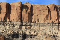
Cool stratigraphy.
My first stop along the road was the Hungo Pavi site. Few people were out on a Sunday evening, so I had it all to myself.
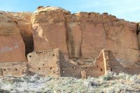
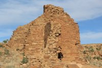
Next I moved on to the larger Chetro Ketl complex. As luck would have it, I also had this site all to myself.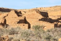
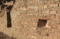
The complex was remodeled throughout the time it was used, closing off this doorway.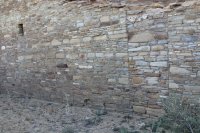
As the sun continued its descent, he wall of the great kiva glowed a vibrant red.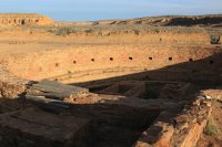
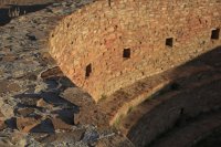
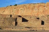
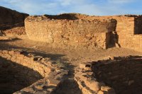
I basked in the light, giddy that I was the only person seeing this beauty.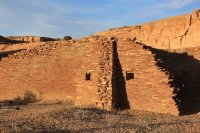
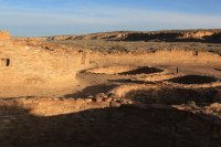
In the silence, I heard wings flapping as a bird flew overhead.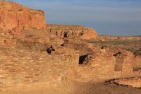
The walls glowed even brighter in the late afternoon sun.
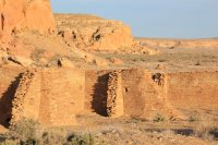
The walls not lit up by the sun were a dull brown. I liked this photo, originally in color, better in grayscale. In the future, I'll have to remember to try taking black and white shots.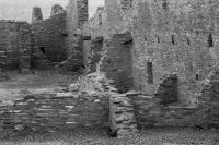
I see a face in the wall every time I look at this picture.
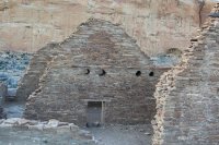
The cliff glowed so brightly for several minutes, it looked like it was on fire.
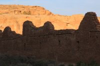
The light faded all too quickly as the sun sank below the mesa top.
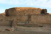
The last of the light signaled that it was time to return to camp for dinner and a snooze.
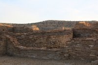
I broke camp camp early the next morning, stopped by the visitor center, then retraced the loop road from the night before, this time stopping at Pueblo Bonito. Unlike the previous night, I didn't have the site all to myself, but the few people there at that time were spread out across the site, so it was the next best thing to solitude.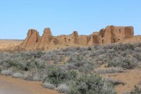
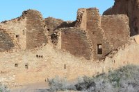
The walls were at least three stories tall. It must have taken an immense amount of work to construct them, especially with as thick as the lower walls had to be to support the weight above them.
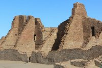
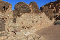
View from the inside
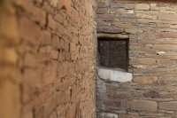
Holes for support beams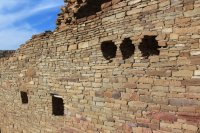
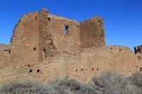
Each complex was spaced about a half mile away from the previous one. Here's the view from Pueblo Bonito to the next one over.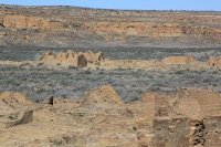
A rock fall from the cliff face behind Pueblo Bonito destroyed part of the complex, though after the site had been abandoned.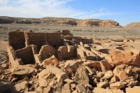
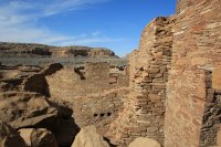
This exterior wall must have been immense when it was intact.
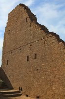
I puzzled over why one side of this opening ended in a smooth edge, while the other was jagged.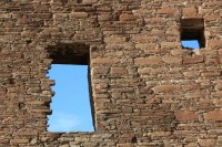
The complex was enormous, originally containing over 600 rooms and covering 3 acres.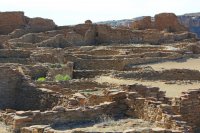
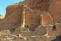
View from inside a room. Imagine how dark it would have been with no exterior windows when the ceiling was in place.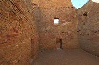
Original support beams, dating from between AD 850-1250. Nearly a thousand year old logs! Also note the remodeled doorway, partially filling it in. I wonder why?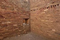
Shall I go left, or shall I go right?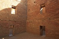
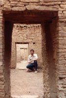
Doorways.
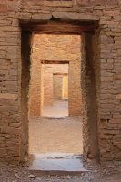
I was enamored with the "windows" in the corners of rooms. I don't think I've seen architecture like it anywhere else.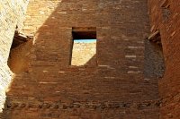
Modern plaster on the walls, re-creating what a room may have originally looked like. I don't recall if the ceiling beams were modern or original.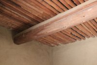
More doorways.
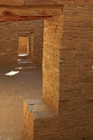
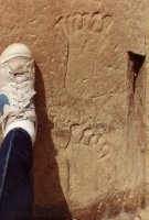
Next I visited the petroglyphs engraved on the cliff, between Chetro Ketl and Pueblo Bonito.
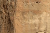
After that, I was ready for the ~5.4 mile loop hike on the mesa above.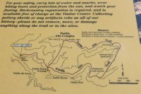
Kin Kletso complex, before climbing up the mesa.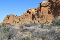
Kin Kletso from above.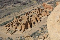
And finally, Kin Kletso from further along the mesa top. (I stopped at the Pueblo Bonito overlook before continuing on, but my pictures from my second stop there at the end of the hike turned out better, so they'll be posted later).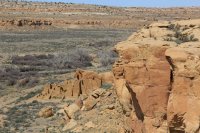
I was on bird level.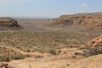
New Alto complex.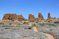
I love the shape of this opening.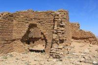
View of New Alto from the older Pueblo Alto site.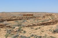
The second half of the hike provided great views into the valleys.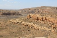
Trace fossils! Casts and molds of burrows from a shrimplike crustacean digging on the shallow ocean floor near the shoreline of the Cretaceous Interior Seaway. (77 mm lens cap for scale)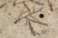
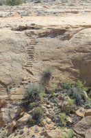
Chacoan stairs carved in the cliff face. The road network cut north-south across the terrain, rather than following easier routes around obstacles.
Look closely at the rocks as you hike, and you'll see more fossils. (approximately fingernail-size for reference)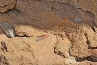
I found a clam bed!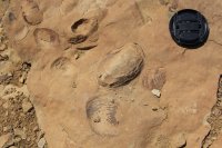
Chetro Ketl in the foreground, with Pueblo Bonito next to the cliff on the right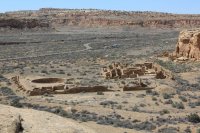
Chetro Ketl from a different angle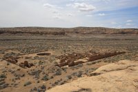
And more Chetro Ketl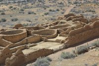
Pueblo Bonito growing closer as I near the end of the hike.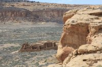
And finally, the Pueblo Bonito complex from above. The walls seemed immense as I stood next to them at ground level, but it's difficult to truly grasp the scale of the site until you see it all at once. Absolutely spectacular.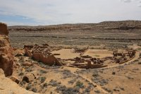
Part 4 of 4 of the New Mexico portion of my roadtrip last spring
****
I had debated whether to visit Chaco NHP, since I had seen it before (though nearly a decade prior), or to skip it and visit new areas. Chaco is spectacular and well worth multiple visits though, so I'm glad I decided to include it.
I rolled into the park's campground in the late Sunday afternoon. The campground was only a third full and I had no trouble grabbing a spot, but I imagine on Friday and Saturday nights it fills up since there's nowhere else around to camp. After setting up my tent, I still had another hour and a half before sunset. The gates on the loop drive through the park didn't close until dusk, so I grabbed my camera, jumped back in the car, and was off!
Cool stratigraphy.

My first stop along the road was the Hungo Pavi site. Few people were out on a Sunday evening, so I had it all to myself.


Next I moved on to the larger Chetro Ketl complex. As luck would have it, I also had this site all to myself.


The complex was remodeled throughout the time it was used, closing off this doorway.

As the sun continued its descent, he wall of the great kiva glowed a vibrant red.


I basked in the light, giddy that I was the only person seeing this beauty.


In the silence, I heard wings flapping as a bird flew overhead.

The walls glowed even brighter in the late afternoon sun.

The walls not lit up by the sun were a dull brown. I liked this photo, originally in color, better in grayscale. In the future, I'll have to remember to try taking black and white shots.

I see a face in the wall every time I look at this picture.

The cliff glowed so brightly for several minutes, it looked like it was on fire.

The light faded all too quickly as the sun sank below the mesa top.

The last of the light signaled that it was time to return to camp for dinner and a snooze.

I broke camp camp early the next morning, stopped by the visitor center, then retraced the loop road from the night before, this time stopping at Pueblo Bonito. Unlike the previous night, I didn't have the site all to myself, but the few people there at that time were spread out across the site, so it was the next best thing to solitude.

The walls were at least three stories tall. It must have taken an immense amount of work to construct them, especially with as thick as the lower walls had to be to support the weight above them.


View from the inside

Holes for support beams


Each complex was spaced about a half mile away from the previous one. Here's the view from Pueblo Bonito to the next one over.

A rock fall from the cliff face behind Pueblo Bonito destroyed part of the complex, though after the site had been abandoned.


This exterior wall must have been immense when it was intact.

I puzzled over why one side of this opening ended in a smooth edge, while the other was jagged.

The complex was enormous, originally containing over 600 rooms and covering 3 acres.


View from inside a room. Imagine how dark it would have been with no exterior windows when the ceiling was in place.

Original support beams, dating from between AD 850-1250. Nearly a thousand year old logs! Also note the remodeled doorway, partially filling it in. I wonder why?

Shall I go left, or shall I go right?

Doorways.

I was enamored with the "windows" in the corners of rooms. I don't think I've seen architecture like it anywhere else.

Modern plaster on the walls, re-creating what a room may have originally looked like. I don't recall if the ceiling beams were modern or original.

More doorways.

Next I visited the petroglyphs engraved on the cliff, between Chetro Ketl and Pueblo Bonito.

After that, I was ready for the ~5.4 mile loop hike on the mesa above.

Kin Kletso complex, before climbing up the mesa.

Kin Kletso from above.

And finally, Kin Kletso from further along the mesa top. (I stopped at the Pueblo Bonito overlook before continuing on, but my pictures from my second stop there at the end of the hike turned out better, so they'll be posted later).

I was on bird level.

New Alto complex.

I love the shape of this opening.

View of New Alto from the older Pueblo Alto site.

The second half of the hike provided great views into the valleys.

Trace fossils! Casts and molds of burrows from a shrimplike crustacean digging on the shallow ocean floor near the shoreline of the Cretaceous Interior Seaway. (77 mm lens cap for scale)

Chacoan stairs carved in the cliff face. The road network cut north-south across the terrain, rather than following easier routes around obstacles.

Look closely at the rocks as you hike, and you'll see more fossils. (approximately fingernail-size for reference)

I found a clam bed!

Chetro Ketl in the foreground, with Pueblo Bonito next to the cliff on the right

Chetro Ketl from a different angle

And more Chetro Ketl

Pueblo Bonito growing closer as I near the end of the hike.

And finally, the Pueblo Bonito complex from above. The walls seemed immense as I stood next to them at ground level, but it's difficult to truly grasp the scale of the site until you see it all at once. Absolutely spectacular.


