Captainricco
New Member
- Joined
- May 10, 2024
- Messages
- 2
My first backpacking in Capitol Reef, May of 2024. I've spent over a year researching the so called "Beehive Traverse", originally pioneered by Steve Howe, and well documented by Wasatch Will and Jamal on Youtube, as well as their extensive blog posts and write ups. I spent two days in Upper Muley Twist, and another day backpacking the easy, southern part of the Traverse, a cross country portion across the beautiful slick rock with views of the valley, and Pleasant Creek.
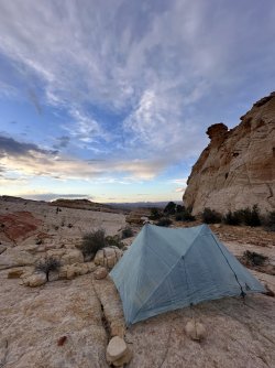
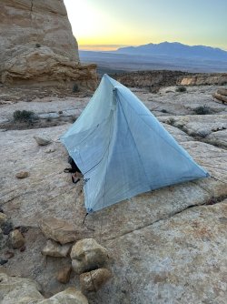
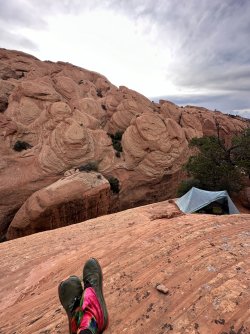
I packed my Durston Xmid Pro 1P for the trip, which allowed me to learn some extra valuable lessons on slick rock camp plus desert wind, plus trekking pole tent. Since I set up in the Upper Muley Twist canyon night one, I had relatively no wind. When I set up high on the slick rock on night two, a prevailing wind arrived from the West and became constant throughout much of the night. The rocks in this area can be especially light/porous for their size. My first set up blew over and I learned that I needed much *larger* , and multiple rocks to keep the tent up. When rain is absolutely not in the forecast (0%), and I've studied the current weather pattern enough, I now set up with a bivy, if desert camping, as a way of cowboy camping with wind protection.
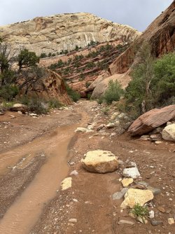
Additionally, weather reports can be a bit unreliable in this area. Although little to no rain was forecast, I experienced a few, quick, afternoon thunderstorms. I checked the flash flood warning for the area at this time, which showed as unlikely. In Upper Muley Twist, as thunder banged throughout the canyon, I watched as waterfalls seemingly formed from nowhere and poured down canyon walls and began to fill the wash! I was constantly aware of the width of the trail I as currently traversing, as well as near accessible high points. This was before the dreaded monsoon season.
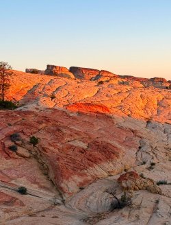
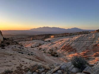
Upper Muley Twist was amazing day 2- coming up onto the "reef" that overlooks the water pocket fold was absolutely stunning, and some of my fondest scenery since moving to Utah. The beehive traverse portion that I did showcased incredible sunrise and sunset hues on the different shades of slick rock ever present. Eventually will be completing the entire Beehive Traverse.
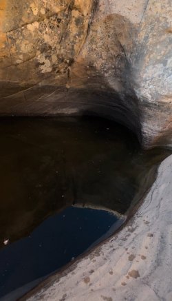
Good to know: BLM land borders the park from the East, where the Notom-Bullfrog Road runs. I car camped there the night before my trip, and parked my vehicle here with no issues. Water was available (not guaranteed) in several of the *massive* potholes in the slick rock of the Traverse. Upper Muley was bone-dry, however. The rangers were...interesting to work with...on securing a permit for the backcountry. The one was very concerned about where my exact location would be at all times. He was only satisfied after I wrote down some GPS coordinates on potential campsites....LOL. I think they are used to folks camping on established trails.
Feel free to PM for any tips or questions!
View of Waterpocket Fold from slick rock crest, Upper Muley.
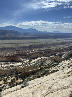
Southernmost Portion of "Beehive Traverse":
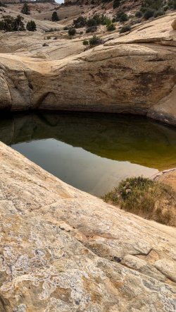
Large Pothole #1 - It was cool to see 'Tadpole Shrimp' swimming around in here!
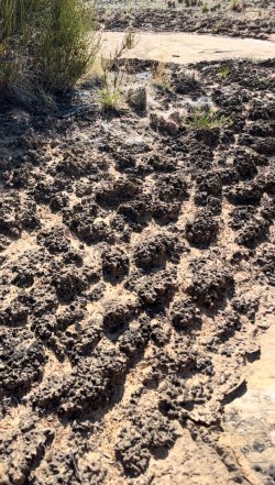
Cryptobiotic Soil - Leave no Trace. Avoid stepping on this beautiful desert organism conglomerate!
Slickrock Wash and Pothole #2
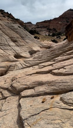
Beautiful sunrise and sunset hues on Golden Throne, Henry Mountains, and Slickrock Washes.
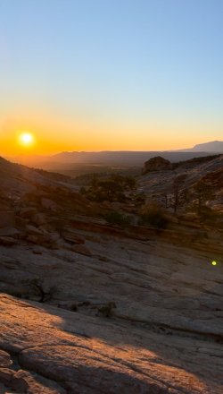
View of Pleasant Creek:
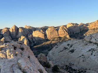
Camp for the night. Durston Xmid: 0, Wind: 1
The wind was SO strong at night. Beautiful view of Henry Mountains.
Upper Muley Twist:
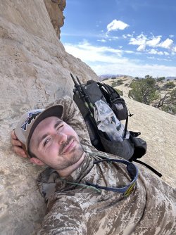
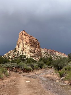
View looking North to the "Beehive"
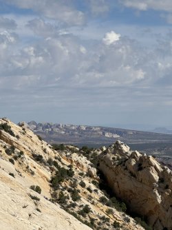
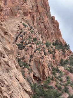
Formations of Upper Muley Twist
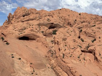
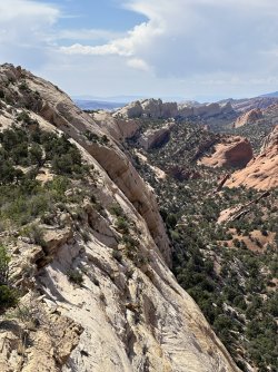
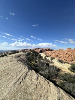
Camped on this ledge overlooking incredible rock formations.
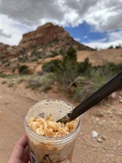
Cold Soak Mac. Yum
Some afternoon thunder, rain in Upper Muley Twist:
I packed my Durston Xmid Pro 1P for the trip, which allowed me to learn some extra valuable lessons on slick rock camp plus desert wind, plus trekking pole tent. Since I set up in the Upper Muley Twist canyon night one, I had relatively no wind. When I set up high on the slick rock on night two, a prevailing wind arrived from the West and became constant throughout much of the night. The rocks in this area can be especially light/porous for their size. My first set up blew over and I learned that I needed much *larger* , and multiple rocks to keep the tent up. When rain is absolutely not in the forecast (0%), and I've studied the current weather pattern enough, I now set up with a bivy, if desert camping, as a way of cowboy camping with wind protection.
Additionally, weather reports can be a bit unreliable in this area. Although little to no rain was forecast, I experienced a few, quick, afternoon thunderstorms. I checked the flash flood warning for the area at this time, which showed as unlikely. In Upper Muley Twist, as thunder banged throughout the canyon, I watched as waterfalls seemingly formed from nowhere and poured down canyon walls and began to fill the wash! I was constantly aware of the width of the trail I as currently traversing, as well as near accessible high points. This was before the dreaded monsoon season.
Upper Muley Twist was amazing day 2- coming up onto the "reef" that overlooks the water pocket fold was absolutely stunning, and some of my fondest scenery since moving to Utah. The beehive traverse portion that I did showcased incredible sunrise and sunset hues on the different shades of slick rock ever present. Eventually will be completing the entire Beehive Traverse.
Good to know: BLM land borders the park from the East, where the Notom-Bullfrog Road runs. I car camped there the night before my trip, and parked my vehicle here with no issues. Water was available (not guaranteed) in several of the *massive* potholes in the slick rock of the Traverse. Upper Muley was bone-dry, however. The rangers were...interesting to work with...on securing a permit for the backcountry. The one was very concerned about where my exact location would be at all times. He was only satisfied after I wrote down some GPS coordinates on potential campsites....LOL. I think they are used to folks camping on established trails.
Feel free to PM for any tips or questions!
View of Waterpocket Fold from slick rock crest, Upper Muley.

Southernmost Portion of "Beehive Traverse":
Large Pothole #1 - It was cool to see 'Tadpole Shrimp' swimming around in here!

Cryptobiotic Soil - Leave no Trace. Avoid stepping on this beautiful desert organism conglomerate!

Slickrock Wash and Pothole #2


Beautiful sunrise and sunset hues on Golden Throne, Henry Mountains, and Slickrock Washes.


View of Pleasant Creek:

Camp for the night. Durston Xmid: 0, Wind: 1
The wind was SO strong at night. Beautiful view of Henry Mountains.


Upper Muley Twist:

View looking North to the "Beehive"

Formations of Upper Muley Twist


Camped on this ledge overlooking incredible rock formations.


Cold Soak Mac. Yum

Some afternoon thunder, rain in Upper Muley Twist:


Last edited:
