NateGeesaman
Donkey
- Joined
- Jan 20, 2012
- Messages
- 272
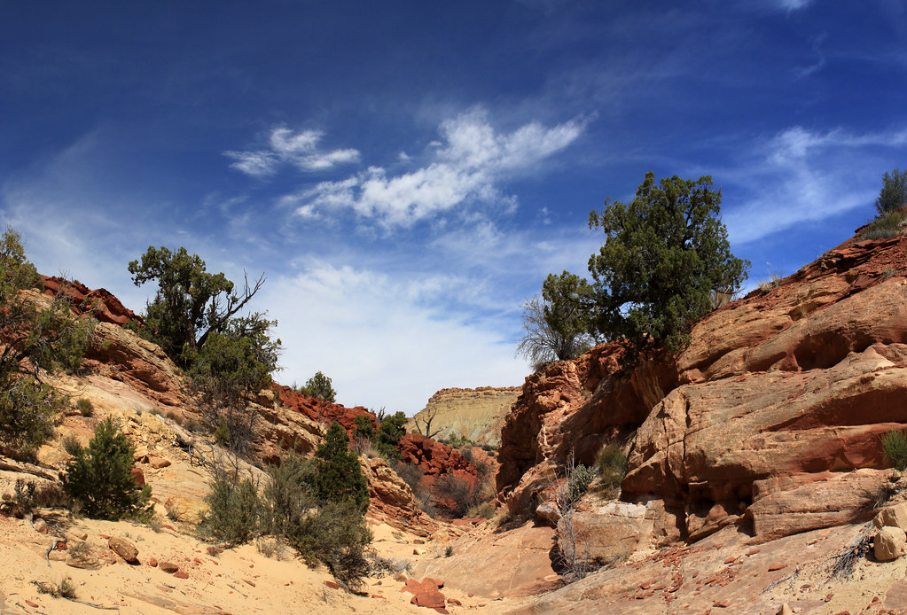
I have been to Capitol Reef many more times than any other camping destination, but when that perfect spring weather hits the desert I was only thinking of Capitol Reef and hiking Upper Muley's Twist Canyon. I left Salt Lake around 6:00 AM so as to have a full day in the park before setting up camp. I arrived in record time to a beautiful partly cloudy spring day.
My first destination was the waterfall in the Northern end of the park where I learned that I bought the wrong neutral density filter (not dark enough for bright sun).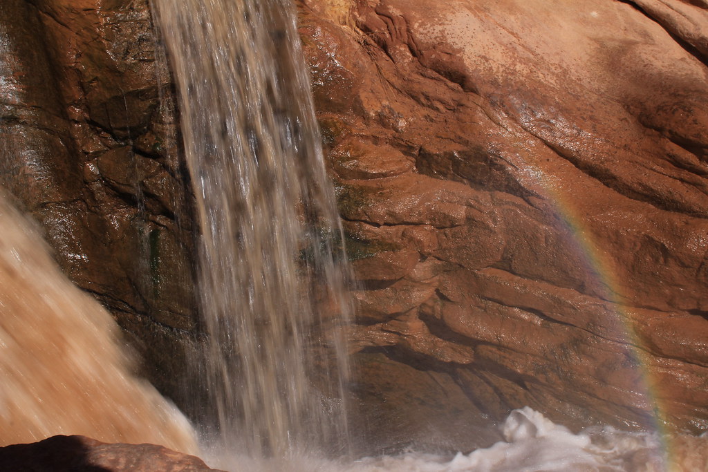
IMG_0711 by NateGeesaman, on Flickr
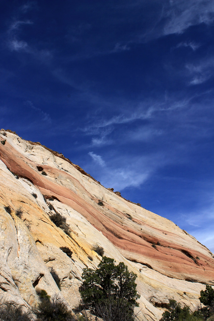
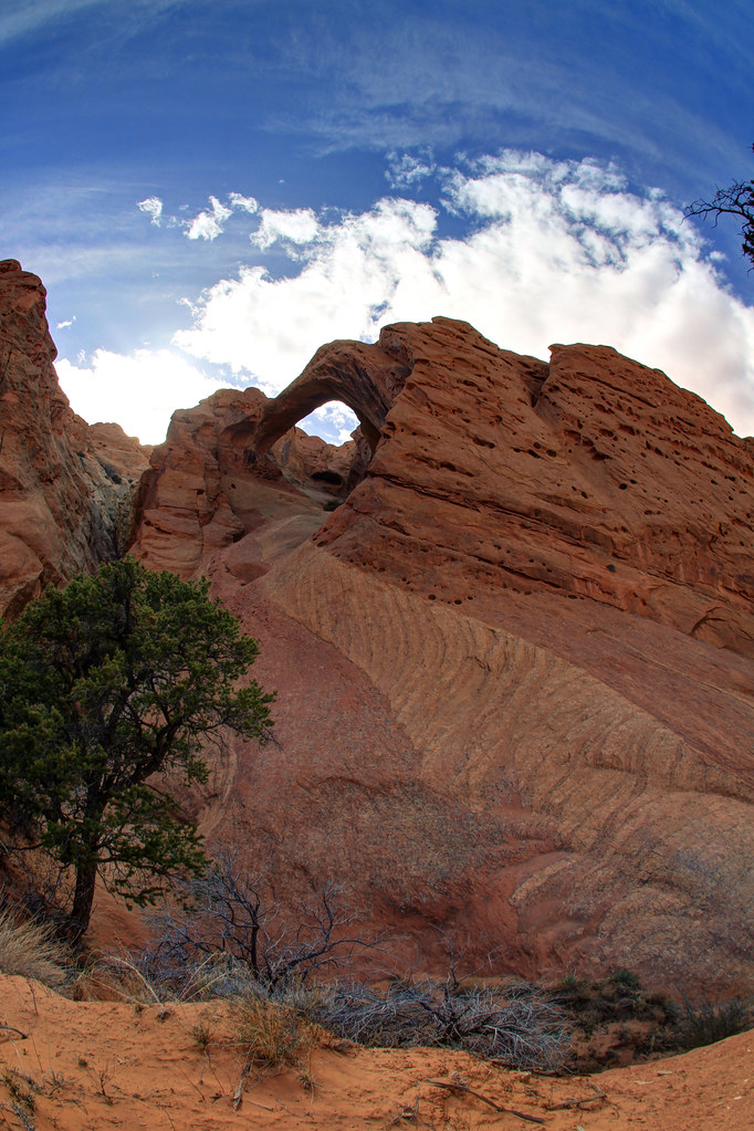
Then it was off to Surprise Canyon.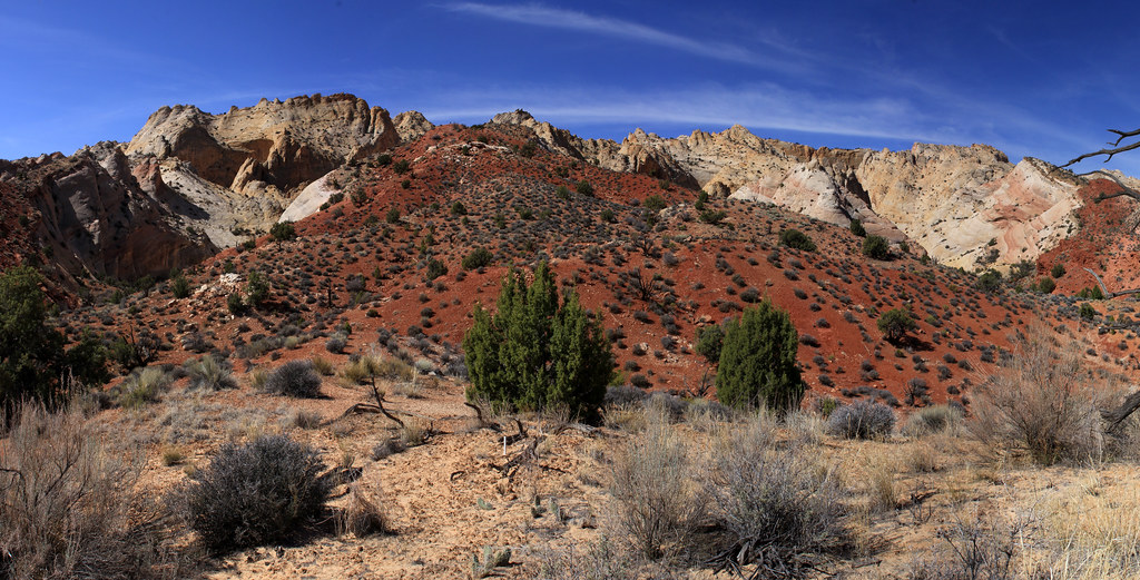
I'm going in there by NateGeesaman, on Flickr
I spent a good amount of time slowly climbing up trying to make a loop out of this hike. I entered the opening on the left of the above photo and tried to find a way to come out that beautiful colorful opening on the right. I cliffed out, just barely, towards the top where I imagined a connection and since I was by myself decided not to try anything too stupid and turned back. I imagine there is a connection lower down from where I went though. Anyway, it was good fun exploring back in here.
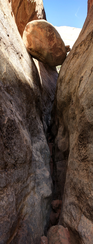
Surprise Canyon's True Colors by NateGeesaman, on Flickr
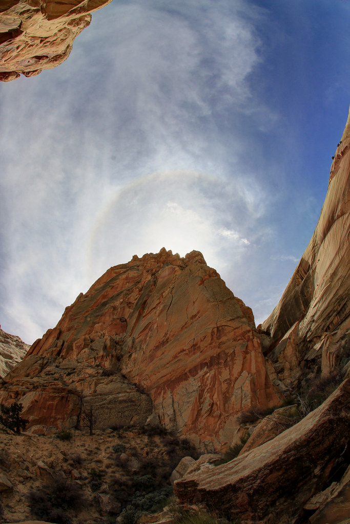
Surprise Canyon Halo by NateGeesaman, on Flickr
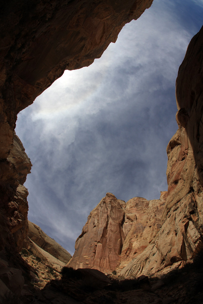
Surprise Canyon Amphitheater by NateGeesaman, on Flickr
Surprise by NateGeesaman, on Flickr
On the way back to the car I was seeing some great clouds and that helped me pick my next destination.
Surprise by NateGeesaman, on Flickr
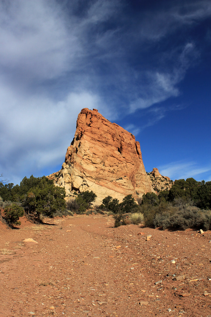
I was debating doing Headquarters Canyon after this, but the clouds were drawing me towards the Strike Valley Overlook hike. The forecast for the next day was sunny and I wanted some panos with good clouds. Plus, I wanted to check out the 4wd high clearance only road and see if my Subie could handle it because I intended to go that route for the Upper Muley's Twist hike the next day. So up the Burr Trail Switchbacks I went.
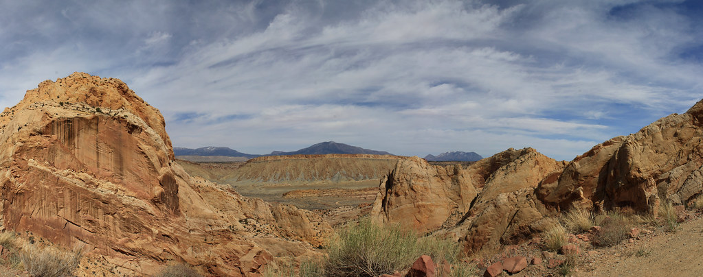
Switchback pano by NateGeesaman, on Flickr
The road to the Strike Valley Overlook and Upper Muley's Twist trail heads was not as bad as I thought it might be. It was actually really fun to drive around up there and extremely beautiful the entire way. The Strike Valley Overlook hike was only 2 miles round trip, but I spent a good 3 hours hanging out, taking photos, and wandering around along the ridge. I went a bit pano crazy up here.
Strike Valley 3 by NateGeesaman, on Flickr
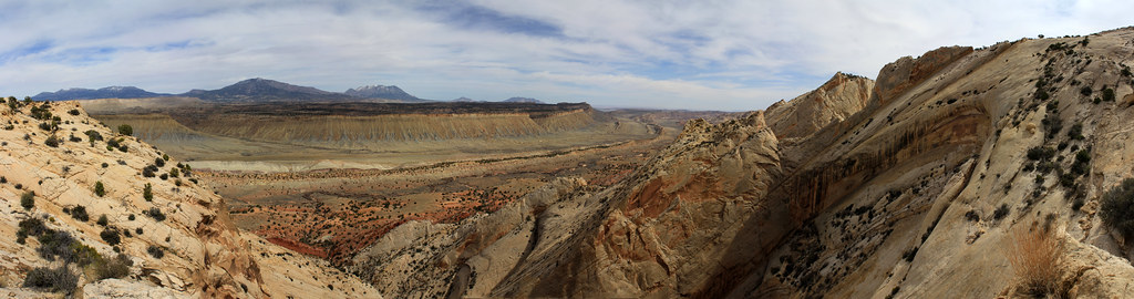
strike valley pano2 by NateGeesaman, on Flickr
Strike Valley Overlook by NateGeesaman, on Flickr
Then I headed back down the switchbacks and off to my hopefully vacant favorite camp site.
I had to stop and try again to get some shots of the beautiful and powerful Bentonite hills along the Burr Trail.
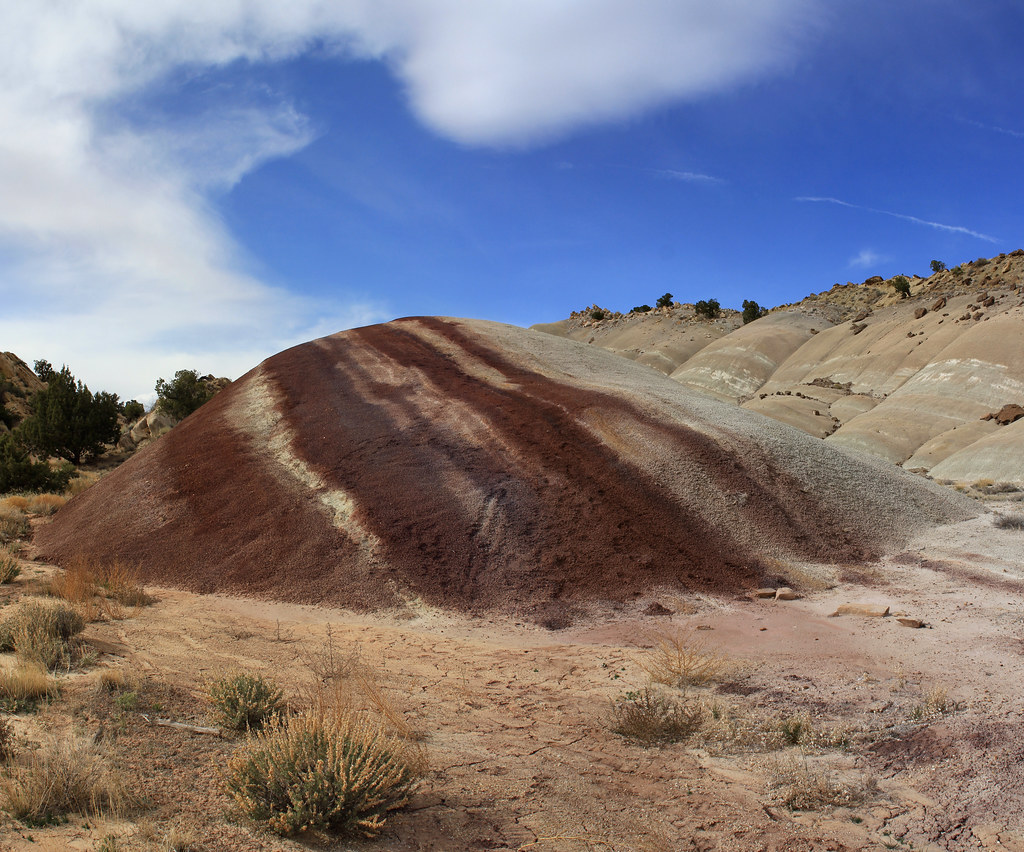
Bentonite Hills by NateGeesaman, on Flickr
I pulled up to the camp spot thinking for sure someone would be there, but once again no one was and I got my preferred fire pit. I set up a time lapse of the Henry Mountains tossing around beautiful clouds and got to making a fire and dinner. Here is a frame from the time lapse, but I am not quite done with the video: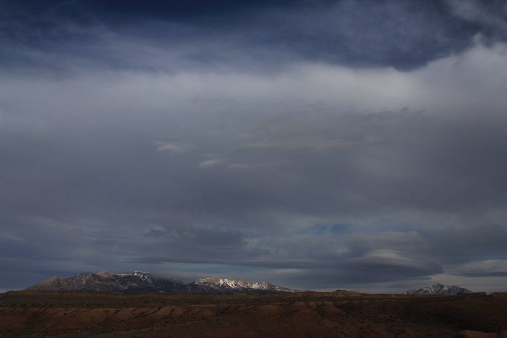
IMG_1776 by NateGeesaman, on Flickr
I really love this spot:

Secret Spot by NateGeesaman, on Flickr
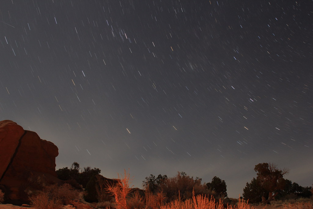
I took some decent star shots that night because the beautiful clouds I had all day cleared just before the sun set :twothumbs: .
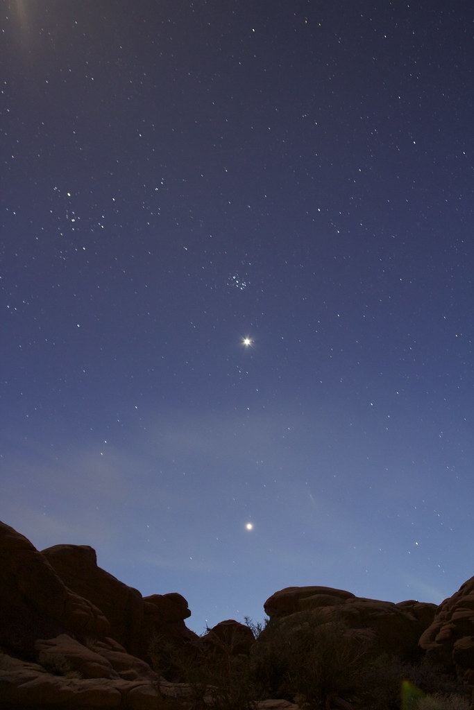
Venus and Jupiter Stack by NateGeesaman, on Flickr
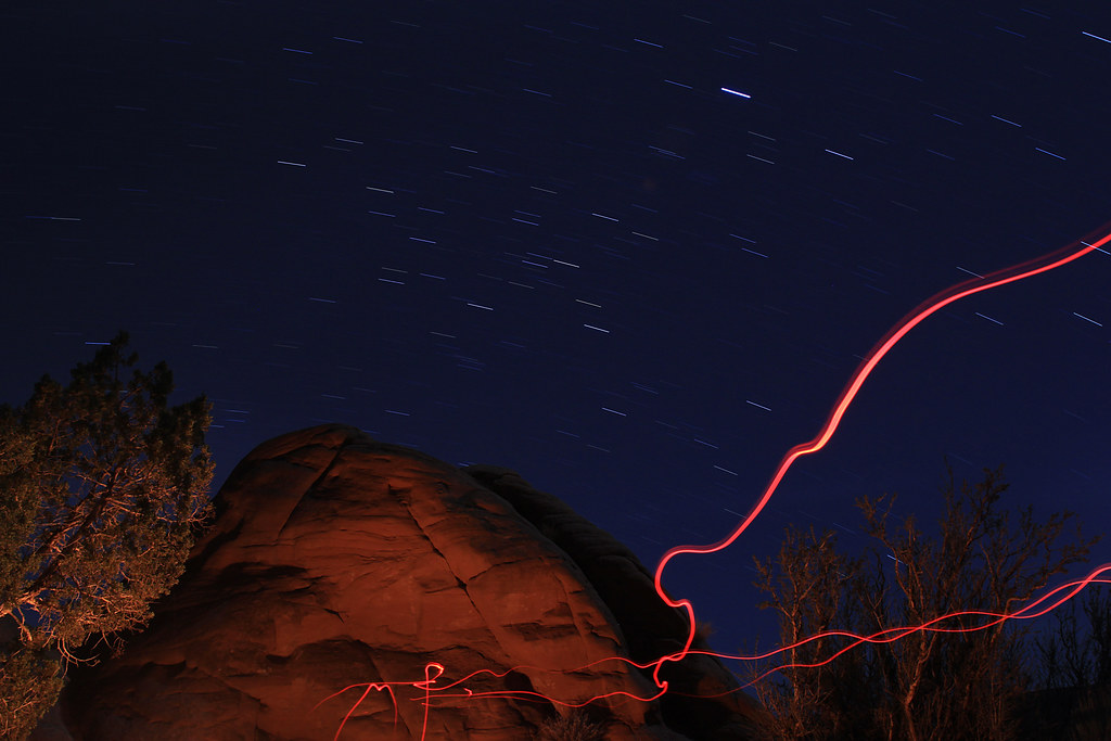
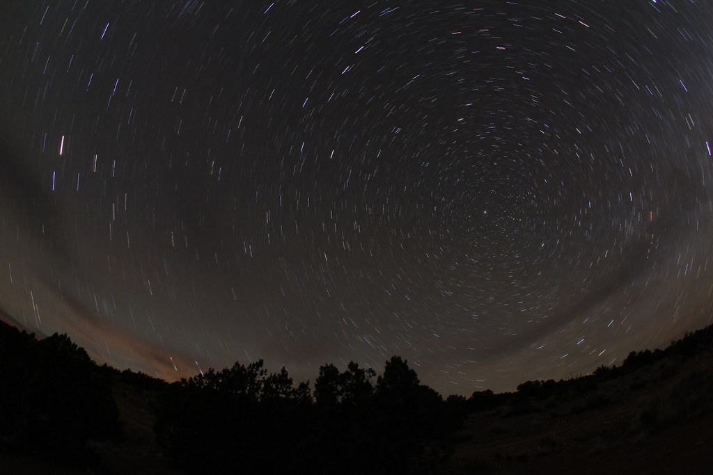
Favorite Spot Trails by NateGeesaman, on Flickr
 Camp Trails by NateGeesaman, on Flickr
IMG_2416 by NateGeesaman, on Flickr
After a long day of hiking and driving, I was beat and slept like a log.
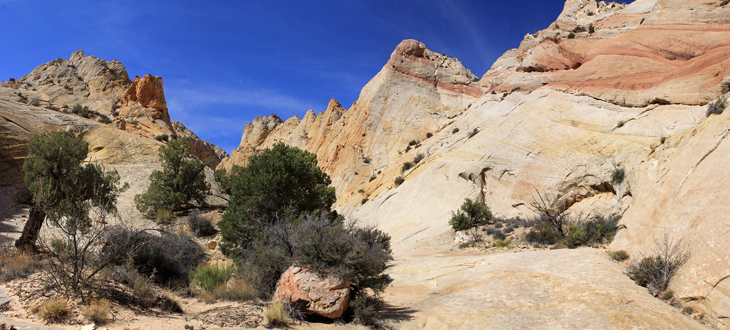
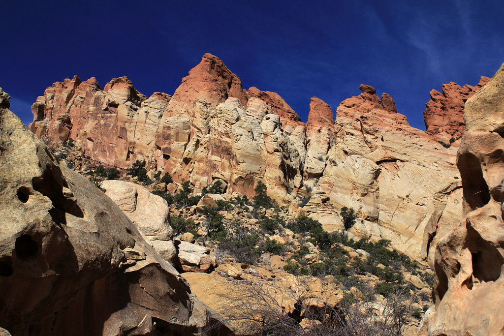
I awoke shortly after sunrise and left camp for Upper Muley's Twist. I can't get enough of that drive along the Waterpocket Fold and thoroughly enjoyed it once again. I got to the trail head in about 30 minutes where I ate some breakfast and charged up for the strenuous hike ahead of me. The trail was beautiful from start to finish.
Muley's Trail by NateGeesaman, on Flickr
Muley's cliffs by NateGeesaman, on Flickr
After 1.7 miles, I arrived at Saddle Arch and started the ascent up to the rim route portion of the loop. Here is a shot looking back at Saddle Arch from near the top of the climb to the canyon rim: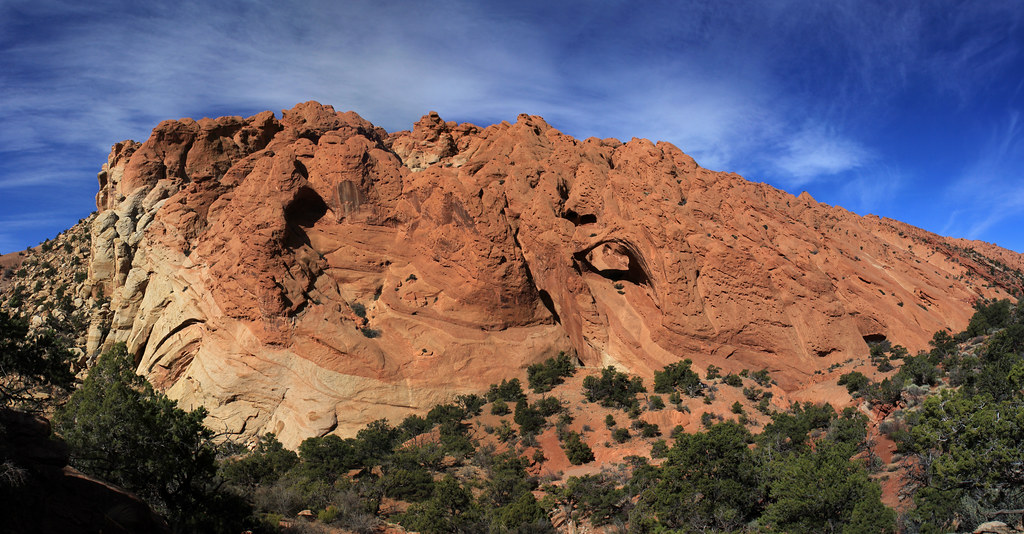
Saddle Arch and Neighbors by NateGeesaman, on Flickr
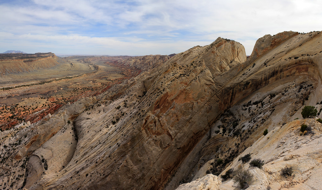
This is another beautiful formation that I saw while climbing up to the rim portion. There is a big arch in the shadow in the center of this that was quite impressive.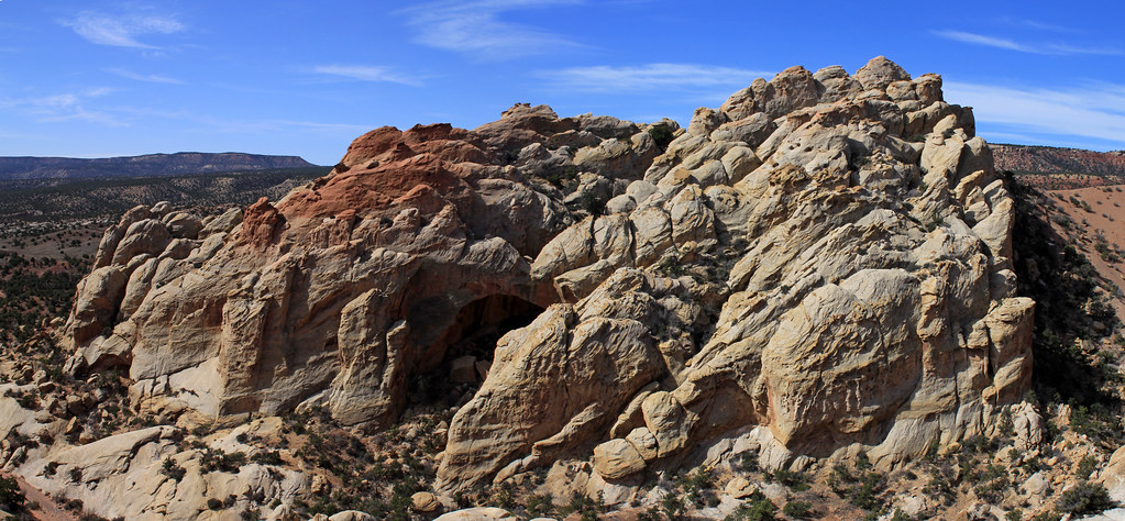
Muley's Cliff arch by NateGeesaman, on Flickr
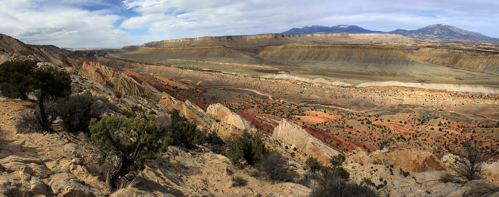
Once I was up on the rim I got that same beautiful view that I had the day before from the Strike Valley overlook to my right (east)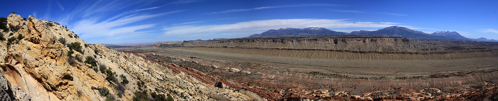
Rim Route Pano Low by NateGeesaman, on Flickr
and to my left (west) a view of the beautiful and unique red sand stone that formed the narrows portion of the hike.
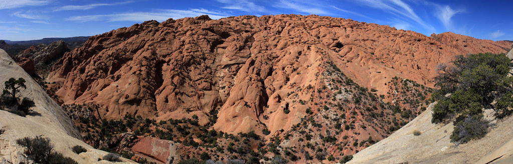
Melting Sand Stone Panorama by NateGeesaman, on Flickr
It is hard to see in this photo, but there were a couple arches mixed into those wrinkly cliffs.
Here is a view of one of the slot canyons:
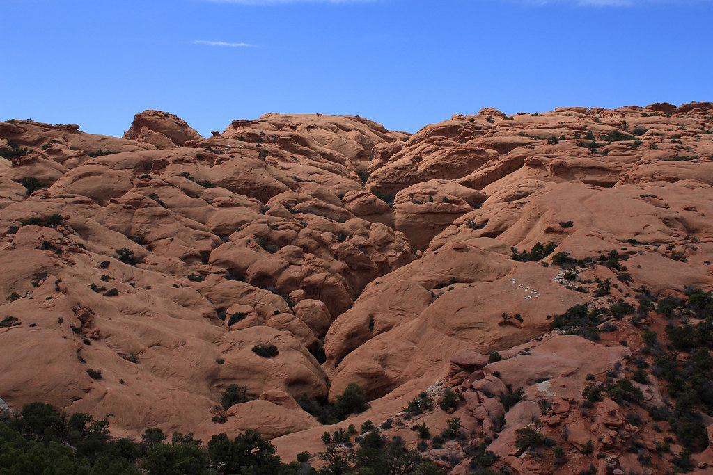
Muley's Narrows by NateGeesaman, on Flickr
After a few miles of overwhelmingly beautiful views along the rim portion, it was time to head down into the wash and hike back along the narrows.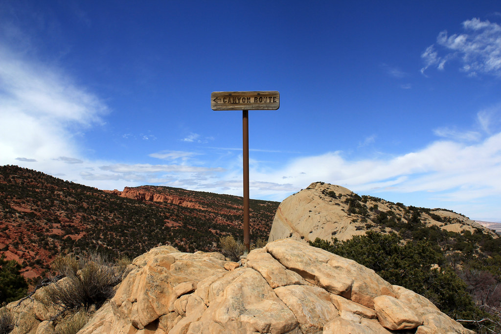
YES by NateGeesaman, on Flickr
I intentionally did the loop counter clockwise so as to get the most difficult and steep portion done with first; then when I was down in the narrows I could be sure I had enough energy and time to explore the slots back there. I found a mouth to a slot that looked worth exploring and this was the view inside: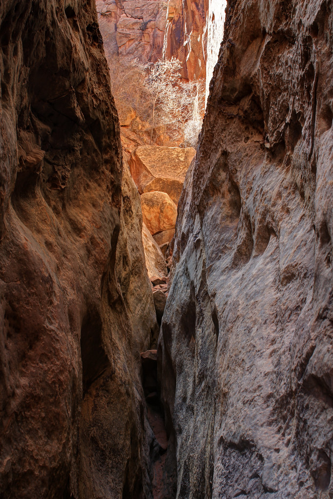
Muley's Slot by NateGeesaman, on Flickr
Muley's Slot Verto by NateGeesaman, on Flickr
Beyond the point where I took those photos the slot opened up to a big beautiful amphitheater with walls going up hundreds of feet, but the light was not ideal for shooting.
I stopped by Saddle Arch and took a few more shots in the afternoon light as I finished the loop.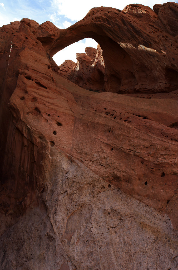
Saddle Arch by NateGeesaman, on Flickr
Saddle Arch Base by NateGeesaman, on Flickr
At the trail head there was a nice retired couple from Texas who were in the parking lot next to my car. I talked with them for a bit about their 6 week journey through the Colorado Plateau, photography, why I love Capitol Reef, and good camping spots. I tried to talk them into spending more time in Capitol Reef, but they had their trip pretty planned out.
Then I was off to look for a good camping spot. I came across just that pretty close to where I had camped the previous night, but with a different view. A room with a view please. To the West :twothumbs:
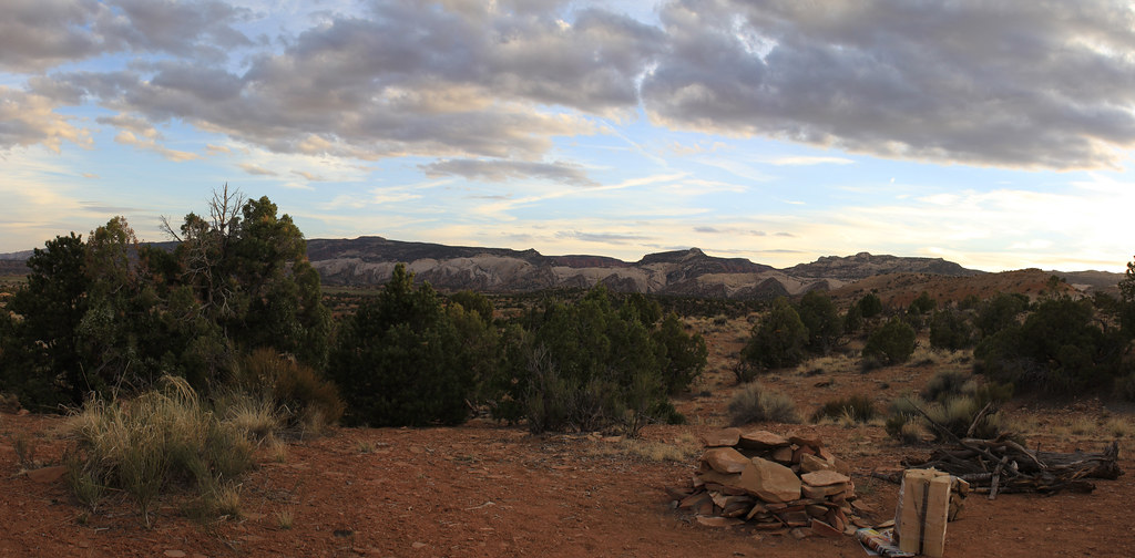
Camp 2 view by NateGeesaman, on Flickr
To the East :twothumbs: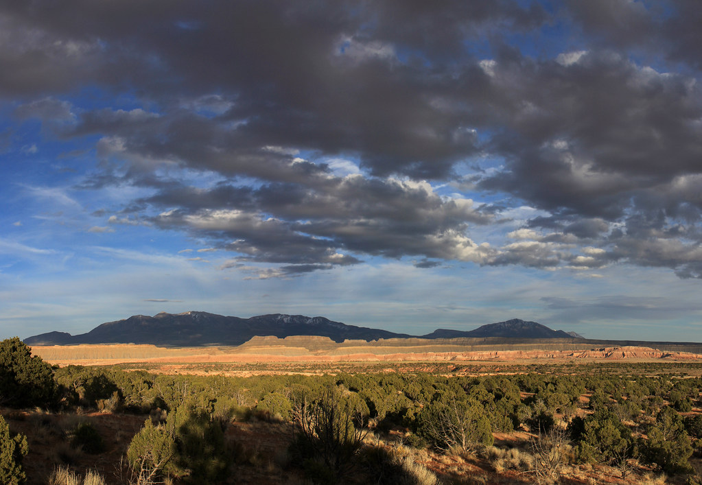
Henry Mountains Cloudscape by NateGeesaman, on Flickr
and a sunset please :twothumbs: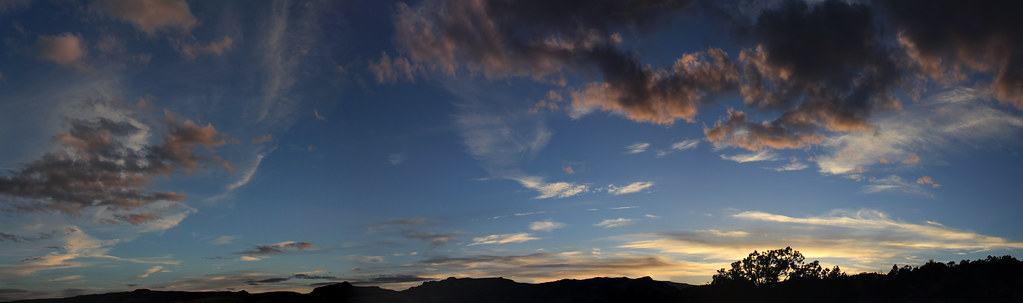
sunset from camp by NateGeesaman, on Flickr
and a nice fire :twothumbs: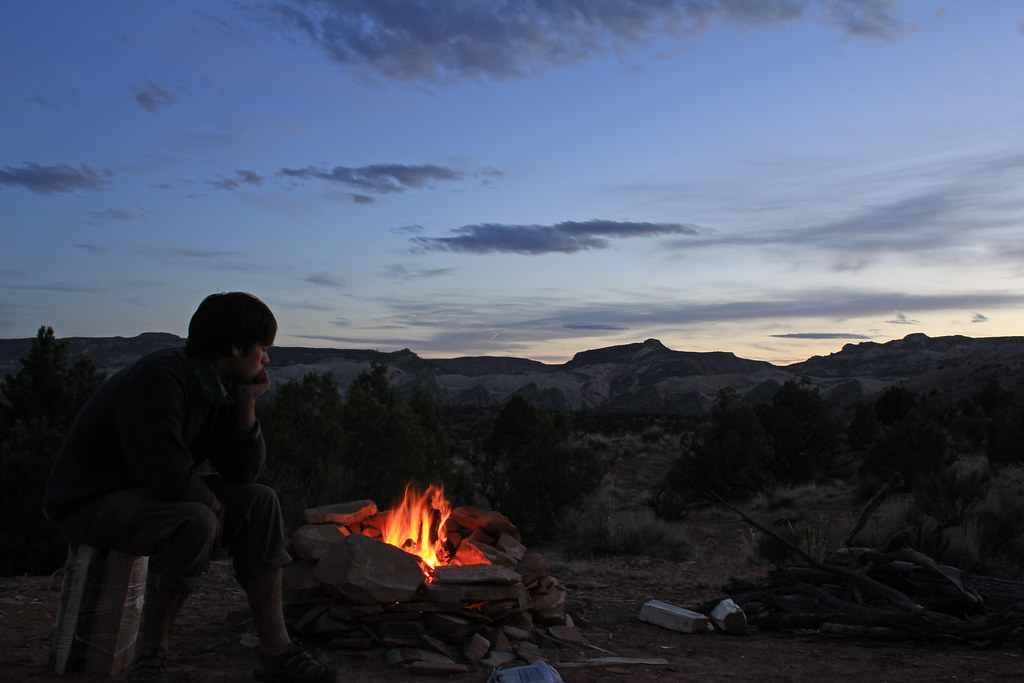
Camp by NateGeesaman, on Flickr
and now that the sunset is over, clouds be gone for some stars :twothumbs: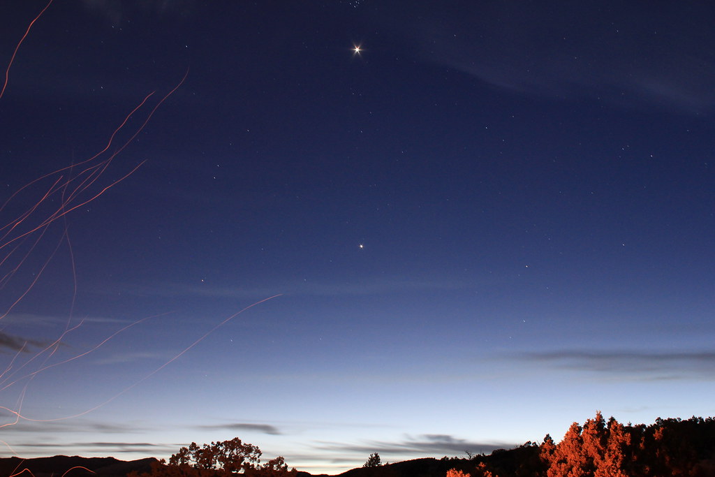
Venus and Jupiter Stack by NateGeesaman, on Flickr
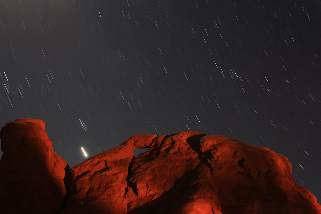
I shot this out the sunroof while drifting off in the back of the Subie. I shook the car a tiny bit unfortunately.
Rooftop Trails by NateGeesaman, on Flickr

The next day provided an awesome drive home in the morning and then it was back to work at night.
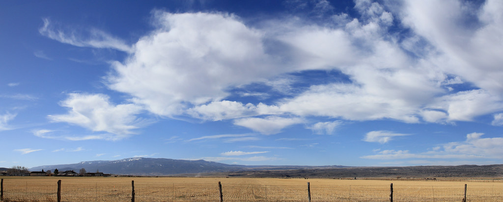
Drive home pano by NateGeesaman, on Flickr
Featured image for slideshow:

My first destination was the waterfall in the Northern end of the park where I learned that I bought the wrong neutral density filter (not dark enough for bright sun).
IMG_0711 by NateGeesaman, on Flickr
Then it was off to Surprise Canyon.
I'm going in there by NateGeesaman, on Flickr
I spent a good amount of time slowly climbing up trying to make a loop out of this hike. I entered the opening on the left of the above photo and tried to find a way to come out that beautiful colorful opening on the right. I cliffed out, just barely, towards the top where I imagined a connection and since I was by myself decided not to try anything too stupid and turned back. I imagine there is a connection lower down from where I went though. Anyway, it was good fun exploring back in here.
Surprise Canyon's True Colors by NateGeesaman, on Flickr
Surprise Canyon Halo by NateGeesaman, on Flickr
Surprise Canyon Amphitheater by NateGeesaman, on Flickr
Surprise by NateGeesaman, on Flickr
On the way back to the car I was seeing some great clouds and that helped me pick my next destination.
Surprise by NateGeesaman, on Flickr
I was debating doing Headquarters Canyon after this, but the clouds were drawing me towards the Strike Valley Overlook hike. The forecast for the next day was sunny and I wanted some panos with good clouds. Plus, I wanted to check out the 4wd high clearance only road and see if my Subie could handle it because I intended to go that route for the Upper Muley's Twist hike the next day. So up the Burr Trail Switchbacks I went.
Switchback pano by NateGeesaman, on Flickr
The road to the Strike Valley Overlook and Upper Muley's Twist trail heads was not as bad as I thought it might be. It was actually really fun to drive around up there and extremely beautiful the entire way. The Strike Valley Overlook hike was only 2 miles round trip, but I spent a good 3 hours hanging out, taking photos, and wandering around along the ridge. I went a bit pano crazy up here.
Strike Valley 3 by NateGeesaman, on Flickr
strike valley pano2 by NateGeesaman, on Flickr
Strike Valley Overlook by NateGeesaman, on Flickr
Then I headed back down the switchbacks and off to my hopefully vacant favorite camp site.
I had to stop and try again to get some shots of the beautiful and powerful Bentonite hills along the Burr Trail.
Bentonite Hills by NateGeesaman, on Flickr
I pulled up to the camp spot thinking for sure someone would be there, but once again no one was and I got my preferred fire pit. I set up a time lapse of the Henry Mountains tossing around beautiful clouds and got to making a fire and dinner. Here is a frame from the time lapse, but I am not quite done with the video:
IMG_1776 by NateGeesaman, on Flickr
I really love this spot:
Secret Spot by NateGeesaman, on Flickr
I took some decent star shots that night because the beautiful clouds I had all day cleared just before the sun set :twothumbs: .
Venus and Jupiter Stack by NateGeesaman, on Flickr
Favorite Spot Trails by NateGeesaman, on Flickr
Camp Trails by NateGeesaman, on FlickrIMG_2416 by NateGeesaman, on Flickr
After a long day of hiking and driving, I was beat and slept like a log.
I awoke shortly after sunrise and left camp for Upper Muley's Twist. I can't get enough of that drive along the Waterpocket Fold and thoroughly enjoyed it once again. I got to the trail head in about 30 minutes where I ate some breakfast and charged up for the strenuous hike ahead of me. The trail was beautiful from start to finish.
Muley's Trail by NateGeesaman, on Flickr
Muley's cliffs by NateGeesaman, on Flickr
After 1.7 miles, I arrived at Saddle Arch and started the ascent up to the rim route portion of the loop. Here is a shot looking back at Saddle Arch from near the top of the climb to the canyon rim:
Saddle Arch and Neighbors by NateGeesaman, on Flickr
This is another beautiful formation that I saw while climbing up to the rim portion. There is a big arch in the shadow in the center of this that was quite impressive.
Muley's Cliff arch by NateGeesaman, on Flickr
Once I was up on the rim I got that same beautiful view that I had the day before from the Strike Valley overlook to my right (east)
Rim Route Pano Low by NateGeesaman, on Flickr
and to my left (west) a view of the beautiful and unique red sand stone that formed the narrows portion of the hike.
Melting Sand Stone Panorama by NateGeesaman, on Flickr
It is hard to see in this photo, but there were a couple arches mixed into those wrinkly cliffs.
Here is a view of one of the slot canyons:
Muley's Narrows by NateGeesaman, on Flickr
After a few miles of overwhelmingly beautiful views along the rim portion, it was time to head down into the wash and hike back along the narrows.
YES by NateGeesaman, on Flickr
I intentionally did the loop counter clockwise so as to get the most difficult and steep portion done with first; then when I was down in the narrows I could be sure I had enough energy and time to explore the slots back there. I found a mouth to a slot that looked worth exploring and this was the view inside:
Muley's Slot by NateGeesaman, on Flickr
Muley's Slot Verto by NateGeesaman, on Flickr
Beyond the point where I took those photos the slot opened up to a big beautiful amphitheater with walls going up hundreds of feet, but the light was not ideal for shooting.
I stopped by Saddle Arch and took a few more shots in the afternoon light as I finished the loop.
Saddle Arch by NateGeesaman, on Flickr
Saddle Arch Base by NateGeesaman, on Flickr
At the trail head there was a nice retired couple from Texas who were in the parking lot next to my car. I talked with them for a bit about their 6 week journey through the Colorado Plateau, photography, why I love Capitol Reef, and good camping spots. I tried to talk them into spending more time in Capitol Reef, but they had their trip pretty planned out.
Then I was off to look for a good camping spot. I came across just that pretty close to where I had camped the previous night, but with a different view. A room with a view please. To the West :twothumbs:
Camp 2 view by NateGeesaman, on Flickr
To the East :twothumbs:
Henry Mountains Cloudscape by NateGeesaman, on Flickr
and a sunset please :twothumbs:
sunset from camp by NateGeesaman, on Flickr
and a nice fire :twothumbs:
Camp by NateGeesaman, on Flickr
and now that the sunset is over, clouds be gone for some stars :twothumbs:
Venus and Jupiter Stack by NateGeesaman, on Flickr
I shot this out the sunroof while drifting off in the back of the Subie. I shook the car a tiny bit unfortunately.
Rooftop Trails by NateGeesaman, on Flickr
The next day provided an awesome drive home in the morning and then it was back to work at night.
Drive home pano by NateGeesaman, on Flickr
Featured image for slideshow:
")
