- Joined
- Dec 2, 2019
- Messages
- 188
After 10 days hiking through Capitol Reef National Park, as I set up camp at the top of the Burr Trail Switchbacks on a calm evening, it appeared that the wet weather of the past few days might have finally passed through.
However, soon after dark the wind began to quickly pick up, and I was being gently swayed and buffeted in my tent. Things then turned nasty rather quickly, with loud thunder claps, violent lightening, and torrential rain. Strong gusts of wind were now starting to fold my tent in a worrying manner. I'd experienced something like it a couple of times in the past, and knew that the tent could withstand some heavy punishment. But then, over the next hour, conditions ramped up several notches, and I realised that this was bad. Unbeknownst to me at the time, but Hurricane Priscilla was in town !
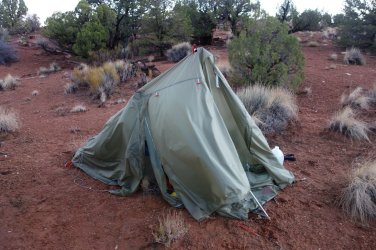
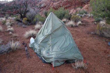
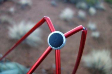
The tent poles were groaning under the pressure of the wind, and the flysheet was straining to stay attached. I instinctively grabbed the two poles closest to me and then thrust my feet upwards in a vain attempt to try to support the tent structure; but the winds were now vicious, and every 30 seconds would unleash their brutal force, throwing me about like a rag-doll. I was literally just clinging on, in the darkness, as the tent was getting smashed. Inevitably, a massive gust hit, and two poles just snapped like twigs, ripping through the flysheet, and throwing me onto my side. The end of one pole snapped the plastic corner grommet, unleashing the adjacent quarter of the flysheet next to me and causing it to flap ferociously, as it tried to rip itself free from the main body of the tent. Unprotected by the flysheet, the heavy rain was now falling directly onto me, and I wasn't sure what I would, or could, do now. This was truly grim.
Somehow, the limp tent structure wasn't quite so vulnerable to the wind, and I was somehow able to ride out the rest of the storm, over the next hour. However, as it eventually eased, I could feel just how much of my gear, including my sleeping bag, was drenched. It was a long night, but I did manage to get some sleep, even inside a wet bag. It was easily the roughest night I've ever spent in a tent, and I was all but ready to abandon my adventure there and then.
.However, soon after dark the wind began to quickly pick up, and I was being gently swayed and buffeted in my tent. Things then turned nasty rather quickly, with loud thunder claps, violent lightening, and torrential rain. Strong gusts of wind were now starting to fold my tent in a worrying manner. I'd experienced something like it a couple of times in the past, and knew that the tent could withstand some heavy punishment. But then, over the next hour, conditions ramped up several notches, and I realised that this was bad. Unbeknownst to me at the time, but Hurricane Priscilla was in town !
The tent poles were groaning under the pressure of the wind, and the flysheet was straining to stay attached. I instinctively grabbed the two poles closest to me and then thrust my feet upwards in a vain attempt to try to support the tent structure; but the winds were now vicious, and every 30 seconds would unleash their brutal force, throwing me about like a rag-doll. I was literally just clinging on, in the darkness, as the tent was getting smashed. Inevitably, a massive gust hit, and two poles just snapped like twigs, ripping through the flysheet, and throwing me onto my side. The end of one pole snapped the plastic corner grommet, unleashing the adjacent quarter of the flysheet next to me and causing it to flap ferociously, as it tried to rip itself free from the main body of the tent. Unprotected by the flysheet, the heavy rain was now falling directly onto me, and I wasn't sure what I would, or could, do now. This was truly grim.
Somehow, the limp tent structure wasn't quite so vulnerable to the wind, and I was somehow able to ride out the rest of the storm, over the next hour. However, as it eventually eased, I could feel just how much of my gear, including my sleeping bag, was drenched. It was a long night, but I did manage to get some sleep, even inside a wet bag. It was easily the roughest night I've ever spent in a tent, and I was all but ready to abandon my adventure there and then.
The aftermath !
.
.
.
.
.
.
In order to lift my spirits, I needed the arrival of a glorious sunny morning; and that's exactly what happened. After a couple of hours drying out my gear (and myself !), I felt completely rejuvenated and was ready to start hiking again. Ironically, on the first day of my hike, I noticed that I had mistakenly packed 2 tent-pole splints and berated myself for having to carry the unnecessary weight. Who knew that 10 days later I would be extremely thankful to have both splints to repair my broken tent-poles !
I had the relatively benign Lower Muley Twist Canyon to negotiate today, so the walking should be straightforward. I had some concerns over mud and newly formed water obstacles in the canyon, after the heavy rains, but when I saw a couple of day-hikers head through the drainage early in the morning, I felt more relaxed about the day ahead. Surely, I was now through the worst of the weather, and things would get a little easier.
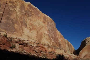
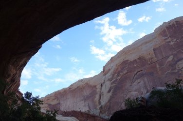
It turned out to be a fantastic day's walking through a magnificent canyon. The drainage is renowned for huge undercuts in the high canyon walls, and these did not disappoint; they are a wonderful sight. There were some puddles and mud in the canyon, but nothing to significantly hamper progress through this lovely area. A stunning campsite, among tall pines, with the towering walls above, made for a splendid end to a very enjoyable day. Hopefully, Storm Priscilla was now spinning off northwards.
.I had the relatively benign Lower Muley Twist Canyon to negotiate today, so the walking should be straightforward. I had some concerns over mud and newly formed water obstacles in the canyon, after the heavy rains, but when I saw a couple of day-hikers head through the drainage early in the morning, I felt more relaxed about the day ahead. Surely, I was now through the worst of the weather, and things would get a little easier.
It turned out to be a fantastic day's walking through a magnificent canyon. The drainage is renowned for huge undercuts in the high canyon walls, and these did not disappoint; they are a wonderful sight. There were some puddles and mud in the canyon, but nothing to significantly hamper progress through this lovely area. A stunning campsite, among tall pines, with the towering walls above, made for a splendid end to a very enjoyable day. Hopefully, Storm Priscilla was now spinning off northwards.
Beautiful Lower Muley Twist Canyon
.
.
Huge undercut, typical of the canyon
.
.
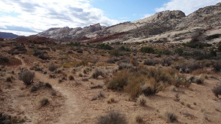
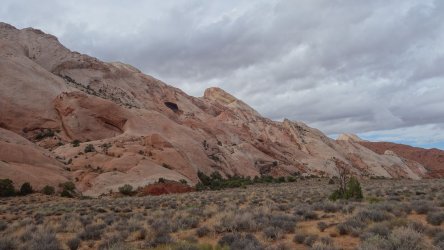
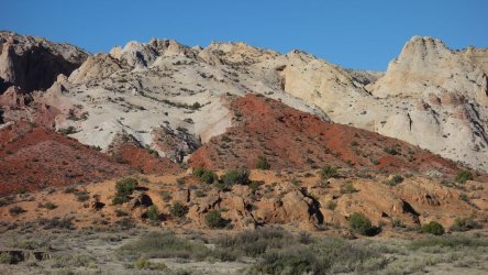
The following morning did turn out to be cloudy and showery once more, but it felt like the storm was finally moving out of the region; albeit more slowly than I would have hoped. It was a very easy walking day, following the Grand Gulch Trail, a well-worn level path alongside Halls Creek, towards the famous Narrows. I visited scenic Hamburger Rocks and Muley Tanks along the way, as well as a stunning huge rock hoodoo on the high cliffs opposite. It was a relaxing morning, and by lunch, I knew that I'd be able to reach my final goal by the end of the day. The views of the multi-coloured slopes of the Waterpocket Fold stretching south were quite magnificent as I hiked through the sunny afternoon. I had hoped to visit the famous double-arch of Brimhall Bridge along the way, but the access area to the upper part of the side-canyon was submerged under several feet of water, so I couldn't reach the arch unfortunately.
.Hiking south, following the Grand Gulch Trail, alongside the Waterpocket Fold
.
.
Colorful Waterpocket Fold
.
.
Hamburger Rocks in the distance
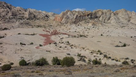
.
.
Hamburger Rocks
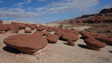 .
..
.
Huge hoodoo (with his little brother towards the right !)
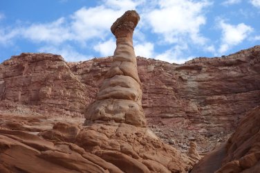
.
.
Colorful Waterpocket Fold
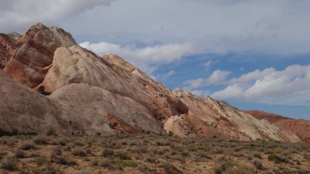
.
.
Muley Tanks
.
.
Colorful Waterpocket Fold
.
.
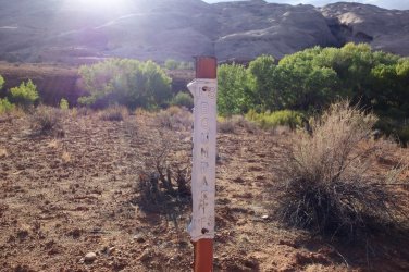
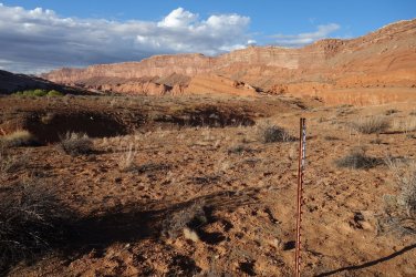
The southern boundary of the National Park turned out to be a single metal pole in the open ground, which was slightly anticlimactic, but even so, I was delighted to have reached my final destination. A feeling of great relief washed over me, as I turned back to look north, and survey all the glorious (and occasionally wet !) miles that I had covered.
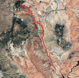
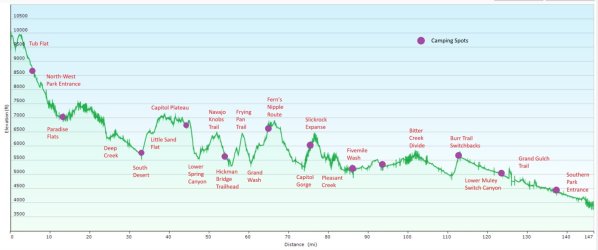
Since starting at the North-Western boundary of the park, at Paradise Flats, I had covered almost 150 miles over 12 days, to reach the Southern boundary at Halls Creek. It was touch-and-go at times, as to whether the conditions would allow me to finally reach my goal, but I was quite proud of myself for persevering.
As it turned out, these days of rain across Utah turned an initially very dry month into the wettest October on record, and the 5th rainiest month overall, since the 1860s.
Hmmm, now how was I going to get home
.Since starting at the North-Western boundary of the park, at Paradise Flats, I had covered almost 150 miles over 12 days, to reach the Southern boundary at Halls Creek. It was touch-and-go at times, as to whether the conditions would allow me to finally reach my goal, but I was quite proud of myself for persevering.
As it turned out, these days of rain across Utah turned an initially very dry month into the wettest October on record, and the 5th rainiest month overall, since the 1860s.
Hmmm, now how was I going to get home
The end of the road !
.
Turning to look north
.
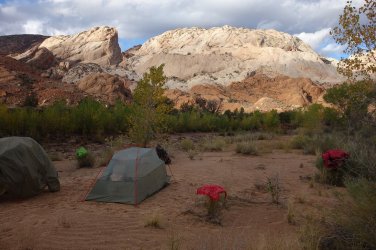
Stunning campsite
.
.Postscript: I had originally intended to then hike further south, and round the southern cliffs of Hall Mesa to reach the Bullfrog area on Lake Powell, from where I would try to then hitch a ride back to Torrey and my vehicle. However, I just wasn't sure how the area might have been impacted by the recent heavy rains and flooding, and so I didn't attempt this unfamiliar route. Instead, I returned north via the Grand Gulch (Halls Creek) Trail, all the way to The Post trailhead, where I connected with the Burr Trail Road, which runs between Boulder and Bullfrog. I had initially hoped that there would be vehicles heading both north or south here, and I would be able to get a ride in either direction fairly easily. Unfortunately, the poor condition of the dirt roads, after the recent rains, was currently putting a lot of people off attempting this route. By the time I had walked north, all the way back to the top of the Burr Trail Switchbacks, I hadn't encountered a single car all afternoon.
After camping (this time uneventfully !) at the top of the switchbacks, several vehicles arrived in the morning (along the paved road) from Boulder for day-trip walks to the nearby Strike Valley Overlook and Upper Muley Twist Canyon. I had hoped that this would be the case. Many people were extremely kind and stopped to ask how I was doing, and before too long, I had a ride back to Boulder. From there, I caught another ride with a very friendly Italian couple, who were heading to the Visitor Center of the National Park. Reunited with my vehicle, the adventure was over, and I was heading home.
.After camping (this time uneventfully !) at the top of the switchbacks, several vehicles arrived in the morning (along the paved road) from Boulder for day-trip walks to the nearby Strike Valley Overlook and Upper Muley Twist Canyon. I had hoped that this would be the case. Many people were extremely kind and stopped to ask how I was doing, and before too long, I had a ride back to Boulder. From there, I caught another ride with a very friendly Italian couple, who were heading to the Visitor Center of the National Park. Reunited with my vehicle, the adventure was over, and I was heading home.
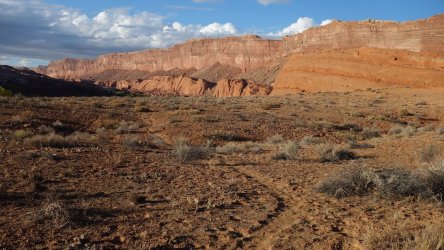
Following the Grand Gulch Trail north
.
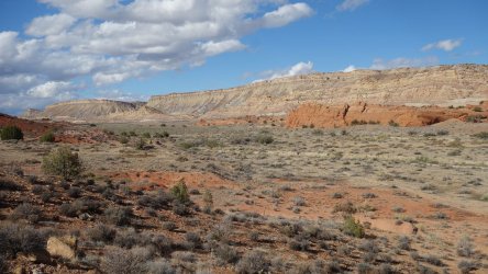
Approaching The Post trailhead and the Burr Trail Road, which would lead me back the Burr Trail Switchbacks
.
.
.
.
.
.
Previous posts:
Part 1
Part 2
Last edited:

