buffington pocket area recs?

regehr

Member
Joined
Mar 28, 2012
Messages
2,389
So I had elaborately planned out a camping trip starting very soon but temps in Utah are looking low enough that we're instead headed to the Buffington Pocket / Muddy Mountains where it looks to be quite a bit warmer. However I know next to nothing about this area! Of course I've done a bit of last minute homework and there's good info available such as this page:

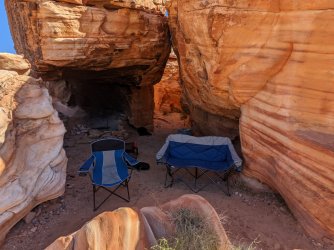
But if anyone has any particular favorites in this area (and particularly, nice places to car camp) I'd love to know either here or in a DM. As always I'm happy to not share info further if you ask me not to. I'm hoping to camp in the vicinity of the Color Rock Quarry, and also hoping to make it down to Hidden Valley if that road isn't too rough. But I'm super clueless.
 
I think that area was included in a trip report on here a while ago, but only as part of a larger trip and not mentioned by name.
I however, do not know any specifics about that area.
Definitely warmer though.
 
I really thought Hidden Valley was quite neat. BirdandHike has good accesss info. Scroll down a bit in this TR for Hidden Valley:

I want to return to explore the nooks and crannies on the margins of the flat "Valley". Rock art was visible from the main wash so there must be more.
we spent a short but very nice day in hidden valley -- did not get started until after lunch and we also had a seven-year-old with us, so we mainly just walked over to the big, well-known tinaja and back. super gorgeous in there!

yesterday we did a hike that was sort of random but I liked it even better than Hidden Valley, need to download some tracks from my phone and then I can give some details

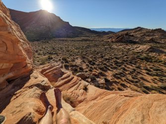
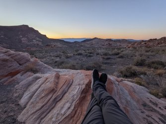
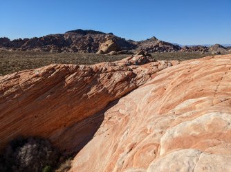
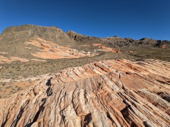
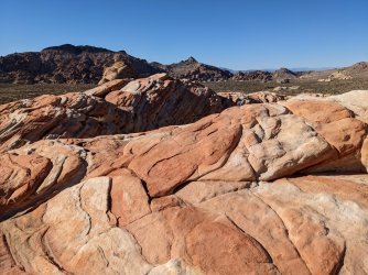
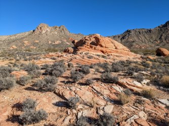
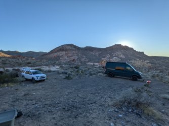
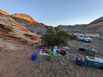
overall I was super happy with this area-- it was warm and pleasant while Utah was sort of cold and nasty. the Aztec sandstone is totally new to me. there weren't a lot of people in there, a jeep or two and a few random ATVs passed by on the bitter springs road (we were camped within sight of it) but would definitely not call it busy. the bitter springs road was a bit stressful for me, not due to the difficulty but rather all the sharp rocks made me fearful of one or more flats (one of the ATVs we saw was driving with a flat tire) but we escaped without incident. my friends who are braver than I am got a big sprinter van down in there too, in the middle of the night no less.
 
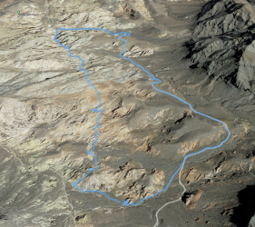
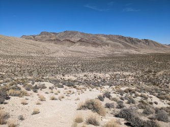
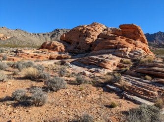
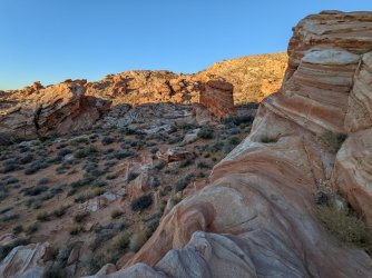
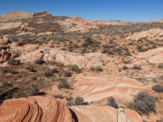
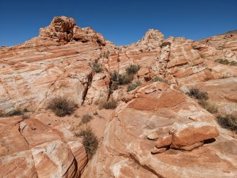
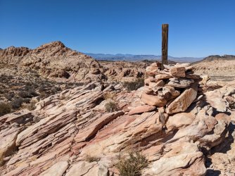
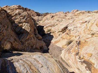
ok, so here's a hike we did yesterday that I thought was just extremely spectacular and could easily serve as a flagship route in a national park if more people knew about it. this screenshot is setup so that north is towards the top of the image. the east (right) side of the route is the northern part of the bitter springs byway. we were camped at the southernmost part of the loop, you can see I didn't turn on GPS tracking until we had walked for a couple minutes. I didn't feel like driving and didn't feel like walking the road, so we headed n north off-trail towards the well-known narrows containing the dam with the owl painted on it. it's not really obvious from the google imagery, but the colors and shapes of the landscape on this portion of the route were completely amazing, as nice as anything I've seen in Utah. it's rugged country but a 7 year old did it just fine. towards the top of the loop we saw the nice petroglyph panels and the dam and then since we weren't real high on energy at that point, walked the road back to camp. total length was only about 5 miles.

Screenshot from 2022-03-13 22-01-33.png
 
Nice! The route you created on the west side of the loop looks like a really great way to connect Buff P with Hidden V. A poor peoples National Park. Was the Biway ,as far as the dam parking, part of the rocky nasty segments? Or was that more the part from there to HV east parking?
 
Last edited:
the worst of the driving is right at the start, where the road drops into the wash for a little while, but it's fairly continuously high-clearance all the way to hidden valley (we didn't go past there). I'd enjoy it a lot if I had better tires on my vehicle! it was rough enough that one of the beers in my cooler exploded, when I started setting up camp my cooler was all full of beer foam, yuck
 
yuck! Sounds like I may be walking to Buff Pocket! Too bad. I like my tires and one irreparable tire means 4 new ones in stupid Subaru Foresters. I appreciate the detailed road report.
 
yuck! Sounds like I may be walking to Buff Pocket! Too bad. I like my tires and one irreparable tire means 4 new ones in stupid Subaru Foresters. I appreciate the detailed road report.
well I'm pretty conservative about driving and again my friends came in in their big sprinter van (in the dark no less). I feel certain people like @Udink would hardly slow down here :). I just would have felt a whole lot better with real truck tires and armored sidewalls! basically you just need clearance and tough tires.

I'm curious how you got into hidden valley, did you approach from the northwest, using the sort of orange road on this map? https://www.thewave.info/BuffingtonPocketsCode/Map.html

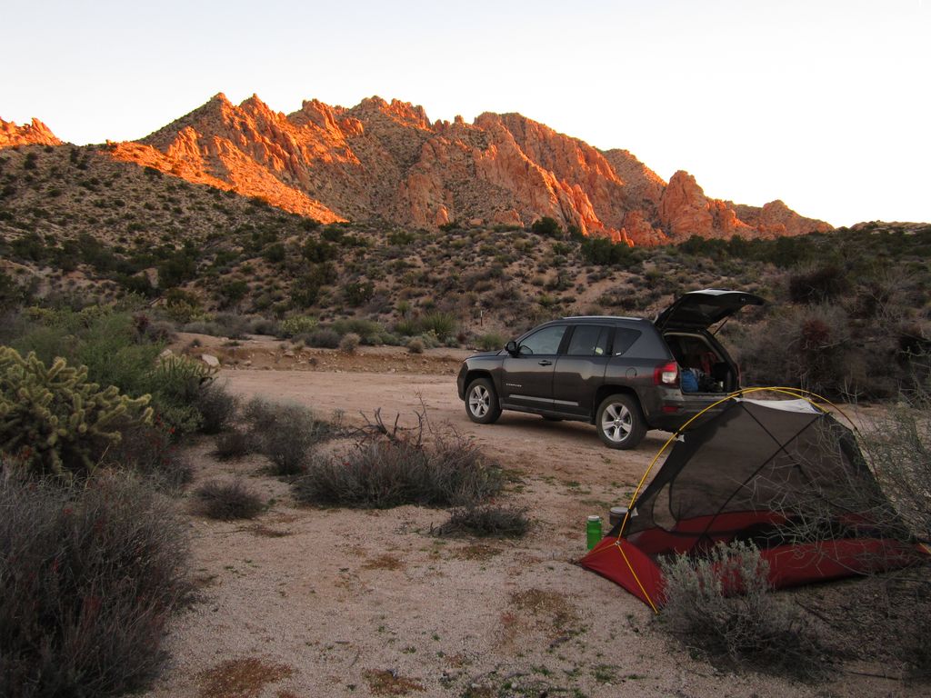
I flew in to Vegas rented this Dodge Compass...drove the orange road to the blue road and camped in that flat.
(photo at Christmas tree Pass)
Another superb free camp by John Morrow, on Flickr

I wouldn't take my Forester up the blue road grade but I think the orange would be fine at least to that junction. I hiked the overlook trail into HV.

Was the big tinaja in the aztec knoll dry?
 
I wouldn't take my Forester up the blue road grade but I think the orange would be fine at least to that junction. I hiked the overlook trail into HV.

Was the big tinaja in the aztec knoll dry?
thanks for the road info! yes all three of them in that cluster were dry, would have been fun to seem them with water. were there a couple of wildlife cams when you were there? it's fun that someone set those up. also some bones in the biggest tinaja! we didn't think it was plausible that an animal couldn't escape when dry but perhaps they drown occasionally?
 
For future reference, Stavros (a.k.a. Stav) out of Las Vegas has a lot of loop hikes mapped out in that area (and others): stavislost.com
I love that limestone! Tilted layers and striations are so neat against the color of the Aztec Sandstone. It is really a great little area. I hope I am traveling south soon and if it stays so cold may have to keep driving to Muddys, VoF, or Gold Butte to start the trip. Was planning East to West starting at San Rafael River but may modify.
 
I know all too well about popped tires in both a Subie and in an Xterra. Will take the Xterra situation over the Subie one any day.
Looks like some sweet VoF style rock out that way.
 

Don't like ads? Become a BCP Supporting Member and kiss them all goodbye. Click here for more info.

Back
Top