Christian
Member
- Joined
- Jun 2, 2012
- Messages
- 161
I am giving this trip report thing a try. Hopefully this turns out interesting and informative.
My friend Taylor and I started planning this trip about 3 weeks ago. We took 2 days off work and made it into a 4 day outing.
We left for GSENM Friday morning from Salt Lake. As we drove past Bryce Canyon snow started falling and the roads were pretty slick and snow-covered, which was perfect because we wanted to see the desert with snow. We saw the sign for Mossy Cave and made an impromptu and short walk up to it. It was awesome seeing the area in serenely falling snow, and making the first footprints going up. When we got to the cave, there were some giant icicles hanging from the ceiling. There were also some great dripping sounds to listen to.

After heading back to the truck, we continued on to Escalante. It was whiteout conditions with visibility at maybe 50 feet for much of the drive. By the time we got to the Hole in the Rock Road it was clear that more rain had fallen in the monument than snow, so it was very slick and muddy. We drove down the road and to the Harris Wash parking area. We made it intact thanks to some crazy drift driving by Taylor. We also had to cross the river 3 times, which was raging when we crossed it but had disappeared by the next day. It was dark when we pulled in so we set up the tent in the hills south of the parking area. It was pretty cold and there was a winter storm warning for the area, but I managed to sleep through wind battering the tent thanks to the earplugs I brought along.
We woke up on Saturday morning to find a rapidly melting dusting of snow and clear skies. We started hiking towards the West Fork Of Red Breaks slot canyon with the goal of completing the loop and seeing the Islomania Dome a.k.a. Cosmic Ashtray a.k.a. Devil's Quagmire a.k.a Escavolcano a.k.a Cosmic Navel a.k.a Intergalactic Bellybutton.
The part of the wash before the slot was surprisingly very dry so we figured we might have a chance at finding the slot passable. However after a fair distance of hiking and arriving at the slot we started encountering pools. At first they weren't bad but by the time we reached the bottom of the first difficult chockstone it was hip deep. Then, about 40 feet past that it was chest deep. Since we weren't equipped for that kind of stupid cold water and we had expensive camera gear with us, we decided to turn around and head out. It sucked putting in all the effort to get over it and then immediately doing the same going back down. I didn't take any pictures in the slot unfortunately. But this picture by Ashergrey shows the Chockstones. The area on the right of his picture was filled all the way up with water. It was a fun failure either way and as an NPS lady once said to me about backcountry outings, "Discretion is the better part of valor."
We drove a short way down Hole in the Rock Road to see the Devil's Garden, which I found to be a particularly fantastic spot and I've wanted to see it for a long time. It was at this point that we saw the first few people of the trip hanging out in the Garden.

Metate Arch ^

Fifty Mile Mountain over Devil's Garden ^
We drove back into Escalante and got some food before setting up the tent in the Escalante Petrified Forest State Park. We woke up the next morning and hiked the 1.75 miles through the petrified forest. The Trail of the Sleeping Rainbows is by far the best part of the place. There are thousands of incredible and varied pieces of wood. Some of the logs are absolutely enormous. It says the trail is extremely steep and strenuous, but even in the mud I found it to be what I would call leisurely and easy with no exposure to speak of. It is slightly steep. So I think they just put that to scare people and keep wood theft down, since it is SO abundant back there.


Me and a Giant Trunk ^

Petrified Bark^
We then drove to the Calf Creek trailhead. It was a spectacular drive between Escalante and Calf Creek. Calf Creek is a 5.5 Mile round trip hike that is essentially flat. The canyon was very quiet and we didn't see anyone else until we started heading back from the falls. I loved the crystal clear creek, and the falls are fantastic, however the greenery is all dead at this time of year, making for drab pics. The falls were flowing with more volume than I've seen in pictures due to snowmelt. Also the smear of green moss was missing from the rock where the falls run over it.

^The Falls

^The Cliffs above Calf Creek

A very tiny peice of rock that's ready to break (and a spiderweb) ^
After Calf Creek, we drove to Torrey by driving over Boulder Mountain. The views from the mountain are awesome, especially looking over the waterpocket fold at the Henry Mountains.

The Henry Mtns. seen from Boulder Mountain^
We got to Torrey just as it was getting dark and figured we'd sleep and then go to Capitol Reef early.
Our first hike in Capitol Reef was to the Tanks in Capitol Gorge. We didn't see a soul the whole time we were there and there were no cars at the trailhead. We took a somewhat unorthodox route to the Tanks which afforded us some spectacular views of the gorge and we saw some great rocks similar to the ones in the Boneyard near the wave.

The road into Capitol Gorge ^

Fascinating Rock Detail^

More Fascinating Rocks set in the landscape^

Cool Patterns on the slickrock^

The Tanks ^

An arch at the Tanks ^
After we saw the Tanks, we went up a boulder field above them and checked out some hanging valleys that looked like no one would have any reason to visit them. They were cool since they were obscure. We did some rock balancing and checked out some of the pools up there, and then headed back out.

A great rock for sitting on^

Climbing to random places^

A little valley that few would venture into^

A naturally balancing rock in said valley^

Unnaturally balancing rock made by Taylor.^ Who knows how long it will stay until the wind gets it.
After leaving Capitol Gorge, we headed back towards Fruita. I scrambled up to this cool hoodoo with the bluish layer behind it. v

To finish the trip, we went to Cathedral Valley. We went around the loop backwards. It's a weird area with the candy cane like bentonite hills and desolate expanses of interesting desert. I really thought Glass Mountain, a gypsum pile by the Temples of the Sun and the Moon was intriguing.

Glass Mountain in the foreground and Temple of the Sun/ Moon in the distance ^

Temple of The Moon looking taller than Temple of the Sun, even though the opposite is true. It's just perspective.
We also saw some humongous balancing rocks way off in the distance that I'm sure few have ever noticed. We needed to get back to home at this point so we took a dirt road that goes straight from Cathedral Valley to I-70. It was a really cool road through some absolutely huge pristine valleys. The first had volcanic black layers contrasting against burning red rock, the second had features similar to Little Wild Horse Butte near Goblin Valley set agains snow capped peaks and endless yellow grasses. The road then bent around past some tall red cliffs and the Temple of Solomon. It continued on for a very long distance and we got a bit worried that we might be headed the wrong way. It was worth it, however, to see black and yellow buttes and old ruined shacks as we went along.

Temple of Solomon on the back way out of Cathedral Valley^

Cool black spikes near Cathedral Valley^

Near Cathedral Valley^
That's the trip, after all this we went home.
Here are some creatures I saw while there:

An ugly spider ^

Lizard^
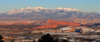
Featured Image for Home Page:

My friend Taylor and I started planning this trip about 3 weeks ago. We took 2 days off work and made it into a 4 day outing.
We left for GSENM Friday morning from Salt Lake. As we drove past Bryce Canyon snow started falling and the roads were pretty slick and snow-covered, which was perfect because we wanted to see the desert with snow. We saw the sign for Mossy Cave and made an impromptu and short walk up to it. It was awesome seeing the area in serenely falling snow, and making the first footprints going up. When we got to the cave, there were some giant icicles hanging from the ceiling. There were also some great dripping sounds to listen to.
After heading back to the truck, we continued on to Escalante. It was whiteout conditions with visibility at maybe 50 feet for much of the drive. By the time we got to the Hole in the Rock Road it was clear that more rain had fallen in the monument than snow, so it was very slick and muddy. We drove down the road and to the Harris Wash parking area. We made it intact thanks to some crazy drift driving by Taylor. We also had to cross the river 3 times, which was raging when we crossed it but had disappeared by the next day. It was dark when we pulled in so we set up the tent in the hills south of the parking area. It was pretty cold and there was a winter storm warning for the area, but I managed to sleep through wind battering the tent thanks to the earplugs I brought along.
We woke up on Saturday morning to find a rapidly melting dusting of snow and clear skies. We started hiking towards the West Fork Of Red Breaks slot canyon with the goal of completing the loop and seeing the Islomania Dome a.k.a. Cosmic Ashtray a.k.a. Devil's Quagmire a.k.a Escavolcano a.k.a Cosmic Navel a.k.a Intergalactic Bellybutton.
The part of the wash before the slot was surprisingly very dry so we figured we might have a chance at finding the slot passable. However after a fair distance of hiking and arriving at the slot we started encountering pools. At first they weren't bad but by the time we reached the bottom of the first difficult chockstone it was hip deep. Then, about 40 feet past that it was chest deep. Since we weren't equipped for that kind of stupid cold water and we had expensive camera gear with us, we decided to turn around and head out. It sucked putting in all the effort to get over it and then immediately doing the same going back down. I didn't take any pictures in the slot unfortunately. But this picture by Ashergrey shows the Chockstones. The area on the right of his picture was filled all the way up with water. It was a fun failure either way and as an NPS lady once said to me about backcountry outings, "Discretion is the better part of valor."
We drove a short way down Hole in the Rock Road to see the Devil's Garden, which I found to be a particularly fantastic spot and I've wanted to see it for a long time. It was at this point that we saw the first few people of the trip hanging out in the Garden.
Metate Arch ^
Fifty Mile Mountain over Devil's Garden ^
We drove back into Escalante and got some food before setting up the tent in the Escalante Petrified Forest State Park. We woke up the next morning and hiked the 1.75 miles through the petrified forest. The Trail of the Sleeping Rainbows is by far the best part of the place. There are thousands of incredible and varied pieces of wood. Some of the logs are absolutely enormous. It says the trail is extremely steep and strenuous, but even in the mud I found it to be what I would call leisurely and easy with no exposure to speak of. It is slightly steep. So I think they just put that to scare people and keep wood theft down, since it is SO abundant back there.
Me and a Giant Trunk ^
Petrified Bark^
We then drove to the Calf Creek trailhead. It was a spectacular drive between Escalante and Calf Creek. Calf Creek is a 5.5 Mile round trip hike that is essentially flat. The canyon was very quiet and we didn't see anyone else until we started heading back from the falls. I loved the crystal clear creek, and the falls are fantastic, however the greenery is all dead at this time of year, making for drab pics. The falls were flowing with more volume than I've seen in pictures due to snowmelt. Also the smear of green moss was missing from the rock where the falls run over it.
^The Falls
^The Cliffs above Calf Creek
A very tiny peice of rock that's ready to break (and a spiderweb) ^
After Calf Creek, we drove to Torrey by driving over Boulder Mountain. The views from the mountain are awesome, especially looking over the waterpocket fold at the Henry Mountains.
The Henry Mtns. seen from Boulder Mountain^
We got to Torrey just as it was getting dark and figured we'd sleep and then go to Capitol Reef early.
Our first hike in Capitol Reef was to the Tanks in Capitol Gorge. We didn't see a soul the whole time we were there and there were no cars at the trailhead. We took a somewhat unorthodox route to the Tanks which afforded us some spectacular views of the gorge and we saw some great rocks similar to the ones in the Boneyard near the wave.
The road into Capitol Gorge ^
Fascinating Rock Detail^
More Fascinating Rocks set in the landscape^
Cool Patterns on the slickrock^
The Tanks ^
An arch at the Tanks ^
After we saw the Tanks, we went up a boulder field above them and checked out some hanging valleys that looked like no one would have any reason to visit them. They were cool since they were obscure. We did some rock balancing and checked out some of the pools up there, and then headed back out.
A great rock for sitting on^
Climbing to random places^
A little valley that few would venture into^
A naturally balancing rock in said valley^
Unnaturally balancing rock made by Taylor.^ Who knows how long it will stay until the wind gets it.
After leaving Capitol Gorge, we headed back towards Fruita. I scrambled up to this cool hoodoo with the bluish layer behind it. v
To finish the trip, we went to Cathedral Valley. We went around the loop backwards. It's a weird area with the candy cane like bentonite hills and desolate expanses of interesting desert. I really thought Glass Mountain, a gypsum pile by the Temples of the Sun and the Moon was intriguing.
Glass Mountain in the foreground and Temple of the Sun/ Moon in the distance ^
Temple of The Moon looking taller than Temple of the Sun, even though the opposite is true. It's just perspective.
We also saw some humongous balancing rocks way off in the distance that I'm sure few have ever noticed. We needed to get back to home at this point so we took a dirt road that goes straight from Cathedral Valley to I-70. It was a really cool road through some absolutely huge pristine valleys. The first had volcanic black layers contrasting against burning red rock, the second had features similar to Little Wild Horse Butte near Goblin Valley set agains snow capped peaks and endless yellow grasses. The road then bent around past some tall red cliffs and the Temple of Solomon. It continued on for a very long distance and we got a bit worried that we might be headed the wrong way. It was worth it, however, to see black and yellow buttes and old ruined shacks as we went along.
Temple of Solomon on the back way out of Cathedral Valley^
Cool black spikes near Cathedral Valley^
Near Cathedral Valley^
That's the trip, after all this we went home.
Here are some creatures I saw while there:
An ugly spider ^
Lizard^
Featured Image for Home Page:
")
