Tarp Boy
Member
- Joined
- Jan 18, 2020
- Messages
- 24
I hike with two groups. This would be a trip with the Patioboys, a group of hiking friends mostly based in Northern Kentucky, a suburban area just south of Cincinnati, Ohio.
In a typical year, we choose dates for a spring and fall trip of 4 days over a weekend and try to accommodate everyone’s schedule. Sometimes we will schedule longer trips.
Our fearless leader Bob has been organizing these trips for decades. We typically gather a week or so before the trip when Bob will present several trail options and we all discuss our preferences and then choose one. Often we just ask Bob which one he likes best and we go with that. Mainly because he really thinks these out.
In the last few years, we have been doing successive short sections of the AT. The option at the top of the list for this fall would have been a NOBO section from near Watauga Lake into Damascus, VA. Bob had been looking forward to ending a trip there to soak in the trail town vibe.
That option had to be abandoned due to the destruction from Hurricane Helene. We are all saddened by the devastation that has befallen the communities in NC and TN, as well as FL, where one of our group lives.
So instead, we chose to do a loop starting at Bandy Creek Campground, in the southern TN portion of the Big South Fork National River & Recreation Area (BSF), about 3 ½ hours away. We had done a spring hike starting at the same location this year.
This trip was planned to start at Bandy Creek Campground, going northwest on the Sheltowee Trace Trail towards Charit Creek Lodge and camp near there or at Jake’s Place on the Twin Arches Loop trail. Please note that the Sheltowee Trace was extended further south several years ag,o using some existing trails, not all named here, so this could be a little confusing if you don't have a map with that reference. From there we would take the Slave Falls - Charit Creek trail towards the Sawmill TH and perhaps add in the Middle Creek Nature Loop trail before connecting to the Laurel Fork Creek Trail and camp where that trail meets the West Entrance Trail. Then it would be an easy hike back to the cars on that trail.
So much for planning though. We found out just prior to leaving that the Laurel Fork Creek Trail was closed due to downed trees from a severe storm in May. It wasn’t readily apparent though as it was not listed in the ‘Alerts’ for the area on the NPS.gov site. We found it buried in a News Release from back in July. Calls to the rangers’ desk didn’t help clarify the situation for us. They were unable to say if it was the entire trail or just the section we planned to take. So, as we gathered at the trailhead parking lot, we discussed some alternatives. Bob’s preferred option involved wading across the BSF river and taking the trail on the east side of the river back to Leatherwood Ford. He’s hiked most of the BSF and has been wanting to do this trail. So, we shuttled a car to Leatherwood Ford. That would later not be needed as you will learn.
You do need a back country permit to camp in the BSF, and I had gotten one online before while we were driving.
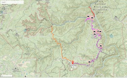
On this map we started at the red pin mark and hiked clockwise. Day 1 is in orange, Day two in blue. Red was my short day hike towards Maude's Crack, Day 3 is in light purple, and Day 4 in a darker purple. Your definition of the colors may vary, but I'm going with those!
There are a couple of locations you can park while backpacking from the Bandy Creek area. We chose to park at the campground pool lot. If you go here, just let the campground attendant at the entry booth know that you are headed to that lot to hike and they will let you through.
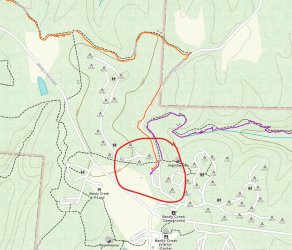
Pool parking lot is circled. This is where we started and ended. As you can see this looks like Grand Central Station, so a good map and a sense of direction is essential.
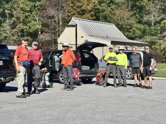
above - Bill, John, Dave (a newbie this trip), Bob, me, Mark N. and Eric
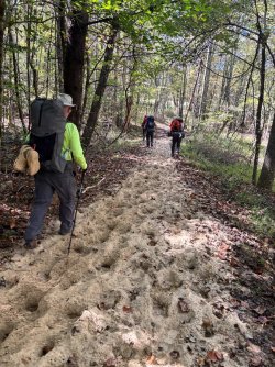
With all seven of us assembled at the campground pool parking lot, we started on the Sheltowee Trace trail just before noon. It starts on the gravel Duncan Hollow Road and cuts back into the woods shortly thereafter. Note that this part of the Sheltowee, as well as many of the sections of the trails we eventually took, are horse trails or forest service roads – not usually my first choice. And indeed, we did encounter several small groups on horses over the weekend. About 20 minutes in, we were hiking on a short section that was like beach hiking – deep loose sand. Very strange for this area we thought.
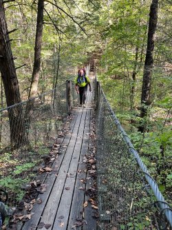
Eventually we left the horse trail and dropped down the Black Horse Branch trail to connect with the Charit Creek Hiking trail to a swinging bridge that crosses Station Camp Creek.
We found a nice campsite near that bridge just up the forest road that is used to supply the nearby Charit Creek Lodge. It’s near the Tackett Cabin ruins and gravesites (c.1863). The campsite was on a small island in a split on the creek.
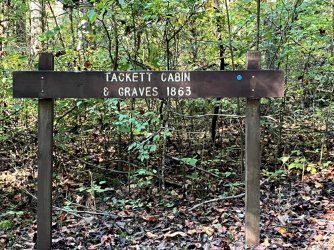
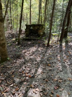
cabin ruin
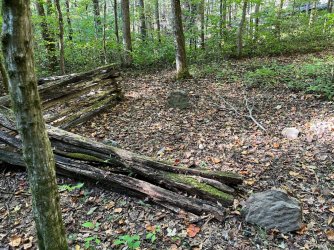
stone grave markers
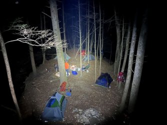
The 'Island campsite' at night.
The plan now was to head to the BSF river the next day and determine if it could be safely crossed and then find a campsite on either side of the river.
Shortly after leaving the campsite, we came to Charit Creek Lodge. I could go into details describing this place, but instead I encourage you to just visit the website https://www.ccl-bsf.com/theexperience to find out more.
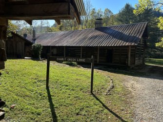
From there, we continued about 4 miles on the Station Creek trail, yet another horse trail.
As we got to the river, we surveyed the crossing and it looked to be shin to knee deep and, although fairly wide, quite doable to cross.
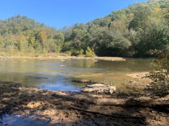
River crossing - the flags are to mark the safest crossing for horses. Note that this view is a little deceiving. What you see in the middle is a sandbar and on the other side the main channel is twice as wide as this near side.
This crossing is mainly used by horse riders to go to or from a horse camp on the ridge across the river. As we looked on, we saw someone preparing to cross from the other side. It turned out to be a bow hunter who knew the area well and advised us that the trail along the other side of the river had been washed out in places years earlier and would require much climbing up steep slopes and bushwhacking to get to the remaining sections of the east river trails. It makes sense now why the trails do not show as connected on my Gaia map.
We setup camp near the crossing and then several of us headed north on the John Muir/ Sheltowee trace trail to attempt to visit Maude’s Crack overlook, which climbs up through a split in the cliff face on a connector trail.
Yes, you read that right westerners, there is a JMT trail in the east too. I only made it a few miles before turning back due to a sore ankle.
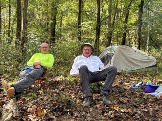
Me and Dave, chillin' at camp
The new plan, for the next day, was to take a connector trail up Station Creek to a junction with the Laurel Fork and John Muir trails where there is a bridge to cross the creek. We had come through that area in the spring and connected to the Laurel Fork trail then. If that trail looked usable, we would take that back to the junction with the West Entrance trail and camp there and then go out the West Entrance trail, as we had originally planned.
The next morning, shortly after starting on the connector trail, we came to a junction of the Laurel Fork and Station Camp creeks where there is another rather substantial bridge, but it had been partially washed away in the past. Fortunately, it was rather easy to rock hop across as I don’t think there had been much rain in the past few months.
At this point a couple of us went on a scouting mission to check where the horse trail splits off and the Laurel Fork trail starts. The decision was quickly made to abandon any thoughts of using this route. Right at that point there was a blow-down covering the split rail fence chute and we could see about 3 more massive trees down beyond that. Hey at least we found out now, before hiking a few more miles in and having to turn around!
With that decision made, the choice was made to follow the John Muir Trail and the Fall Branch Trail to our starting point after one more night out. Both of these trails are part of the Sheltowee Trace now. There was another shorter option but it was straight up on a horse trail. The JMT was nicely switch-backed over the 700' climb and didn't seem bad at all.
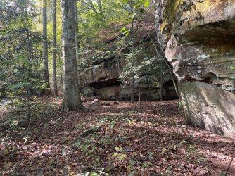
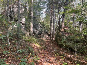
We had been on these trails in the spring, although we were going the opposite direction this time. I do love this section though because at times it opens up to some wonderful views and along the way there are many rock house caves under the cliffs in every hollow. We logged about 9 miles to get to a beautiful, but small campsite on a point overlooking the BSF river gorge. Note that there was only one water source that was flowing in this section. Fortunately, I had carried about an extra gallon of water up the steep climb after tanking up at Laurel Fork. It was fortunate because no one else (with a filter) who preceded the last three of us had thought about stopping at that last source. We all had to ration our water a bit on the last day out.
Here are some pics from this section:
And since it is that Halloween season:
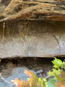
That night, we crammed into a small campsite at an exposed point high above the BSF river. There are few campsites to be had on this section of trail.
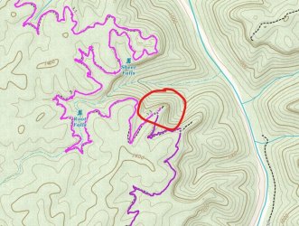
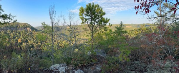
After dinner, we began to hear some thunder and see flashes in the distance. Someone mentioned it was only ‘heat lightning.’ Bill, our weather guru, said there is no such thing. And of course, the rest of us just jumped on that to get his goat. We did have some cell service, so I eventually came to his defense after doing a search verifying his statement. But the gentle ribbing was fun while it lasted. Bill checked and quickly revised his previous assessment of the storm to the north of us. A small but intense red ‘blob’ had suddenly appeared on the radar, moving straight to at us at about 50 miles per hour. It will be on top of us in 10 minutes he said, and he was spot on. We dove in the tents and did a lot of praying (serious praying) as the nearby thunder and lightning abounded. That and the light shower only lasted about 10 minutes – to our relief!
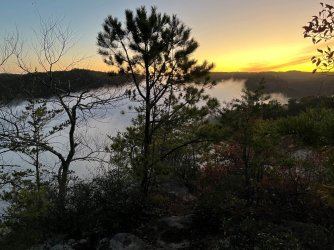
Sunrise the next morning.
The next morning, we got an early(ish) start and after about 4 miles got to a trail junction at the end of a forest service road where we took a break to let everyone catch up. Eric and I had gotten a jump on it because I was still having ankle problems and he had a sore throat and hadn’t eaten much or slept much. He was having a painful time swallowing. At the road, there was a mountain biker loading his bike in the back of a pickup. The JMT in this section is a hiking and mountain biking trail. We quickly arranged for him to take Eric back to Bandy Creek so he could head out and get his throat checked. Turns out he had a tonsillar abscess. Look that one up – it’s rather serious. He ended up being admitted to the hospital overnight for treatment but recovered quickly.
We took the Fall Branch trail at this junction and shortly passed some nice campsites and a good flowing stream, and after 4.6 miles we finished the final section at the campground where we started.
Overall, we hiked about 30 miles, not counting the side trip some took to Maude's crack.
I think I would have enjoyed the original, planned route more, but sometimes you just have to suck it up and realize that a day in the outdoors is great no matter what gets thrown at you. I think there are lots of opportunities to make loops of varying length here or to even do point to point hikes throughout the BSF. I’m ready to go back!
In a typical year, we choose dates for a spring and fall trip of 4 days over a weekend and try to accommodate everyone’s schedule. Sometimes we will schedule longer trips.
Our fearless leader Bob has been organizing these trips for decades. We typically gather a week or so before the trip when Bob will present several trail options and we all discuss our preferences and then choose one. Often we just ask Bob which one he likes best and we go with that. Mainly because he really thinks these out.
In the last few years, we have been doing successive short sections of the AT. The option at the top of the list for this fall would have been a NOBO section from near Watauga Lake into Damascus, VA. Bob had been looking forward to ending a trip there to soak in the trail town vibe.
That option had to be abandoned due to the destruction from Hurricane Helene. We are all saddened by the devastation that has befallen the communities in NC and TN, as well as FL, where one of our group lives.
So instead, we chose to do a loop starting at Bandy Creek Campground, in the southern TN portion of the Big South Fork National River & Recreation Area (BSF), about 3 ½ hours away. We had done a spring hike starting at the same location this year.
This trip was planned to start at Bandy Creek Campground, going northwest on the Sheltowee Trace Trail towards Charit Creek Lodge and camp near there or at Jake’s Place on the Twin Arches Loop trail. Please note that the Sheltowee Trace was extended further south several years ag,o using some existing trails, not all named here, so this could be a little confusing if you don't have a map with that reference. From there we would take the Slave Falls - Charit Creek trail towards the Sawmill TH and perhaps add in the Middle Creek Nature Loop trail before connecting to the Laurel Fork Creek Trail and camp where that trail meets the West Entrance Trail. Then it would be an easy hike back to the cars on that trail.
So much for planning though. We found out just prior to leaving that the Laurel Fork Creek Trail was closed due to downed trees from a severe storm in May. It wasn’t readily apparent though as it was not listed in the ‘Alerts’ for the area on the NPS.gov site. We found it buried in a News Release from back in July. Calls to the rangers’ desk didn’t help clarify the situation for us. They were unable to say if it was the entire trail or just the section we planned to take. So, as we gathered at the trailhead parking lot, we discussed some alternatives. Bob’s preferred option involved wading across the BSF river and taking the trail on the east side of the river back to Leatherwood Ford. He’s hiked most of the BSF and has been wanting to do this trail. So, we shuttled a car to Leatherwood Ford. That would later not be needed as you will learn.
You do need a back country permit to camp in the BSF, and I had gotten one online before while we were driving.

On this map we started at the red pin mark and hiked clockwise. Day 1 is in orange, Day two in blue. Red was my short day hike towards Maude's Crack, Day 3 is in light purple, and Day 4 in a darker purple. Your definition of the colors may vary, but I'm going with those!
There are a couple of locations you can park while backpacking from the Bandy Creek area. We chose to park at the campground pool lot. If you go here, just let the campground attendant at the entry booth know that you are headed to that lot to hike and they will let you through.

Pool parking lot is circled. This is where we started and ended. As you can see this looks like Grand Central Station, so a good map and a sense of direction is essential.

above - Bill, John, Dave (a newbie this trip), Bob, me, Mark N. and Eric
With all seven of us assembled at the campground pool parking lot, we started on the Sheltowee Trace trail just before noon. It starts on the gravel Duncan Hollow Road and cuts back into the woods shortly thereafter. Note that this part of the Sheltowee, as well as many of the sections of the trails we eventually took, are horse trails or forest service roads – not usually my first choice. And indeed, we did encounter several small groups on horses over the weekend. About 20 minutes in, we were hiking on a short section that was like beach hiking – deep loose sand. Very strange for this area we thought.

Eventually we left the horse trail and dropped down the Black Horse Branch trail to connect with the Charit Creek Hiking trail to a swinging bridge that crosses Station Camp Creek.

We found a nice campsite near that bridge just up the forest road that is used to supply the nearby Charit Creek Lodge. It’s near the Tackett Cabin ruins and gravesites (c.1863). The campsite was on a small island in a split on the creek.


cabin ruin

stone grave markers

The 'Island campsite' at night.
The plan now was to head to the BSF river the next day and determine if it could be safely crossed and then find a campsite on either side of the river.
Shortly after leaving the campsite, we came to Charit Creek Lodge. I could go into details describing this place, but instead I encourage you to just visit the website https://www.ccl-bsf.com/theexperience to find out more.

From there, we continued about 4 miles on the Station Creek trail, yet another horse trail.
As we got to the river, we surveyed the crossing and it looked to be shin to knee deep and, although fairly wide, quite doable to cross.

River crossing - the flags are to mark the safest crossing for horses. Note that this view is a little deceiving. What you see in the middle is a sandbar and on the other side the main channel is twice as wide as this near side.
This crossing is mainly used by horse riders to go to or from a horse camp on the ridge across the river. As we looked on, we saw someone preparing to cross from the other side. It turned out to be a bow hunter who knew the area well and advised us that the trail along the other side of the river had been washed out in places years earlier and would require much climbing up steep slopes and bushwhacking to get to the remaining sections of the east river trails. It makes sense now why the trails do not show as connected on my Gaia map.
We setup camp near the crossing and then several of us headed north on the John Muir/ Sheltowee trace trail to attempt to visit Maude’s Crack overlook, which climbs up through a split in the cliff face on a connector trail.
Yes, you read that right westerners, there is a JMT trail in the east too. I only made it a few miles before turning back due to a sore ankle.

Me and Dave, chillin' at camp
The new plan, for the next day, was to take a connector trail up Station Creek to a junction with the Laurel Fork and John Muir trails where there is a bridge to cross the creek. We had come through that area in the spring and connected to the Laurel Fork trail then. If that trail looked usable, we would take that back to the junction with the West Entrance trail and camp there and then go out the West Entrance trail, as we had originally planned.
The next morning, shortly after starting on the connector trail, we came to a junction of the Laurel Fork and Station Camp creeks where there is another rather substantial bridge, but it had been partially washed away in the past. Fortunately, it was rather easy to rock hop across as I don’t think there had been much rain in the past few months.
At this point a couple of us went on a scouting mission to check where the horse trail splits off and the Laurel Fork trail starts. The decision was quickly made to abandon any thoughts of using this route. Right at that point there was a blow-down covering the split rail fence chute and we could see about 3 more massive trees down beyond that. Hey at least we found out now, before hiking a few more miles in and having to turn around!
With that decision made, the choice was made to follow the John Muir Trail and the Fall Branch Trail to our starting point after one more night out. Both of these trails are part of the Sheltowee Trace now. There was another shorter option but it was straight up on a horse trail. The JMT was nicely switch-backed over the 700' climb and didn't seem bad at all.
We had been on these trails in the spring, although we were going the opposite direction this time. I do love this section though because at times it opens up to some wonderful views and along the way there are many rock house caves under the cliffs in every hollow. We logged about 9 miles to get to a beautiful, but small campsite on a point overlooking the BSF river gorge. Note that there was only one water source that was flowing in this section. Fortunately, I had carried about an extra gallon of water up the steep climb after tanking up at Laurel Fork. It was fortunate because no one else (with a filter) who preceded the last three of us had thought about stopping at that last source. We all had to ration our water a bit on the last day out.
Here are some pics from this section:


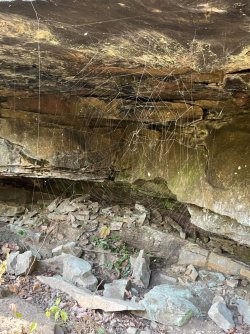
And since it is that Halloween season:


That night, we crammed into a small campsite at an exposed point high above the BSF river. There are few campsites to be had on this section of trail.


After dinner, we began to hear some thunder and see flashes in the distance. Someone mentioned it was only ‘heat lightning.’ Bill, our weather guru, said there is no such thing. And of course, the rest of us just jumped on that to get his goat. We did have some cell service, so I eventually came to his defense after doing a search verifying his statement. But the gentle ribbing was fun while it lasted. Bill checked and quickly revised his previous assessment of the storm to the north of us. A small but intense red ‘blob’ had suddenly appeared on the radar, moving straight to at us at about 50 miles per hour. It will be on top of us in 10 minutes he said, and he was spot on. We dove in the tents and did a lot of praying (serious praying) as the nearby thunder and lightning abounded. That and the light shower only lasted about 10 minutes – to our relief!

Sunrise the next morning.
The next morning, we got an early(ish) start and after about 4 miles got to a trail junction at the end of a forest service road where we took a break to let everyone catch up. Eric and I had gotten a jump on it because I was still having ankle problems and he had a sore throat and hadn’t eaten much or slept much. He was having a painful time swallowing. At the road, there was a mountain biker loading his bike in the back of a pickup. The JMT in this section is a hiking and mountain biking trail. We quickly arranged for him to take Eric back to Bandy Creek so he could head out and get his throat checked. Turns out he had a tonsillar abscess. Look that one up – it’s rather serious. He ended up being admitted to the hospital overnight for treatment but recovered quickly.
We took the Fall Branch trail at this junction and shortly passed some nice campsites and a good flowing stream, and after 4.6 miles we finished the final section at the campground where we started.
Overall, we hiked about 30 miles, not counting the side trip some took to Maude's crack.
I think I would have enjoyed the original, planned route more, but sometimes you just have to suck it up and realize that a day in the outdoors is great no matter what gets thrown at you. I think there are lots of opportunities to make loops of varying length here or to even do point to point hikes throughout the BSF. I’m ready to go back!

