Bechler Meadows off trail?

shredhiker

Member
Joined
Feb 14, 2023
Messages
151
We're headed out next week on a 6 day trip out & back from the Bechler Ranger Station. Our last two nights are at 9B2, then 9A1. I'm curious to know if this section of meadow would be OK for off trail travel this time of year? It looks to be about half a mile across, vs 3 miles around the long way on the the trail. It'll be our first time in this section of the park,, so I thought I'd ask rather than assume it's as easy as the satellite view makes it appear. Ideally, I'd like the option to drop our packs at camp and make a side trip up to Dunanda Falls that day.

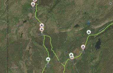
2nd photo is a more zoomed out look for context.
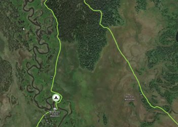
2024-08-02_18h26_59.jpg

2024-08-02_18h28_00.jpg
 
Good question. I don't love the idea of bashing through the Bechler - especially given how wet it often is - from an LNT standpoint. Easy to leave an unsightly trail of smashed grass that other visitors may further develop as a desire-path. I'd probably just take the 45 minutes and go the long way.
 
We're headed out next week on a 6 day trip out & back from the Bechler Ranger Station. Our last two nights are at 9B2, then 9A1. I'm curious to know if this section of meadow would be OK for off trail travel this time of year? It looks to be about half a mile across, vs 3 miles around the long way on the the trail. It'll be our first time in this section of the park,, so I thought I'd ask rather than assume it's as easy as the satellite view makes it appear. Ideally, I'd like the option to drop our packs at camp and make a side trip up to Dunanda Falls that day.

2nd photo is a more zoomed out look for context.
View attachment 133250

View attachment 133251
Given that many portions of Bechler Meadow have standing water year-round, I'd be hesitant to go off-trail for very long if at all. Unless you don't mind wet feet and mud.

I'm just thinking of the little sections along the trail where the water is 6" deep even in late September and early October when I usually go. Bechler Meadow is an interesting place. Haha.

Edit: looking more closely at sat images, it almost looks like there are portions of a use trail through there... 44.2085277, -111.0061383
Also definitely some marshy spots to deal with.
 
Last edited:
We opted to stick to the trail, the eastern end of that was all grass and pretty well dried out.

The western end had a lot of willows etc. limiting visibility and it was hard to tell what we might get into trying to get through that.
 
Back
Top