Arch/Texas Canyon Rim Route Beta

rwyble

New Member
Joined
Sep 30, 2025
Messages
3
Howdy y'all! I'm interested in putting together a multiday bikepack+backpack combo trip around and in the Texas and Arch Canyon area but haven't been into those canyons yet.

I've got two areas of question if anyone has some intel they'd be willing to share.

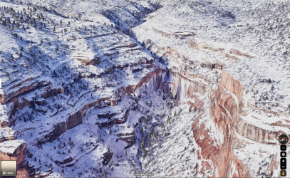
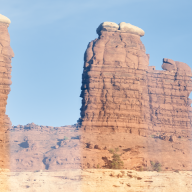
First, has anyone found a route to get out of the head of any of the branches of Arch or Texas Canyons to get up onto the rim and connect to the dirt roads on the rim?

Second, has anybody biked the West Rim Texas Canyon trail? Or if you've hiked it, how much of that trail would be bike friendly? On sat image maps it looks like part of it was an old double track, so I'm hopeful it would be ridable to connect from Elk Ridge Road down to the road that goes up west of Lower Arch and Texas Canyons (East of North Fork Mule Canyon)

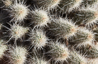
Here's a picture of some cactus needles for fun :)
Screenshot 2026-10-28 at 4.16.26 PM.png
 
Just glancing at Google Earth I see the places (2 are trails to get out) I get time I can rough plot them for you. Depends how much bushwack you want to do.
 
Second, has anybody biked the West Rim Texas Canyon trail? Or if you've hiked it, how much of that trail would be bike friendly? On sat image maps it looks like part of it was an old double track, so I'm hopeful it would be ridable to connect from Elk Ridge Road down to the road that goes up west of Lower Arch and Texas Canyons (East of North Fork Mule Canyon)

I have spent time on the canyon rims and the West Rim Texas Canyon Trail.

@Bob, I am interested in the 2 trails/places that could get out, even just the general locations.

I have been down the West Rim Texas Canyon trail from Elk Ridge, it is an old double track. The descent down from Elk Ridge is steeper than it looks. We did it during some thunderstorm rains in June a couple years back. We only went west until we hit the wash- which was flashing at the time, and then we turned back and went east/SE over a small ridge and then on to an overlook down into Arch.
Some sections would be easier to bike than others. The track after the wash heading west to southwest looks much better for a bike.

For Texas canyon.
From across the canyon, getting down into the very upper reaches of Texas looked straightforward from a slope on the west.
The problem is, I have not found any route mentioned past the pouroff just past that entry into Texas. The only thing I have found is someone rappelled it and complained of the bushwack until the canyon turned east. They rode out the jeep road in Arch.

GE of the Texas pouoff- there are some really tall ponderosas in the box canyon.
1793637284152.png

For Arch, I have looked down from the rim by South Elk Hole, and there were large pouroffs both for Arch and Butts. They were easy to see when we were there, because everything was flashing. Butts seemed to have access to the upper canyon, but not sure if pouroff blocked it farther down.

I hope to be proven wrong with a route down in.
 
Ugly ...... all I did was plot a prelim route around in there, alot of years ago. No on the ground looks. I'll take a look again in a day or two and post what i think..... A lot depends on your comfortablility on exposure and steepness...lol. Back then I deemed it as a difficult route, albit very remote and a low chance many had been thru there....which we liked back when we were doing a lot of routes down in that country.
 
Ok, Here is what I had plotted, with additions. Red - route. Blue - some existing trails (conditon?). Yellow - looks like it goes. Blue dots - water. I'd bet the Arch Canyon road is about gone, especially after this fallsrains, unless you have a decent 4x4. Never was that great. Looks like only way out of Texas Canyon would be tough...a lot of trial and error.......I'd call it a no go. There is a old trail up to the fork. The trail dead ends at the pouroff in Arch Canyon. Looks like Butts you can get out by the spring.

I'd do the route, but I don't guarantee some places would go and I dont know anyones experience. Water is a question, there are tanks on GE, should be water at pouroffs, but it could be a crapshoot. It's a Spring or Fall trip. Caching water would be advised. It's a trip not for the newby. Help is a long ways away!

Click here to view on CalTopo
 
Last edited:
I have been down the West Rim Texas Canyon trail from Elk Ridge, it is an old double track. The descent down from Elk Ridge is steeper than it looks. We did it during some thunderstorm rains in June a couple years back. We only went west until we hit the wash- which was flashing at the time, and then we turned back and went east/SE over a small ridge and then on to an overlook down into Arch.
Some sections would be easier to bike than others. The track after the wash heading west to southwest looks much better for a bike.
Hey! Thanks for the info about the trail, I'd happily hike a bike down some of the steep first descent if its a bit gnarly. Then hopefully its smoother riding the rest of the way to connect to the dirt road on the south end
 
Looks like Butts you can get out by the spring.
Bob, this is awesome, thanks for intel and map routing. From my scouting I was liking the route out of Butts by the Spring as best option, looks like it should go.

On the red route you drew, getting out of upper Arch to connect up to the overlook, have you done that exit section or heard of others making it up there? I thought it looked potentially too cliffy to make it out there, but again I've not been to this canyon system yet.

As for experience/exposure, I'm fine with some exposure and route finding so I think there's good potential to make something happen here. I also was thinking caching water would be the move.
 
I have not been there, havent talked to anyone that has. Can't say any of it is a go.... Its pretty rugged and will have a lot of "looking" for the route. Make sure to take multiple lengths of webbing. I plotted it to do many years ago....but never went for it. If you attempt it we expect a trip report and pics!
 
Back
Top