balzaccom
Member
- Joined
- Sep 30, 2014
- Messages
- 898
We had both spent the previous three previous years recovering from various ailments--me from arthritis in my knee, and M from tendonitis in her left foot. And that one took forever. But we were now healthy, and this trip was our chance hike about 40 miles in five days, back to our good old days of more ambitious backpacking trips.
But that's not exactly what happened.
DAY ONE:
On the drive down to Lake thomas Edison, we discovered the wonderful Rancho San Miguel Market in Madera, where we found a delicious torta de jamon that exceeded expectations...and great produce at great prices...and whole hispanic foods to go section. We made a note to ourselves to stop here on the way back home!
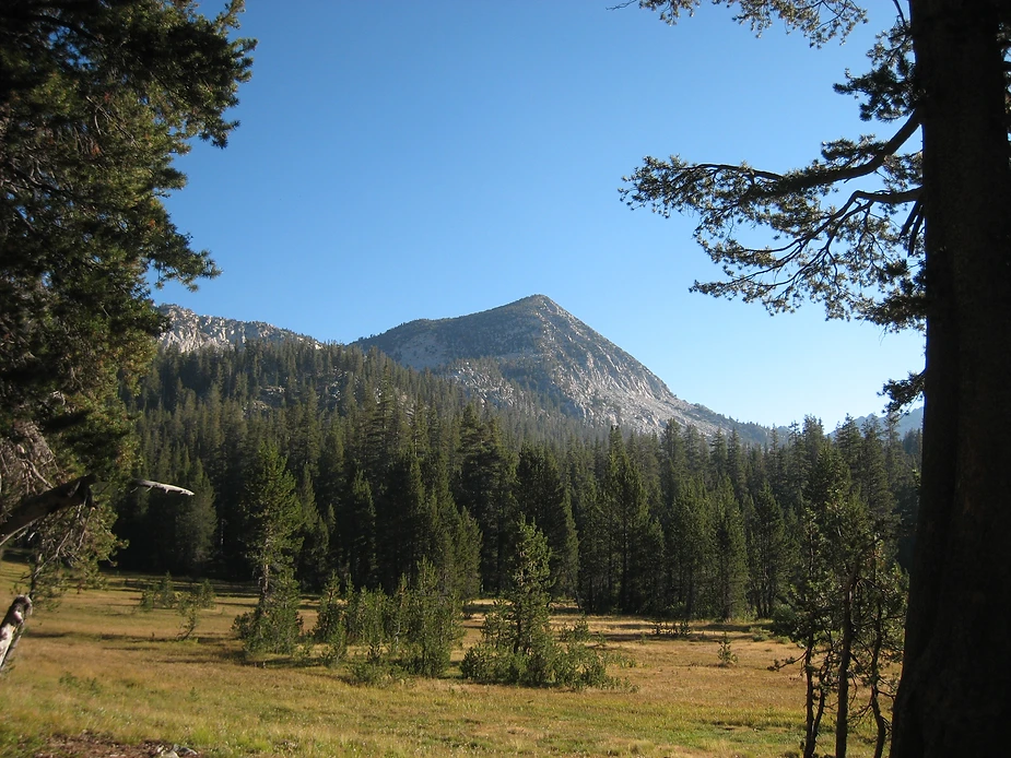
The permit box was jam-packed at the USFS office in Prather, and we pawed through at least fifty envelopes before we found ours. From there we drove through Shaver and Huntington Lakes to find that the road to Vermilion Valley Resortwas worse than ever--just as steep and narrow and twisty, but the pavement was in much worse shape than ten years ago. We found a campsite at the regular VVR campground and wandered around, checking out the trailheads--there are two here...but the one to Graveyard Lakes and Mono Pass is missing its sign, since a giant pine fell on it.
DAY TWO:
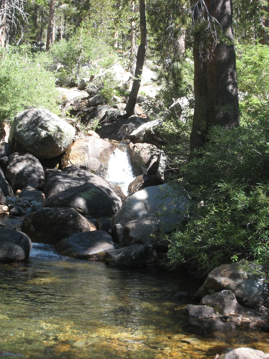
We got a good start and were up at the junction at Cold Creek by 10 am, delighted to have seen a bear racing through the woods on the uphill section below Cold Creek. We stopped there to filter water, then continued on across the creek towards Goodale Pass. There were not many people on the trail--we met only one hiker in this first section, then two guys at the junction. And we didn't see another hiker until the Graveyard spur trail.
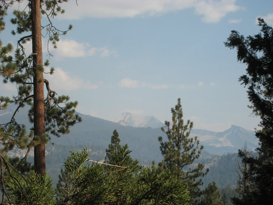
The good news was that the smoky air from distant fires cleared up as we hiked.
By 11:45 we were at the spur trail, and chatted with a hiker/hunter from south AFrica. We wondered how he would get a deer out of here. That's a long eight miles to carry that much weight.
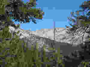
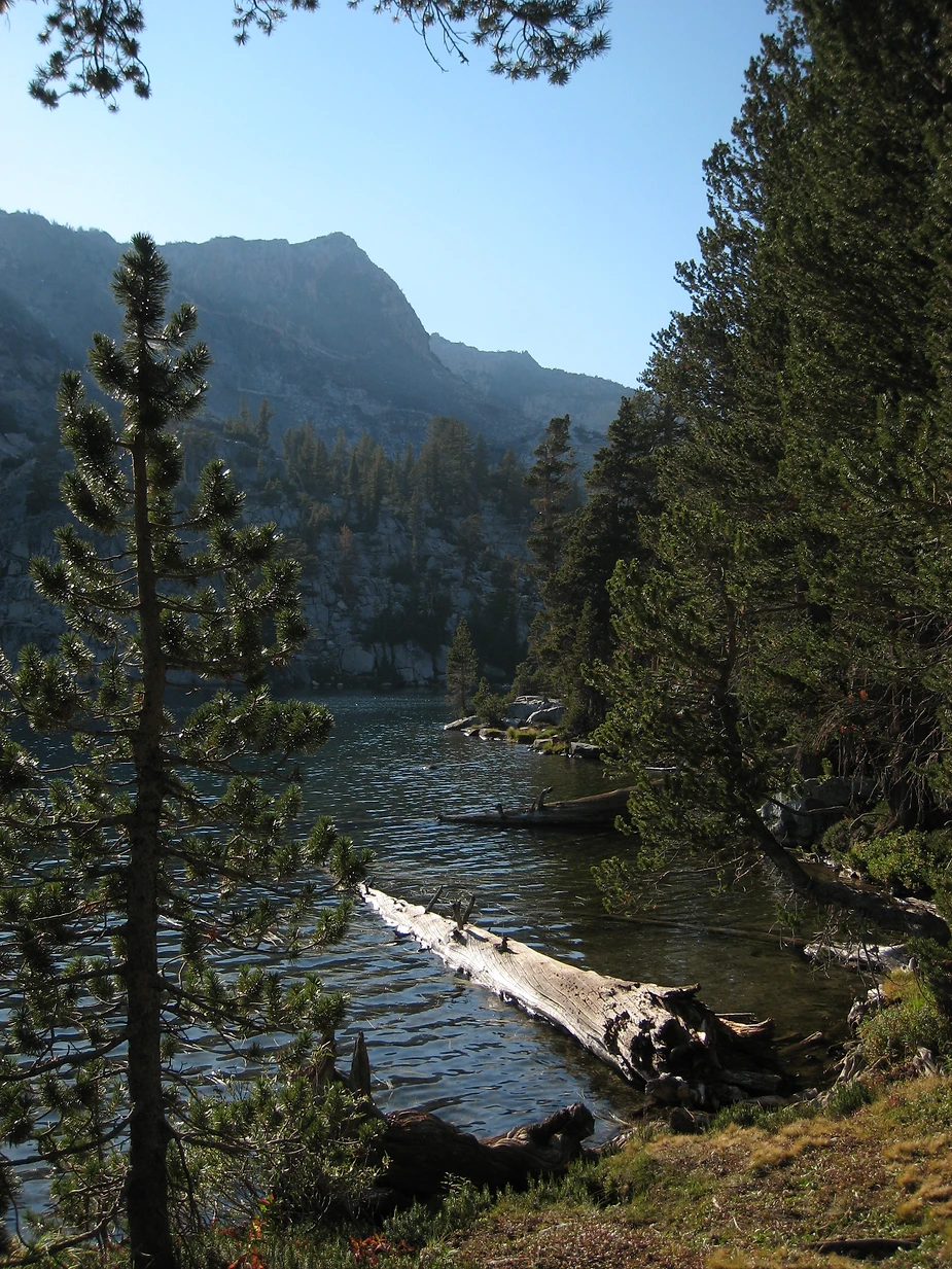
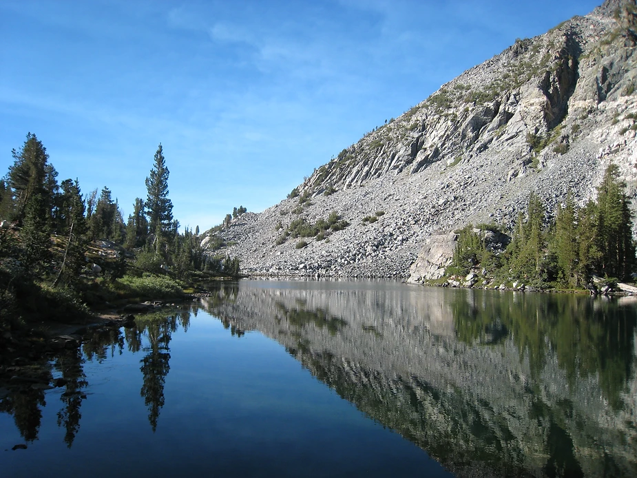
It was a tough, steep climb to Graveyard Lakes, but we arruved by 2:30 or so...and on the way we saw a deer on the way that had eluded our hunter friend.
There was only one other group at Graveyard lake, and they were camped to the left of the trail, so we camped at a large site on the right. Later we found an even more secluded site beyond ours...but didn't see any real reason to move. But next time...
We took a nap, and then wandered up to the far end of the lake to explore the trail up to the rest of the lakes...which made a steep and rocky ascent up a rough talus slope. Here there was no smoke at all. We ate an early dinner and early to bed, well satisfied with a good day's hiking and a beautiful campsite. So far, so good.
DAY THREE:
We woke up ready for another good day, hiking over Goodale Pass to Lake of the Lone Indian and Wilbur May Lake. That was the plan. But walking around camp, M was in tears. After three years of slow recovery from bad tendonitis on her left heel, her right heel was now giving her the same kind of pain.
That led to a serious conversation over breakfast. We could keep going, but if her heel got worse, that meant a longer hike out, and didn't seem like a good idea. We could hike back out slowly today...maybe taking two days...or even three if we needed them. But she was unwilling to bail completely. So what should we do?
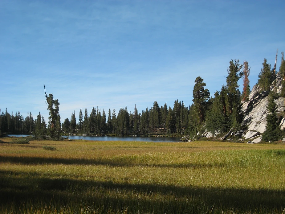
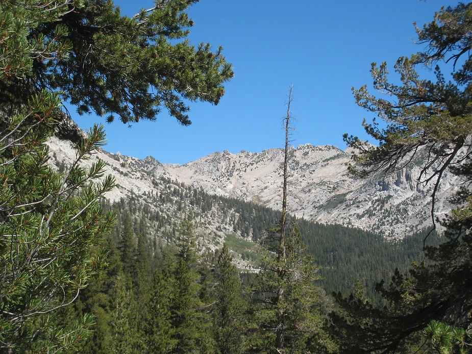
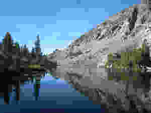
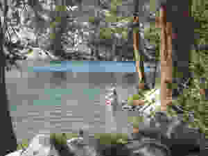
In the end, we decided to take a lay day at Graveyard Lakes and then see how her heel felt. Without our packs we spent the morning slowly walk through the four major lakes. I fished at all four, and caught fish at all four. The upper lake was quite alpine and austere, and we were delight to see a tiny pika in the rocks. The two middle lakes are more intimate. There's a nice campsite at the second lake, and I preferred the fishing there, too.
We met and chatted with the other group at the lake, who told us that the hunter was thinking of carrying the deer out (he claimed to be able to carry 130 pounds in his pack) or seal the meat in plastic bags in the lake and make two trips....hmmm.
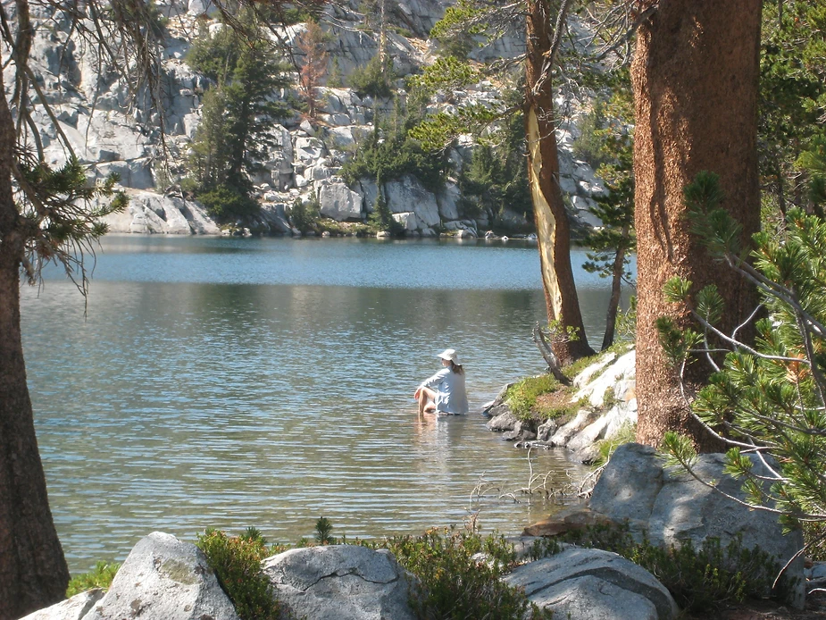
We were back in camp by lunchtime, and after the usual nap the afternoon went slowly. M meditated and iced her foot in the lake, I tried to fish with small success...and then we settled in for an early dinner and another long conversation about plans. We decided that we shouldn't try to go farther...as we couldn't be sure M's heel wouldn't get worse. So we would hike out slowly, taking as long as we needed, and camping along the way if her heel needed more rest. We were disappointed, but happy that we had seen this lovely place.
But a nice early dinner of ramen curry was delicious and we were in bed.
DAY FOUR:
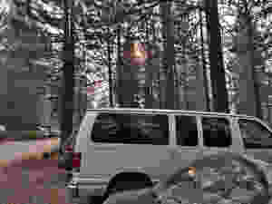
We woke up at 4:30 to the smell of smoke. That's never a good sign when you are in the backcountry. Then at 5:30 an idiot arrived at the lake and started calling for his dog Reno and giving piercing whistles. Labor Day always seems to bring out the knuckleheads.
The smoke smell was still there at 6:30 when we got up...but we couldn't see much in the air. We packed up and hit the trail before 8. We took it easy, but were still down at Cold Creek junction by a bit after ten. Stopped here to rest and let M soak her foot for a while in the icy stream. We'd already seen about fifteen people hiking on the trail in, and expected more.because of the beginning of Labor Day weekend.
Part of our plan was to camp here if needed, but after icing her foot in the stream M felt good enough to continue. But which trail should we take? We met our friends from Graveyard Lakes again here, and they took the shorter trail.
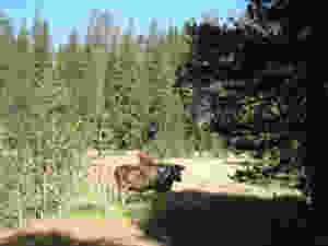
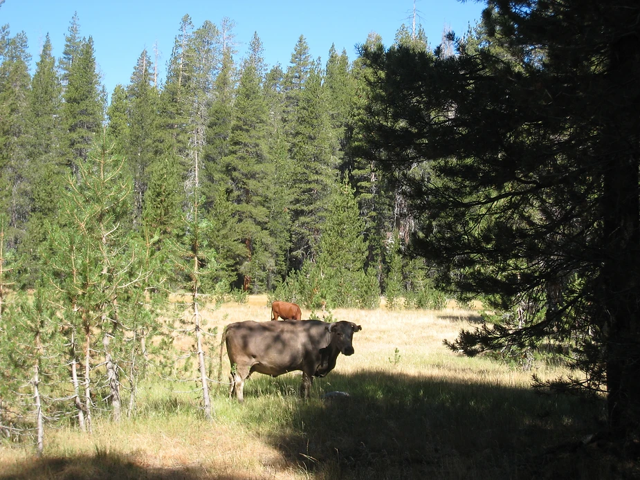
We decided to try the cut-off to the Devil's Bathtub Trail ..with the idea we could camp along Cold Creek if needed, since the trail roughly followed it. The trail was easy...albeit full of cows and their leavings, and very dusty from the cattle traffic, who clearly used it more than hikers do. But it is a good ways from the creek, and it would have been hard to find a campsite along here if we had needed it. Luckily, M's foot held out and we didn't.
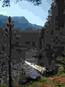
By 11:45 we were at the junction with the Devil's Bathtub Trail...and had twice seen a young bear foraging through the wood. The creek here looked miserable--muddy and trampled by cows--but I suppose you could find a place to get water if you went upstream...
We pushed on, thinking that we could get M a place to soak her foot while we are lunch where the trail meets Cold Creek again. Now we were meeting lots more people...and some day-hikers to the lake as well as backpackers. But the trail and Cold Creek never really meet--and we finally gave up and ate lunch where it crosses a small tributary. From there it was an easy mile back to the trailhead...but it was a hot, smoky mile.
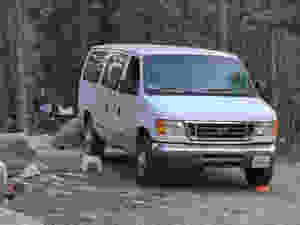
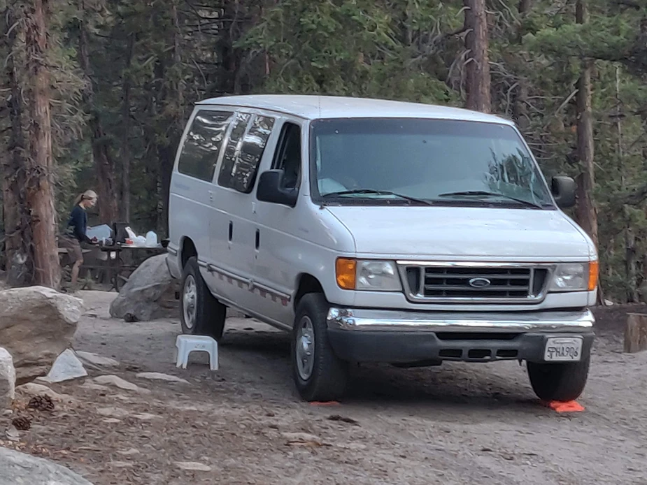
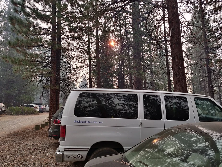
We made it to our van about 1:30 and decided to stay the night at the campground there, rather than driving the six hours home--an amusing consideration, as it would turn out. because we later found out that we didn't have a choice.
We napped in the van, read books, and later in the afternoon were joined by two hikers who set up a tent nearby. After their tent was up, one if them stopped by to say hello...and that's when we learned that the fire above Shaver Lake had closed off Highway 168 completely... and that was our only road out. (The guys had been camped just the other side of Goodale Pass, and from there they could not only smell the smoke...they could see the column rising to the West.)
And so what began as a restful evening before the drive out became something less--a waiting for Godot kind of existence.
DAY FIVE:
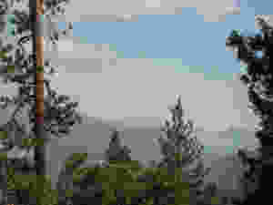
The smoke was really bad this morning...and we ate breakfast in the van to avoid going out into the air. The sun is a dull orange glow.
So what began as a challenge to see if we could still get out into the backcountry became a challenge to see if we could get out OF the backcountry. We were in good shape for the short term. We had food...two more days from our backpacking trip, plus extra food we always have in the van. Water was available at the main campground, and we had ten gallons in the van. But clean air to breathe was harder to find.. and who knows how long we might have to stay here...a day, two, or more.
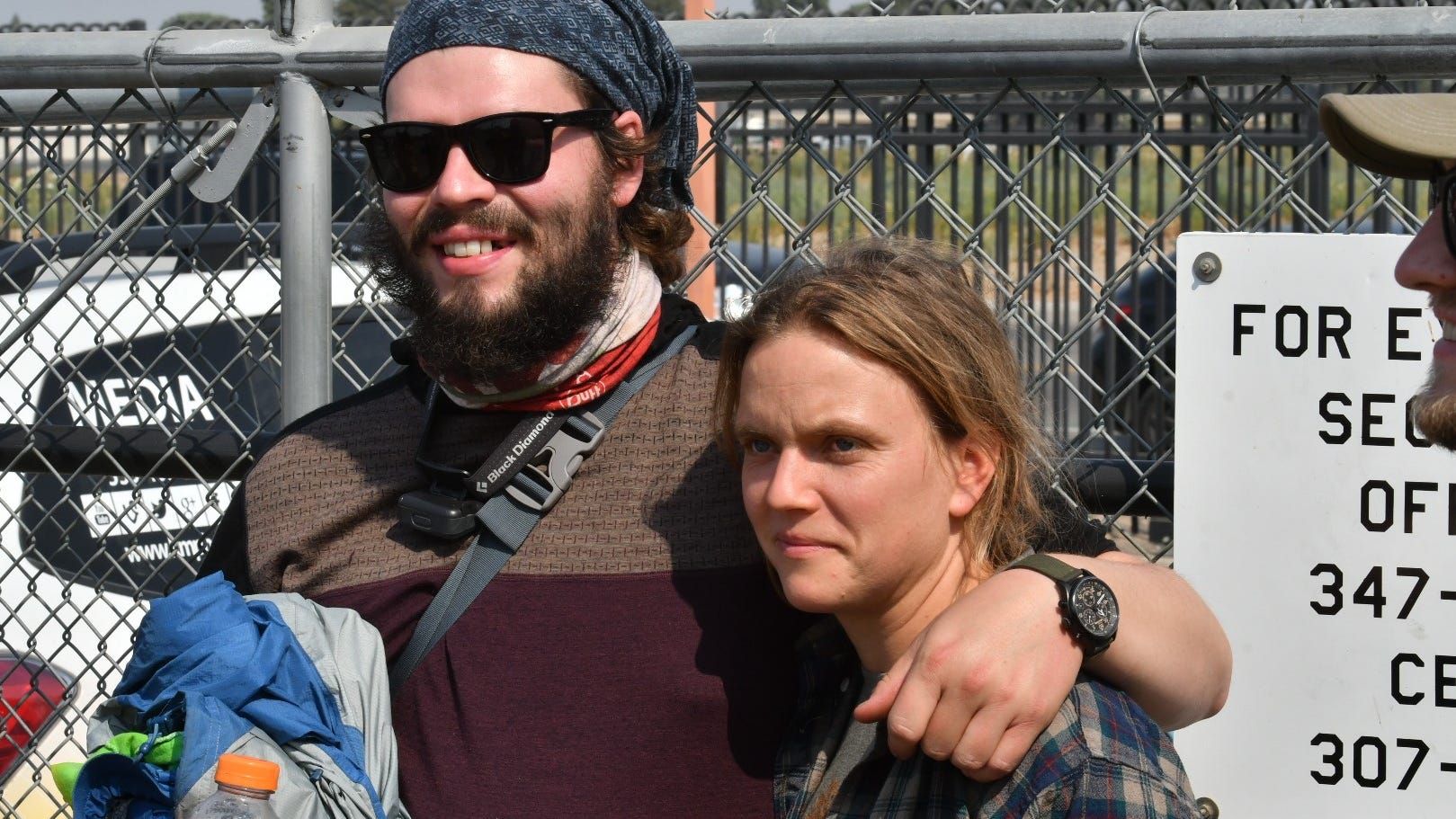
At the trailhead, we chatted with some hikers who come out and want to leave. Others arrive and leave on day-hikes from the campground, looking to stay busy . And we are all waiting for word from CalFire...
And then just before noon, that word comes that the entire area is to be evacuated...and the road is open. So from being trapped, we go to being told to leave.
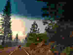
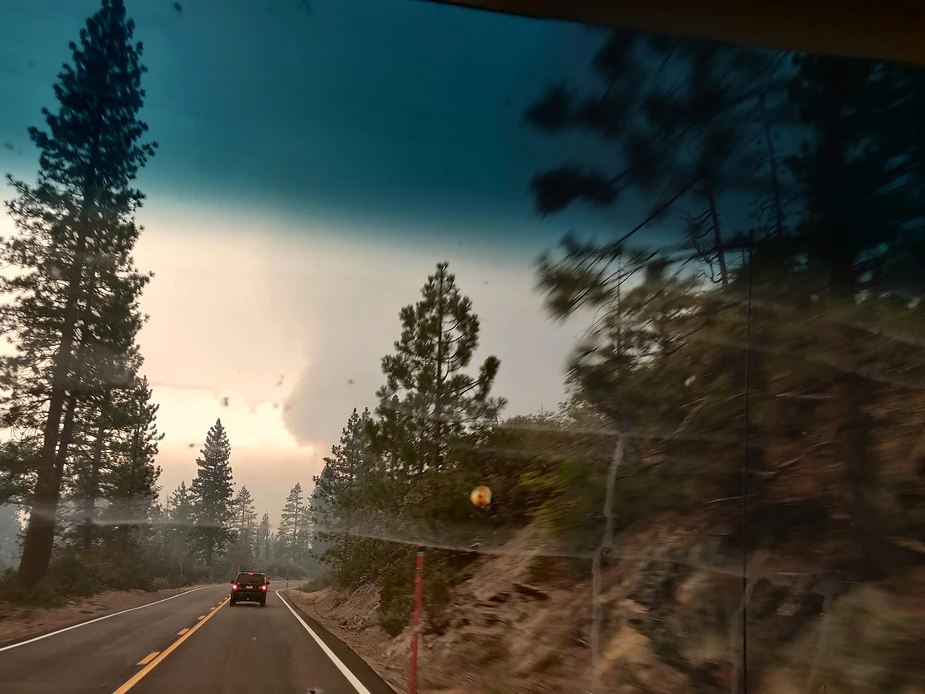
We joined a convoy of vehicles over Kaiser Pass Road, slowly climbing out of danger. And after passing through clouds of smoke on the way--the worst was near Shaver Lake--we finally got down to Prather and relative safety.
Here's hoping that all those through hikers at VVR got to where they wanted to go---or at least got to where they could get free of the fires and smoke.
But that's not exactly what happened.
DAY ONE:
On the drive down to Lake thomas Edison, we discovered the wonderful Rancho San Miguel Market in Madera, where we found a delicious torta de jamon that exceeded expectations...and great produce at great prices...and whole hispanic foods to go section. We made a note to ourselves to stop here on the way back home!
The permit box was jam-packed at the USFS office in Prather, and we pawed through at least fifty envelopes before we found ours. From there we drove through Shaver and Huntington Lakes to find that the road to Vermilion Valley Resortwas worse than ever--just as steep and narrow and twisty, but the pavement was in much worse shape than ten years ago. We found a campsite at the regular VVR campground and wandered around, checking out the trailheads--there are two here...but the one to Graveyard Lakes and Mono Pass is missing its sign, since a giant pine fell on it.
DAY TWO:
We got a good start and were up at the junction at Cold Creek by 10 am, delighted to have seen a bear racing through the woods on the uphill section below Cold Creek. We stopped there to filter water, then continued on across the creek towards Goodale Pass. There were not many people on the trail--we met only one hiker in this first section, then two guys at the junction. And we didn't see another hiker until the Graveyard spur trail.
The good news was that the smoky air from distant fires cleared up as we hiked.
By 11:45 we were at the spur trail, and chatted with a hiker/hunter from south AFrica. We wondered how he would get a deer out of here. That's a long eight miles to carry that much weight.
It was a tough, steep climb to Graveyard Lakes, but we arruved by 2:30 or so...and on the way we saw a deer on the way that had eluded our hunter friend.
There was only one other group at Graveyard lake, and they were camped to the left of the trail, so we camped at a large site on the right. Later we found an even more secluded site beyond ours...but didn't see any real reason to move. But next time...
We took a nap, and then wandered up to the far end of the lake to explore the trail up to the rest of the lakes...which made a steep and rocky ascent up a rough talus slope. Here there was no smoke at all. We ate an early dinner and early to bed, well satisfied with a good day's hiking and a beautiful campsite. So far, so good.
DAY THREE:
We woke up ready for another good day, hiking over Goodale Pass to Lake of the Lone Indian and Wilbur May Lake. That was the plan. But walking around camp, M was in tears. After three years of slow recovery from bad tendonitis on her left heel, her right heel was now giving her the same kind of pain.
That led to a serious conversation over breakfast. We could keep going, but if her heel got worse, that meant a longer hike out, and didn't seem like a good idea. We could hike back out slowly today...maybe taking two days...or even three if we needed them. But she was unwilling to bail completely. So what should we do?
In the end, we decided to take a lay day at Graveyard Lakes and then see how her heel felt. Without our packs we spent the morning slowly walk through the four major lakes. I fished at all four, and caught fish at all four. The upper lake was quite alpine and austere, and we were delight to see a tiny pika in the rocks. The two middle lakes are more intimate. There's a nice campsite at the second lake, and I preferred the fishing there, too.
We met and chatted with the other group at the lake, who told us that the hunter was thinking of carrying the deer out (he claimed to be able to carry 130 pounds in his pack) or seal the meat in plastic bags in the lake and make two trips....hmmm.
We were back in camp by lunchtime, and after the usual nap the afternoon went slowly. M meditated and iced her foot in the lake, I tried to fish with small success...and then we settled in for an early dinner and another long conversation about plans. We decided that we shouldn't try to go farther...as we couldn't be sure M's heel wouldn't get worse. So we would hike out slowly, taking as long as we needed, and camping along the way if her heel needed more rest. We were disappointed, but happy that we had seen this lovely place.
But a nice early dinner of ramen curry was delicious and we were in bed.
DAY FOUR:
We woke up at 4:30 to the smell of smoke. That's never a good sign when you are in the backcountry. Then at 5:30 an idiot arrived at the lake and started calling for his dog Reno and giving piercing whistles. Labor Day always seems to bring out the knuckleheads.
The smoke smell was still there at 6:30 when we got up...but we couldn't see much in the air. We packed up and hit the trail before 8. We took it easy, but were still down at Cold Creek junction by a bit after ten. Stopped here to rest and let M soak her foot for a while in the icy stream. We'd already seen about fifteen people hiking on the trail in, and expected more.because of the beginning of Labor Day weekend.
Part of our plan was to camp here if needed, but after icing her foot in the stream M felt good enough to continue. But which trail should we take? We met our friends from Graveyard Lakes again here, and they took the shorter trail.
We decided to try the cut-off to the Devil's Bathtub Trail ..with the idea we could camp along Cold Creek if needed, since the trail roughly followed it. The trail was easy...albeit full of cows and their leavings, and very dusty from the cattle traffic, who clearly used it more than hikers do. But it is a good ways from the creek, and it would have been hard to find a campsite along here if we had needed it. Luckily, M's foot held out and we didn't.
By 11:45 we were at the junction with the Devil's Bathtub Trail...and had twice seen a young bear foraging through the wood. The creek here looked miserable--muddy and trampled by cows--but I suppose you could find a place to get water if you went upstream...
We pushed on, thinking that we could get M a place to soak her foot while we are lunch where the trail meets Cold Creek again. Now we were meeting lots more people...and some day-hikers to the lake as well as backpackers. But the trail and Cold Creek never really meet--and we finally gave up and ate lunch where it crosses a small tributary. From there it was an easy mile back to the trailhead...but it was a hot, smoky mile.
We made it to our van about 1:30 and decided to stay the night at the campground there, rather than driving the six hours home--an amusing consideration, as it would turn out. because we later found out that we didn't have a choice.
We napped in the van, read books, and later in the afternoon were joined by two hikers who set up a tent nearby. After their tent was up, one if them stopped by to say hello...and that's when we learned that the fire above Shaver Lake had closed off Highway 168 completely... and that was our only road out. (The guys had been camped just the other side of Goodale Pass, and from there they could not only smell the smoke...they could see the column rising to the West.)
And so what began as a restful evening before the drive out became something less--a waiting for Godot kind of existence.
DAY FIVE:
The smoke was really bad this morning...and we ate breakfast in the van to avoid going out into the air. The sun is a dull orange glow.
So what began as a challenge to see if we could still get out into the backcountry became a challenge to see if we could get out OF the backcountry. We were in good shape for the short term. We had food...two more days from our backpacking trip, plus extra food we always have in the van. Water was available at the main campground, and we had ten gallons in the van. But clean air to breathe was harder to find.. and who knows how long we might have to stay here...a day, two, or more.
At the trailhead, we chatted with some hikers who come out and want to leave. Others arrive and leave on day-hikes from the campground, looking to stay busy . And we are all waiting for word from CalFire...
And then just before noon, that word comes that the entire area is to be evacuated...and the road is open. So from being trapped, we go to being told to leave.
We joined a convoy of vehicles over Kaiser Pass Road, slowly climbing out of danger. And after passing through clouds of smoke on the way--the worst was near Shaver Lake--we finally got down to Prather and relative safety.
Here's hoping that all those through hikers at VVR got to where they wanted to go---or at least got to where they could get free of the fires and smoke.