Udink
Still right here.
- Joined
- Jan 17, 2012
- Messages
- 1,748
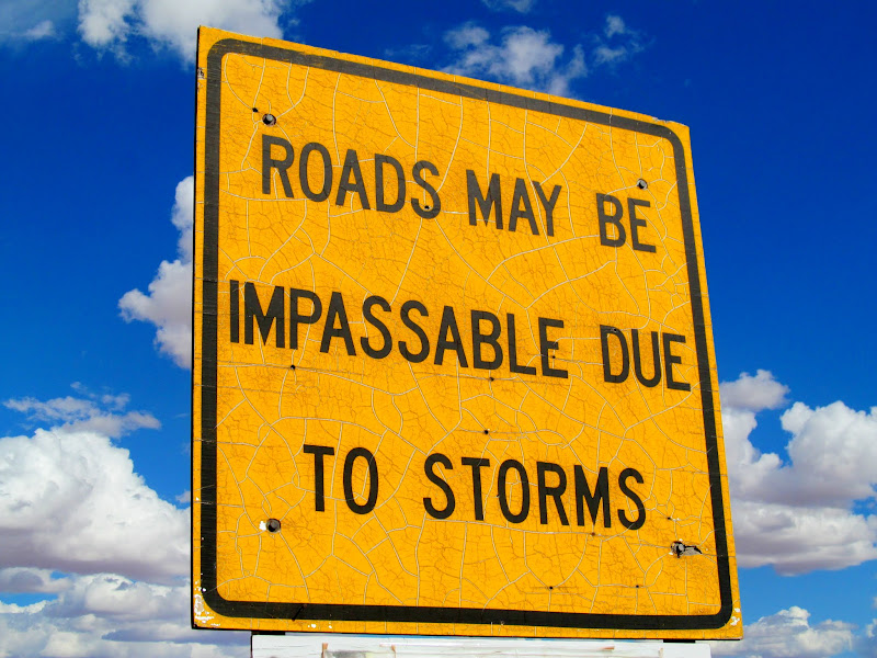
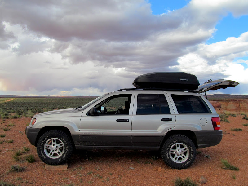
I had a lot of plans swirling in my head for the upcoming Memorial Day weekend. Backpacking, or camping and day-hiking? Mountains or desert? Stay home and vegetate? On Thursday I fixed a single course of action in my mind, but didn't decide to carry it out until midway though my workday on Friday. After work I hastily threw some gear and a couple of dogs into the Jeep and hit the road. I was hoping to right the wrong I'd done last year when I failed to reach Robber's Roost Canyon from the west side of the Angel Point Trail. The day before that trip a friend e-mailed me about a route on the east side that goes from Angel Point to Robber's Roost Canyon and entirely bypasses the Dirty Devil River, but I already had the west side loop planned out and stuck with it--with poor results. This time, armed with the knowledge of a more direct route, I found myself at the dirt road turnoff from Highway 24 that leads into the Roost.
Road sign at the start of the dirt road
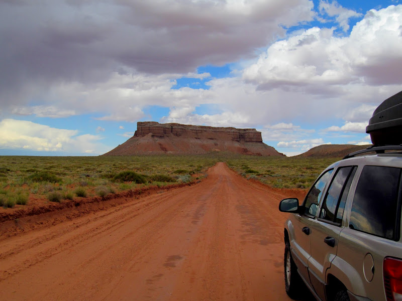
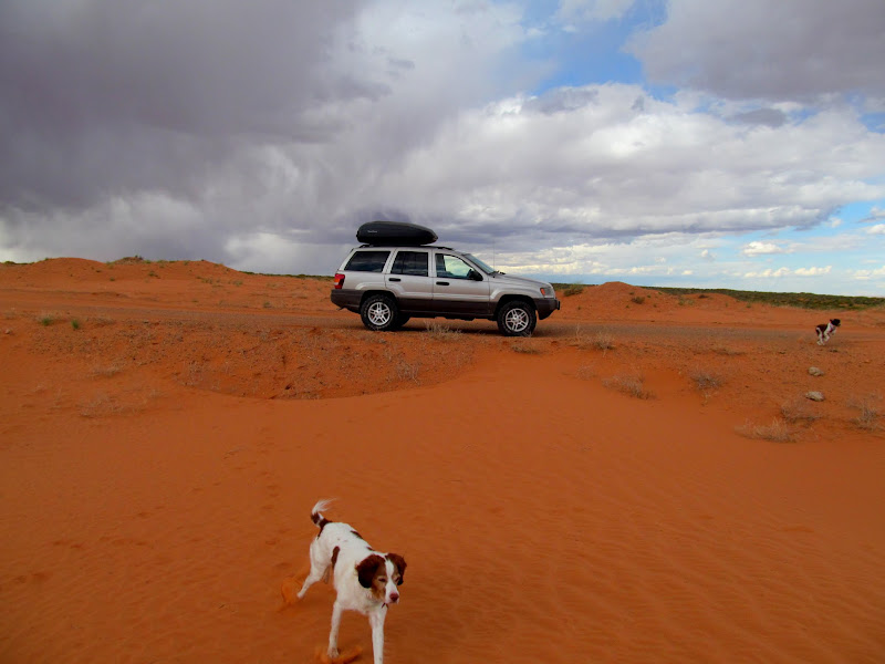
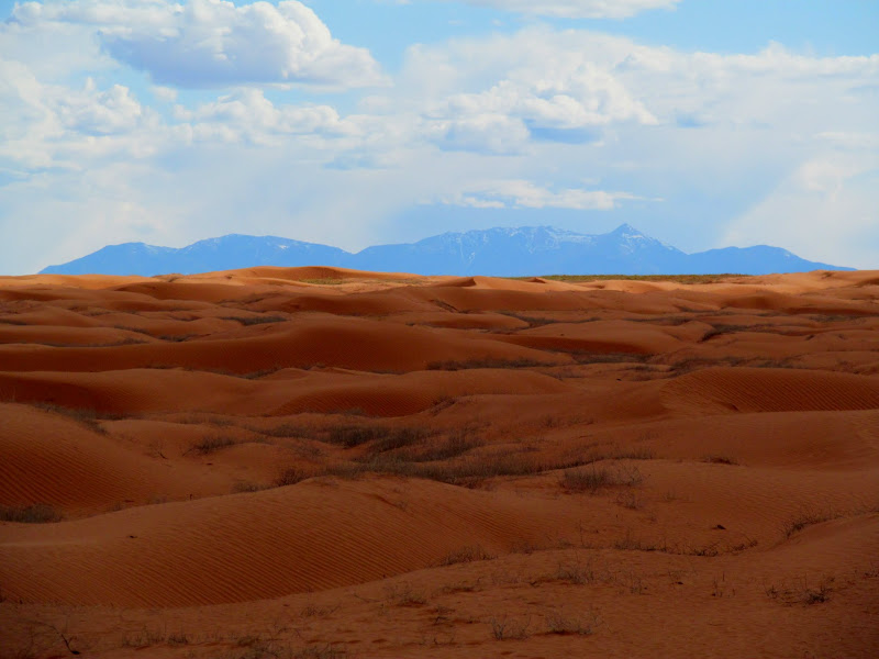
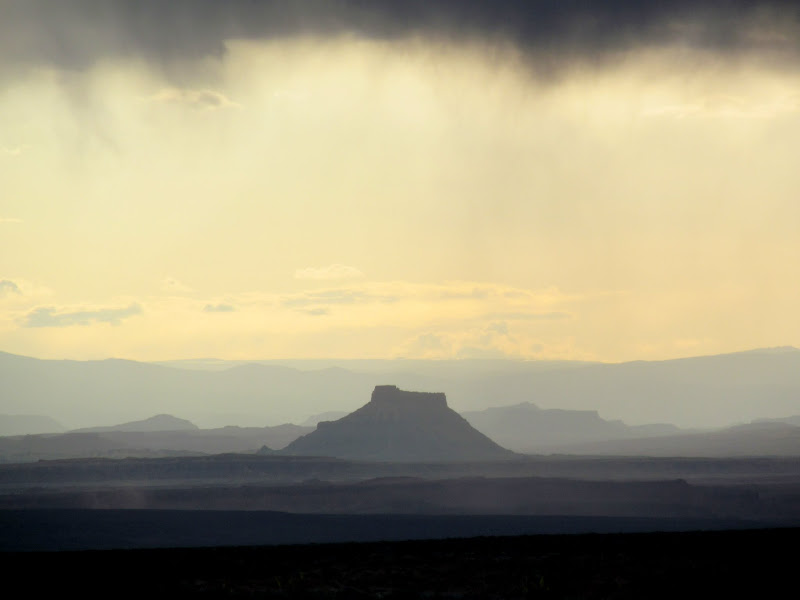
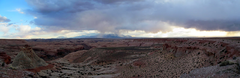
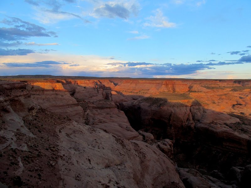
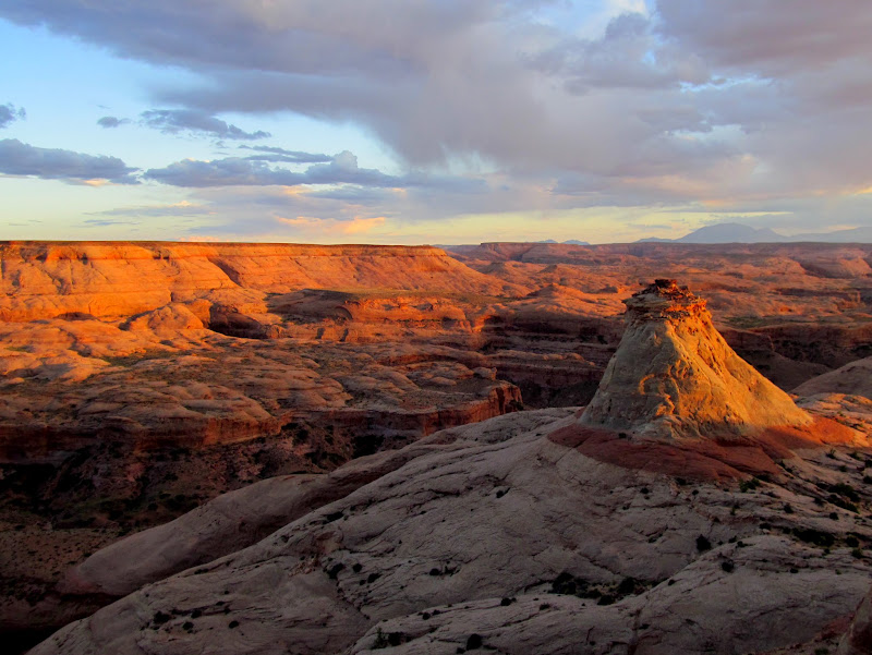
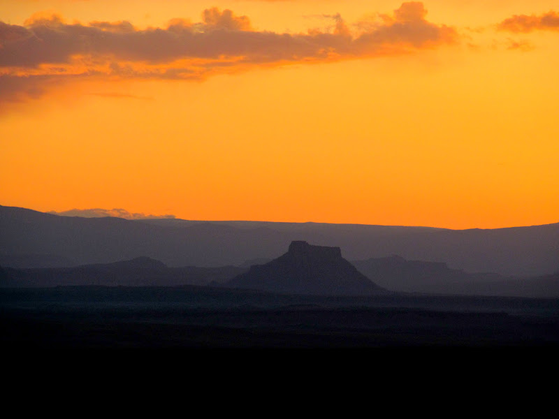
The graded dirt road was in decent shape and I did 40-50 MPH on all but the curvy bits, ignoring the washboard and hoping no bolts fell out of the suspension. Quick stop at the sand dunes to let the dogs run around a bit. A few stops for photos when it suited me. I scoped out potential camp spots as I got closer to the Angel Point trailhead. One near the dirt airstrip had looked good in Google Earth but there was a couple with their dog in a Honda CR-V parked there, so I tried another on the south end of the landing strip and it was perfect--well out of sight and earshot of any neighbors. Shortly after I got things set up I noticed the CR-V driving off toward the trailhead. Camp was on the rim of the North Fork of No Man's Canyon and had nice views over the slickrock toward the Henry Mountains. In the distance and to the west I could see many familiar landmarks: Factory, Wild Horse, and Gilson buttes; Boulder, Thousand Lake, and Temple mountains. I enjoyed watching the distant storms churn, and just before sunset the sun peeked out of the clouds and put on a good light show on the canyon walls. I read for a while and then climbed into my sleeping bag before 10PM.
Little Flat Top
Giving the dogs a break from the drive
Sand dunes and Henry Mountains
The tent is all set up and leveled!
Factory Butte below the storm
View south of camp
North Fork of No Man's Canyon
Last light on the cliffs
Factory Butte after sunset
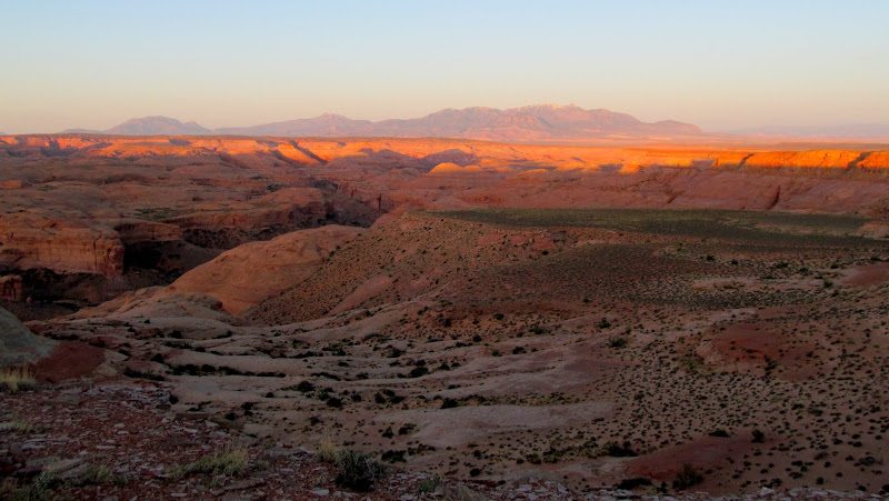
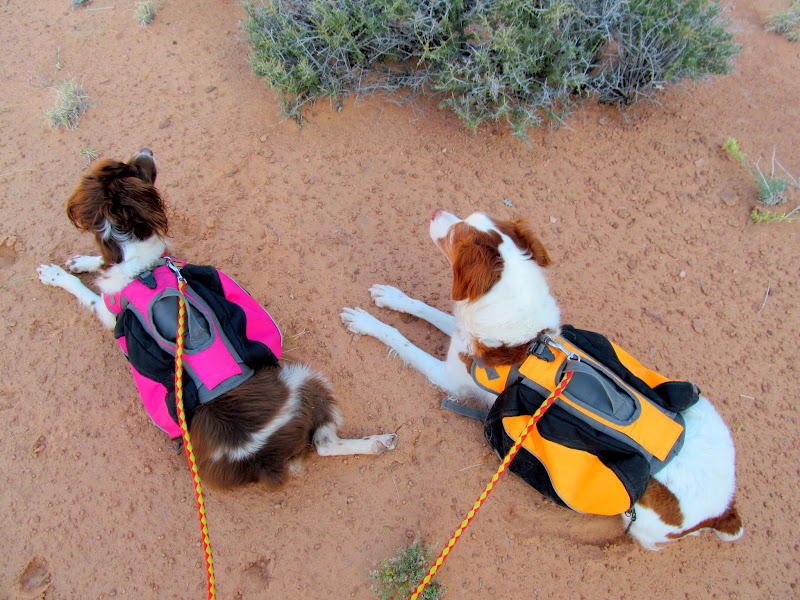
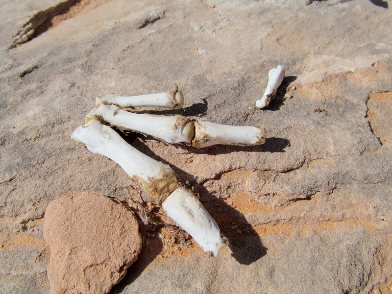
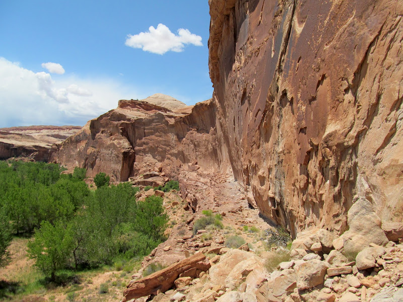
I awoke when the sun's disk was halfway over the horizon--the clock read 6:13AM. It seemed to early to rise but I felt rested so I rolled out of the Jeep and fired up the camp stove for some coffee. By 8 o'clock I was at the Angel Point trailhead with backpacks strapped on me and both dogs, ready to start walking. That CR-V was the only other vehicle there, and the occupants had signed the TH register the evening before. I made the first tier of the descent on the Angel Point Trail but then my route deviated from any trail. Down a notch in the ledges and then some steep slickrock slopes, through and across sandy washes and sandstone knolls. I stopped twice for the dogs to rest, once in some shade and again at a pothole about halfway through the route. I took a slight detour to examine some shallow overhangs that looked like they could hold something interesting. All I found were some chert flakes and a single piece that had been worked into a jagged but sharp edge. The route approached the cliffs above the Dirty Devil River and it began to look trail-like. There were even a few signs of trail construction in a couple of spots, but it hadn't seen much use recently. I passed some bones that looked like beaver, which would make more sense to me later in the day.
Sunrise over Robber's Roost country
Factory Butte
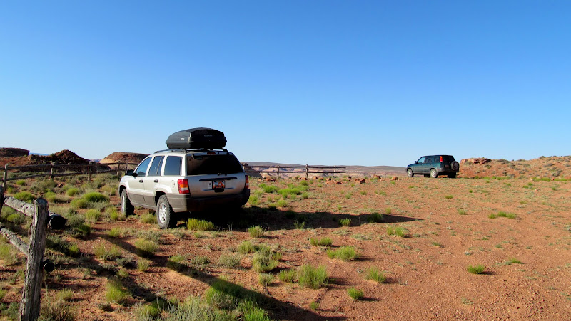
Sharing the trailhead with one other vehicle
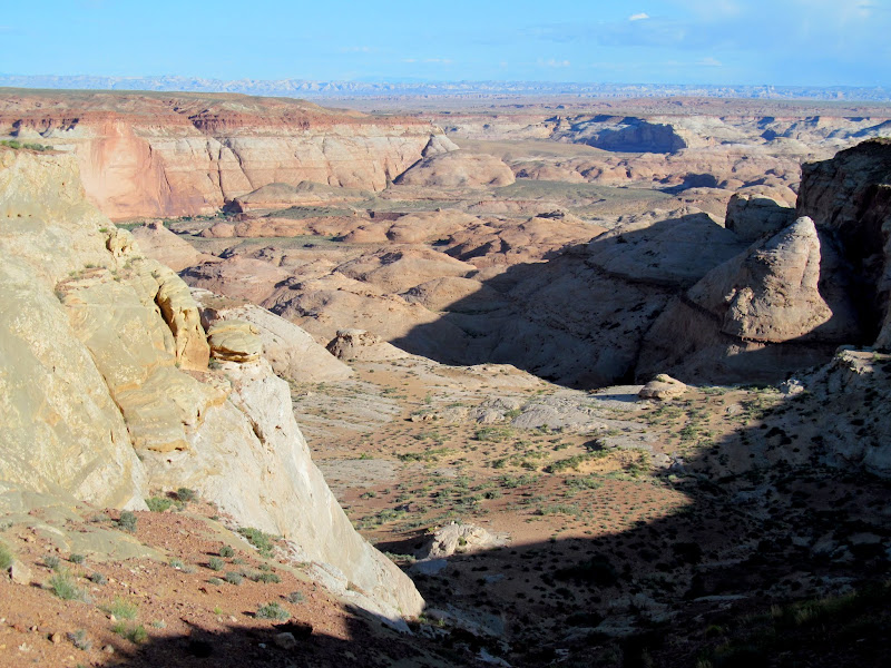
View over my route into Robber's Roost Canyon
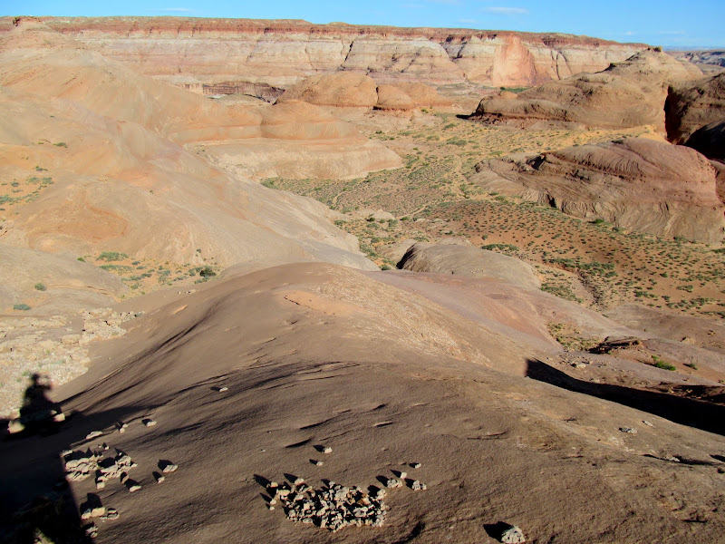
Slickrock slope leading away from Angel Point
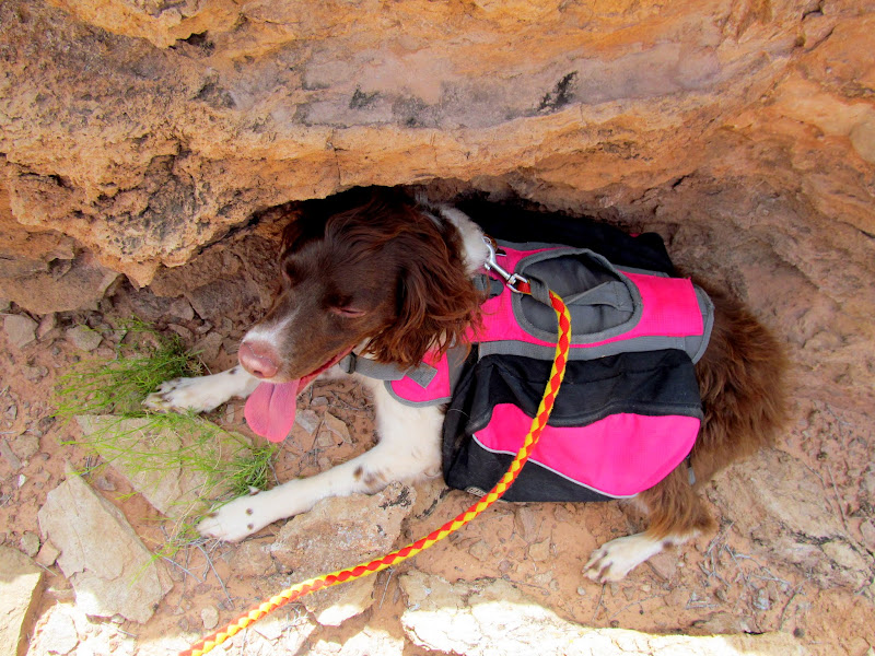
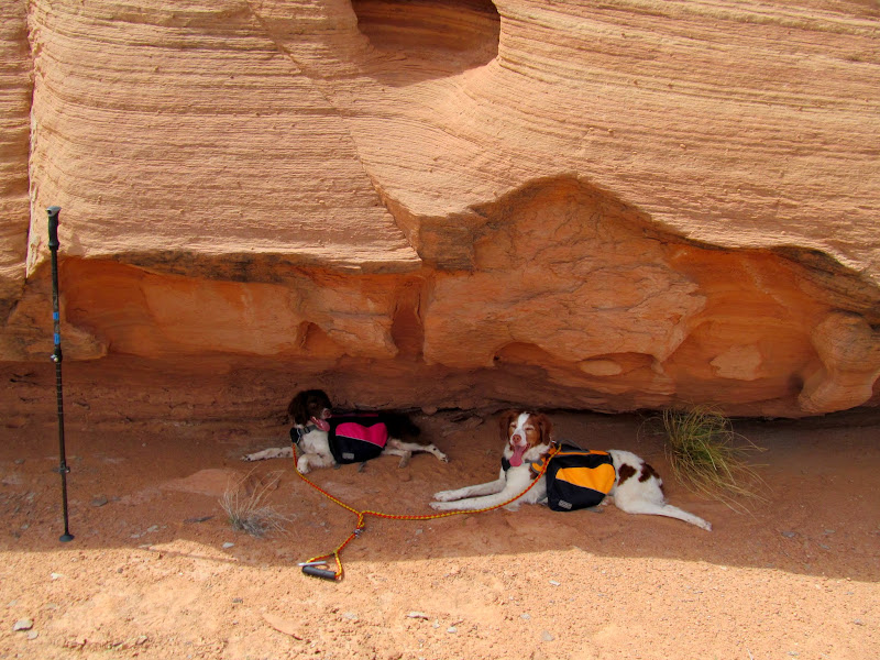
A brief rest in the shade
Tiny purple flowers on a bush
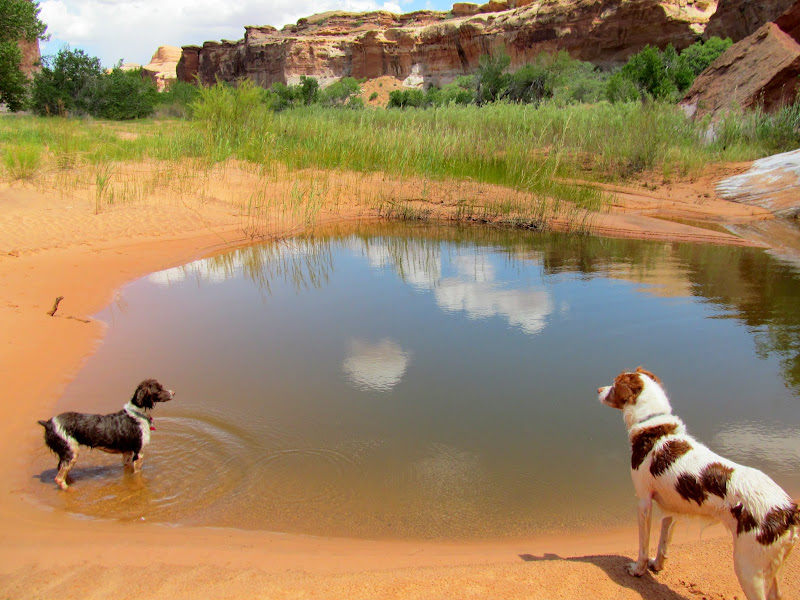
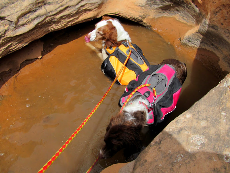
The dogs drinking from a pothole
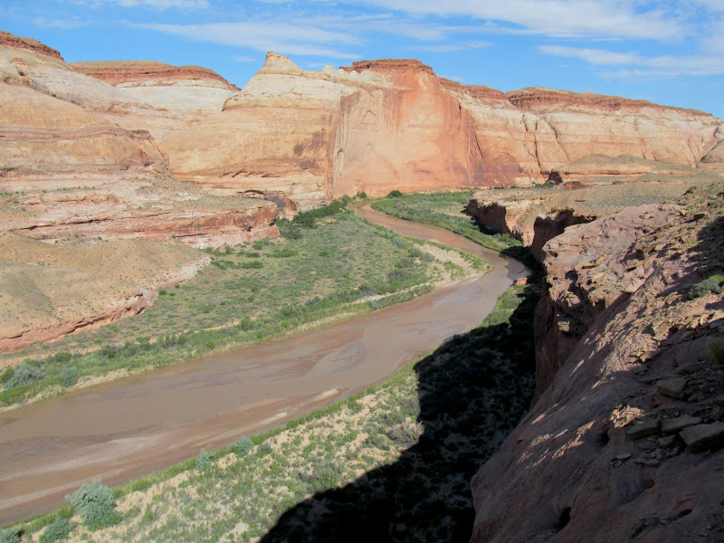
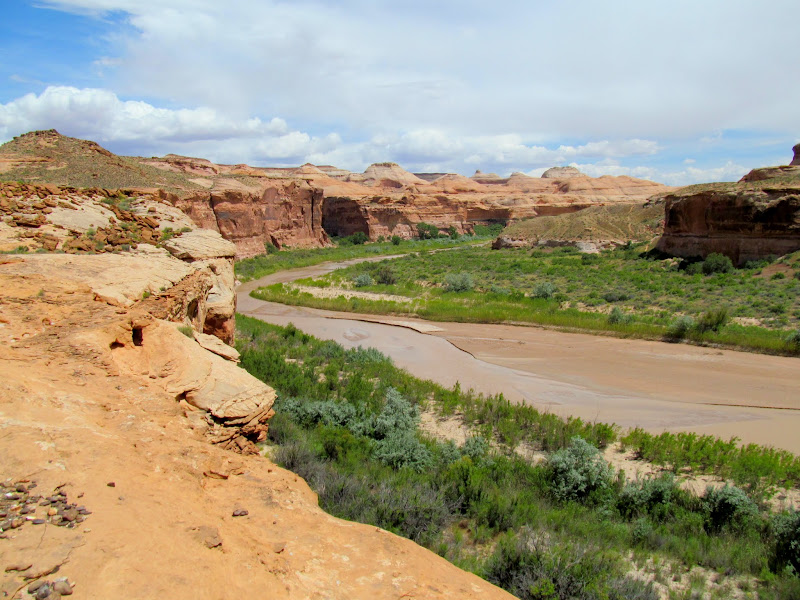
My first view of the Dirty Devil River
Worked piece of chert in a shallow alcove
Dirty-D
Beaver bones
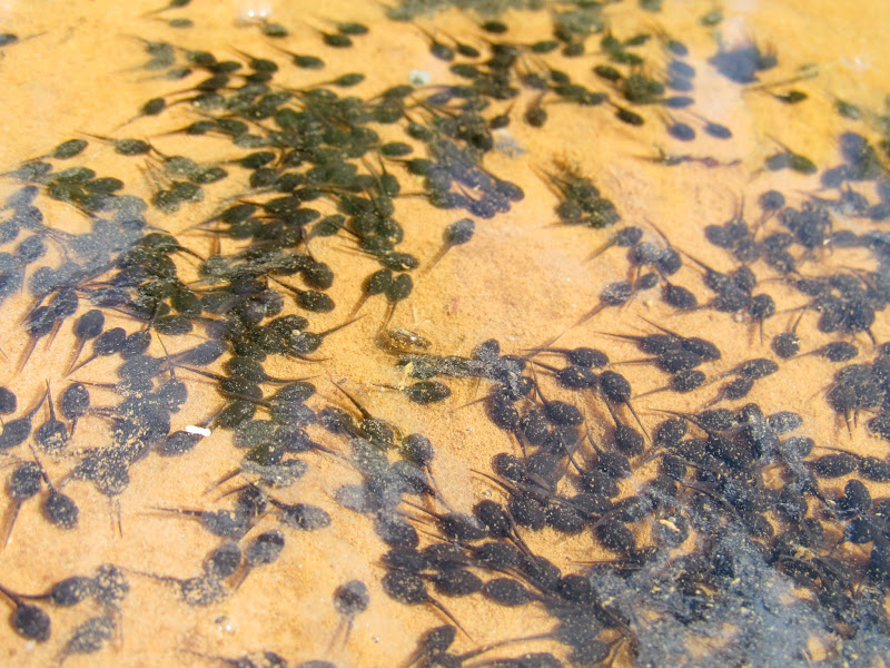
I dropped into Robber's Roost Canyon and immediately ran into a pool of water that the dogs could drink from. I do hope they didn't slurp up any of the tiny tadpoles. I thought it would be an easy walk over to where the canyon empties into the Dirty Devil but I had to fight through a lot of growth to get to the water's edge. Any plans I had of crossing the D to get to some rock art on the other side were thwarted. Still not gonna try crossing that Devil alone.
Tadpoles in a pool in Robber's Roost Canyon
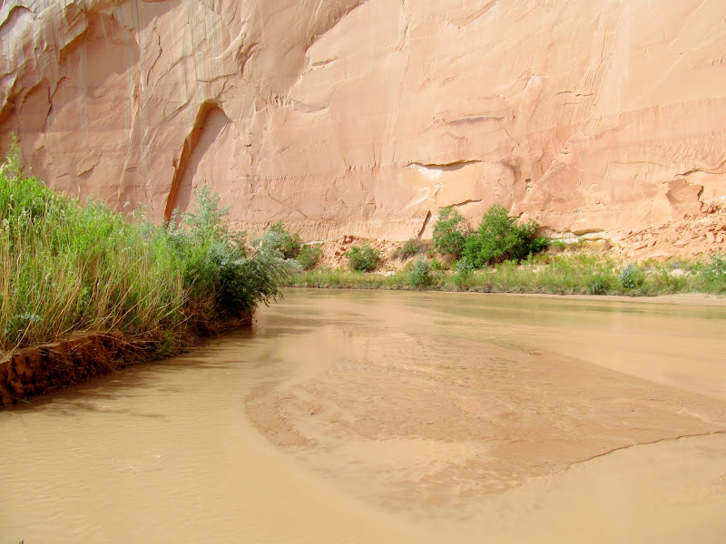
Dirty Devil at the confluence with Robber's Roost Canyon
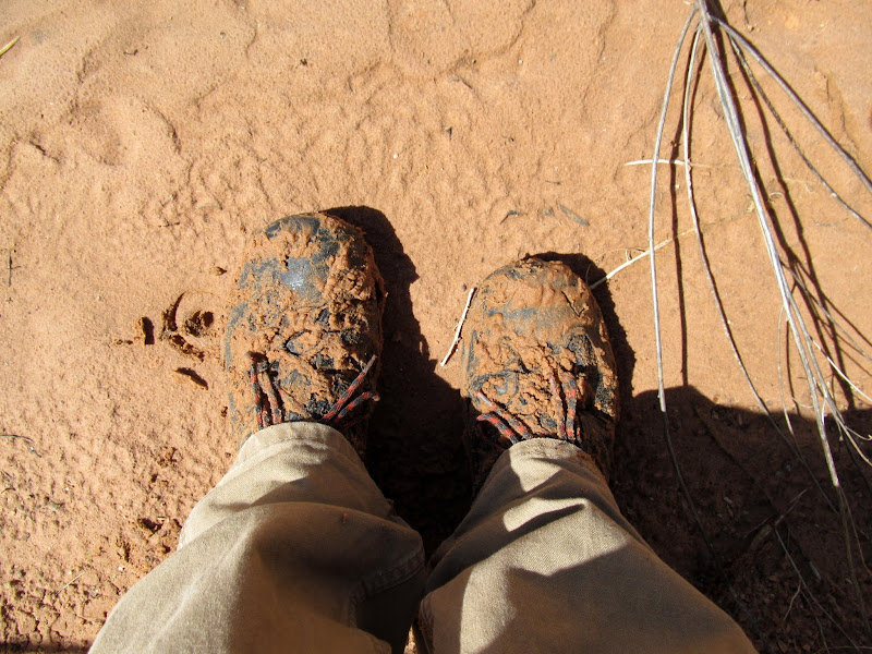
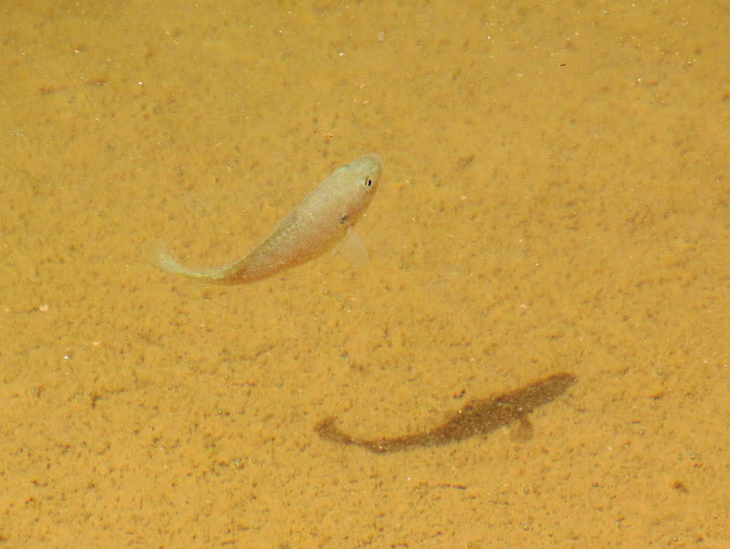
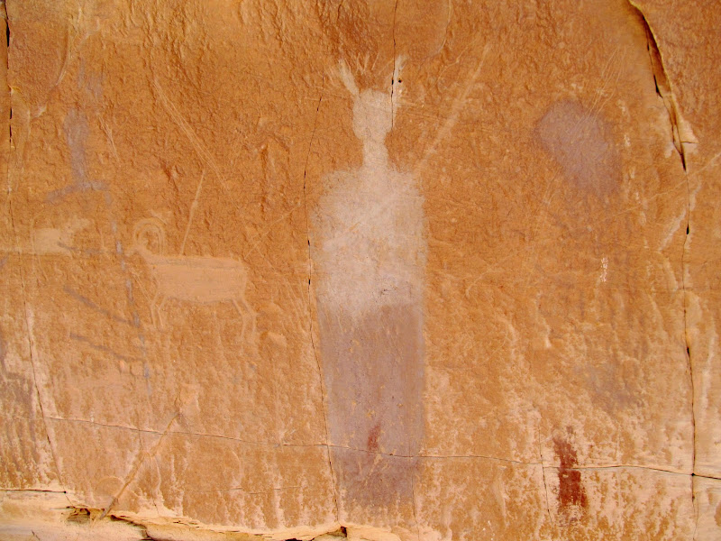
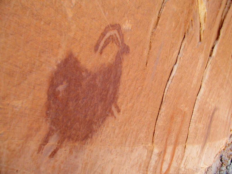
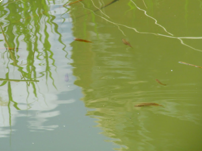
I thrashed my way back up the canyon. With two dogs on a tandem leash it made for a frustrating time. I scanned the canyon walls for rock art and soon ran into some not-so-great petroglyphs. Well, one figure was decent, and some of the bighorn sheep glyphs were both abraded and incised--pretty unusual. Oh, and there was one Fremont style pictograph kinda by its lonesome. During one crossing of the watercourse where the sand looked damp but firm, my feet began to sink after a few steps. The quicksand got ankle deep before I could stumble my way out of it toward the dry bank, but the dogs stayed on top of it with ease. A nearby water pool gave me a good surprise--fish! There were several small fish, maybe four inches long, and not too skittish either.
Somewhat crude petroglyphs
Strange animal-like petroglyph
Unusual abraded and incised sheep glyphs
My shoes after I discovered some quicksand
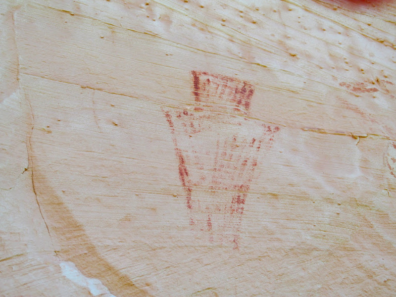
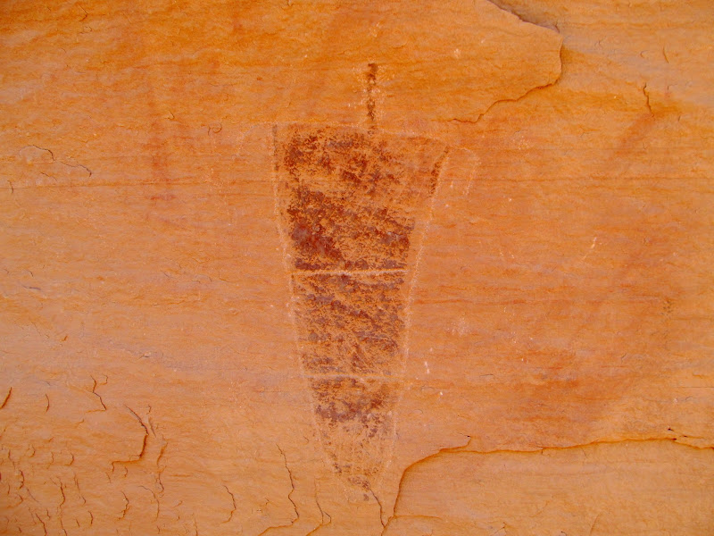
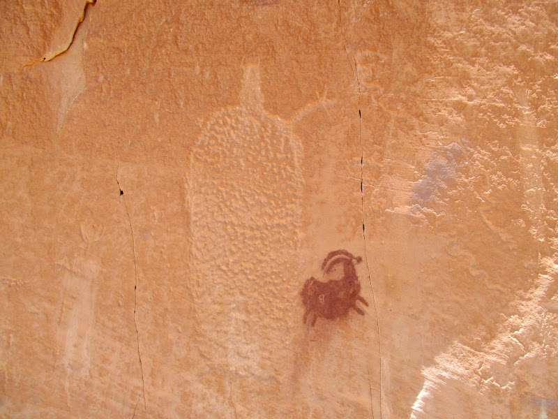
Fremont style pictograph
Fish in a pool of water
I reached a huge overhang fronted by a large pile of rocky debris. It was easily a couple hundred feet wide with a large enough overhang to protect from most any weather, but surprisingly devoid of any rock art or signs of habitation. I removed my pack and the dogs and I rested there in the shade for a while. Moving on, I got to the first of a couple of pictograph panels. This one was smaller, with only a few scattered figures, and a fair amount of lithics and even a few worked pieces.
Huge overhang
Small pictograph panel
Petroglyph/pictograph combo
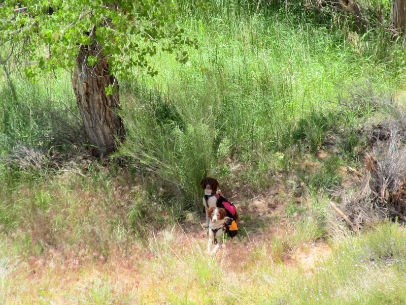
The dogs enjoying what little shade the overhang provides
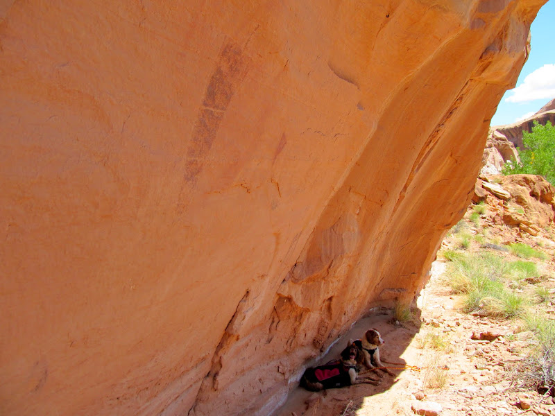
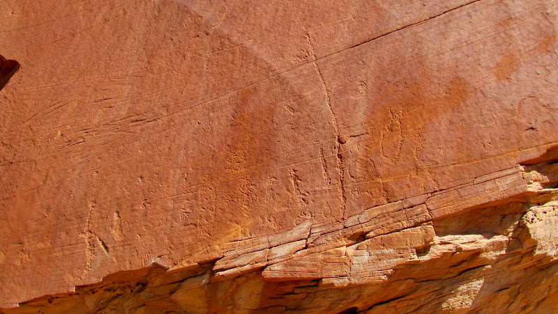
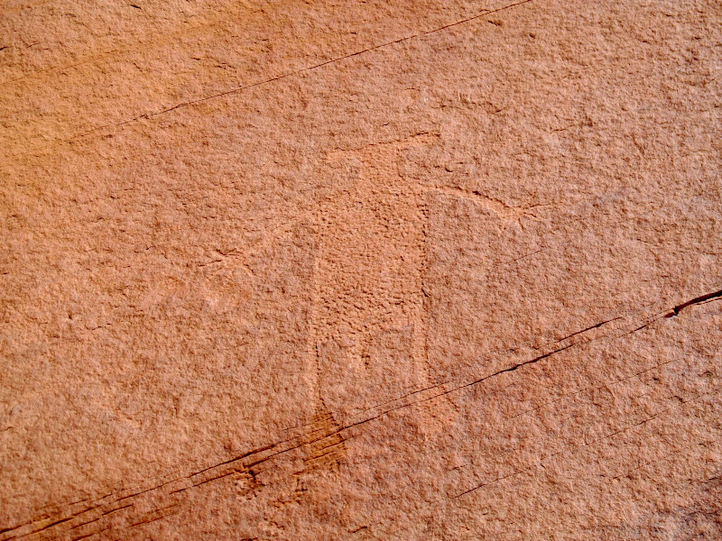
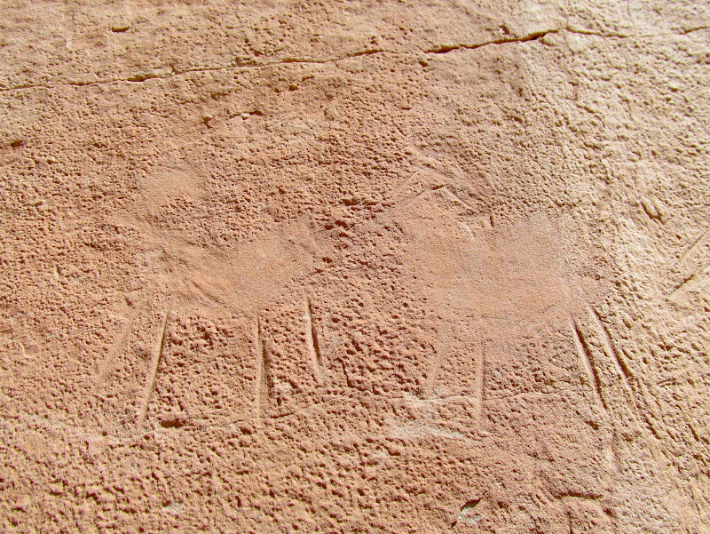
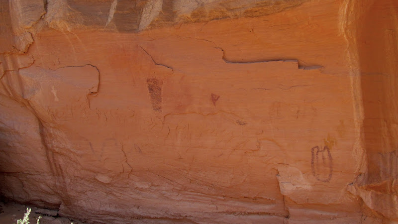
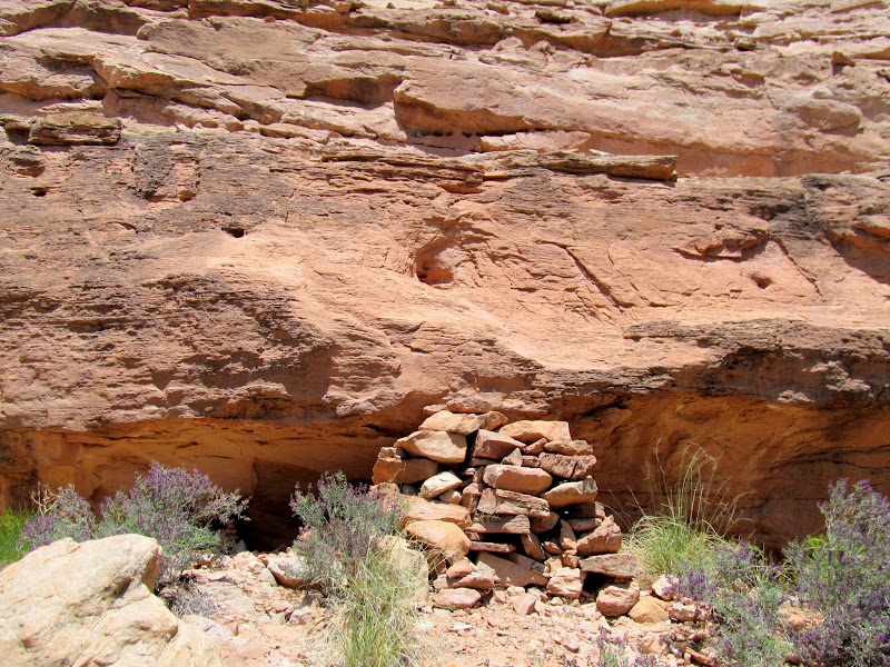
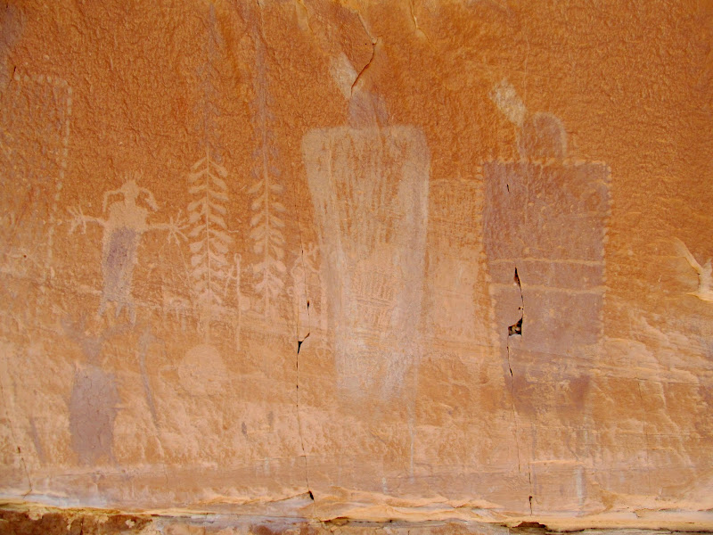
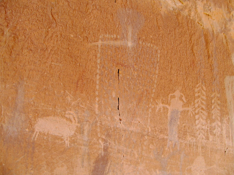
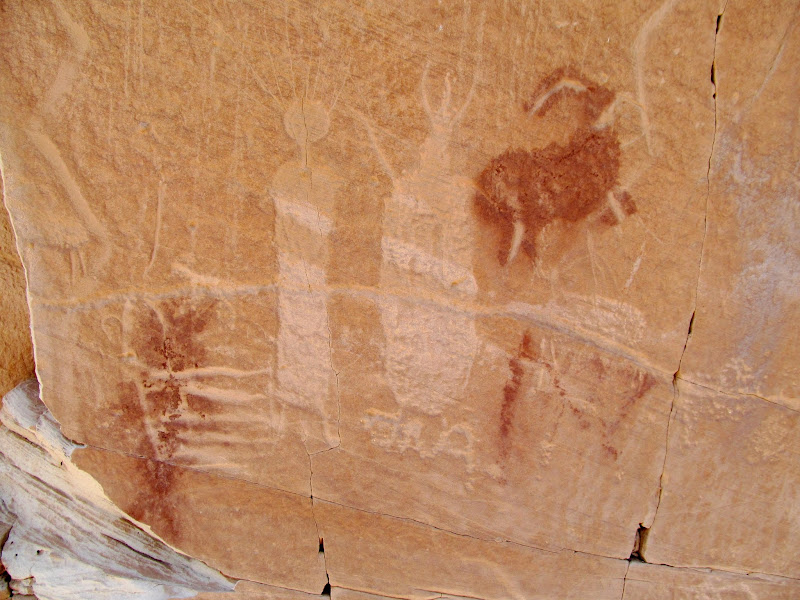
The next panel is the reason I was there. I'd heard a little about it and had even seen some photos taken from a distance, but I had no idea how really great it was 'til I was standing below it. It was high on a cliff just above a narrow-ish ledge, and the only obvious way to get up close was by climbing a large rock pile (maybe four feet tall) and a couple more ledges. I stood atop the rock pile and contemplated making the next big step up onto a ledge, but the rock pile shifted underneath me and a couple of rocks fell out. Nuh-uh. I struggled to even get off the rock pile without falling--no way I was going to go any higher. I resigned myself to viewing it with binoculars and taking photos from below, but that meant stepping back far enough to see over the ledge below the rock art, which put me over 100 feet away. The panel was one long gallery, covering a wide ribbon of the cliff above the ledge.
Rock stack giving access to some rock art above
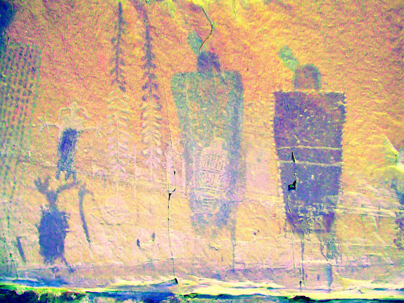
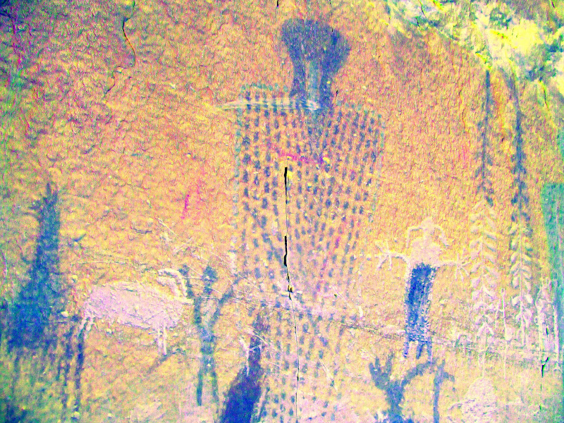
I finished taking photos of all the various panels and elements but I knew the details wouldn't come through. Looking up-canyon I could see that the ledge below the rock art continued around the next bend but the cliff below appeared to get taller as well. I decided to take a look around the corner. Perhaps there was a way up that just wasn't visible from directly below the rock art. I didn't feel good about leaving the dogs tied up in the shade of a cottonwood tree, but I did anyway and walked up the canyon and out of their sight. Nearly three hundred yards up the canyon I did find a relatively easy way up onto the ledge, which I then followed back down-canyon to the rock art. Phew--the dogs were still there resting quietly. Up close the details in the rock art were amazing! What I had assumed was white paint was in many places actually pecked out. Many of the elements were an unusual mixture of pictographs and petroglyphs. The paint was quite faded but DStretch brought out a lot of details that I didn't notice in person.
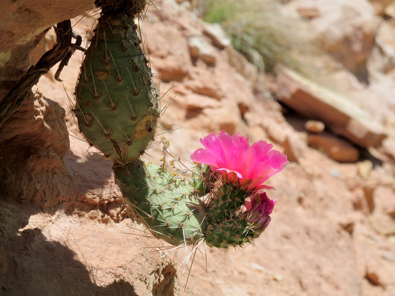
Hanging cactus in bloom
Ledge leading to a long rock art gallery
Boulder and Torrey waiting in the shade
Interesting mix of petroglphs and pictographs
Interesting mix of petroglphs and pictographs (DStretch enhanced)
Large figure with dotted body
Large figure with dotted body (DStretch enhanced)
Large two-tone figure
Big fat sheep
Large glyph and fat sheep picto
Pictographs and petroglyphs
Beaver-felled trees and a beaver pond in the willows
It was close to 1:30PM and I was a little worried about the hike back up to Angel Point with the temperature in the low 80s. I began the hike down Robber's Roost Canyon and back up to Angel Point, stopping for lunch in a narrow band of shade that began to disappear as the sun worked its way west. I stopped above the river to glass the cliffs on the opposite side to catch a glimpse of some pictographs. When I reached the edge of the cliff I noticed a hiker stopped along the river bank below, but it was a while before he spotted me. It felt awkward looking through binoculars and taking photos in his direction (albeit way over his head) knowing that he might think I was taking an interest in him! After leaving Robber's Roost Canyon the hike back to the TH took about two hours. I took it easy, stopping a few times in the shade to let the dogs cool off. Boulder began gravitating toward any small patch of shade that we neared. We stopped once again at the halfway pothole, which was the only water I'd seen on the overland route. It was a relief when, just before the big slickrock climb back to the Angel Point Trail, some dark storm clouds drifted in and blocked out the sun.
Five fish
Boulder and Torrey at a big pool
Dirty Devil River
Pictographs barely visible across the river
Boulder in a tiny bit of shade
Shaded resting spot
Another stop at the halfway pothole
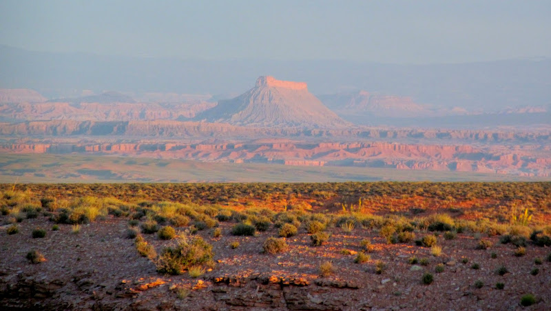
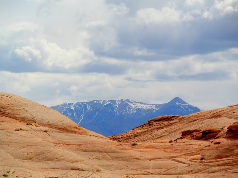
Sandstone and Mt. Ellen
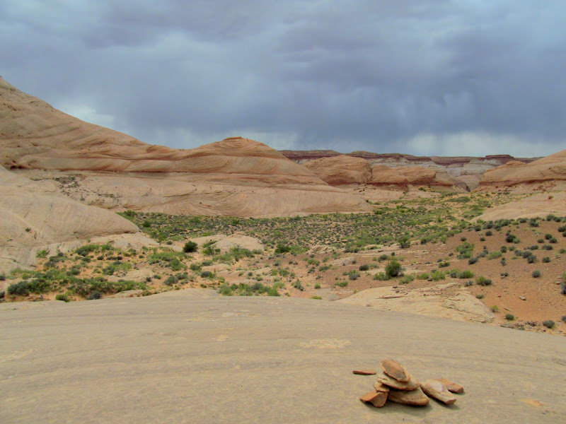
Storm moving in
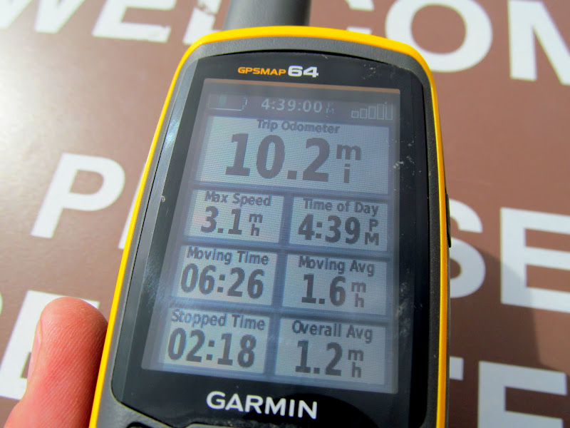
The hike out didn't kill me and, in fact, the dogs seemed to be okay as well--no torn foot pads for Boulder this time! I reached the trailhead and it had been nearly nine hours and just over 10 miles since I'd left. Besides the hiker and the folks in the CR-V (which was still at the TH), I'd seen nobody else for over 24 hours. I was in a big hurry to get home and made good time on the dirt road back to the pavement. Memorial Day weekend traffic was still heavy, particularly on US-6. I'd eaten very little all day, so when I got home around 8PM I devoured some dinner that my wife had saved for me, then showered and crashed hard 'til late the next morning.
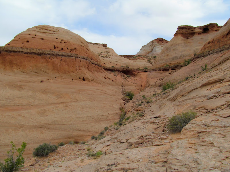
The final climb to Angel Point
GPS stats
Grazing horses seen on the drive out
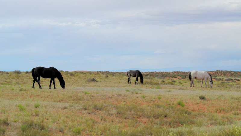
Photo Gallery: Angel Point to Robber's Roost Canyon
Road sign at the start of the dirt road
The graded dirt road was in decent shape and I did 40-50 MPH on all but the curvy bits, ignoring the washboard and hoping no bolts fell out of the suspension. Quick stop at the sand dunes to let the dogs run around a bit. A few stops for photos when it suited me. I scoped out potential camp spots as I got closer to the Angel Point trailhead. One near the dirt airstrip had looked good in Google Earth but there was a couple with their dog in a Honda CR-V parked there, so I tried another on the south end of the landing strip and it was perfect--well out of sight and earshot of any neighbors. Shortly after I got things set up I noticed the CR-V driving off toward the trailhead. Camp was on the rim of the North Fork of No Man's Canyon and had nice views over the slickrock toward the Henry Mountains. In the distance and to the west I could see many familiar landmarks: Factory, Wild Horse, and Gilson buttes; Boulder, Thousand Lake, and Temple mountains. I enjoyed watching the distant storms churn, and just before sunset the sun peeked out of the clouds and put on a good light show on the canyon walls. I read for a while and then climbed into my sleeping bag before 10PM.
Little Flat Top
Giving the dogs a break from the drive
Sand dunes and Henry Mountains
The tent is all set up and leveled!
Factory Butte below the storm
View south of camp
North Fork of No Man's Canyon
Last light on the cliffs
Factory Butte after sunset
I awoke when the sun's disk was halfway over the horizon--the clock read 6:13AM. It seemed to early to rise but I felt rested so I rolled out of the Jeep and fired up the camp stove for some coffee. By 8 o'clock I was at the Angel Point trailhead with backpacks strapped on me and both dogs, ready to start walking. That CR-V was the only other vehicle there, and the occupants had signed the TH register the evening before. I made the first tier of the descent on the Angel Point Trail but then my route deviated from any trail. Down a notch in the ledges and then some steep slickrock slopes, through and across sandy washes and sandstone knolls. I stopped twice for the dogs to rest, once in some shade and again at a pothole about halfway through the route. I took a slight detour to examine some shallow overhangs that looked like they could hold something interesting. All I found were some chert flakes and a single piece that had been worked into a jagged but sharp edge. The route approached the cliffs above the Dirty Devil River and it began to look trail-like. There were even a few signs of trail construction in a couple of spots, but it hadn't seen much use recently. I passed some bones that looked like beaver, which would make more sense to me later in the day.
Sunrise over Robber's Roost country
Factory Butte
Sharing the trailhead with one other vehicle
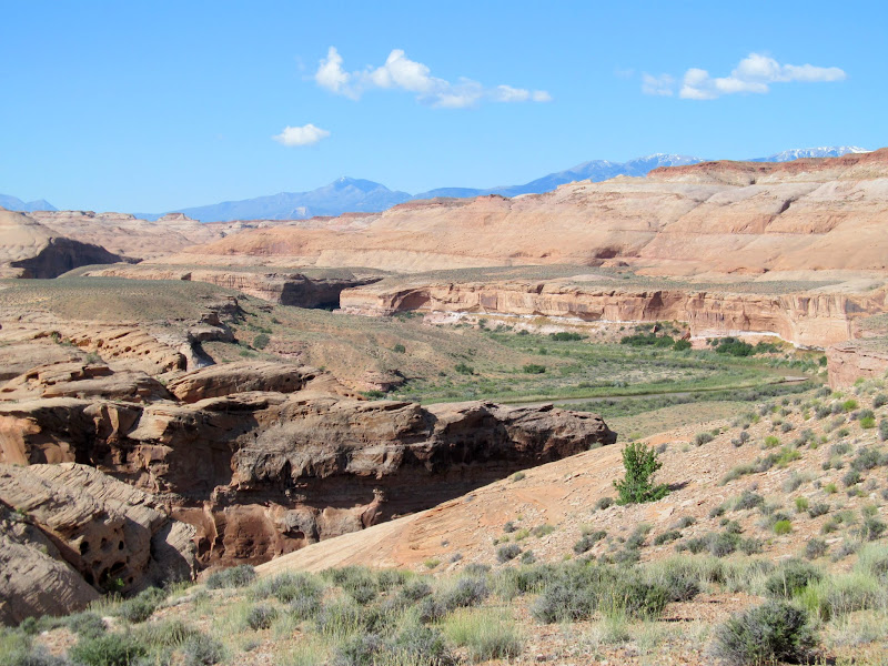
View over my route into Robber's Roost Canyon
Slickrock slope leading away from Angel Point
A brief rest in the shade
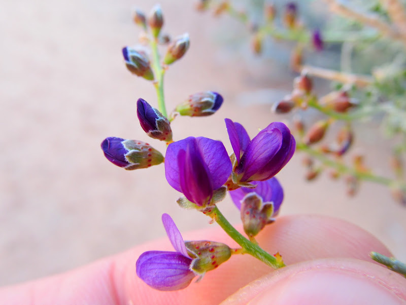
Tiny purple flowers on a bush
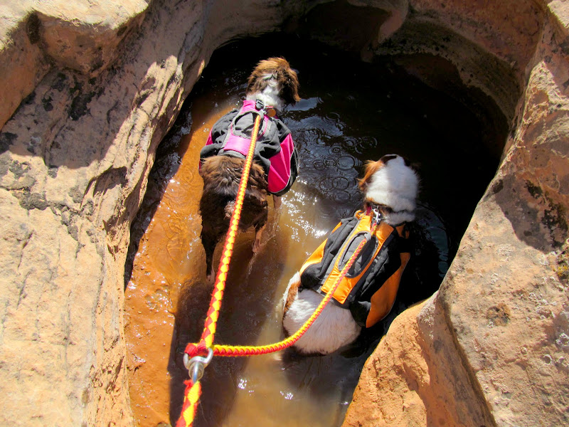
The dogs drinking from a pothole
My first view of the Dirty Devil River
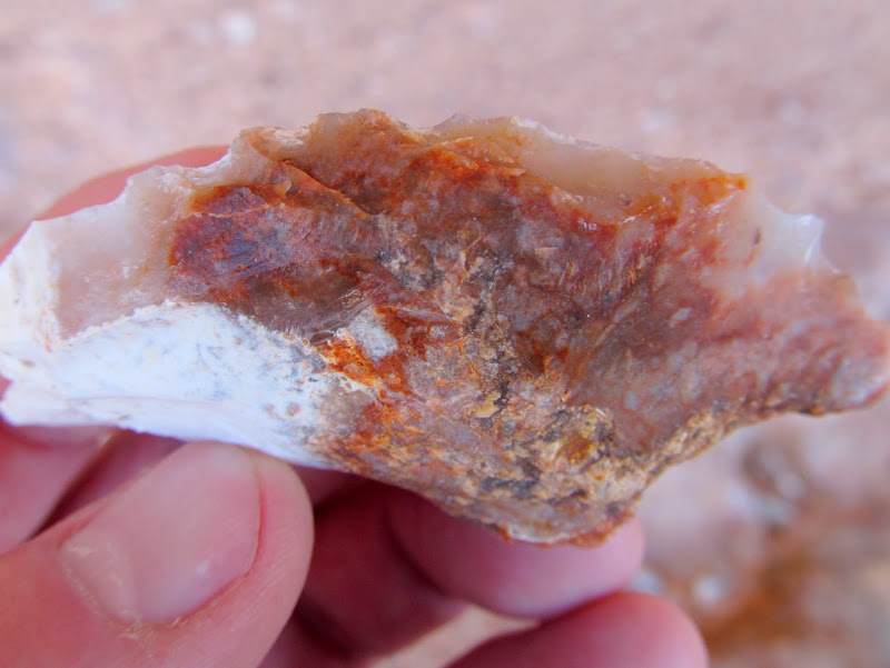
Worked piece of chert in a shallow alcove
Dirty-D
Beaver bones
I dropped into Robber's Roost Canyon and immediately ran into a pool of water that the dogs could drink from. I do hope they didn't slurp up any of the tiny tadpoles. I thought it would be an easy walk over to where the canyon empties into the Dirty Devil but I had to fight through a lot of growth to get to the water's edge. Any plans I had of crossing the D to get to some rock art on the other side were thwarted. Still not gonna try crossing that Devil alone.
Tadpoles in a pool in Robber's Roost Canyon
Dirty Devil at the confluence with Robber's Roost Canyon
I thrashed my way back up the canyon. With two dogs on a tandem leash it made for a frustrating time. I scanned the canyon walls for rock art and soon ran into some not-so-great petroglyphs. Well, one figure was decent, and some of the bighorn sheep glyphs were both abraded and incised--pretty unusual. Oh, and there was one Fremont style pictograph kinda by its lonesome. During one crossing of the watercourse where the sand looked damp but firm, my feet began to sink after a few steps. The quicksand got ankle deep before I could stumble my way out of it toward the dry bank, but the dogs stayed on top of it with ease. A nearby water pool gave me a good surprise--fish! There were several small fish, maybe four inches long, and not too skittish either.
Somewhat crude petroglyphs
Strange animal-like petroglyph
Unusual abraded and incised sheep glyphs
My shoes after I discovered some quicksand
Fremont style pictograph
Fish in a pool of water
I reached a huge overhang fronted by a large pile of rocky debris. It was easily a couple hundred feet wide with a large enough overhang to protect from most any weather, but surprisingly devoid of any rock art or signs of habitation. I removed my pack and the dogs and I rested there in the shade for a while. Moving on, I got to the first of a couple of pictograph panels. This one was smaller, with only a few scattered figures, and a fair amount of lithics and even a few worked pieces.
Huge overhang
Small pictograph panel
Petroglyph/pictograph combo
The dogs enjoying what little shade the overhang provides
The next panel is the reason I was there. I'd heard a little about it and had even seen some photos taken from a distance, but I had no idea how really great it was 'til I was standing below it. It was high on a cliff just above a narrow-ish ledge, and the only obvious way to get up close was by climbing a large rock pile (maybe four feet tall) and a couple more ledges. I stood atop the rock pile and contemplated making the next big step up onto a ledge, but the rock pile shifted underneath me and a couple of rocks fell out. Nuh-uh. I struggled to even get off the rock pile without falling--no way I was going to go any higher. I resigned myself to viewing it with binoculars and taking photos from below, but that meant stepping back far enough to see over the ledge below the rock art, which put me over 100 feet away. The panel was one long gallery, covering a wide ribbon of the cliff above the ledge.
Rock stack giving access to some rock art above
I finished taking photos of all the various panels and elements but I knew the details wouldn't come through. Looking up-canyon I could see that the ledge below the rock art continued around the next bend but the cliff below appeared to get taller as well. I decided to take a look around the corner. Perhaps there was a way up that just wasn't visible from directly below the rock art. I didn't feel good about leaving the dogs tied up in the shade of a cottonwood tree, but I did anyway and walked up the canyon and out of their sight. Nearly three hundred yards up the canyon I did find a relatively easy way up onto the ledge, which I then followed back down-canyon to the rock art. Phew--the dogs were still there resting quietly. Up close the details in the rock art were amazing! What I had assumed was white paint was in many places actually pecked out. Many of the elements were an unusual mixture of pictographs and petroglyphs. The paint was quite faded but DStretch brought out a lot of details that I didn't notice in person.
Hanging cactus in bloom
Ledge leading to a long rock art gallery
Boulder and Torrey waiting in the shade
Interesting mix of petroglphs and pictographs
Interesting mix of petroglphs and pictographs (DStretch enhanced)
Large figure with dotted body
Large figure with dotted body (DStretch enhanced)
Large two-tone figure
Big fat sheep
Large glyph and fat sheep picto
Pictographs and petroglyphs
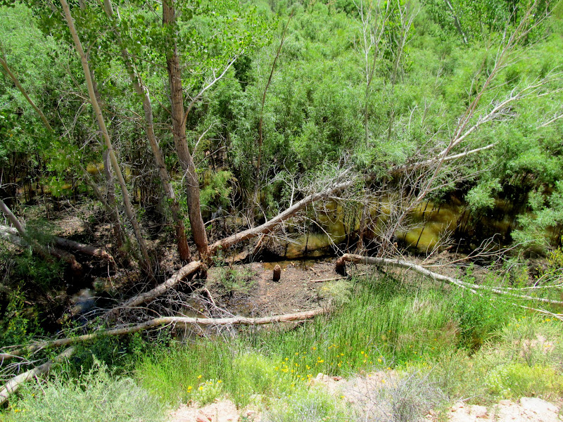
Beaver-felled trees and a beaver pond in the willows
It was close to 1:30PM and I was a little worried about the hike back up to Angel Point with the temperature in the low 80s. I began the hike down Robber's Roost Canyon and back up to Angel Point, stopping for lunch in a narrow band of shade that began to disappear as the sun worked its way west. I stopped above the river to glass the cliffs on the opposite side to catch a glimpse of some pictographs. When I reached the edge of the cliff I noticed a hiker stopped along the river bank below, but it was a while before he spotted me. It felt awkward looking through binoculars and taking photos in his direction (albeit way over his head) knowing that he might think I was taking an interest in him! After leaving Robber's Roost Canyon the hike back to the TH took about two hours. I took it easy, stopping a few times in the shade to let the dogs cool off. Boulder began gravitating toward any small patch of shade that we neared. We stopped once again at the halfway pothole, which was the only water I'd seen on the overland route. It was a relief when, just before the big slickrock climb back to the Angel Point Trail, some dark storm clouds drifted in and blocked out the sun.
Five fish
Boulder and Torrey at a big pool
Dirty Devil River
Pictographs barely visible across the river
Boulder in a tiny bit of shade
Shaded resting spot
Another stop at the halfway pothole
Sandstone and Mt. Ellen
Storm moving in
The hike out didn't kill me and, in fact, the dogs seemed to be okay as well--no torn foot pads for Boulder this time! I reached the trailhead and it had been nearly nine hours and just over 10 miles since I'd left. Besides the hiker and the folks in the CR-V (which was still at the TH), I'd seen nobody else for over 24 hours. I was in a big hurry to get home and made good time on the dirt road back to the pavement. Memorial Day weekend traffic was still heavy, particularly on US-6. I'd eaten very little all day, so when I got home around 8PM I devoured some dinner that my wife had saved for me, then showered and crashed hard 'til late the next morning.
The final climb to Angel Point
GPS stats
Grazing horses seen on the drive out
Photo Gallery: Angel Point to Robber's Roost Canyon