Big Sky Boiler
Member
- Joined
- Apr 19, 2025
- Messages
- 35
I figured it was time for me to be more than just a BCP bystander, so here's my first crack at a trip report. This hike was done on a whim, as a bit of an afternoon excursion. We received 4-5" of snow on Sunday and low clouds and cold drizzle had continued through the first of the week. The sun finally popped out around midday on Wednesday. My youngest son, who is visiting for the week, had been getting antsy to get out and do something, so he, my wife, and I headed off to the nearby Sheep Creek trail to stretch our legs. Here are some photos from the afternoon, including one highlighting a gear mistake.
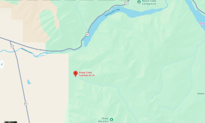
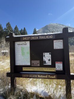
The Sheep Creek Trail is in the Custer-Gallatin National Forest. The trailhead is very near the western edge of Quake Lake, where the Madison River Canyon opens up into the valley. It's about 30 minutes NW of West Yellowstone. If you follow the trail to its end, you'll reach Sheep Lake, a beautiful high alpine lake in a cirque. It's a roughly 13-mile out-and-back, which we did not have the time for on this day, given our 1:30 PM-ish start and sunset around 6:45 PM.
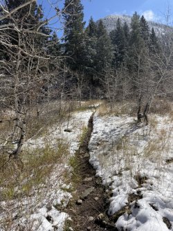
The trail starts in an aspen grove. It's gorgeous in September when the leaves are at their peak but rather barren at this point in the season.
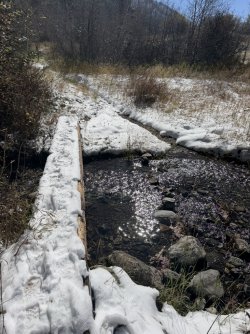
The trail features numerous crossings of Sheep Creek, though each one has a well-maintained footbridge. This is just a couple hundred yards from the trailhead and it seems a couple other folks had ventured up here since the snowfall (there was one other vehicle parked at the TH).
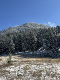
The trail leads almost due east at this point, so you're looking to the south at the north-facing slopes, where the snow is making its first contact with the sun and the day's warmer temps (foreshadowing my gear mistake).
This gives you a better sense for the snowfall, which was above the ankles in many spots.
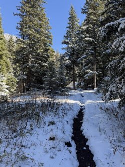
Another footbridge and trail traffic has already waned to a single set of tracks.
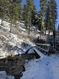
Typical terrain on the first three quarters of this trail. It's a slow, steady climb. Quite rocky in spots, made just a tad tricky and slippery today due to the snow cover.
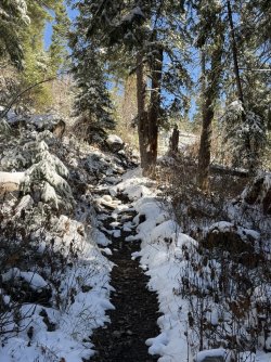
Some of the cool rock formations and cliffs at the top of the canyon walls.
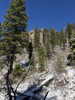
The brilliant blue sky and sun striking the snow-covered evergreens made for a gorgeous day. My meager iPhone photos don't do it justice.
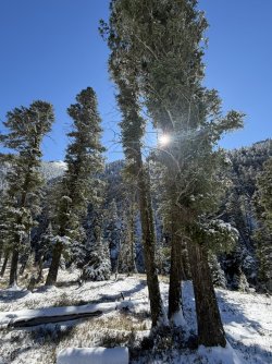
Looking across at the south side of the Sheep Creek canyon.
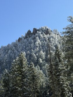
One of multiple scree/talus fields on the north side of the creek.
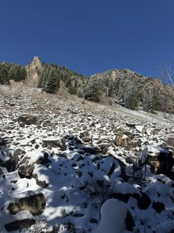
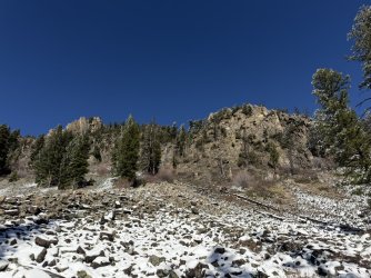
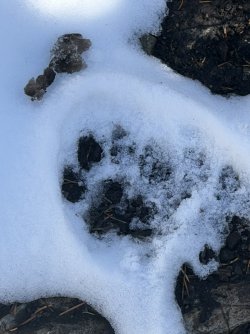
It was about this point when we passed the other hiker who was headed back toward the trailhead. We visited briefly with him and he noted seeing mountain lion tracks and scat on the trail, just a little ways up from where we were. Sure enough...
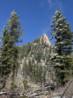
More cool rock formations above the trail.
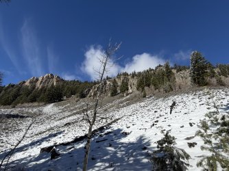
Another scree field on the north side of the trail.
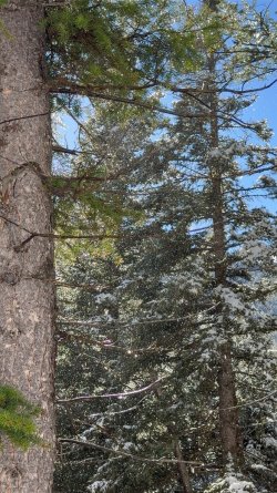
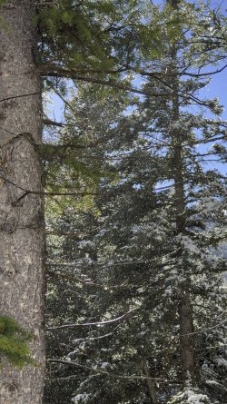
Oh, and about the amateurish gear mistake I made... Well, the skies were brilliant blue, the sun was shining, there was not a cloud in the sky, and it was a very comfortable day - around 50 degrees. Since I knew we'd only be out for a few hours, I took only the bare minimum gear. Omitted was any rain gear because...you know...blue skies + sunshine + short hike = no need for it. In a smooth-brained moment, what I utterly failed to consider was the obvious result of sunshine and 50 degrees on the snow, when I knew good and well that much of this hike was through forested area. So while there was sunshine and blue sky above the trees, there was a very steady "rain" below them. It took no time at all to get pretty drenched by the snow melt. This is a still frame from a 5-second video I took, where the sun is lighting up the melting snow that is falling from the branches above. This was steady all the way up the trail on the north side of the creek, wherever the sun was hitting the trees.
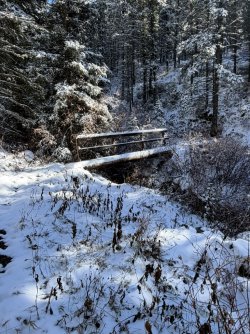
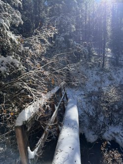
Yet another bridge on which to cross the creek. It was clear that neither or fellow hiker, nor anyone else, had come this far since the snowfall. The handrail was appreciated; this bridge was slippery and it would've been a bit tenuous without it.
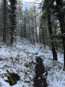
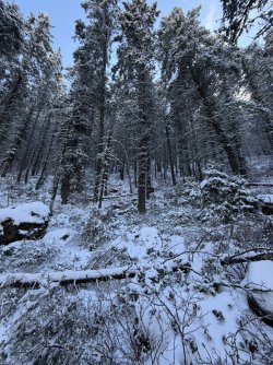
The sun hadn't touched the north-facing slope on the south side of the creek. Good: the "rainfall" was at a much lower volume. Bad: the temperature was several degrees cooler and our wet clothing made it rather chilly.
The sun hitting the cliff walls is the most eye-catching thing in this photo, but there's a very nice waterfall in the shade below.
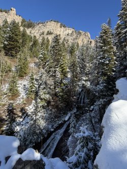
Better shots of the waterfall. This was a little bit tricky because, to get a good view of the waterfall, one must hike down about 30' off the trail and navigate some rocks, being careful to avoid a rapid and unfortunate trip to the bottom of the falls. Not a big deal at all when dry; a bit treacherous when those same rocks are snow-covered. If you listen carefully, you may be able to hear my wife scolding me through the photos.
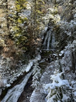
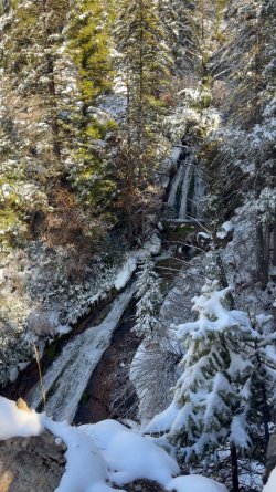
The wet clothing and shaded/chilly side of the creek led to us turning around shortly after the falls. Back on the north side, the sun had melted the snow rapidly enough to make the trail a bit of a creek unto itself.
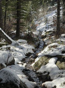
Retracing our steps through the talus as the skies begin to get a little cloudy.
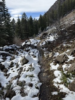
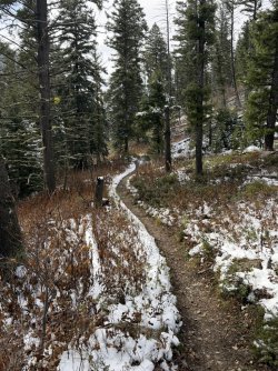
Back on drier ground now. As an aside, this is an exceptionally well-maintained trail. There are a couple areas surrounded by blow-down, but the trail is completely clear.
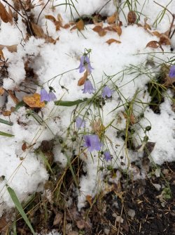
Some of autumn's last holdouts - harebells.
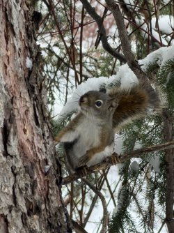
Aside from a small group of mule deer that I wasn't quick enough to photograph, this curious guy giving me the side-eye was the only wildlife we saw on the day.
Back near the trailhead with the upper Madison Valley in view and the Gravelly Range in the distance.
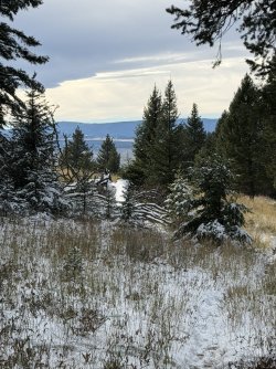
Hiding behind this guy, just to the north is Hilgard Peak, the highest peak in the Madison Range. Had we hiked another mile or so up the trail, there's a nice clearing from which Hilgard is visible.
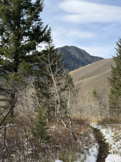
Back where we started.
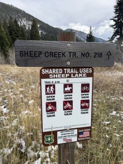
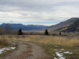
Looking northwest from the trailhead parking area into the Madison Valley.
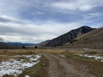
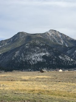
About 1.5 miles west of the trailhead, looking back to the east, is Sheep Mountain. In the lower-middle of this photo, to the left side, you'll see the now barren aspen grove at the trailhead.
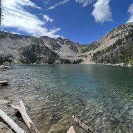
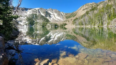
This is not my photo but here is an image of Sheep Lake, if one was to hike to the top of the trail.
If you got this far, God love ya.
THE END.
The Sheep Creek Trail is in the Custer-Gallatin National Forest. The trailhead is very near the western edge of Quake Lake, where the Madison River Canyon opens up into the valley. It's about 30 minutes NW of West Yellowstone. If you follow the trail to its end, you'll reach Sheep Lake, a beautiful high alpine lake in a cirque. It's a roughly 13-mile out-and-back, which we did not have the time for on this day, given our 1:30 PM-ish start and sunset around 6:45 PM.
The trail starts in an aspen grove. It's gorgeous in September when the leaves are at their peak but rather barren at this point in the season.
The trail features numerous crossings of Sheep Creek, though each one has a well-maintained footbridge. This is just a couple hundred yards from the trailhead and it seems a couple other folks had ventured up here since the snowfall (there was one other vehicle parked at the TH).
The trail leads almost due east at this point, so you're looking to the south at the north-facing slopes, where the snow is making its first contact with the sun and the day's warmer temps (foreshadowing my gear mistake).
This gives you a better sense for the snowfall, which was above the ankles in many spots.
Another footbridge and trail traffic has already waned to a single set of tracks.
Typical terrain on the first three quarters of this trail. It's a slow, steady climb. Quite rocky in spots, made just a tad tricky and slippery today due to the snow cover.
Some of the cool rock formations and cliffs at the top of the canyon walls.
The brilliant blue sky and sun striking the snow-covered evergreens made for a gorgeous day. My meager iPhone photos don't do it justice.
Looking across at the south side of the Sheep Creek canyon.
One of multiple scree/talus fields on the north side of the creek.
It was about this point when we passed the other hiker who was headed back toward the trailhead. We visited briefly with him and he noted seeing mountain lion tracks and scat on the trail, just a little ways up from where we were. Sure enough...
More cool rock formations above the trail.
Another scree field on the north side of the trail.
Oh, and about the amateurish gear mistake I made... Well, the skies were brilliant blue, the sun was shining, there was not a cloud in the sky, and it was a very comfortable day - around 50 degrees. Since I knew we'd only be out for a few hours, I took only the bare minimum gear. Omitted was any rain gear because...you know...blue skies + sunshine + short hike = no need for it. In a smooth-brained moment, what I utterly failed to consider was the obvious result of sunshine and 50 degrees on the snow, when I knew good and well that much of this hike was through forested area. So while there was sunshine and blue sky above the trees, there was a very steady "rain" below them. It took no time at all to get pretty drenched by the snow melt. This is a still frame from a 5-second video I took, where the sun is lighting up the melting snow that is falling from the branches above. This was steady all the way up the trail on the north side of the creek, wherever the sun was hitting the trees.
Yet another bridge on which to cross the creek. It was clear that neither or fellow hiker, nor anyone else, had come this far since the snowfall. The handrail was appreciated; this bridge was slippery and it would've been a bit tenuous without it.
The sun hadn't touched the north-facing slope on the south side of the creek. Good: the "rainfall" was at a much lower volume. Bad: the temperature was several degrees cooler and our wet clothing made it rather chilly.
The sun hitting the cliff walls is the most eye-catching thing in this photo, but there's a very nice waterfall in the shade below.
Better shots of the waterfall. This was a little bit tricky because, to get a good view of the waterfall, one must hike down about 30' off the trail and navigate some rocks, being careful to avoid a rapid and unfortunate trip to the bottom of the falls. Not a big deal at all when dry; a bit treacherous when those same rocks are snow-covered. If you listen carefully, you may be able to hear my wife scolding me through the photos.
The wet clothing and shaded/chilly side of the creek led to us turning around shortly after the falls. Back on the north side, the sun had melted the snow rapidly enough to make the trail a bit of a creek unto itself.
Retracing our steps through the talus as the skies begin to get a little cloudy.
Back on drier ground now. As an aside, this is an exceptionally well-maintained trail. There are a couple areas surrounded by blow-down, but the trail is completely clear.
Some of autumn's last holdouts - harebells.
Aside from a small group of mule deer that I wasn't quick enough to photograph, this curious guy giving me the side-eye was the only wildlife we saw on the day.
Back near the trailhead with the upper Madison Valley in view and the Gravelly Range in the distance.
Hiding behind this guy, just to the north is Hilgard Peak, the highest peak in the Madison Range. Had we hiked another mile or so up the trail, there's a nice clearing from which Hilgard is visible.
Back where we started.
Looking northwest from the trailhead parking area into the Madison Valley.
About 1.5 miles west of the trailhead, looking back to the east, is Sheep Mountain. In the lower-middle of this photo, to the left side, you'll see the now barren aspen grove at the trailhead.
This is not my photo but here is an image of Sheep Lake, if one was to hike to the top of the trail.
If you got this far, God love ya.
THE END.