- Joined
- Jul 23, 2013
- Messages
- 1,666
Death Hollow. This one has been on my list for sometime now, ever since first coming to know about its existence years ago in a trip report right here on this forum. In fact, I've hatched a handful of trip ideas from browsing reports here. Then last summer happened and my friend @Devin Ashby reached out to see if I was up for it. Fortunately I was able to make it work for me and so we made it happen.
Friday - August 28, 2020
Day 1: Trailhead to Death Hollow Rim
Miles Hiked: 5
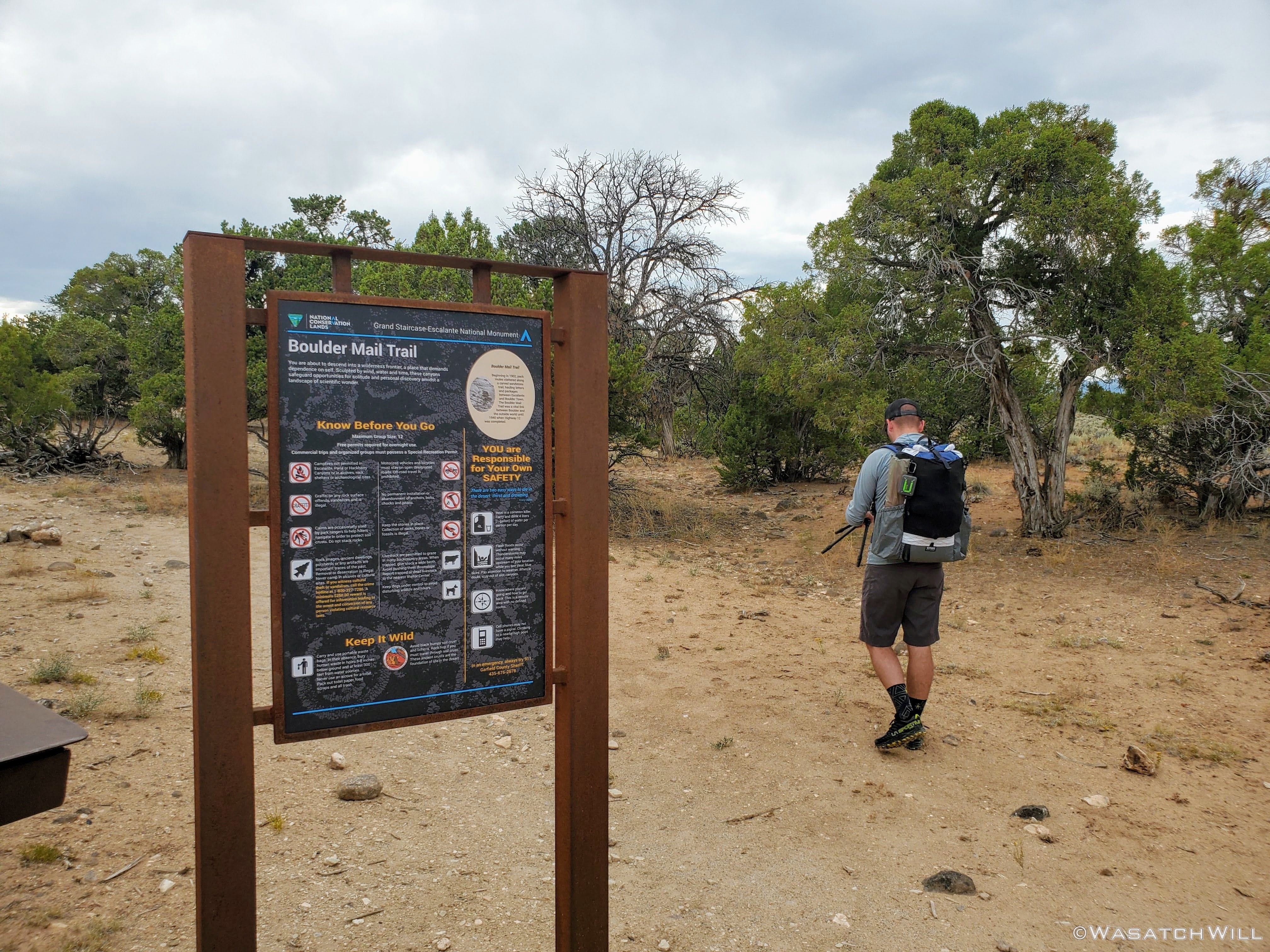
We both put in a half day of work in the morning and due to nearly a four hour drive to the trailhead, we didn't get started on the route until late in the afternoon, or, rather early in the evening. The trailhead we chose to start at was the eastern terminus for the Boulder Mail Trail out by an old air strip.

Starting our hike
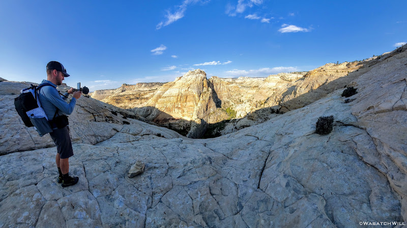
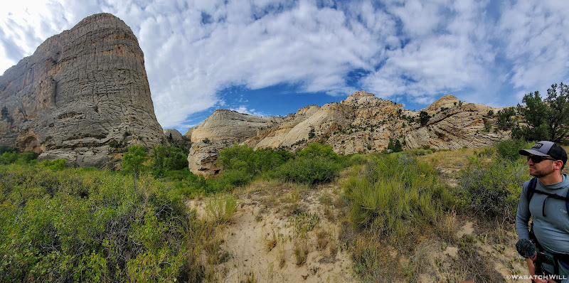
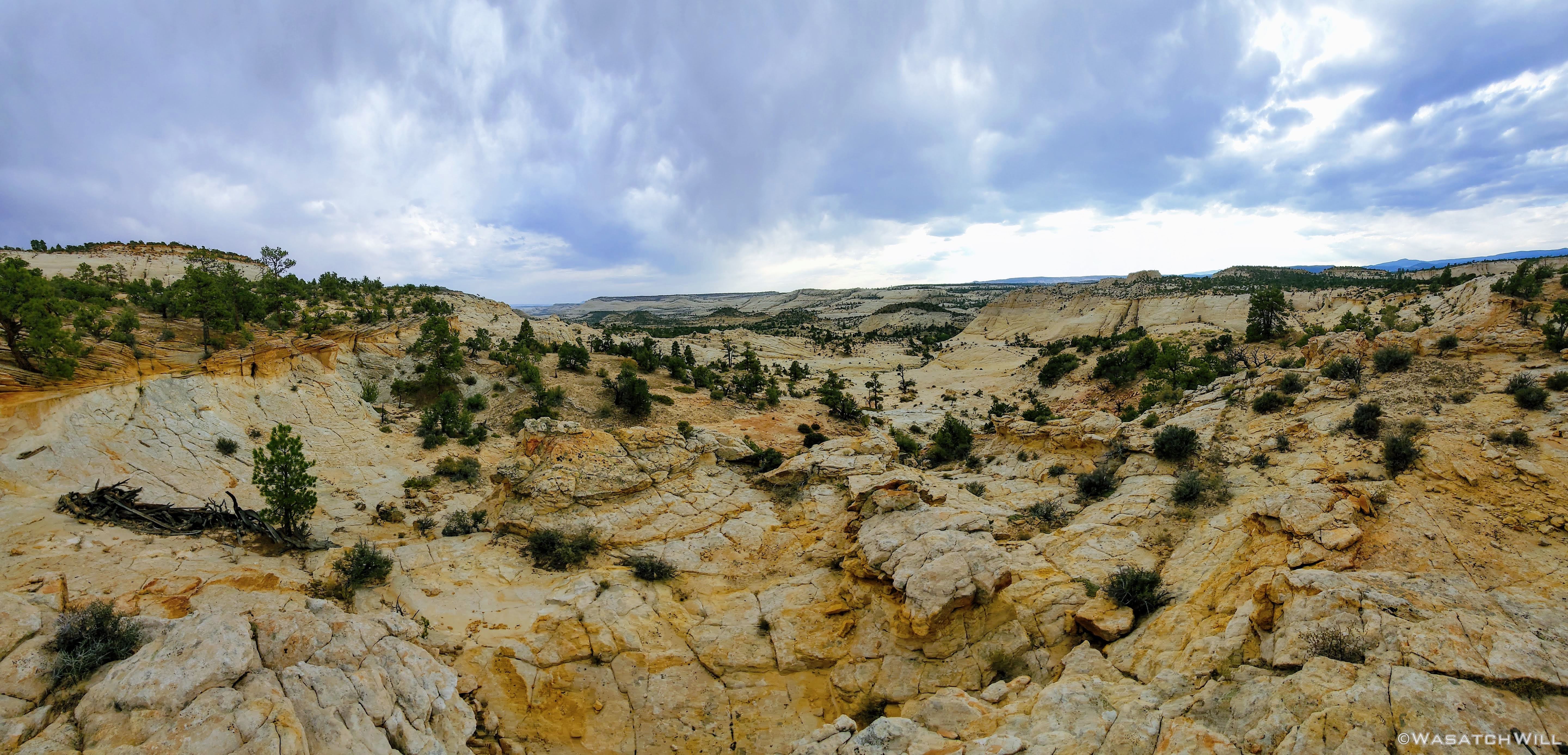
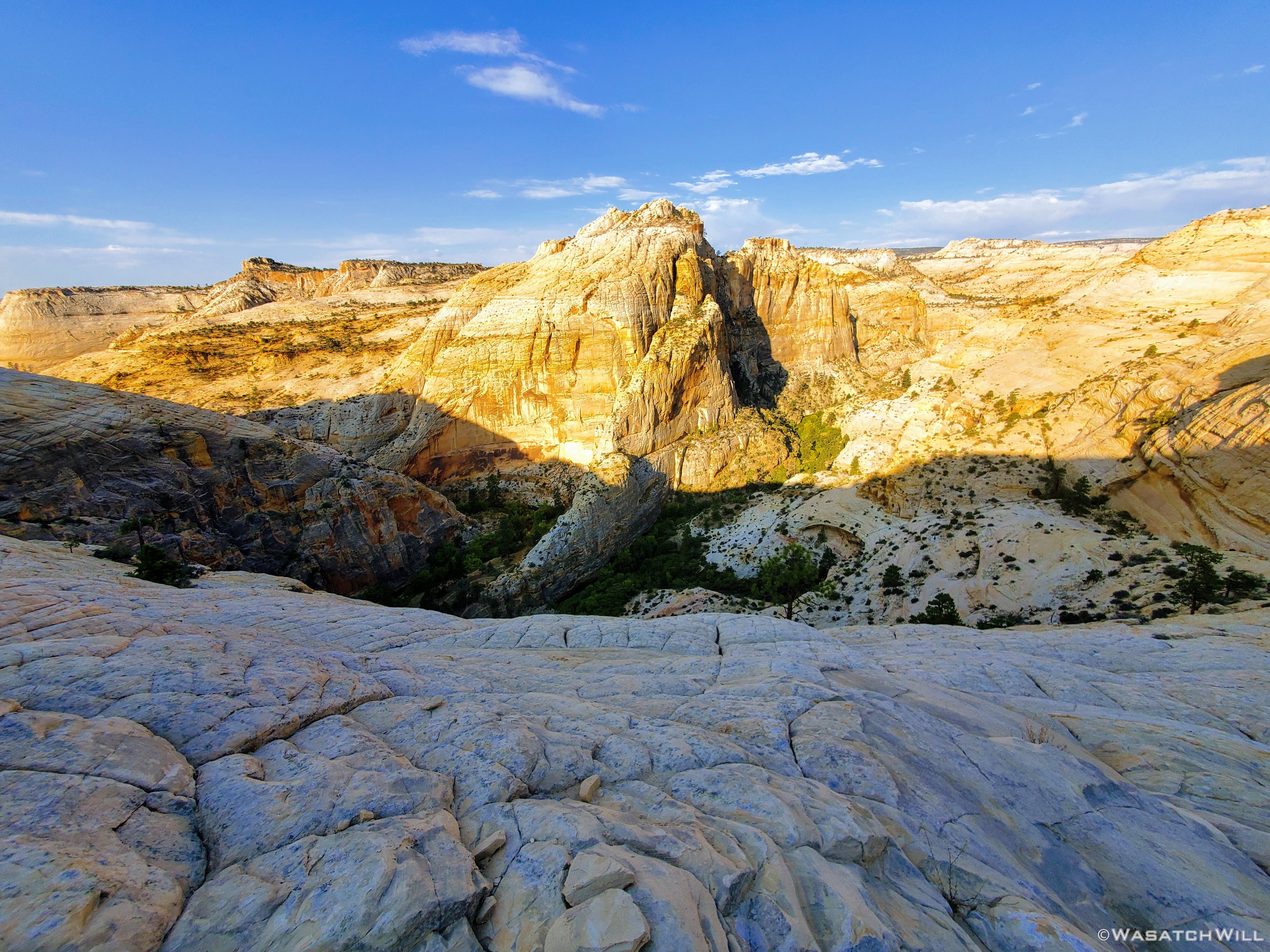
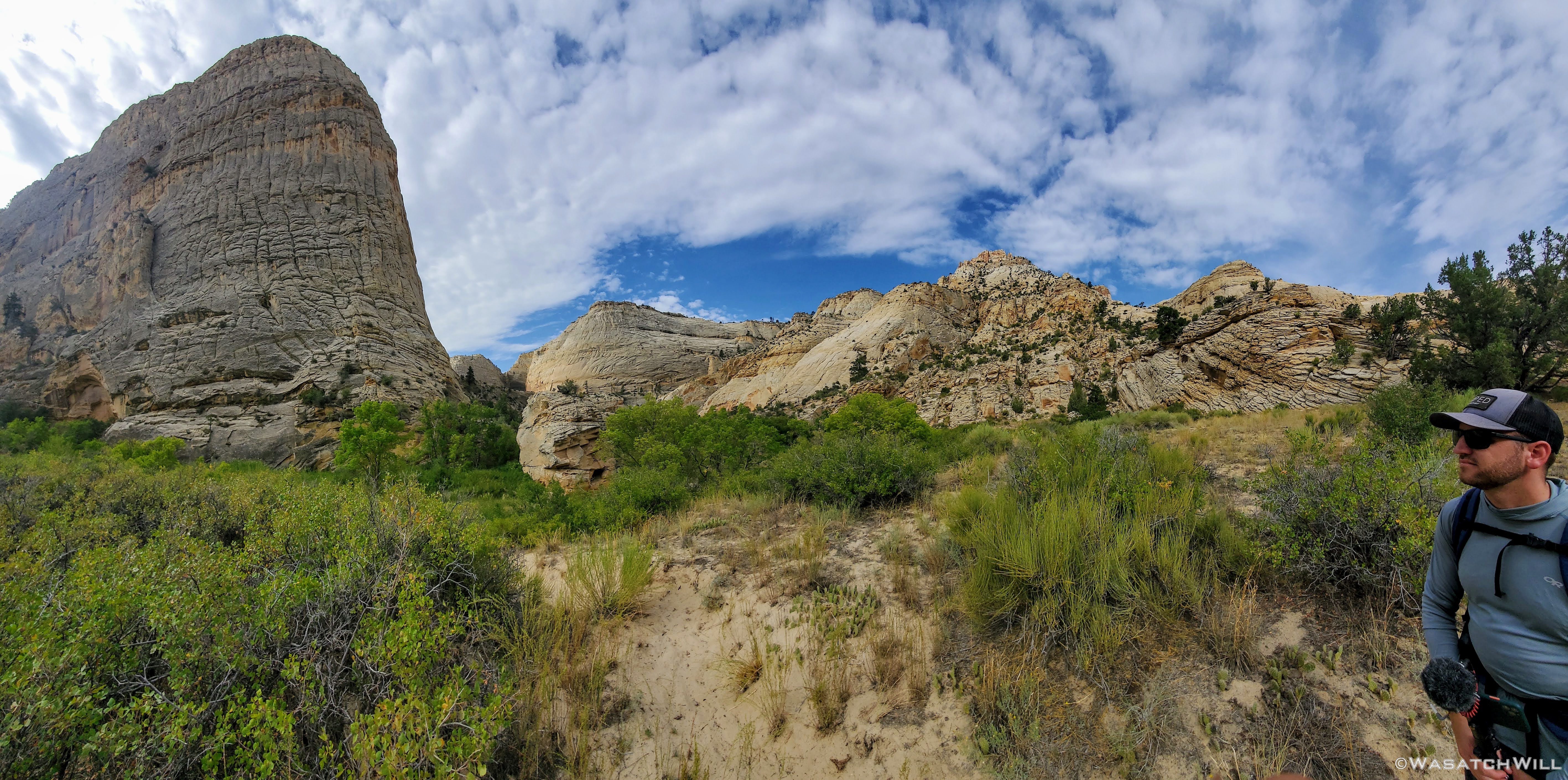
Normally this time of year, being late August, it would still be quite hot along the mesa top we would be traversing the first few miles. Somehow though, we lucked out with some nice cloud cover and a nice breeze to give us a very comfortable temperature for the rest of the day. I had not expected to be wowed too much until we actually reached Death Hollow itself but it didn't take long before we were enjoying some rather expansive views.

The first big view
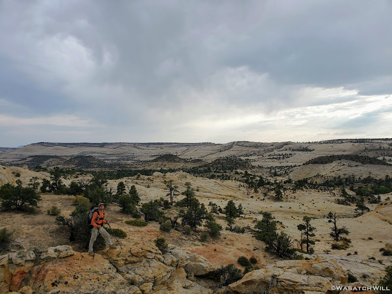
Trying to pose for a photo
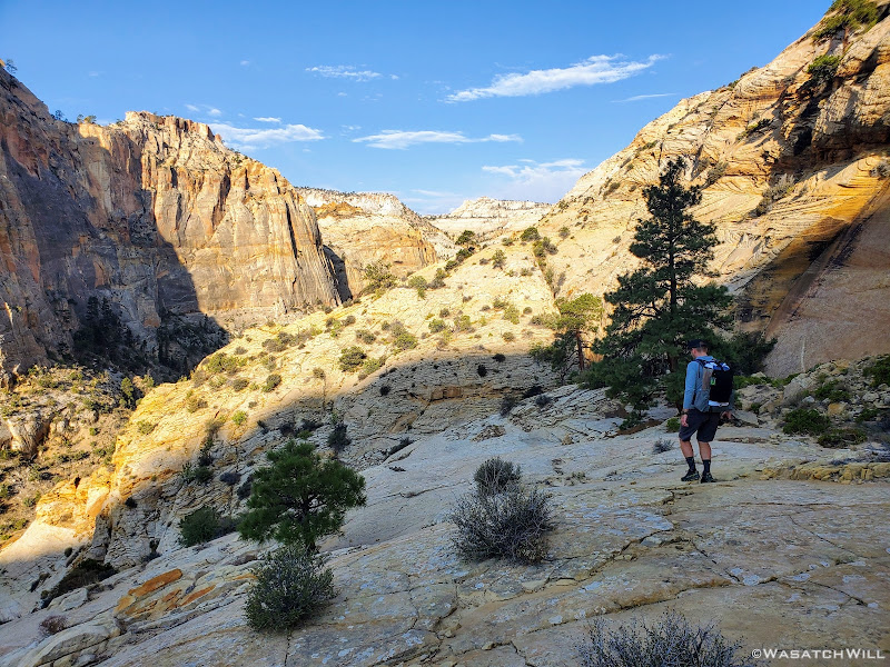
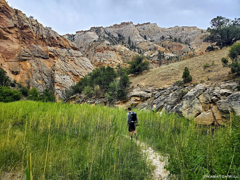
We wound our way in and out and through a number of various basins.
Devin descends a desert basin
Rounding our way past Sand Creek
At various points we paralleled and passed under an old historic telegraph line. The line was strung up in 1910 to enable the small town of Boulder to have its first technological communication with the outside world. Prior to that it was via the mail trail, which had only been established 8 years earlier in 1902, in order for Boulder to receive and send mail by virtue of the trail's connection to the town of Escalante and beyond from there.

The old telegraph line appears

Telegraph connection on tree

Devin ascends a little slickrock rise
Approaching sunset

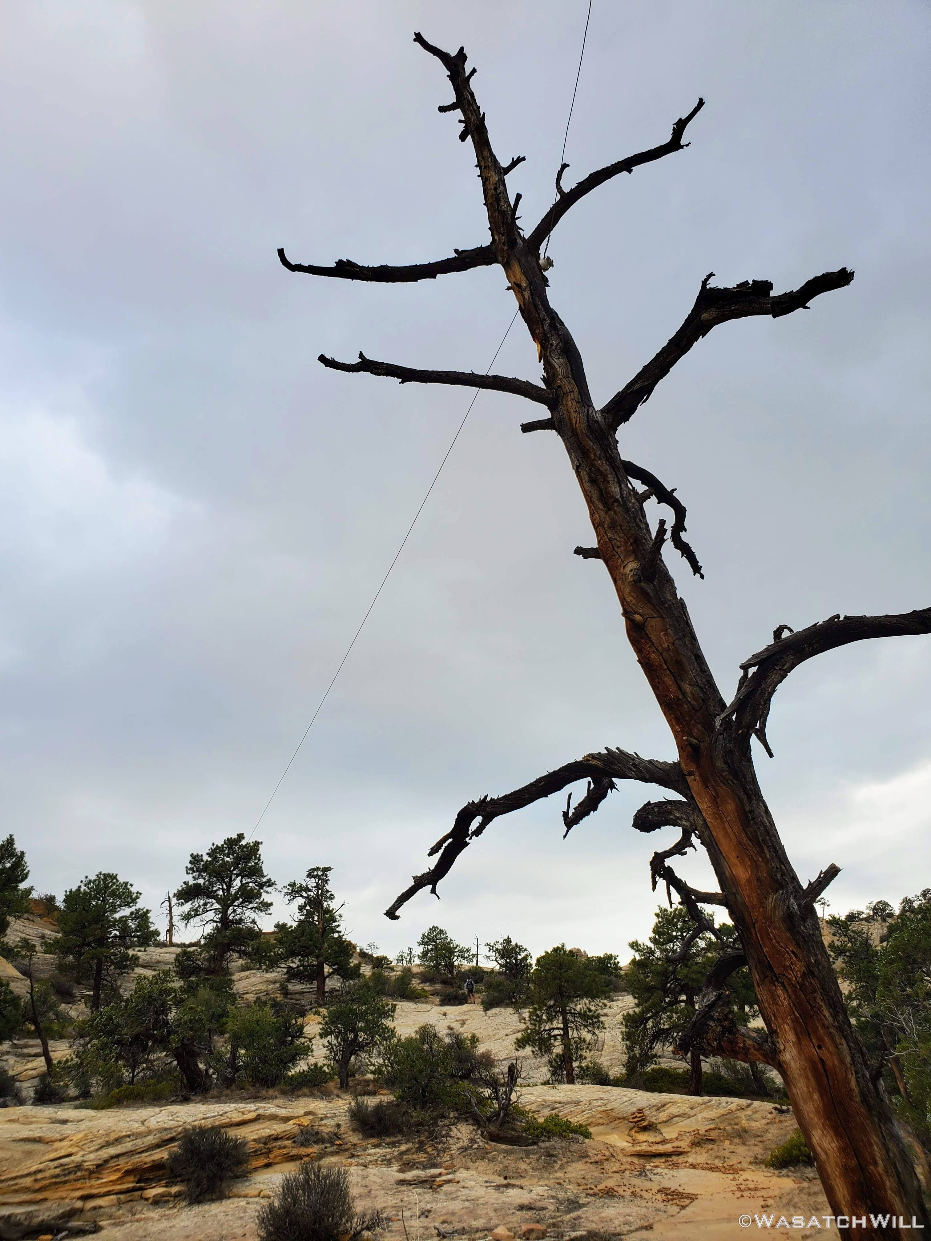
A lively looking but very dead tree
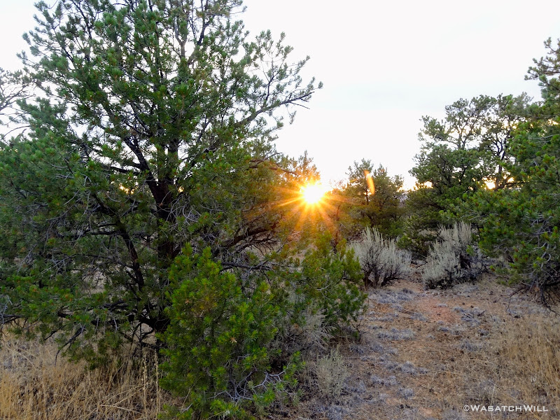
Setting sun
We had high hopes of making it down into Death Hollow and camping creekside down in the canyon but we also didn't want to hike down the somewhat exposed trail down into it in the dark if we could avoid it, and that was looking like it would be the case if we didn't settle for something sooner.
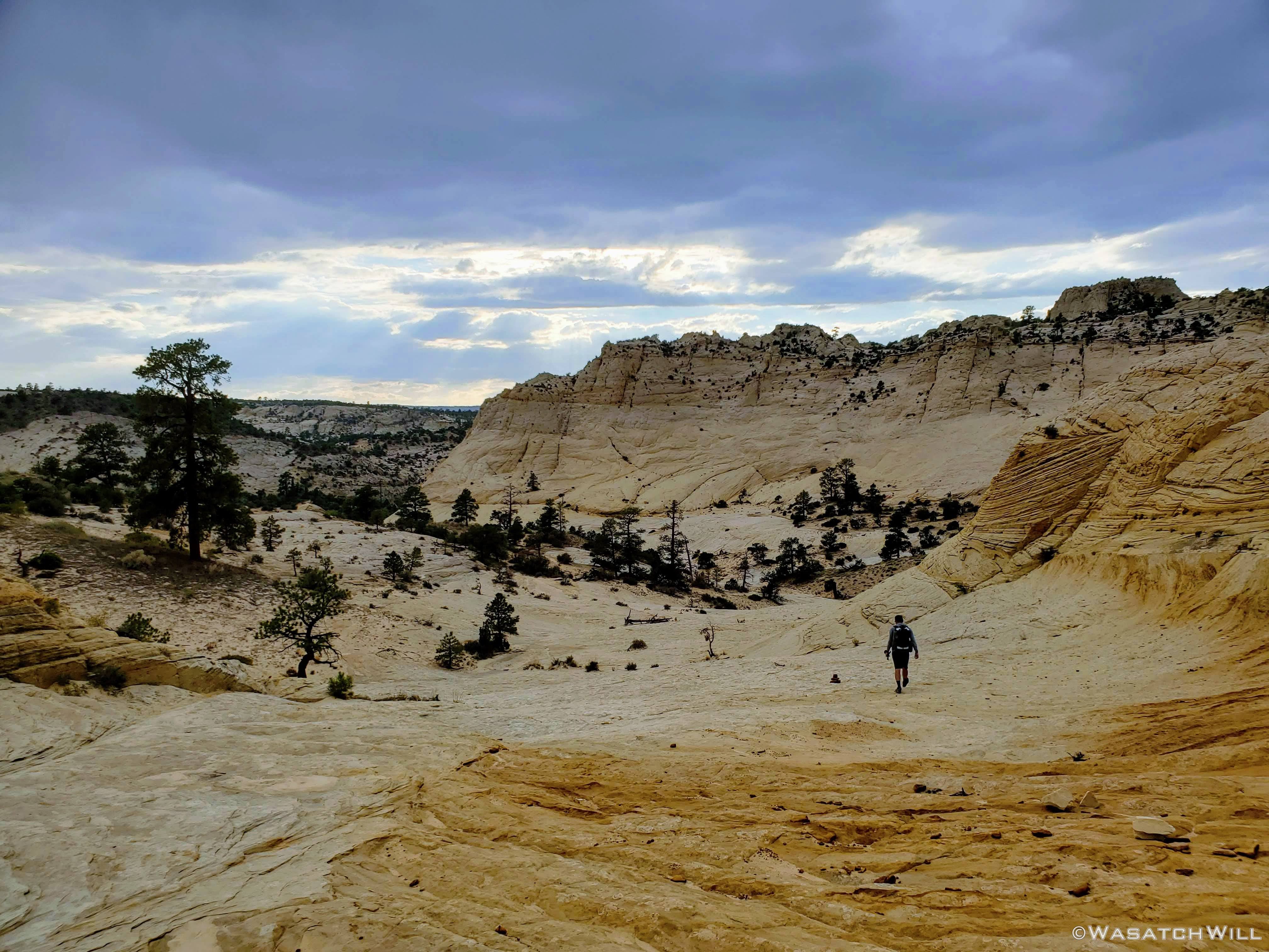
Looking down Slickrock Saddle
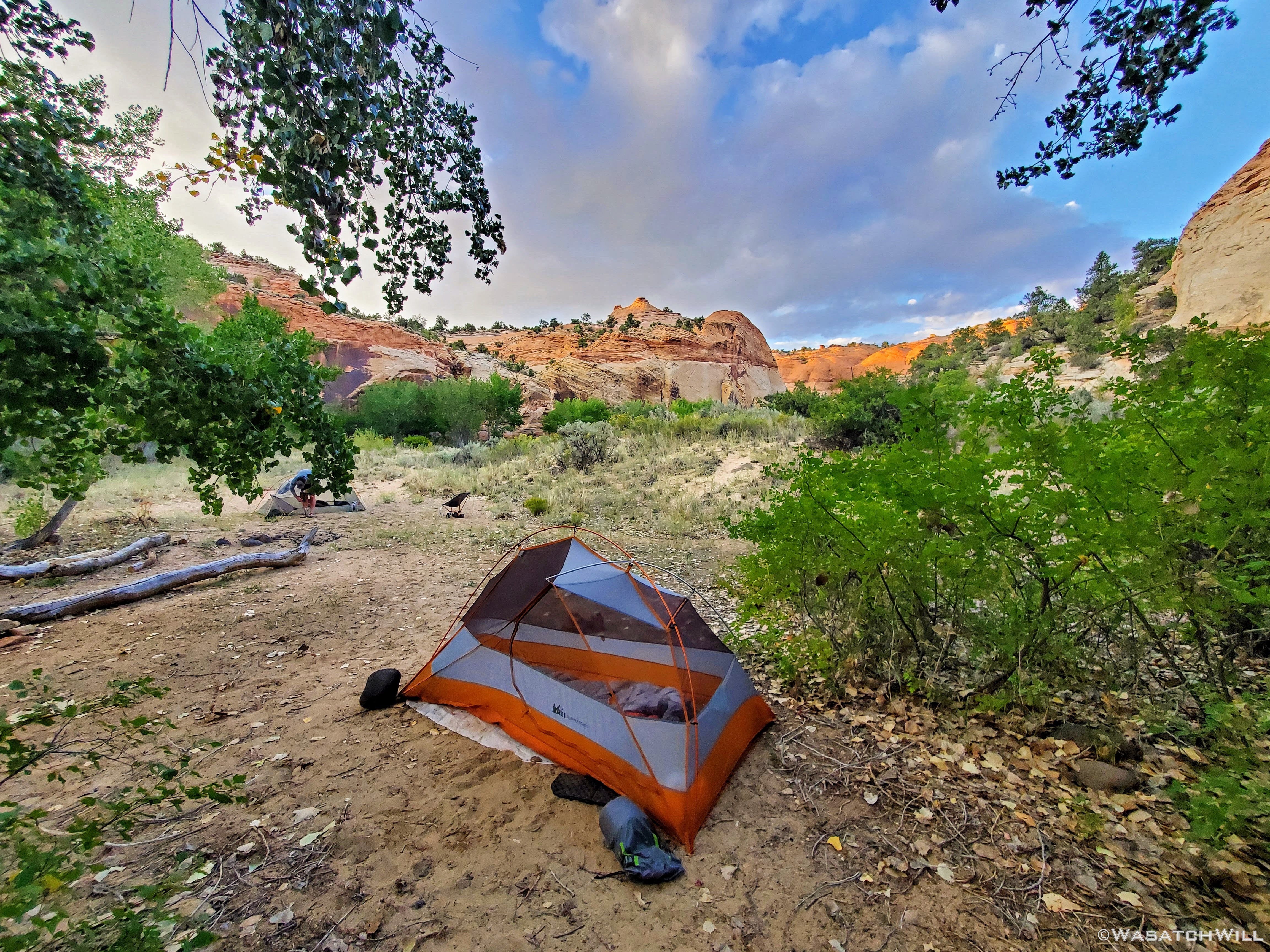
Fortunately, on account of the ideal weather conditions we were blessed with for the five mile hike out to the Slickrock Saddle, we didn't go through as much water as we otherwise may have and thus we still had an adequate amount to enable us to have a "dry camp". In fact, we ended up not even needing to stop over at the crossing with Sand Creek a couple miles back to top off any water stores. We therefor chose to pull over along the edge of the Slickrock Saddle and make camp there.
We were spared just enough light to get our tents up before it really got dark as we prepared our dinners. Shortly after getting into our tents for the night, we had a short little light shower come over our camp. It was just enough to get us both out to put up our flies, only to have it all stop for the remainder of the night once we did so. Temperatures remained comfortable enough to not even require zipping up my sleeping bag.

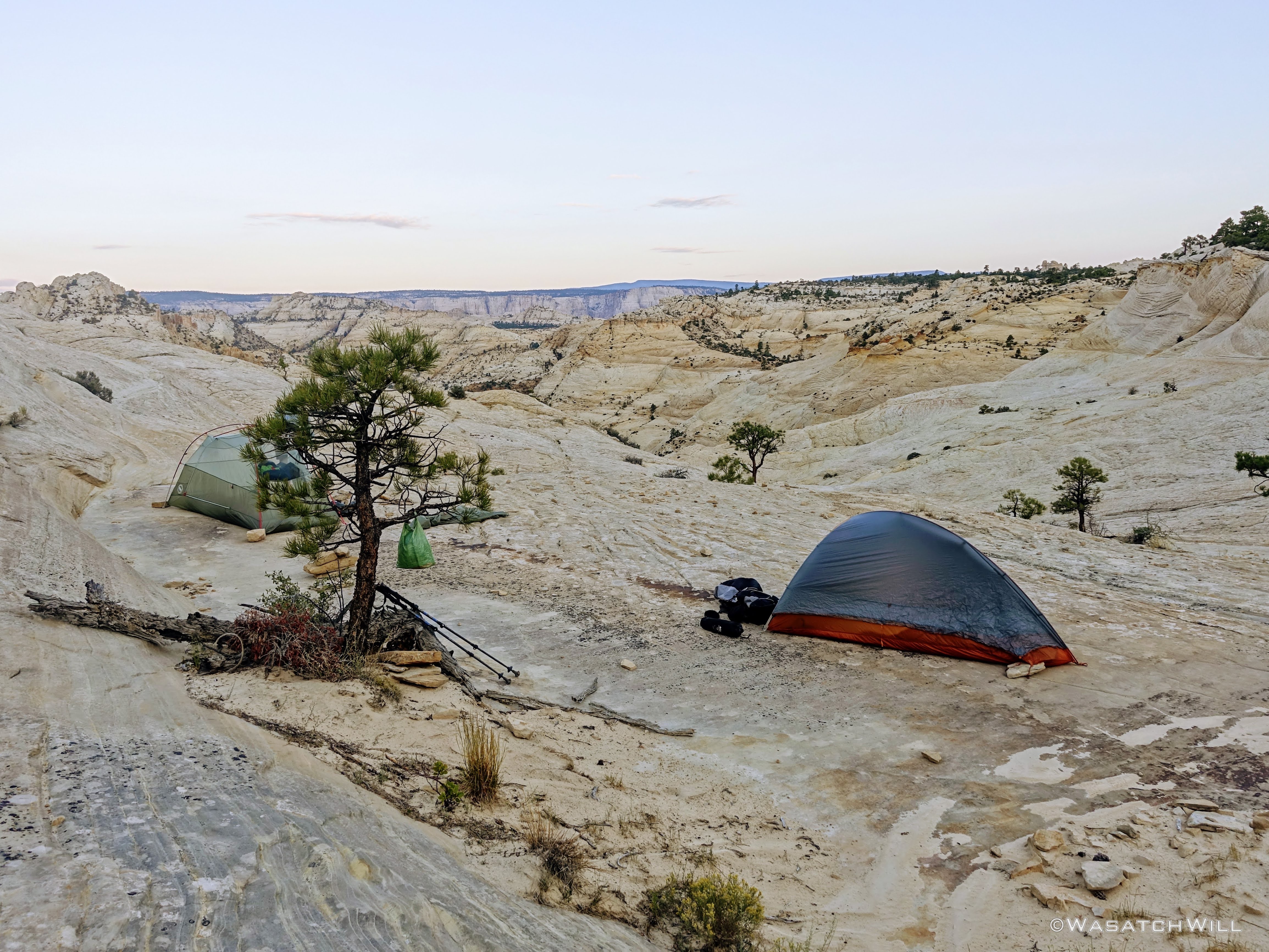
Slickrock Saddle Camp
Saturday - August 29, 2020
Day 2: Death Hollow to Sand Creek
Miles Hiked: 12
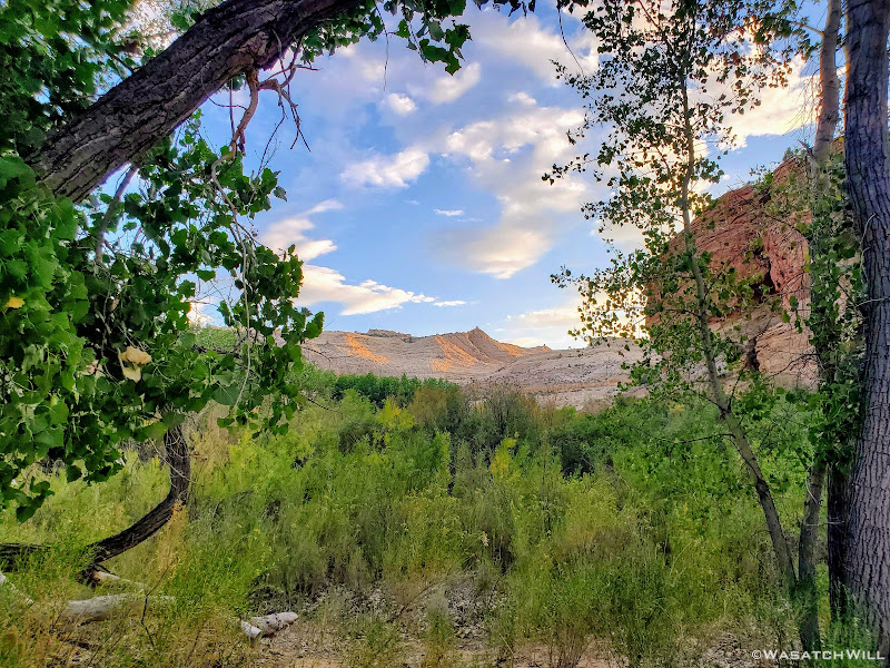
When we awoke, virtually all the clouds had now vacated the sky. No worries for a hot and sunny day on this day though. With less than a mile to go, we'd be dropping down off Slickrock Saddle and into the Death Hollow canyon and its accompanying creek. From there we'd follow the creek down to its junction with the Escalante River and then follow that downstream to the junction of Sand Creek where we'd settle into another camp at the end of the day. In other words, we'd be in and alongside a constant source of water for the rest of the day, and in fact, for the remainder of the whole trip's route.

Morning view from camp
Rising Sun
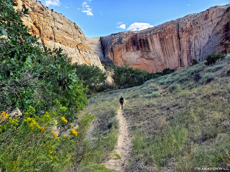
With the sun up, we commenced our morning routines of attending to nature calls, breakfast, changing into hiking clothes, packing up camp and so on. It was now time to lower our elevation in a hurry. Seven hundred feet in seven tenths of a mile to be almost exact. The views were simply stunning all the way down!
Myself, taking in the big view down into Death Hollow
Devin check his shot

Death Hollow awaits

Looking back up from about half-way down the descent
Devin on the descent
Another big view down into Death Hollow
Before we knew it, we had reached the creek. And right on cue, we were immediately greeted with our first patch of poison ivy. We knew there would be loads of it along sections of the creek, some of it almost unavoidable. There was even one stretch of trail where it was reaching well over it from both sides. Perhaps we could have avoided it by staying in the creek but we gambled and went for it. It surely brushed against our clothing, bare legs, and even arms a bit. Devin and I must both be in the lucky 10-15 percent of the human population that doesn't seem to have an allergic reaction to it. Or if we did, it was very, very mild, for what symptoms we may have felt from it quickly dissipated as we got back into the creek and continued onward. Or...maybe hopping back into the creek simply washed away whatever oils may have otherwise lingered longer to cause a more irritating reaction.
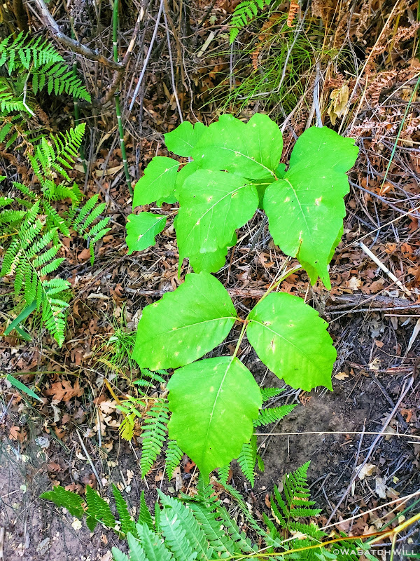
Poison Ivy
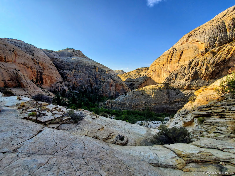
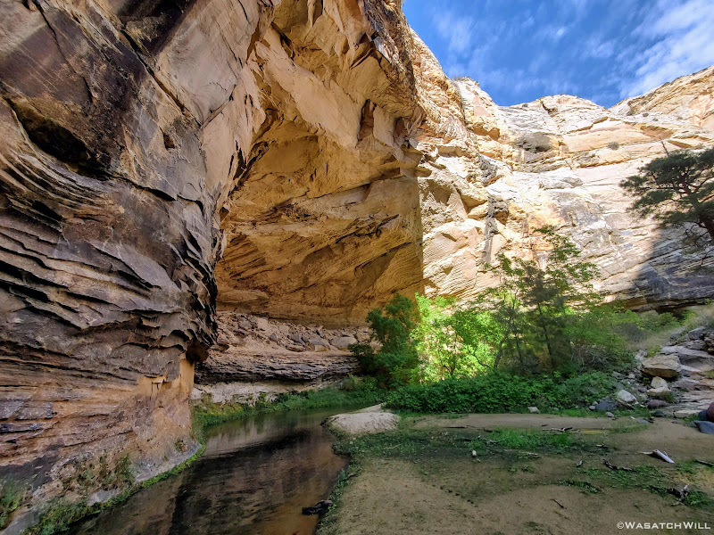
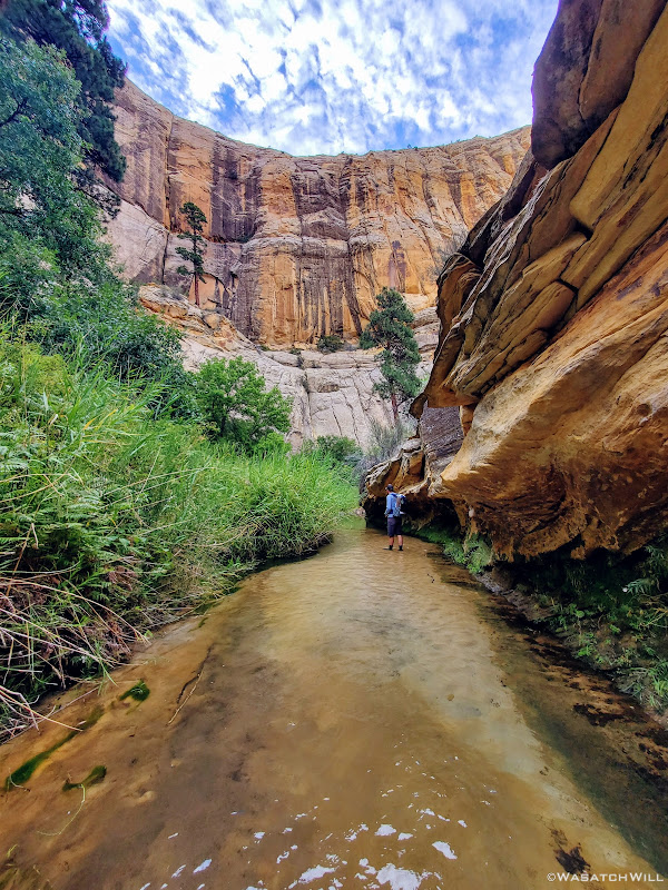
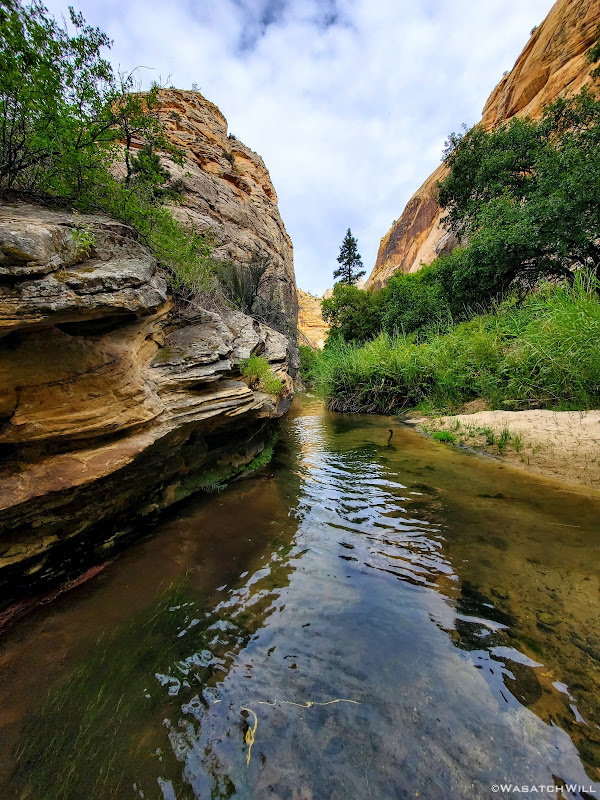
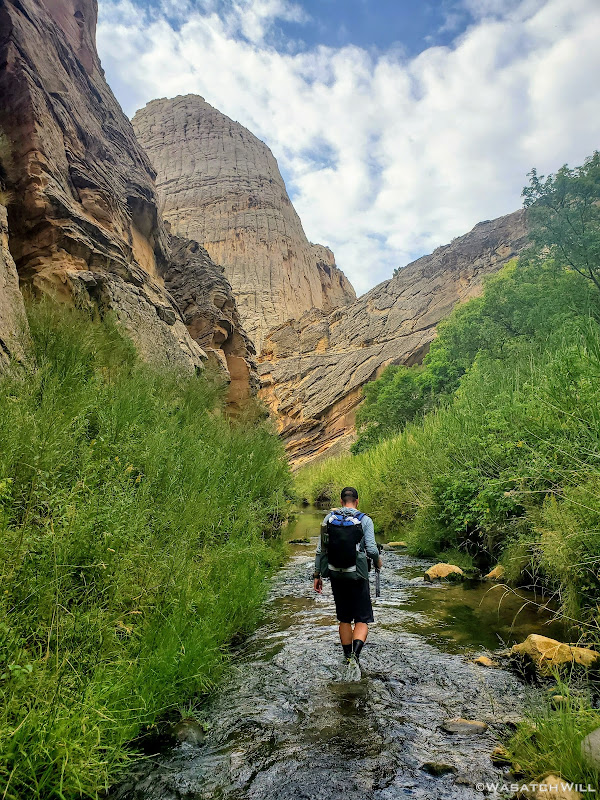
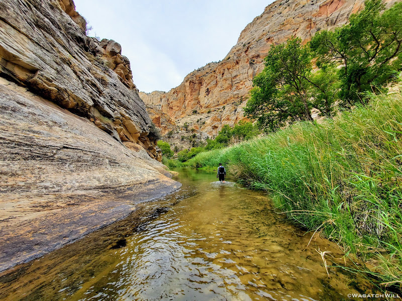
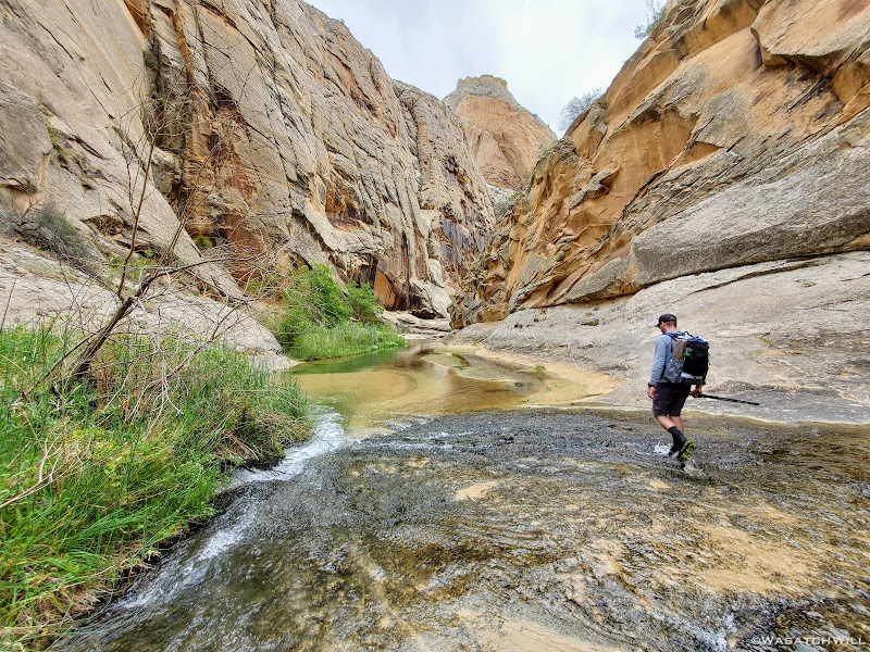
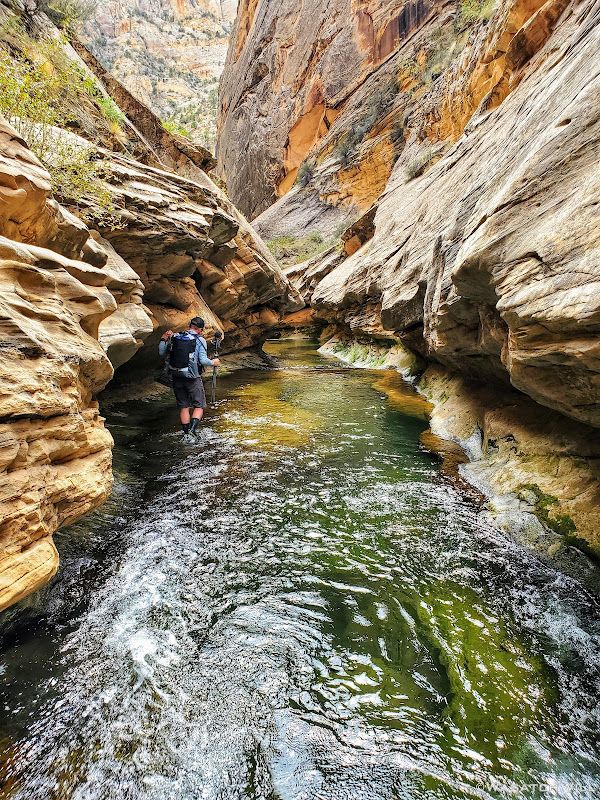
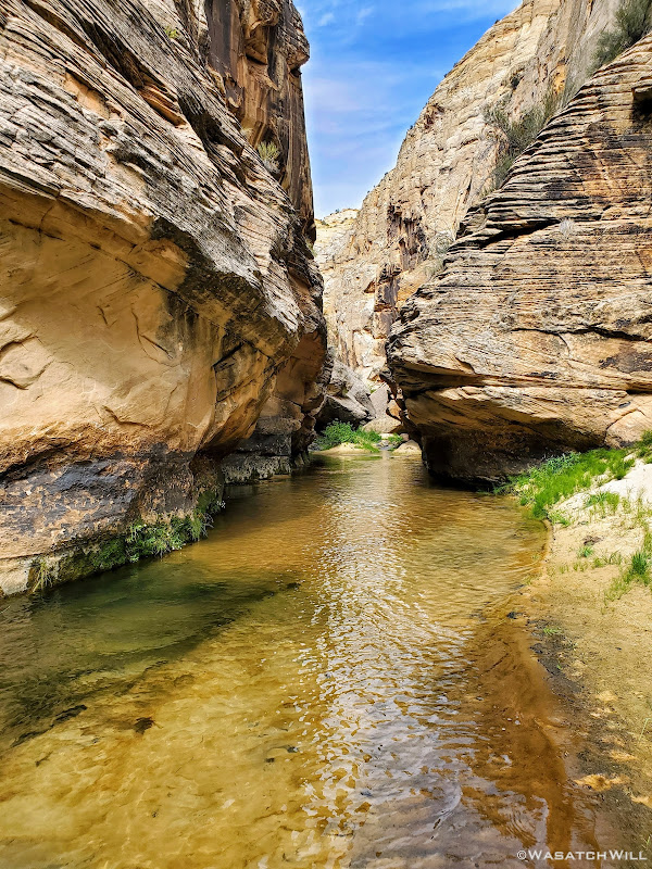
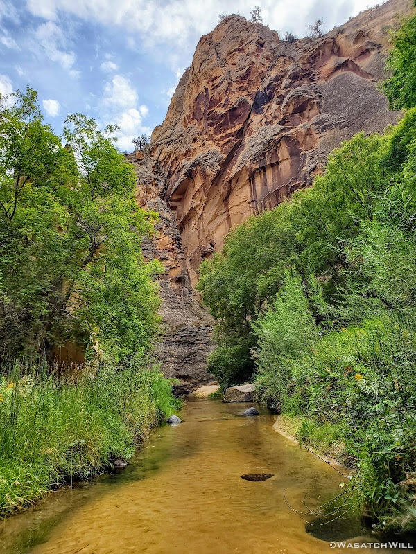
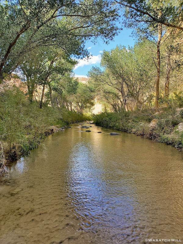
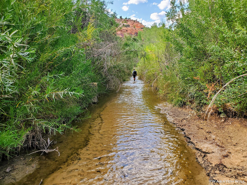
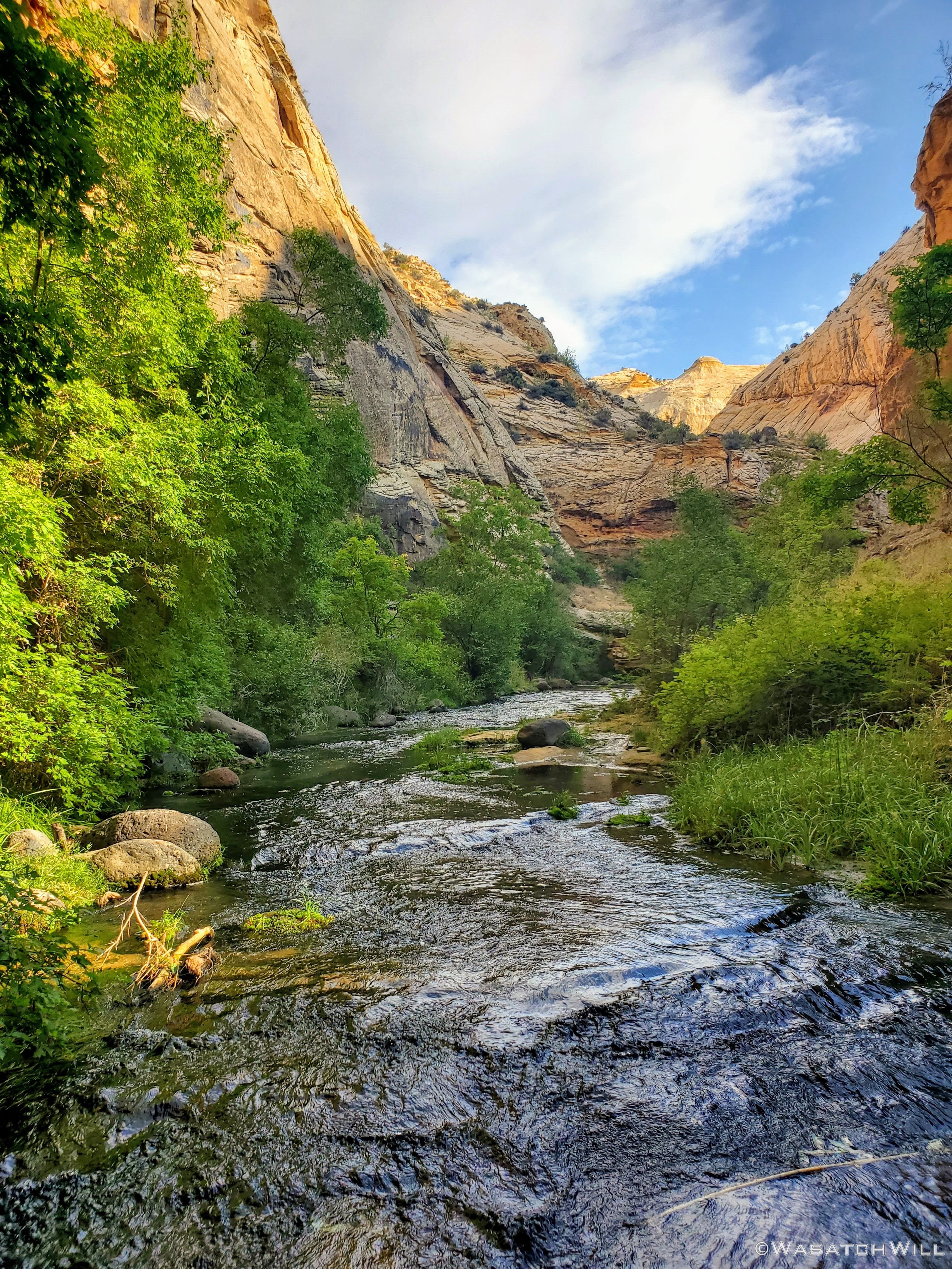
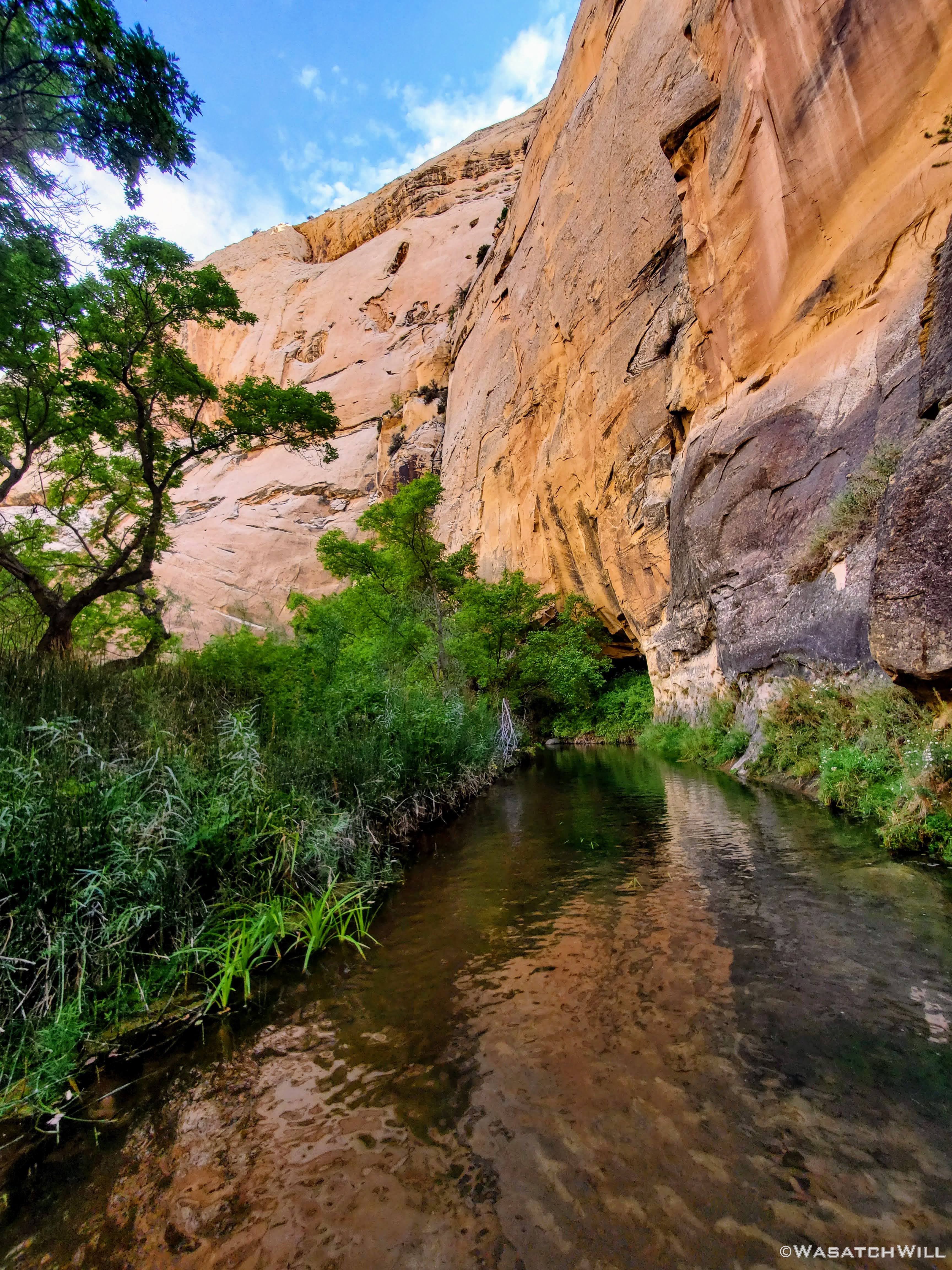
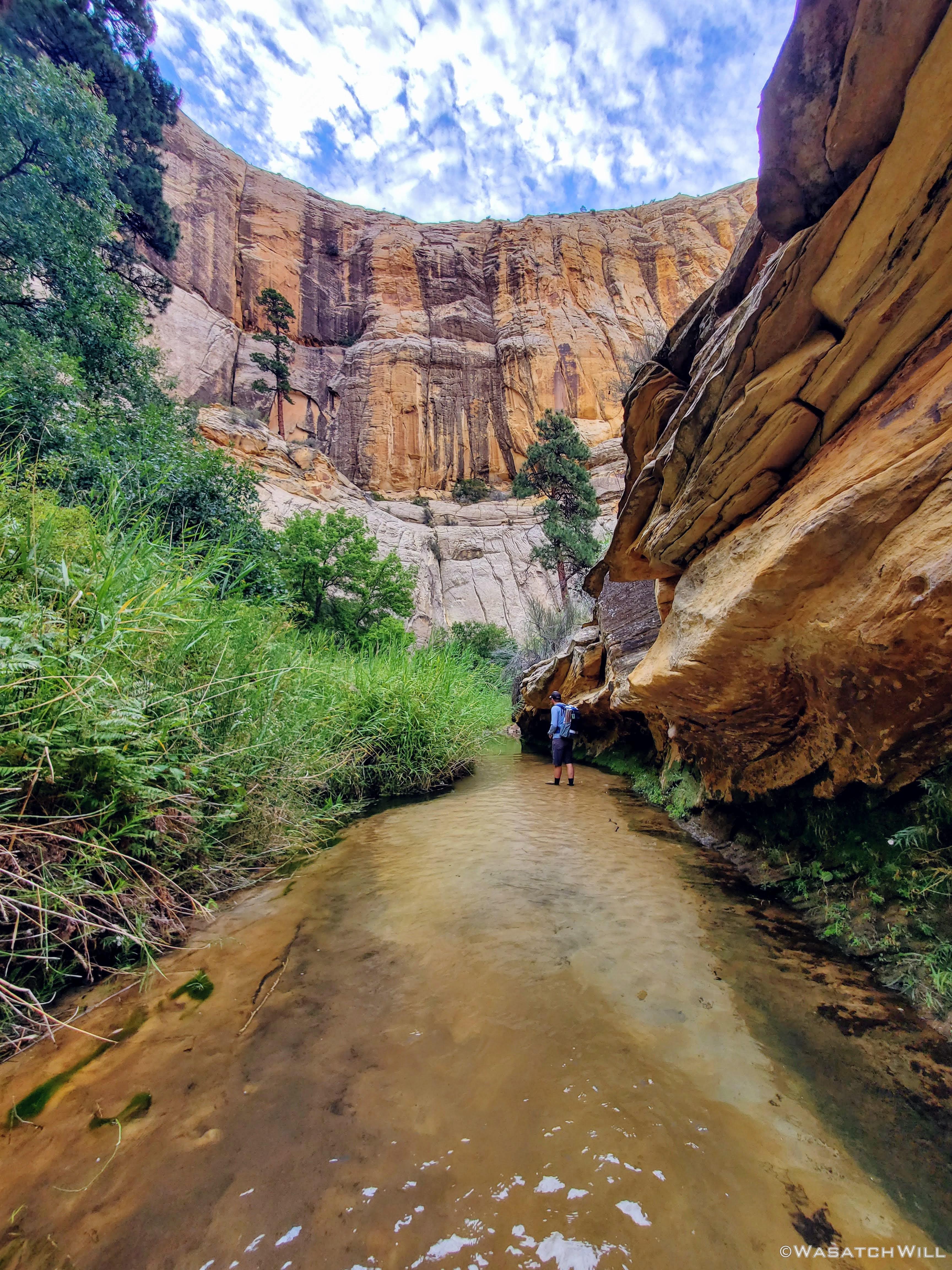
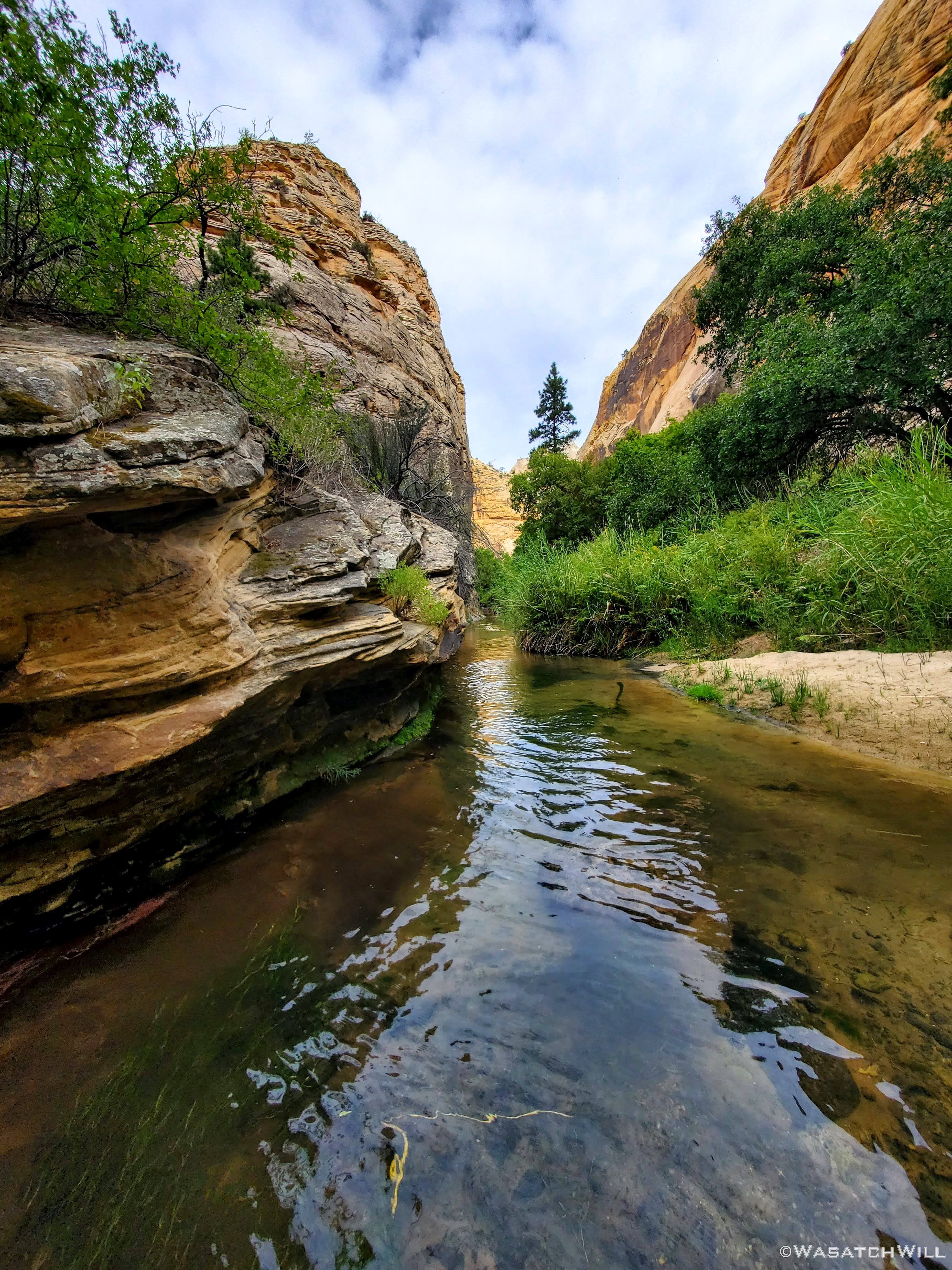
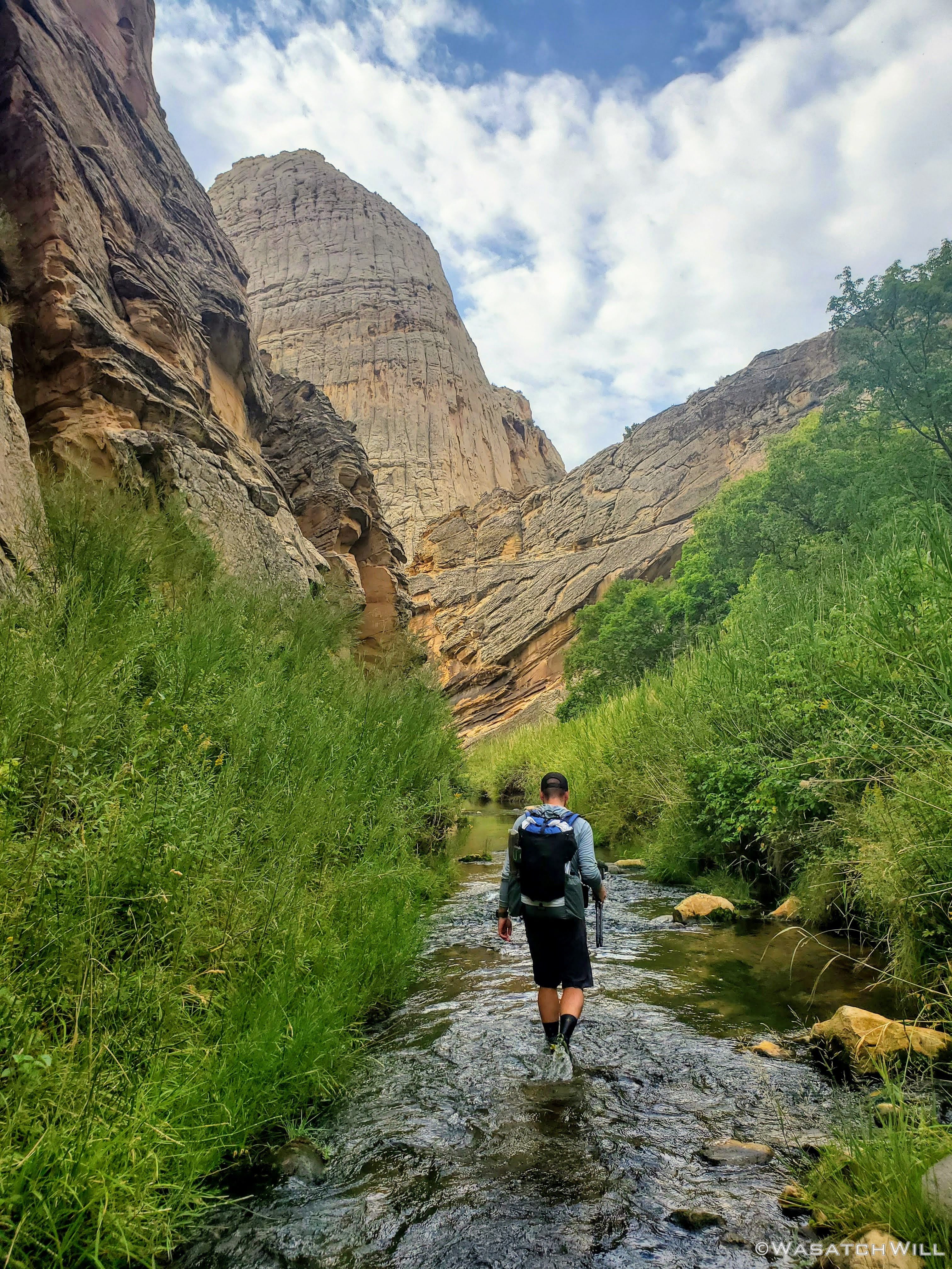
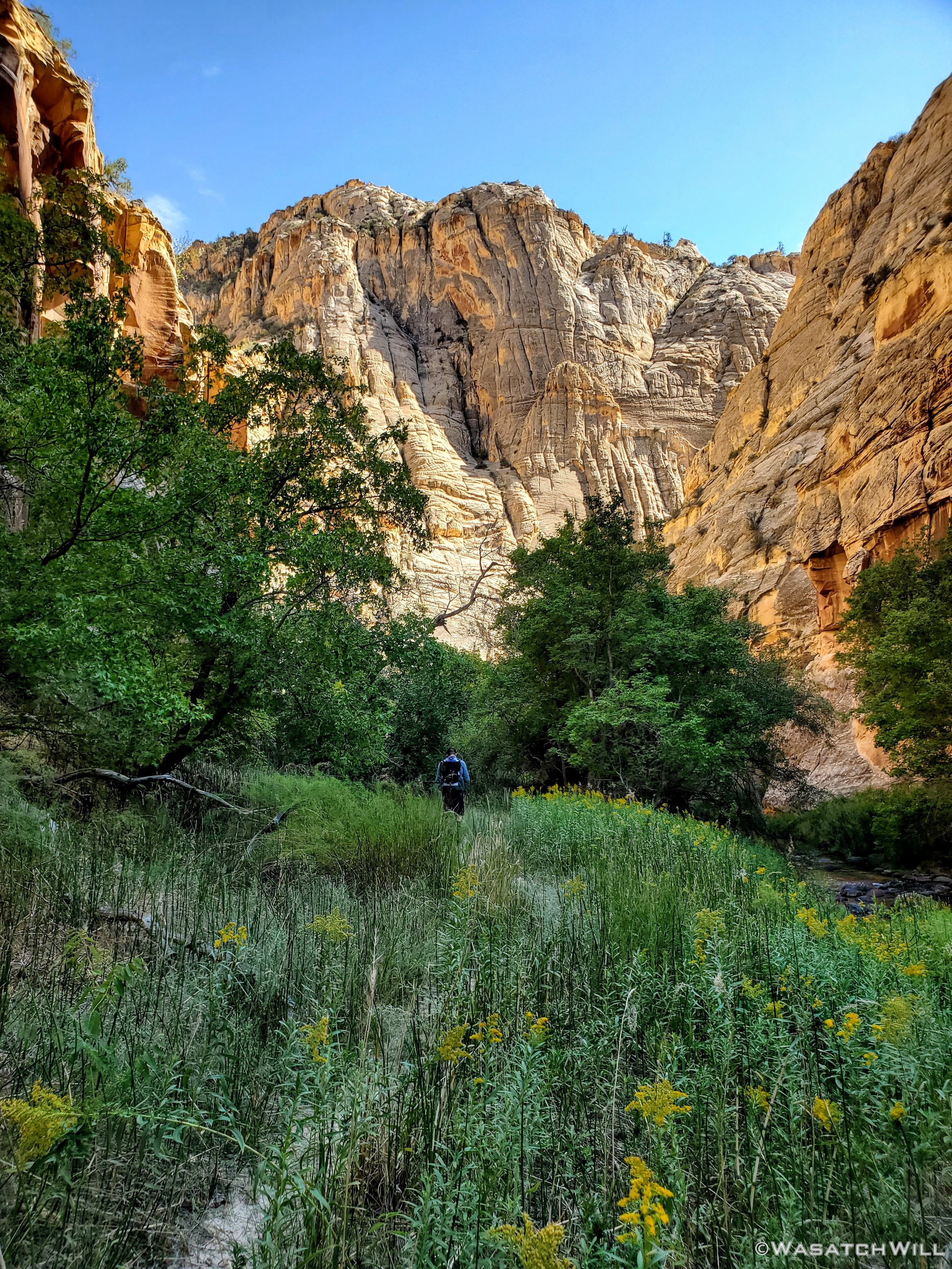
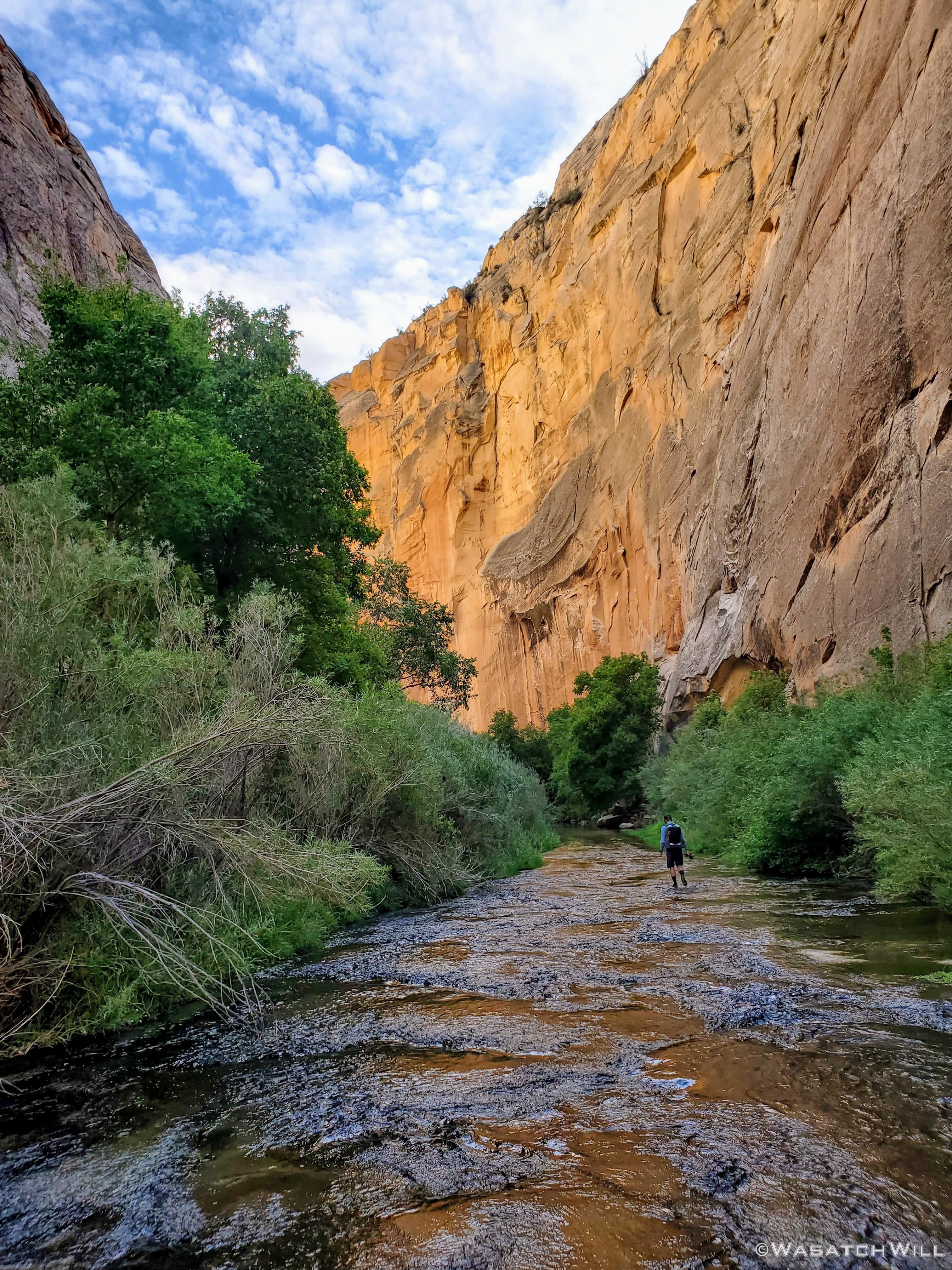
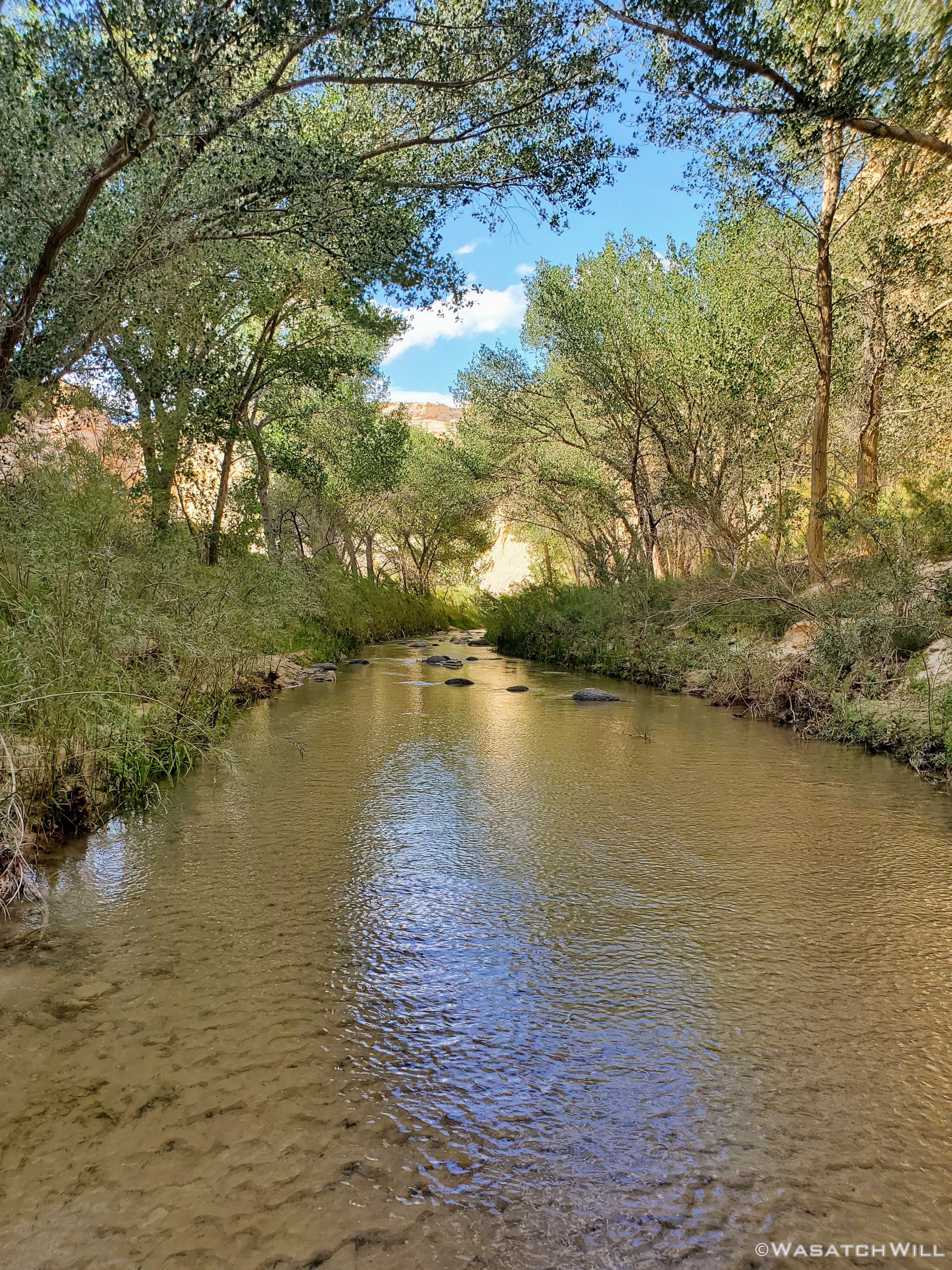
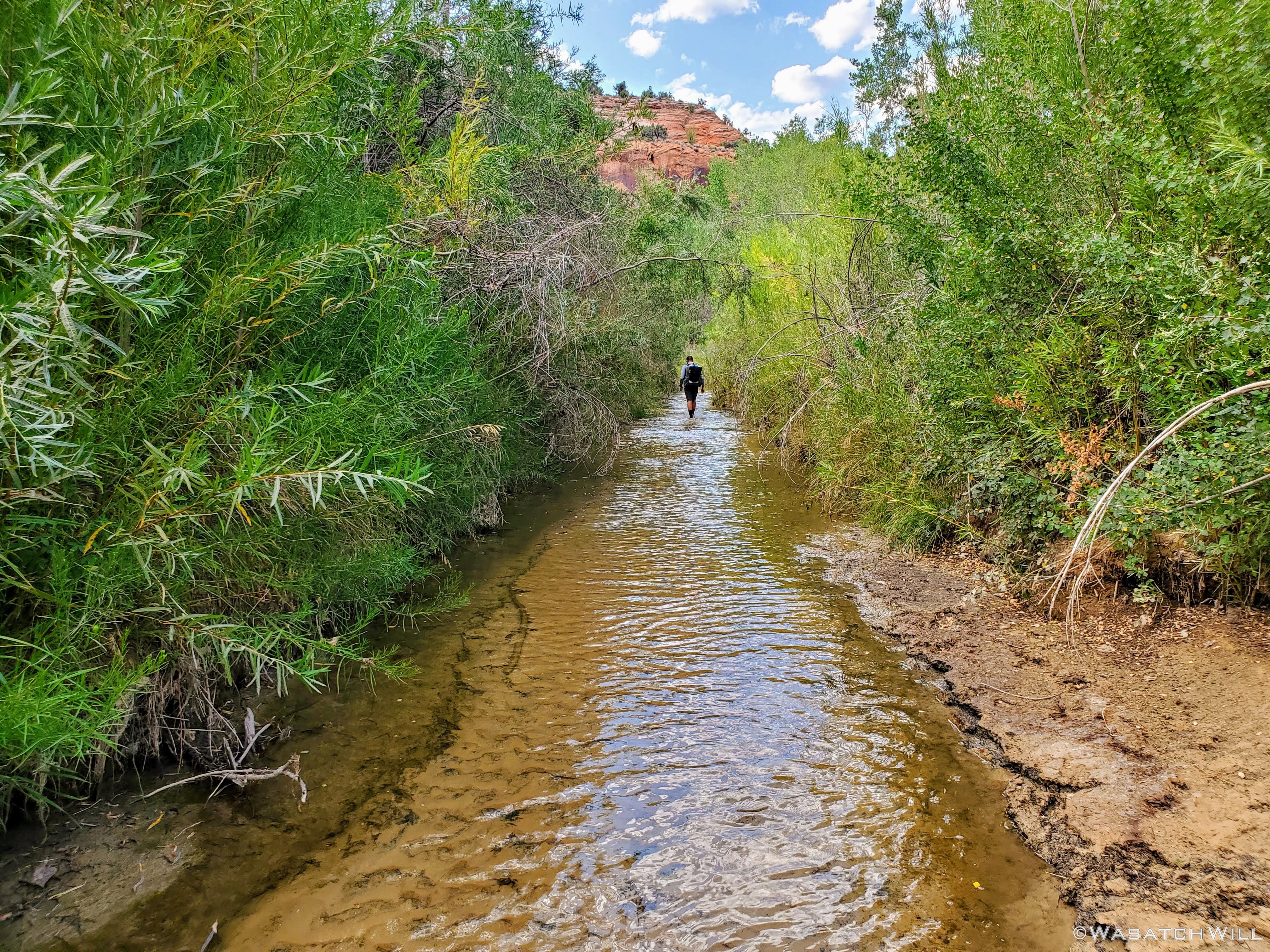
From thereon down the creek, it was a typical hike in a desert canyon with a clear flowing creek. That is, it was incredible, awesome, and featured lots of WOW moments around almost every corner and turn in the canyon, all in between the occasional sections of bushwhacking there was to do. The water was pleasant. Cool and refreshing, but not bone-chilling cold. I'm sure it would be a different story earlier in the year, during the spring thaw with all the run-off that must flow this way from the southern flanks of nearby Boulder Mountain. But again, it was now late August.

Into the creek...

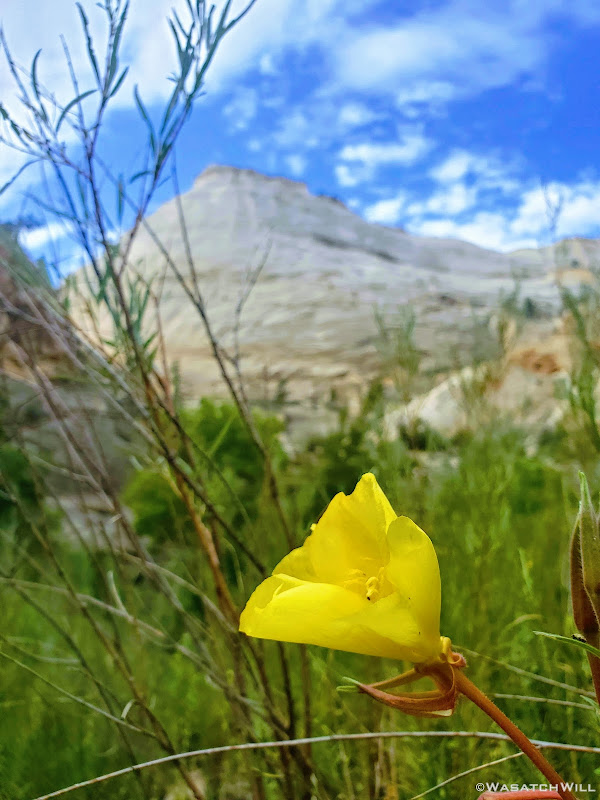
A rare late season wildflower
At various spots along the creek bottom you could see fish scurrying about. Upon trying to look up what type of fish they were after returning home, I'm fairly confident in identifying them as Bluehead Suckers. Many were as big as trout, but they were most definitely not trout.
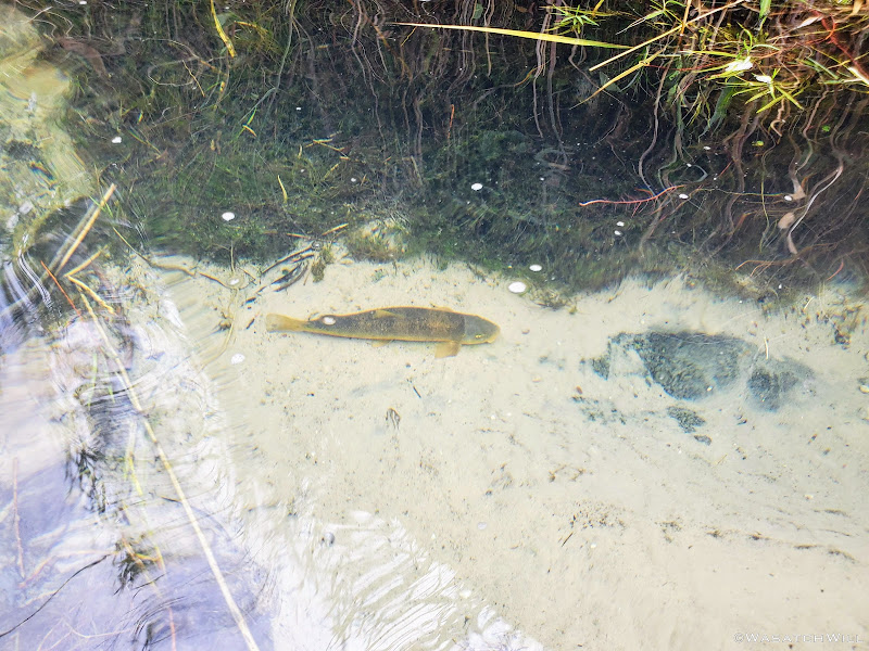
Bluehead Sucker
I really enjoy the way the green ferns can often be found growing along the seeps and springs of canyon walls such as this. It's like a touch of rainforest or some jungle clashing with what is supposed to be a desert.

Ferns
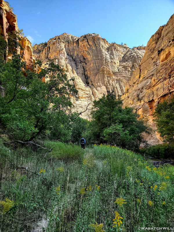
Devin makes his way through sea of tall grass
Back into the creek
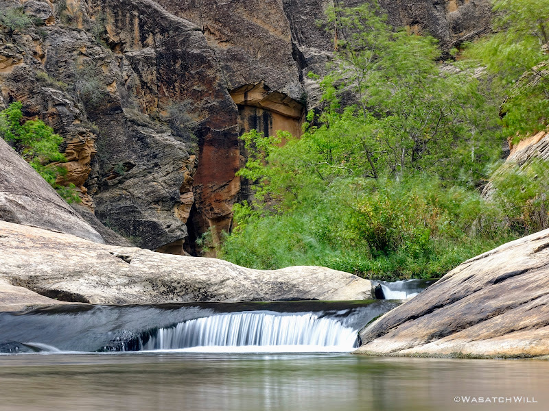
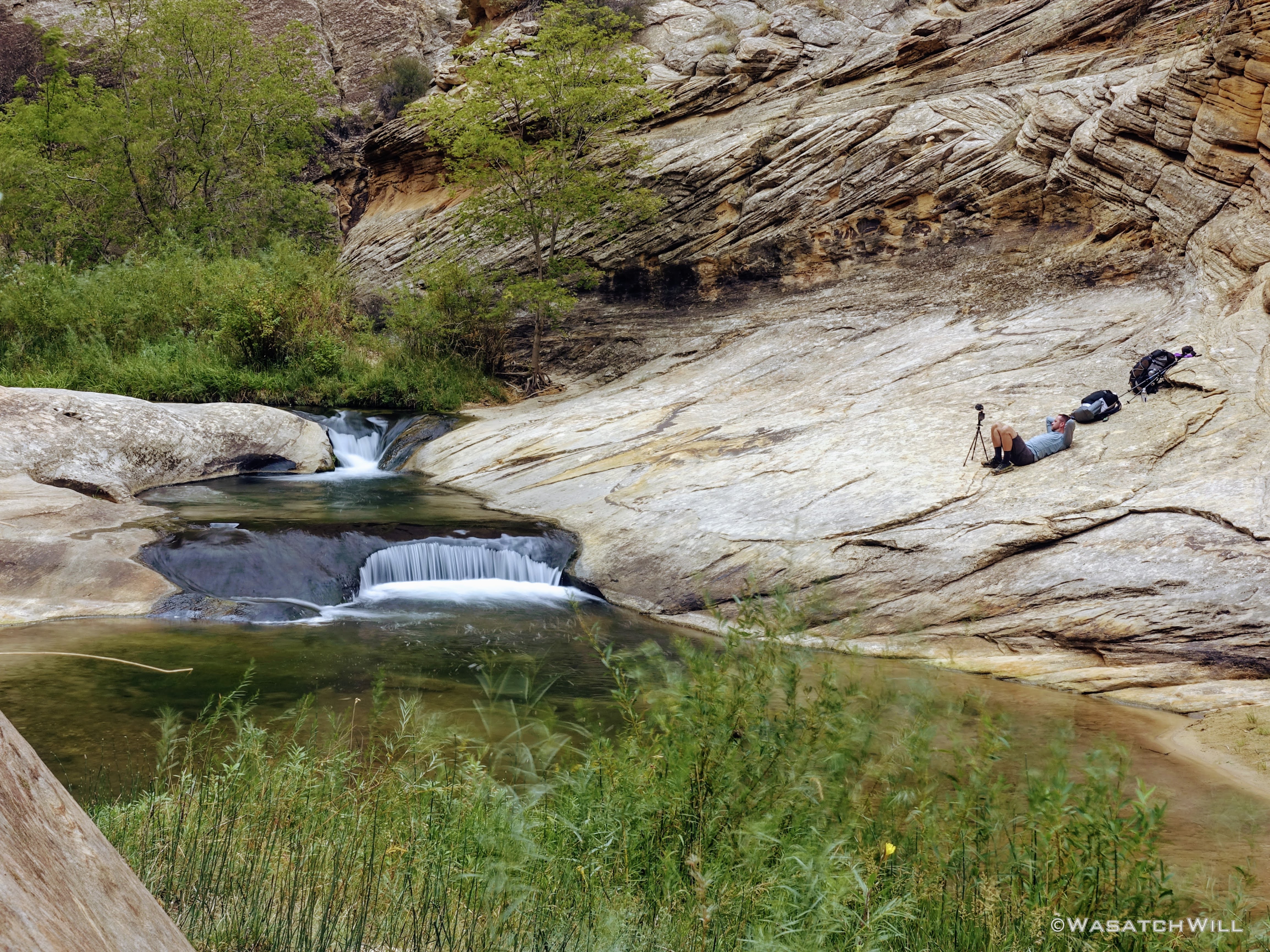
Soon we reached the waterfalls where we stopped and lounged for lunch followed by a dip. Somehow we got lucky to get this spot all to ourselves. For once we made it down past the narrows a little way downstream, there were a handful of groups that appeared to be heading up for the same spot coming from down canyon, or so we assumed.
Waterfall

Setting up for lunch
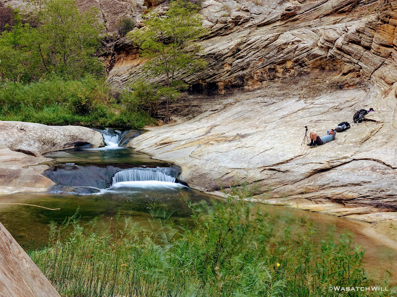
Lounging

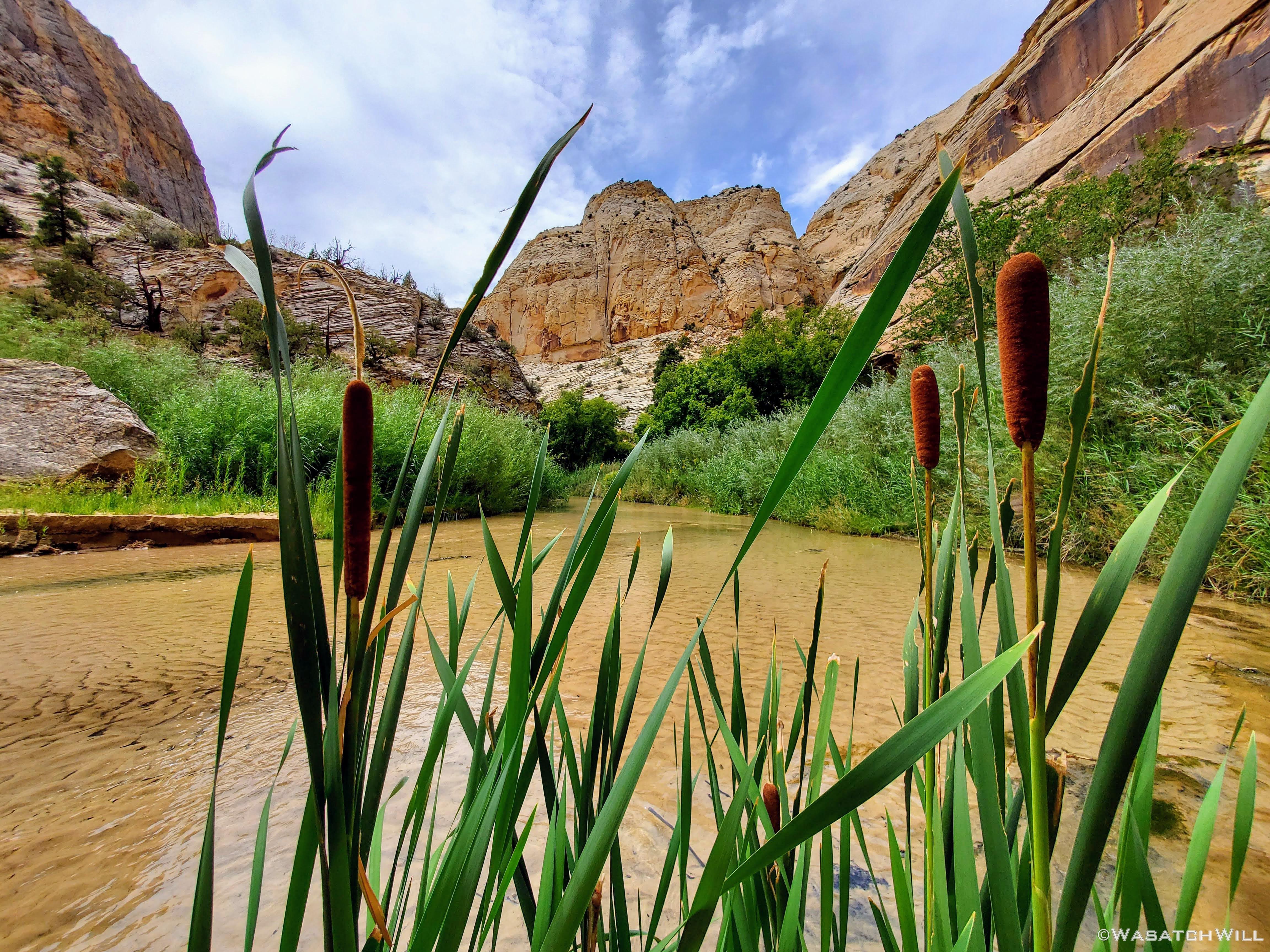
Cattails
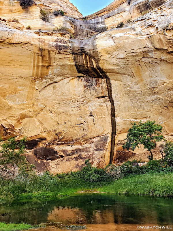
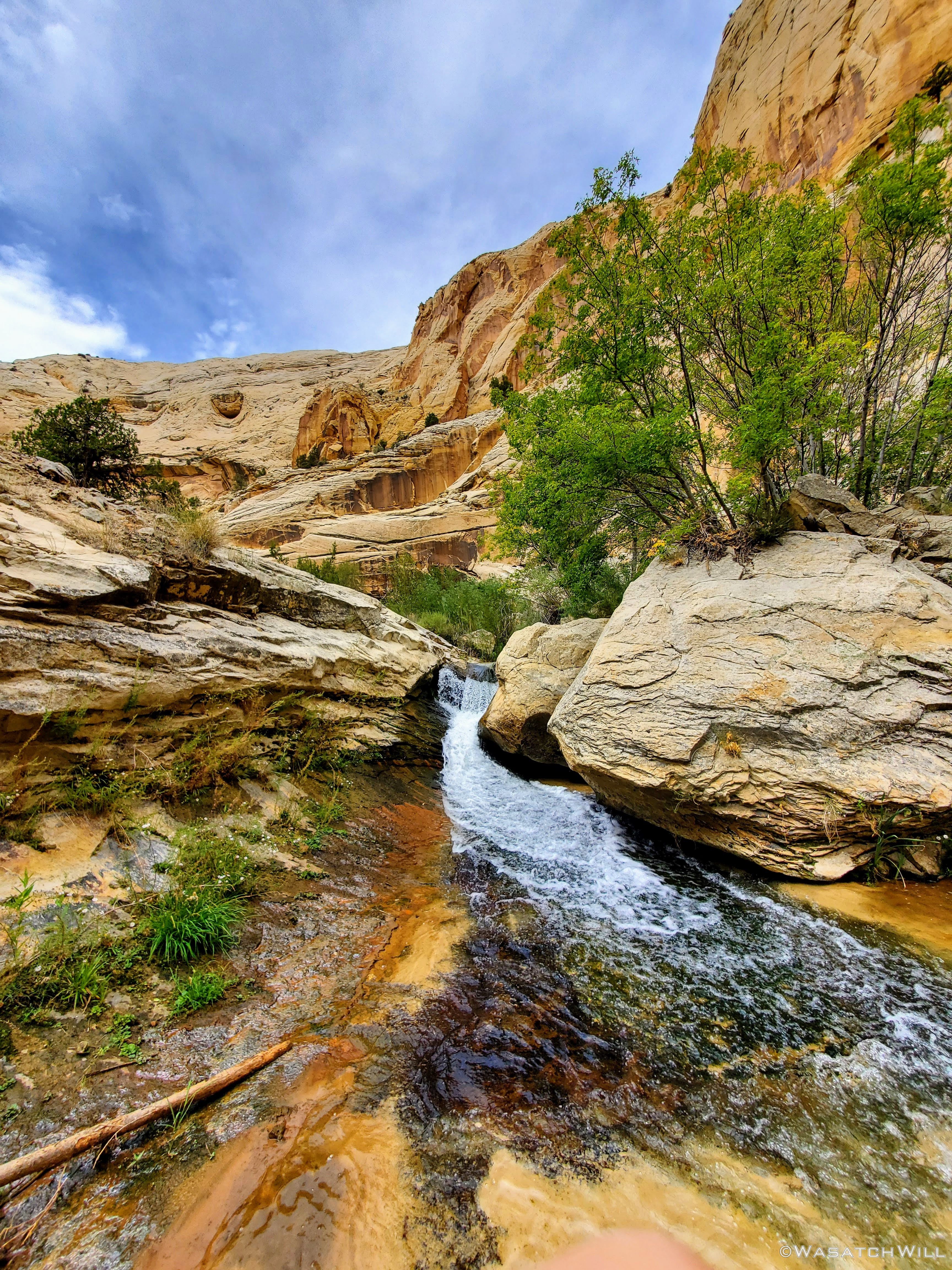
Further down canyon, had I not looked back, I would have missed this other waterfall.
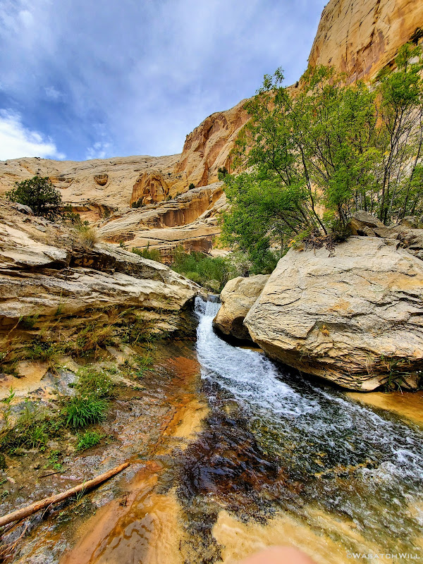
Another waterfall
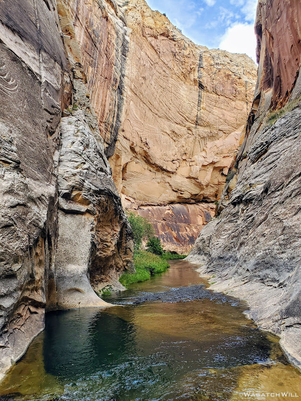
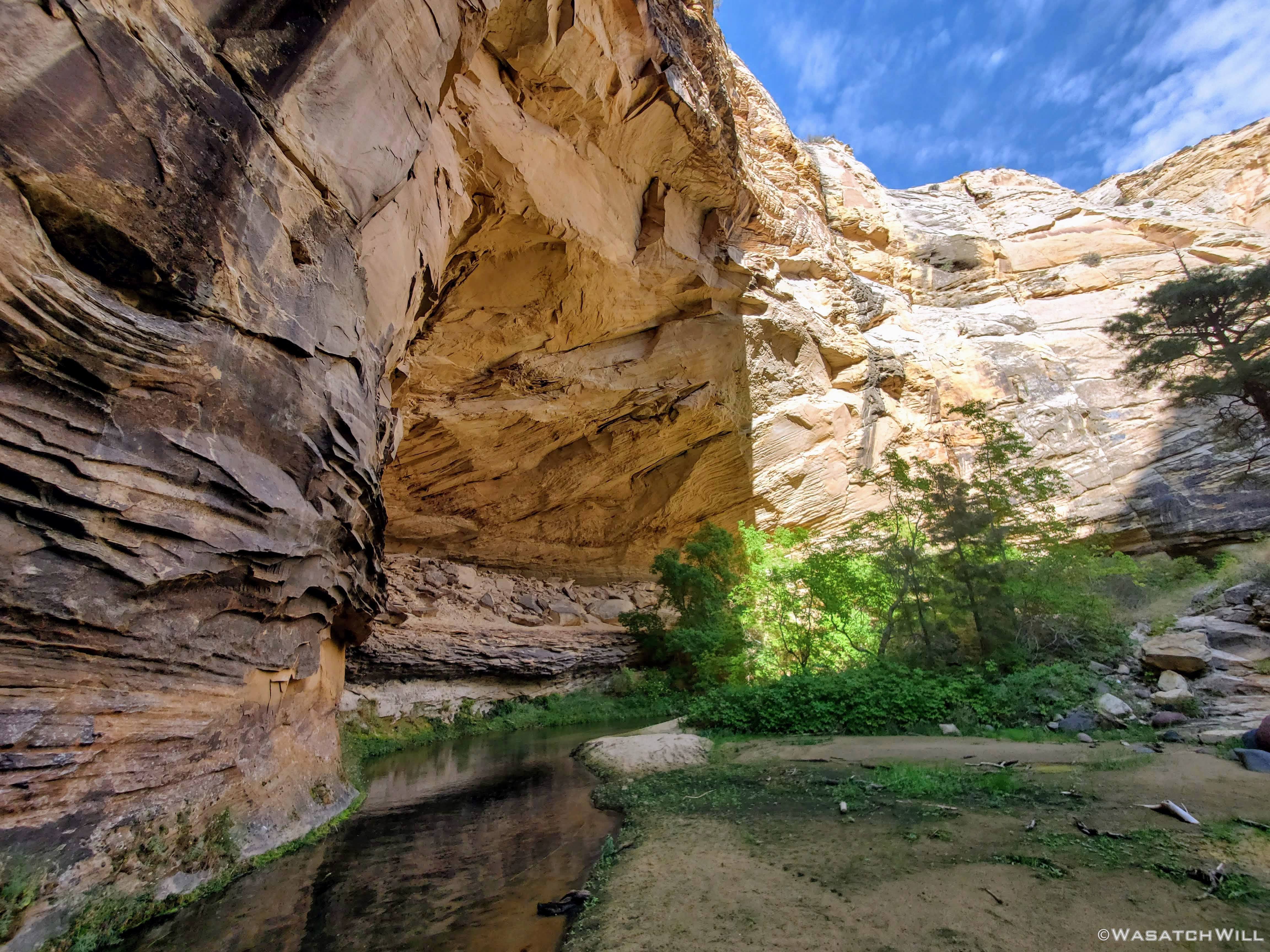
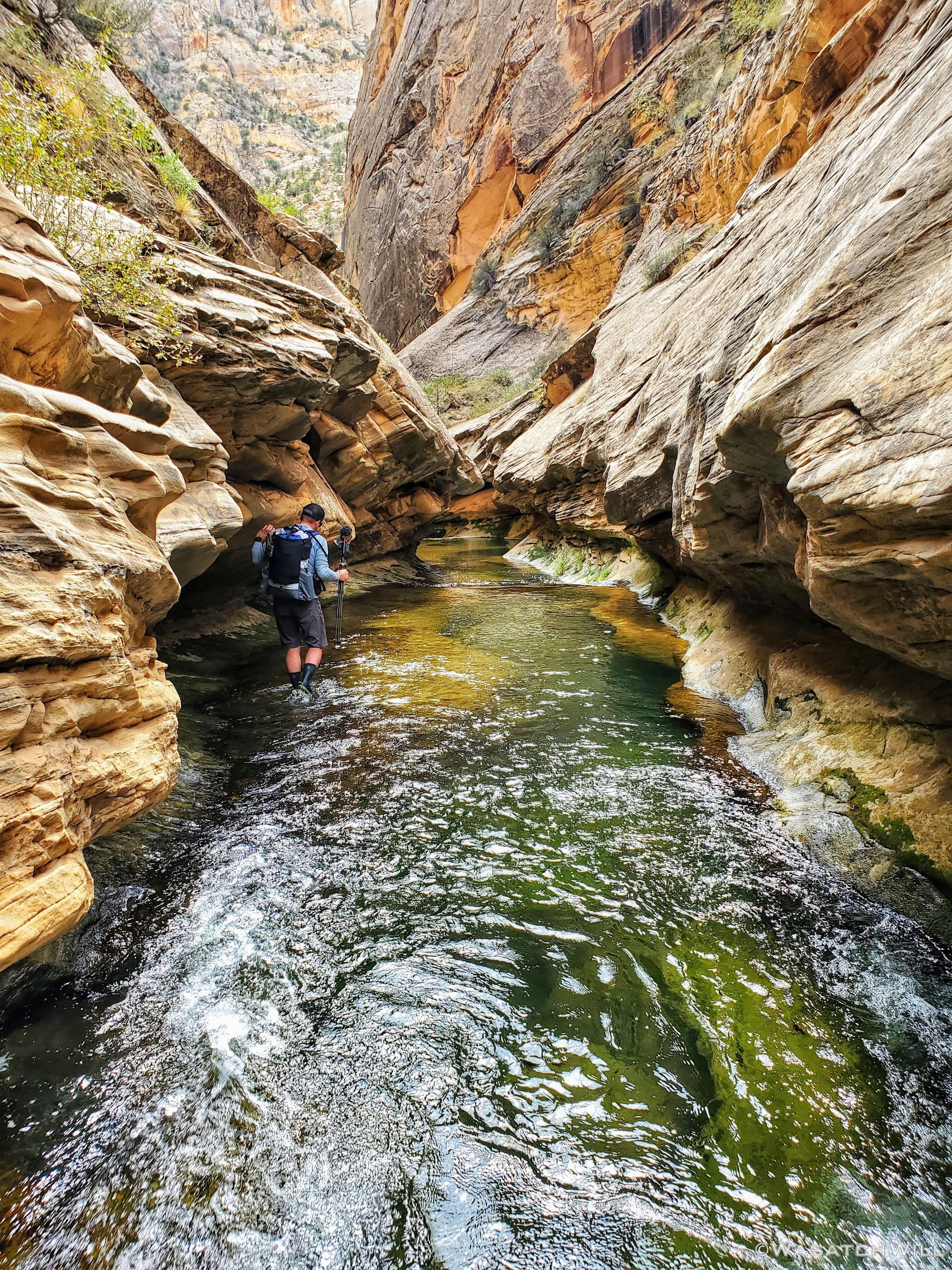
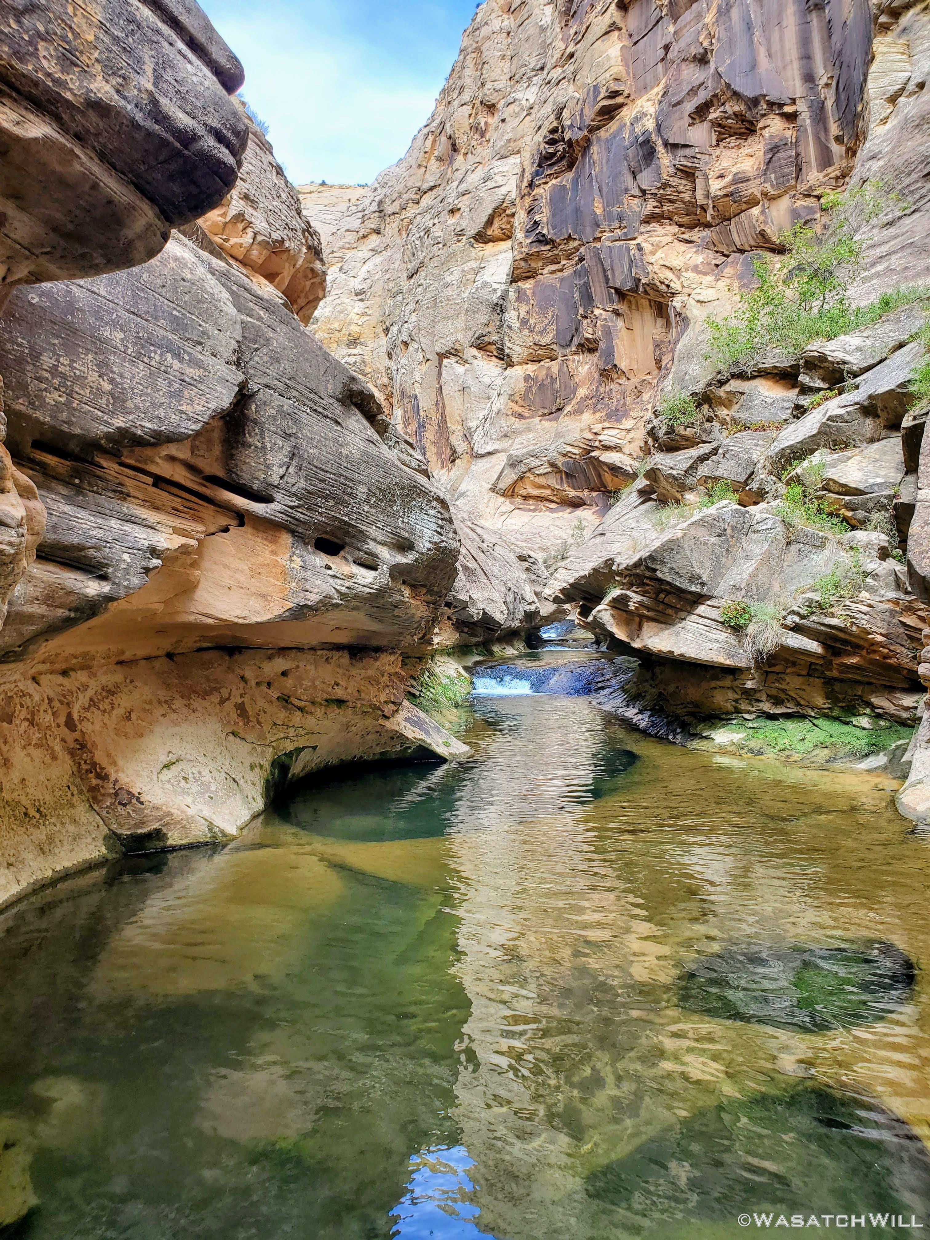
It was now time for the narrows. This part is most often the crux of the route. The time of year and depth of flow will determine just how challenging the crux may be, that being a spot deep enough to be a certain swimmer. Whether flows are higher or not, the preferred way to bypass it is by essentially crawling along a narrow bench along the side. Or so it would seem because it exists in a 'subway' type carving in the canyon wall where water has eroded it in such a way that it has created a bit of an overhang that arches up and over from the narrow ledge. But if you don't want to crawl it, you can always do what we did and play a little limbo with it. We were able to keep to our feet by arching our backs back a bit and holding on to some hand holds as we side stepped along the ledge. Probably not as good of a choice as crawling given that we had overnight packs on and the ledge was quite slippery in spots, requiring careful footing, but it worked for us.
Approaching the narrows
Devin traverses the narrow ledge
Looking back upstream after completing the so-called crux
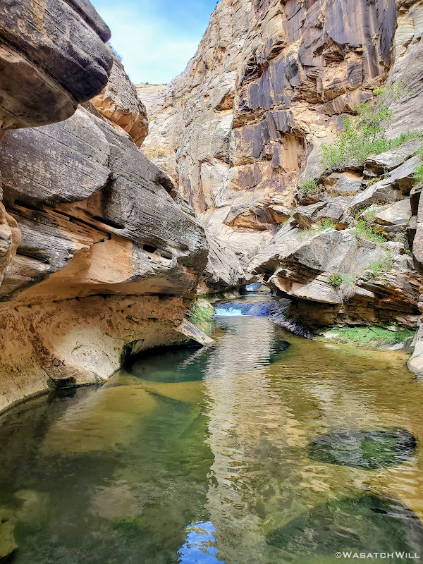
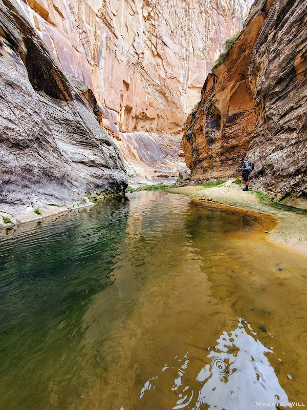
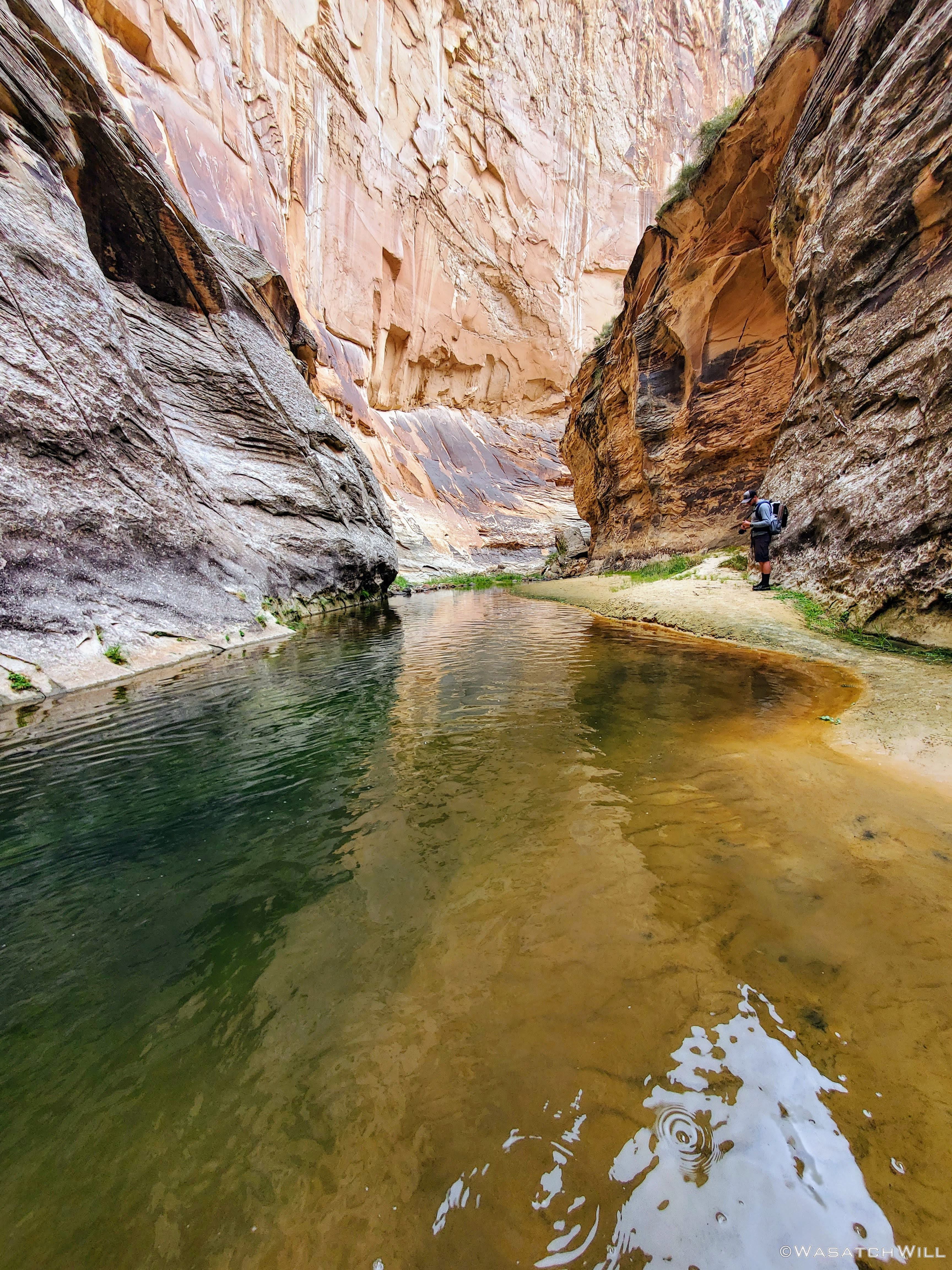
Through the rest of the narrows, the deeper pools that remained were more easily bypassed through shallower sections of the creek bed.
More narrows
Another deep pool to skirt around
And another...
Back up out of the creek
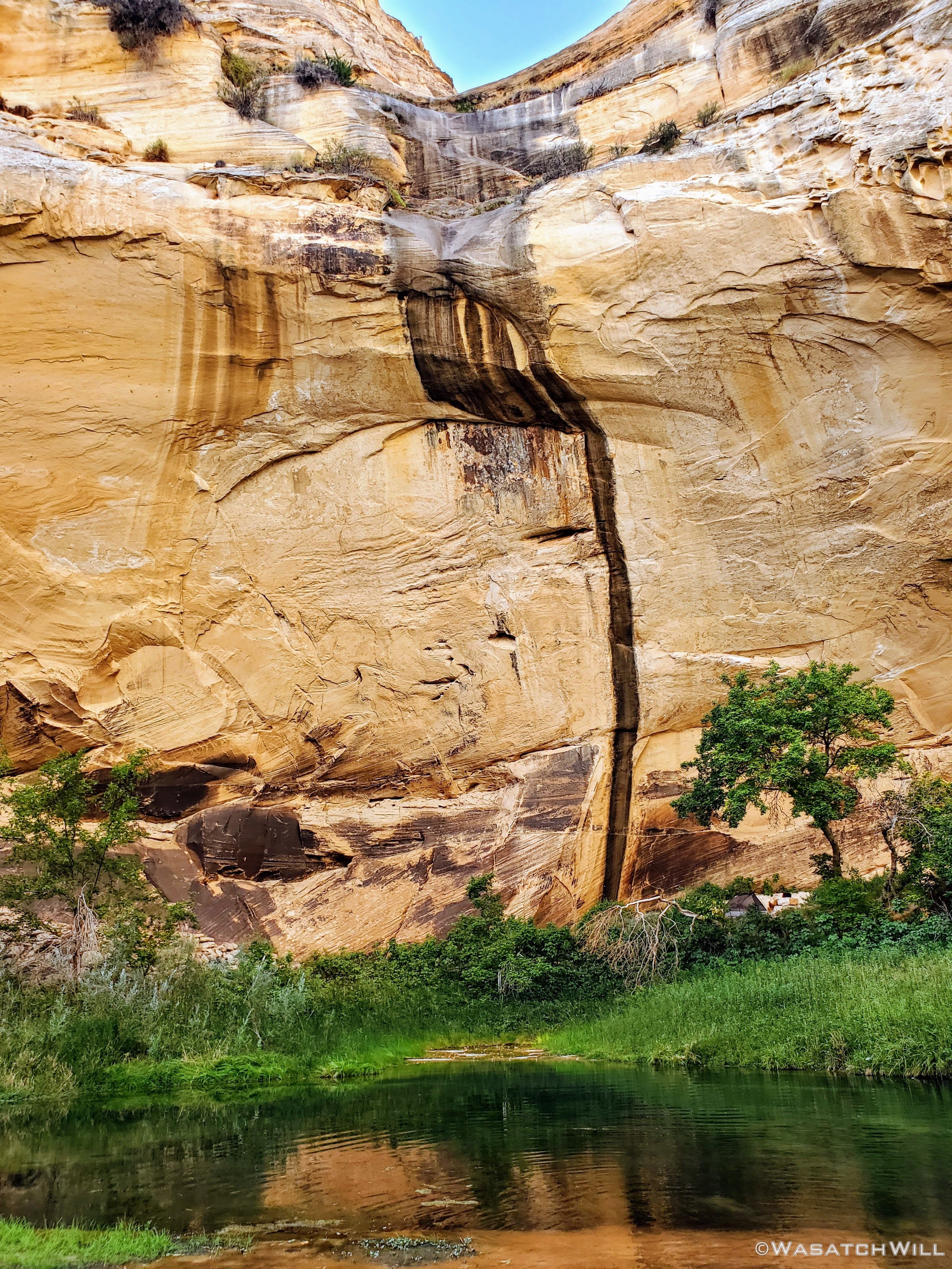
A pretty pour-off

Nearing the Escalante River confluence
In due time we reached the creek's confluence with the Escalante River. The confluence is a popular area for others to camp and we both treasure more peaceful camps with more solitude, so from there we went on to hike close to four more miles to reach the Sand Creek confluence.
Escalante River
One of many river bend shortcuts
Approaching a high canyon wall
Once at Sand Creek, we veered off to follow it upstream a little ways before jumping out and settling into a cozy little campsite for the final night of the trip.
Heading up Sand Creek

Sand Creek Camp
Evening alpenglow
While trying to sleep, I kept awaking to the sound of something hopping all around in the leaves on the ground and in the bushes outside my tent. I wasn't sure if it was birds or what. Eventually I shined my light out to find that it was at least one kangaroo rat running about out there. I didn't leave any food out and accessible so I'm not sure what was attracting it near my tent but it sure was a bit of a nuisance. While awake, I set up my camera for a shot of the star-filled sky just outside my tent and got a nice little star-trail time-lapse with my camera's app that can be seen at 17:47 in the video at the end of this report.

Starry night
Sunday - August 30, 2020
Day 3: Sand Creek to Trailhead
Miles Hiked: 2.5
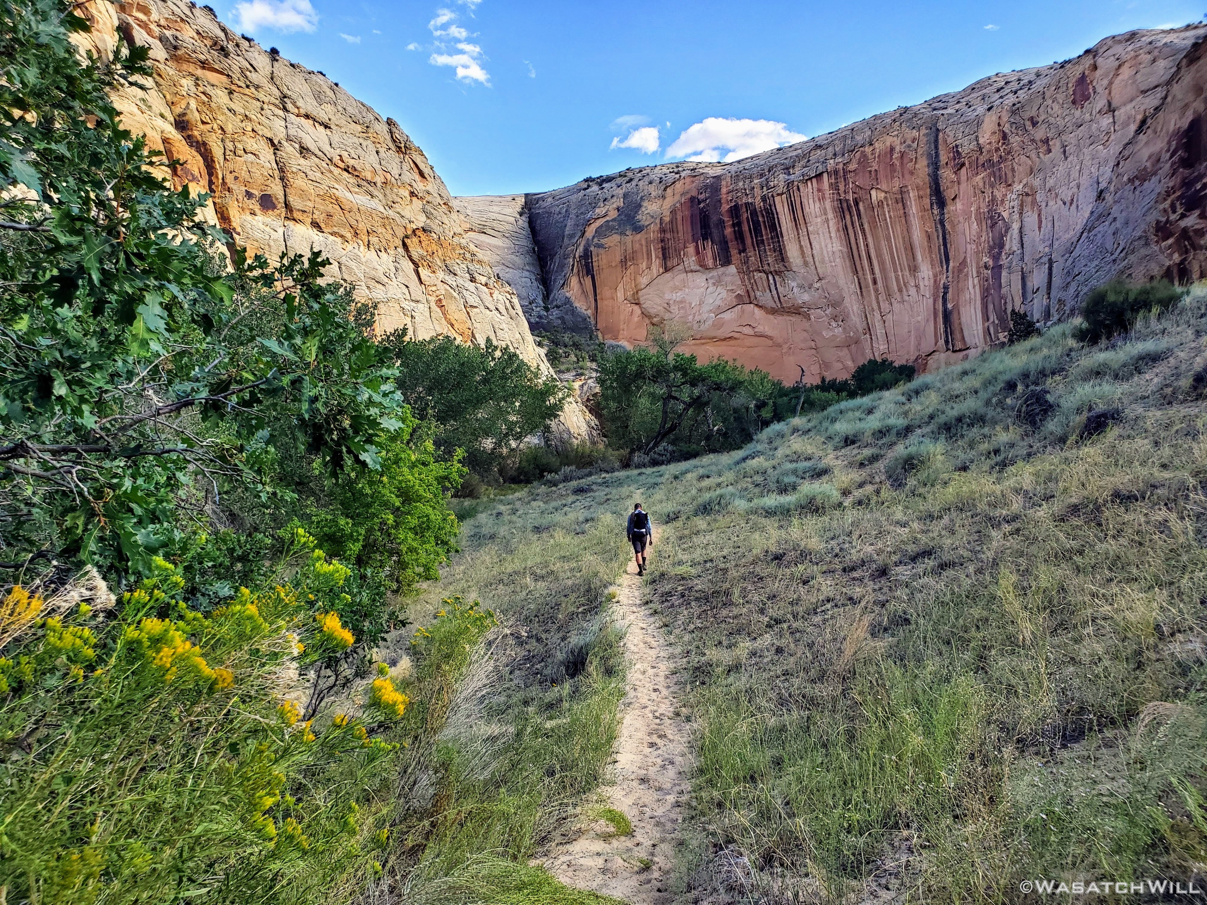
The hike out promised to be a short one, only about two and half miles. But there'd be quite a bit to see in that final stretch. To start off, there was an arch high up on the canyon wall. Apparently there is a ruin or granary up near it too, but I didn't know to look for it at the time.
Arch
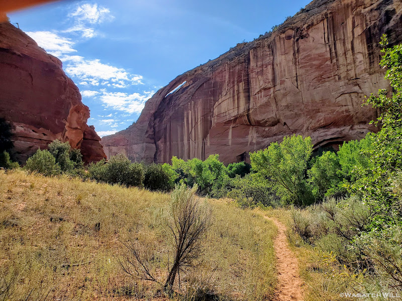
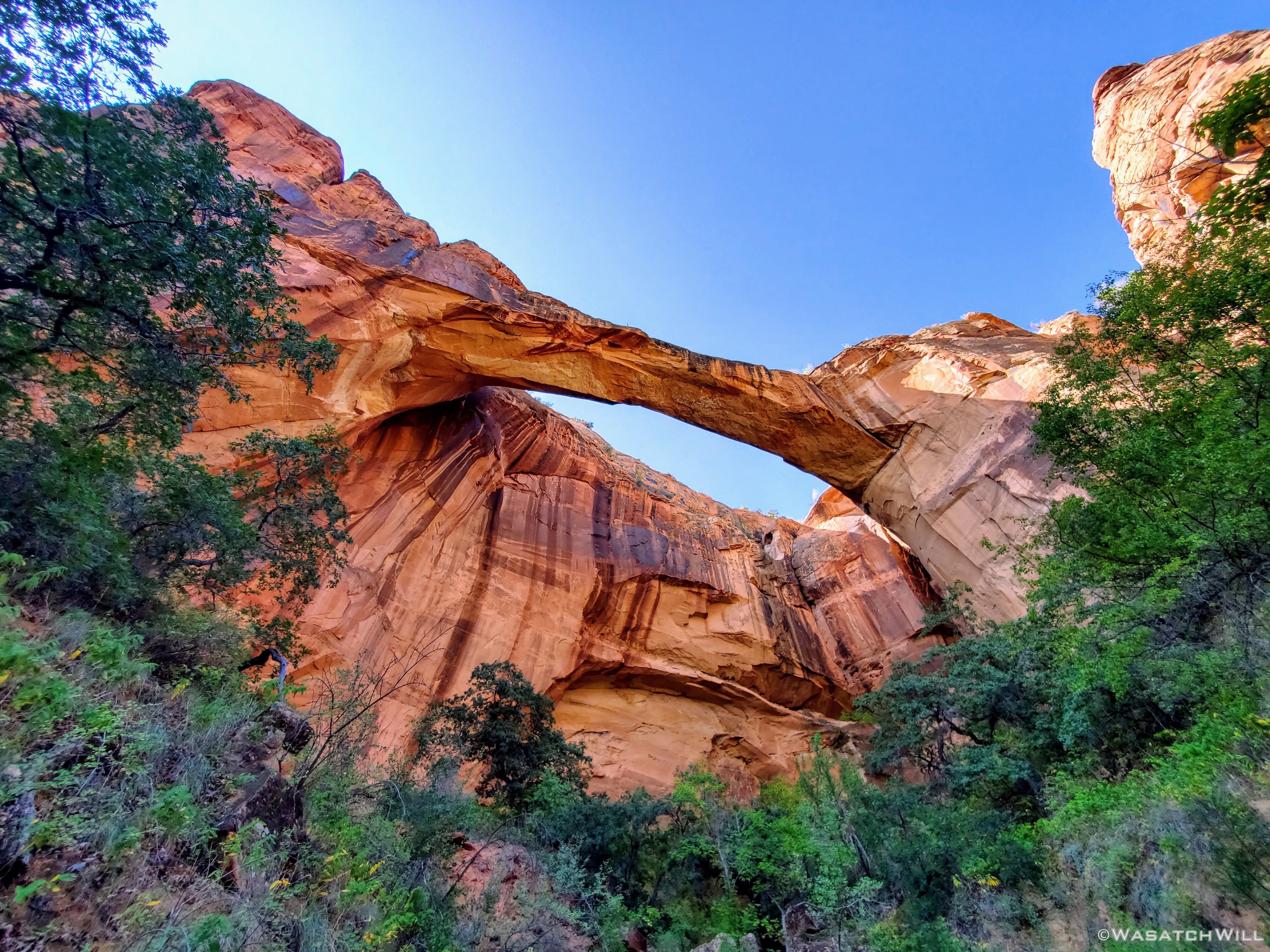
The arch was followed by Escalante Natural Bridge. This was a rather large bridge that is a popular spot for a short and easy day hike from the trailhead we'd be finishing out at. Luckily for us, being so early in the morning, it was a feature we once again had all to ourselves. Not long after leaving it though, several other groups were making their way up from the trailhead, no doubt with plans to visit it themselves.
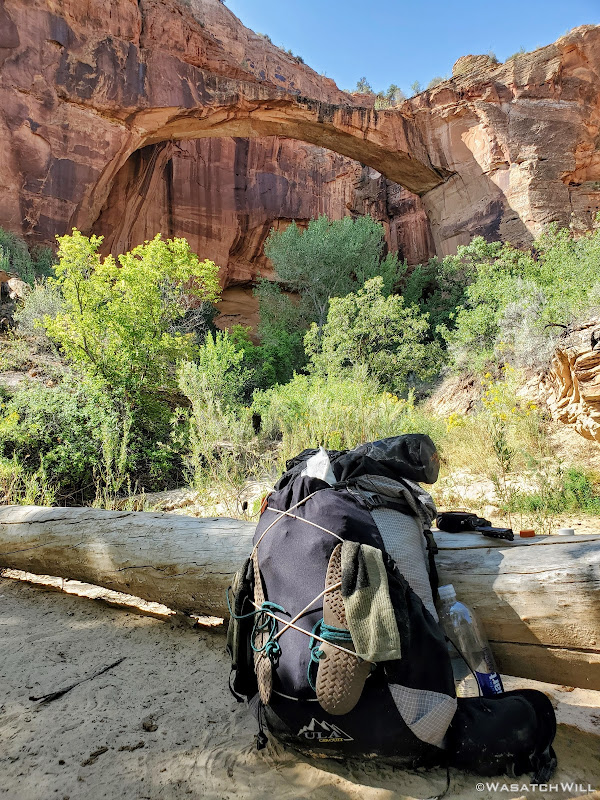
Taking a quick break at Escalante Natural Bridge

Looking up through the bridge

Looking out from the back side of the bridge

Looking out from the back side of the bridge
A short while later, we arrived at the Escalante River Trailhead to conclude our little weekend adventure, a trip into the desert, that ironically allowed us to escape the summer's heat.
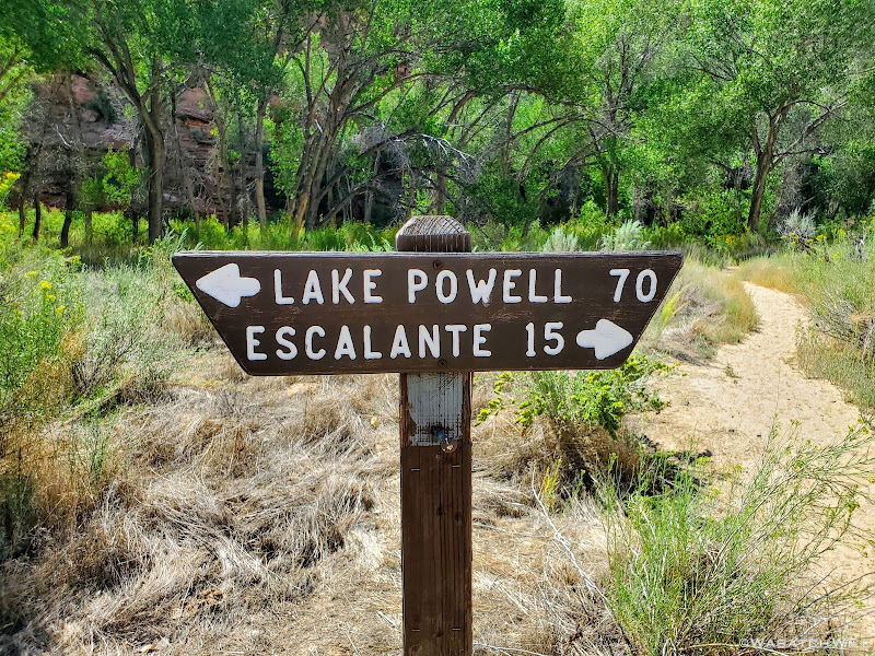
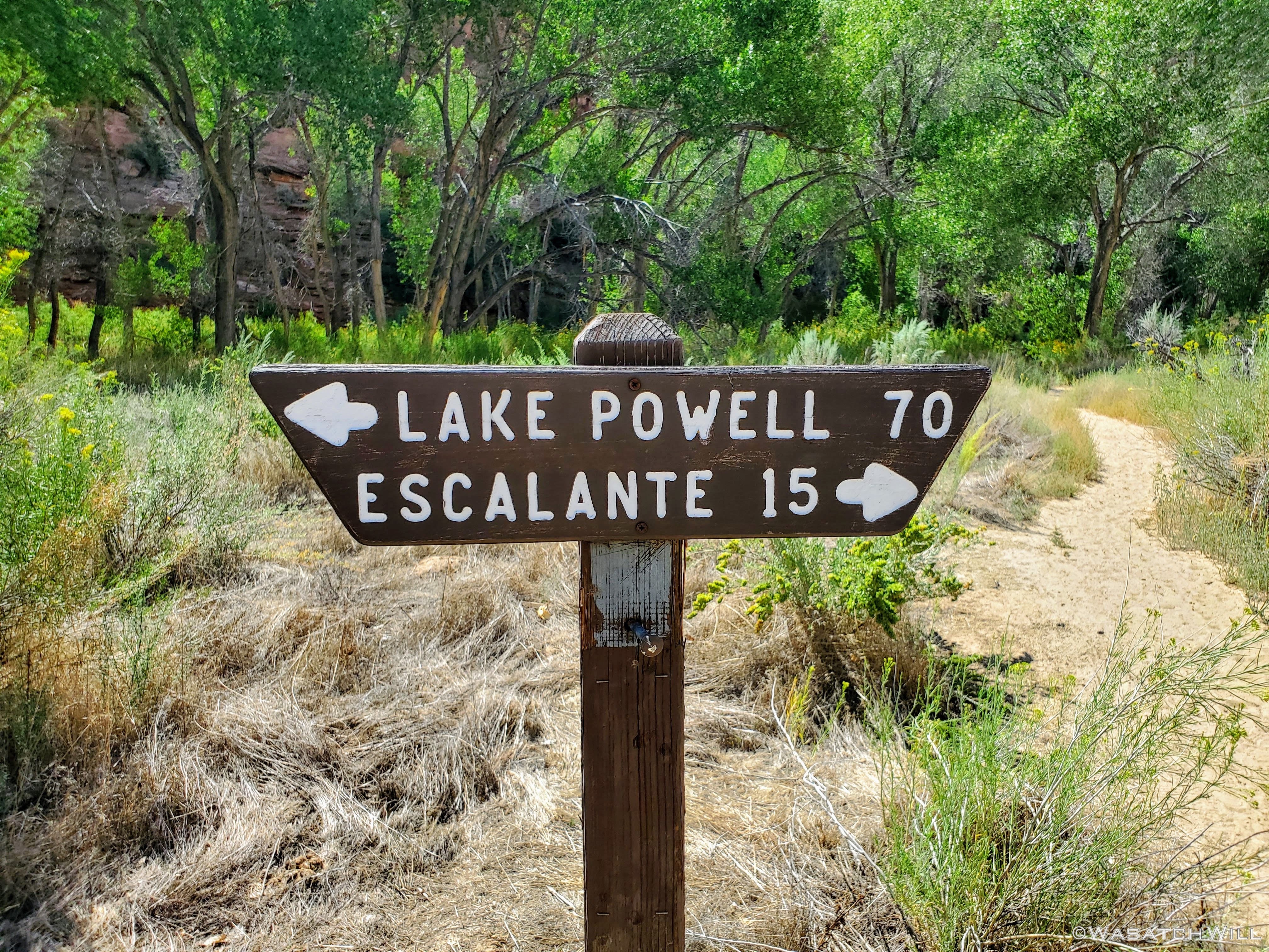
Escalante River mileage sign

Trailhead
It was here we had a big decision to make. Either attempt to hitchhike back to the other trailhead where Devin's car sat, at the height of the Covid-19 pandemic for Utah, or use my InReach to message my in-laws over across the other side of Boulder Mountain, about an hour away, and ask them to come pick us up and drive us back to the trailhead. We opted for the latter. My in-laws responded enthusiastically saying they were trying to think of a good route to go for a Sunday drive anyway. I'm not sure if they were just saying that to be nice, but they do like to go for Sunday drives, so it worked out well and we were very grateful for their service to us.
Given the time we'd have to wait for their arrival, we used it to simply hang out at the trailhead and have ourselves some lunch and a good rest in some shade.
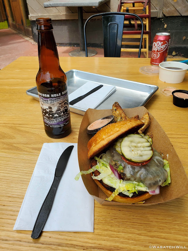
Once they arrived, we were able to load up and get the awaited ride back to the BMT trailhead at the old air strip. That in turn was followed by a stop at the Burr Trail Grill in Boulder for a post-hike burger before heading back home.

Old Boulder Airstrip
Burr Trail Burger
Friday - August 28, 2020
Day 1: Trailhead to Death Hollow Rim
Miles Hiked: 5
We both put in a half day of work in the morning and due to nearly a four hour drive to the trailhead, we didn't get started on the route until late in the afternoon, or, rather early in the evening. The trailhead we chose to start at was the eastern terminus for the Boulder Mail Trail out by an old air strip.
Starting our hike
Normally this time of year, being late August, it would still be quite hot along the mesa top we would be traversing the first few miles. Somehow though, we lucked out with some nice cloud cover and a nice breeze to give us a very comfortable temperature for the rest of the day. I had not expected to be wowed too much until we actually reached Death Hollow itself but it didn't take long before we were enjoying some rather expansive views.
The first big view
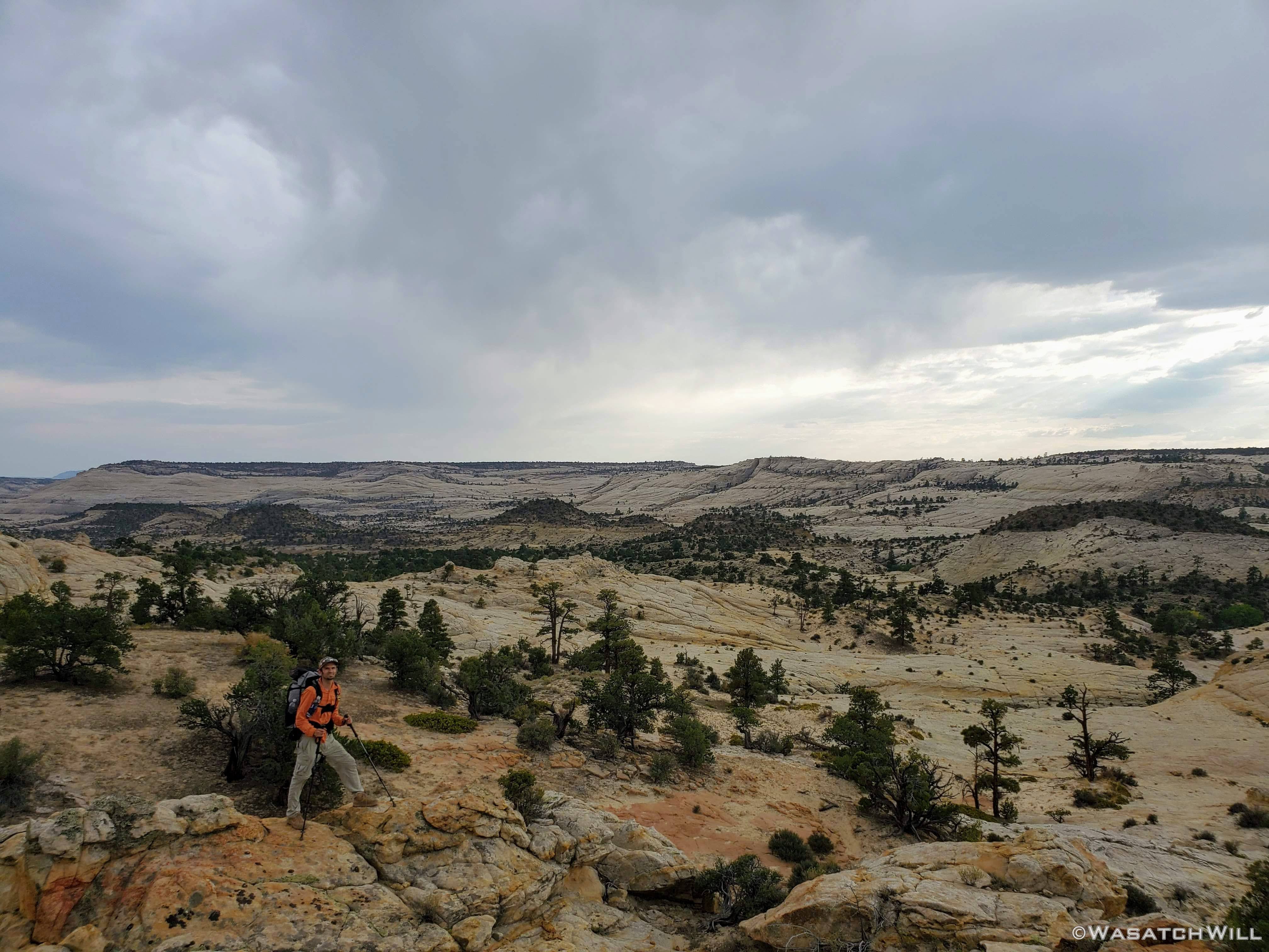
Trying to pose for a photo
We wound our way in and out and through a number of various basins.
Devin descends a desert basin
Rounding our way past Sand Creek
At various points we paralleled and passed under an old historic telegraph line. The line was strung up in 1910 to enable the small town of Boulder to have its first technological communication with the outside world. Prior to that it was via the mail trail, which had only been established 8 years earlier in 1902, in order for Boulder to receive and send mail by virtue of the trail's connection to the town of Escalante and beyond from there.
The old telegraph line appears
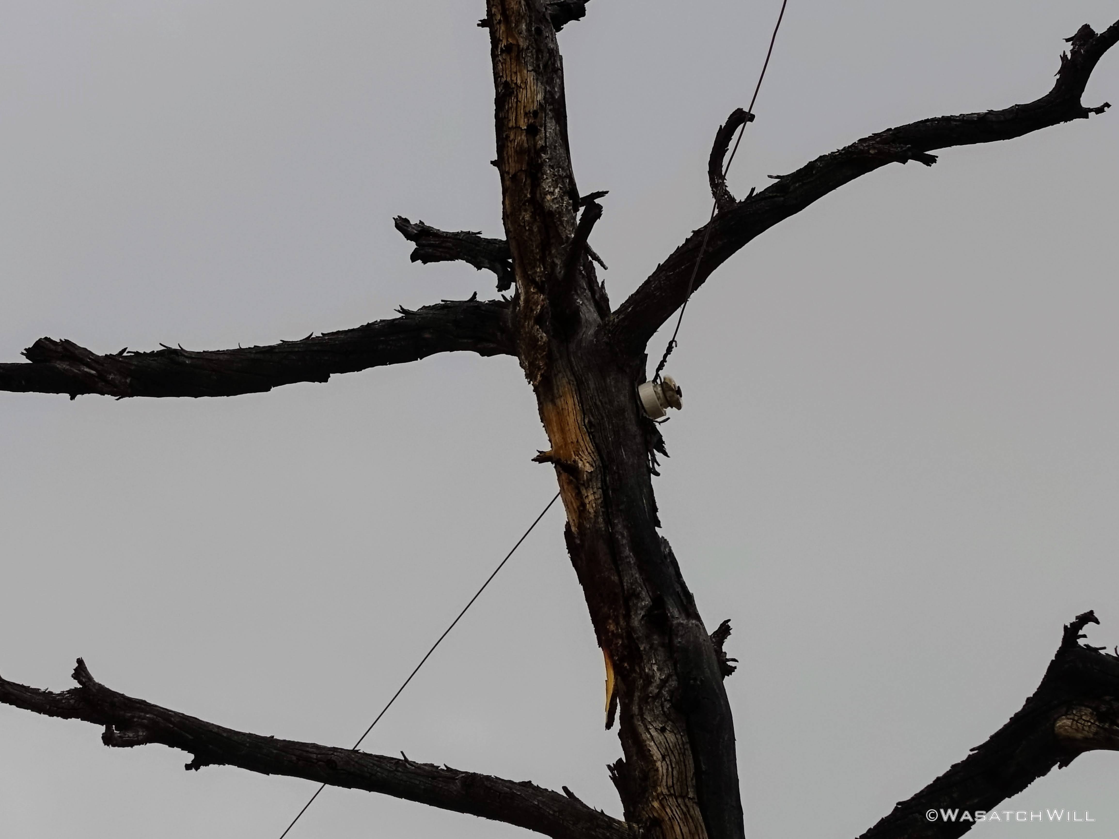
Telegraph connection on tree
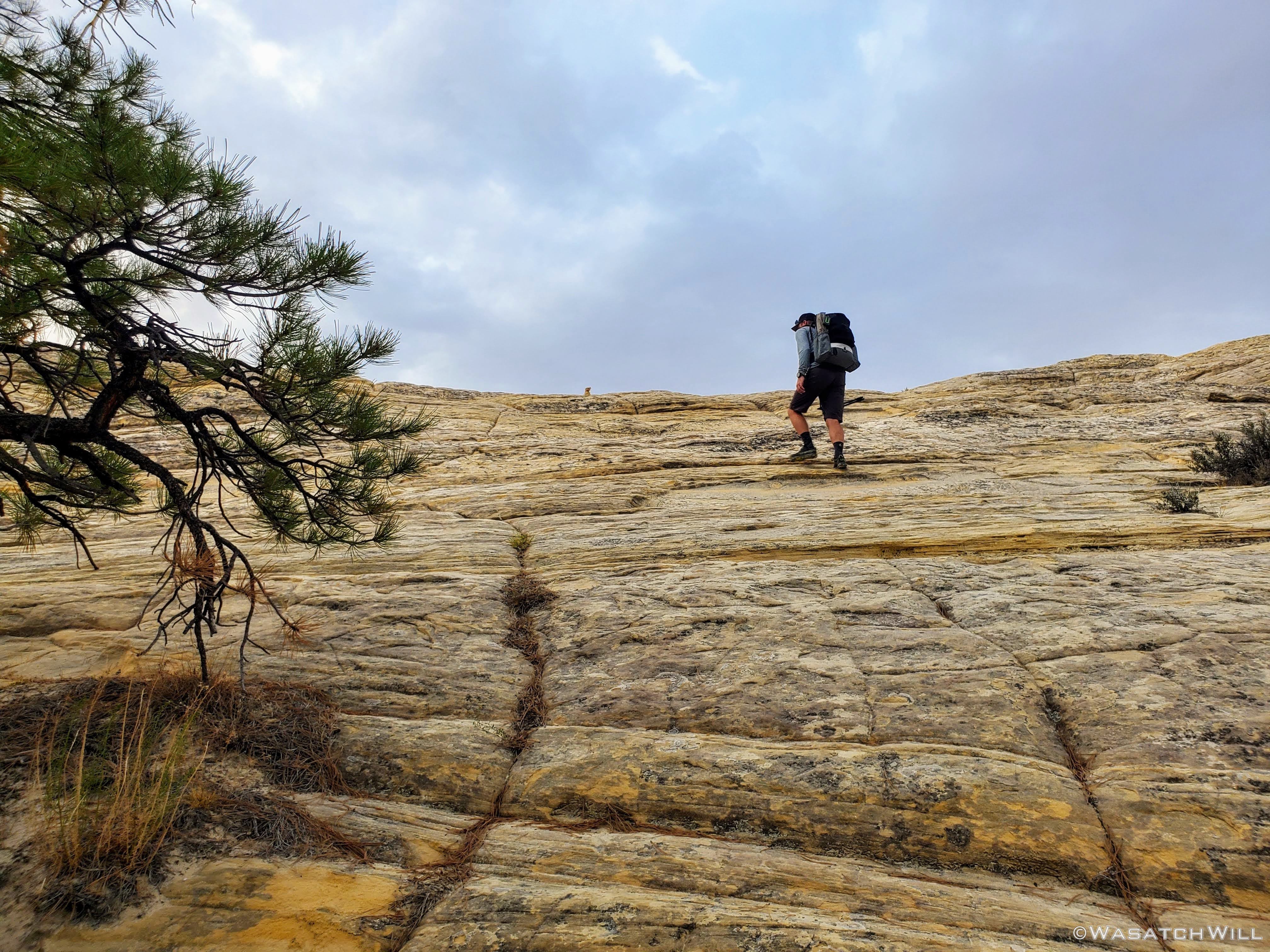
Devin ascends a little slickrock rise

Approaching sunset
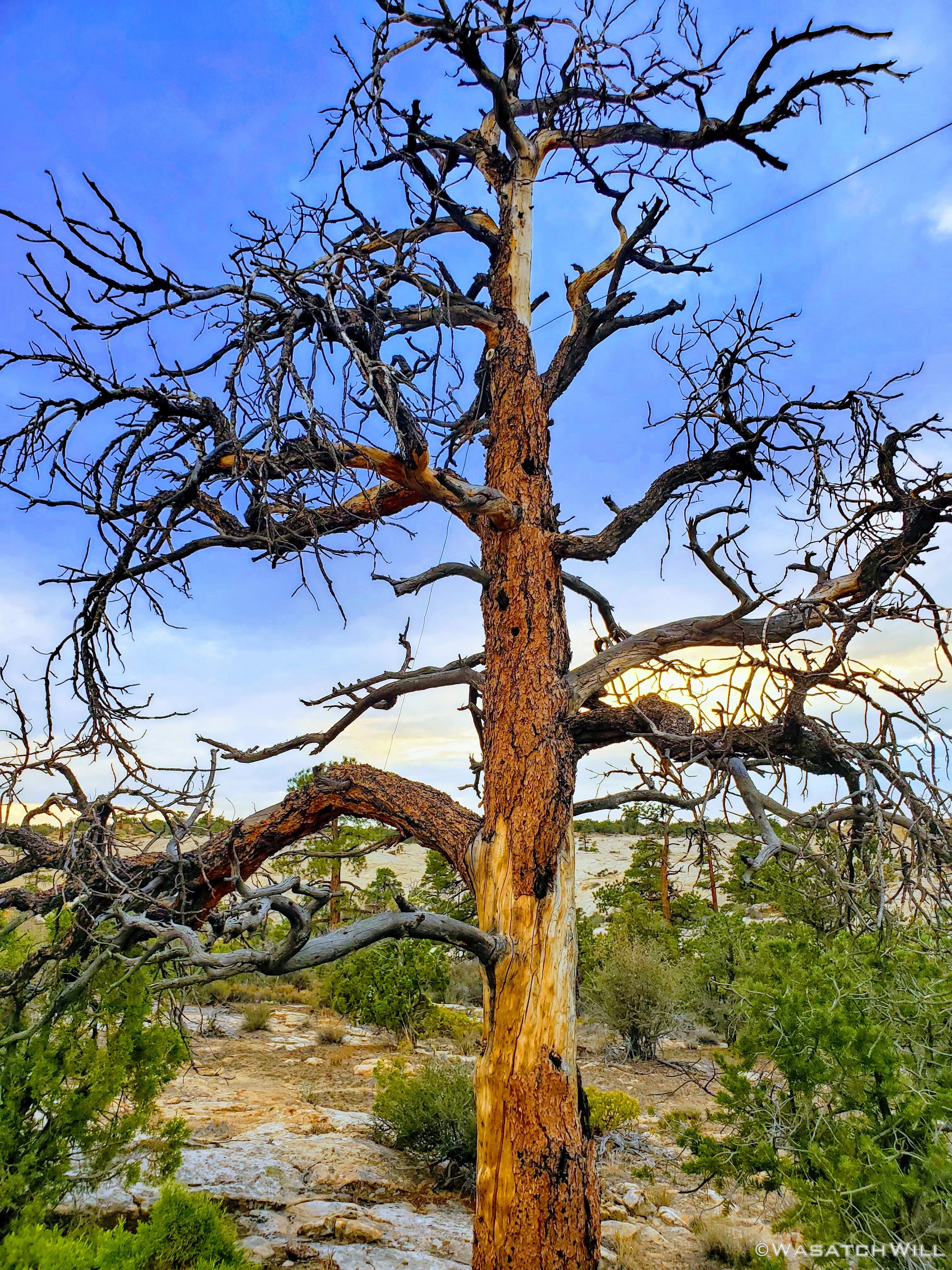
A lively looking but very dead tree

Setting sun
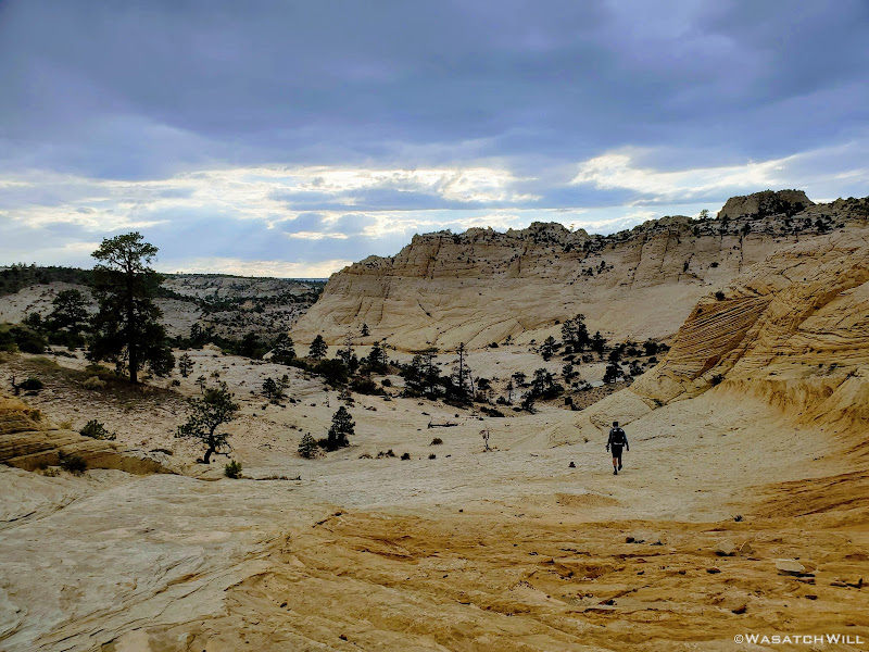
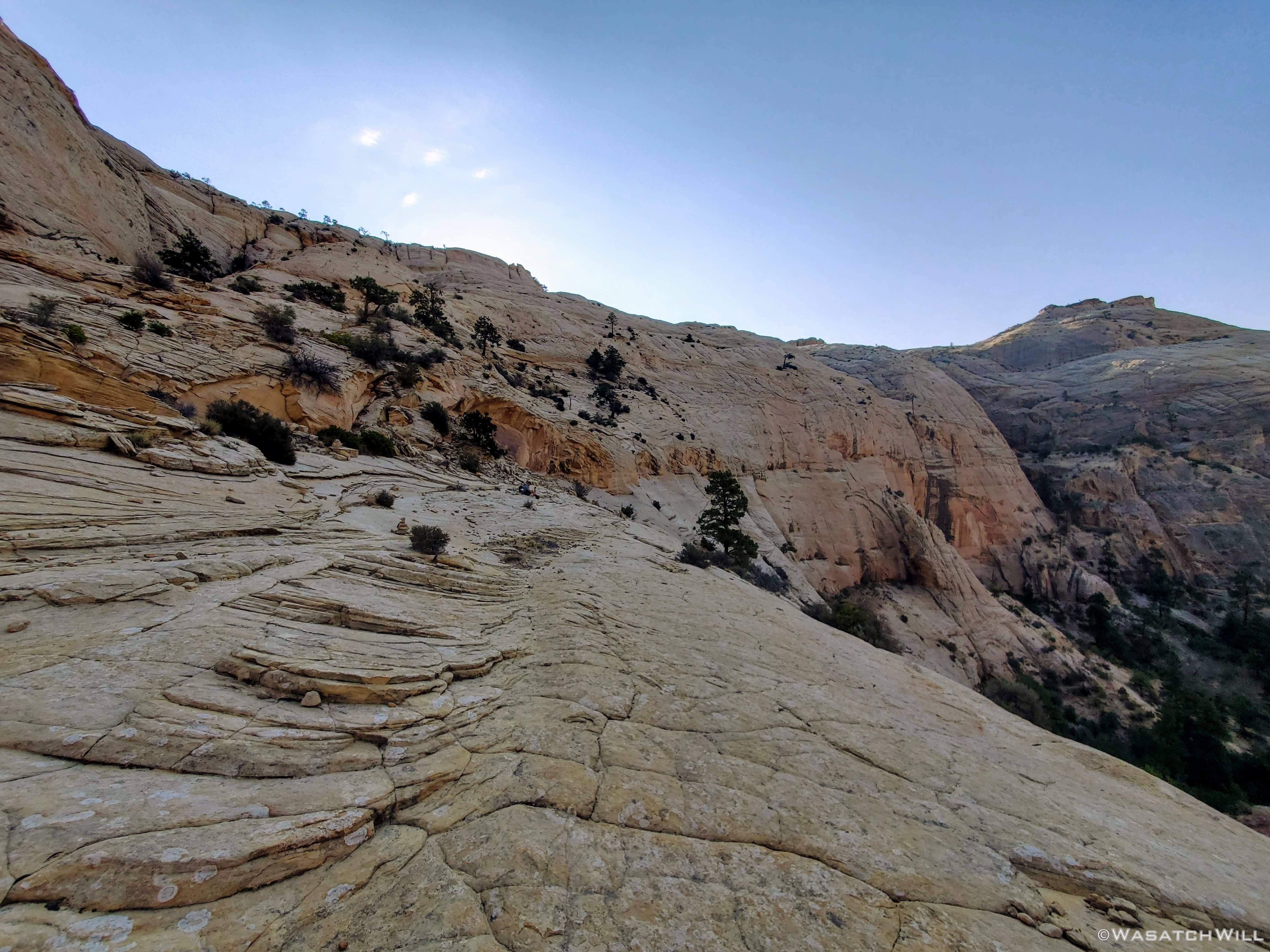
We had high hopes of making it down into Death Hollow and camping creekside down in the canyon but we also didn't want to hike down the somewhat exposed trail down into it in the dark if we could avoid it, and that was looking like it would be the case if we didn't settle for something sooner.
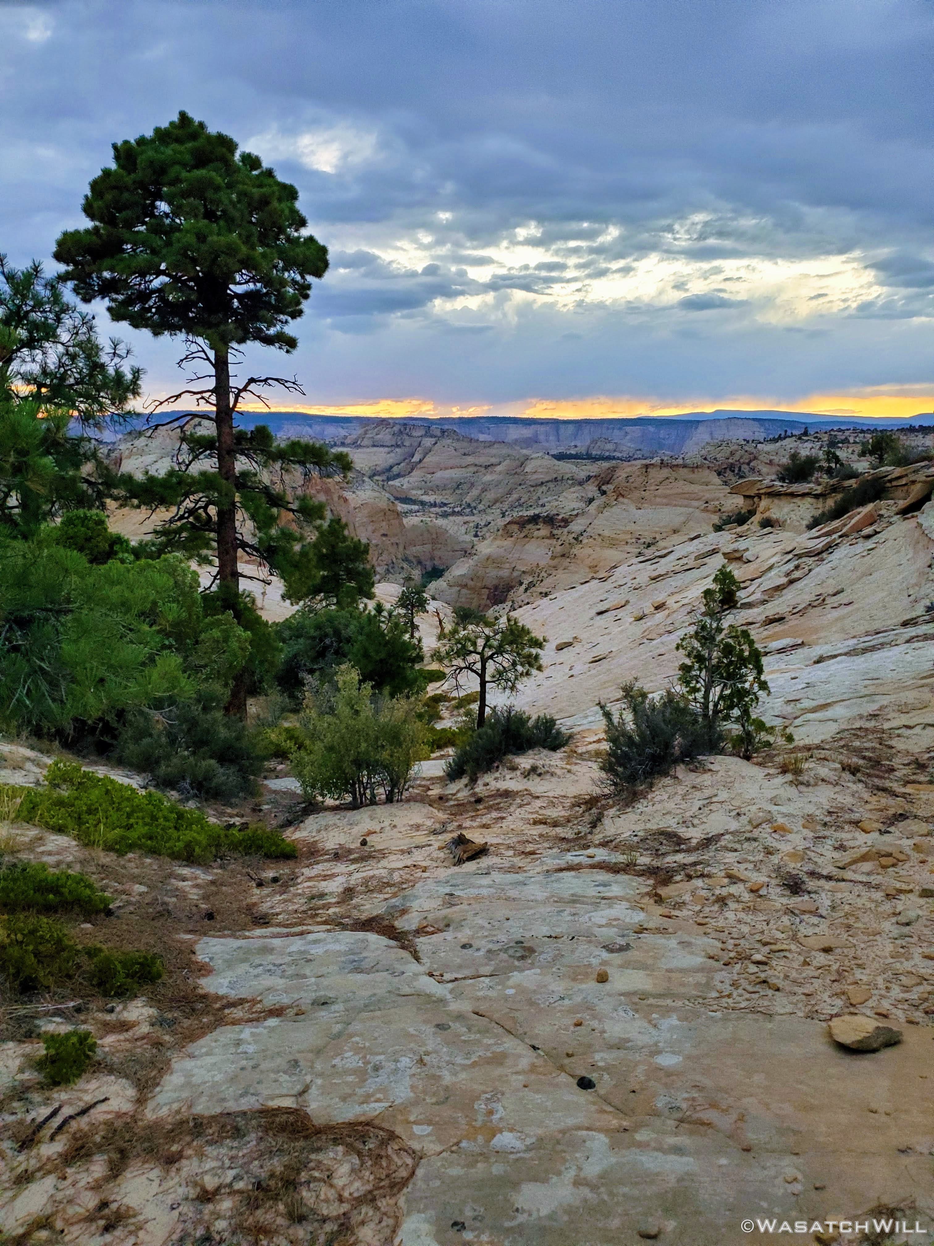
Looking down Slickrock Saddle
Fortunately, on account of the ideal weather conditions we were blessed with for the five mile hike out to the Slickrock Saddle, we didn't go through as much water as we otherwise may have and thus we still had an adequate amount to enable us to have a "dry camp". In fact, we ended up not even needing to stop over at the crossing with Sand Creek a couple miles back to top off any water stores. We therefor chose to pull over along the edge of the Slickrock Saddle and make camp there.
We were spared just enough light to get our tents up before it really got dark as we prepared our dinners. Shortly after getting into our tents for the night, we had a short little light shower come over our camp. It was just enough to get us both out to put up our flies, only to have it all stop for the remainder of the night once we did so. Temperatures remained comfortable enough to not even require zipping up my sleeping bag.
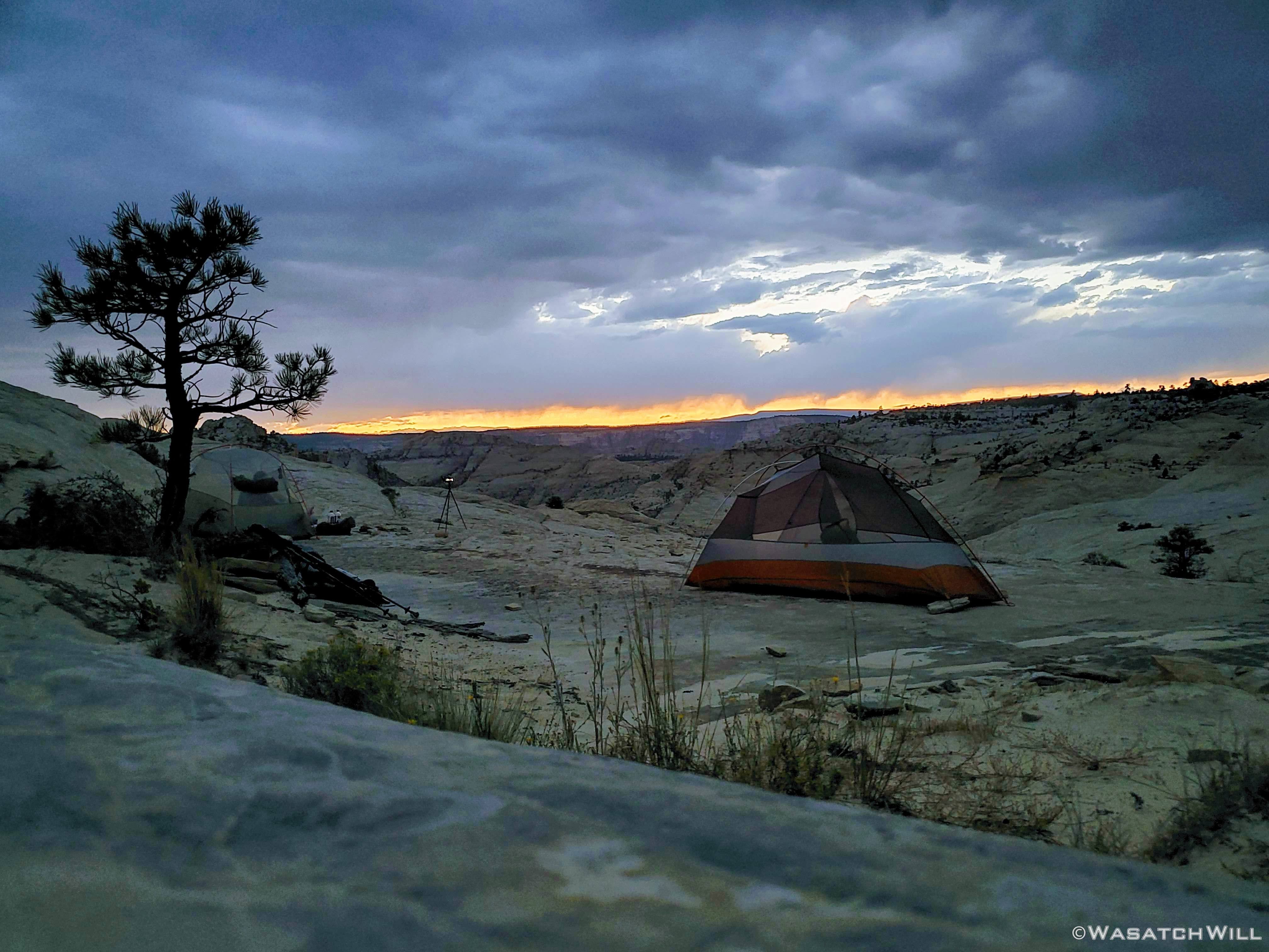
Slickrock Saddle Camp
Saturday - August 29, 2020
Day 2: Death Hollow to Sand Creek
Miles Hiked: 12
When we awoke, virtually all the clouds had now vacated the sky. No worries for a hot and sunny day on this day though. With less than a mile to go, we'd be dropping down off Slickrock Saddle and into the Death Hollow canyon and its accompanying creek. From there we'd follow the creek down to its junction with the Escalante River and then follow that downstream to the junction of Sand Creek where we'd settle into another camp at the end of the day. In other words, we'd be in and alongside a constant source of water for the rest of the day, and in fact, for the remainder of the whole trip's route.
Morning view from camp
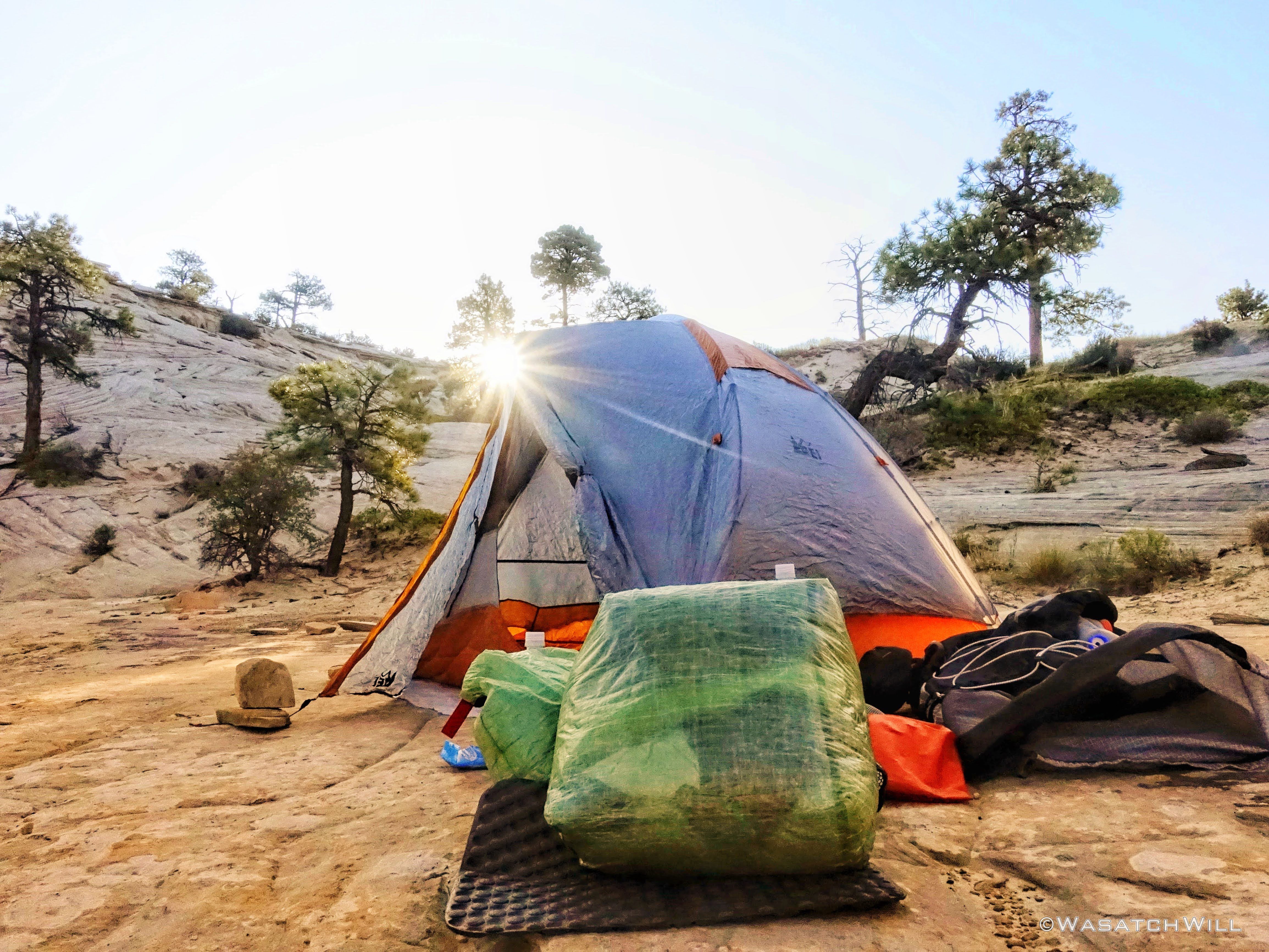
Rising Sun
With the sun up, we commenced our morning routines of attending to nature calls, breakfast, changing into hiking clothes, packing up camp and so on. It was now time to lower our elevation in a hurry. Seven hundred feet in seven tenths of a mile to be almost exact. The views were simply stunning all the way down!

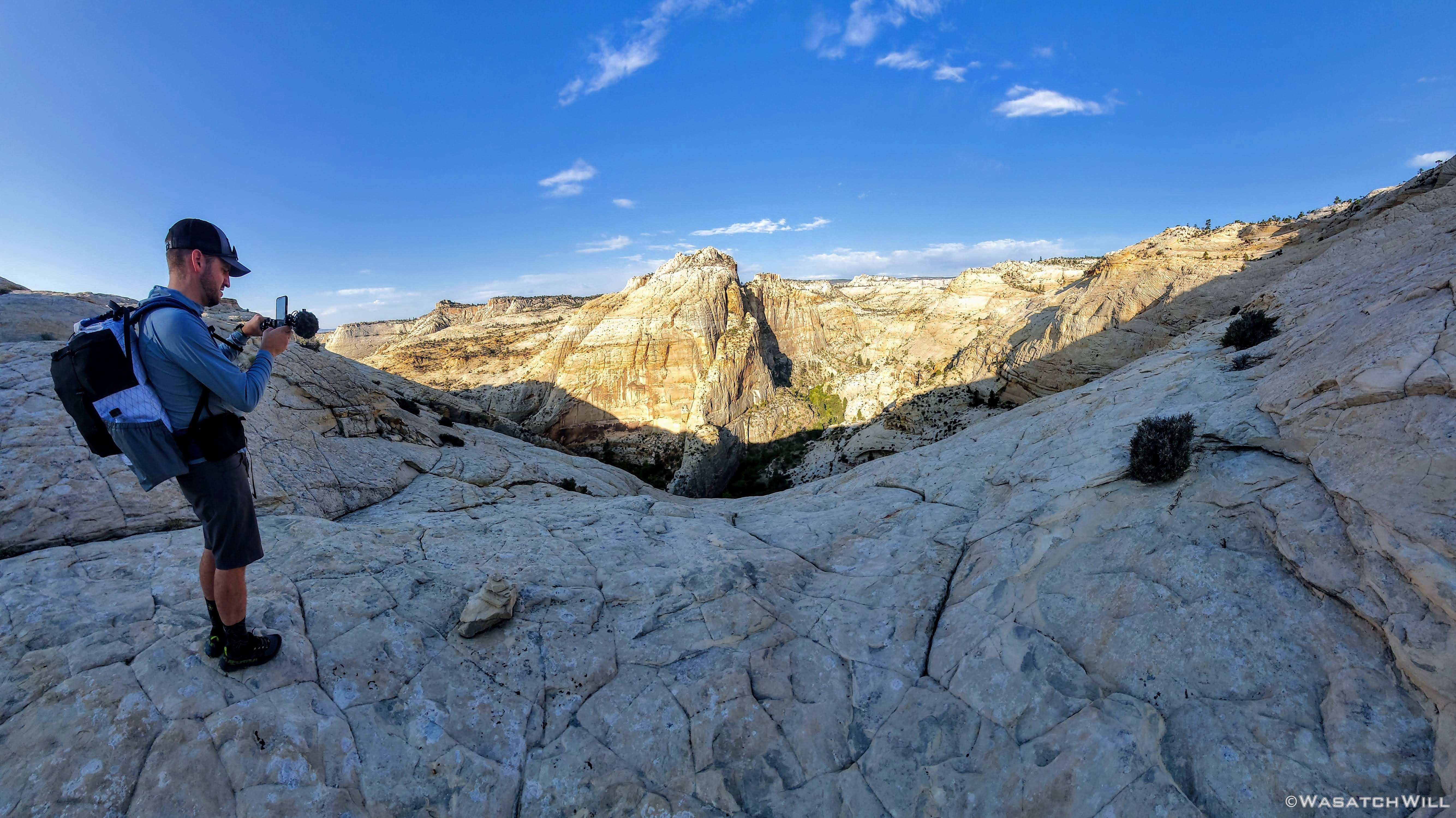
Myself, taking in the big view down into Death Hollow
Devin check his shot
Death Hollow awaits
Looking back up from about half-way down the descent

Devin on the descent

Another big view down into Death Hollow
Before we knew it, we had reached the creek. And right on cue, we were immediately greeted with our first patch of poison ivy. We knew there would be loads of it along sections of the creek, some of it almost unavoidable. There was even one stretch of trail where it was reaching well over it from both sides. Perhaps we could have avoided it by staying in the creek but we gambled and went for it. It surely brushed against our clothing, bare legs, and even arms a bit. Devin and I must both be in the lucky 10-15 percent of the human population that doesn't seem to have an allergic reaction to it. Or if we did, it was very, very mild, for what symptoms we may have felt from it quickly dissipated as we got back into the creek and continued onward. Or...maybe hopping back into the creek simply washed away whatever oils may have otherwise lingered longer to cause a more irritating reaction.

Poison Ivy
From thereon down the creek, it was a typical hike in a desert canyon with a clear flowing creek. That is, it was incredible, awesome, and featured lots of WOW moments around almost every corner and turn in the canyon, all in between the occasional sections of bushwhacking there was to do. The water was pleasant. Cool and refreshing, but not bone-chilling cold. I'm sure it would be a different story earlier in the year, during the spring thaw with all the run-off that must flow this way from the southern flanks of nearby Boulder Mountain. But again, it was now late August.
Into the creek...

A rare late season wildflower
At various spots along the creek bottom you could see fish scurrying about. Upon trying to look up what type of fish they were after returning home, I'm fairly confident in identifying them as Bluehead Suckers. Many were as big as trout, but they were most definitely not trout.

Bluehead Sucker
I really enjoy the way the green ferns can often be found growing along the seeps and springs of canyon walls such as this. It's like a touch of rainforest or some jungle clashing with what is supposed to be a desert.
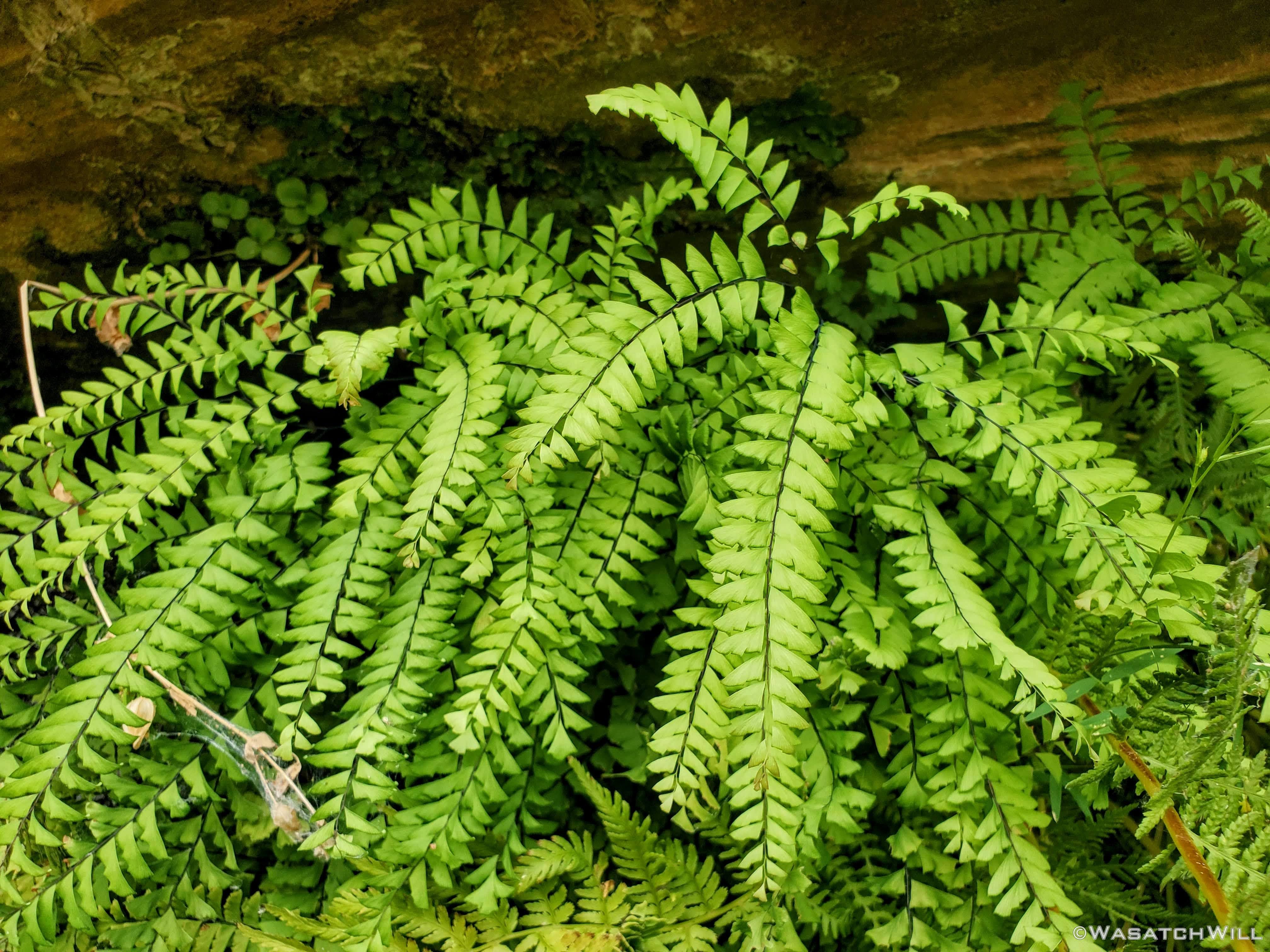
Ferns
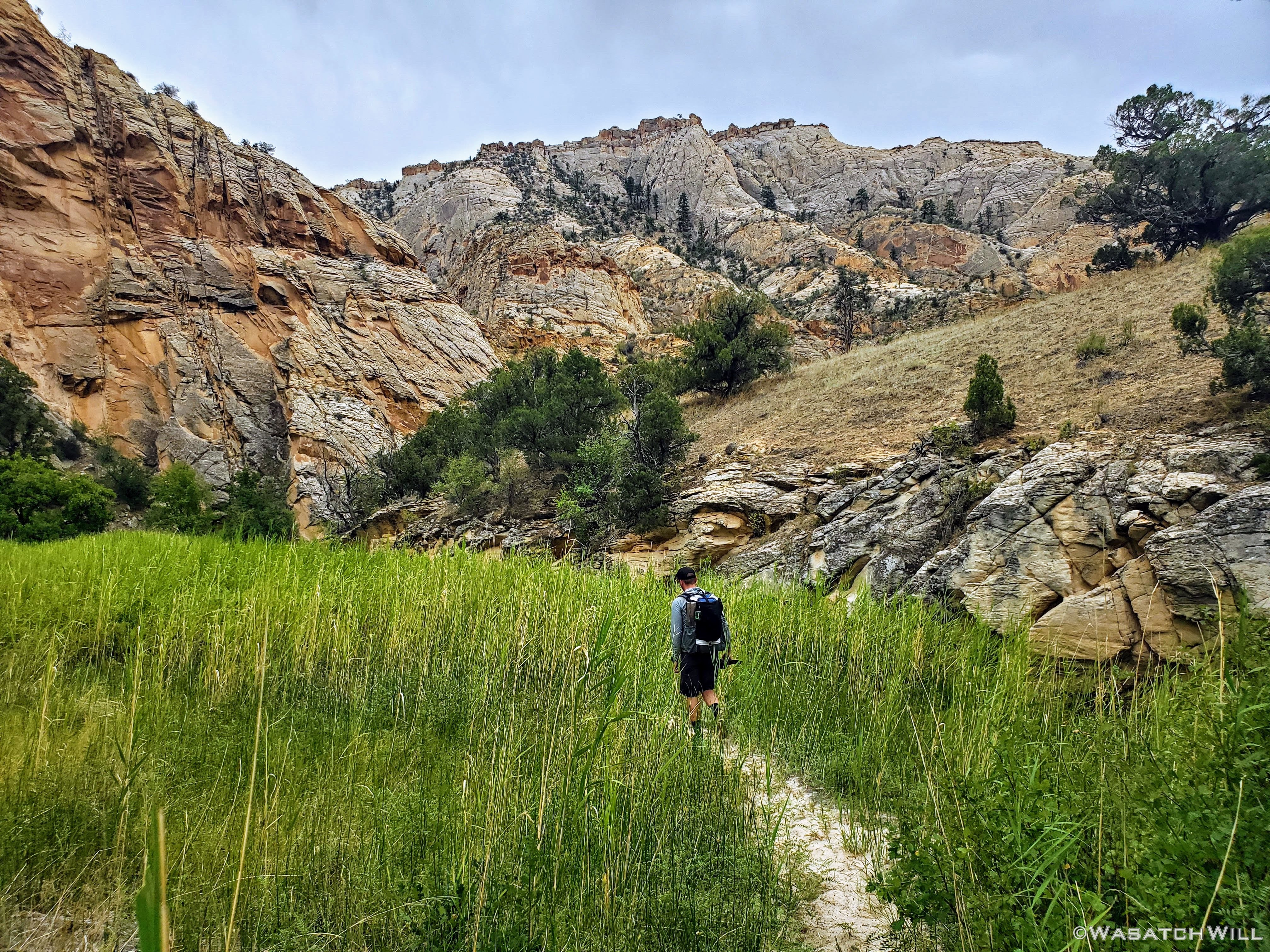
Devin makes his way through sea of tall grass

Back into the creek
Soon we reached the waterfalls where we stopped and lounged for lunch followed by a dip. Somehow we got lucky to get this spot all to ourselves. For once we made it down past the narrows a little way downstream, there were a handful of groups that appeared to be heading up for the same spot coming from down canyon, or so we assumed.

Waterfall
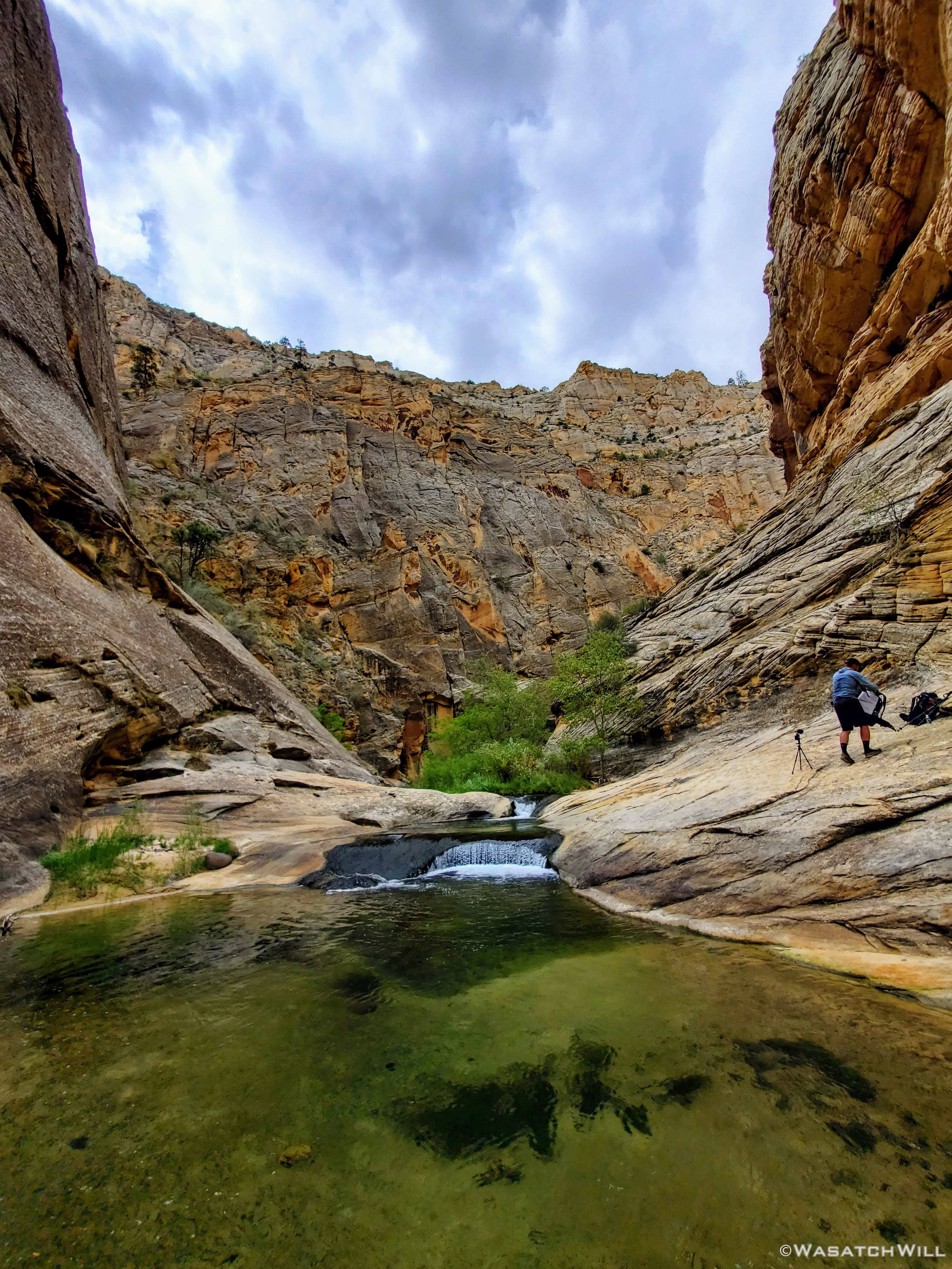
Setting up for lunch
Lounging
Cattails
Further down canyon, had I not looked back, I would have missed this other waterfall.
Another waterfall
It was now time for the narrows. This part is most often the crux of the route. The time of year and depth of flow will determine just how challenging the crux may be, that being a spot deep enough to be a certain swimmer. Whether flows are higher or not, the preferred way to bypass it is by essentially crawling along a narrow bench along the side. Or so it would seem because it exists in a 'subway' type carving in the canyon wall where water has eroded it in such a way that it has created a bit of an overhang that arches up and over from the narrow ledge. But if you don't want to crawl it, you can always do what we did and play a little limbo with it. We were able to keep to our feet by arching our backs back a bit and holding on to some hand holds as we side stepped along the ledge. Probably not as good of a choice as crawling given that we had overnight packs on and the ledge was quite slippery in spots, requiring careful footing, but it worked for us.

Approaching the narrows
Devin traverses the narrow ledge
Looking back upstream after completing the so-called crux
Through the rest of the narrows, the deeper pools that remained were more easily bypassed through shallower sections of the creek bed.

More narrows


Another deep pool to skirt around
And another...
Back up out of the creek
A pretty pour-off
Nearing the Escalante River confluence
In due time we reached the creek's confluence with the Escalante River. The confluence is a popular area for others to camp and we both treasure more peaceful camps with more solitude, so from there we went on to hike close to four more miles to reach the Sand Creek confluence.
Escalante River
One of many river bend shortcuts

Approaching a high canyon wall
Once at Sand Creek, we veered off to follow it upstream a little ways before jumping out and settling into a cozy little campsite for the final night of the trip.
Heading up Sand Creek
Sand Creek Camp

Evening alpenglow
While trying to sleep, I kept awaking to the sound of something hopping all around in the leaves on the ground and in the bushes outside my tent. I wasn't sure if it was birds or what. Eventually I shined my light out to find that it was at least one kangaroo rat running about out there. I didn't leave any food out and accessible so I'm not sure what was attracting it near my tent but it sure was a bit of a nuisance. While awake, I set up my camera for a shot of the star-filled sky just outside my tent and got a nice little star-trail time-lapse with my camera's app that can be seen at 17:47 in the video at the end of this report.
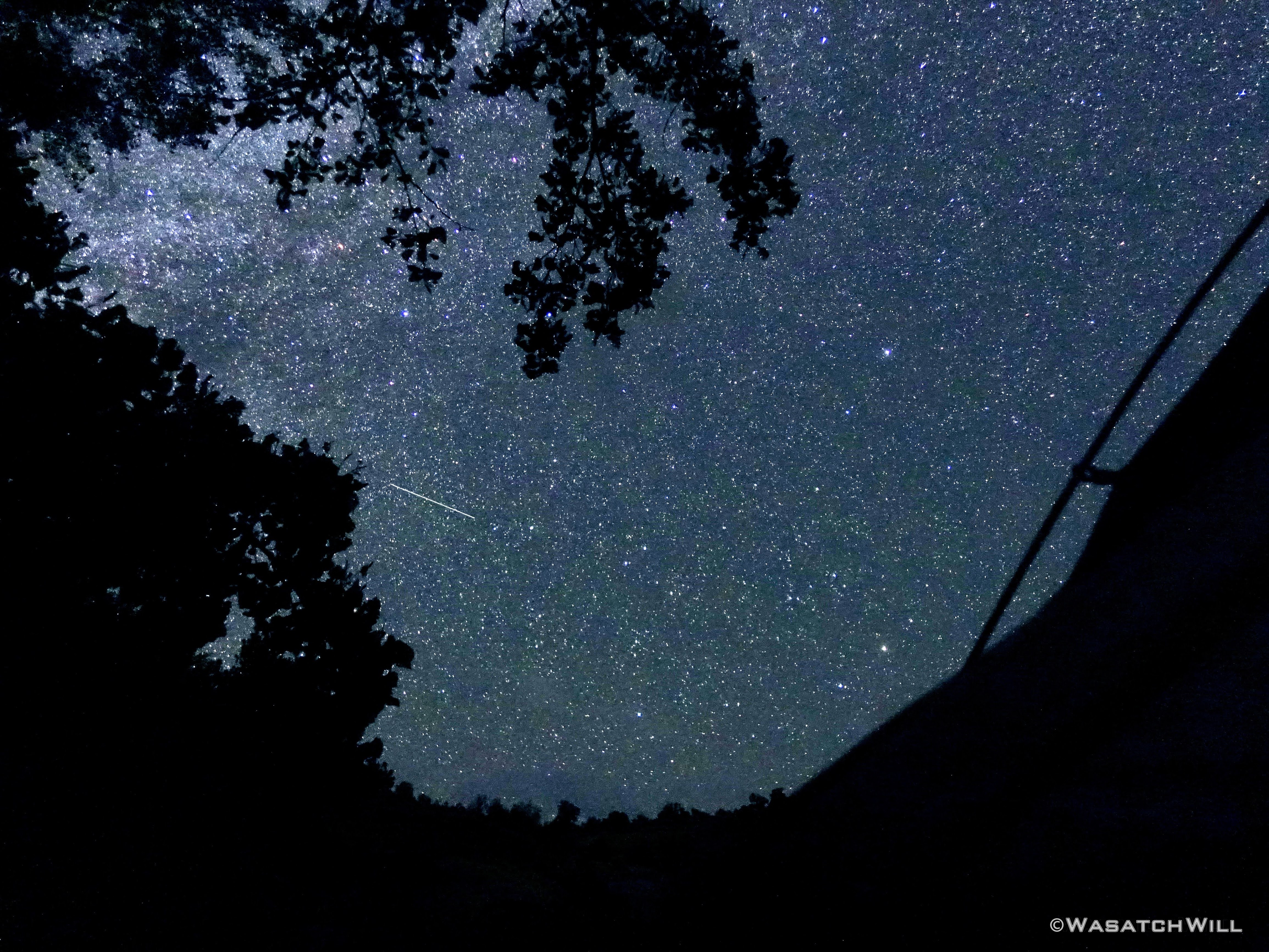
Starry night
Sunday - August 30, 2020
Day 3: Sand Creek to Trailhead
Miles Hiked: 2.5
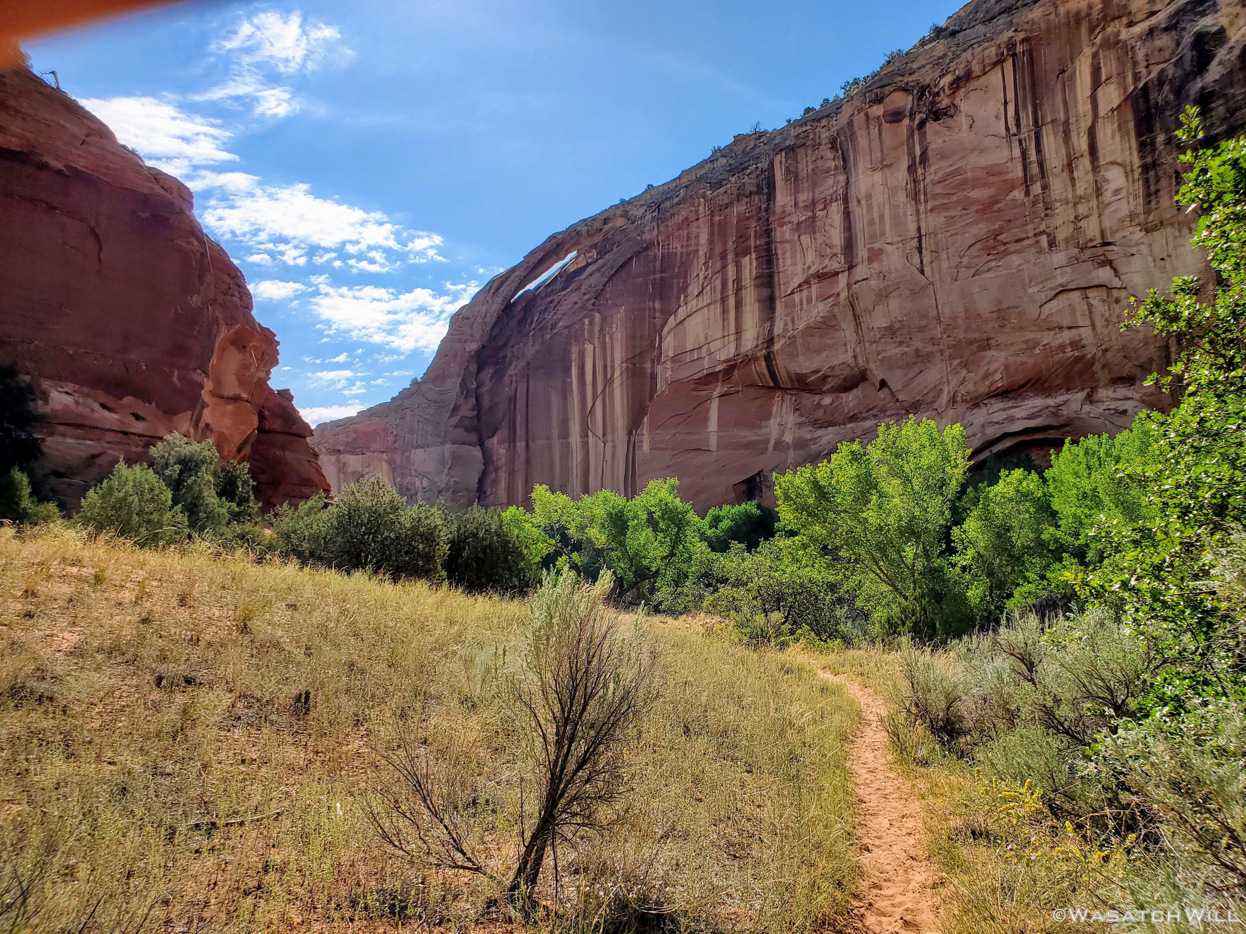
The hike out promised to be a short one, only about two and half miles. But there'd be quite a bit to see in that final stretch. To start off, there was an arch high up on the canyon wall. Apparently there is a ruin or granary up near it too, but I didn't know to look for it at the time.
Arch
The arch was followed by Escalante Natural Bridge. This was a rather large bridge that is a popular spot for a short and easy day hike from the trailhead we'd be finishing out at. Luckily for us, being so early in the morning, it was a feature we once again had all to ourselves. Not long after leaving it though, several other groups were making their way up from the trailhead, no doubt with plans to visit it themselves.
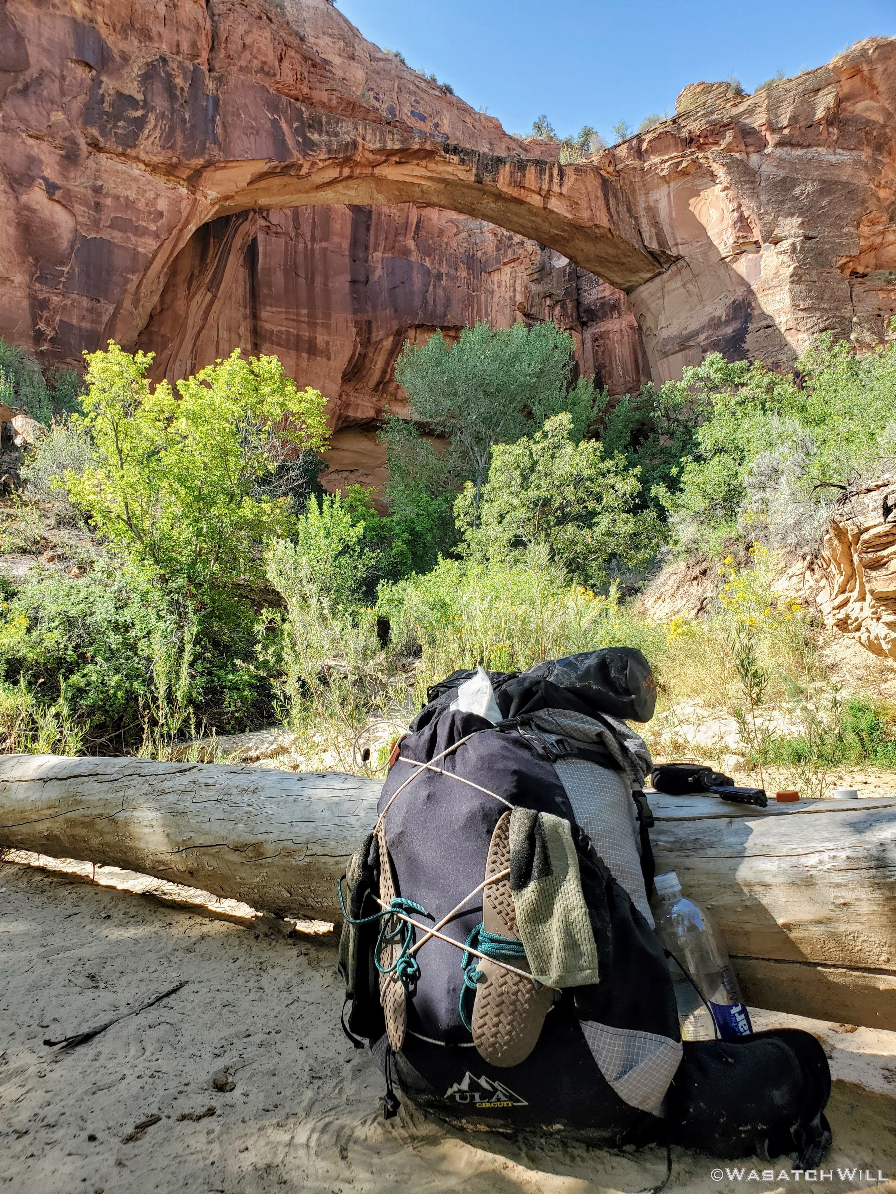
Taking a quick break at Escalante Natural Bridge
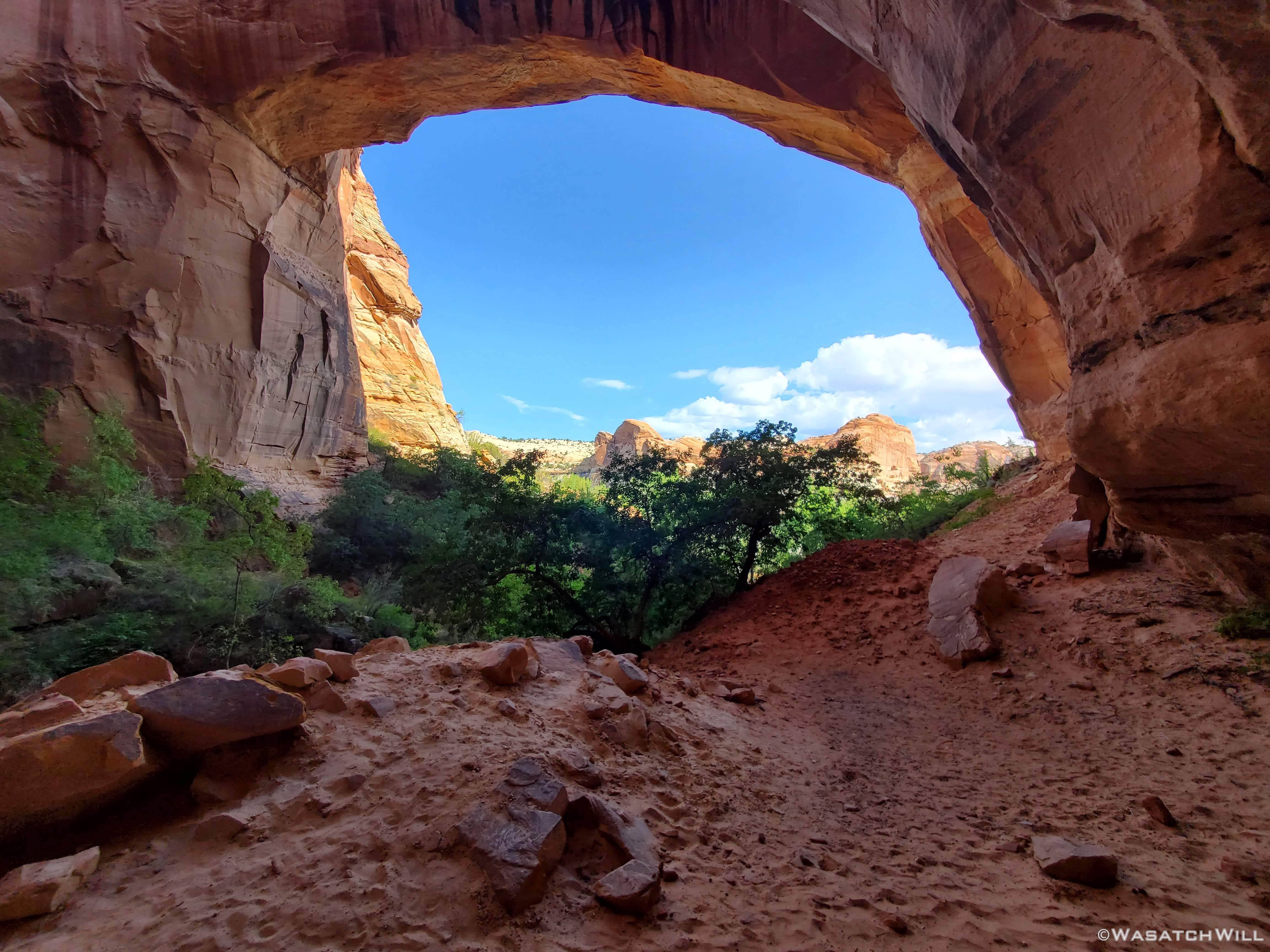
Looking up through the bridge
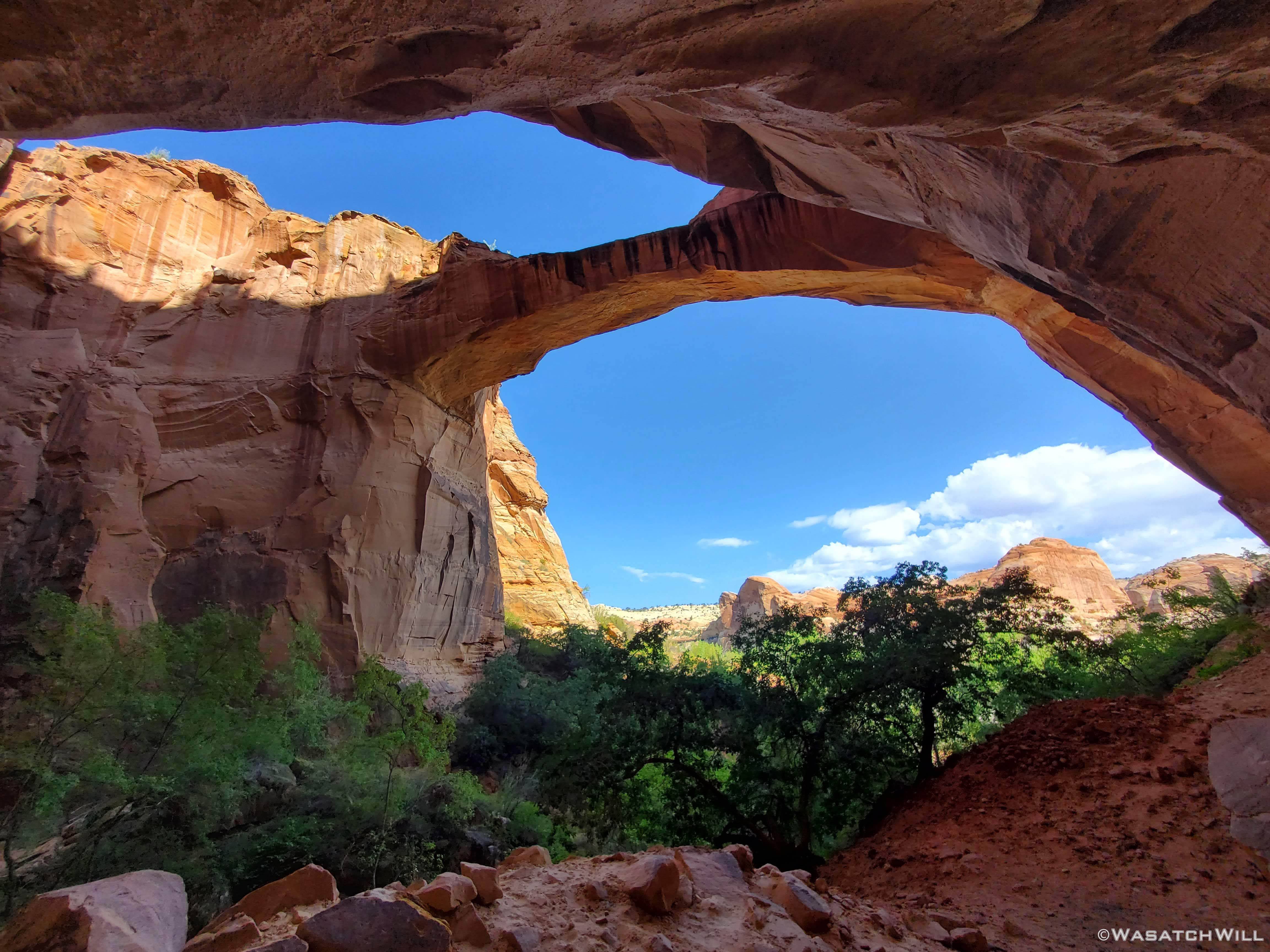
Looking out from the back side of the bridge
Looking out from the back side of the bridge
A short while later, we arrived at the Escalante River Trailhead to conclude our little weekend adventure, a trip into the desert, that ironically allowed us to escape the summer's heat.
Escalante River mileage sign
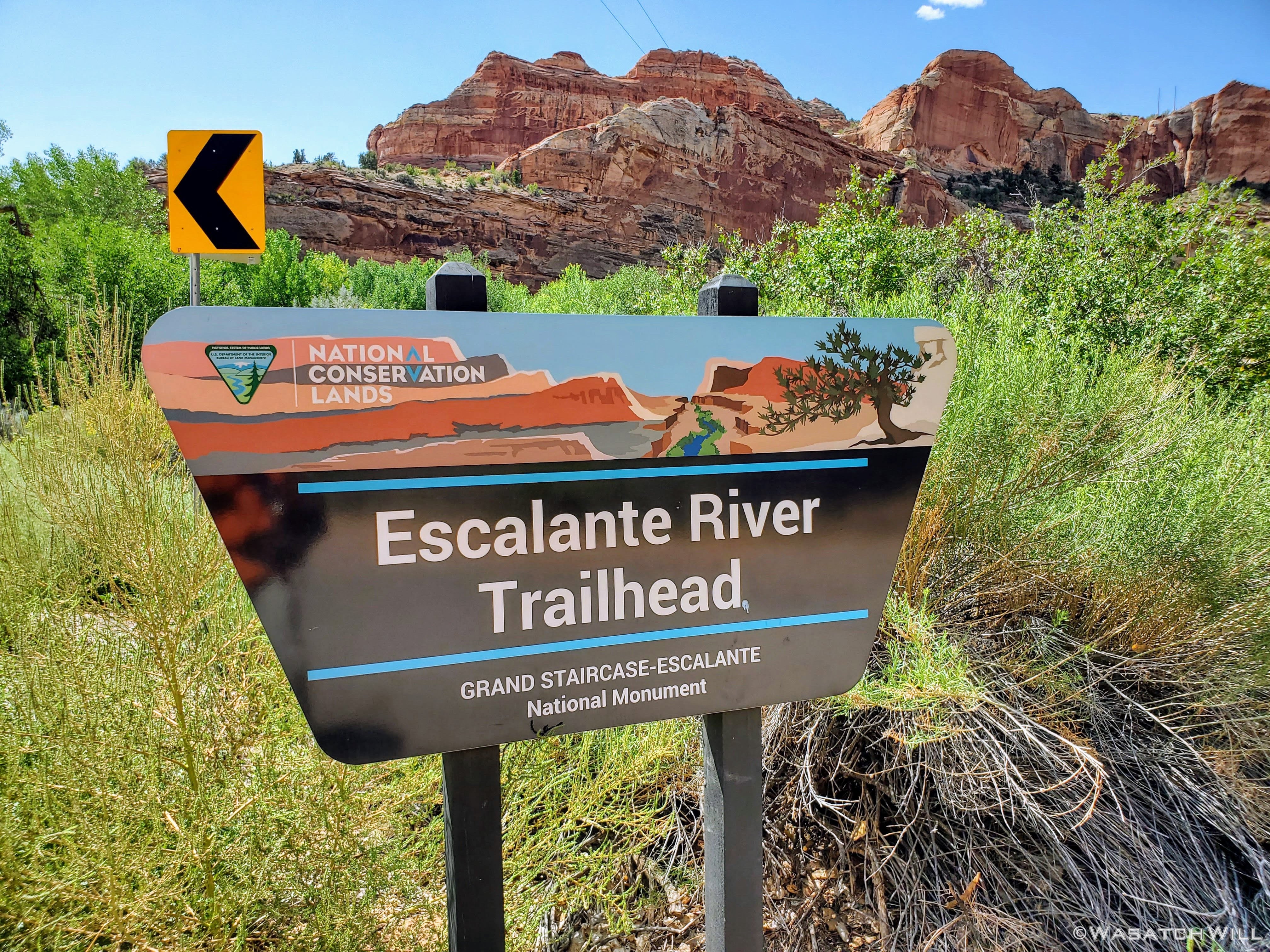
Trailhead
It was here we had a big decision to make. Either attempt to hitchhike back to the other trailhead where Devin's car sat, at the height of the Covid-19 pandemic for Utah, or use my InReach to message my in-laws over across the other side of Boulder Mountain, about an hour away, and ask them to come pick us up and drive us back to the trailhead. We opted for the latter. My in-laws responded enthusiastically saying they were trying to think of a good route to go for a Sunday drive anyway. I'm not sure if they were just saying that to be nice, but they do like to go for Sunday drives, so it worked out well and we were very grateful for their service to us.
Given the time we'd have to wait for their arrival, we used it to simply hang out at the trailhead and have ourselves some lunch and a good rest in some shade.
Once they arrived, we were able to load up and get the awaited ride back to the BMT trailhead at the old air strip. That in turn was followed by a stop at the Burr Trail Grill in Boulder for a post-hike burger before heading back home.
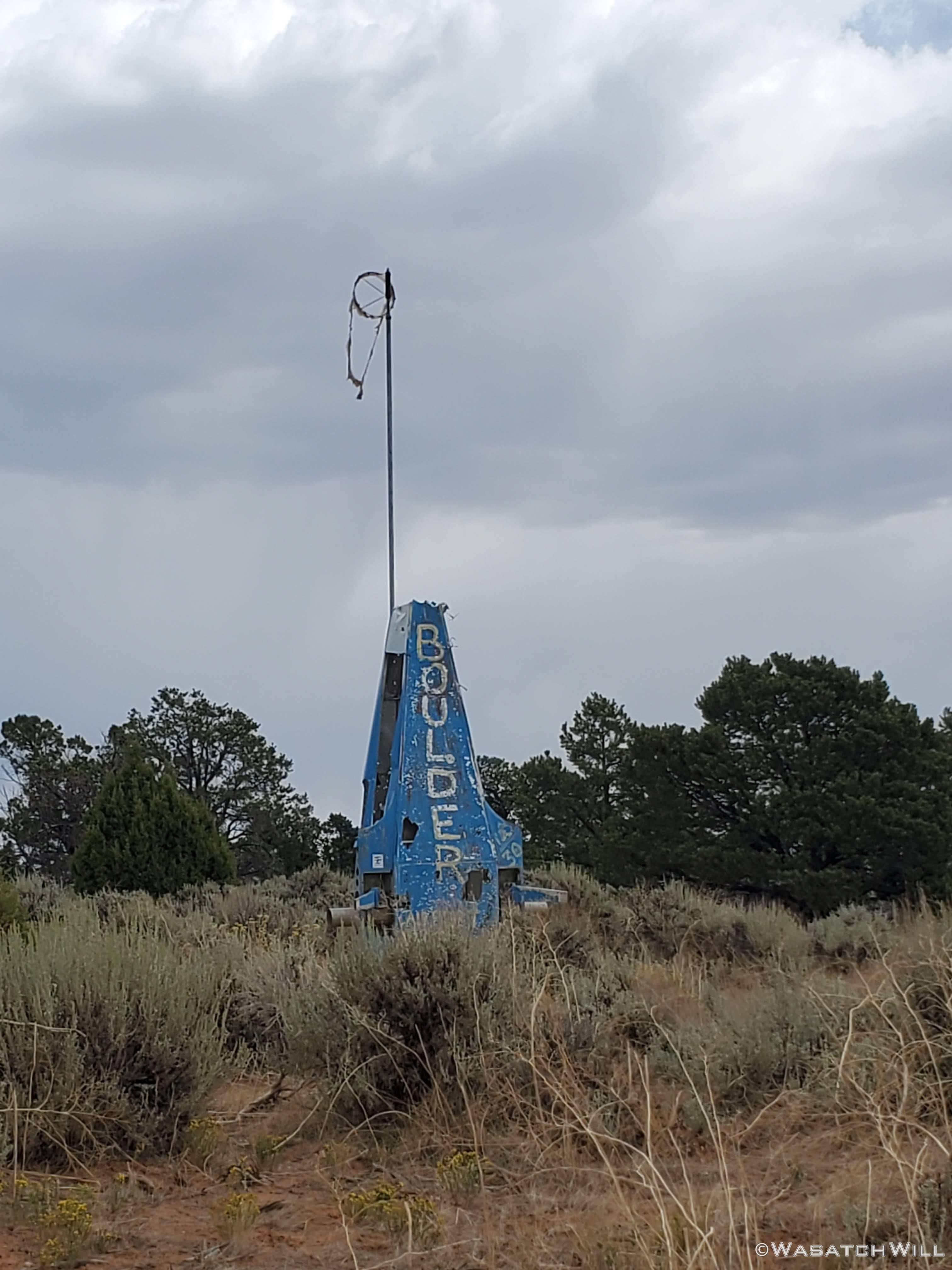
Old Boulder Airstrip

Burr Trail Burger
")

