- Joined
- Jul 23, 2013
- Messages
- 1,666
When @Blake Merrell recently found some free time on his schedule and reached out to see if I wanted to shoot down south for a quick overnight trip, I said, "Sure!"
At first we were looking at San Rafael Swell, but at the last minute, I suggested Cedar Mesa and it was ultimately agreed upon.
Day 1
Tuesday - February 23, 2016
With a 5 hour drive from Utah County including a stop for gas, and a lost wallet scare at the trailhead (it was found), we did not end up on the trail until about 8:30 in the evening. Being winter, all of the daylight was completely gone and the only light we now had was that from our headlamps and the light of a nearly full moon in clear skies. It all proved just enough to enable us to negotiate the many obstacles we'd encounter such as pot holes full of icy water, icy slickrock, pour offs, logs, and so on.
Road Canyon was our canyon of choice as it contained a few ruin sites I've had on my list of many to still see, including the Citadel which was thwarted by snow in last month's trip to the area. It would also be Blake's first ever visit to the area. The intended approach this time around was to enter in the canyon from the upper canyon and work our way down the canyon bottom where we had hoped to find a suitable campsite below the rim of the Citadel. We were making great progress and did well in bypassing many of the obstacles until less than a mile from our intended target for the night, we were stopped by a seemingly impassable pour-off right after the confluence with the first major tributary coming in from the north. We could have swam it, but gambling with hypothermic conditions did not sound appealing. Instead, we were able to get up on the bench above it to the east and get to the other side of the bend, and while there appeared to be a good path that continued on, it also appeared to run right out to another icy pour-off at the next bend and no obvious way down.
Due to the darkness and how high the bench brought us above the canyon bottom, it looked all but hopeless to continue on. It was nearing midnight and we were getting tired enough, so we opted to pull back and return to another bench we had just come down from across the canyon prior to encountering the final pour-off. It had some open spots suitable enough to camp at and ultimately served us well. We set up camp, warmed up with a hot dinner, and jumped in our tents for some sleep.
Because of the time, lack of light, and the focus on getting down the canyon, I didn't attempt to take any photos along the way.
Day 2
Wednesday - February 24, 2016
Waking up at our unplanned campsite proved to be as beautiful a setting as just about any I could imagine in the canyon.
Rise & Shine
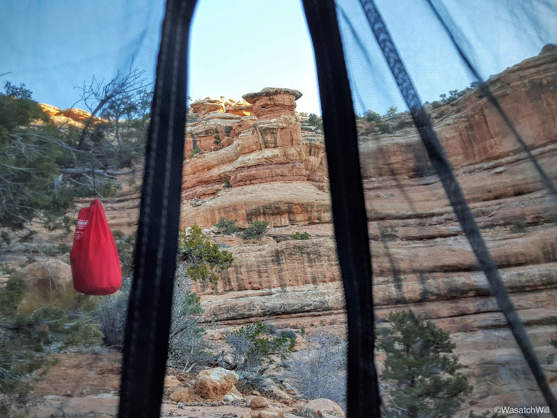
My tent and the canyon bottom below
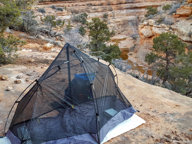
Our camp

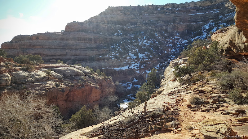
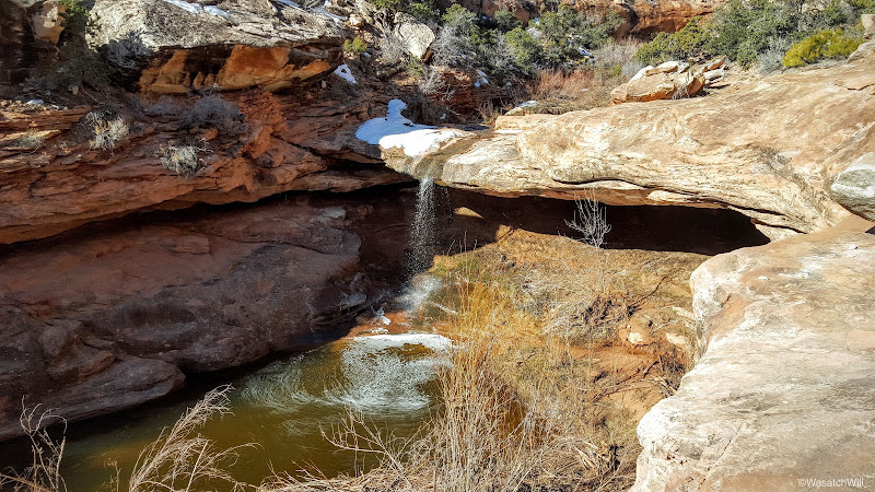
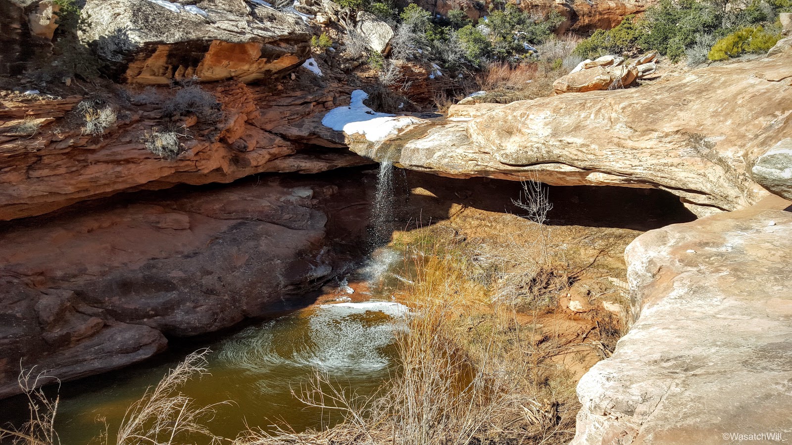
With the welcome light of the new day, we made our way back down from our camp to scout out around the stubborn pour-off that gave us fits the night before to see if it would be easier to find a suitable way around. Again, we could have swam right across it, but the cold deep water combined with the cold morning air was all too intimidating. Had the sun been higher in the sky...maybe.
The pour-off

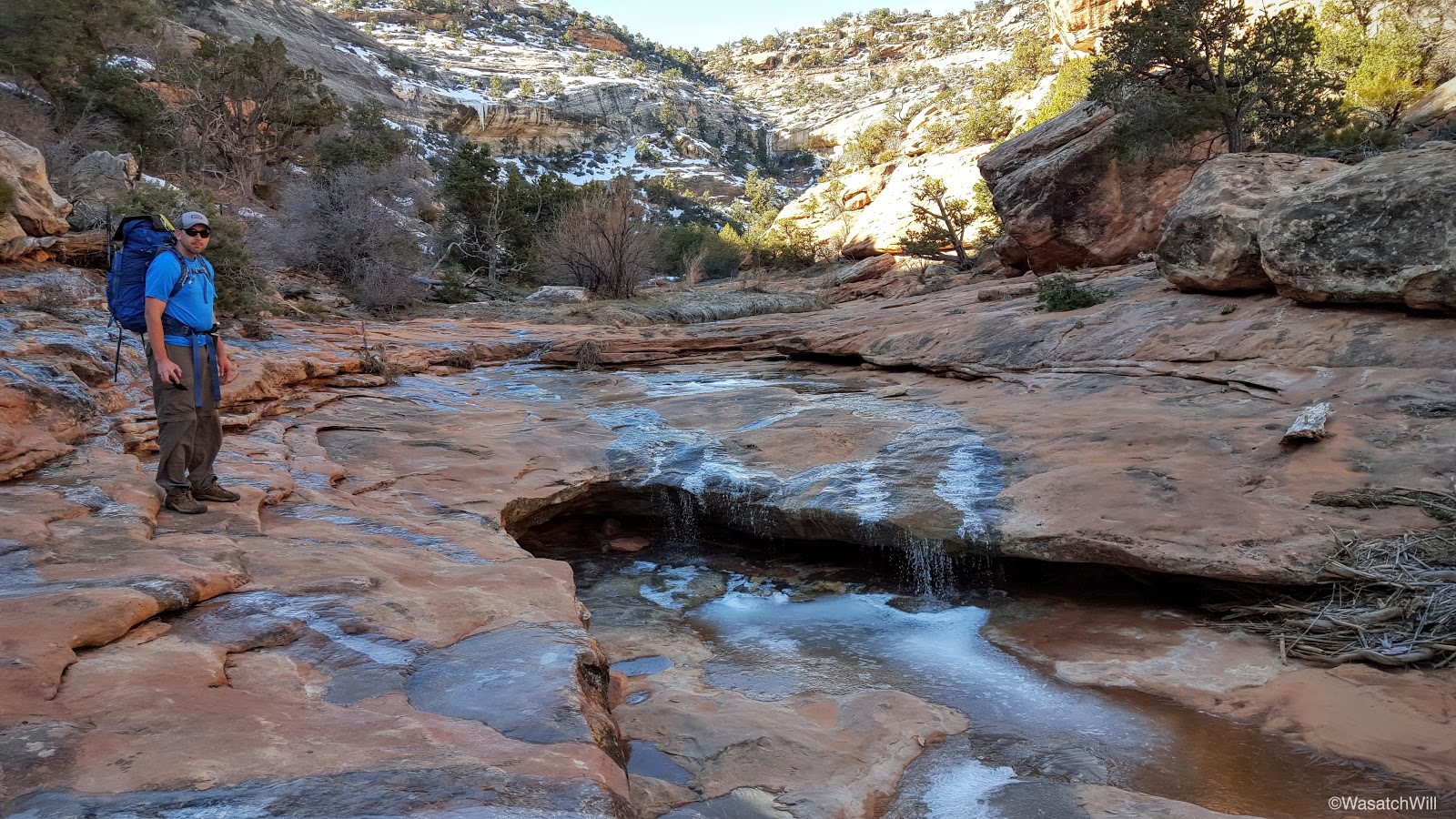
We then proceeded back up the bench we had tried to navigate around the night before. Again, we were staring at a path that appeared to head straight across the top of an icy pour-off. Not being able to see around the next bend to see if the bench would ultimately provide a way back down to the bottom of the canyon, we chose to cease further progress and turn back to break our camp and head back up canyon for the Falling Roof ruins near the route we had come into the canyon the night before (further analysis of some satellite imagery revealed that there indeed may be a simple enough way off the bench at the very next bend beyond what we could see). To pursue the Citadel, we'd end up taking the car out to the rim above it later that afternoon and make it easier on ourselves.
The bench leading out to the icy unknown
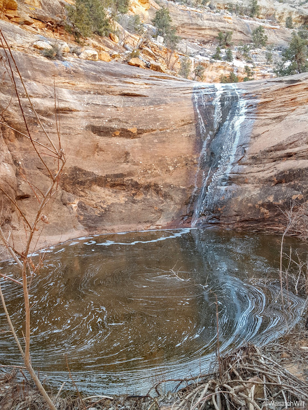
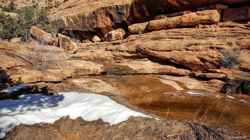
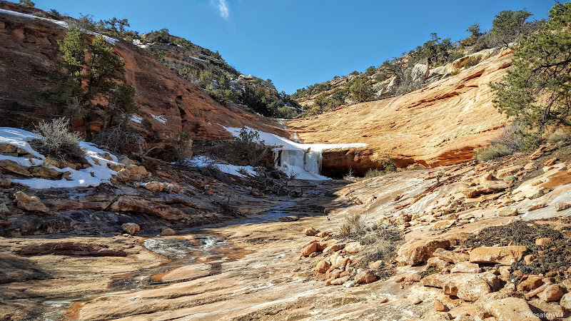
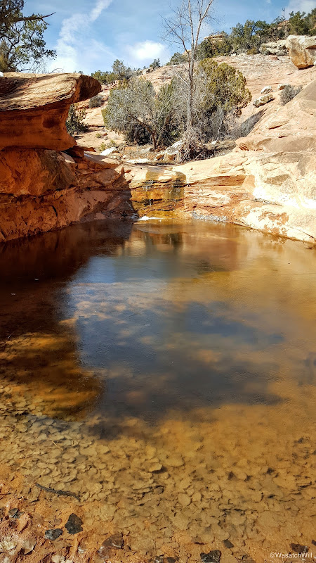
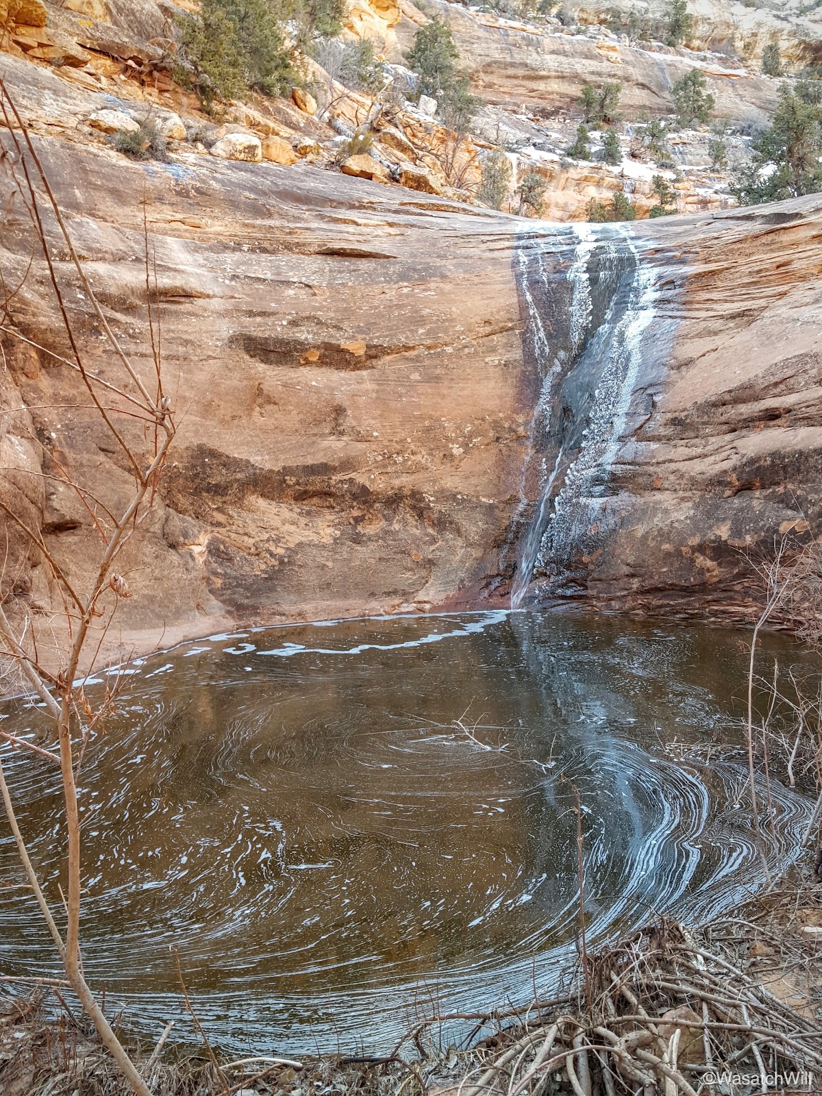
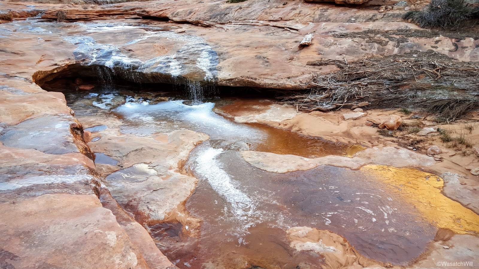
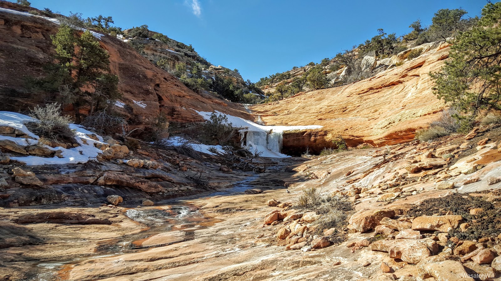
Prior to breaking camp, we paused to investigate another pour-off and pool we had camped right above which lied just about 100 yards upstream from the other pour-off.
Waterfall & pool
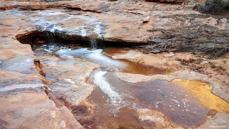
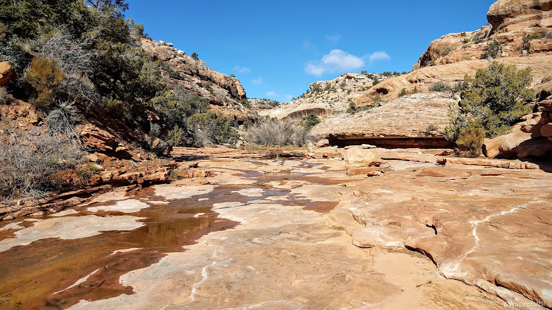
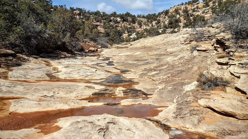
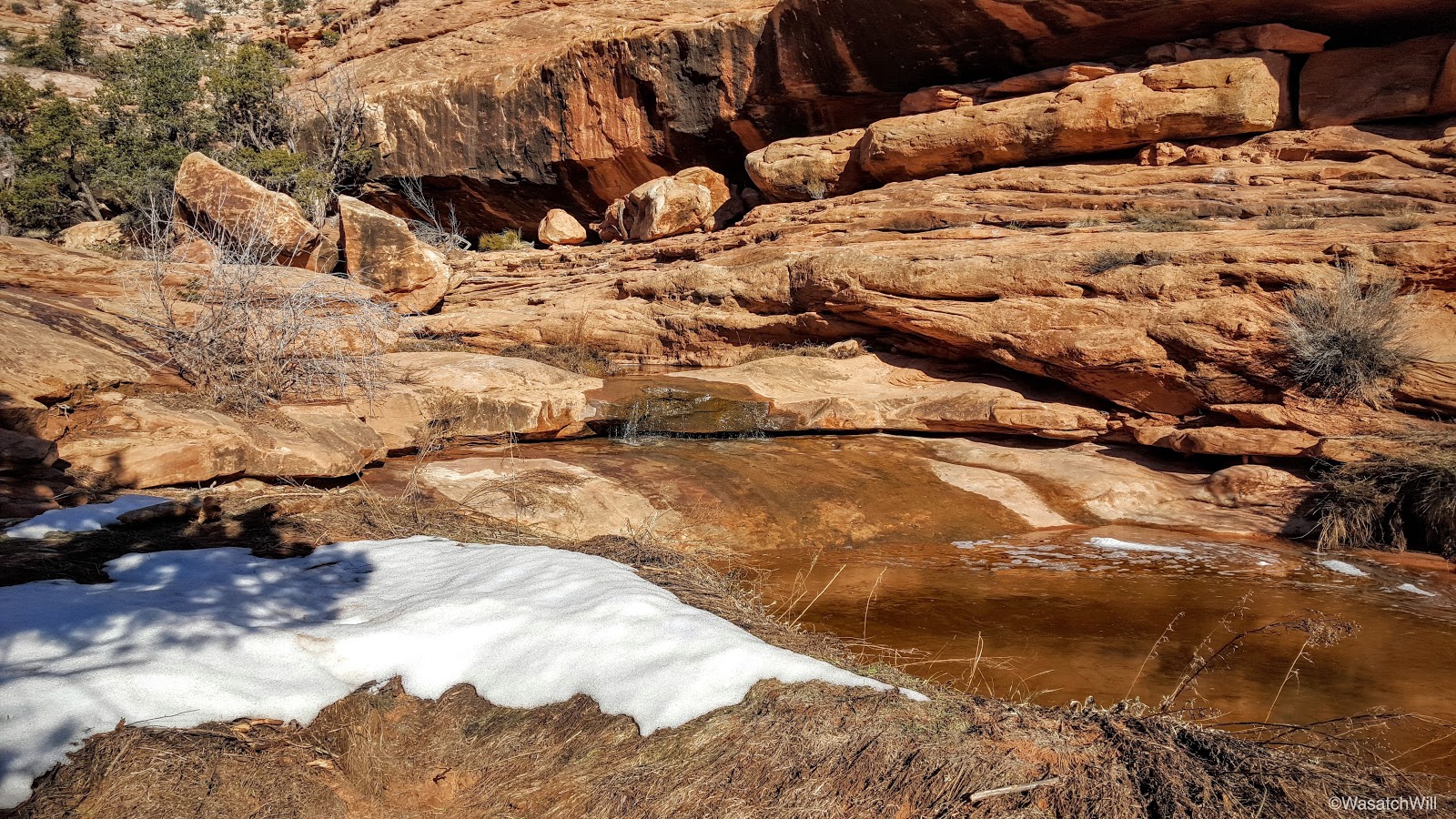
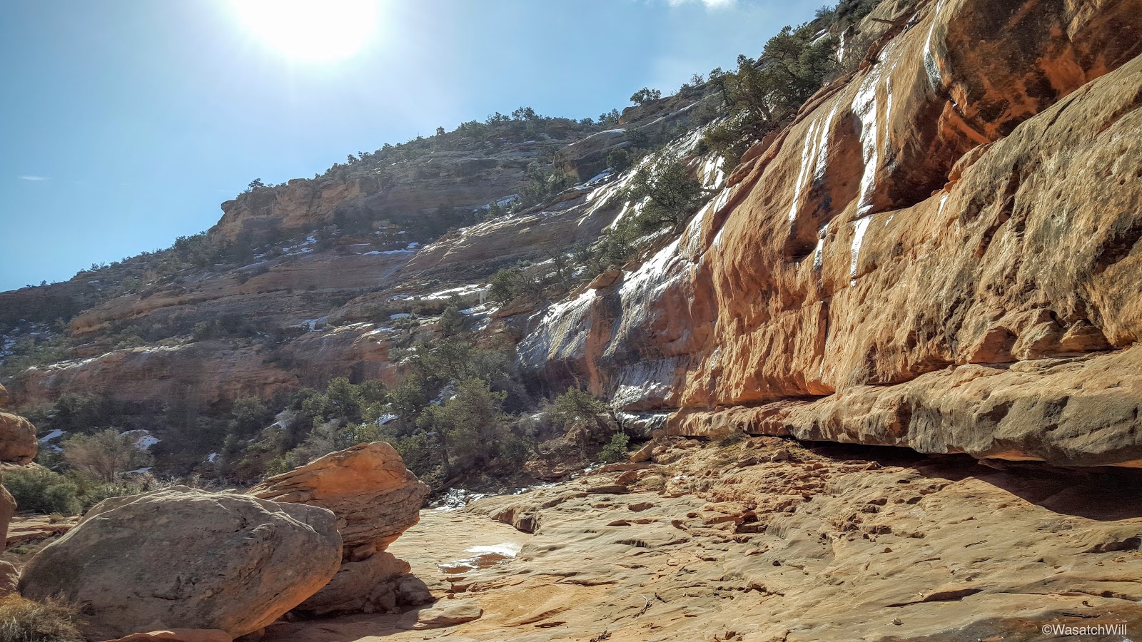
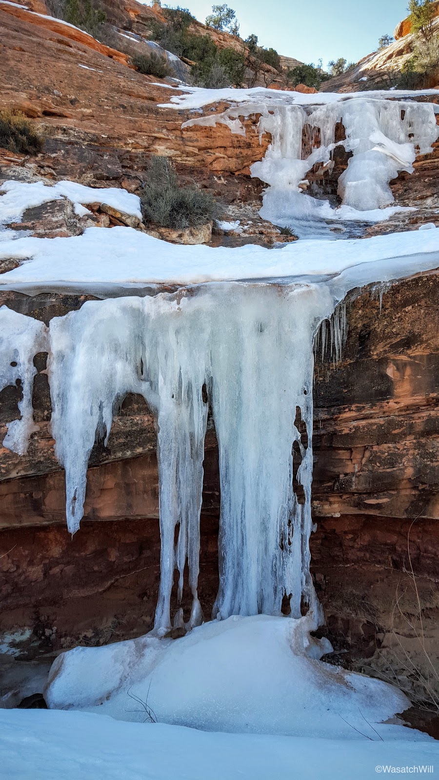
With everything all packed up, we made our way back upstream taking in the sights of the canyon. I'm confident many of the waterfalls and the shallower pools we encountered all dry up come summer season. The Mesa had received significantly more snow than it has in many years this past winter so we felt treated to see all the extra beauty created by the seasonal stream fed by all the snowmelt.
A seasonal waterfall
Morning light reflecting off the icy cliffs

Seasonal stream
Blake admiring the icy stream

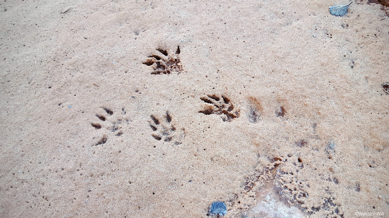
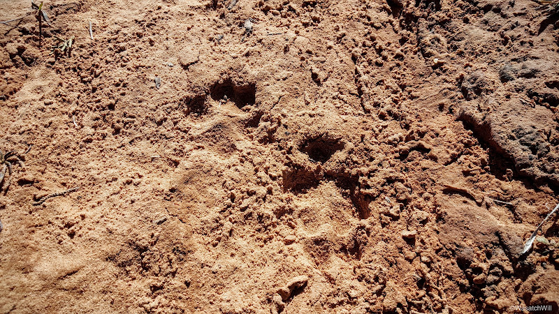
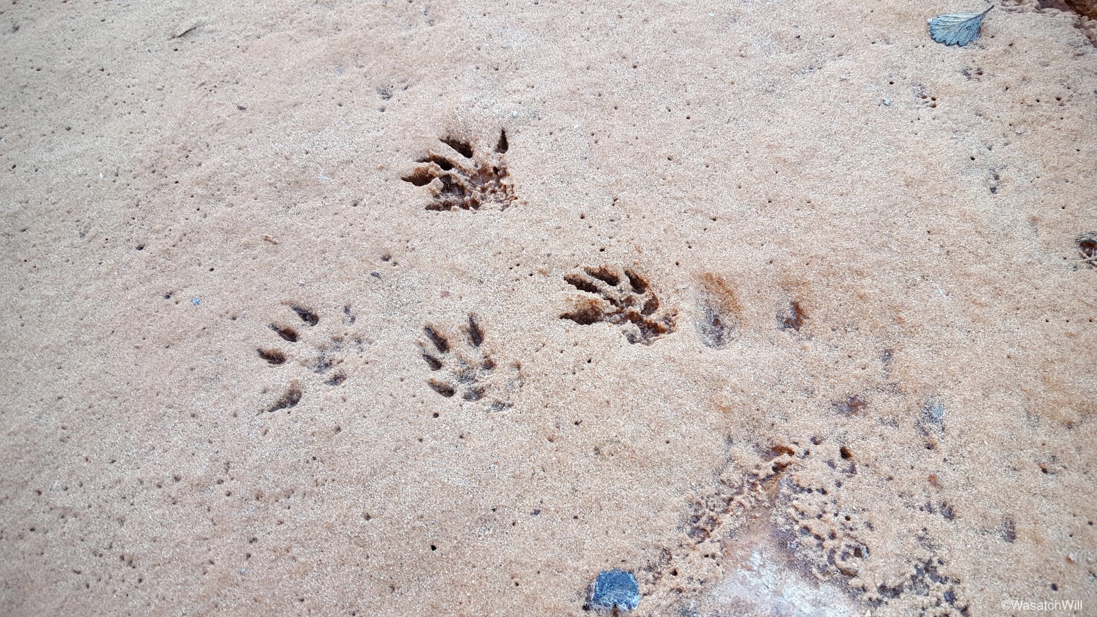
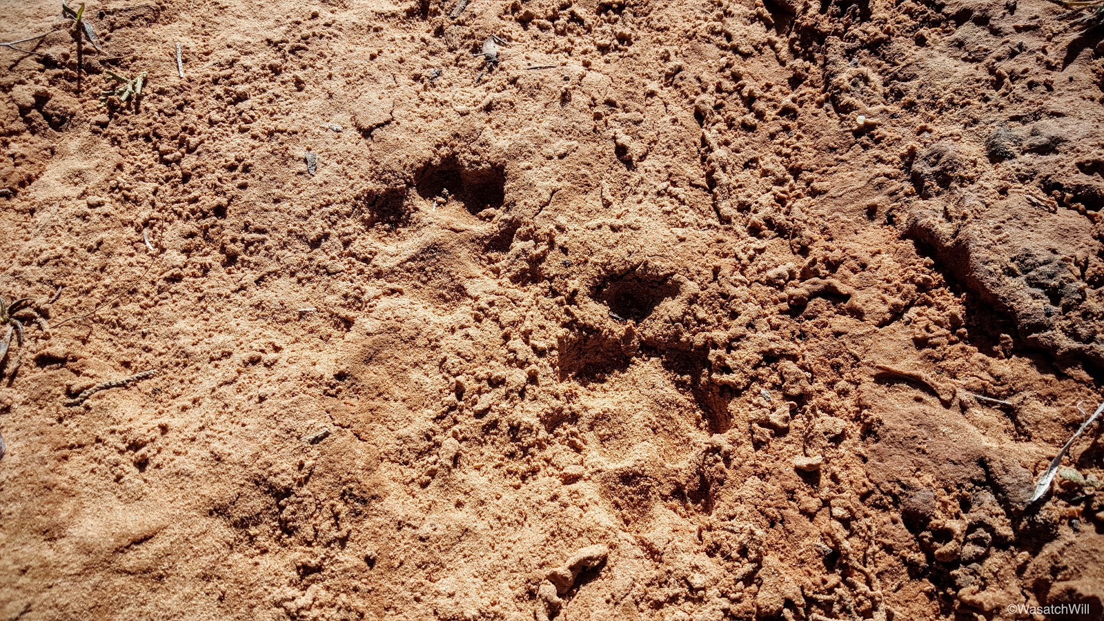
Muskrat?
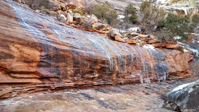
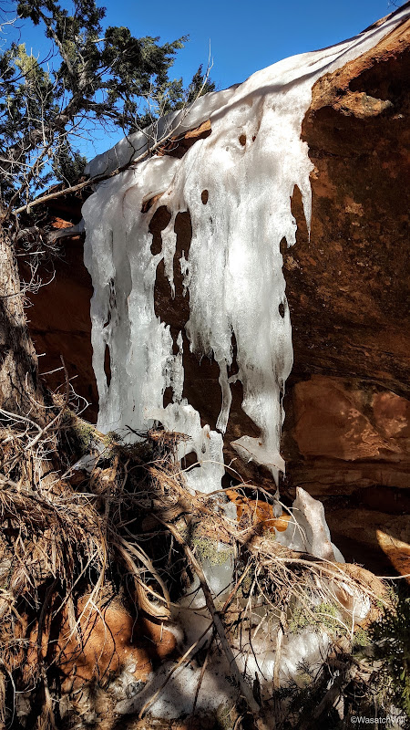
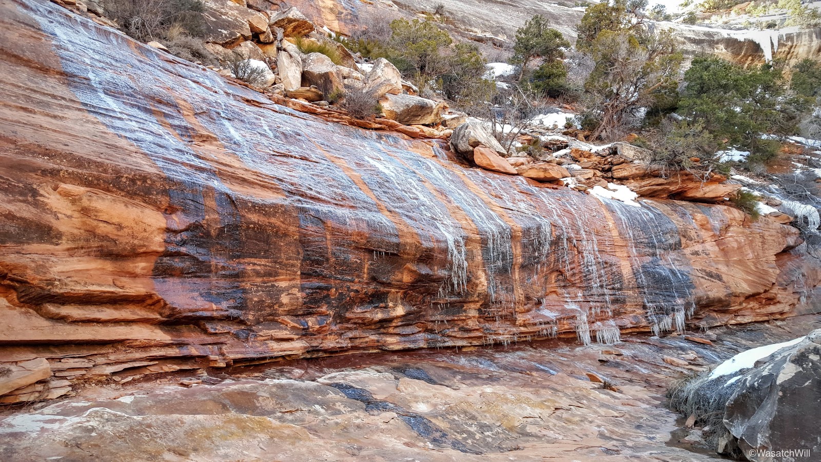
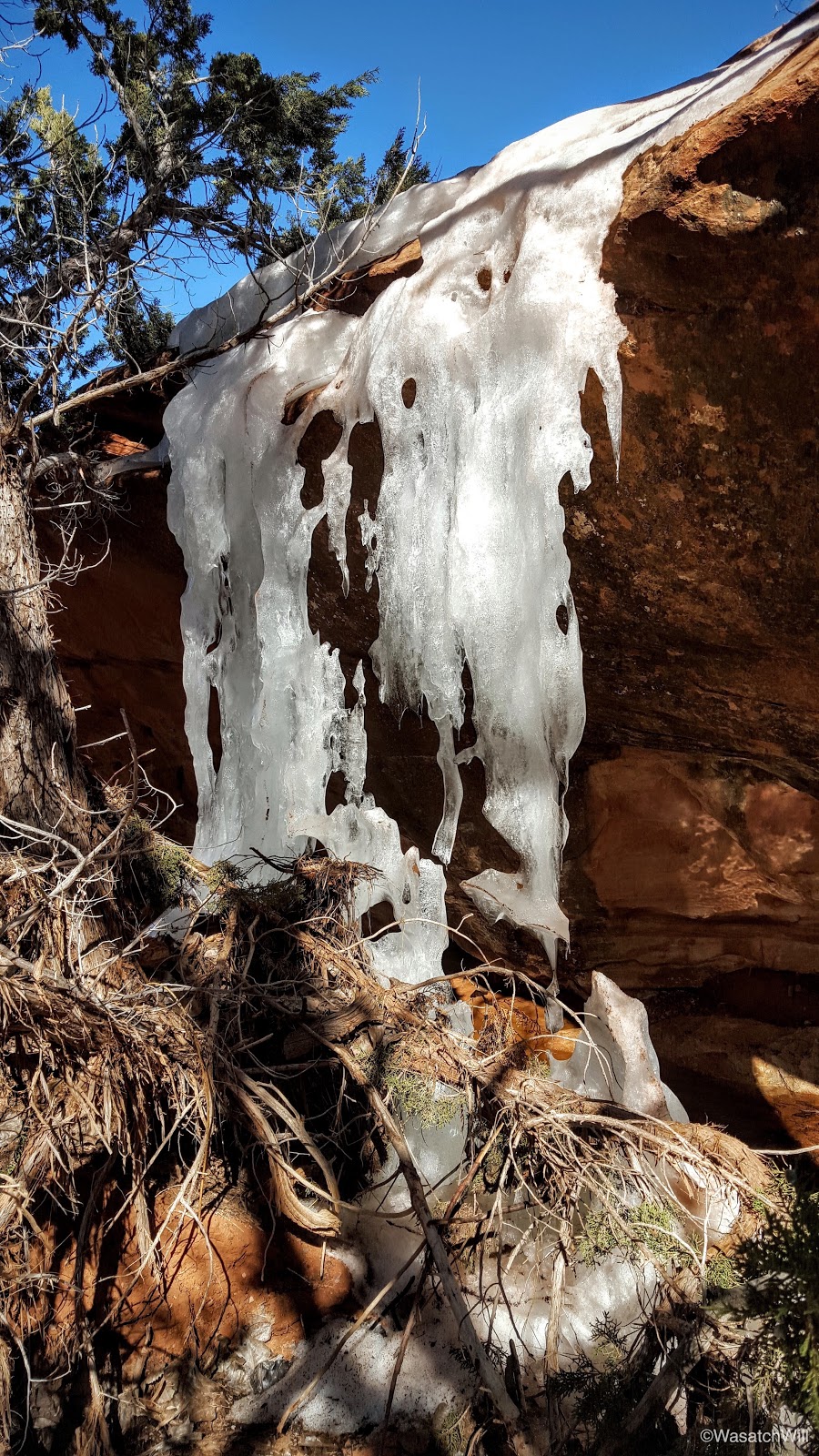
Ice wall
Icefall up a tributary
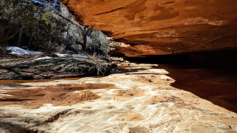
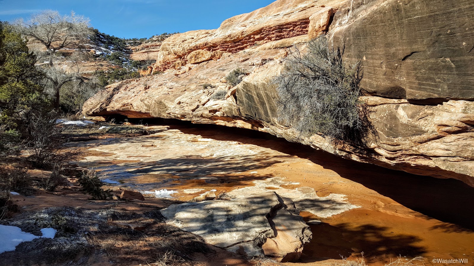
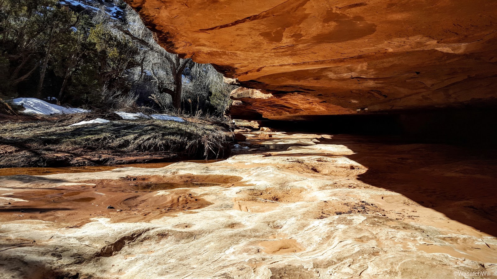
Undercut

Under the undercut
More icefall

Fox?
Just below Falling Roof was an ice ghost guarding the way.
Ice Ghost
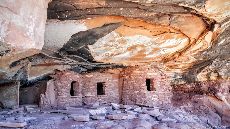
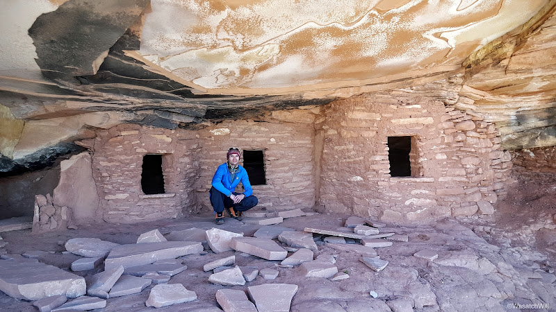
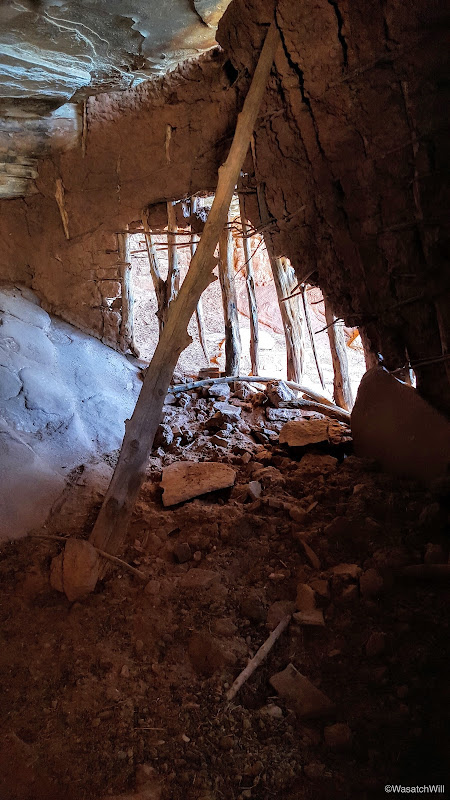
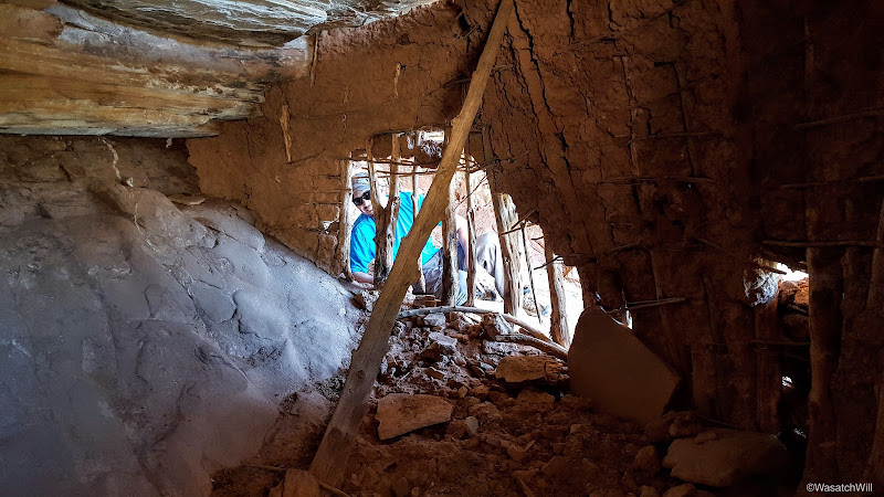
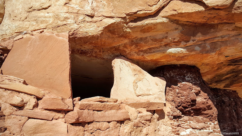
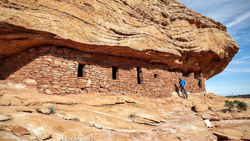
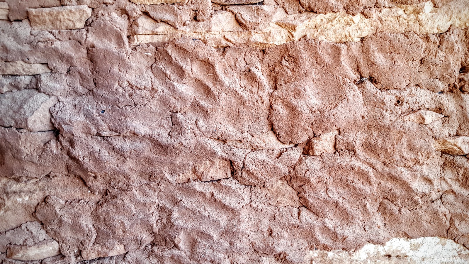
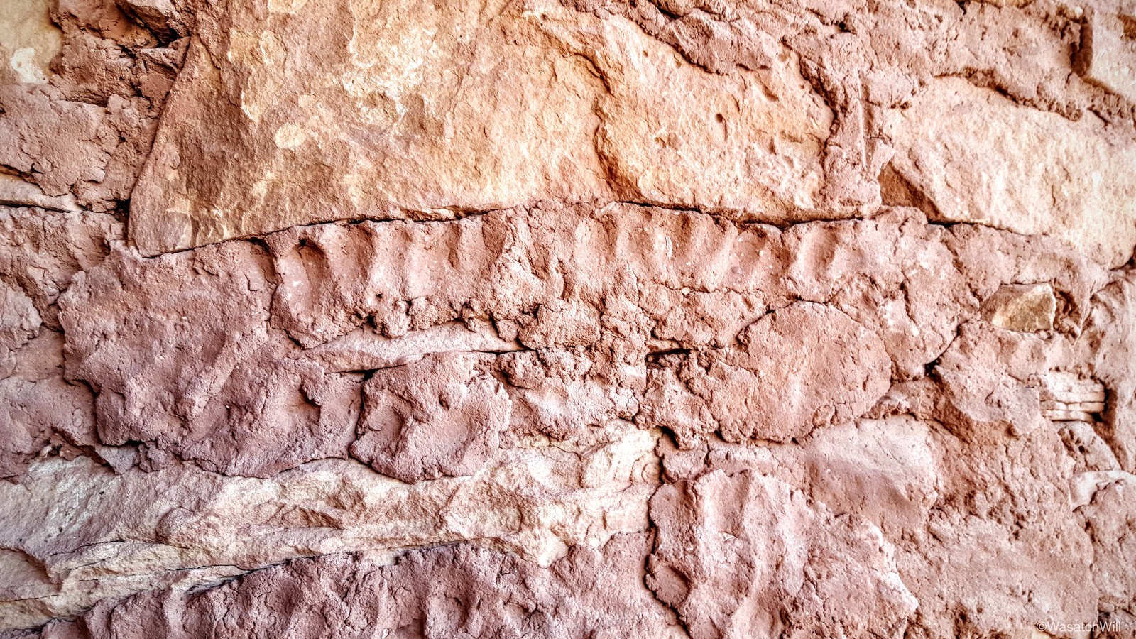
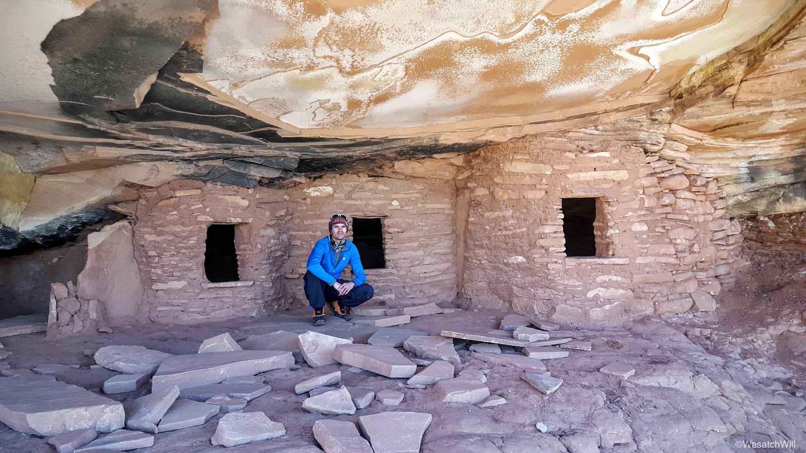
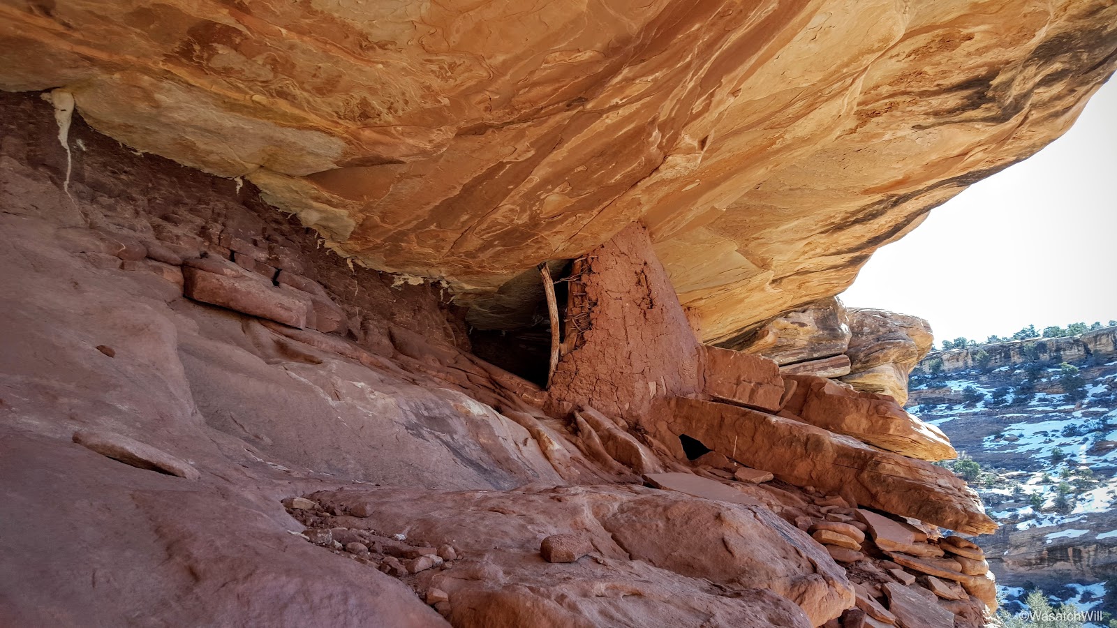
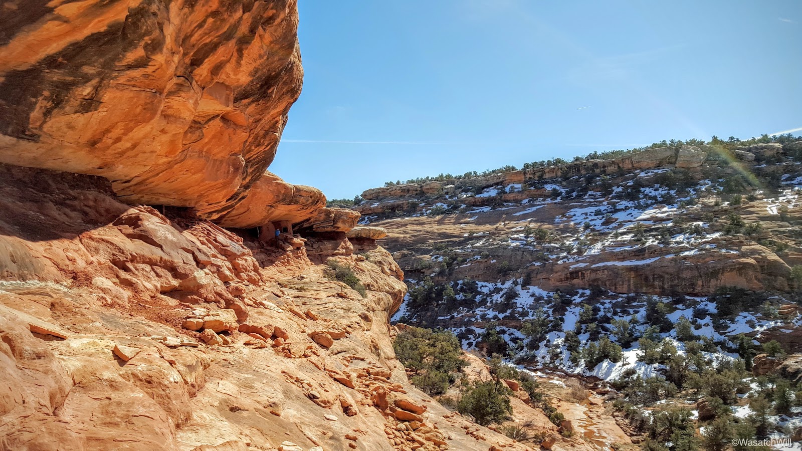
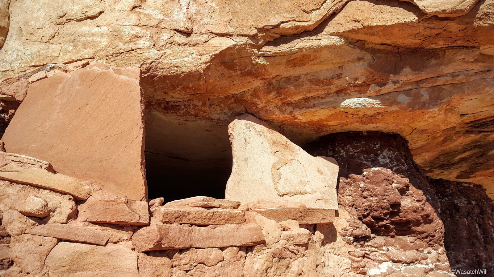
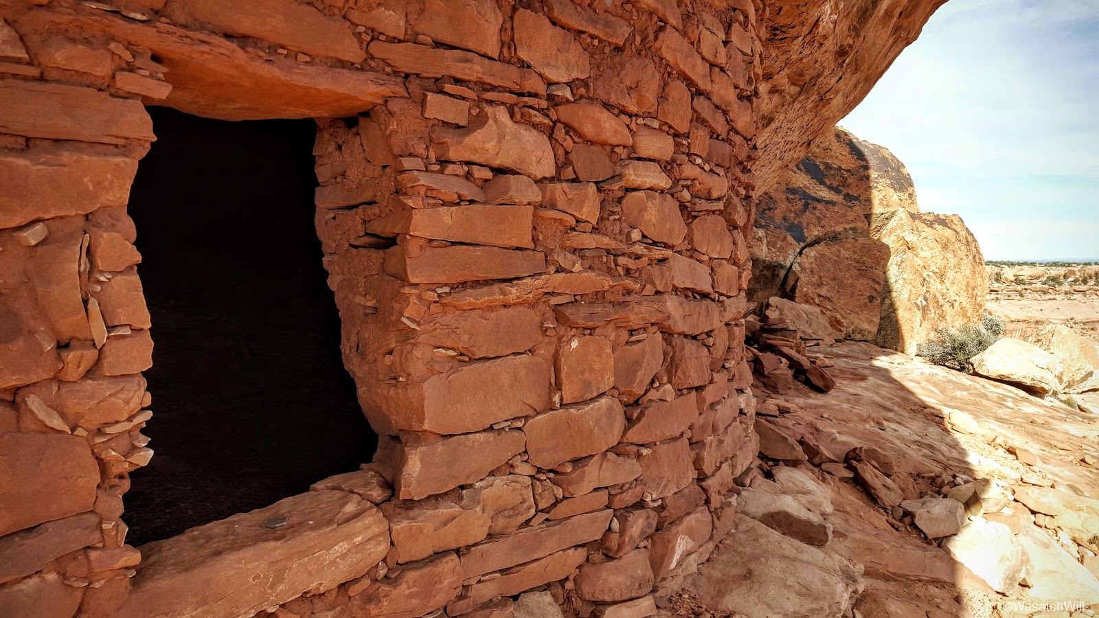
After making friends with the ghost, we set our packs down and headed up for a visit to Falling Roof. It gets its name from the roof of the little alcove it sits in having cracked and fragmented with a few chunks of the debris scattered beneath it. It gives off the illusion that the roof is collapsing onto the ancient dwellings. It was also really interesting to see the textured handprints embedded and immortalized into the sides of the structures where the adobe mortar had been compressed and formed to hold the stone bricks.
Falling Roof Ruin
Handprints
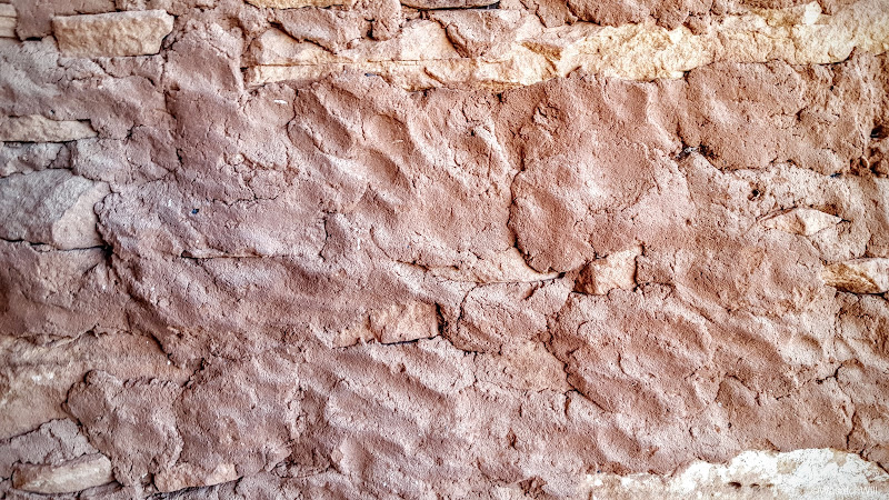
More handprints

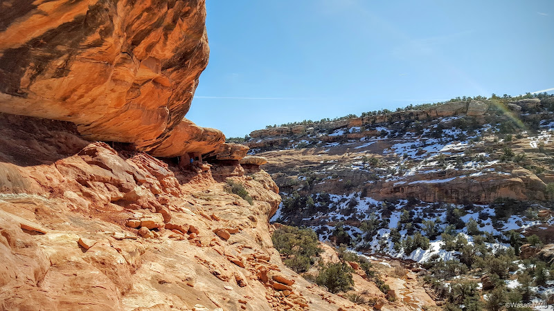
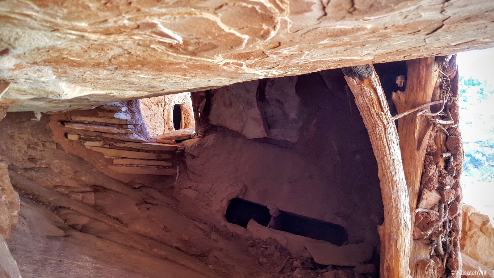
We also explored further on, checking out some additional ruins nearby. I believe they may have been granaries.
The approach
A granary?

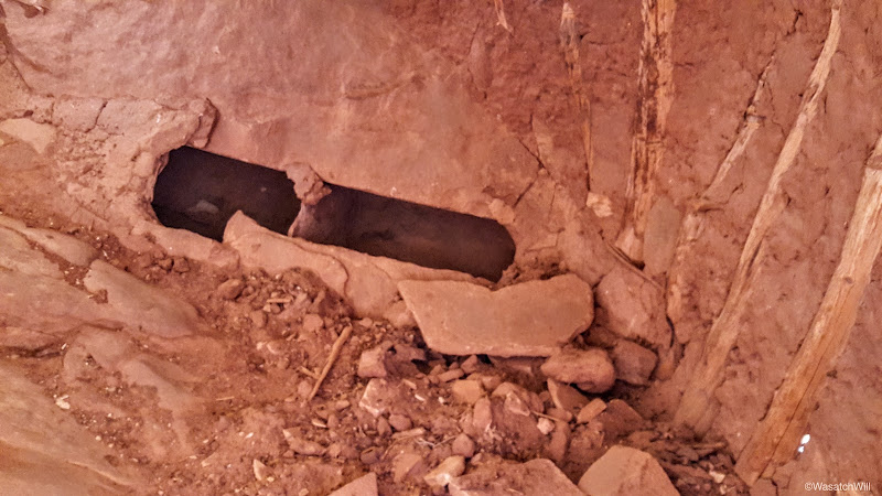
An interesting cavity in an interior wall. A secret cache at one time?
A tale of contrasts

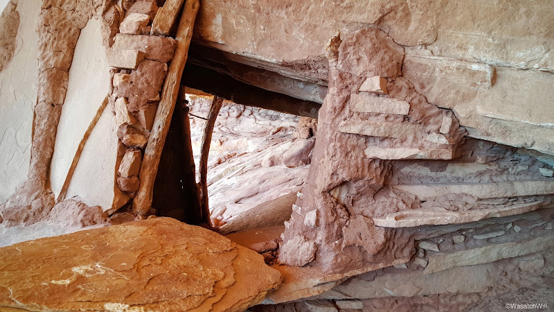
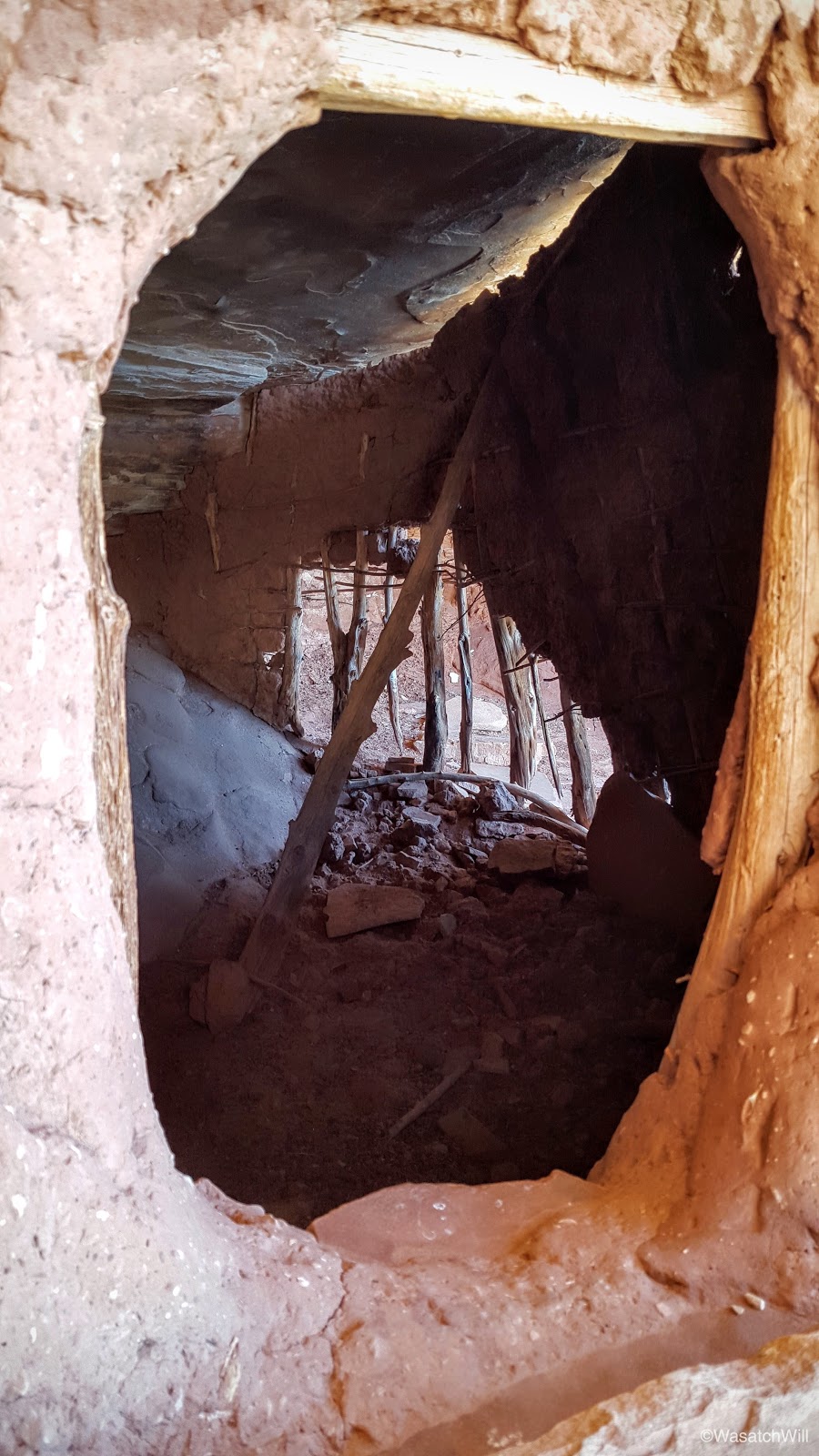
Through the window

Through the other side of the window
Inside the second structure

If only the name "Jailhouse Ruin" wasn't already taken
Another angle
Blake checking out the view from the other side
Looking back one last time
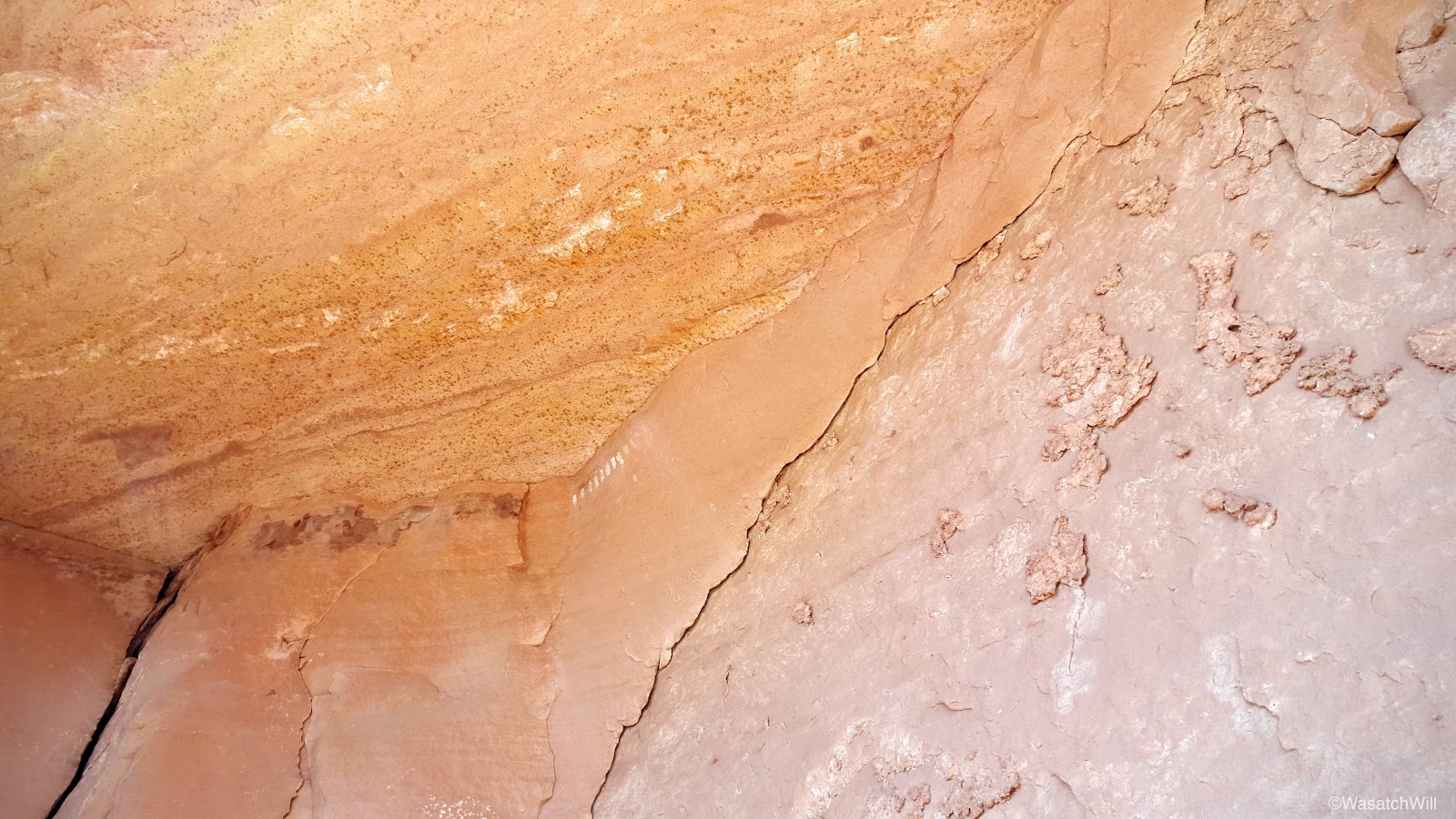
Along the way back, we discovered a few other traces of the ancient culture that had once inhabited the canyon.
A little empty cache
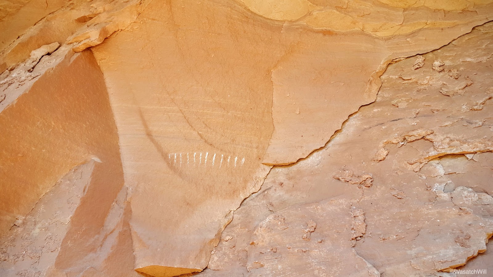
An ancient tally?

More tally marks

Once we returned to our packs it was time to finish off our exit from the canyon. There were just a few more pools to navigate around among other obstacles.
A nice little oasis
Crossing the slickrock
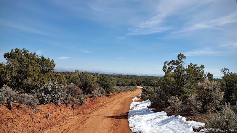
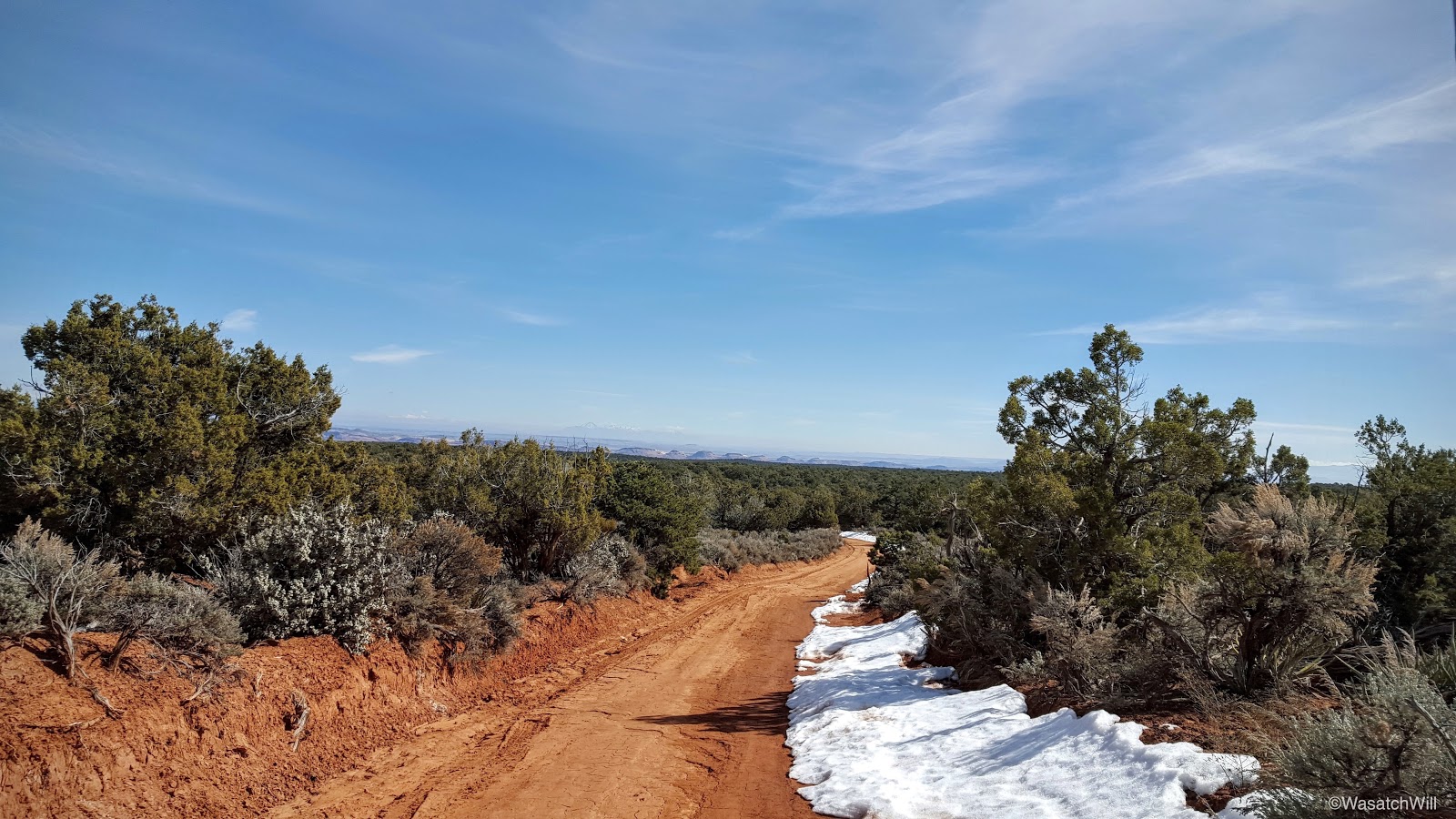
We arrived back at the car about mid-day and soon made the drive further eastward and out to the rim further down canyon to make another attempt at the Citadel. The road was in relatively good shape and allowed us to get all the way out to the rim. In other words, the conditions were much better than a month ago.
The road
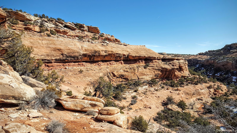
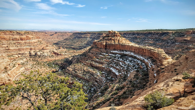
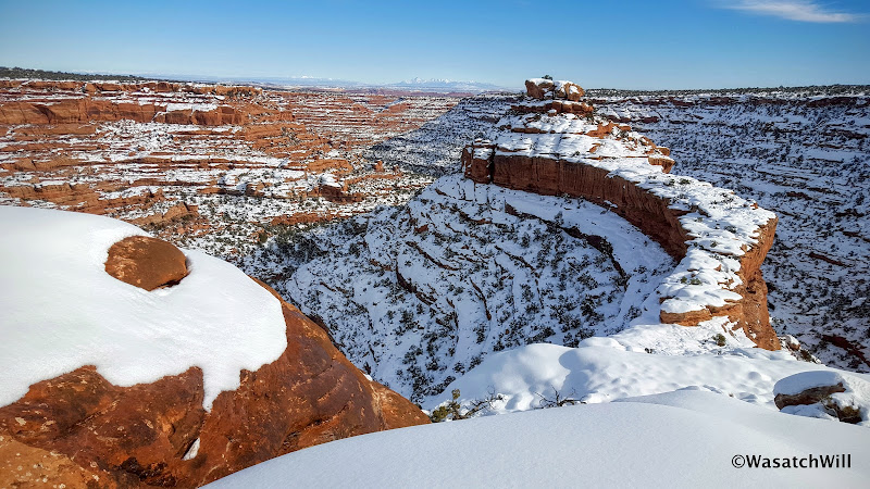
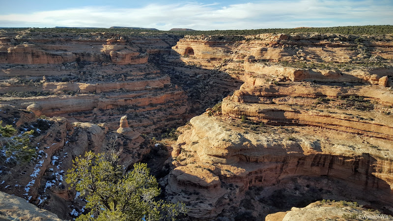
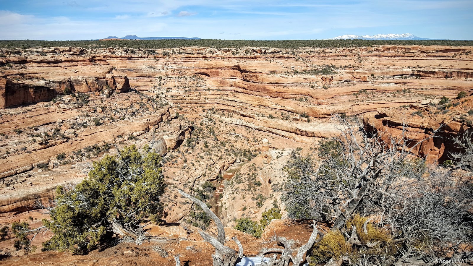
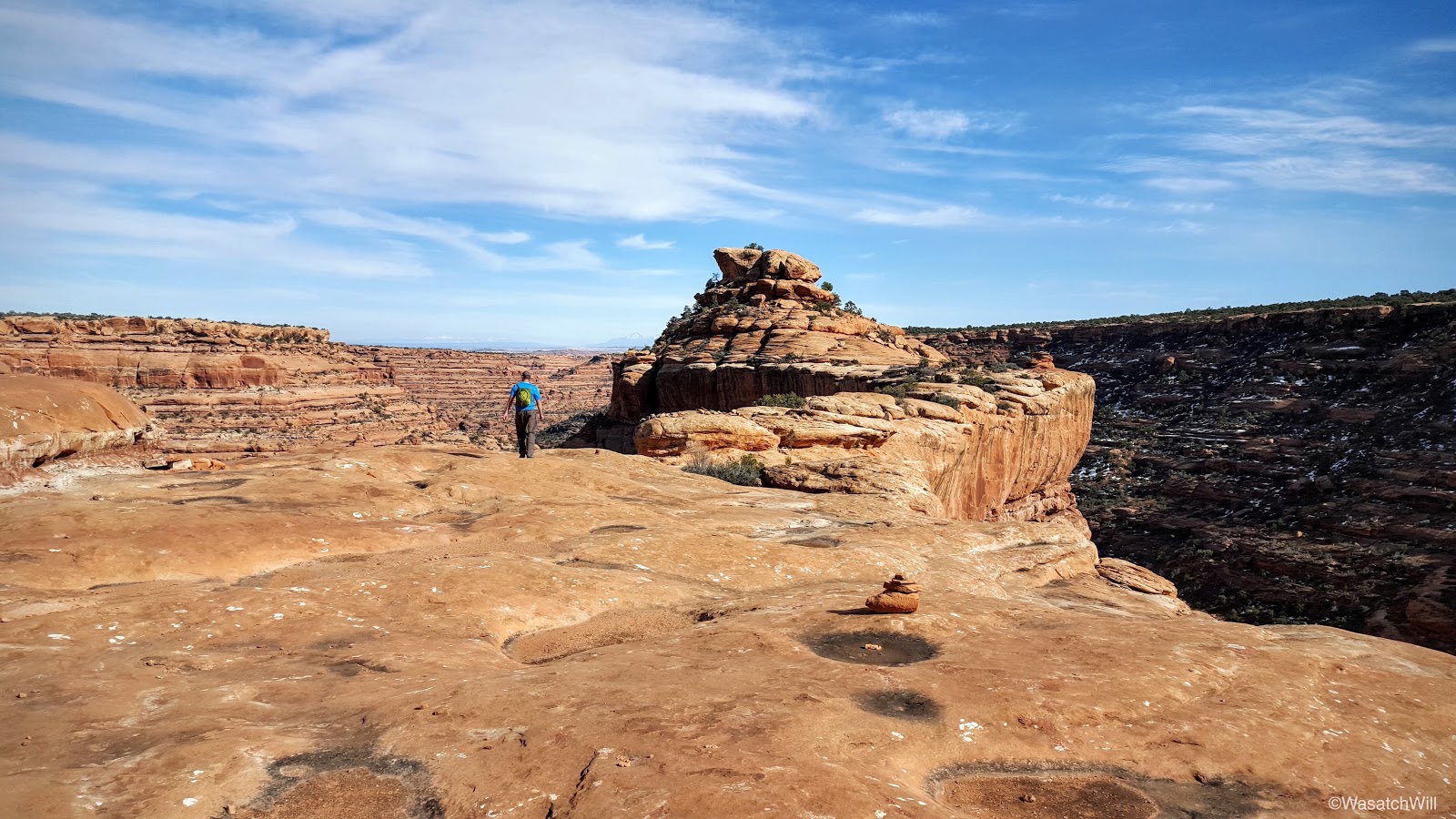
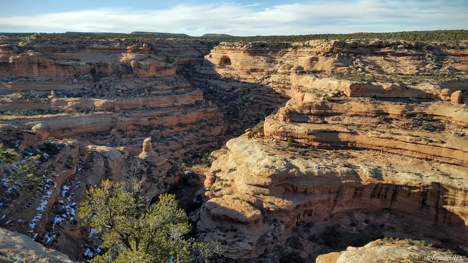
Road Canyon from the rim

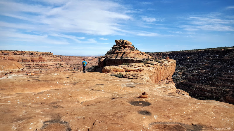
We hiked the path eastward for about another 2 miles and there on the horizon appeared the Citadel.
The Citadel
For comparison sake, here's a shot of the same landmark a month ago:
The Citadel, January 2016
Finding our way down to the actual land bridge or isthmus that leads out to it took a bit of route finding but ultimately, a path of cairns proved reliable. It was an incredible sight and an incredible site.
Blake and the Citadel
Blake and the dwellings
A peek inside the central room. Note the form of a shelf in the corner.
The exterior

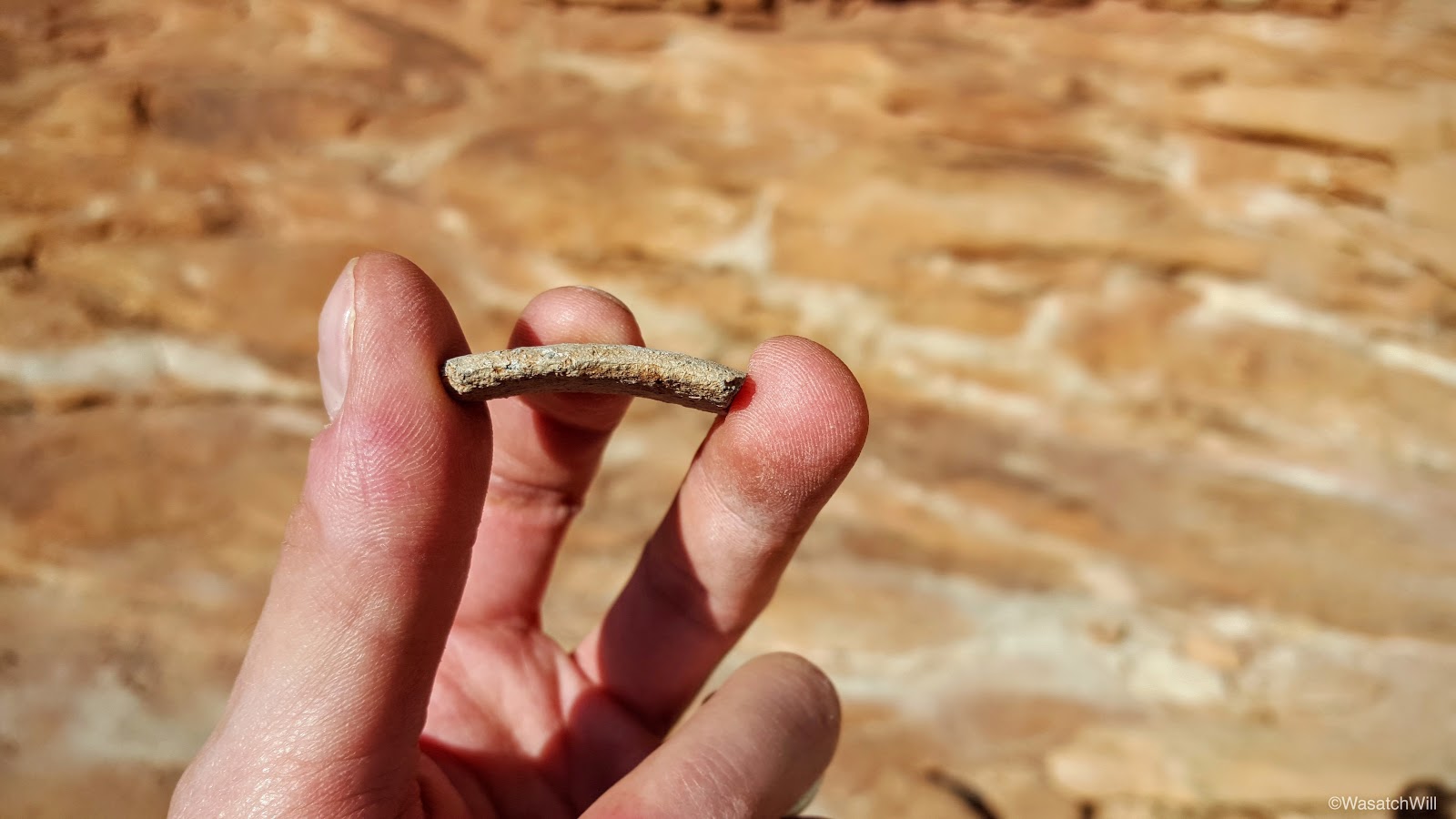
I've visited a few other ruin sites in my past, but this would be the first time I also had my eyes focused on finding some potsherds and sure enough, there was a few pieces scattered around and another little collection others had contributed to for display.
Potsherd
Corrugated sherd
Potsherd collection with some shards of flint
A piece of a pot's rim

It was now getting later in the afternoon and we still had to drive back home so it was time to say goodbye to the Citadel and start making our way home. The views along the rim were every bit as spectacular.
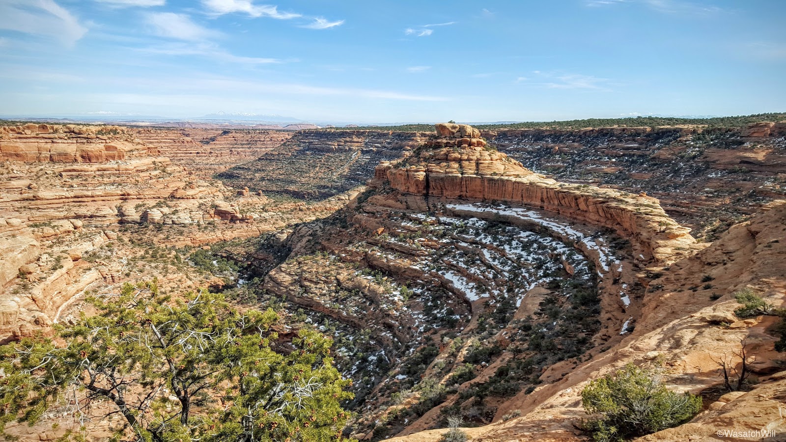
Road Canyon from the rim
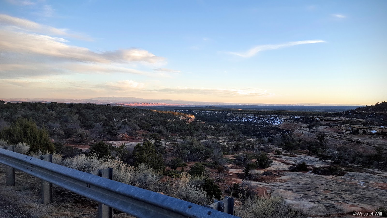
Back at the car we chose to take a different route home. Instead of shooting back through Hanksville, we opted to head on over Comb Ridge and into Blanding for dinner before making the long drive back home. There we would also meet up with a resident friend of Blake who was someone I also knew through social media accounts but had yet to meet in person.
Driving over the Mesa

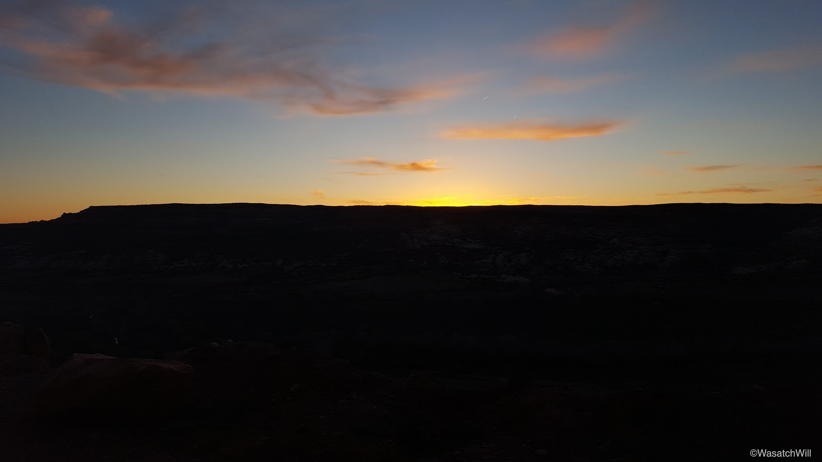
Sunset over the Mesa

Dinner time at the Patio Drive-In
While once again, this trip didn't go entirely according to plan, we were able to make the most of it and thoroughly enjoyed ourselves.
Like many others that can probably relate, I can only wonder and imagine what all the ancient ruin sites in the area would have looked like, what kind of artifacts would still be present at each of the sites, if it weren't for the Weatherill digs and other aspiring archaeologists that began to forage the area in the late 1800's, not to mention all those that have since followed, who've taken away additional objects, for good or for evil, over the last 130 years. What would it have been like to be the first person to stumble into such sites in over 700 years? Of course, hindsight is always clearer than foresight and so I wonder if I wouldn't have reacted with the same excitement and desire to take and share the discoveries with the outer world when no laws such as the Antiquities Act forbade the compromise of such objects. Still, what a living museum Cedar Mesa and the surrounding area would be if all artifacts were left in place!?
I suppose I'm being spoiled with those thoughts though. I should be grateful enough for what does remain and the glimpses into a past culture that can still be experienced at such sites. I'm very much looking forward to additional visits to the Mesa in the future to see what's left and what remains in other canyons, including what's arguably the granddaddy of them all, Grand Gulch. Even without the ruins, rock art, and other fascinating archeological treasures that remain in the area, the canyons themselves are sculpted into beautiful geologic formations while the high rims offer stunning panoramic views that can rival any other. I hope that the land remains protected and good conservation practices continue to be practiced and promoted so as to preserve what remains of the fragile and treasured archeological resources, the ecosystem, and the surrounding viewsheds.
At first we were looking at San Rafael Swell, but at the last minute, I suggested Cedar Mesa and it was ultimately agreed upon.
Day 1
Tuesday - February 23, 2016
With a 5 hour drive from Utah County including a stop for gas, and a lost wallet scare at the trailhead (it was found), we did not end up on the trail until about 8:30 in the evening. Being winter, all of the daylight was completely gone and the only light we now had was that from our headlamps and the light of a nearly full moon in clear skies. It all proved just enough to enable us to negotiate the many obstacles we'd encounter such as pot holes full of icy water, icy slickrock, pour offs, logs, and so on.
Road Canyon was our canyon of choice as it contained a few ruin sites I've had on my list of many to still see, including the Citadel which was thwarted by snow in last month's trip to the area. It would also be Blake's first ever visit to the area. The intended approach this time around was to enter in the canyon from the upper canyon and work our way down the canyon bottom where we had hoped to find a suitable campsite below the rim of the Citadel. We were making great progress and did well in bypassing many of the obstacles until less than a mile from our intended target for the night, we were stopped by a seemingly impassable pour-off right after the confluence with the first major tributary coming in from the north. We could have swam it, but gambling with hypothermic conditions did not sound appealing. Instead, we were able to get up on the bench above it to the east and get to the other side of the bend, and while there appeared to be a good path that continued on, it also appeared to run right out to another icy pour-off at the next bend and no obvious way down.
Due to the darkness and how high the bench brought us above the canyon bottom, it looked all but hopeless to continue on. It was nearing midnight and we were getting tired enough, so we opted to pull back and return to another bench we had just come down from across the canyon prior to encountering the final pour-off. It had some open spots suitable enough to camp at and ultimately served us well. We set up camp, warmed up with a hot dinner, and jumped in our tents for some sleep.
Because of the time, lack of light, and the focus on getting down the canyon, I didn't attempt to take any photos along the way.
Day 2
Wednesday - February 24, 2016
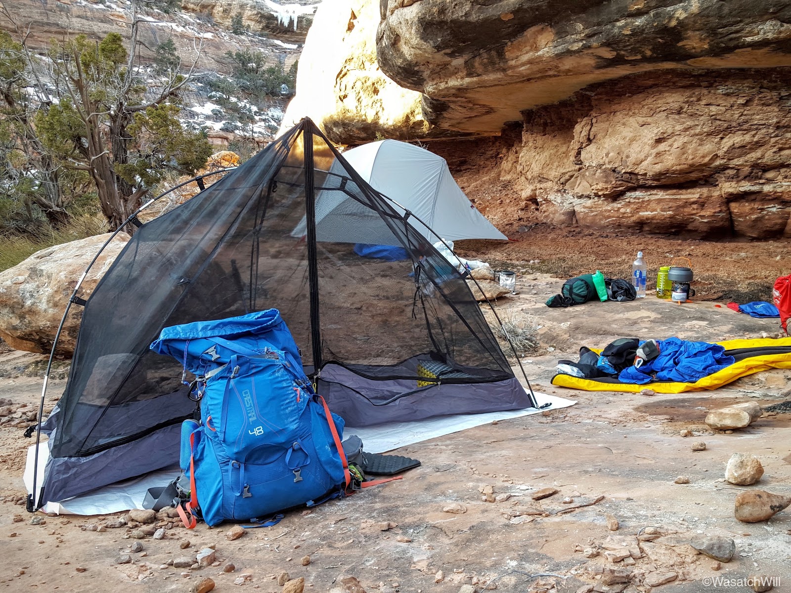
Waking up at our unplanned campsite proved to be as beautiful a setting as just about any I could imagine in the canyon.
Rise & Shine

My tent and the canyon bottom below

Our camp
With the welcome light of the new day, we made our way back down from our camp to scout out around the stubborn pour-off that gave us fits the night before to see if it would be easier to find a suitable way around. Again, we could have swam right across it, but the cold deep water combined with the cold morning air was all too intimidating. Had the sun been higher in the sky...maybe.
The pour-off
We then proceeded back up the bench we had tried to navigate around the night before. Again, we were staring at a path that appeared to head straight across the top of an icy pour-off. Not being able to see around the next bend to see if the bench would ultimately provide a way back down to the bottom of the canyon, we chose to cease further progress and turn back to break our camp and head back up canyon for the Falling Roof ruins near the route we had come into the canyon the night before (further analysis of some satellite imagery revealed that there indeed may be a simple enough way off the bench at the very next bend beyond what we could see). To pursue the Citadel, we'd end up taking the car out to the rim above it later that afternoon and make it easier on ourselves.
The bench leading out to the icy unknown

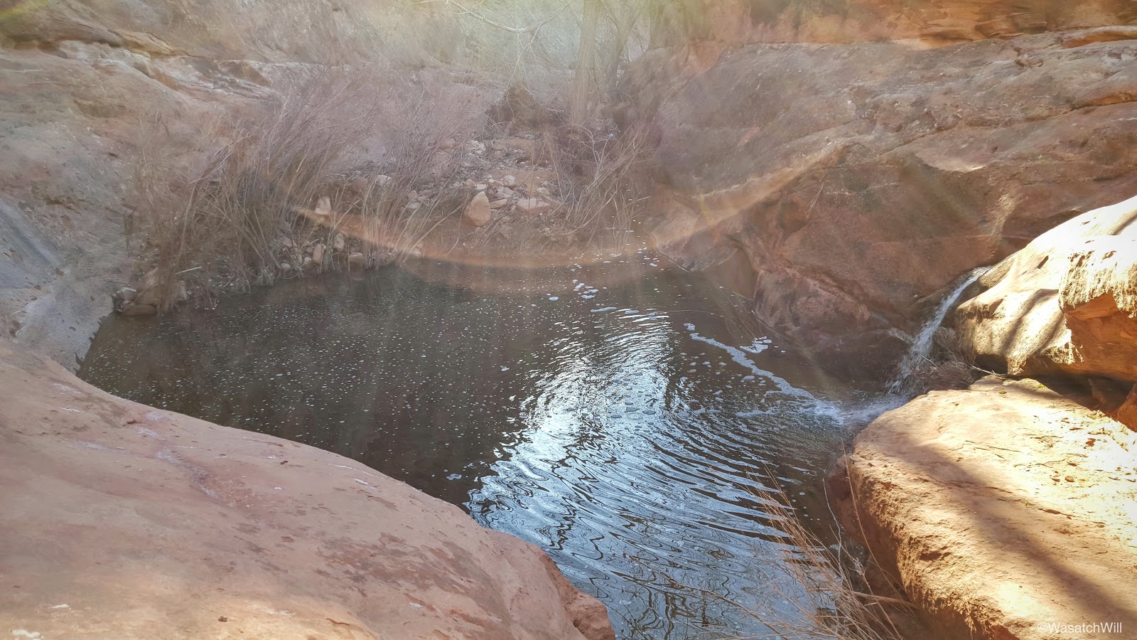
Prior to breaking camp, we paused to investigate another pour-off and pool we had camped right above which lied just about 100 yards upstream from the other pour-off.
Waterfall & pool
With everything all packed up, we made our way back upstream taking in the sights of the canyon. I'm confident many of the waterfalls and the shallower pools we encountered all dry up come summer season. The Mesa had received significantly more snow than it has in many years this past winter so we felt treated to see all the extra beauty created by the seasonal stream fed by all the snowmelt.
A seasonal waterfall
Morning light reflecting off the icy cliffs
Seasonal stream
Blake admiring the icy stream
Muskrat?
Ice wall
Icefall up a tributary
Undercut
Under the undercut
More icefall
Fox?

Just below Falling Roof was an ice ghost guarding the way.
Ice Ghost
After making friends with the ghost, we set our packs down and headed up for a visit to Falling Roof. It gets its name from the roof of the little alcove it sits in having cracked and fragmented with a few chunks of the debris scattered beneath it. It gives off the illusion that the roof is collapsing onto the ancient dwellings. It was also really interesting to see the textured handprints embedded and immortalized into the sides of the structures where the adobe mortar had been compressed and formed to hold the stone bricks.
Falling Roof Ruin

Handprints
More handprints
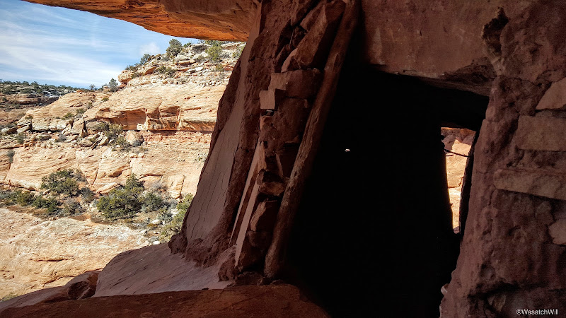
We also explored further on, checking out some additional ruins nearby. I believe they may have been granaries.
The approach

A granary?
An interesting cavity in an interior wall. A secret cache at one time?

A tale of contrasts

Through the window
Through the other side of the window

Inside the second structure
If only the name "Jailhouse Ruin" wasn't already taken

Another angle

Blake checking out the view from the other side

Looking back one last time
Along the way back, we discovered a few other traces of the ancient culture that had once inhabited the canyon.
A little empty cache
An ancient tally?
More tally marks
Once we returned to our packs it was time to finish off our exit from the canyon. There were just a few more pools to navigate around among other obstacles.
A nice little oasis

Crossing the slickrock

We arrived back at the car about mid-day and soon made the drive further eastward and out to the rim further down canyon to make another attempt at the Citadel. The road was in relatively good shape and allowed us to get all the way out to the rim. In other words, the conditions were much better than a month ago.
The road
Road Canyon from the rim
We hiked the path eastward for about another 2 miles and there on the horizon appeared the Citadel.
The Citadel
For comparison sake, here's a shot of the same landmark a month ago:
The Citadel, January 2016
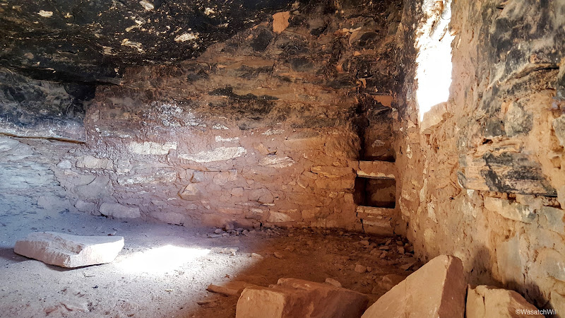
Finding our way down to the actual land bridge or isthmus that leads out to it took a bit of route finding but ultimately, a path of cairns proved reliable. It was an incredible sight and an incredible site.
Blake and the Citadel
Blake and the dwellings

A peek inside the central room. Note the form of a shelf in the corner.

The exterior
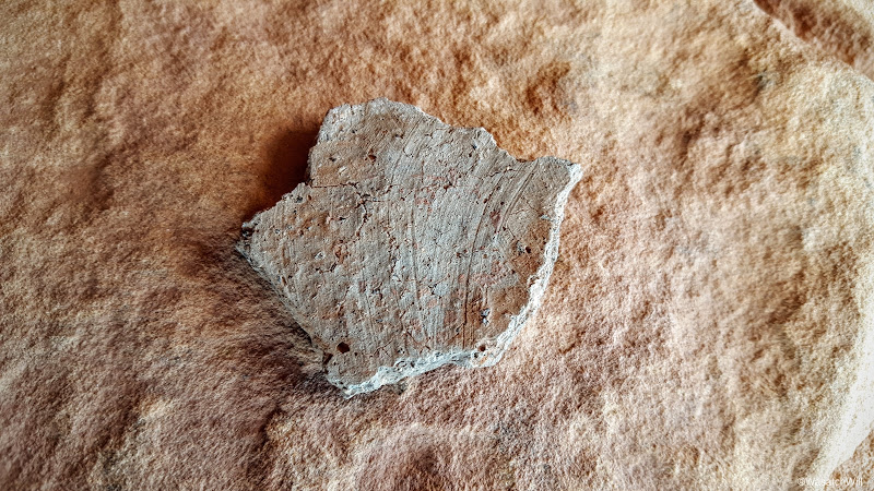
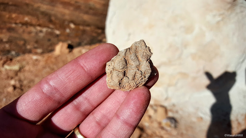
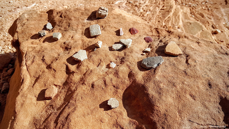
I've visited a few other ruin sites in my past, but this would be the first time I also had my eyes focused on finding some potsherds and sure enough, there was a few pieces scattered around and another little collection others had contributed to for display.
Potsherd
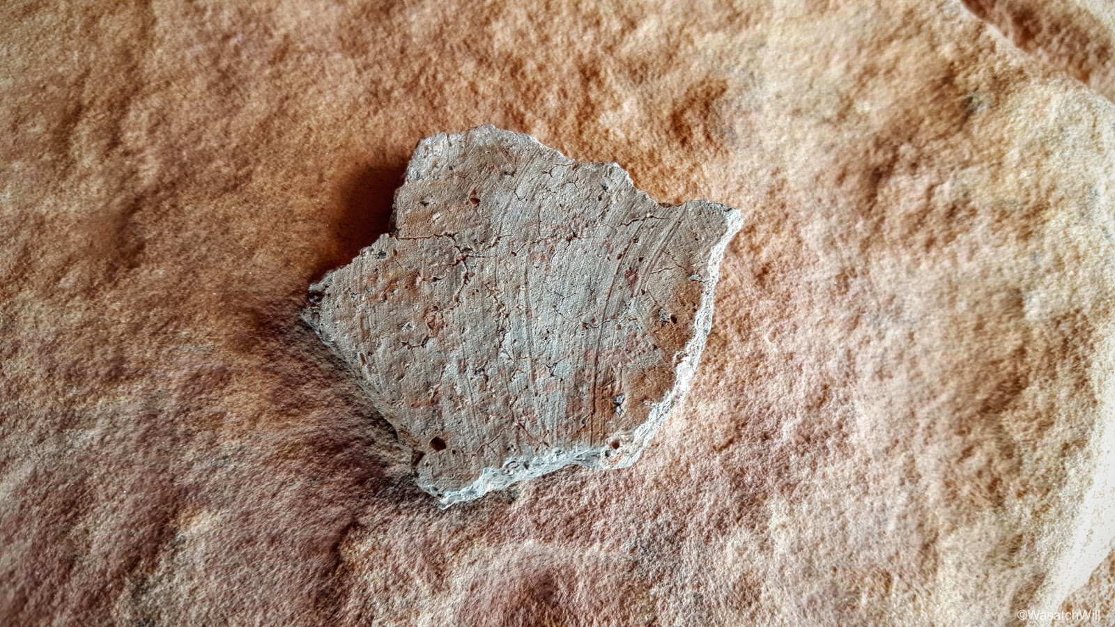
Corrugated sherd
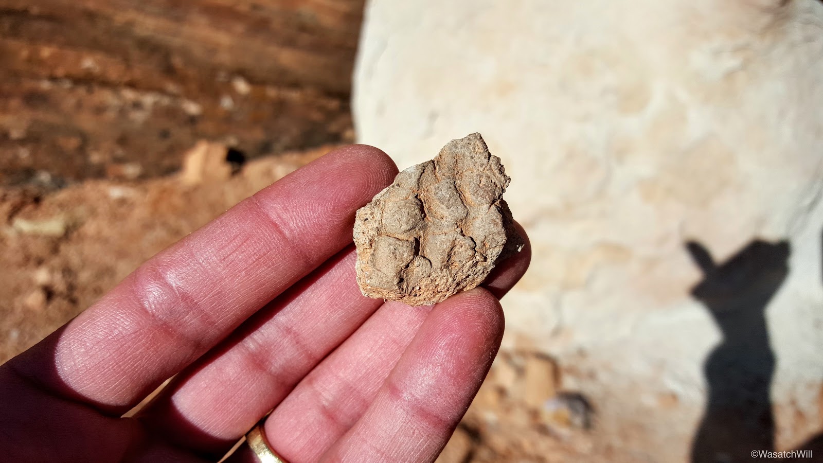
Potsherd collection with some shards of flint

A piece of a pot's rim
It was now getting later in the afternoon and we still had to drive back home so it was time to say goodbye to the Citadel and start making our way home. The views along the rim were every bit as spectacular.
Road Canyon from the rim
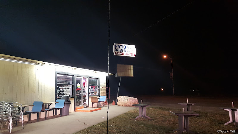
Back at the car we chose to take a different route home. Instead of shooting back through Hanksville, we opted to head on over Comb Ridge and into Blanding for dinner before making the long drive back home. There we would also meet up with a resident friend of Blake who was someone I also knew through social media accounts but had yet to meet in person.
Driving over the Mesa
Sunset over the Mesa
Dinner time at the Patio Drive-In

While once again, this trip didn't go entirely according to plan, we were able to make the most of it and thoroughly enjoyed ourselves.
Like many others that can probably relate, I can only wonder and imagine what all the ancient ruin sites in the area would have looked like, what kind of artifacts would still be present at each of the sites, if it weren't for the Weatherill digs and other aspiring archaeologists that began to forage the area in the late 1800's, not to mention all those that have since followed, who've taken away additional objects, for good or for evil, over the last 130 years. What would it have been like to be the first person to stumble into such sites in over 700 years? Of course, hindsight is always clearer than foresight and so I wonder if I wouldn't have reacted with the same excitement and desire to take and share the discoveries with the outer world when no laws such as the Antiquities Act forbade the compromise of such objects. Still, what a living museum Cedar Mesa and the surrounding area would be if all artifacts were left in place!?
I suppose I'm being spoiled with those thoughts though. I should be grateful enough for what does remain and the glimpses into a past culture that can still be experienced at such sites. I'm very much looking forward to additional visits to the Mesa in the future to see what's left and what remains in other canyons, including what's arguably the granddaddy of them all, Grand Gulch. Even without the ruins, rock art, and other fascinating archeological treasures that remain in the area, the canyons themselves are sculpted into beautiful geologic formations while the high rims offer stunning panoramic views that can rival any other. I hope that the land remains protected and good conservation practices continue to be practiced and promoted so as to preserve what remains of the fragile and treasured archeological resources, the ecosystem, and the surrounding viewsheds.
