
OldBill
Member
- Joined
- Aug 18, 2015
- Messages
- 603
@Jackson's recent post reminded me I need to post my adventures in the Winds this year. Mostly due to laziness, though some valid excuse will be attempted at the end of this post. I may get a few of the photos mixed up as the memory is fading. Total was about 100 miles, 15000' gain/loss over 3 1/2 wks. That seems to get less every year.
I arrived in mid August this, about 10 days earlier than usual. The original plan was to try a week fishing and exploring fairly deep on the East side of the range with a few companions. But, plans had to change a few weeks prior before I left. There's so much to do out there I drew up a few solo routes on my bucket list.
Then I got a message from a fellow BCP'er, @Dreamer , to meet up in Pinedale and see if there was something to do together. Welcome news; I learn a lot from those with more experience. I flew into Salt Lake this year because of the ridiculous prices of car rentals in Jackson and made plans to meet in Pinedale.
As a flatlander, I like to give myself about 3 days to acclimate but there was a good window of weather so Dreamer convinced me to try it with just 2 (1 night in Kemmerer and 1 in Pinedale). There was a route both of us were interested in. Dreamer had done variations of it before. I had it on my list, with a route @Bob had mapped out. It was a loop through the middle of the range, with some great off-trail sections and good fishing.
After our meeting I drove straight to Elkhart to hike Sacred Rim to get a bit of time at 9000'. Walked as far and fast as I could but didn't quite make the Rim before rain started. Got back to town late afternoon and started going from "air travel pack mode" to "backpack ready". Even though this was 6-7 days, my new 70L SWD Wolverine was pretty full. Last year I had (firmly) stuffed nearly the same gear into a 50L Long Haul.
We started out the next morning. I like hitting the trail early on day 1 and the time zone difference was helping with that so I had a few hours of repacking to do before we drove up together. I'd suggested starting from the Scab Creek trailhead. I've used that a number of times, including right after the 2020 wind storm that had destroyed Elkhart and Big Sandy THs. Weather was perfect; no hint of the smoke from prior weeks,
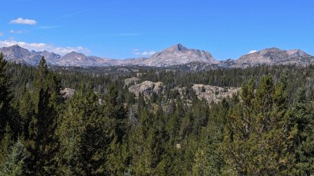
We made the nearly 10m 2500' route to Dream Lake in good time, though breaking tree line took longer than I had remembered. I think the same trails get longer every year. My left knee was pretty sore, but that was nothing unexpected. We had dinner and discussed plans for the next day. Unfortunately, I'd neglected to tell Dreamer that, while I leave early on day 1, I'm usually lazy getting started on once the trail. I generally leave camp about 9-9:30, but said I'd do my best to get moving.
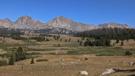
I wasted some time looking for a former camp spot I'd used in 2020, then set up closer to lake, keeping our camps separate as there was no one else around. Great skies at sunset.
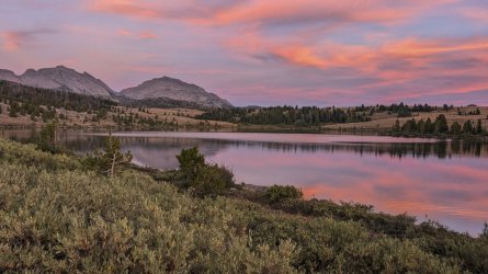
Waking at 5am, I did manage to get ready earlier than usual. Having warm weather helped; with Raynaud's I generally wait for the sun to warm things up a bit. But since this was mid Aug vs the usual early Sept, that worked in my favor as well. With great skies, we headed up towards the Divide.
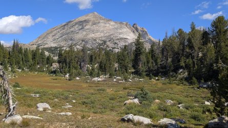
We only saw a few other folks on the way, which was a pleasant surprise. Since Dreamer knew the route so well, I could relax and just tag along. We reached our camp by Hall's L well before sundown. A five star location - both scenic and comfortable.
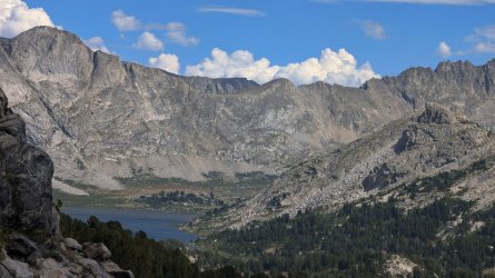
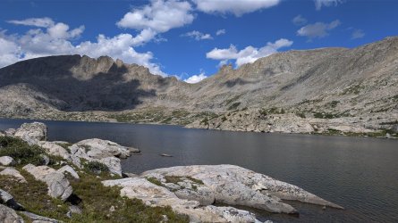
Day 3 started with more brilliant weather, outstanding scenery and easy off trail routes towards Europe Canyon. It was a lower mileage day and there was plenty of time for even me to get time to fish before dinner. I don't recall seeing anyone else that day.
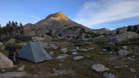
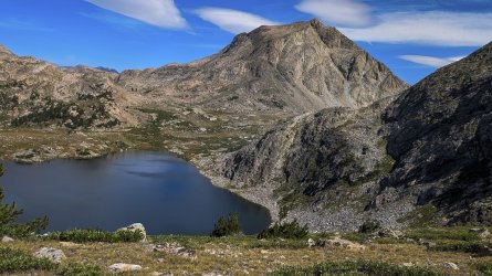
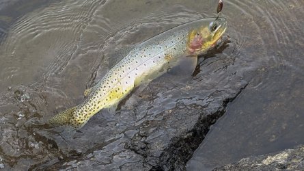
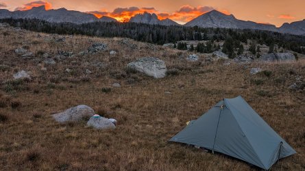
The following day was even lower mileage and mostly off trail. We did run into 2 women that I believe had crossed the Divide that day. Another picture perfect day, but as we neared our destination at Long L storm clouds were starting to build. There were not a lot of options to stake out the tents, but we didn't see anything else suitable. The Tarptent Dipole is a bit fussy about geometry if it is to be taut. I tried moving a few rocks around to get space on a small section of level ground, but the ants living under a few of those did not like my plan, so I gave them back their home.
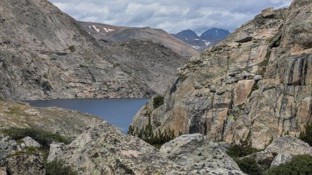
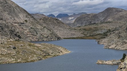
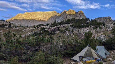
It wasn't too long before we got hit with a good bit of pea-sized hail and then rain. Dreamer's tent was in the path of some runoff, so he had an interesting time in his floor-less mid. Like most summer storms, it was short so we enjoyed another night of stars, though I was too lazy to use the small tripod I had packed all this way for the specific purpose of photographing the night sky.
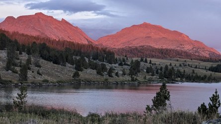
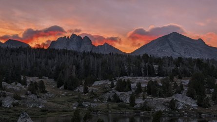
Day 5 was the start of the return. I was headed out the next day while Dreamer was continuing on for his usual extended journeys. We dropped about 800' in less than 2 miles along the creek, picking up the various animal trails which soon led to use trails. Turning south on the Fremont we did a long day back to Dream L (ca. 10m, +1K/-2K'). Another great sunrise and sunset. Maybe that's why it's called "Dream" Lake.
We parted ways in the morning with Dreamer continuing on a much longer route. I had plans to explore some trails out of Lander trailheads. The forecast called for a period of unsettled weather, so I was happy to take a break and prepare for the next route. It was an uneventful ~ 10m exit, seeing only 2 pairs of backpackers heading in.
My goal was to explore the Roaring Fk route to the Divide with the intent on seeing Tayo and Coon. The weather was still unstable but improving for the next few days, though the wind was predicted to be "breezy" with "high gusts". Good enough to start so I left the Worthen Trailhead on the Stough Ck Lakes trail after a light morning shower. The trail was easy, with a few crossings requiring wading. I use midweight boots so it was shoes off. Slowed the pace but it felt good - at least until the feet started going numb from the cold.
The view at the pass was worth the climb. I made sure to don a windshirt while sheltered before making the final push as the "gusty" forecast was indeed on target. I got to the intersection with the trail to Stough Creek Lakes by late afternoon.
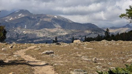
Hunted around for a camp spot nearby to save 3 miles but found nothing worthwhile so I crossed the bridge and headed to the lakes. Ran into a couple going the opposite way in about 0.5 mile in. They said they were on their way back to their camp on the upper lake. I told them there weren't any lakes behind me! Evidently they'd walked right past it. I continued on and set up between the first and second lakes. Plenty of good, but well used campsites. Just finished dinner clean up chores when the rain started so couldn't have asked for better timing. Very scenic location with long plateaus common in the southern part of the range.
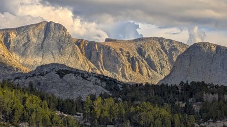
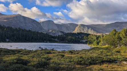
Day 2 started off cloudy and I reached the Stough Ck Cutoff trail by midmorning. There were a few more crossings needing boots-off and I passed the couple I'd run into the day before. Learned they were doing a loop over the Ice Lakes trail to Deep Ck Lakes. I'd camped near the lower lake twice - scenic location. The trail was a fairly rocky long descent to Tayo Park where I reached the trail to Tayo. Tayo L trail was a pleasant change from the prior rocky, mostly downhill trails. A mile or 2 in I spotted a large lama outfit near a lake. Took a quick photo but thunder was around so I moved along.
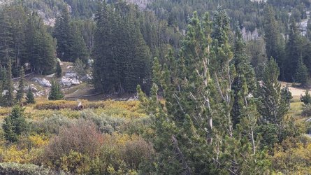
I reached the intersection of trails to Tayo and Coon late afternoon. Had planned to basecamp at Mountain Sheep L but got lazy and set up closer to the intersection. I just completed getting water for camp when I saw a group of about 8 going down the Coon L trail. No one saw me so I left them alone. Probably the lama group.
Day 3 was a fishing hike to Tayo L so I took my time in the morning. Left camp and was refilling at the creek when the lama group showed up again. All women, none of which said anything, but the guide and I had a good chat. They were headed for Coon. I had looked at my maps the prior night and decided to change my out-and-back plan; I didn't look forward to returning up Stough Ck trail. I knew the Deep Ck trail was easy footing, so asked about the Ice Lakes trail. "A lot of Up" but great area, good fishing was the feedback. So, I left for Tayo with that thought to consider.
The trek up to Tayo L was easy, the most difficult was deciding whether to cross in the water or over the log across the stream. I chose the the water as the safer bet.
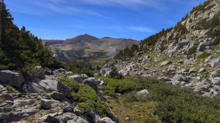
The weather had cleared up but it was seriously *windy* (forget "breezy') and about 50F at the lake. I immediately knew fishing was out for me, despite having a spinning outfit. So I stayed high, enjoyed the scenery and had what passes for a lunch for me (trail mix and a tortilla with PB). The wind was tough even there and my eyes were starting to water so I retreated back. I'll definitely return.
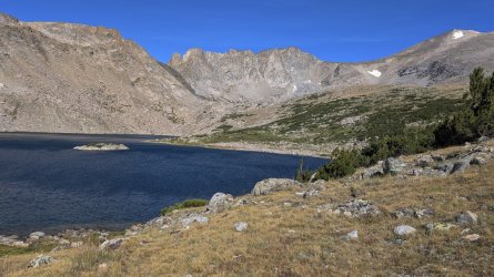
On the way down I made the decision to break camp and explore the Ice Lakes Trail, maybe spend an extra day at Deep Ck lakes. I didn't hit the Ice Lakes trail intersection until after noon, but knew I still had plenty of day light.
I underestimated the effort.
Or, overestimated my abilities. The printed Caltopo maps I had showed about 2.5 miles from the junction, then about 5 miles to the Deep Lake trail. I estimated about 1500' gain (1680' is the actual gain I got from Caltopo at home) and neglected to add in the ~2.5m, 660' gain to Tayo and back. But while the climb was tiring, it was totally enjoyable. I saw no one that day.
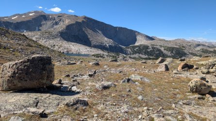
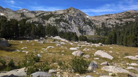
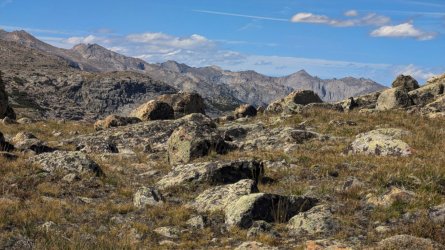
One section was a bit confusing and cost me 15 min to figure out. The trail disappeared into some tall willows around some muck. I missed that the first attempt as the footprints led another direction. Apparently, I wasn't the only one to make the mistake. Overall outstanding scenery, with the trail otherwise easy to follow. But, I was slow and the sun was getting low as I neared the Deep Ck Lakes.
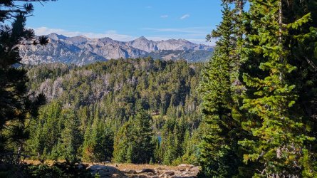
My left knee was complaining more the usual so I decided I needed to bag the extra night. As I still had energy and wasn't sure what the next day would bring, I kept going towards the exit. It was getting dark before I found an acceptable camp spot. It ended up being about a 12 m, 2500' day. There was a fine stream flowing into the main creek nearby, but I slipped getting water and came down hard on my right hand. Could tell my wrist did not like that. Put my hand in the water until numb, then needed to get ready for bed, so took a Celebrex and called it a night.
Waking well before first light, I packed up, had coffee and a package of Pop-Tarts for breakfast and broke camp. Had to stuff gear using my left arm as the right wrist was swollen. At least it didn't look as bad as @scatman's after his slip, and wasn't too painful so I figured just a sprain. I hit the trail about 6:30, a new record for me. I saw just one person all day as I neared the trailhead - a woman bow-hunter. After about 10 miles, I was happy to not be in worse shape. Headed back to town for a real bed and multiple ice packs.
Returned to Pinedale and spent a few days fishing the Upper Green while I rested the knee and wrist. Always fun, but caught nothing noteworthy. With plenty of time left, I planned a 5-6 day loop to Grave L. Big Sandy was busy as usual, but at least I didn't have to walk an extra quarter mile to the trailhead. Weather was spectacular. Leaving most of the crowd going to the Cirque behind, the first day was enjoyable, even though I've seen it many times. But, by the end of the day the knee was acting up.
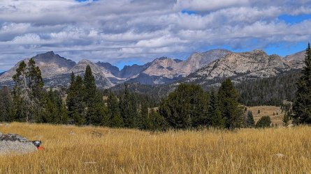
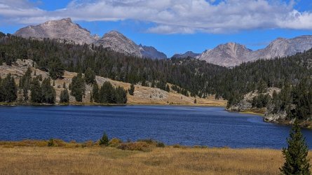
I set up near Washakie Ck after 10 miles and looked at the 11.6K' Washakie pass I planned to cross. I knew it was easy having done a different loop over it. Decided to make the call in the morning.
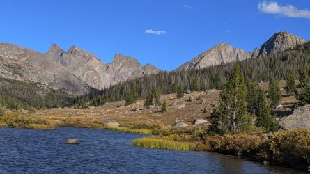
Annoyed and disappointed with my knee the next morning, I abandoned my plan. Thought it'd be foolish to cross the divide knowing the joint was likely to get worse. My MRI was already scheduled just after my return home anyway. Took a leisurely walk back to the car and knew I made the right decision in the final 2 miles.
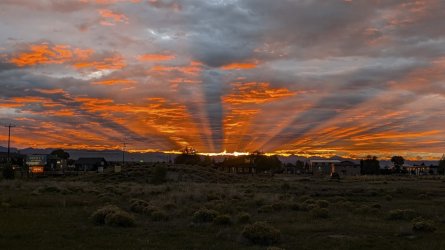
Saw a great sunrise in town. Fitting end shot. I left for Salt Lake City, spent 2 days at the Family Search Center doing some research, then headed home.
A few weeks later the MRI results showed a number of issues that the X-rays did not. By X-ray the physician was shocked at how well my knees were for my age and activity level. After reviewing the MRI his most memorable comment was "If this was my knee, I'd get it replaced." The referral to top knee replacement surgeon led to a first appointment available in January! Nope. Not waiting on that. Minimum 6-8 month to full recovery.
Saw a surgeon in another practice who'd worked on the same knee 14 years ago. His opinion: "your X-rays resemble that of a 20 year old. You do not need a replacement." Some tib-fib instability and meniscal tears. Surgery set mid-December and I expect to to return to the Winds next year. Already made my reservations.
I arrived in mid August this, about 10 days earlier than usual. The original plan was to try a week fishing and exploring fairly deep on the East side of the range with a few companions. But, plans had to change a few weeks prior before I left. There's so much to do out there I drew up a few solo routes on my bucket list.
Then I got a message from a fellow BCP'er, @Dreamer , to meet up in Pinedale and see if there was something to do together. Welcome news; I learn a lot from those with more experience. I flew into Salt Lake this year because of the ridiculous prices of car rentals in Jackson and made plans to meet in Pinedale.
As a flatlander, I like to give myself about 3 days to acclimate but there was a good window of weather so Dreamer convinced me to try it with just 2 (1 night in Kemmerer and 1 in Pinedale). There was a route both of us were interested in. Dreamer had done variations of it before. I had it on my list, with a route @Bob had mapped out. It was a loop through the middle of the range, with some great off-trail sections and good fishing.
After our meeting I drove straight to Elkhart to hike Sacred Rim to get a bit of time at 9000'. Walked as far and fast as I could but didn't quite make the Rim before rain started. Got back to town late afternoon and started going from "air travel pack mode" to "backpack ready". Even though this was 6-7 days, my new 70L SWD Wolverine was pretty full. Last year I had (firmly) stuffed nearly the same gear into a 50L Long Haul.
We started out the next morning. I like hitting the trail early on day 1 and the time zone difference was helping with that so I had a few hours of repacking to do before we drove up together. I'd suggested starting from the Scab Creek trailhead. I've used that a number of times, including right after the 2020 wind storm that had destroyed Elkhart and Big Sandy THs. Weather was perfect; no hint of the smoke from prior weeks,
We made the nearly 10m 2500' route to Dream Lake in good time, though breaking tree line took longer than I had remembered. I think the same trails get longer every year. My left knee was pretty sore, but that was nothing unexpected. We had dinner and discussed plans for the next day. Unfortunately, I'd neglected to tell Dreamer that, while I leave early on day 1, I'm usually lazy getting started on once the trail. I generally leave camp about 9-9:30, but said I'd do my best to get moving.
I wasted some time looking for a former camp spot I'd used in 2020, then set up closer to lake, keeping our camps separate as there was no one else around. Great skies at sunset.
Waking at 5am, I did manage to get ready earlier than usual. Having warm weather helped; with Raynaud's I generally wait for the sun to warm things up a bit. But since this was mid Aug vs the usual early Sept, that worked in my favor as well. With great skies, we headed up towards the Divide.
We only saw a few other folks on the way, which was a pleasant surprise. Since Dreamer knew the route so well, I could relax and just tag along. We reached our camp by Hall's L well before sundown. A five star location - both scenic and comfortable.
Day 3 started with more brilliant weather, outstanding scenery and easy off trail routes towards Europe Canyon. It was a lower mileage day and there was plenty of time for even me to get time to fish before dinner. I don't recall seeing anyone else that day.
The following day was even lower mileage and mostly off trail. We did run into 2 women that I believe had crossed the Divide that day. Another picture perfect day, but as we neared our destination at Long L storm clouds were starting to build. There were not a lot of options to stake out the tents, but we didn't see anything else suitable. The Tarptent Dipole is a bit fussy about geometry if it is to be taut. I tried moving a few rocks around to get space on a small section of level ground, but the ants living under a few of those did not like my plan, so I gave them back their home.
It wasn't too long before we got hit with a good bit of pea-sized hail and then rain. Dreamer's tent was in the path of some runoff, so he had an interesting time in his floor-less mid. Like most summer storms, it was short so we enjoyed another night of stars, though I was too lazy to use the small tripod I had packed all this way for the specific purpose of photographing the night sky.
Day 5 was the start of the return. I was headed out the next day while Dreamer was continuing on for his usual extended journeys. We dropped about 800' in less than 2 miles along the creek, picking up the various animal trails which soon led to use trails. Turning south on the Fremont we did a long day back to Dream L (ca. 10m, +1K/-2K'). Another great sunrise and sunset. Maybe that's why it's called "Dream" Lake.
We parted ways in the morning with Dreamer continuing on a much longer route. I had plans to explore some trails out of Lander trailheads. The forecast called for a period of unsettled weather, so I was happy to take a break and prepare for the next route. It was an uneventful ~ 10m exit, seeing only 2 pairs of backpackers heading in.
My goal was to explore the Roaring Fk route to the Divide with the intent on seeing Tayo and Coon. The weather was still unstable but improving for the next few days, though the wind was predicted to be "breezy" with "high gusts". Good enough to start so I left the Worthen Trailhead on the Stough Ck Lakes trail after a light morning shower. The trail was easy, with a few crossings requiring wading. I use midweight boots so it was shoes off. Slowed the pace but it felt good - at least until the feet started going numb from the cold.
The view at the pass was worth the climb. I made sure to don a windshirt while sheltered before making the final push as the "gusty" forecast was indeed on target. I got to the intersection with the trail to Stough Creek Lakes by late afternoon.
Hunted around for a camp spot nearby to save 3 miles but found nothing worthwhile so I crossed the bridge and headed to the lakes. Ran into a couple going the opposite way in about 0.5 mile in. They said they were on their way back to their camp on the upper lake. I told them there weren't any lakes behind me! Evidently they'd walked right past it. I continued on and set up between the first and second lakes. Plenty of good, but well used campsites. Just finished dinner clean up chores when the rain started so couldn't have asked for better timing. Very scenic location with long plateaus common in the southern part of the range.
Day 2 started off cloudy and I reached the Stough Ck Cutoff trail by midmorning. There were a few more crossings needing boots-off and I passed the couple I'd run into the day before. Learned they were doing a loop over the Ice Lakes trail to Deep Ck Lakes. I'd camped near the lower lake twice - scenic location. The trail was a fairly rocky long descent to Tayo Park where I reached the trail to Tayo. Tayo L trail was a pleasant change from the prior rocky, mostly downhill trails. A mile or 2 in I spotted a large lama outfit near a lake. Took a quick photo but thunder was around so I moved along.
I reached the intersection of trails to Tayo and Coon late afternoon. Had planned to basecamp at Mountain Sheep L but got lazy and set up closer to the intersection. I just completed getting water for camp when I saw a group of about 8 going down the Coon L trail. No one saw me so I left them alone. Probably the lama group.
Day 3 was a fishing hike to Tayo L so I took my time in the morning. Left camp and was refilling at the creek when the lama group showed up again. All women, none of which said anything, but the guide and I had a good chat. They were headed for Coon. I had looked at my maps the prior night and decided to change my out-and-back plan; I didn't look forward to returning up Stough Ck trail. I knew the Deep Ck trail was easy footing, so asked about the Ice Lakes trail. "A lot of Up" but great area, good fishing was the feedback. So, I left for Tayo with that thought to consider.
The trek up to Tayo L was easy, the most difficult was deciding whether to cross in the water or over the log across the stream. I chose the the water as the safer bet.
The weather had cleared up but it was seriously *windy* (forget "breezy') and about 50F at the lake. I immediately knew fishing was out for me, despite having a spinning outfit. So I stayed high, enjoyed the scenery and had what passes for a lunch for me (trail mix and a tortilla with PB). The wind was tough even there and my eyes were starting to water so I retreated back. I'll definitely return.
On the way down I made the decision to break camp and explore the Ice Lakes Trail, maybe spend an extra day at Deep Ck lakes. I didn't hit the Ice Lakes trail intersection until after noon, but knew I still had plenty of day light.
I underestimated the effort.
Or, overestimated my abilities. The printed Caltopo maps I had showed about 2.5 miles from the junction, then about 5 miles to the Deep Lake trail. I estimated about 1500' gain (1680' is the actual gain I got from Caltopo at home) and neglected to add in the ~2.5m, 660' gain to Tayo and back. But while the climb was tiring, it was totally enjoyable. I saw no one that day.
One section was a bit confusing and cost me 15 min to figure out. The trail disappeared into some tall willows around some muck. I missed that the first attempt as the footprints led another direction. Apparently, I wasn't the only one to make the mistake. Overall outstanding scenery, with the trail otherwise easy to follow. But, I was slow and the sun was getting low as I neared the Deep Ck Lakes.
My left knee was complaining more the usual so I decided I needed to bag the extra night. As I still had energy and wasn't sure what the next day would bring, I kept going towards the exit. It was getting dark before I found an acceptable camp spot. It ended up being about a 12 m, 2500' day. There was a fine stream flowing into the main creek nearby, but I slipped getting water and came down hard on my right hand. Could tell my wrist did not like that. Put my hand in the water until numb, then needed to get ready for bed, so took a Celebrex and called it a night.
Waking well before first light, I packed up, had coffee and a package of Pop-Tarts for breakfast and broke camp. Had to stuff gear using my left arm as the right wrist was swollen. At least it didn't look as bad as @scatman's after his slip, and wasn't too painful so I figured just a sprain. I hit the trail about 6:30, a new record for me. I saw just one person all day as I neared the trailhead - a woman bow-hunter. After about 10 miles, I was happy to not be in worse shape. Headed back to town for a real bed and multiple ice packs.
Returned to Pinedale and spent a few days fishing the Upper Green while I rested the knee and wrist. Always fun, but caught nothing noteworthy. With plenty of time left, I planned a 5-6 day loop to Grave L. Big Sandy was busy as usual, but at least I didn't have to walk an extra quarter mile to the trailhead. Weather was spectacular. Leaving most of the crowd going to the Cirque behind, the first day was enjoyable, even though I've seen it many times. But, by the end of the day the knee was acting up.
I set up near Washakie Ck after 10 miles and looked at the 11.6K' Washakie pass I planned to cross. I knew it was easy having done a different loop over it. Decided to make the call in the morning.
Annoyed and disappointed with my knee the next morning, I abandoned my plan. Thought it'd be foolish to cross the divide knowing the joint was likely to get worse. My MRI was already scheduled just after my return home anyway. Took a leisurely walk back to the car and knew I made the right decision in the final 2 miles.
Saw a great sunrise in town. Fitting end shot. I left for Salt Lake City, spent 2 days at the Family Search Center doing some research, then headed home.
A few weeks later the MRI results showed a number of issues that the X-rays did not. By X-ray the physician was shocked at how well my knees were for my age and activity level. After reviewing the MRI his most memorable comment was "If this was my knee, I'd get it replaced." The referral to top knee replacement surgeon led to a first appointment available in January! Nope. Not waiting on that. Minimum 6-8 month to full recovery.
Saw a surgeon in another practice who'd worked on the same knee 14 years ago. His opinion: "your X-rays resemble that of a 20 year old. You do not need a replacement." Some tib-fib instability and meniscal tears. Surgery set mid-December and I expect to to return to the Winds next year. Already made my reservations.
Last edited: