b.stark
Forever Wandering
- Joined
- Apr 8, 2015
- Messages
- 1,295
Spent about a week in August riding my bike in Colorado this year. Got in some good rides, but I'm just putting up a report for this one as it was the most interesting one by a good margin.
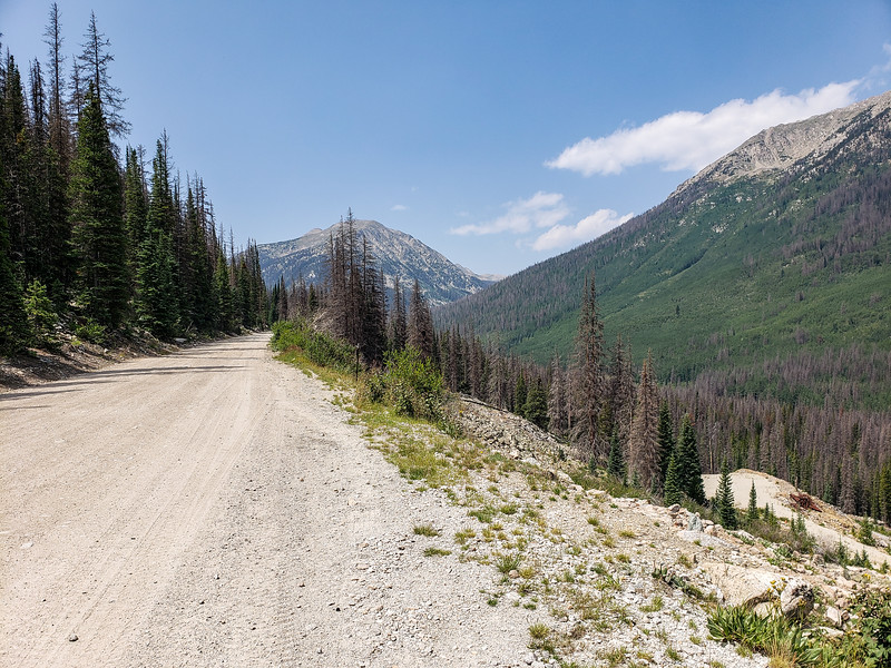
This is a loop that starts and ends in St. Elmo, CO and it's more known as a mountain bike route (sometimes referred to as the Alpine Tunnel Loop). Total distance is just shy of 18 miles, but the elevation tops out at over 12,000 feet on a section of the Continental Divide Trail.
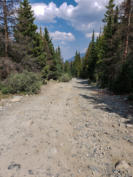
The climb from St. Elmo follows an old railroad grade, and continues up this grade until it reaches the Northern end of the collapsed Alpine Tunnel.
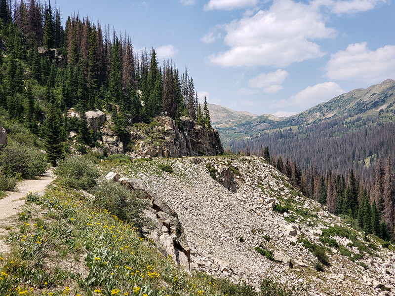
There are scads of old mining ruins along this section of road.
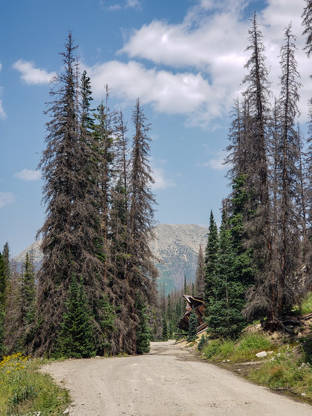
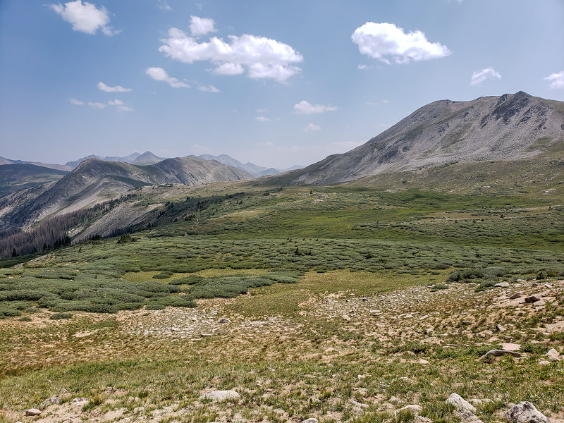
The road levels off a bit when it reaches a high basin. A very cool spot up here.
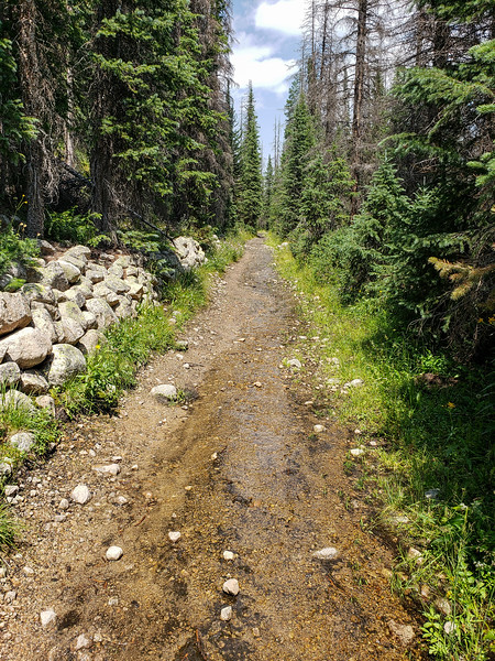
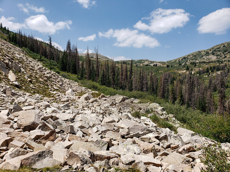
After this basin, the railroad grade is no longer "improved" into a good road, and is mostly just the old railroad bed. Some of the old railroad ties are still visible on sections. The railroad has been abandoned for over 100 years. Lower portions of this section were basically a creek, which was a bit annoying to ride through.
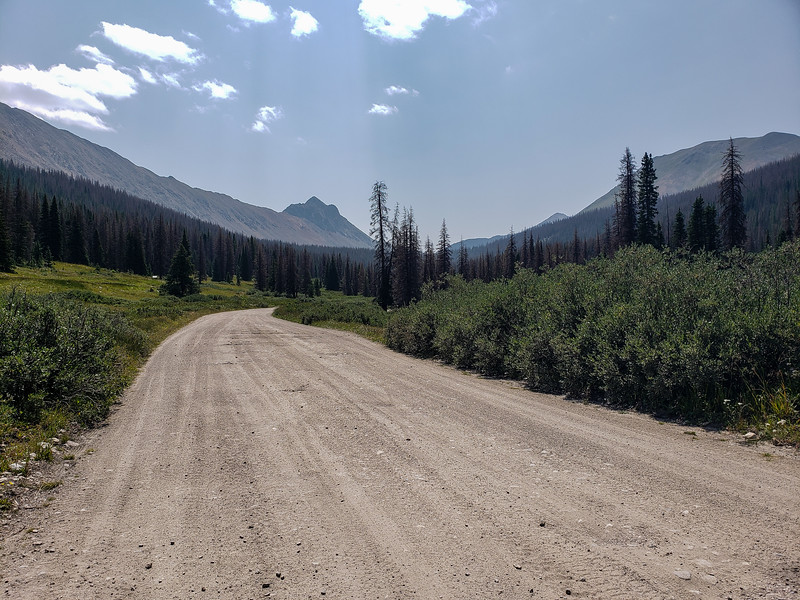
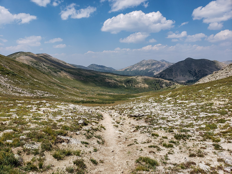
After some time views open up to the alpine section, where I would ride on the Continental Divide Trail.
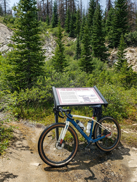
My steed at one end of the Alpine Tunnel. At this point I made a mistake. After talking to some hikers, it sounded as though there was a cutoff trail that would save me a bit of climbing. We may have been talking past each other, but I understood them to be saying that the trail existed. Also, the map I was using ended up being incorrect as to where the actual trail was, so I ended up heading off toward nothing.
The map showed the main trail as maybe 1/4 mile away, so although the small use trail that I started off following disappeared, I pushed on thinking I would hit the real trail eventually. After going well past where the map showed the trail, I had to admit that the map was wrong and I had to take a different approach. After looking at the map, I figured that the real trail must follow on a bench about 300 feet above my location. Ended up climbing up along a small very steep stream. Just as I topped out on top of the bench... there was the trail. The mistake cost me about an hour's worth of bushwhacking and carrying a bike at over 11,000ft elevation. Even though I was in pretty fair shape, that still took a lot out of me. I sat by the stream to take a rest, eat some food, and refill water. I had to decide at this point whether to keep going or turn back down the way I had come. After some careful consideration, I decided to keep going.
Finding the trail was a very uplifting moment.
Did a lot of walking with my bike for the next mile or two. Still needed to recover from the bushwhack, and parts of the trail were a bit rocky for my fully rigid drop bar bike. It takes time for me to recover at this altitude, and the bushwhack took quite a bit out of me. I rode where I could do so easily, but otherwise walked and drank plenty of water. Slowly started feeling better, which was both expected and encouraging.
Topped over the first big "hill" at over 12K and stopped to take a good look at the trail ahead. At this point I knew that although it would hurt a bit, I was going to make the loop just fine physically. I was able to ride much more at this point and started making better progress.
Being up in the high alpine country is just glorious, to me. I stopped for another break at the top of the second "hill." At the top of this one there is a perfect flat rock by the trail where surely many people have sat to rest. I checked it for function and found it excellent. The trail is essentially all downhill from here, and I was feeling back to pretty much full strength.

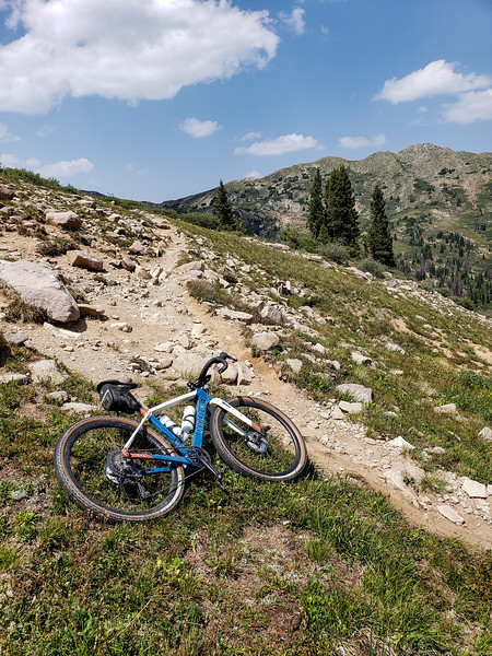
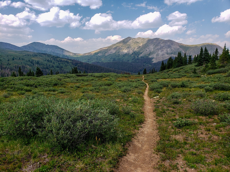
Now the trail gets fun. Clearly it has been worked on by mountain bikers here. Once the trail hits treeline, it's as blissful of a smooth singletrack descent as you could ever want, and it descends about 1000 feet. In the distance in this photo is the road to Tin Cup Pass. The singletrack descends to this road, which I would then take back to St. Elmo.
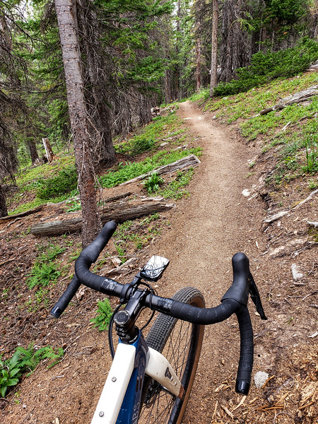
Yes this is good stuff here.
I had figured on a nice road descent back to St Elmo, but the road had other ideas. It was just a path of rocks, often softball sized or larger. Extremely rough and slow going for a relentless 5 miles. Kind of a sucker punch at the end. Eventually the road smooths out just before entering the town site of St. Elmo. I did not stop in town, although it looked a bit neat. Lots of tourists were wandering around and at this point I was thinking a lot about a cold drink from the cooler in my pickup.
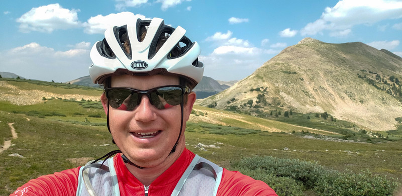
And here's a picture of myself, double chin and spandex and all, from up on the high alpine section. All in all this was a very fun ride. Would skip the off trail bushwhack on the next time, though, and follow the real trail.
All said and done this took just under 5 hours. Could have been quite a bit less without the detour! Weather was as perfect as it could be. It was an excellent finale for my time in Colorado.
This is a loop that starts and ends in St. Elmo, CO and it's more known as a mountain bike route (sometimes referred to as the Alpine Tunnel Loop). Total distance is just shy of 18 miles, but the elevation tops out at over 12,000 feet on a section of the Continental Divide Trail.
The climb from St. Elmo follows an old railroad grade, and continues up this grade until it reaches the Northern end of the collapsed Alpine Tunnel.
There are scads of old mining ruins along this section of road.
The road levels off a bit when it reaches a high basin. A very cool spot up here.
After this basin, the railroad grade is no longer "improved" into a good road, and is mostly just the old railroad bed. Some of the old railroad ties are still visible on sections. The railroad has been abandoned for over 100 years. Lower portions of this section were basically a creek, which was a bit annoying to ride through.
After some time views open up to the alpine section, where I would ride on the Continental Divide Trail.
My steed at one end of the Alpine Tunnel. At this point I made a mistake. After talking to some hikers, it sounded as though there was a cutoff trail that would save me a bit of climbing. We may have been talking past each other, but I understood them to be saying that the trail existed. Also, the map I was using ended up being incorrect as to where the actual trail was, so I ended up heading off toward nothing.
The map showed the main trail as maybe 1/4 mile away, so although the small use trail that I started off following disappeared, I pushed on thinking I would hit the real trail eventually. After going well past where the map showed the trail, I had to admit that the map was wrong and I had to take a different approach. After looking at the map, I figured that the real trail must follow on a bench about 300 feet above my location. Ended up climbing up along a small very steep stream. Just as I topped out on top of the bench... there was the trail. The mistake cost me about an hour's worth of bushwhacking and carrying a bike at over 11,000ft elevation. Even though I was in pretty fair shape, that still took a lot out of me. I sat by the stream to take a rest, eat some food, and refill water. I had to decide at this point whether to keep going or turn back down the way I had come. After some careful consideration, I decided to keep going.
Finding the trail was a very uplifting moment.
Did a lot of walking with my bike for the next mile or two. Still needed to recover from the bushwhack, and parts of the trail were a bit rocky for my fully rigid drop bar bike. It takes time for me to recover at this altitude, and the bushwhack took quite a bit out of me. I rode where I could do so easily, but otherwise walked and drank plenty of water. Slowly started feeling better, which was both expected and encouraging.
Topped over the first big "hill" at over 12K and stopped to take a good look at the trail ahead. At this point I knew that although it would hurt a bit, I was going to make the loop just fine physically. I was able to ride much more at this point and started making better progress.
Being up in the high alpine country is just glorious, to me. I stopped for another break at the top of the second "hill." At the top of this one there is a perfect flat rock by the trail where surely many people have sat to rest. I checked it for function and found it excellent. The trail is essentially all downhill from here, and I was feeling back to pretty much full strength.
Now the trail gets fun. Clearly it has been worked on by mountain bikers here. Once the trail hits treeline, it's as blissful of a smooth singletrack descent as you could ever want, and it descends about 1000 feet. In the distance in this photo is the road to Tin Cup Pass. The singletrack descends to this road, which I would then take back to St. Elmo.
Yes this is good stuff here.
I had figured on a nice road descent back to St Elmo, but the road had other ideas. It was just a path of rocks, often softball sized or larger. Extremely rough and slow going for a relentless 5 miles. Kind of a sucker punch at the end. Eventually the road smooths out just before entering the town site of St. Elmo. I did not stop in town, although it looked a bit neat. Lots of tourists were wandering around and at this point I was thinking a lot about a cold drink from the cooler in my pickup.
And here's a picture of myself, double chin and spandex and all, from up on the high alpine section. All in all this was a very fun ride. Would skip the off trail bushwhack on the next time, though, and follow the real trail.
All said and done this took just under 5 hours. Could have been quite a bit less without the detour! Weather was as perfect as it could be. It was an excellent finale for my time in Colorado.