Ben
Member
- Joined
- Sep 12, 2014
- Messages
- 1,873
In july, partly on a friends particular interest, partly because it was some thing i'd wanted to do at some point, we hiked the Seven Devils loop. It's not long, almost 30 miles around the entire tiny range. The elevation isn't too high, around 7000' for most of it. Trail head access at Windy Saddle is a little less than four hours from Boise.
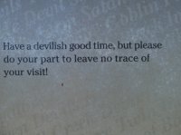
A well intentioned sign at the parking lot.
We got there early after noon and started hiking. I got to bring my dog Isaac on this trip, and that was good. We started hiking south, along the east side of the mountains, which was good, saving the better scenery for the end of the trip. There wasn't a lot to see for this stretch, just broad views of generic Idaho hills. The kind of thing you see all the time just from the highway. The peaks of the 7 Devils were blocked from view by lower ridges. it was probably 7.5 miles to Dog Creek. There is an open camp site on the creek just off the loop trail that looks like it's seen some pretty good use. There is a trail up to Dog Lake on old topo maps, but if i had to guess, i'd say it's probably been a decade or two, at least, since the trail has seen any maintenance. We were able to follow trail at the start, and later again at the end, but in the middle i am unconvinced that there remains any trail to speak of. There are a few cairns in the first and last thirds of the way from the trail and the lake, but i couldn't see any between. There is a lot of dead fall on the way up, and A LOT of dead fall in the middle of the way. Having a good map got us there though.

Dog Lake was beautiful. And larger than it looks in these pictures. It branches just a little bit. The ridge above it was great, topped by the Twin Imps. We had it all to our selves, too. I imagine it sees relatively little use with the terrain getting to it. It's probably a little less than a mile and a half from the main trail. Much less crowded than the Sawtooths would be on a week end like this.
An other view of Dog.
The next day we made our way back down from the lake. We were able to find better trail closer to the lake, but eventually it disappeared again. Crossed though some thick brush and dead fall for a little ways getting back to where the trail picked back up. This is still near the lake.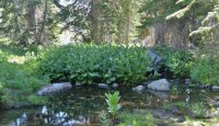
From Dog Creek the trail turns around the south side of the mountains, gaining and losing a little elevation. Here's a view out to the south over the West Fork Rapid River drainage.
Flowers along the trail up to the pass near Horse Heaven.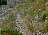
Looking back south near the pass. It got rocky and beautiful. From here on i found the scenery pretty enjoyable. The south and east sides of the loop weren't particularly interesting.

Looking back south again after having crossed the pass. The long ridge is called Freezeout, but here it looked warm and inviting. On the top of the left end of it there is a small building that i think is Horse Heaven.
From here, along the west side, there were great views out over Hells Canyon. You could even make out the Wallowa Mountains over in Oregon a little to the south.
And there were flowers on the higher side above the trail.
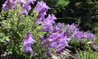
And Hells Canyon again. Also, i should mention that it's a ways between water sources from Dog Creek to Bald Lake, or the creek below it. A longer than usual seven miles. Isaac struggled with it with the heat some, even though i didn't think it was really all that hot.
Butterflies where the trail crosses Baldy Lake's out flow. It's probably about a mile to the lake from the loop trail. We passed by the turn for Baldy, and went on to Echo Lake for a shorter hike out the next day. Baldy Lake is bigger, but i was happier with our decision. There are a few other lakes around Echo that i hiked to to see.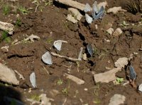
Coming up on Echo Lake. Probably almost 14 miles for the day. I think it's Mount Belial in the center, back ground.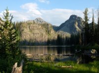
Again, no one else at the lake. What's more, we didn't see any one else on the trail that whole day. The day before there were only a couple parties coming out the way we were coming in.
After setting up camp at Echo Lake, and eating some, i hiked farther up the trail to see what was out there. He Devil Lake was more scenic, but i think that Echo had better camping. Not that He Devil was bad at all. There's the little island in He Devil.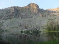
There's good trail up from Echo to He Devil Lake. and then a good use trail from He Devil over to Triangle Lake. Here's an unnamed kidney shaped tarn between the two.
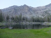
Triangle Lake in the disappearing light. You can see the water's dropping.
From Triangle Lake i cross countried down the hill to Quad Lake, where the water was also low. I also passed these flowers on the way down there.
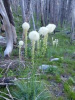
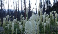
Here's Quad Lake, long and rectangular.
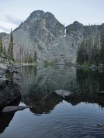
From Quad it was a short level cross country back to Echo Lake, and then a poor use trail back to my camp. Nice area, and quiet. The next day we got up to hike out.
Lilies for days.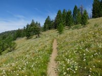
Here is where we turned back east toward the trail head. The trail descends in to this drainage, West Fork Sheep Creek, and back up the other side. Some of the best views of the peaks along here. Prior to this we hadn't seen much of them except at the lakes. There is a nice area to camp by some cascades along the creek down in the center. It was some thing that always stuck with me in my memory from when i hiked here once as a teenager.
Devils Tooth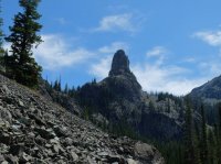
From the other side of West Fork Sheep Creek. Chris, Devils Tooth, and He Devil. We actually saw a good number of people between here and the trail junction for Sheep Lake. That really is where the best scenery is any way. It's where i'd gone here before, and what held it in my mind as one of the best places i'd been backpacking.
Zoomed in, you can see Dry Diggins Lookout on the hill. We'd also walked out there the one time i'd come before. Good views of Hells Canyon from there. You can look down into the gorge more than we were able from the loop trail.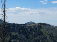
Looking back one more time over the drainage before turning into the East Fork Sheep Creek, the last stretch back to the car at Windy Saddle.

And here, from about that same point, you can just make out the Lookout at Heavens Gate on top of the hill. The road heading out to it is obvious. From Heavens Gate, if the sky is clear, you can see Washington, Oregon, Idaho, and Montana. Haze from fires often prevent this.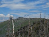
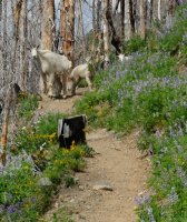
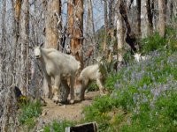
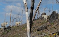
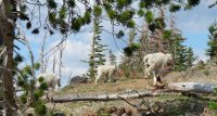
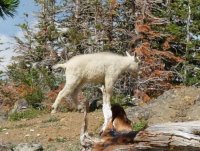
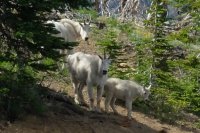
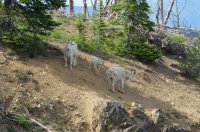
And then we met these guys. The whole family. Some other hikers had warned us they passed them on the trail, but i didn't expect to get as lucky. I thought they would have moved on.

Some pretty flowers along the last stretch. Decent elevation change at the end, but not terrible. I've done worse, much worse.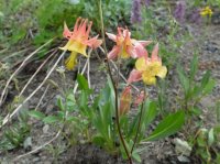
It was good to get back to the car.
Back at the parking lot. The road goes from the trail head parking to the Seven Devils campground just a little farther on. I really like this picture a lot, because you can see the sign for the trail we started on on the left, and the sign for the way we came out on the right. It feels very complete.

Drove home, stopped in McCall for burgers in milk shakes. Good trip, especially seeing no one else for so much of the time. Decent amount of dead fall along the east and south sides of the loop. I recommend Dog Lake, in spite of the difficulty getting to it, may be even more because of.
A well intentioned sign at the parking lot.

We got there early after noon and started hiking. I got to bring my dog Isaac on this trip, and that was good. We started hiking south, along the east side of the mountains, which was good, saving the better scenery for the end of the trip. There wasn't a lot to see for this stretch, just broad views of generic Idaho hills. The kind of thing you see all the time just from the highway. The peaks of the 7 Devils were blocked from view by lower ridges. it was probably 7.5 miles to Dog Creek. There is an open camp site on the creek just off the loop trail that looks like it's seen some pretty good use. There is a trail up to Dog Lake on old topo maps, but if i had to guess, i'd say it's probably been a decade or two, at least, since the trail has seen any maintenance. We were able to follow trail at the start, and later again at the end, but in the middle i am unconvinced that there remains any trail to speak of. There are a few cairns in the first and last thirds of the way from the trail and the lake, but i couldn't see any between. There is a lot of dead fall on the way up, and A LOT of dead fall in the middle of the way. Having a good map got us there though.

Dog Lake was beautiful. And larger than it looks in these pictures. It branches just a little bit. The ridge above it was great, topped by the Twin Imps. We had it all to our selves, too. I imagine it sees relatively little use with the terrain getting to it. It's probably a little less than a mile and a half from the main trail. Much less crowded than the Sawtooths would be on a week end like this.
An other view of Dog.

The next day we made our way back down from the lake. We were able to find better trail closer to the lake, but eventually it disappeared again. Crossed though some thick brush and dead fall for a little ways getting back to where the trail picked back up. This is still near the lake.

From Dog Creek the trail turns around the south side of the mountains, gaining and losing a little elevation. Here's a view out to the south over the West Fork Rapid River drainage.

Flowers along the trail up to the pass near Horse Heaven.

Looking back south near the pass. It got rocky and beautiful. From here on i found the scenery pretty enjoyable. The south and east sides of the loop weren't particularly interesting.

Looking back south again after having crossed the pass. The long ridge is called Freezeout, but here it looked warm and inviting. On the top of the left end of it there is a small building that i think is Horse Heaven.

From here, along the west side, there were great views out over Hells Canyon. You could even make out the Wallowa Mountains over in Oregon a little to the south.

And there were flowers on the higher side above the trail.

And Hells Canyon again. Also, i should mention that it's a ways between water sources from Dog Creek to Bald Lake, or the creek below it. A longer than usual seven miles. Isaac struggled with it with the heat some, even though i didn't think it was really all that hot.

Butterflies where the trail crosses Baldy Lake's out flow. It's probably about a mile to the lake from the loop trail. We passed by the turn for Baldy, and went on to Echo Lake for a shorter hike out the next day. Baldy Lake is bigger, but i was happier with our decision. There are a few other lakes around Echo that i hiked to to see.

Coming up on Echo Lake. Probably almost 14 miles for the day. I think it's Mount Belial in the center, back ground.

Again, no one else at the lake. What's more, we didn't see any one else on the trail that whole day. The day before there were only a couple parties coming out the way we were coming in.
After setting up camp at Echo Lake, and eating some, i hiked farther up the trail to see what was out there. He Devil Lake was more scenic, but i think that Echo had better camping. Not that He Devil was bad at all. There's the little island in He Devil.

There's good trail up from Echo to He Devil Lake. and then a good use trail from He Devil over to Triangle Lake. Here's an unnamed kidney shaped tarn between the two.

Triangle Lake in the disappearing light. You can see the water's dropping.

From Triangle Lake i cross countried down the hill to Quad Lake, where the water was also low. I also passed these flowers on the way down there.


Here's Quad Lake, long and rectangular.

From Quad it was a short level cross country back to Echo Lake, and then a poor use trail back to my camp. Nice area, and quiet. The next day we got up to hike out.
Lilies for days.

Here is where we turned back east toward the trail head. The trail descends in to this drainage, West Fork Sheep Creek, and back up the other side. Some of the best views of the peaks along here. Prior to this we hadn't seen much of them except at the lakes. There is a nice area to camp by some cascades along the creek down in the center. It was some thing that always stuck with me in my memory from when i hiked here once as a teenager.

Devils Tooth

From the other side of West Fork Sheep Creek. Chris, Devils Tooth, and He Devil. We actually saw a good number of people between here and the trail junction for Sheep Lake. That really is where the best scenery is any way. It's where i'd gone here before, and what held it in my mind as one of the best places i'd been backpacking.

Zoomed in, you can see Dry Diggins Lookout on the hill. We'd also walked out there the one time i'd come before. Good views of Hells Canyon from there. You can look down into the gorge more than we were able from the loop trail.

Looking back one more time over the drainage before turning into the East Fork Sheep Creek, the last stretch back to the car at Windy Saddle.

And here, from about that same point, you can just make out the Lookout at Heavens Gate on top of the hill. The road heading out to it is obvious. From Heavens Gate, if the sky is clear, you can see Washington, Oregon, Idaho, and Montana. Haze from fires often prevent this.

And then we met these guys. The whole family. Some other hikers had warned us they passed them on the trail, but i didn't expect to get as lucky. I thought they would have moved on.


Some pretty flowers along the last stretch. Decent elevation change at the end, but not terrible. I've done worse, much worse.

It was good to get back to the car.
Back at the parking lot. The road goes from the trail head parking to the Seven Devils campground just a little farther on. I really like this picture a lot, because you can see the sign for the trail we started on on the left, and the sign for the way we came out on the right. It feels very complete.

Drove home, stopped in McCall for burgers in milk shakes. Good trip, especially seeing no one else for so much of the time. Decent amount of dead fall along the east and south sides of the loop. I recommend Dog Lake, in spite of the difficulty getting to it, may be even more because of.
Last edited:
