Udink
Still right here.
- Joined
- Jan 17, 2012
- Messages
- 1,692
This isn't my usual kind of trip report--kinda a lot of people around--but despite that it was a great hike.
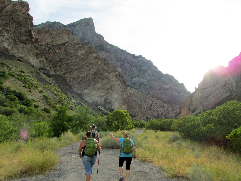
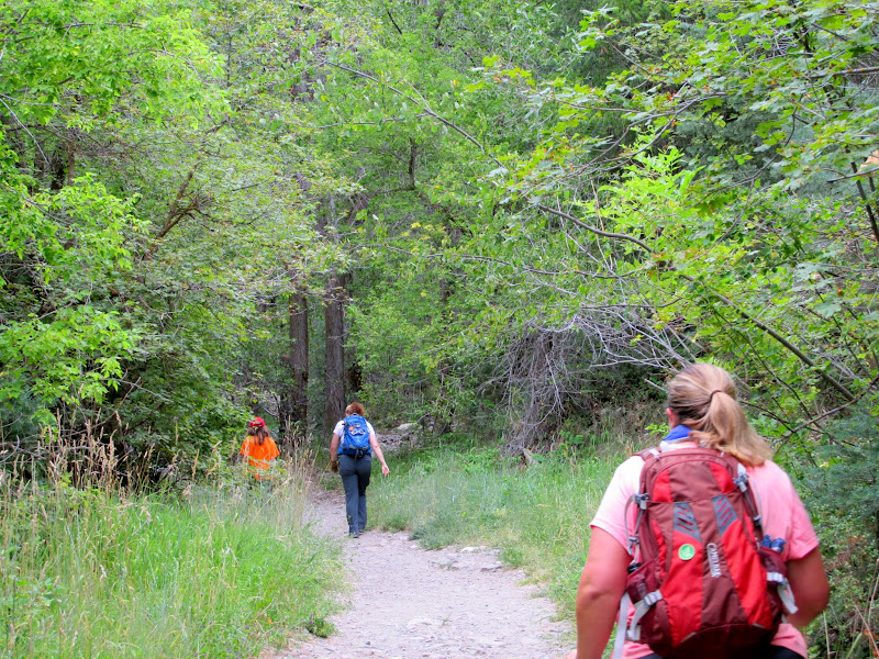
There's a group of geocachers who meet one Sunday a month to hike, usually somewhere around the Salt Lake Valley, and for years I've wanted to join up with them. This past weekend I was free and their hike was close enough to home--only a 1.5-hour drive--for me to make it. Chris Rock, who usually attends my semi-annual geocaching events in the San Rafael Swell, planned this hike in Rock Canyon near Provo. I woke up at 6:00AM and hit the road by about 6:30 in order to make it to the trailhead by 8:00. People slowly gathered until 8:30 and then we hit the trail. I only knew four out of the 20 others who showed up, though I'd at least heard of most of them. For the first mile and a half we hiked up an easy trail and gained about 1,000 feet of elevation while stopping occasionally to find geocaches.
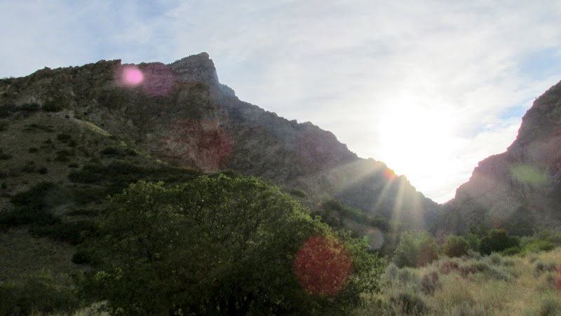
Squaw Peak and the sun rising over Rock Canyon
Beginning our hike
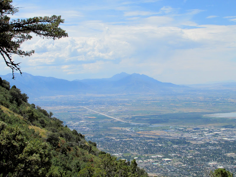
Last view of Provo for a while before it disappeared behind the trees
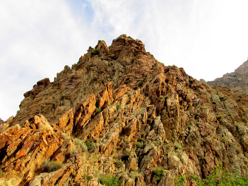
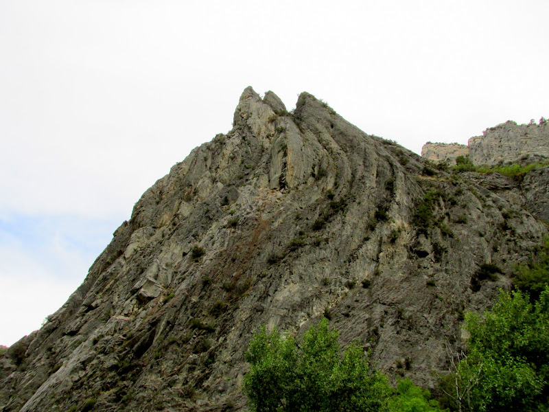
Tortured rock layers
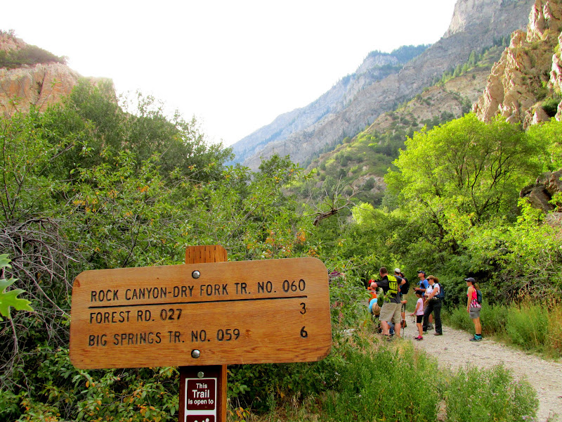
Trail sign near the first geocache we stopped at
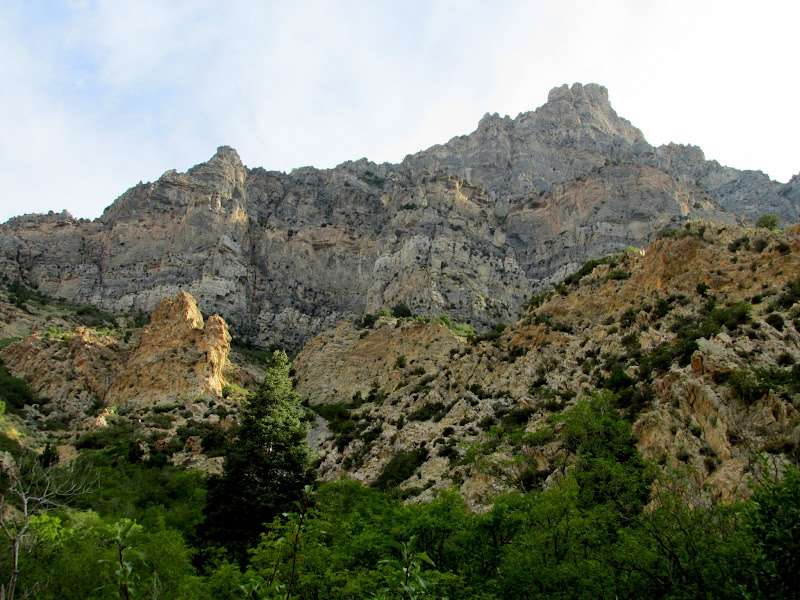
Squaw Peak and the north wall of Rock Canyon
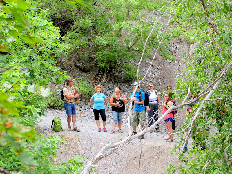
Part of the group waiting while a few of us found a geocache
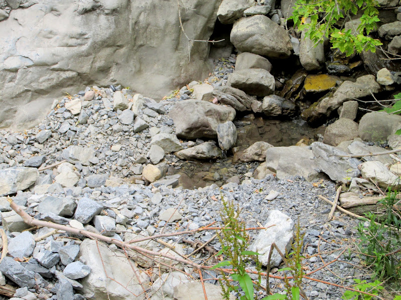
The lowest trace of water in Rock Canyon before it disappeared below the gravel
More twisted layers
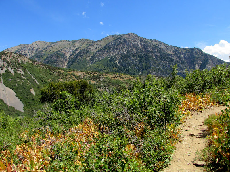
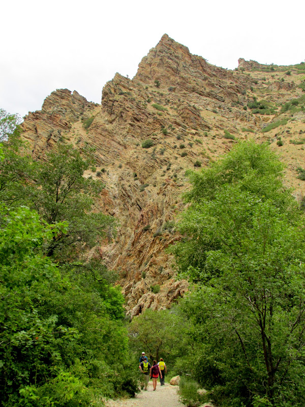
Hiking farther up the trail
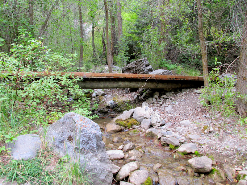
Bridge over the creek in Rock Canyon
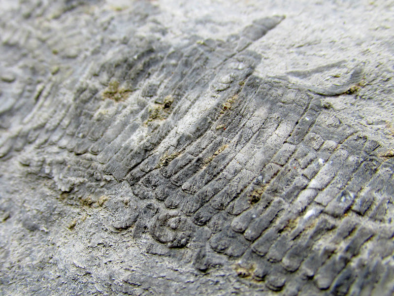
Fossil
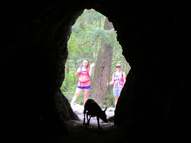
Inside a mine tunnel
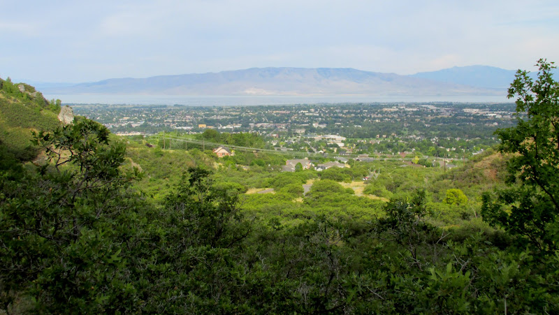
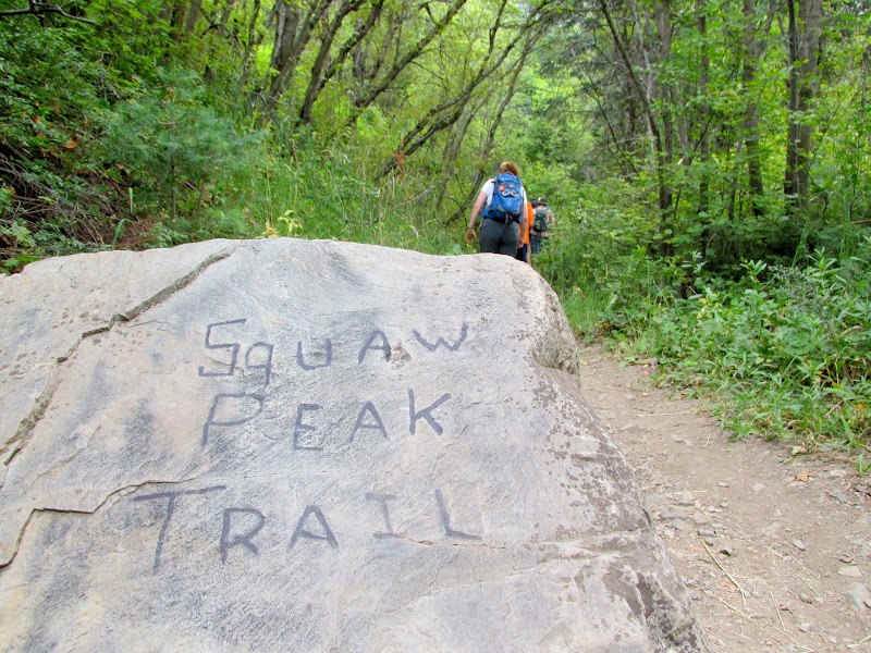
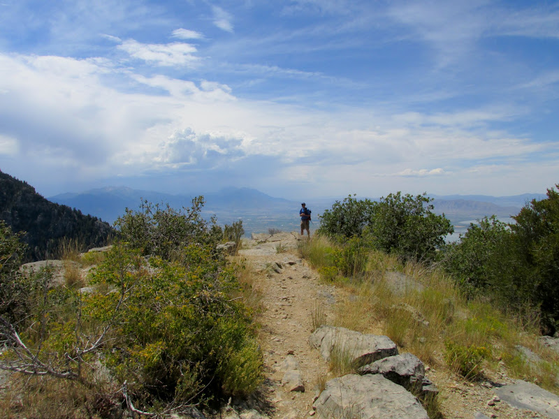
At a fork in the trail we split into two groups--one that stayed in Rock Canyon for more geocaching, and another that I followed that took the trail up to Squaw Peak. The Squaw Peak trail climbed an additional 1,800 feet over 2.25 miles, and my legs got so tired and sore that I almost turned back. Since I was slow and bringing up the rear, however, I didn't want to skip out without anyone in the group knowing what happened to me, so I plugged along and it was wholly worth it! After climbing up the First Left Fork of Rock Canyon we hit a series of flat meadows and then a nice overlook of Utah Valley. From there it was a relatively short and easier climb to the summit of Squaw Peak.
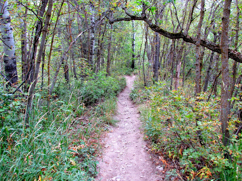
Beginning of the Squaw Peak trail
Squaw Peak trail
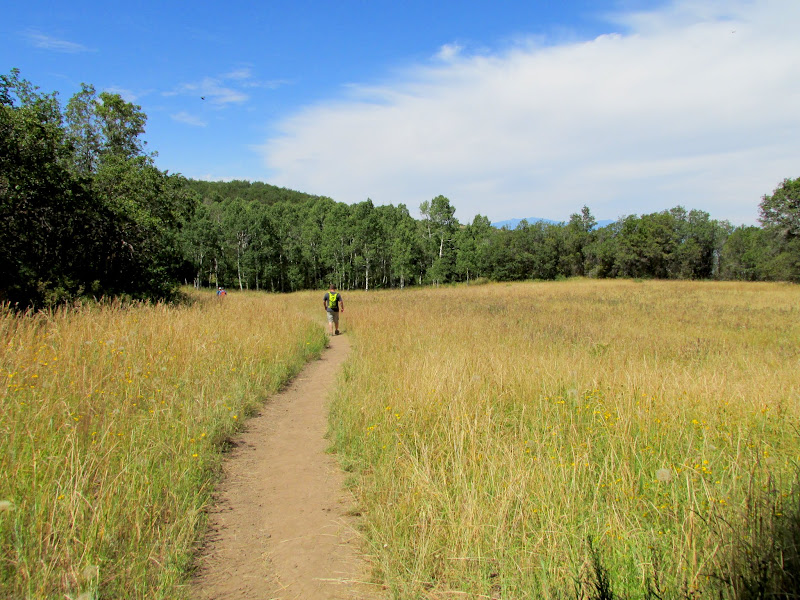
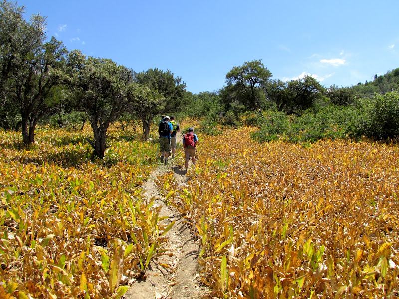
Meadow along the Squaw Peak trail
View south to Dry Mountain and Mt. Nebo
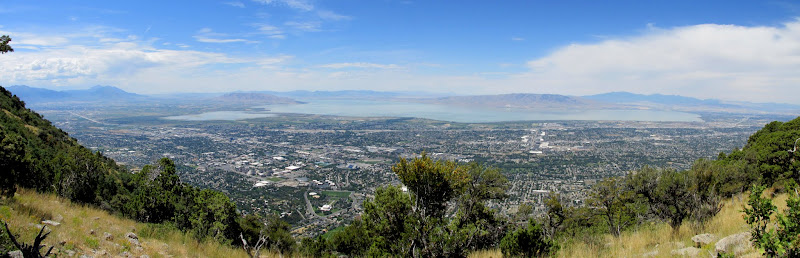
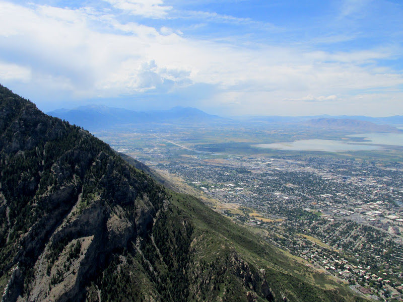
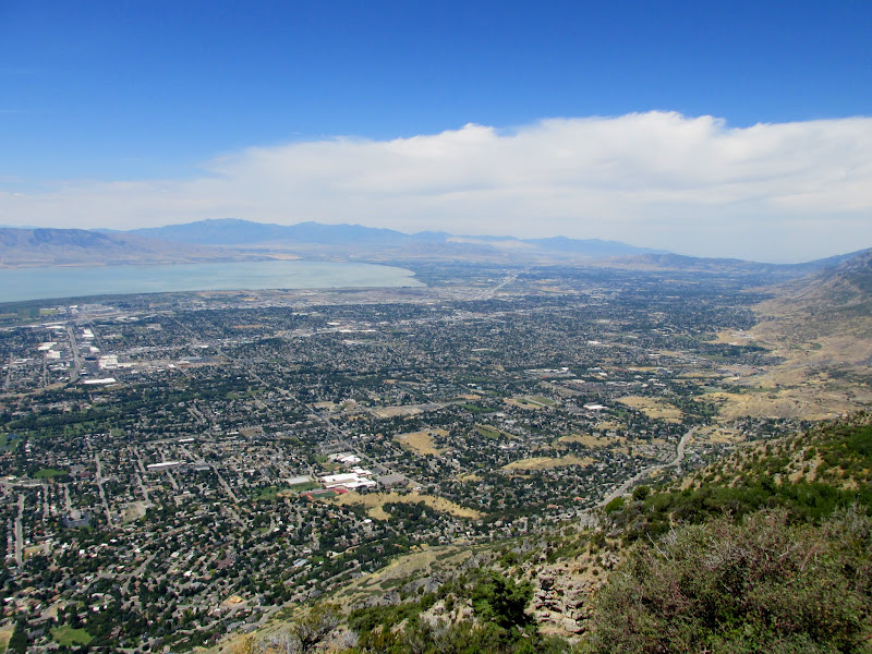
Utah Valley panorama
Squaw Peak trail
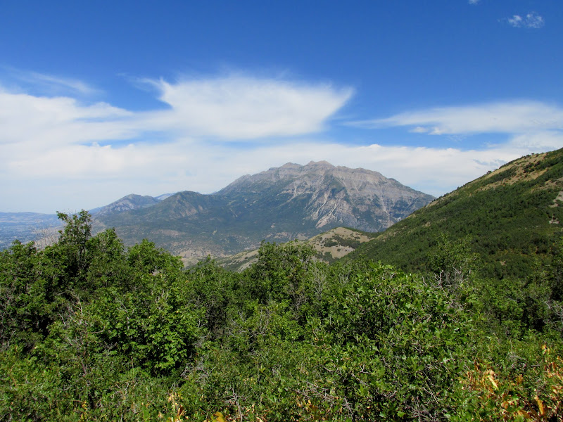
Mt. Timpanogos
Cascade Mountain
End of the trail at the summit of Squaw Peak
We rested at the summit and enjoyed the views, then descended to the west a short distance to find one final geocache. After climbing back east toward the summit it was all downhill back to the trailhead. With some weather moving in we had cooler temps, thunder, and even a little sprinkle during the descent. The summit group met up with the other group at a trailhead pavilion and drank some cold soda provided by Chris before I split and headed home. I picked up some Papa Murphy's pizza--a favorite of my family's that we rarely enjoy since the local franchise shut down--and got delayed by an hour during the drive home due to some flash-flooding that deposited debris on US-6 near the Red Narrows in Spanish Fork Canyon. I got home and savored a single cold beer and a couple slices of pizza while my leg muscles recovered from the day's hiking.
View south over Rock Canyon
View northwest
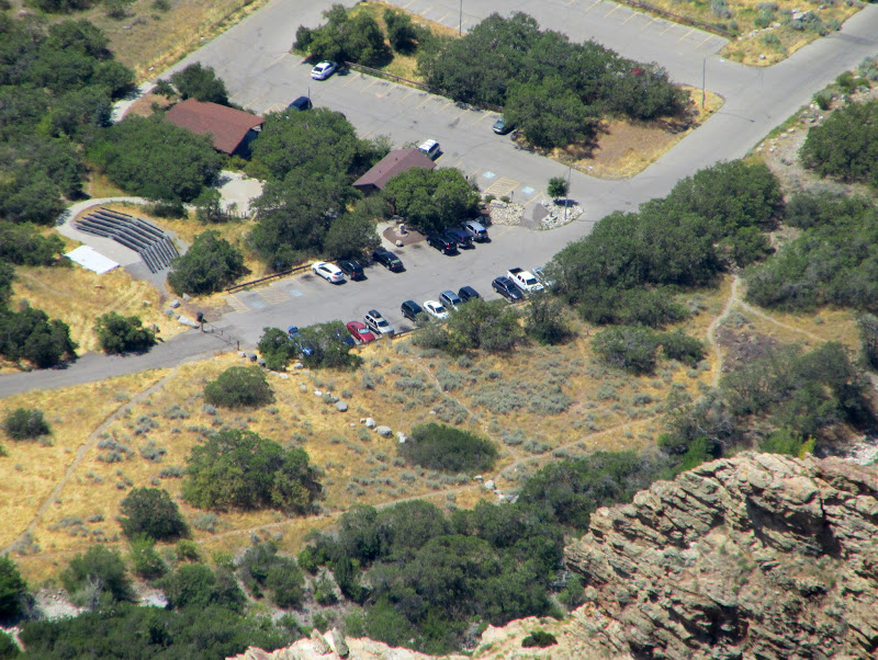
Parking lot at the trailhead (see my Jeep?)
Summit panorama showing Cascade Mountain, Freedom Peak, Provo Peak, and Y Mountain

Descending Rock Canyon
Hike stats
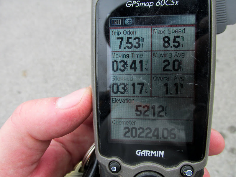
Photo Gallery: Rock Canyon to Squaw Peak
GPS Track and Photo Waypoints:
[ Google Earth KMZ ] [ Gmap4 Satellite ] [ Gmap4 Topo ]
Featured image for home page:

There's a group of geocachers who meet one Sunday a month to hike, usually somewhere around the Salt Lake Valley, and for years I've wanted to join up with them. This past weekend I was free and their hike was close enough to home--only a 1.5-hour drive--for me to make it. Chris Rock, who usually attends my semi-annual geocaching events in the San Rafael Swell, planned this hike in Rock Canyon near Provo. I woke up at 6:00AM and hit the road by about 6:30 in order to make it to the trailhead by 8:00. People slowly gathered until 8:30 and then we hit the trail. I only knew four out of the 20 others who showed up, though I'd at least heard of most of them. For the first mile and a half we hiked up an easy trail and gained about 1,000 feet of elevation while stopping occasionally to find geocaches.
Squaw Peak and the sun rising over Rock Canyon
Beginning our hike
Last view of Provo for a while before it disappeared behind the trees
Tortured rock layers
Trail sign near the first geocache we stopped at
Squaw Peak and the north wall of Rock Canyon
Part of the group waiting while a few of us found a geocache
The lowest trace of water in Rock Canyon before it disappeared below the gravel
More twisted layers
Hiking farther up the trail
Bridge over the creek in Rock Canyon
Fossil
Inside a mine tunnel
At a fork in the trail we split into two groups--one that stayed in Rock Canyon for more geocaching, and another that I followed that took the trail up to Squaw Peak. The Squaw Peak trail climbed an additional 1,800 feet over 2.25 miles, and my legs got so tired and sore that I almost turned back. Since I was slow and bringing up the rear, however, I didn't want to skip out without anyone in the group knowing what happened to me, so I plugged along and it was wholly worth it! After climbing up the First Left Fork of Rock Canyon we hit a series of flat meadows and then a nice overlook of Utah Valley. From there it was a relatively short and easier climb to the summit of Squaw Peak.
Beginning of the Squaw Peak trail
Squaw Peak trail
Meadow along the Squaw Peak trail
View south to Dry Mountain and Mt. Nebo
Utah Valley panorama
Squaw Peak trail
Mt. Timpanogos
Cascade Mountain
End of the trail at the summit of Squaw Peak
We rested at the summit and enjoyed the views, then descended to the west a short distance to find one final geocache. After climbing back east toward the summit it was all downhill back to the trailhead. With some weather moving in we had cooler temps, thunder, and even a little sprinkle during the descent. The summit group met up with the other group at a trailhead pavilion and drank some cold soda provided by Chris before I split and headed home. I picked up some Papa Murphy's pizza--a favorite of my family's that we rarely enjoy since the local franchise shut down--and got delayed by an hour during the drive home due to some flash-flooding that deposited debris on US-6 near the Red Narrows in Spanish Fork Canyon. I got home and savored a single cold beer and a couple slices of pizza while my leg muscles recovered from the day's hiking.
View south over Rock Canyon
View northwest
Parking lot at the trailhead (see my Jeep?)
Summit panorama showing Cascade Mountain, Freedom Peak, Provo Peak, and Y Mountain
Descending Rock Canyon
Hike stats
Photo Gallery: Rock Canyon to Squaw Peak
GPS Track and Photo Waypoints:
[ Google Earth KMZ ] [ Gmap4 Satellite ] [ Gmap4 Topo ]
Featured image for home page: