randakag
Member
- Joined
- Jun 8, 2013
- Messages
- 30
Rawah Wilderness "Lollipop" Loop, Sept 7-12, 2023
Overview: Until recently I thought the highlight of my year was taking my eleven year old daughter to see Taylor Swift. Then I spent 6 days in the Rawah Wilderness in North-central Colorado. Peter, Chris and I began at the West Branch Trailhead, hiked N to Camp Lake, and then spent 5 days going along the upper spine of the Medicine Bow Mountains. The scenery was spectacular, its colors and geological diversity rivaling pretty much anything we’d seen. It reminded us of a 50 mile traverse of the Sawtooths in Idaho that we did (and loved) in 2014. The weather was perfect, with nearly 5 days cloud free and mild. I never used gloves, and aside from one passing afternoon shower, it only rained once, on night 4, while we slept. While it’s certainly possible to do this in fewer days, the extra time gave us a chance to explore upper alpine valleys and ledges without full packs. We spent the last 2 nights in the massive basin around Island Lake. We could have spent 3 there as there is simply too much beauty to absorb.
Trailhead: West Branch off of Route 103 off of CO 14, 55 miles west of Fort Collins
Route: Lollipop from Camp Lake to Island Lake
Miles: 31+ including day hikes
Gross elevation GL: about 11,000
(We didn’t bring GPS to log exact mileage or elevation)
NOTE 1: About 1/3 of this was off trail. Day 4 from Twin Crater Lakes to Island Lake Basin via the slopes of Dodad Peak was completely off trail. Do not attempt this route unless you have good weather AND experience on steep off trail slopes and rock falls. While not technical, this route requires solid route finding skills and lots of patience.
NOTE 2: There are fewer “established” tent sites than expected in the high country, and almost none in the glacial cirques below the biggest peaks. Most people seem to camp in the valleys below and hike up for the day. Which means greater solitude for those that stay around 11,000.
NOTE 3: Hunting season for black powder opened when we set out. If going in September or October, remember to bring orange clothing and to wear it in the mornings and afternoons when the hunters are most active (if not all the time). The hunters we met were generally camping down in the valleys, closer to rivers. You can get very cool orange CSU hats in Fort Collins.
Day 1: West Branch TH (8,576ft) to Camp Lake (10,522), 7.7 miles, +1900 feet
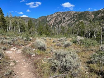
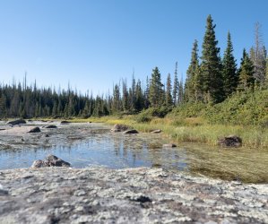
The drive from Fort Collins up the Cache la Poudre River Canyon is beautiful. About 50 miles up river we turned right up Route 103 and drove about 10 miles to the West Branch (of the Laramie River) trailhead. There was no sign-in or usage/parking fees. Under a clear and dry sky we began the 7.7 mile trek to Camp Lake. After following the river a few minutes we began a steady 2.4 mile and 800 foot ascent. We turned right/north on the Camp Lake Trail junction and began a tough (for 3 men over 50 who live at sea level) climb that gained another 800 feet in a mile. The trail then flattened out absurdly, following an old small gage rail bed for almost 3 miles around the slopes of an unnamed mountain. At the next junction we went left/NW and climbed the last 200 feet to Camp Lake. At the recommendation of two women we met going up, we looked for tent sites on the Eastern shore of the lake in the trees. While protected from a constant wind, the sites were ok, and the water access only so-so. The next day we’d learn that the other side of the lake had seemingly excellent sites, if more exposed.
Day 2: Camp Lake to Upper Sandbar Lake + day hike to near Grassy Pass, approximately 5 miles.
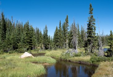
The same women who recommended camping on the eastern shore of Camp Lake said staying at Rawah Lake 3 (our plan) might not be great, that we should consider Rainbow Lake instead. While that lake and its campsites were nice, we were only a mile into the day. A mile later we came across an excellent site between Upper and Lower Sandbar Lakes. We made camp early, had lunch, explored the lakes, and then did a day hike up the unnamed valley above Upper Sandbar. This was completely off trail and boggy at first. After a quarter of a mile or so we rose up the right/W side of the valley and approached Grassy Pass, where we planned to go the next day from a different approach. At about 11,100 we crossed to the left/E side of the valley and picked up a faint trail to a small unnamed pond at 10,900. Here were some of the best campsites we’d see all week. We then went cross country down the slopes back to the boggy flats before picking up the trail back to camp. Nestled between the Sandbar Lakes with views of the high peaks, this is a gem of a site.
Day 3: Upper Sandbar to Twin Crater Lakes, 5 miles
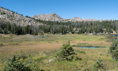
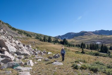
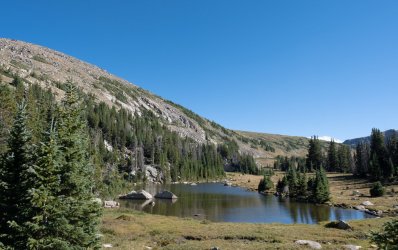
There are two routes to Grassy Pass, one along the Rawah Lakes beneath the peaks, and the other on a ridge higher up facing the peaks. We chose the latter, and were rewarded with massive views and a gentle ascent. A bit after the pass there’s a great rest spot on the right/W side just below South Rawah Peak, and above the expansive valley below. We then dropped 500 feet into the valley and caught the trail to Twin Crater Lakes, a 700 foot ascent. We had a late lunch there and looked for good camping sites, but found only poor ones in strange nooks. So we took our packs back down 250 feet and found a great site between two streams with big views up to the peaks and down the valley.
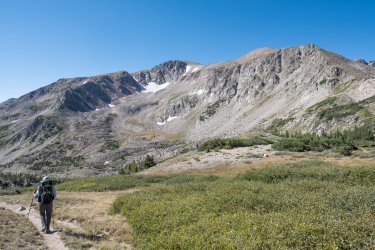
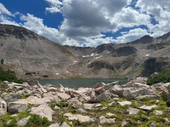
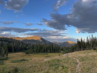
Day 4: the Dodad Traverse to Island Lake, approximately 3 miles, all off trail.
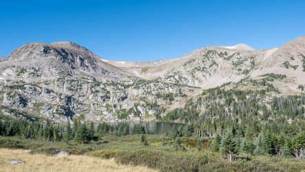
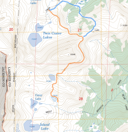
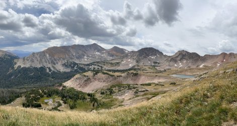
This was a gamble, and it paid off. The safe route was back down into the valley and then up to Island Lake. The riskiest was via a saddle between Twin Crater and Carey Lakes that is on Summitpost as an approach to Dodad Peak. The third option was cross country to a saddle on the East side of Dodad Peak. While not written up anywhere, on Google Earth you can see switchbacks approaching the saddle and a trail skirting the slopes of Dodad at around 11,500. This wraps around to the other side, possibly allowing one to drop into the basin around Island Lake. There seemed to be two approaches to the switchbacks: one directly above our camp, and another from lower in the valley that might be more gradual. We took the direct approach, which was steeper than expected, and required a long rock field crossing. After about 90 minutes we found the trail to the saddle, but it was tiring. We all agreed that the other approach would have been safer and easier (see map below, orange is our route, blue would have been better). We then spent another 90 minutes skirting Dodad. Each time we hit a rock field or thick vegetation, we went up instead of down, and that proved correct. When we were almost above a large unnamed lake at the Northern side of the basin we began our descent. But not before having lunch on a grassy ledge high above the basin with tremendous views. Once we reached the unnamed lake we went South towards Carey Lake, and came out by a smaller unnamed lake at 11,000. There, on the Eastern shore in the trees we found two very good sites. We used one for meals (it has a top notch fire ring) and the other for our tents. We were the only people up there, so we didn’t regret being greedy. We camped there 2 nights, and could have easily spent 3. It rained that night, and there was a dusting of snow on the peaks when we woke the next day.
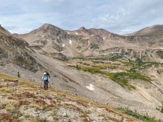
Day 5: Exploring the Basin
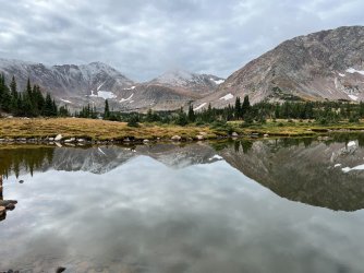
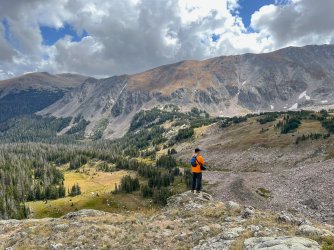
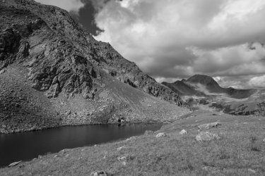
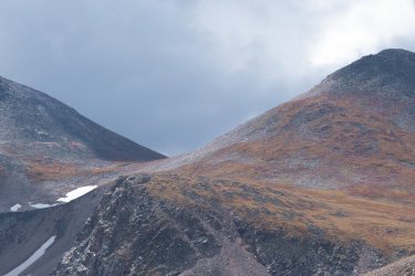
After breakfast the clouds moved on and it was clear skies again. We spent the morning rambling around Island and Carey Lakes. In the afternoon we tried to go cross country to Timber Lake, but make a wrong turn and ended up much higher up at a pair of unnamed lakes underneath the second summit of Clark Peak. From there we had great views of Timber Lake and the surrounding valley. After returning to camp we spent the late afternoon on a ledge to the East of our camp facing the long and imposing Clark Peak. The views in all directions were stunning. One of the best places we’ve ever camped.
Day 6: Island Lake Basin to West Branch Trailhead, 7.1 miles, all on trails
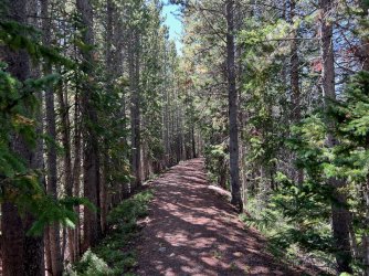
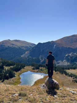
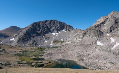
After breakfast we went up to a ledge above Carey Lake for excellent views of that and Island Lakes, as well as the rest of the basin. From there it was pretty much all down all day, mostly in the forest. The initial descent was steep and reminded me of New Hampshire. Once in the valley floor the trail is more gradual and passes through lovely forest. After a few miles it opens up on the right side and there are great views of the high peaks and swaths of willow turning gold in the sun. At the Camp Lake Trail junction we completed the loop and had 3 miles and 800 feet down to go. At around 3pm we reached the TH, giddy after having pulled off a fabulous backcountry loop with perfect weather and near solitude.
Conclusion:
Peter, Chris and I have spent the last dozen years trekking some of the most beautiful wilderness in America. From The Bob to the Pasayten and lots in between. None of us had heard of Rawah until two years ago, and even then there wasn’t much info online for people who want to go there for more than a few days. We all agreed at the end that this was one of the best trips we’d done. It required lots of off trail trekking, and that made it both more fun and challenging. It also had fewer miles with full packs, allowing us to explore drainages and slopes around camp. The perfect weather was certainly a major factor (as the terrible weather in the Uintas was in 2022). Anyone who wants solitude, stunning alpine scenery and a cross country challenge should put the Rawah Wilderness in their calendar. It might even be better than Taylor Swift.
Overview: Until recently I thought the highlight of my year was taking my eleven year old daughter to see Taylor Swift. Then I spent 6 days in the Rawah Wilderness in North-central Colorado. Peter, Chris and I began at the West Branch Trailhead, hiked N to Camp Lake, and then spent 5 days going along the upper spine of the Medicine Bow Mountains. The scenery was spectacular, its colors and geological diversity rivaling pretty much anything we’d seen. It reminded us of a 50 mile traverse of the Sawtooths in Idaho that we did (and loved) in 2014. The weather was perfect, with nearly 5 days cloud free and mild. I never used gloves, and aside from one passing afternoon shower, it only rained once, on night 4, while we slept. While it’s certainly possible to do this in fewer days, the extra time gave us a chance to explore upper alpine valleys and ledges without full packs. We spent the last 2 nights in the massive basin around Island Lake. We could have spent 3 there as there is simply too much beauty to absorb.
Trailhead: West Branch off of Route 103 off of CO 14, 55 miles west of Fort Collins
Route: Lollipop from Camp Lake to Island Lake
Miles: 31+ including day hikes
Gross elevation GL: about 11,000
(We didn’t bring GPS to log exact mileage or elevation)
NOTE 1: About 1/3 of this was off trail. Day 4 from Twin Crater Lakes to Island Lake Basin via the slopes of Dodad Peak was completely off trail. Do not attempt this route unless you have good weather AND experience on steep off trail slopes and rock falls. While not technical, this route requires solid route finding skills and lots of patience.
NOTE 2: There are fewer “established” tent sites than expected in the high country, and almost none in the glacial cirques below the biggest peaks. Most people seem to camp in the valleys below and hike up for the day. Which means greater solitude for those that stay around 11,000.
NOTE 3: Hunting season for black powder opened when we set out. If going in September or October, remember to bring orange clothing and to wear it in the mornings and afternoons when the hunters are most active (if not all the time). The hunters we met were generally camping down in the valleys, closer to rivers. You can get very cool orange CSU hats in Fort Collins.
Day 1: West Branch TH (8,576ft) to Camp Lake (10,522), 7.7 miles, +1900 feet
The drive from Fort Collins up the Cache la Poudre River Canyon is beautiful. About 50 miles up river we turned right up Route 103 and drove about 10 miles to the West Branch (of the Laramie River) trailhead. There was no sign-in or usage/parking fees. Under a clear and dry sky we began the 7.7 mile trek to Camp Lake. After following the river a few minutes we began a steady 2.4 mile and 800 foot ascent. We turned right/north on the Camp Lake Trail junction and began a tough (for 3 men over 50 who live at sea level) climb that gained another 800 feet in a mile. The trail then flattened out absurdly, following an old small gage rail bed for almost 3 miles around the slopes of an unnamed mountain. At the next junction we went left/NW and climbed the last 200 feet to Camp Lake. At the recommendation of two women we met going up, we looked for tent sites on the Eastern shore of the lake in the trees. While protected from a constant wind, the sites were ok, and the water access only so-so. The next day we’d learn that the other side of the lake had seemingly excellent sites, if more exposed.


Day 2: Camp Lake to Upper Sandbar Lake + day hike to near Grassy Pass, approximately 5 miles.
The same women who recommended camping on the eastern shore of Camp Lake said staying at Rawah Lake 3 (our plan) might not be great, that we should consider Rainbow Lake instead. While that lake and its campsites were nice, we were only a mile into the day. A mile later we came across an excellent site between Upper and Lower Sandbar Lakes. We made camp early, had lunch, explored the lakes, and then did a day hike up the unnamed valley above Upper Sandbar. This was completely off trail and boggy at first. After a quarter of a mile or so we rose up the right/W side of the valley and approached Grassy Pass, where we planned to go the next day from a different approach. At about 11,100 we crossed to the left/E side of the valley and picked up a faint trail to a small unnamed pond at 10,900. Here were some of the best campsites we’d see all week. We then went cross country down the slopes back to the boggy flats before picking up the trail back to camp. Nestled between the Sandbar Lakes with views of the high peaks, this is a gem of a site.


Day 3: Upper Sandbar to Twin Crater Lakes, 5 miles
There are two routes to Grassy Pass, one along the Rawah Lakes beneath the peaks, and the other on a ridge higher up facing the peaks. We chose the latter, and were rewarded with massive views and a gentle ascent. A bit after the pass there’s a great rest spot on the right/W side just below South Rawah Peak, and above the expansive valley below. We then dropped 500 feet into the valley and caught the trail to Twin Crater Lakes, a 700 foot ascent. We had a late lunch there and looked for good camping sites, but found only poor ones in strange nooks. So we took our packs back down 250 feet and found a great site between two streams with big views up to the peaks and down the valley.


Day 4: the Dodad Traverse to Island Lake, approximately 3 miles, all off trail.
This was a gamble, and it paid off. The safe route was back down into the valley and then up to Island Lake. The riskiest was via a saddle between Twin Crater and Carey Lakes that is on Summitpost as an approach to Dodad Peak. The third option was cross country to a saddle on the East side of Dodad Peak. While not written up anywhere, on Google Earth you can see switchbacks approaching the saddle and a trail skirting the slopes of Dodad at around 11,500. This wraps around to the other side, possibly allowing one to drop into the basin around Island Lake. There seemed to be two approaches to the switchbacks: one directly above our camp, and another from lower in the valley that might be more gradual. We took the direct approach, which was steeper than expected, and required a long rock field crossing. After about 90 minutes we found the trail to the saddle, but it was tiring. We all agreed that the other approach would have been safer and easier (see map below, orange is our route, blue would have been better). We then spent another 90 minutes skirting Dodad. Each time we hit a rock field or thick vegetation, we went up instead of down, and that proved correct. When we were almost above a large unnamed lake at the Northern side of the basin we began our descent. But not before having lunch on a grassy ledge high above the basin with tremendous views. Once we reached the unnamed lake we went South towards Carey Lake, and came out by a smaller unnamed lake at 11,000. There, on the Eastern shore in the trees we found two very good sites. We used one for meals (it has a top notch fire ring) and the other for our tents. We were the only people up there, so we didn’t regret being greedy. We camped there 2 nights, and could have easily spent 3. It rained that night, and there was a dusting of snow on the peaks when we woke the next day.


Day 5: Exploring the Basin
After breakfast the clouds moved on and it was clear skies again. We spent the morning rambling around Island and Carey Lakes. In the afternoon we tried to go cross country to Timber Lake, but make a wrong turn and ended up much higher up at a pair of unnamed lakes underneath the second summit of Clark Peak. From there we had great views of Timber Lake and the surrounding valley. After returning to camp we spent the late afternoon on a ledge to the East of our camp facing the long and imposing Clark Peak. The views in all directions were stunning. One of the best places we’ve ever camped.


Day 6: Island Lake Basin to West Branch Trailhead, 7.1 miles, all on trails
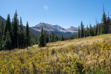
After breakfast we went up to a ledge above Carey Lake for excellent views of that and Island Lakes, as well as the rest of the basin. From there it was pretty much all down all day, mostly in the forest. The initial descent was steep and reminded me of New Hampshire. Once in the valley floor the trail is more gradual and passes through lovely forest. After a few miles it opens up on the right side and there are great views of the high peaks and swaths of willow turning gold in the sun. At the Camp Lake Trail junction we completed the loop and had 3 miles and 800 feet down to go. At around 3pm we reached the TH, giddy after having pulled off a fabulous backcountry loop with perfect weather and near solitude.


Conclusion:
Peter, Chris and I have spent the last dozen years trekking some of the most beautiful wilderness in America. From The Bob to the Pasayten and lots in between. None of us had heard of Rawah until two years ago, and even then there wasn’t much info online for people who want to go there for more than a few days. We all agreed at the end that this was one of the best trips we’d done. It required lots of off trail trekking, and that made it both more fun and challenging. It also had fewer miles with full packs, allowing us to explore drainages and slopes around camp. The perfect weather was certainly a major factor (as the terrible weather in the Uintas was in 2022). Anyone who wants solitude, stunning alpine scenery and a cross country challenge should put the Rawah Wilderness in their calendar. It might even be better than Taylor Swift.
