Missing hiker in Uintas - Ray Humpherys

Let me just add, the drone idea is good except for the fact the Utah DPS helicopter and civil air patrol are both active in the area. So drone flights are likely to interfere with aerial operations in the search.

My understanding is Ray and his family had backpacked into Hidden Lake on numerous past occasions. It was one of their favorite spots. He knew the area quite well. They went in Wednesday morning. He was grabbing water from the lake to douse the fire on Wednesday night when he disappeared. The family didn't realize he was unaccounted for until the following morning. SAR was notified around noon on Thursday.

I'd imagine the highest probability areas to search (aside from the immediate environs around the camp and lake) would be the slopes descending from Hidden Lake and the western foot of Mt. Watson down into the Middle Fork Weber River gorge. That is not easy country to search effectively.
 
Some initial thoughts and observations on the search for missing backpacker Ray Humpherys:

Ray is 66. He is an avid backpacker. He has visited the Hidden Lake area of the Uintas repeatedly (a family member told me it is one of their favorite places to visit because it is relatively quiet and secluded). Ray and several family members departed from the Crystal Lake TH on the morning of Wed. July 18, 2018. At about 10:30 p.m. on Wednesday, Ray went to grab water from Hidden Lake to douse a camp fire. The rest of the family retired to their tents. Ray was discovered to be missing the following morning. Summit County SAR received notification around noon on Thurs. July 19, 2018 and launched a search.

Ray was known to be wearing a jacket and vest when last seen. He was also carrying a head lamp. The Humpherys family camping party had originally planned to return from their trip on Fri. July 20, 2018. Due to the disappearance they have remained on scene.

A check of the weather at the Trial Lake SNOTEL station shows very mild conditions.

Screen Shot 2018-07-22 at 12.24.07 PM.png

In summary, daytime highs have been between 70-75 degrees F. Nighttime lows have been near 50 degrees F. Precipitation has been negligible. That's good! Very survivable weather. The lack of precip is especially encouraging.

Now, let's talk about the terrain.

Hidden Lake sits at about 10,260 feet above sea level. It is bounded on the north by Notch Mountain and the south by Mount Watson. Both of these mountains are barriers to travel. The ground slopes uphill to the east of Hidden Lake, rising about 200 vertical feet to the Three Divide area. Some of that ground is wooded, but much of it is at the tree line interface so vegetation is thin and visibility is good.

To the west, the ground falls gradually at first and then steeply into the gorge of the Middle Fork Weber River. Hidden Lake is part of the Weber River drainage. Its output flows through a series of meadows before reaching a steep and rocky slope, where the stream drops to the river. The elevation of the river directly west of Hidden Lake is roughly 9,400 feet ASL. That's a drop of about 800 vertical feet.

The terrain would force someone attempting to traverse north around the west side of Notch Mountain gradually downhill. That's also true for the traverse south around Mount Watson, but to a lesser degree (I've followed good game trails near the 10,200 foot contour line around the western foot of Mt. Watson).

The slopes above the river are heavily wooded. Travel through that terrain is difficult. It is also a very difficult area to find someone who is sheltered up and possibly non-verbal.

Standard protocol on a SAR mission is to send hasty teams down the established trails immediately, to eliminate the possibility of the missing person being on a trail. We can presume that happened on day one of the search (July19). On day two, SAR put a dive team in Hidden Lake.

_MG_0070.jpg

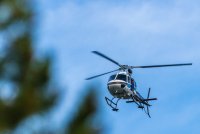
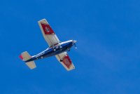
They've also been using the Utah Department of Public Safety helicopter and fixed-wing aircraft from the Civil Air Patrol to search from the air.

_MG_0155.jpg

UAS (drone) operations are currently prohibited in the area due to the ongoing use of aircraft in the search. However, my brother recorded video of the search area in 2015. The video begins looking south toward Long Mountain and the Middle Fork Weber River headwaters. It then pans toward the east, revealing a corner of Hidden Lake. The camera then moves toward Three Divide, with Mount Watson on the right and Long Mountain on the left.


Search dogs have been employed, though I'm not sure to what effect. They would seem to be one of the best resources, given that the searchers have scent items readily available.

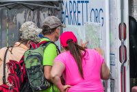
The Garrett Bardsley Foundation activated to organize volunteers for the search on day three (Sat. July 22, 2018). About 100 volunteers registered and were split into four groups.

_MG_0014.jpg

I took part in the Bardsley Foundation grid search as part of group four. The area we covered was in the proximity of Notch Lake, north of the Notch Mountain Trail. I tracked my search by GPS. However, I'm not exactly certain where the other three teams searched.

I'm also not certain if the volunteer grids were assigned by the professional SAR team or if the Foundation crafted them independently.

Some thoughts on probabilities:

An experienced backpacker is going to recognize the Middle Fork Weber River as a barrier to travel. Therefore, I'd surmise that it presents the western boundary of the high-probability search area. The other barriers as identified above are Notch Mountain, Three Divide and Mount Watson. So I'd draw a heat map within those boundaries, with the probability falling away the father one traveled from the lake.

(EDIT - Map link removed)

My expectation is that SAR is scouring the slopes immediately west of Hidden Lake. The volunteer search continued on Sun. July 22, 2018. At this time, I am not aware of where those volunteers were focused. It would make sense to me though to use them in what I listed as the "cool zone" on the map above, presuming those areas aren't already being covered by SAR.

However, it's also worth considering the length of time Mr. Humpherys was unaccounted for before being reported missing (approximately 12 hours) and the distance he might have traveled in that time. He may very well be outside of my probability zones. Missing people go missing because they behave unexpectedly.

As a parting note, Hidden Lake played a role in the story of Kim Beverly and Carole Wetherton. It was the location of two of their final photographs. Kim and Carole's remains were eventually located at an improvised rock shelter directly west of Mount Watson, well south and a little west of the lake.
 
Last edited:
It seems to me that if one were a seasoned hiker/backpacker, that when they realized they were lost, they would just stay put, especially since they had family they knew would come looking for them. But I guess one's desire to get found would take over and you'd start trying to figure out where you were. Climbing a high spot to reconnoiter would seem likely.
 
It seems to me that if one were a seasoned hiker/backpacker, that when they realized they were lost, they would just stay put, especially since they had family they knew would come looking for them. But I guess one's desire to get found would take over and you'd start trying to figure out where you were. Climbing a high spot to reconnoiter would seem likely.

I would not expect someone to climb to a highpoint to recon when it's dark out. And I imagine the fact he became lost while walking a short distance between the lake and camp in an area he knew well suggests there was some factor at play that affected his reasoning.
 
I would not expect someone to climb to a highpoint to recon when it's dark out. And I imagine the fact he became lost while walking a short distance between the lake and camp in an area he knew well suggests there was some factor at play that affected his reasoning.
Well no, of course not in the dark, I was thinking the next day. But I'm still wondering if he didn't fall in the lake.
 
A commenter on KSL said one problem is the Uintas are an east-west range, so people get confused, being used to north-south orientations. I wonder if this is really a factor - makes sense, but it seems one would be able to tell their direction from the sun, even w/o a compass. Lots of trees and rocks to create shadows.
 
Melvin Heaps dissapeared 7.31.17. Damn near a year later they are looking for Ray in the same general area. I don't think he fell into the Lake or got lost. With the resources and people that have been deployed, they would have found him by now. An experienced backpacker would not wonder in the dark without gear. Plus that area gets a lot of hikers. I've never once been to Clyde, Three Divide, or Hidden Lakes without seeing other hikers. This case and Melvins case have eerie similarities to the cases in the Missing 411 books.
 
With the resources and people that have been deployed, they would have found him by now.

I disagree. We have many examples of past SAR efforts in this area where resources were not the deciding factor. A combination of complex terrain, communication challenges and logistics make manning an intensive search very difficult. Yes, hikers visit these lakes with some frequency. However, most will not wander too far from existing trails. Missing people are not found on trails.

A missing person can shelter in a crag of a rock or fall into a boulder field and be obstructed from view. Finding a person in these conditions is not easy.

Consider that most of day one (Thursday) probably involved mobilizing resources, gathering information from the family, coordinating with partner agencies (USFS, DPS, DNR etc.) and making plans. So that would mean they've only had two full days of searching, Friday and Saturday. That's not a lot of time.

In spite of the surface similarities between Mr. Heaps and Mr. Humpherys' situations, there are some key differences. With Mr. Heaps, the last known position was the trailhead with no indication of his intended destination. But we know he was going to hike somewhere. That meant the search had to encompass all of the trail systems fanning out from Crystal Lake.

With Mr. Humpherys, we have no indication that he intended to go anywhere but to his tent which was just a short distance away. I don't have GPS tracks to confirm it, but I suspect the search area was very focused around the lake and campsite at first. As time passes, the search has to expand to cover much more ground. That's what I was attempting to show with the map linked above. Even searching the "warm" area with any kind of rigor could take weeks or months.

As for experience, it must be counter-balanced against the effects of fatigue and fear. It's useful insofar as it informs decisions, but experience doesn't make a person infallible. We've all made bad decisions in the out of doors, some with greater consequence than others. People make mistakes. So while we can all question what we might do in a similar situation, remember that we're thinking it through from a position of comfort and security at our keyboards.
 
Last edited:
This case and Melvins case have eerie similarities to the cases in the Missing 411 books.

From Wiki: Paulides attributes mysterious, unspecified causes to these disappearances, while data analyst Kyle Polich has analyzed Paulides' data and concluded that, statistically, these disappearances are not mysterious in any way.
 
Last edited:
MODERATOR NOTE: Please use caution on where this discussion goes. If you want to start a conversation about the broader subject of missing people, please start a separate thread. This one is about a currently missing person and it needs to stay on point and respectful. This thread is about the search for Ray Humpherys.
 
OK, I deleted the part of my post that could be construed as controversial, but feel free to delete it all if you think it's off-topic, @Nick - I just find the Missing 411 conspiracy stuff to be somewhat disrespectful to both the missing and their families. (And you can delete this one, too, if you deem it part of the fray.) :)
 
Last edited:
OK, I deleted the part of my post that could be construed as controversial, but feel free to delete it all if you think it's off-topic, @Nick - I just find the Missing 411 conspiracy stuff to be somewhat disrespectful to both the missing and their families. (And you can delete this one, too, if you deem it part of the fray.) :)

I didn't know anything about any of that, so I can't really even say what was controversial. But yeah, different discussion for a different thread. Thanks. :)
 
I disagree. We have many examples of past SAR efforts in this area where resources were not the deciding factor. A combination of complex terrain, communication challenges and logistics make manning an intensive search very difficult. Yes, hikers visit these lakes with some frequency. However, most will not wander too far from existing trails. Missing people are not found on trails.

A missing person can shelter in a crag of a rock or fall into a boulder field and be obstructed from view. Finding a person in these conditions is not easy.

Consider that most of day one (Thursday) probably involved mobilizing resources, gathering information from the family, coordinating with partner agencies (USFS, DPS, DNR etc.) and making plans. So that would mean they've only had two full days of searching, Friday and Saturday. That's not a lot of time.

In spite of the surface similarities between Mr. Heaps and Mr. Humpherys' situations, there are some key differences. With Mr. Heaps, the last known position was the trailhead with no indication of his intended destination. But we know he was going to hike somewhere. That meant the search had to encompass all of the trail systems fanning out from Crystal Lake.

With Mr. Humpherys, we have no indication that he intended to go anywhere but to his tent which was just a short distance away. I don't have GPS tracks to confirm it, but I suspect the search area was very focused around the lake and campsite at first. As time passes, the search has to expand to cover much more ground. That's what I was attempting to show with the map linked above. Even searching the "warm" area with any kind of rigor could take weeks or months.

As for experience, it must be counter-balanced against the effects of fatigue and fear. It's useful insofar as it informs decisions, but experience doesn't make a person infallible. We've all made bad decisions in the out of doors, some with greater consequence than others. People make mistakes. So while we can all question what we might do in a similar situation, remember that we're thinking it through from a position of comfort and security at our keyboards.

If they find Ray, I'll agree to all of that. Because we will know the story. If they don't find him, a lot of questions will remain. Then all assumptions will be just that. I hope they find him.
 
MODERATOR NOTE: Please use caution on where this discussion goes. If you want to start a conversation about the broader subject of missing people, please start a separate thread. This one is about a currently missing person and it needs to stay on point and respectful. This thread is about the search for Ray Humpherys.

I'm sorry I even mentioned it. I'm sorry that I see similarities to Melvins disappearance. Not gonna go there but you know why I have my suspicions. I hope they find Ray alive and well.
 
Some initial thoughts and observations on the search for missing backpacker Ray Humpherys:

Ray is 66. He is an avid backpacker. He has visited the Hidden Lake area of the Uintas repeatedly (a family member told me it is one of their favorite places to visit because it is relatively quiet and secluded). Ray and several family members departed from the Crystal Lake TH on the morning of Wed. July 18, 2018. At about 10:30 p.m. on Wednesday, Ray went to grab water from Hidden Lake to douse a camp fire. The rest of the family retired to their tents. Ray was discovered to be missing the following morning. Summit County SAR received notification around noon on Thurs. July 19, 2018 and launched a search.

Ray was known to be wearing a jacket and vest when last seen. He was also carrying a head lamp. The Humpherys family camping party had originally planned to return from their trip on Fri. July 20, 2018. Due to the disappearance they have remained on scene.

A check of the weather at the Trial Lake SNOTEL station shows very mild conditions.

View attachment 66582

In summary, daytime highs have been between 70-75 degrees F. Nighttime lows have been near 50 degrees F. Precipitation has been negligible. That's good! Very survivable weather. The lack of precip is especially encouraging.

Now, let's talk about the terrain.

Hidden Lake sits at about 10,260 feet above sea level. It is bounded on the north by Notch Mountain and the south by Mount Watson. Both of these mountains are barriers to travel. The ground slopes uphill to the east of Hidden Lake, rising about 200 vertical feet to the Three Divide area. Some of that ground is wooded, but much of it is at the tree line interface so vegetation is thin and visibility is good.

To the west, the ground falls gradually at first and then steeply into the gorge of the Middle Fork Weber River. Hidden Lake is part of the Weber River drainage. Its output flows through a series of meadows before reaching a steep and rocky slope, where the stream drops to the river. The elevation of the river directly west of Hidden Lake is roughly 9,400 feet ASL. That's a drop of about 800 vertical feet.

The terrain would force someone attempting to traverse north around the west side of Notch Mountain gradually downhill. That's also true for the traverse south around Mount Watson, but to a lesser degree (I've followed good game trails near the 10,200 foot contour line around the western foot of Mt. Watson).

The slopes above the river are heavily wooded. Travel through that terrain is difficult. It is also a very difficult area to find someone who is sheltered up and possibly non-verbal.

Standard protocol on a SAR mission is to send hasty teams down the established trails immediately, to eliminate the possibility of the missing person being on a trail. We can presume that happened on day one of the search (July19). On day two, SAR put a dive team in Hidden Lake.

View attachment 66583

They've also been using the Utah Department of Public Safety helicopter and fixed-wing aircraft from the Civil Air Patrol to search from the air.

View attachment 66584

UAS (drone) operations are currently prohibited in the area due to the ongoing use of aircraft in the search. However, my brother recorded video of the search area in 2015. The video begins looking south toward Long Mountain and the Middle Fork Weber River headwaters. It then pans toward the east, revealing a corner of Hidden Lake. The camera then moves toward Three Divide, with Mount Watson on the right and Long Mountain on the left.


Search dogs have been employed, though I'm not sure to what effect. They would seem to be one of the best resources, given that the searchers have scent items readily available.

The Garrett Bardsley Foundation activated to organize volunteers for the search on day three (Sat. July 22, 2018). About 100 volunteers registered and were split into four groups.

View attachment 66585

I took part in the Bardsley Foundation grid search as part of group four. The area we covered was in the proximity of Notch Lake, north of the Notch Mountain Trail. I tracked my search by GPS. However, I'm not exactly certain where the other three teams searched.

I'm also not certain if the volunteer grids were assigned by the professional SAR team or if the Foundation crafted them independently.

Some thoughts on probabilities:

An experienced backpacker is going to recognize the Middle Fork Weber River as a barrier to travel. Therefore, I'd surmise that it presents the western boundary of the high-probability search area. The other barriers as identified above are Notch Mountain, Three Divide and Mount Watson. So I'd draw a heat map within those boundaries, with the probability falling away the father one traveled from the lake.

Click here to view on CalTopo
My expectation is that SAR is scouring the slopes immediately west of Hidden Lake. The volunteer search continued on Sun. July 22, 2018. At this time, I am not aware of where those volunteers were focused. It would make sense to me though to use them in what I listed as the "cool zone" on the map above, presuming those areas aren't already being covered by SAR.

However, it's also worth considering the length of time Mr. Humpherys was unaccounted for before being reported missing (approximately 12 hours) and the distance he might have traveled in that time. He may very well be outside of my probability zones. Missing people go missing because they behave unexpectedly.

As a parting note, Hidden Lake played a role in the story of Kim Beverly and Carole Wetherton. It was the location of two of their final photographs. Kim and Carole's remains were eventually located at an improvised rock shelter directly west of Mount Watson, well south and a little west of the lake.
Dave, you really ought to do this for a living. Not investigation and reporting, which you already do well for a living. SAR. Serious respect pal.
 
Last edited:
The Bardsley Foundation says they've been notified Monday will be the final day of the volunteer search effort. I'm not sure if that means Summit County plans to wind down at EOD tomorrow as well.
 
The Bardsley Foundation says they've been notified Monday will be the final day of the volunteer search effort. I'm not sure if that means Summit County plans to wind down at EOD tomorrow as well.

I'm a little confused. Isn't the Bardsley Foundation pretty much running the volunteer search effort? Does that mean Summit County told them to stop?
 
I'm a little confused. Isn't the Bardsley Foundation pretty much running the volunteer search effort? Does that mean Summit County told them to stop?

The Bardsley Foundation works at the request of the law enforcement agency. So yes, Summit County provides the foundation with the grid squares to search. Volunteers completed that area today, so the Foundation isles unless provided more area to search by Summit County.
 
Similar threads
Thread starter Title Forum Replies Date
Nick Missing Hiker on Kings Peak General Discussion 3
K Missing 411 General Discussion 12
GarrettM Carpooling App or Some Hack I'm Missing? Resource Discussions 0
N Missing camera General Discussion 2
Parma Missing Person In Canyonlands General Discussion 2
Bob Missing the snow ? General Discussion 5
Dave Missing Boy Scout in the Winds General Discussion 7
Melissa Missing Endangered Melvin Heaps General Discussion 40
regehr 9 dead, boy missing in flash flood in Arizona swim hole General Discussion 1
andyjaggy Missing Uinta Man Found General Discussion 0
CaptnKidd Canyonlands (2010) with Mineral Bottom Switchbacks Missing.... Off Road 6
hatchcanyon The missing link to Lockhart Basin Off Road 2
Seldom Seen Anderson Missing Backpackers General Discussion 10
Nick 2 Boy Scouts Missing Near King's Peak General Discussion 6
Nick Randy Udall missing in Wind Rivers General Discussion 4
F Group Leaves Injured Hiker Behind General Discussion 3
Rockskipper 'Bear cam' viewers save stranded hiker in Alaska General Discussion 5
canadug Hiker death in Zion National park :( Hiking & Camping 32
balzaccom Hiker history Backpacking 0
GramaNana Hello from Utah - future GWT hiker Noobs: Introduce yourself! 11
zionsky Hiker Dies from Fall at Angels Landing General Discussion 1
zionsky Rainier hiker back from the dead General Discussion 2
Rockskipper Hiker seriously injured by rock at Fisher Towers General Discussion 12
Parma PCT Hiker Trying to Lose 200 lbs on the Trail! General Discussion 7
N FL hiker who travels to Teton Wilderness area frequently. Noobs: Introduce yourself! 3
Perry Hiker Dies in the Wave of Appearent Heat-related Conditions General Discussion 12
Perry Injured Utah Hiker Rescued Near Kings Peak General Discussion 9
Perry Grizzlies follow hiker - Holy Cow! General Discussion 14
regehr hiker injured and rescued in Little Cottonwood General Discussion 3
WasatchWill Runner's Toe (or Hiker's Toe) General Discussion 10
Jackson Hiker Killed by Grizzly Bear in Yellowstone General Discussion 59
Deepak YAH. Yet Another Hiker Noobs: Introduce yourself! 1
Mr. Me Another (but Awesomer) Hiker/Photographer Noobs: Introduce yourself! 1
ogg Court ruling, hiker must pay SAR bill General Discussion 12
balzaccom How did the hiker cross the stream? General Discussion 5
Vegan.Hiker Drones to be used for hiker resupply General Discussion 8
regehr Hiker death in White Pine, Little Cottonwood General Discussion 0
Vegan.Hiker East coast hiker visiting Utah Trip Planning 28
Bill Gear Review Clik Elite Hiker Gear Reviews 9
Yellowstone 1 Gear Review Katadyn Hiker Pro Filter Gear Reviews 3
Tarp Boy Looking for Shuttle service for Uintas Granddaddy basin trip Trip Planning 0
2eez4life Suggestions: Uintas Backpacking with some rock climbing routes Trip Planning 0
regehr (Uintas) Lake Fork Fun Backpacking 8
scatman Reid's Peak - Uintas - July 22, 2023 Hiking & Camping 6
Upgrayedd Uintas Conditions 2023 Trip Planning 39
NorthwestWanderer First time in the High Uintas | Red Castle SNEAK Loop | I give these mountains 5 out of 5 stars Backpacking 7
2eez4life Uintas Conditions 2022 Trip Planning 18
regehr Uintas this weekend? Trip Planning 4
2eez4life 4 days 3 nights in the Uintas Trip Planning 9
6 Uintas Trip Planning Trip Planning 5

Similar threads

Back
Top