marmot_boi
Rodent
- Joined
- Dec 1, 2020
- Messages
- 210
Stuck inside for a few days thanks to snow, figured it would be a good time to write something up about this trip.
This was a 5 night trip I did in late July/early August of last year with a couple good friends. This was my first trip to the Winds and I will absolutely be coming back. It was also a fantastic culmination to probably dozens of hours spent on Caltopo poring over maps.
We started from Big Sandy at about 4 pm, and of course it started hailing about 100 yards from the trailhead. Luckily it didn't last very long, and we had great weather for (almost) the entire rest of the trip.
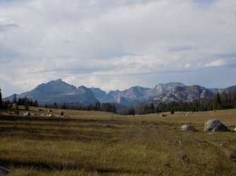
Our first glimpse of the real mountains. Looking into the peaks surrounding the East Fork drainage from the southern end of Fish Creek Park.
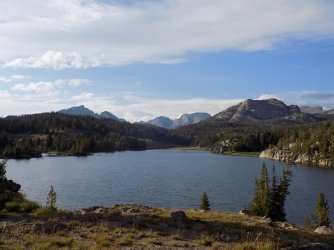
Dads Lake. Maybe not the most dramatic in the range but beautiful nonetheless. The best part was the loons on the lake that called all night long. 8/10 lake for the loons.
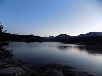
Dawn over Dads lake.
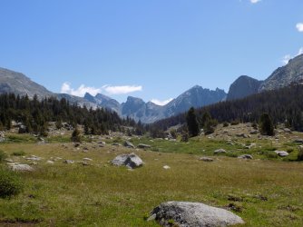
Looking towards Shadow Lake and the back side of the Cirque from near Washakie Creek. The crossing here was annoying but luckily pretty shallow.
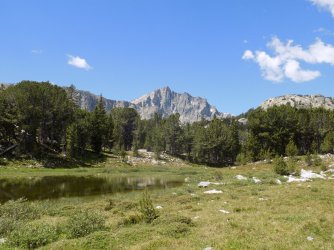
A small unnamed pond with Geikie looming above.
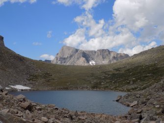
Upper Twin Lake, Hailey Pass, and Musumbeah peak (btw, how do you pronounce that name?). Really like the way this one turned out. What I really didn't like was the steep, loose descent on the north side of the pass.
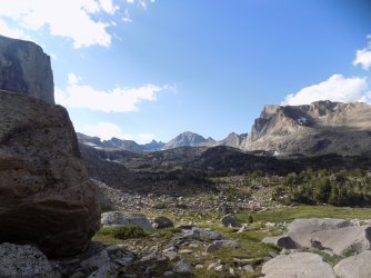
Looking across the valley at the Baptiste Lake cirque. The Twin Lions are the pointy peaks in the center, with Mount Lander just to the right. Musumbeah on the far right. Stopped to rest in this location and regretted it. Some of the worst mosquitoes of the trip. Set my current record here for number of mosquitoes killed in a single slap, I think I got 11 or 12. In the basin below here I briefly glimpsed my fourth-ever pine marten. Not a great sighting but one of my favorite animals so I can't complain.
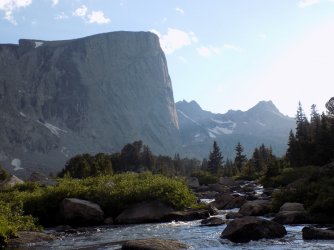
Mount Hooker's impressive north face lit by the evening sun, as seen from Baptiste Creek near camp for nights 2 and 3.
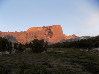
Sunrise on Mount Hooker on day 3. Note the ridge that culminates in a small snowfield on Hooker's summit plateau, the standard route up. No thanks, I'll stick to basins.
The crossing of Baptiste Creek looked harder than it was. The only issue was that some of the rocks were quite slick.
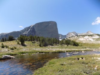
Mount Hooker above Baptiste Creek, on the way to Baptiste Lake.
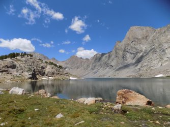
Baptiste Lake. 7/10 lake. Beautiful, but very barren-feeling. Perhaps my opinion of it would have changed had I spent more time here. From the lake we returned to the same campsite as the previous night. It was warm enough that it felt really good to dip our feet in the creek.
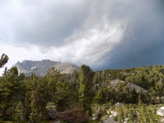
Ominous storm clouds above Musumbeah from camp. We thought we were in the clear; the darkest portion of the storm was tracking east of us. Probably a minute after I took this picture we had to dive in the tent because it started hailing.
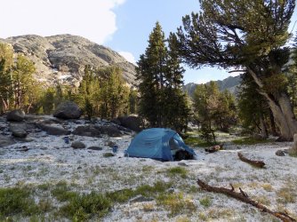
Camp after the hailstorm. It probably hailed for 15 minutes. We were really jealous of the people camped nearby that had a roaring fire going, because it got real cold real quick once the sun went down.
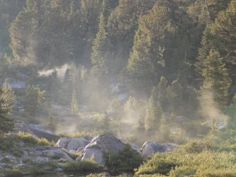
Steam from sublimating hail on the rocks that were warm to the touch just 20 minutes earlier. Looked like a geyser basin.
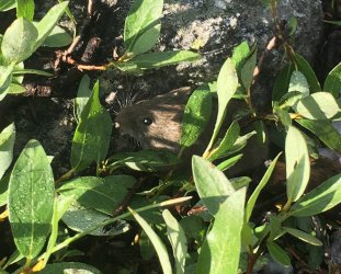
This little guy ran out from under our tent when we were taking it down in the morning. I think he had taken shelter there during the storm. He was very curious and climbed up on my boot. Probably had never seen a human before.
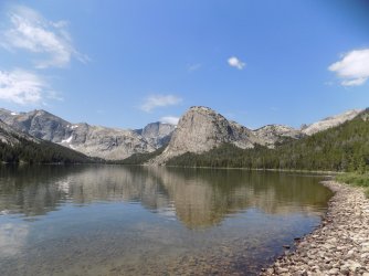
Grave lake. 10/10 lake. Possibly the highlight of the trip for me. I love the fjord-like nature of it, and the views of all the cliffs and peaks. Really remote and wild-feeling. Also has a nice beach. Would love to come back and spend a few nights here.
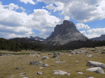
Lizard Head, Buffalo Head, and Ranger Park. Had been dreading the crossing of the South Fork Little Wind here, but it turned out not to be a very big deal. Just lots of pointy, uncomfortable rocks. Around dusk we saw a herd of cow and calf elk in the upper part of Ranger Park. They kept barking at each other long after we spooked them from the meadows.
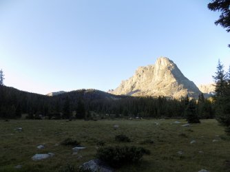
Early morning light on Buffalo Head on day 5.
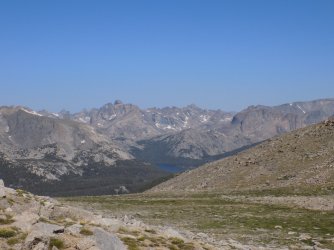
Grave Lake with the Twin Lions, Lander, and Musumbeah beyond.
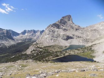
Possibly my favorite view of the entire trip. Lizard Head with the Bear Lakes below and Cirque of the Towers beyond. Would love to return to this vantage point for sunrise.
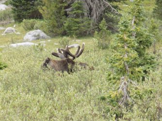
Moose in Lizard Head Meadows.
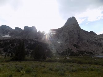
The sun goes down behind Pingora. Lonesome Lake might be the least aptly named place I've ever been. It's beautiful, but the sheer number of people around make this a 5/10 lake.
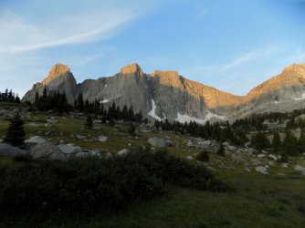
Sunrise on Warbonnet and the Warrior Peaks.
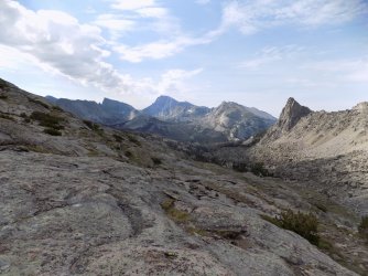
Wind River, East Temple, and Temple Peaks. I really liked Jackass Pass. The views of the Cirque and across the Big Sandy valley are nice, and the sheer scale of the east face of Warbonnet is incredible.
The rest of the trail from this point on wasn't nearly as scenic as what we had done, and it was very crowded with climbers, dayhikers, and backpackers destined for Big Sandy Lake or the Cirque. We made excellent time though, and went to Pinedale to get some burritos, then headed to Green River Lakes. Every site at the campground was full, except the three walk-in sites. I guess people prefer to camp right next to their cars. ("Do you have to, like, hike back to those?" one lady walking around the campground loop asked us.) 100 yards of walking from the car still felt luxurious after backpacking.
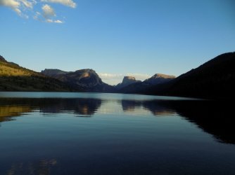
Sunset on lower Green River Lake. Another place I will definitely coming back to.
Next time I come to the Winds I will definitely bring fishing gear and sandals to make fording streams easier.
It was tough to narrow down my 1008 photos to the 26 posted here. I do think we really lucked out with the weather. All in all, a very enjoyable trip to a very scenic place, but it felt really good to be done, eat non-dehydrated food, and take a shower.
This was a 5 night trip I did in late July/early August of last year with a couple good friends. This was my first trip to the Winds and I will absolutely be coming back. It was also a fantastic culmination to probably dozens of hours spent on Caltopo poring over maps.
We started from Big Sandy at about 4 pm, and of course it started hailing about 100 yards from the trailhead. Luckily it didn't last very long, and we had great weather for (almost) the entire rest of the trip.

Our first glimpse of the real mountains. Looking into the peaks surrounding the East Fork drainage from the southern end of Fish Creek Park.

Dads Lake. Maybe not the most dramatic in the range but beautiful nonetheless. The best part was the loons on the lake that called all night long. 8/10 lake for the loons.

Dawn over Dads lake.

Looking towards Shadow Lake and the back side of the Cirque from near Washakie Creek. The crossing here was annoying but luckily pretty shallow.

A small unnamed pond with Geikie looming above.

Upper Twin Lake, Hailey Pass, and Musumbeah peak (btw, how do you pronounce that name?). Really like the way this one turned out. What I really didn't like was the steep, loose descent on the north side of the pass.

Looking across the valley at the Baptiste Lake cirque. The Twin Lions are the pointy peaks in the center, with Mount Lander just to the right. Musumbeah on the far right. Stopped to rest in this location and regretted it. Some of the worst mosquitoes of the trip. Set my current record here for number of mosquitoes killed in a single slap, I think I got 11 or 12. In the basin below here I briefly glimpsed my fourth-ever pine marten. Not a great sighting but one of my favorite animals so I can't complain.

Mount Hooker's impressive north face lit by the evening sun, as seen from Baptiste Creek near camp for nights 2 and 3.

Sunrise on Mount Hooker on day 3. Note the ridge that culminates in a small snowfield on Hooker's summit plateau, the standard route up. No thanks, I'll stick to basins.
The crossing of Baptiste Creek looked harder than it was. The only issue was that some of the rocks were quite slick.

Mount Hooker above Baptiste Creek, on the way to Baptiste Lake.

Baptiste Lake. 7/10 lake. Beautiful, but very barren-feeling. Perhaps my opinion of it would have changed had I spent more time here. From the lake we returned to the same campsite as the previous night. It was warm enough that it felt really good to dip our feet in the creek.

Ominous storm clouds above Musumbeah from camp. We thought we were in the clear; the darkest portion of the storm was tracking east of us. Probably a minute after I took this picture we had to dive in the tent because it started hailing.

Camp after the hailstorm. It probably hailed for 15 minutes. We were really jealous of the people camped nearby that had a roaring fire going, because it got real cold real quick once the sun went down.

Steam from sublimating hail on the rocks that were warm to the touch just 20 minutes earlier. Looked like a geyser basin.

This little guy ran out from under our tent when we were taking it down in the morning. I think he had taken shelter there during the storm. He was very curious and climbed up on my boot. Probably had never seen a human before.

Grave lake. 10/10 lake. Possibly the highlight of the trip for me. I love the fjord-like nature of it, and the views of all the cliffs and peaks. Really remote and wild-feeling. Also has a nice beach. Would love to come back and spend a few nights here.

Lizard Head, Buffalo Head, and Ranger Park. Had been dreading the crossing of the South Fork Little Wind here, but it turned out not to be a very big deal. Just lots of pointy, uncomfortable rocks. Around dusk we saw a herd of cow and calf elk in the upper part of Ranger Park. They kept barking at each other long after we spooked them from the meadows.

Early morning light on Buffalo Head on day 5.

Grave Lake with the Twin Lions, Lander, and Musumbeah beyond.

Possibly my favorite view of the entire trip. Lizard Head with the Bear Lakes below and Cirque of the Towers beyond. Would love to return to this vantage point for sunrise.

Moose in Lizard Head Meadows.

The sun goes down behind Pingora. Lonesome Lake might be the least aptly named place I've ever been. It's beautiful, but the sheer number of people around make this a 5/10 lake.

Sunrise on Warbonnet and the Warrior Peaks.

Wind River, East Temple, and Temple Peaks. I really liked Jackass Pass. The views of the Cirque and across the Big Sandy valley are nice, and the sheer scale of the east face of Warbonnet is incredible.
The rest of the trail from this point on wasn't nearly as scenic as what we had done, and it was very crowded with climbers, dayhikers, and backpackers destined for Big Sandy Lake or the Cirque. We made excellent time though, and went to Pinedale to get some burritos, then headed to Green River Lakes. Every site at the campground was full, except the three walk-in sites. I guess people prefer to camp right next to their cars. ("Do you have to, like, hike back to those?" one lady walking around the campground loop asked us.) 100 yards of walking from the car still felt luxurious after backpacking.

Sunset on lower Green River Lake. Another place I will definitely coming back to.
Next time I come to the Winds I will definitely bring fishing gear and sandals to make fording streams easier.
It was tough to narrow down my 1008 photos to the 26 posted here. I do think we really lucked out with the weather. All in all, a very enjoyable trip to a very scenic place, but it felt really good to be done, eat non-dehydrated food, and take a shower.

