Navigation
Install the app
How to install the app on iOS
Follow along with the video below to see how to install our site as a web app on your home screen.
Note: This feature may not be available in some browsers.
More options
You are using an out of date browser. It may not display this or other websites correctly.
You should upgrade or use an alternative browser.
You should upgrade or use an alternative browser.
Guess the spot: Utah Edition
- Thread starter Ben
- Start date
John Morrow
Member
- Joined
- May 22, 2015
- Messages
- 1,063
John Morrow
Member
- Joined
- May 22, 2015
- Messages
- 1,063
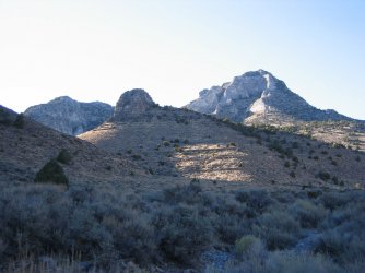
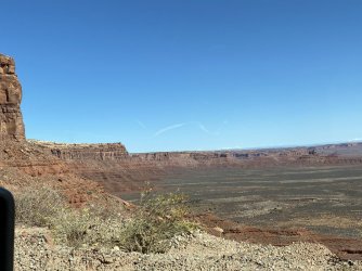
I can't match the photo up with the satellite imagery yet, but is it the Big Ridge?
I hope not because I have never heard of Big Ridge! It is definitely not called Big ridge on the USGS topos.
Udink
Still right here.
- Joined
- Jan 17, 2012
- Messages
- 1,696
This is the Big Ridge I was thinking of. Your photo sure reminds me of the Flint Flat area, but I must be in the wrong area of the state.I hope not because I have never heard of Big Ridge! It is definitely not called Big ridge on the USGS topos.
John Morrow
Member
- Joined
- May 22, 2015
- Messages
- 1,063
Oh yeah, I like the looks of the Happy/Big ridge/Hatch area. Someday....
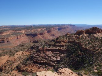
Not the Vermillion Cliffs, though I see the resemblance. These short cliff faces are wingate. A feature on the top left far distant skyline ought to give the general region away...
Not the Vermillion Cliffs, though I see the resemblance. These short cliff faces are wingate. A feature on the top left far distant skyline ought to give the general region away...
John Morrow
Member
- Joined
- May 22, 2015
- Messages
- 1,063
regehr
Member
- Joined
- Mar 28, 2012
- Messages
- 2,252
argh I missed the bears ears!
that silhouette even sort of saved my life once. I mean not really but: I had probably a glass of wine too many at dinner and went for a hike to find some mesa-top ruins that I thought might be near where we were camped. I found these and they were super cool, but then got turned around in some complex drainages on the way back to camp right around dusk and then all of a sudden I saw the bears ears in front of me and realized I was walking 90 degrees off from where I had hoped to be going. got back to camp before dark but this might have been a bit of an adventure if it hand't seen that distinctive skyline view
that silhouette even sort of saved my life once. I mean not really but: I had probably a glass of wine too many at dinner and went for a hike to find some mesa-top ruins that I thought might be near where we were camped. I found these and they were super cool, but then got turned around in some complex drainages on the way back to camp right around dusk and then all of a sudden I saw the bears ears in front of me and realized I was walking 90 degrees off from where I had hoped to be going. got back to camp before dark but this might have been a bit of an adventure if it hand't seen that distinctive skyline view
John Morrow
Member
- Joined
- May 22, 2015
- Messages
- 1,063
I am pretty sure I have been there, but each canyon runs together in my memory....I should give it to someone else.
SteveR
Member
- Joined
- Sep 22, 2016
- Messages
- 890
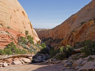
Well, I didn't think that this latest canyon was THAT nondescript! @John Morrow, you seem to have a pretty good idea of where. Take a swing at it!
John Morrow
Member
- Joined
- May 22, 2015
- Messages
- 1,063
Well, I didn't think that this latest canyon was THAT nondescript! @John Morrow, you seem to have a pretty good idea of where. Take a swing at it!
Ooh, then I am likely wrong 'cause I was thinking one of the Comb Ridge canyons near Tooth BM.
SteveR
Member
- Joined
- Sep 22, 2016
- Messages
- 890
Best (and only!) guess so far. Yes, this canyon is not far south of Tooth. That's a good enough guess for me, but the answer that I was really looking for was that this particular canyon holds the "Eagles Nest" ruin as well as the "Ladder" pictograph. Not revealing any secrets here as both are well documented online with locations and tracks, as well as in some guidebooks. Also interesting on our loop with the next canyon south were two sets of cougar prints, one large and one small, in the wet sand of the wash lower down.Ooh, then I am likely wrong 'cause I was thinking one of the Comb Ridge canyons near Tooth BM.
Take it away, @John Morrow.
John Morrow
Member
- Joined
- May 22, 2015
- Messages
- 1,063
Best (and only!) guess so far. Yes, this canyon is not far south of Tooth. That's a good enough guess for me, but the answer that I was really looking for was that this particular canyon holds the "Eagles Nest" ruin as well as the "Ladder" pictograph. Not revealing any secrets here as both are well documented online with locations and tracks, as well as in some guidebooks. Also interesting on our loop with the next canyon south were two sets of cougar prints, one large and one small, in the wet sand of the wash lower down.
Take it away, @John Morrow.
I have a geographic problem remembering which canyon is which on the Comb and what sites reside in which. But I am pretty sure I hiked that loop. We past the ladder. It all runs together in my memory, like a Comb void or vortex. Kinda nice in that each time I visit or revisit I seem to see things I have missed.
John Morrow
Member
- Joined
- May 22, 2015
- Messages
- 1,063
- Joined
- Aug 18, 2018
- Messages
- 1,675

