Guess the spot: Maps Edition

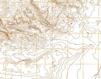
SomewhereBB.jpg
Ha, ha, I didn't realize how this worked. I'm up and my computer caught on fire last week destroying the power supply which I replaced and the DVD drive which I have not replaced yet so I can't get to my Topo but USGS File Depot will do.

At least one member at BCP has been here. We found a set of dinosaur tracks and something else old but not as old as that but I'll not give anything more away just yet, but with the inclusion of the road I think this might not be too hard.
 
I recognized that instantly, even though it's not a USGS topo. ;)

It did look a bit different and that threw me a bit too but it stamped with the USGS mark and has "Produced by the United States Geological Survey marked at the bottom too. I'm curious, why do you say it is not a USGS topo. It looks older too but is marked 2014, maybe some kind of little update? I'd like to know your thoughts on this map.
 
Oops...I meant it's not one of their 1:24,000 digitized print topos (which I'm more accustomed to). I didn't notice your mention of using USGS File Depot.
 
Bingo Micheal. Well done sir. Old Woman wash in indeed in there and the 7.5' quad I cropped it from is named the same. It's your ball.

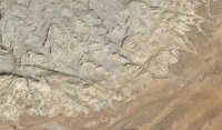
When Udink posted the Google earth screenshot with all the photo icons I checked into those. When I visited the area I didn't even know about Google earth. I didn't see any photos of the pictograph panel but photos all around it. IntrepidX has visited it too and that is how I found the name of the panel. When we found it we were just exploring off trail after seeing the Great Gallery in Horseshoe to the east. We wanted a place off the map so to speak where other folks didn't go and where we didn't know what would happen to us ahead of time. It took us a good part of the day to find the Barrier art. We were eating lunch in the shade of a shallow alcove on our way back and saw the Big Man's upper half, when got closer to see the snake charmers, the sheep conjurer and the hunter.

Kelsey didn't think too much of the area but I wonder if he was just having a bad day. There is good and colorful geology, many layered three dimensional chess moves to get through the folded reef. The dinosaur tracks in the mudstone are the only ones I have ever found on my own too. We liked it so much we went back again and found a very nice colorful lithic scatter among other things, no pottery though. You can't go 10 ' without having to go up, down, left or right, real good canyon country experience if you push it.
 
Thank you for your comments @Wyatt Carson and Dennis @Udink for the picture.
Yes, that's a very beautiful and versatile area. We never were in Old Woman Wash. Not enough time and unfortunatly not the right vehicle. But we visited Hurst Bridge, Temple Mtn Wash, Dennis Wash and Goblins Lair.
The whole area from I-70 down to SR24 is worth for visiting again and again.

Ok, next round. For some of the BCP-Community - easy. :)

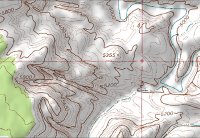
GTS_ME_ms06.jpg
 
Yep, that's Escalante River and the mouth of Spencer Canyon.
In direction to 5355 you'll find a another way to the river.


Gesendet von meinem iPadAir2 mit TapaTalk
 
Time to maybe get this thread back on track. The satellite image/topo I posted is Rock Creek Ranch on the Green River. Anyone who wants to post up another map/image, go for it. :D
 
Back
Top