- Joined
- Dec 2, 2019
- Messages
- 137
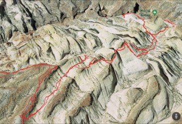
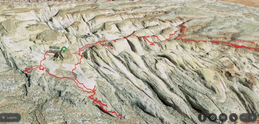
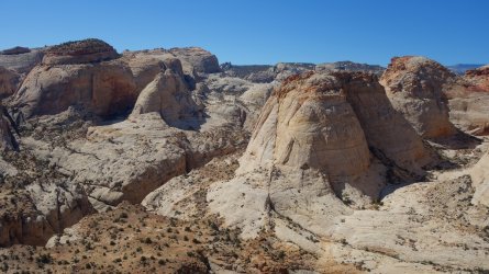
I would like to say that this day-hike had been meticulously planned in advance, but that wasn't really the case. On a Gaia GPS map, I had seen a small side-canyon, north of Capitol Gorge in Capitol Reef National Park. If it went, it looked like it could lead to a nice viewpoint of some of the huge sandstone domes, typical of this section of the park.
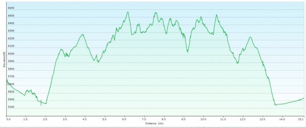
The route up through the side-canyon was a little tricky, with a couple of steep-ish, but short, slickrock slopes to negotiate. After emerging onto the upper levels, the walking was very easy, and it was possible to stroll along the rim and find a multitude of excellent viewpoints of the surrounding area. This had definitely been worth the effort.
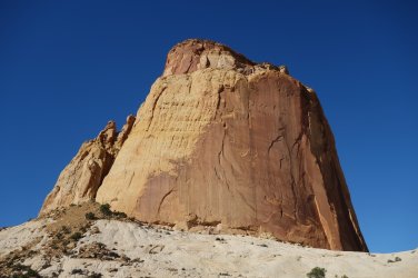
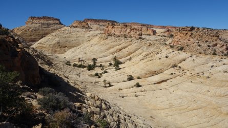
It hadn't taken me long to reach the higher areas, so I decided to do a little exploring. I was pleasantly surprised to find that I could scramble down to the next drainage to the north, and it was then a simple job to follow this scenic valley westwards. After easily rounding a couple of sandstone fins, I realized that I was headed directly towards the iconic Golden Throne feature. After descending a bumpy sandstone slope, the route was relatively straightforward, and before long I was standing alongside this magnificent formation.
I then had a quick glance at the Topo map on my GPS device, and realized that I was only a few hundred yards from the Golden Throne Trail, one of the most popular maintained trails in the park. I was delighted, since this meant I could follow this route back to the parking lot for a very satisfying loop hike. It also meant I wouldn't have to retrace my steps back across the rather convoluted route I had taken so far to reach this point. I should be back at my car within the hour ... hooray !
Ah ! Perhaps a quick glance at my map wasn't very sensible. Although the park trail was tantalizingly close, there was the small inconvenience of an almost 300 foot drop to reach the lower level. Oops ! I did try to scramble down a small gully, but this resulted in a sheer 100 foot cliff below me.
The upside was that I could return to my original route by completing the circuit of the Golden Throne itself, which was a fantastic short walk, with incredible views of many additional stunning sandstone domes. I had spent way too much time earlier looking for a way down from the higher levels, so it was a rather exhausting walk back. It was getting towards sunset when I descended down through the small side-canyon that took me back to Capitol Gorge, and it was dark by the time I reached my car. My hoped-for 1 hour return journey had turned into over 3 hours ! I couldn't complain though; it was a wonderful day's hiking.
I had expected the parking lot to be empty when I returned, but there were 2 guys wandering around the area, with their headlamps shining in all directions. What was going on ? I was a bit nervous as I approached, but it turned out that they had been hiking earlier in the day, and had returned to their motel, only to find that they had left a phone behind at the parking lot. I joined them in the search, and soon after, they fortunately found the phone nearby !
.The route up through the side-canyon was a little tricky, with a couple of steep-ish, but short, slickrock slopes to negotiate. After emerging onto the upper levels, the walking was very easy, and it was possible to stroll along the rim and find a multitude of excellent viewpoints of the surrounding area. This had definitely been worth the effort.
It hadn't taken me long to reach the higher areas, so I decided to do a little exploring. I was pleasantly surprised to find that I could scramble down to the next drainage to the north, and it was then a simple job to follow this scenic valley westwards. After easily rounding a couple of sandstone fins, I realized that I was headed directly towards the iconic Golden Throne feature. After descending a bumpy sandstone slope, the route was relatively straightforward, and before long I was standing alongside this magnificent formation.
I then had a quick glance at the Topo map on my GPS device, and realized that I was only a few hundred yards from the Golden Throne Trail, one of the most popular maintained trails in the park. I was delighted, since this meant I could follow this route back to the parking lot for a very satisfying loop hike. It also meant I wouldn't have to retrace my steps back across the rather convoluted route I had taken so far to reach this point. I should be back at my car within the hour ... hooray !
Ah ! Perhaps a quick glance at my map wasn't very sensible. Although the park trail was tantalizingly close, there was the small inconvenience of an almost 300 foot drop to reach the lower level. Oops ! I did try to scramble down a small gully, but this resulted in a sheer 100 foot cliff below me.
The upside was that I could return to my original route by completing the circuit of the Golden Throne itself, which was a fantastic short walk, with incredible views of many additional stunning sandstone domes. I had spent way too much time earlier looking for a way down from the higher levels, so it was a rather exhausting walk back. It was getting towards sunset when I descended down through the small side-canyon that took me back to Capitol Gorge, and it was dark by the time I reached my car. My hoped-for 1 hour return journey had turned into over 3 hours ! I couldn't complain though; it was a wonderful day's hiking.
I had expected the parking lot to be empty when I returned, but there were 2 guys wandering around the area, with their headlamps shining in all directions. What was going on ? I was a bit nervous as I approached, but it turned out that they had been hiking earlier in the day, and had returned to their motel, only to find that they had left a phone behind at the parking lot. I joined them in the search, and soon after, they fortunately found the phone nearby !
.
==========================================================
.
.
.
.
.
.
.
.
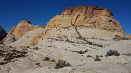
Sandstone Domes above Capitol Gorge (gorge visible left center)
.
.
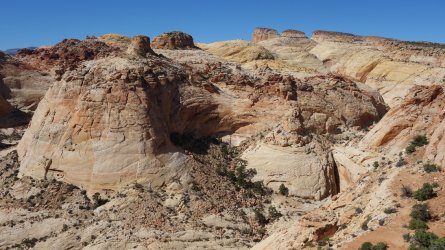
Golden Throne visible in the far distance
.
.
Descending into the next valley to the north
.
.
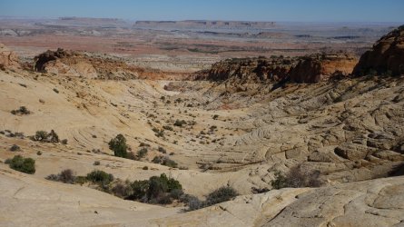
Incredible views eastwards, across the slickrock sea, towards the Notom-Bullfrog Road
.
.
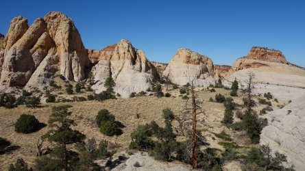
Small domes to the north
.
.
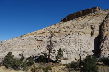
At the bottom of the bumpy sandstone descent
.
.
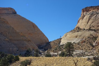
Following the scenic valley towards Golden Throne
.
.
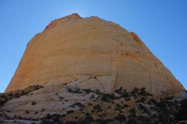
Eastern flank of Golden Throne
.
.
More pretty sandstone formations
.
.
Southern flank of Golden Throne
