- Joined
- Dec 23, 2013
- Messages
- 3,910
@Artemus and his wife Becky graciously invited my family to join them on their backpacking trip across the Gallatin Range in the northwest quadrant of Yellowstone National Park. The trip would include summiting Electric Peak and staying at Sportsman Lake. While my wife was unable to join in, my kids and I gladly accepted the invitation for a five day trek (turned out to be four) in the park. What follows is my interpretation of the facts, and only the facts, of our adventure. All names have been changed to protect the innocent. 
We met up with Art and Becky in West Yellowstone at the Backcounrty Office, located in the southwest corner of the Visitors' Center. They were already watching the backcountry safety video when we walked in to join them. After finishing the video, we collected our official permit, and paid our fee for staying in the backcountry for four nights. We were then off to park my car (the shuttle vehicle) at the Speciman Creek Trailhead located just off highway 191, north of West Yellowstone and just inside the western boundary of the park. As we closed in our trailhead, we noticed to the west of the road, some small fires up on the ridge in the Lee Metcalf Wilderness. Unbeknownst to us, these had been named the Bacon Rind Fire and would come to affect our trip plans while in the backcountry.
Now Art had a couple of cans of expired bear spray on him, so after transferring all of our gear to Art's truck and securing my vehicle, we walked off into the sagebrush and trees to practice with the expired cans.
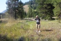
What does he think he is doing? Please do not try this at home.
Well, after four of us had the opportunity to spray, my daughter stepped to the plate and let er rip. Unfortunately the wind had changed slightly and the cloud of spray drifted towards the rest of us. I wasn't quick enough to avoid it, so I got a good swallow and Art got hit too. I coughed for about ten minutes, and it took another twenty after that for the feeling in my throat to dissipate. That makes twice that I have gotten a small dose of bear spray in the face. You know what? That's right, third strike and I am out.
We then all hopped in Art's truck and made our way back to West Yellowstone for dinner and then on to Madison Campground where we stayed for the night before beginning our backpacking in earnest the next day.
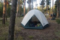
Our tent at Madison Campground located at Madison Junction in Yellowstone. Can three people really fit in there?
Day 1 - The big day has finally arrived. We are up by 8:00 am and on the road by 10:00 am heading to Bunsen Peak Trailhead which is located just south of Mammoth. Now normally for this hike, we would park at the Glen Creek Trailhead, but because of construction at this trailhead, we had to park across the Grand Loop Road instead, at the Bunsen Peak Trailhead.
Nothing spectacular happened to us on the way to the trailhead. There was some construction between Norris and Mammoth that we had to contend with. We ended up waiting for about ten minutes while they let cars going in the opposite direction (southbound) through. While we waited, we were entertained by four ravens who were going down the line of cars and cawing at all of us.
After the slight delay, we soon found ourselves at the trailhead, and after getting our gear ready, we were off and on the trail.
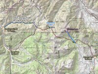
Trip overview map - roughly 33 miles including the summiting of Electric Peak
We started out making our way across the northern portion of Swan Lake Flat then following Glen Creek to the northwest. Once we left Glen Creek, we hike up and over a small ridge, dropping down to the Gardner River and then on to our campsite 1G4 for the night which is located on the Gardner.
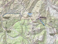
Day 1 overview map
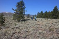
Making our way through the northern end of Swan Lake Flat
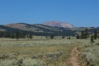
The ever present Electric Peak
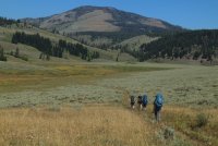
Nearing Glen Creek with Sepulcher Mountain ahead
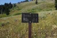
Trail junction sign
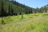
Entering the Glen Creek Drainage
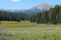
Meadows along Glenn Creek
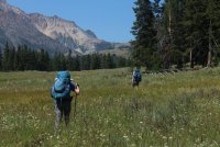
Moving out of the Glen Creek Drainage
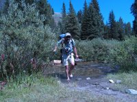
Art crossing the Gardner River just below our campsite
Campsite 1G4
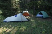
Our tent site at 1G4
Campsite 1G4 was located on the Gardner River (water source for the campsite) with a small meadow to the east full of wildflowers. While staying at this site, we were able to hear an owl hooting and a couple of bugling elk.
Day 2 - The attempt of Electric Peak. We woke up relatively early for this hike and were on the trail just after 9:00 am. As we crossed the Gardner River, we met some folks from Wisconsin who were going to attempt the summit also. After putting our shoes back on after the crossing, we left them, but would occasionally see them making their way up the ridge behind us. They ended up not summiting though one of their members got close. Essentially, the trail just takes you up the ridgeline (steep at times) to a false summit. To the north is the real summit and once the trail ends there is a lot of class 3 and 4 scrambling that takes place in order for one to reach the summit. @Artemus is going to add to this report on his expert take on our ascent. I'm sure he can add all of the technical alpine jargon along with some interesting images of our route to the top.
Of course views from the top were spectacular. :twothumbs: We could see south to Mount Holmes and even further to Mount Sheridan. If it hadn't been slightly smoky, I believe we could have seen the Tetons also. To the east, the town of Gardner, MT below us, The Black Canyon of the Yellowstone, Mount Washburn, some of the Grand Canyon of the Yellowstone and a piece of Hayden Valley. To the west we could see deep into the heart of the Lee Metcalf Wilderness, and the fire we drove by to park the shuttle vehicle on our way in, had grown in size. Hmm? And of course to the north, we could see the mighty Yellowstone River making its way towards the Missouri.
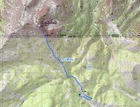
Overview map for day 2 - summitng Electric Peak
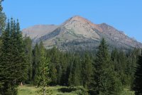
Our destination
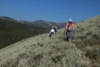
Becky joined us for about the first third of the hike then went back to camp. While back at camp, she had to deal with an unexpected visitor at our campsite.
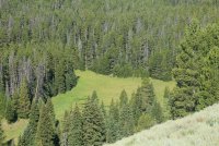
Up above the meadow we are camped by. If you look closely, you can just make out my tent in the trees.
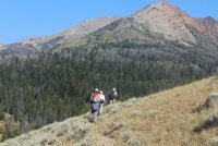
Still seems far away to me.
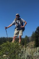
He's got Summit Fever! Almost like a bull bison in the rut.
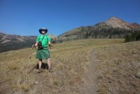
Not sure what I've got. Maybe Flatland Fever?
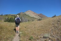
Art, taking Electric Peak all in.
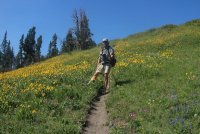
Art, among the Goldeneye, Geraniums and Lupine
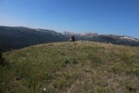
Jr. in deep meditation
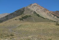
The difficult part of the hike is about to begin.
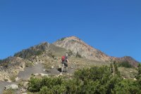
Jr. takes the lead - I want my youth back!
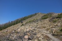
Art, tackling a steep section.
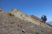
Art, looking up at the false summit.
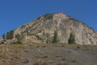
Mmm, Mmm, Mmm, am I going to make this? Breathing hard at this point.
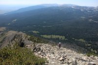
Katie - oops, I mean Scatgirl digging in along the ridge.
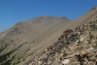
Ridge to the west of Electric Peak Summit
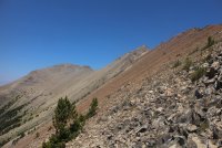
First view of the true summit
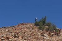
Art. on the ridge
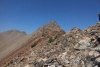
Almost seems within reach
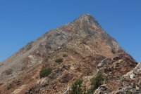
Close up of summit
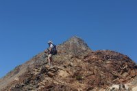
Art and summit or perhaps, Summit Art
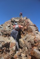
Let the scrambling begin
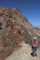
The way to the top isn't so clear at this point
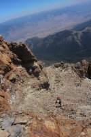
Jr., making his way up
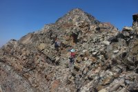
Butt puckering on my part about now. Some good exposure on this stretch. As @Artemus would say, "The Crux!" Momma (southern spelling) told me there'd be days like this.
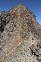
Still more? You know, I can't hold a butt pucker for this long! Ascend to Safety!
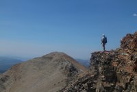
This shot reminds me of King Kong on Skull Island - Art surveying his domain.
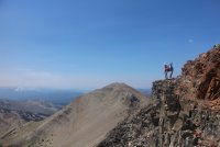
Scatgirl looking down, Art looking up. Ascend to Safety!
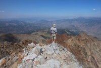
Art on top, looking north and wondering about the various mountain ranges within his sight.
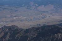
Gardner, Montana below.
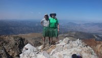
You know the old saying, "Those who share a kilt together stay together."
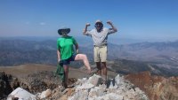
Altitude sickness at work
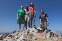
Group shot on summit
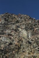
Beginning to work our way back down
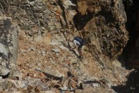
Down climbing off the summit
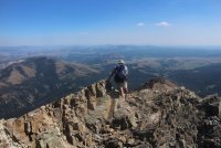
Scrambling down across the ridge. Mount Washburn can be seen in the far distance.
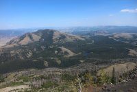
Sepulcher Mountain and Cache Lake, You can just make out Swan Lake and Bunsen Peak in the upper right of the image.
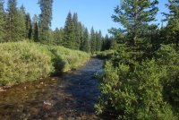
Back to ford the rather small at this point Gardner River.
After approximately nine hours we arrived back at camp to find we had an uninvited guest - one Mike from California who had set his tent up in the meadow by our campsite. Now Mike claimed that he had reserved our sight for the next night and that he had hiked in a day early. We suggested that since the people from Wisconsin had left our neighboring campsite, that he go check it out, and if not occupied, move his gear over there. He obliged us and changed campsites. We checked on Mike later that evening to make sure he was okay with camping solo in a bear management area and he had some more stories for us to chew on. He said he was okay, so we returned to our campsite and called it a night.
Day 3 - Our route on day three will take us up and over Electric Pass and drop us down to Sportsman Lake and campsite WD2.
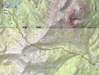
Overview map for day 3
I knew that this day would be the toughest for me, because I was still tired from climbing Electric Peak the day before. It was a steady climb to the pass and once there we took a long break and watched a large herd of elk along the ridge to southwest of us. I counted 159 elk, but I probably missed a few along the way. There were still some snow fields along the hillside and the elk were walking across them, seemingly enjoying themselves. The younger elk would prance back and forth across the snow. We had a pair of binoculars and a monocular and we sat and watched them for a good amount of time.
Once rested, we descended down a steep trail to the basin that Sportsman Lake sits in and set up our camp. On the west side of the pass, not only was the smoke in the air a little thicker, but we could smell the smoke of a distant fire too. Hmm.
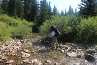
Becky, crossing the Gardner River on day 3
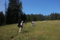
Beginning our ascent towards the pass
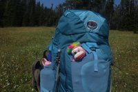
Instead of a Lego figure @Miya , we have Tarquin - a sock monkey
A butterfly along the trail
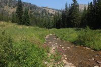 Monkey Flower and the Headwaters of the Gardner River
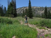
On break
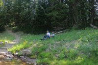
Art and Becky enjoying their lunch
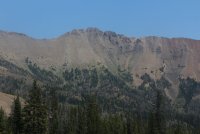
A peak back at Electric Peak
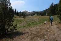
Becky and Katie making their way towards Electric Pass
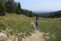
Becky and Art - looking east, back down the Gardner River Drainage
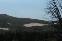
A herd of elk spotted at the top of the ridge to the southwest of us. They are the little dots on top of the ridge.
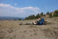
Oh the life! Jr. on Electric Pass
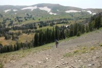
Art, almost at the pass
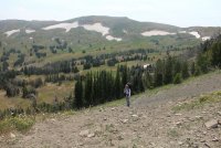
Becky, almost at the pass. The snowfields behind Becky are the ones the elk walked across.
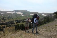
Art, the helper engine. Called upon only for steep grades.
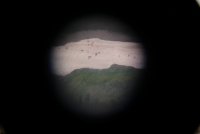
A shot through my monocular of the elk on one of the snowfields.
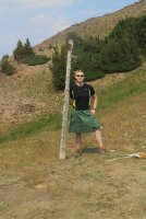
Holding a downed post up so that those who cross the pass will know which way to go. My good deed for the day.
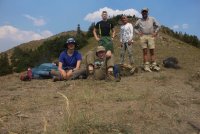
Group shot on Electric Pass
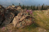
Fireweed and Rock - on our descent to Sportsman Lake
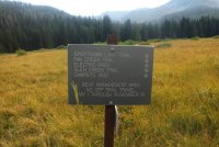
Sign located in the meadow near Sportsman Lake
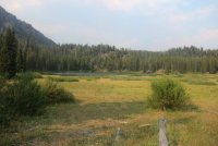
Sportsman Lake
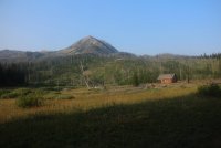
Patrol Cabin at Sportsman Lake
While eating dinner, I noticed a black bear walking across the hillside behind the patrol cabin. He was moving from right to left across the above image and eventually. I lost sight of him in the trees towards the left side of the image. After dinner, two trail crew members, who were staying at the patrol cabin, stopped in to tell us that all the trailheads were closed north of the Bighorn Pass trailhead along highway 191 due to the Bacon Rind Fire. Our choices at this time were to hike back to mammoth, the way we had come in ( I didn't really want to go back over Electric Pass from this side ) or exit at the Bighorn Pass Trailhead which would be a twenty mile day. I'm not sure that I have a twenty mile day with a full pack on in me anymore. I began to worry about my car now, would it burn up sitting at trails end? If we exit south of our trails end how will we get back to it?
The trail crew boss told us that he would be making a call on his satellite phone at eight o'clock the next morning and would update us on the situation but in the meantime be thinking about our options.
As dusk settled, the kids and I headed for our tents to rest up for what ever decision was made in the morning. Art and Becky stayed at the food area to catch the first night stars and maybe a meteor or two (the Perseid meteor shower would reach its maximum activity on the 13th). When they had finished star gazing, they got up to head to their tent. Unbeknownst to them, a black bear had walked in right next to the food area. Them getting up startled the bear, and he ran off down the trail and right between our tents. Nothing like a good adrenaline rush at the end of the day to make for a good night's sleep. I'm sure Art and Becky were as startled by the bear as the bear was of them. Needless to say, I didn't get a lot of sleep that night due to fire and bear worries. I think I noticed a collar on the bear that said @Rockskipper on it, but who knows, I could have dreamed it sometime throughout my restless night.
Day 4 - Just before 8:00 am, I headed over to the patrol cabin to see what our fate was going to be. The trail crew boss had some semi-good news for us. They were going to let us exit at the Fawn Pass Trailhead instead of having to hike back to Mammoth. This would still leave us six miles south of my car parked at the Specimen Creek Trailhead, but it was better than either the Bighorn option or going back up the pass towards Mammoth. They assured us that there would be someone form the fire crew or a ranger that would shuttle us back to my car when we arrived at the trailhead. We didn't have to beat our heads together for too long to decide that we would take this option, even though it did add a little distance to our exit.
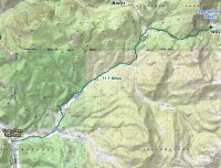
Day four overview map
This exit route would take us down Fan Creek instead of Specimen Creek. Back in the day, I had hiked up Fan Creek in order to do the Skyrim Trail and the meadows along Fan Creek are beautiful and did not disappoint on the second go round. On our way out, we saw an adolescent hawk that shrieked at us for a bit, and we saw a long tailed weasel. As we approached the trailhead, you could tell the fire was worse than when we parked the shuttle car five days earlier.
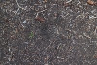
Black Bear print near the food prep area from the night before.
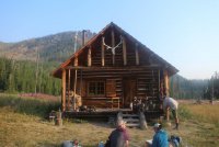
Patrol Cabin and some of the trail crew around 8:00 am.
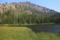
Sportsman Lake in the morning
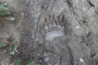
A black bear print on our way out of the Sportsman Lake Basin
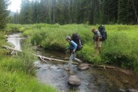
Becky and Art crossing the North Fork of Fan Creek
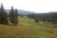
Meadows along Fan Creek - smoky too.
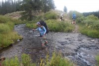
Becky, crossing Fan Creek
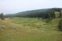
More of the gorgeous meadows along Fan Creek. Where are the moose?
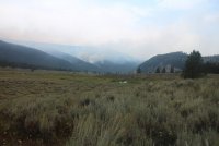
Part of the Bacon Rind Fire to the north of us.
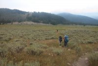
The Fawn Pass Trailhead is within sight.
At the trailhead, there turned out to be nobody waiting for us, so I hitched a ride north to my vehicle and returned to pick everybody up.
Whew. I think I worked up a sweat just writing this puppy up. Art and Becky, thank you both so much for inviting us on this trip. Not only was it a great trip and we all had a wonderful time, but we got to spend it with great company and learned company at that. Please feel free to add whatever you want to this report. If I have gotten anything wrong or exaggerated too much, please knock me back in line with your or Becky's perspective. The mileage I included was taken off of maps and I added roughly ten percent to the daily totals to arrive at 32.9 miles. I know your GPS had us at a touch over 33, so you're welcome to correct my numbers if need be.
One last thing. I'll be posting this report on the same day that Aretha Franklin passed away. She was one of my favorite singers and one of the truly greats IMHO. I hummed a few of her songs passing over the Gallatins on this trip. Rest in peace Areatha. And remember to Rock Steady all you BCP folks, Rock Steady.
Over and out.
We met up with Art and Becky in West Yellowstone at the Backcounrty Office, located in the southwest corner of the Visitors' Center. They were already watching the backcountry safety video when we walked in to join them. After finishing the video, we collected our official permit, and paid our fee for staying in the backcountry for four nights. We were then off to park my car (the shuttle vehicle) at the Speciman Creek Trailhead located just off highway 191, north of West Yellowstone and just inside the western boundary of the park. As we closed in our trailhead, we noticed to the west of the road, some small fires up on the ridge in the Lee Metcalf Wilderness. Unbeknownst to us, these had been named the Bacon Rind Fire and would come to affect our trip plans while in the backcountry.
Now Art had a couple of cans of expired bear spray on him, so after transferring all of our gear to Art's truck and securing my vehicle, we walked off into the sagebrush and trees to practice with the expired cans.

What does he think he is doing? Please do not try this at home.

Well, after four of us had the opportunity to spray, my daughter stepped to the plate and let er rip. Unfortunately the wind had changed slightly and the cloud of spray drifted towards the rest of us. I wasn't quick enough to avoid it, so I got a good swallow and Art got hit too. I coughed for about ten minutes, and it took another twenty after that for the feeling in my throat to dissipate. That makes twice that I have gotten a small dose of bear spray in the face.
 You know what? That's right, third strike and I am out.
We then all hopped in Art's truck and made our way back to West Yellowstone for dinner and then on to Madison Campground where we stayed for the night before beginning our backpacking in earnest the next day.

Our tent at Madison Campground located at Madison Junction in Yellowstone. Can three people really fit in there?
Day 1 - The big day has finally arrived. We are up by 8:00 am and on the road by 10:00 am heading to Bunsen Peak Trailhead which is located just south of Mammoth. Now normally for this hike, we would park at the Glen Creek Trailhead, but because of construction at this trailhead, we had to park across the Grand Loop Road instead, at the Bunsen Peak Trailhead.
Nothing spectacular happened to us on the way to the trailhead. There was some construction between Norris and Mammoth that we had to contend with. We ended up waiting for about ten minutes while they let cars going in the opposite direction (southbound) through. While we waited, we were entertained by four ravens who were going down the line of cars and cawing at all of us.
After the slight delay, we soon found ourselves at the trailhead, and after getting our gear ready, we were off and on the trail.

Trip overview map - roughly 33 miles including the summiting of Electric Peak
We started out making our way across the northern portion of Swan Lake Flat then following Glen Creek to the northwest. Once we left Glen Creek, we hike up and over a small ridge, dropping down to the Gardner River and then on to our campsite 1G4 for the night which is located on the Gardner.

Day 1 overview map

Making our way through the northern end of Swan Lake Flat

The ever present Electric Peak

Nearing Glen Creek with Sepulcher Mountain ahead

Trail junction sign

Entering the Glen Creek Drainage

Meadows along Glenn Creek

Moving out of the Glen Creek Drainage

Art crossing the Gardner River just below our campsite

Campsite 1G4

Our tent site at 1G4
Campsite 1G4 was located on the Gardner River (water source for the campsite) with a small meadow to the east full of wildflowers. While staying at this site, we were able to hear an owl hooting and a couple of bugling elk.
Day 2 - The attempt of Electric Peak. We woke up relatively early for this hike and were on the trail just after 9:00 am. As we crossed the Gardner River, we met some folks from Wisconsin who were going to attempt the summit also. After putting our shoes back on after the crossing, we left them, but would occasionally see them making their way up the ridge behind us. They ended up not summiting though one of their members got close. Essentially, the trail just takes you up the ridgeline (steep at times) to a false summit. To the north is the real summit and once the trail ends there is a lot of class 3 and 4 scrambling that takes place in order for one to reach the summit. @Artemus is going to add to this report on his expert take on our ascent. I'm sure he can add all of the technical alpine jargon along with some interesting images of our route to the top.
Of course views from the top were spectacular. :twothumbs: We could see south to Mount Holmes and even further to Mount Sheridan. If it hadn't been slightly smoky, I believe we could have seen the Tetons also. To the east, the town of Gardner, MT below us, The Black Canyon of the Yellowstone, Mount Washburn, some of the Grand Canyon of the Yellowstone and a piece of Hayden Valley. To the west we could see deep into the heart of the Lee Metcalf Wilderness, and the fire we drove by to park the shuttle vehicle on our way in, had grown in size. Hmm? And of course to the north, we could see the mighty Yellowstone River making its way towards the Missouri.

Overview map for day 2 - summitng Electric Peak

Our destination

Becky joined us for about the first third of the hike then went back to camp. While back at camp, she had to deal with an unexpected visitor at our campsite.

Up above the meadow we are camped by. If you look closely, you can just make out my tent in the trees.

Still seems far away to me.

He's got Summit Fever! Almost like a bull bison in the rut.


Not sure what I've got. Maybe Flatland Fever?

Art, taking Electric Peak all in.

Art, among the Goldeneye, Geraniums and Lupine

Jr. in deep meditation

The difficult part of the hike is about to begin.

Jr. takes the lead - I want my youth back!

Art, tackling a steep section.

Art, looking up at the false summit.

Mmm, Mmm, Mmm, am I going to make this? Breathing hard at this point.


Katie - oops, I mean Scatgirl digging in along the ridge.

Ridge to the west of Electric Peak Summit

First view of the true summit

Art. on the ridge

Almost seems within reach

Close up of summit

Art and summit or perhaps, Summit Art

Let the scrambling begin

The way to the top isn't so clear at this point

Jr., making his way up

Butt puckering on my part about now. Some good exposure on this stretch. As @Artemus would say, "The Crux!" Momma (southern spelling) told me there'd be days like this.

Still more? You know, I can't hold a butt pucker for this long! Ascend to Safety!

This shot reminds me of King Kong on Skull Island - Art surveying his domain.

Scatgirl looking down, Art looking up. Ascend to Safety!

Art on top, looking north and wondering about the various mountain ranges within his sight.

Gardner, Montana below.

You know the old saying, "Those who share a kilt together stay together."

Altitude sickness at work

Group shot on summit

Beginning to work our way back down

Down climbing off the summit

Scrambling down across the ridge. Mount Washburn can be seen in the far distance.

Sepulcher Mountain and Cache Lake, You can just make out Swan Lake and Bunsen Peak in the upper right of the image.

Back to ford the rather small at this point Gardner River.
After approximately nine hours we arrived back at camp to find we had an uninvited guest - one Mike from California who had set his tent up in the meadow by our campsite. Now Mike claimed that he had reserved our sight for the next night and that he had hiked in a day early. We suggested that since the people from Wisconsin had left our neighboring campsite, that he go check it out, and if not occupied, move his gear over there. He obliged us and changed campsites. We checked on Mike later that evening to make sure he was okay with camping solo in a bear management area and he had some more stories for us to chew on. He said he was okay, so we returned to our campsite and called it a night.
Day 3 - Our route on day three will take us up and over Electric Pass and drop us down to Sportsman Lake and campsite WD2.

Overview map for day 3
I knew that this day would be the toughest for me, because I was still tired from climbing Electric Peak the day before. It was a steady climb to the pass and once there we took a long break and watched a large herd of elk along the ridge to southwest of us. I counted 159 elk, but I probably missed a few along the way. There were still some snow fields along the hillside and the elk were walking across them, seemingly enjoying themselves. The younger elk would prance back and forth across the snow. We had a pair of binoculars and a monocular and we sat and watched them for a good amount of time.
Once rested, we descended down a steep trail to the basin that Sportsman Lake sits in and set up our camp. On the west side of the pass, not only was the smoke in the air a little thicker, but we could smell the smoke of a distant fire too. Hmm.

Becky, crossing the Gardner River on day 3

Beginning our ascent towards the pass

Instead of a Lego figure @Miya , we have Tarquin - a sock monkey

A butterfly along the trail
 Monkey Flower and the Headwaters of the Gardner River
On break

Art and Becky enjoying their lunch

A peak back at Electric Peak

Becky and Katie making their way towards Electric Pass

Becky and Art - looking east, back down the Gardner River Drainage

A herd of elk spotted at the top of the ridge to the southwest of us. They are the little dots on top of the ridge.

Oh the life! Jr. on Electric Pass

Art, almost at the pass

Becky, almost at the pass. The snowfields behind Becky are the ones the elk walked across.

Art, the helper engine. Called upon only for steep grades.

A shot through my monocular of the elk on one of the snowfields.

Holding a downed post up so that those who cross the pass will know which way to go. My good deed for the day.

Group shot on Electric Pass

Fireweed and Rock - on our descent to Sportsman Lake

Sign located in the meadow near Sportsman Lake

Sportsman Lake

Patrol Cabin at Sportsman Lake
While eating dinner, I noticed a black bear walking across the hillside behind the patrol cabin. He was moving from right to left across the above image and eventually. I lost sight of him in the trees towards the left side of the image. After dinner, two trail crew members, who were staying at the patrol cabin, stopped in to tell us that all the trailheads were closed north of the Bighorn Pass trailhead along highway 191 due to the Bacon Rind Fire. Our choices at this time were to hike back to mammoth, the way we had come in ( I didn't really want to go back over Electric Pass from this side ) or exit at the Bighorn Pass Trailhead which would be a twenty mile day. I'm not sure that I have a twenty mile day with a full pack on in me anymore. I began to worry about my car now, would it burn up sitting at trails end? If we exit south of our trails end how will we get back to it?
The trail crew boss told us that he would be making a call on his satellite phone at eight o'clock the next morning and would update us on the situation but in the meantime be thinking about our options.
As dusk settled, the kids and I headed for our tents to rest up for what ever decision was made in the morning. Art and Becky stayed at the food area to catch the first night stars and maybe a meteor or two (the Perseid meteor shower would reach its maximum activity on the 13th). When they had finished star gazing, they got up to head to their tent. Unbeknownst to them, a black bear had walked in right next to the food area. Them getting up startled the bear, and he ran off down the trail and right between our tents. Nothing like a good adrenaline rush at the end of the day to make for a good night's sleep. I'm sure Art and Becky were as startled by the bear as the bear was of them. Needless to say, I didn't get a lot of sleep that night due to fire and bear worries.
Day 4 - Just before 8:00 am, I headed over to the patrol cabin to see what our fate was going to be. The trail crew boss had some semi-good news for us. They were going to let us exit at the Fawn Pass Trailhead instead of having to hike back to Mammoth. This would still leave us six miles south of my car parked at the Specimen Creek Trailhead, but it was better than either the Bighorn option or going back up the pass towards Mammoth. They assured us that there would be someone form the fire crew or a ranger that would shuttle us back to my car when we arrived at the trailhead. We didn't have to beat our heads together for too long to decide that we would take this option, even though it did add a little distance to our exit.

Day four overview map
This exit route would take us down Fan Creek instead of Specimen Creek. Back in the day, I had hiked up Fan Creek in order to do the Skyrim Trail and the meadows along Fan Creek are beautiful and did not disappoint on the second go round. On our way out, we saw an adolescent hawk that shrieked at us for a bit, and we saw a long tailed weasel. As we approached the trailhead, you could tell the fire was worse than when we parked the shuttle car five days earlier.

Black Bear print near the food prep area from the night before.

Patrol Cabin and some of the trail crew around 8:00 am.

Sportsman Lake in the morning

A black bear print on our way out of the Sportsman Lake Basin

Becky and Art crossing the North Fork of Fan Creek

Meadows along Fan Creek - smoky too.

Becky, crossing Fan Creek

More of the gorgeous meadows along Fan Creek. Where are the moose?

Part of the Bacon Rind Fire to the north of us.

The Fawn Pass Trailhead is within sight.
At the trailhead, there turned out to be nobody waiting for us, so I hitched a ride north to my vehicle and returned to pick everybody up.
Whew. I think I worked up a sweat just writing this puppy up. Art and Becky, thank you both so much for inviting us on this trip. Not only was it a great trip and we all had a wonderful time, but we got to spend it with great company and learned company at that. Please feel free to add whatever you want to this report. If I have gotten anything wrong or exaggerated too much, please knock me back in line with your or Becky's perspective. The mileage I included was taken off of maps and I added roughly ten percent to the daily totals to arrive at 32.9 miles. I know your GPS had us at a touch over 33, so you're welcome to correct my numbers if need be.
One last thing. I'll be posting this report on the same day that Aretha Franklin passed away. She was one of my favorite singers and one of the truly greats IMHO. I hummed a few of her songs passing over the Gallatins on this trip. Rest in peace Areatha. And remember to Rock Steady all you BCP folks, Rock Steady.
Over and out.
Attachments
Last edited:

