- Joined
- Aug 9, 2007
- Messages
- 12,957
This is the third part of three trip reports from my 3-day backpacking trip through Maidenwater Canyon, Trachyte Creek and Swett Creek.
Part 1: Maidenwater Canyon
Part 2: Trachyte Creek
April 2012
After our side trip down to Lake Powell, we were back at the mouth of Swett Creek grabbing a liter of water out of Trachyte before heading into the unknown. We had mistakenly believed there would be a bit of water flowing through Swett but it was bone dry. We didn't particularly want to drink Trachyte because of the heavy cow traffic that day, but we had no idea when or if we would find water in Swett.
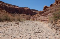
Lower Swett is grand and wide like a landscape from a western movie. This mudstone hoodoo had managed to survive almost right in the middle of the wash.
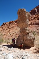
Within a half mile or so we were relieved to start seeing some signs of water.
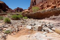
There was a trickle coming over this ledge. Nothing like a shot I've seen from Jammer where it was a full blow waterfall.
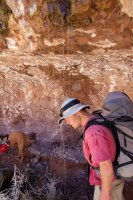
Above the ledge, the water picked up a bit as we approached Hoskinnini Monument, a huge pillar of wingate sandstone near the mouth of South Fork Swett Creek.
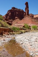
Soon after Hoskinnini Monument, the water dried up and we were walking up a very hot, very dry wash. We stopped under a large boulder to give Sonny some shade and have a look at the map. The route information I had said that the upcoming narrows could be quite difficult and hold 'a lot of water'. We hoped to camp before entering the narrows so we could start fresh there in the morning, but at the rate we were going with water, we would need to get all the way in tonight.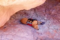
To complicate the situation, the herd of cows that we had followed down Trachyte Creek earlier had come up Swett Creek. We tried to get around them back at South Fork Swett but the moment they would see us, they would just run up canyon. Not a big deal I suppose if we weren't headed directly into a slot canyon impassable to cows. What would you even do if you ran a couple dozen cows into the slot you were headed for?
Luckily, we approached the herd again while they were on a bit of a bench and made it past all but a cow and calf. After following them for a mile or so, we finally got past and they went running back for the herd. So glad we didn't run them all the way into the slot!
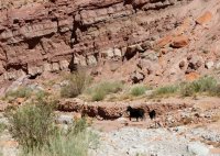
This is the area we really wanted to camp in. It was beautiful but also very hot and very dry. As we approached the final bend before the narrows, we gave up hope for water and decided we would need to camp on the other side of the narrows, or if we were lucky enough to find water and a campsite, perhaps in the narrows.
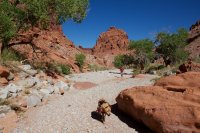
Just as we had given up hope, we crossed another ledge of chinle and found a huge pothole. It didn't look all that great but we weren't going to be picky. We about jumped in for a swim but then realized we'd probably better purify some water first. We made the terrible mistake of bringing the Steripen instead of an actual water filter on this trip. Don't get me wrong, I LOVE the Steripen, but there are some situations where only a filter will do and this was one of them.
Nate went to work with a liter of water. It looked disturbingly murky in the nalgene bottle but we still gave it a cycle with the steripen and then a little taste test. Nate tried it first... a little "funky" he says. So I take it and went for a full gulp. That dead animal silt funk feces stew hit my gag reflex like a semi and I about puked immediately. This was not going to fly. So we poured it out and decided we were going for the narrows but first, a quick dip in the pool. As soon as we got in, we were waist+ deep in water and another foot or more of nasty mud. The smell of death came rushing up from the water as we disturbed the sediment. NASTY.
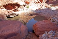
So we started up into the narrows of Swett Creek, thirsty and tired, where our spirits were quickly lifted by the incredible scenery.
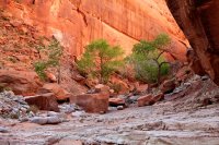
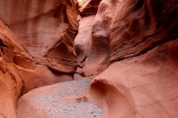
We quickly hit the first major obstacle. This doesn't look all that bad but it would have been extremely difficult to ascent solo and even harder if the pool below had been full like I believe it often is. I had to get Nate up onto my shoulders to get him up. There were just no handholds anywhere and the granite boulder had been polished quite smooth.
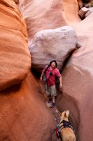
Nate had to pull me most of the way up, this was taken where I finally could get myself up the rest of the way.
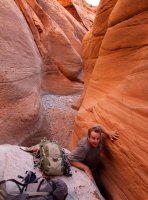
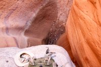
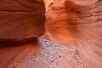
Around a bend or two, we ran into the next significant obstacle. This was much worse than the first. I regret not getting a shot with scale in it but we were actually getting a bit nervous at this point. This one took some serious teamwork to surmount, only an excellent climber could climb this solo.
Just to give you an idea, I am 6'4" tall, Nate is probably 5'6" or so. With me standing upright and him on my shoulders, he was barely able to get himself onto this boulder. To get myself up, Nate tied a 30 foot piece of webbing around his waste and wedged himself on the other side of the boulder. I tied a few loops in the webbing and climbed it hand over hand with pretty much no foot holds at all. It was a serious task. I'd say this was 15 feet from top to bottom, might not look quite like it but the low point in the sand is the highest we could stand without being under the overhang.
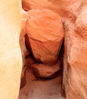
Above the obstacles, the narrows are wider but no less beautiful. We passed by multiple good small slickrock bench campsites that would have been awesome... if we had some water.
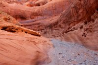
One of the things I liked the most about the canyons below Boulder Mountain is the granite. Where else do you get beautiful red sandstone filled with awesome grey granite?
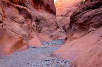
We walked further up the canyon to a bend that had a spring marked on the topo map. At this point, it was our only hope for finding water and being able to camp another night. The truck was another 4-5 miles away, it was getting late and we had already put down a lot of miles. We reached the bend and found what looks like a dried up seep. What a bummer that was. So it was decided, unless we found some good water, we were going to hike out in the dark and car camp. On the bright side, a cold beer was sounding very, very good.
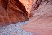
But around another bend, I smelled it.. WATER! Around another bend or two and there it was. First a couple of small puddles, it didn't look the best, but we could drink it. Then we hit it... clear, gently flowing water for about 100 feet. This pool was actually quite deep, a little over the waste.
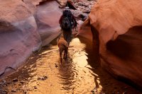
Just upstream, we found a nice little flat spot next to a small side canyon to setup camp.
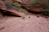
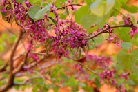
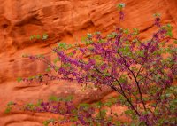
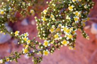
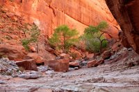
There was a cairn there and it looked like a grotto at the top. Nate went to check it out while I took photos of the trees. There were so many of these flowering trees in this section of the canyon.
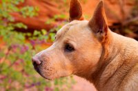
Sonny waiting for Nate to return.
The grotto had some seepage but nothing we could collect from so we dropped our gear and walked a couple hundred feet back down canyon to the best pools. The water was clear and tasted fantastic.
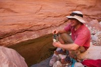
There was an active frog population at this spring. It was quite the stereo experience to sit where we were and purify water. Here's a short video clip to give you an idea. Make sure your volume is turned up.
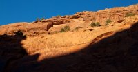
Last light on the wall above camp. This went out abruptly when the sun passed over the Henry Mountains
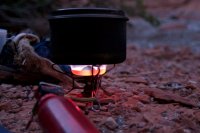
A shot I liked of Nate cooking his dinner. I have gone stove-free and after this trip, I think Nate is too. It's just so much easier...
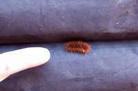
We slept that night on the tarp again, with the chorus of frogs down canyon and a starry, moonless sky above. The next morning, we found our first official 'creepy crawly' to infiltrate the tarp. This little guy was hiding in between cels on the underside of Nate's sleeping pad.
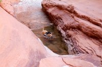
We thought we were past the water but we did run into one more pool the next day.
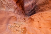
The narrows continued to amaze as we hiked up the canyon
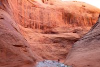
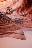
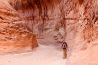
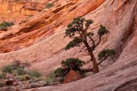
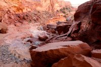
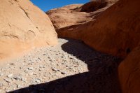
There is a short section where the canyon opens up but then immediately closes back up as it winds the last couple of miles through this shallow navajo slot.
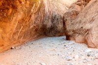
26 miles later, we were back at Highway 276 where my truck was waiting. We didn't see anyone for the entire hike until the last mile of Swett Creek. And the people we did see were equally surprised to see us.
This was an all around excellent trip, high on my list of desert backpacking routes. I would highly recommend it to more experienced backpackers and those who really crave solitude and the feeling of being so far away from civilization. There's a good chance you won't even see footprints on some sections of this hike.
And if the 4-mile bike shuttle down 276 doesn't work for you, the loop through Swett and Woodruff also looks very good. I believe that is closer to 17 miles and you could just walk the last half mile or so between the trailheads.
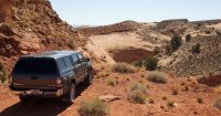
Featured image for slideshow:
Part 1: Maidenwater Canyon
Part 2: Trachyte Creek
April 2012
After our side trip down to Lake Powell, we were back at the mouth of Swett Creek grabbing a liter of water out of Trachyte before heading into the unknown. We had mistakenly believed there would be a bit of water flowing through Swett but it was bone dry. We didn't particularly want to drink Trachyte because of the heavy cow traffic that day, but we had no idea when or if we would find water in Swett.

Lower Swett is grand and wide like a landscape from a western movie. This mudstone hoodoo had managed to survive almost right in the middle of the wash.

Within a half mile or so we were relieved to start seeing some signs of water.

There was a trickle coming over this ledge. Nothing like a shot I've seen from Jammer where it was a full blow waterfall.

Above the ledge, the water picked up a bit as we approached Hoskinnini Monument, a huge pillar of wingate sandstone near the mouth of South Fork Swett Creek.

Soon after Hoskinnini Monument, the water dried up and we were walking up a very hot, very dry wash. We stopped under a large boulder to give Sonny some shade and have a look at the map. The route information I had said that the upcoming narrows could be quite difficult and hold 'a lot of water'. We hoped to camp before entering the narrows so we could start fresh there in the morning, but at the rate we were going with water, we would need to get all the way in tonight.

To complicate the situation, the herd of cows that we had followed down Trachyte Creek earlier had come up Swett Creek. We tried to get around them back at South Fork Swett but the moment they would see us, they would just run up canyon. Not a big deal I suppose if we weren't headed directly into a slot canyon impassable to cows. What would you even do if you ran a couple dozen cows into the slot you were headed for?
Luckily, we approached the herd again while they were on a bit of a bench and made it past all but a cow and calf. After following them for a mile or so, we finally got past and they went running back for the herd. So glad we didn't run them all the way into the slot!

This is the area we really wanted to camp in. It was beautiful but also very hot and very dry. As we approached the final bend before the narrows, we gave up hope for water and decided we would need to camp on the other side of the narrows, or if we were lucky enough to find water and a campsite, perhaps in the narrows.

Just as we had given up hope, we crossed another ledge of chinle and found a huge pothole. It didn't look all that great but we weren't going to be picky. We about jumped in for a swim but then realized we'd probably better purify some water first. We made the terrible mistake of bringing the Steripen instead of an actual water filter on this trip. Don't get me wrong, I LOVE the Steripen, but there are some situations where only a filter will do and this was one of them.
Nate went to work with a liter of water. It looked disturbingly murky in the nalgene bottle but we still gave it a cycle with the steripen and then a little taste test. Nate tried it first... a little "funky" he says. So I take it and went for a full gulp. That dead animal silt funk feces stew hit my gag reflex like a semi and I about puked immediately. This was not going to fly. So we poured it out and decided we were going for the narrows but first, a quick dip in the pool. As soon as we got in, we were waist+ deep in water and another foot or more of nasty mud. The smell of death came rushing up from the water as we disturbed the sediment. NASTY.

So we started up into the narrows of Swett Creek, thirsty and tired, where our spirits were quickly lifted by the incredible scenery.


We quickly hit the first major obstacle. This doesn't look all that bad but it would have been extremely difficult to ascent solo and even harder if the pool below had been full like I believe it often is. I had to get Nate up onto my shoulders to get him up. There were just no handholds anywhere and the granite boulder had been polished quite smooth.

Nate had to pull me most of the way up, this was taken where I finally could get myself up the rest of the way.


Around a bend or two, we ran into the next significant obstacle. This was much worse than the first. I regret not getting a shot with scale in it but we were actually getting a bit nervous at this point. This one took some serious teamwork to surmount, only an excellent climber could climb this solo.
Just to give you an idea, I am 6'4" tall, Nate is probably 5'6" or so. With me standing upright and him on my shoulders, he was barely able to get himself onto this boulder. To get myself up, Nate tied a 30 foot piece of webbing around his waste and wedged himself on the other side of the boulder. I tied a few loops in the webbing and climbed it hand over hand with pretty much no foot holds at all. It was a serious task. I'd say this was 15 feet from top to bottom, might not look quite like it but the low point in the sand is the highest we could stand without being under the overhang.

Above the obstacles, the narrows are wider but no less beautiful. We passed by multiple good small slickrock bench campsites that would have been awesome... if we had some water.

One of the things I liked the most about the canyons below Boulder Mountain is the granite. Where else do you get beautiful red sandstone filled with awesome grey granite?

We walked further up the canyon to a bend that had a spring marked on the topo map. At this point, it was our only hope for finding water and being able to camp another night. The truck was another 4-5 miles away, it was getting late and we had already put down a lot of miles. We reached the bend and found what looks like a dried up seep. What a bummer that was. So it was decided, unless we found some good water, we were going to hike out in the dark and car camp. On the bright side, a cold beer was sounding very, very good.

But around another bend, I smelled it.. WATER! Around another bend or two and there it was. First a couple of small puddles, it didn't look the best, but we could drink it. Then we hit it... clear, gently flowing water for about 100 feet. This pool was actually quite deep, a little over the waste.

Just upstream, we found a nice little flat spot next to a small side canyon to setup camp.

There was a cairn there and it looked like a grotto at the top. Nate went to check it out while I took photos of the trees. There were so many of these flowering trees in this section of the canyon.


Sonny waiting for Nate to return.

The grotto had some seepage but nothing we could collect from so we dropped our gear and walked a couple hundred feet back down canyon to the best pools. The water was clear and tasted fantastic.

There was an active frog population at this spring. It was quite the stereo experience to sit where we were and purify water. Here's a short video clip to give you an idea. Make sure your volume is turned up.
Last light on the wall above camp. This went out abruptly when the sun passed over the Henry Mountains

A shot I liked of Nate cooking his dinner. I have gone stove-free and after this trip, I think Nate is too. It's just so much easier...

We slept that night on the tarp again, with the chorus of frogs down canyon and a starry, moonless sky above. The next morning, we found our first official 'creepy crawly' to infiltrate the tarp. This little guy was hiding in between cels on the underside of Nate's sleeping pad.

We thought we were past the water but we did run into one more pool the next day.

The narrows continued to amaze as we hiked up the canyon


There is a short section where the canyon opens up but then immediately closes back up as it winds the last couple of miles through this shallow navajo slot.


26 miles later, we were back at Highway 276 where my truck was waiting. We didn't see anyone for the entire hike until the last mile of Swett Creek. And the people we did see were equally surprised to see us.
This was an all around excellent trip, high on my list of desert backpacking routes. I would highly recommend it to more experienced backpackers and those who really crave solitude and the feeling of being so far away from civilization. There's a good chance you won't even see footprints on some sections of this hike.
And if the 4-mile bike shuttle down 276 doesn't work for you, the loop through Swett and Woodruff also looks very good. I believe that is closer to 17 miles and you could just walk the last half mile or so between the trailheads.

Featured image for slideshow:


