chandlerwest
Member
- Joined
- Feb 7, 2015
- Messages
- 533
in 1980 I drove into Zion Canyon for the first time and to be honest I just didn't get it. Yeah...cool tall walls but it just wasn't speaking to me. Maybe I was just tired from having been on the road for a week. Then I drove thru the mile long tunnel to the east side. Any of you remember the computer game Amazon Trail? You exit the tunnel and you are "transported to a different time and place." I took the short hike to the Canyon Overlook where I could see both the canyon and the upper terrain in the same view. It was like I had all the pieces of the puzzle and the wonder of Zion clicked.
Fast forward 35 years (10 years after moving to St. George) and I finally had the time and no excuses to not explore the east canyons of Zion National Park. There are nothing but social trails up there but most of the canyons have information on the internet. In December I climbed/scrambled Progeny Peak. From its summit I looked to the north and witnessed a huge, incredible, hidden, basin. "Is there any way to get down there?"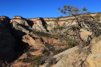
Imagine driving by a large beautiful house every day. Stoically sitting back from the road. One day there was an Open House sign in the yard. Being nosey you stop to check it out. Eventually you reach the back porch and unfolding before you is a beautiful manicured back yard. Completely oblivious to those driving by the house. That was my experience standing on top of Progeny Peak.
Looking at Google Earth I assume that the entrance to this area would be from Pine Creek, so last Friday I set off to find my entrance to Brigadoon. (Maybe some of you know that movie.) Pine Creek is the access route for those Canyoneers doing Spry Canyon so there is plenty of information on the lower end of the drainage.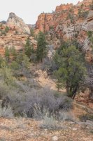
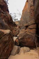
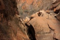
Getting up this blockage was quite tricky.
But I missed the zig to the left and found myself scrambling up hundreds of feet of rock and brush infested slope. I got to the top and looked west and said "oh....there is Pine Creek." Looking up canyon the east wall towered above me for as far as I could see. I instantly knew that my entrance to the east was not going to be low.....so by accident I was glad that I had missed the zig to the left. Looking at the lighting I felt there was a lower spot in the wall wayyyy ahead of me. But it was still higher then I was. I started following ever narrower routes.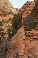
I wasn't on a bench but I wasn't on a ledge either. Just unstable rock where a slip meant a fair amount of pain, if not worse. At least five times I reached a point where I was uncomfortable taking another step so I would back up to usually drop down to a better route. The old "going down to go higher" method. I finally hit a wall to the north, (seen in the above shot) which happened to be at the low spot where, during a flash flood, it is probably a pretty great waterfall. But the top was still higher than I was. Luckily the terrain started to roll out so it was just a case of finding steps to use. Once I topped out I was greeted with yet another tall steep hill. "Give me a break!"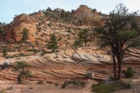
This shot is from the ridgeline looking back down Pine Creek in the direction I had climbed.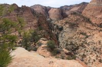
Luckily there was a drainage between me and the hill so I didn't have to climb that. I got my first good view of Progeny Peak.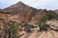
I saw that to get to the inner sanctum of the hidden basin I was going to have to get up a large slickrock area. Delaying that route finding (I admit to getting squeamish around steep pitched slickrock....I have heavily worn boots.) I followed the slickrock drainage to where it plunged into Pine Creek.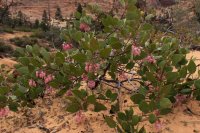
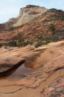 East Temple
While down in this lower end of the drainage I saw three sets of footprints. One new set of boots. One set of worn boots, and one set of smaller bare feet. (I would see them off and on during the day.) At the base of a ramp like slope I saw them going many different directions and that planted the thought "did they come into this are via that ramp?" I was already trying to NOT go back down the way I had come up.
Luckily the trek up the slickrock went relatively well and I popped out in the basin.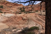
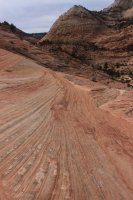
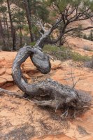
To make a long story short I headed east to the canyon on that side of the basin then followed the ridgeline north observing the numerous side drainages coming down from the East Rim.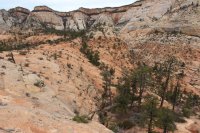
You can barely make out the road at the west side of the Small Tunnel.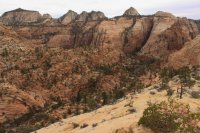
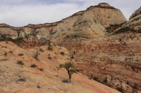
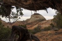
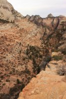
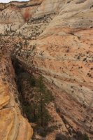
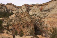
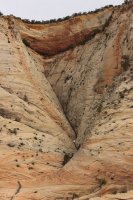
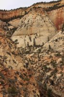
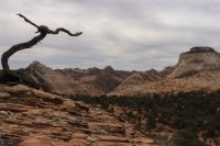
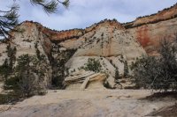
These shots are from the northern most reaches of the basin.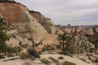
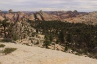
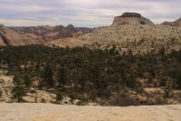
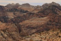
I then start my walk back to the hopefully alternative exit route.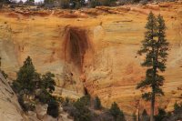
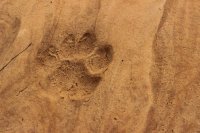
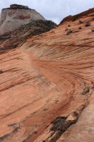
The hopeful exit route.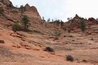
I had some knowledge of the topography to the south due to my Progeny Peak/Two Pines Arch trip. But I didn't know if the ramp cliffed out to Pine Creek, or did it cliff out to the Two Pine Drainage, or would it work out well for me! This shot looks back to the north. I had entered the basin behind the higher ridge in the center of the shot.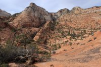
This is an arch want-a-be that I saw from many angles.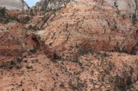
Initially at the top of the ramp I saw hundreds of feet of straight drop into Pine Creek. I looked to the left and saw Two Pines Arch and its higher drainage.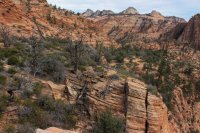
The wall in the lower right of the above shot is the drop into Pine Creek. I headed off toward Two Pines and of course came to an 8 foot drop onto a slanting away from me heavily pitched slope. Argh! To the right in some trees I felt there might be a break in the drop off so I made for that. On the way I saw this ravine. It was long, steep and full of boulders. "I can manage that!" So down I went.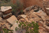
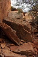
I happened to be looking up enough that I saw this space between two shack size rocks.
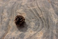
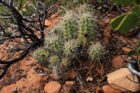
At the bottom of the ravine I found this happy, healthy cactus. And this slickrock space that was doing a fine imitation of tree rings.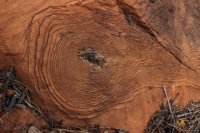
I know that from Two Pines Arch it was an easy scramble back to the car.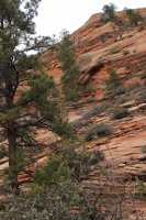
I was not exhausted enough so I went to Shelf Canyon. Access to this canyon is at a very popular parking lot. The info on the route says "short but the boulders keep the general public out." At the end of a long day "short" is a subjective term but the boulders were definitely real.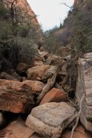
I love it when the outer layer of rock breaks away exposing the innards. It reminds me of those old science books with the plastic pages. You start with a solid person and with each turn a different layer of the inner body is revealed.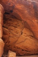
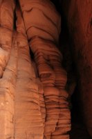
I came to this spot and was stumped. That wall might as well have been ice, as I could not get a single foot planted to even try to wedge myself up this.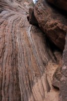
Looking off to the right I saw a "trail" clawing its ways up a very steep slope UNDER the brush. It was like climbing up a garbage chute. Grabbing any root or tree trunk I could. Once it flatten out I popped up to take this shot back toward the parking lot.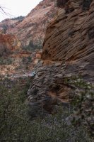
I literally had to crawl across the top stretch as the brush was too thick to stand up. Then I had to control fall down an equally steep slope back into the drainage. It was QUITE fun! Shortly the canyon slotted up.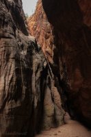
The left wall is a series of ledges/shelves.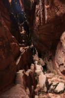
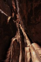
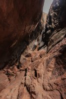
Scott mentioned to me how distorted this shot is. It is shot down canyon and my right leg must have been shorter than my left for a moment.
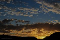
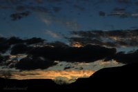
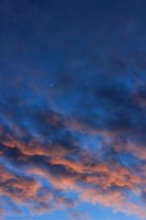
Thinking my day was done I headed for home. BUT there was a sunset to document.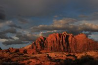

From a backcountry perspective I don't think Zion National Park gets much love. But I wanted my first trip report to share that there are numerous adventures to be had in Zion.
Fast forward 35 years (10 years after moving to St. George) and I finally had the time and no excuses to not explore the east canyons of Zion National Park. There are nothing but social trails up there but most of the canyons have information on the internet. In December I climbed/scrambled Progeny Peak. From its summit I looked to the north and witnessed a huge, incredible, hidden, basin. "Is there any way to get down there?"

Imagine driving by a large beautiful house every day. Stoically sitting back from the road. One day there was an Open House sign in the yard. Being nosey you stop to check it out. Eventually you reach the back porch and unfolding before you is a beautiful manicured back yard. Completely oblivious to those driving by the house. That was my experience standing on top of Progeny Peak.
Looking at Google Earth I assume that the entrance to this area would be from Pine Creek, so last Friday I set off to find my entrance to Brigadoon. (Maybe some of you know that movie.) Pine Creek is the access route for those Canyoneers doing Spry Canyon so there is plenty of information on the lower end of the drainage.


Getting up this blockage was quite tricky.
But I missed the zig to the left and found myself scrambling up hundreds of feet of rock and brush infested slope. I got to the top and looked west and said "oh....there is Pine Creek." Looking up canyon the east wall towered above me for as far as I could see. I instantly knew that my entrance to the east was not going to be low.....so by accident I was glad that I had missed the zig to the left. Looking at the lighting I felt there was a lower spot in the wall wayyyy ahead of me. But it was still higher then I was. I started following ever narrower routes.

I wasn't on a bench but I wasn't on a ledge either. Just unstable rock where a slip meant a fair amount of pain, if not worse. At least five times I reached a point where I was uncomfortable taking another step so I would back up to usually drop down to a better route. The old "going down to go higher" method. I finally hit a wall to the north, (seen in the above shot) which happened to be at the low spot where, during a flash flood, it is probably a pretty great waterfall. But the top was still higher than I was. Luckily the terrain started to roll out so it was just a case of finding steps to use. Once I topped out I was greeted with yet another tall steep hill. "Give me a break!"

This shot is from the ridgeline looking back down Pine Creek in the direction I had climbed.

Luckily there was a drainage between me and the hill so I didn't have to climb that. I got my first good view of Progeny Peak.

I saw that to get to the inner sanctum of the hidden basin I was going to have to get up a large slickrock area. Delaying that route finding (I admit to getting squeamish around steep pitched slickrock....I have heavily worn boots.) I followed the slickrock drainage to where it plunged into Pine Creek.

 East Temple
While down in this lower end of the drainage I saw three sets of footprints. One new set of boots. One set of worn boots, and one set of smaller bare feet. (I would see them off and on during the day.) At the base of a ramp like slope I saw them going many different directions and that planted the thought "did they come into this are via that ramp?" I was already trying to NOT go back down the way I had come up.
Luckily the trek up the slickrock went relatively well and I popped out in the basin.


To make a long story short I headed east to the canyon on that side of the basin then followed the ridgeline north observing the numerous side drainages coming down from the East Rim.

You can barely make out the road at the west side of the Small Tunnel.


These shots are from the northern most reaches of the basin.


I then start my walk back to the hopefully alternative exit route.


The hopeful exit route.

I had some knowledge of the topography to the south due to my Progeny Peak/Two Pines Arch trip. But I didn't know if the ramp cliffed out to Pine Creek, or did it cliff out to the Two Pine Drainage, or would it work out well for me! This shot looks back to the north. I had entered the basin behind the higher ridge in the center of the shot.

This is an arch want-a-be that I saw from many angles.

Initially at the top of the ramp I saw hundreds of feet of straight drop into Pine Creek. I looked to the left and saw Two Pines Arch and its higher drainage.

The wall in the lower right of the above shot is the drop into Pine Creek. I headed off toward Two Pines and of course came to an 8 foot drop onto a slanting away from me heavily pitched slope. Argh! To the right in some trees I felt there might be a break in the drop off so I made for that. On the way I saw this ravine. It was long, steep and full of boulders. "I can manage that!" So down I went.


I happened to be looking up enough that I saw this space between two shack size rocks.

At the bottom of the ravine I found this happy, healthy cactus. And this slickrock space that was doing a fine imitation of tree rings.


I know that from Two Pines Arch it was an easy scramble back to the car.

I was not exhausted enough so I went to Shelf Canyon. Access to this canyon is at a very popular parking lot. The info on the route says "short but the boulders keep the general public out." At the end of a long day "short" is a subjective term but the boulders were definitely real.

I love it when the outer layer of rock breaks away exposing the innards. It reminds me of those old science books with the plastic pages. You start with a solid person and with each turn a different layer of the inner body is revealed.


I came to this spot and was stumped. That wall might as well have been ice, as I could not get a single foot planted to even try to wedge myself up this.

Looking off to the right I saw a "trail" clawing its ways up a very steep slope UNDER the brush. It was like climbing up a garbage chute. Grabbing any root or tree trunk I could. Once it flatten out I popped up to take this shot back toward the parking lot.

I literally had to crawl across the top stretch as the brush was too thick to stand up. Then I had to control fall down an equally steep slope back into the drainage. It was QUITE fun! Shortly the canyon slotted up.

The left wall is a series of ledges/shelves.


Scott mentioned to me how distorted this shot is. It is shot down canyon and my right leg must have been shorter than my left for a moment.
Thinking my day was done I headed for home. BUT there was a sunset to document.


From a backcountry perspective I don't think Zion National Park gets much love. But I wanted my first trip report to share that there are numerous adventures to be had in Zion.
