napatony13
Member
- Joined
- Feb 5, 2021
- Messages
- 145
A stunningly beautiful spot in California that somehow manages to remain virtually unknown. A challenging hike and scramble take you to the foot of the 2nd highest peak in the entire Cascade Range There you’ll find 40-acre glacier-fed alpine lake cradled in a steep-walled granite cirque. Meltwater cascades down on three sides of this amphitheater, gathers its forces in the crystal-clear basin, and immediately pour over a 10-story cliff and thunders down 600’ to the verdant valley below.
Timing this hike can be a bit tricky. I did it on June 30th of 2017. The lower parts of Grizzly Falls were still buried in a blanket of snow and the ice was just beginning to release its grip on Grizzly Lake. But the summer heat that can be brutal down in the lower elevations of the Central Valley had already begun to make its way up into the high country. The steep climb out of the Grizzly Creek drainage was a sweaty affair.
The hike is listed at 14 miles round trip with 5400’ of elevation change. I wanted to complete it as a day hike, so that meant getting an early start. I left home in the Bay Area after lunch, headed up the I-5 to Mount Shasta, then hung a left and headed about 60 miles towards the coast. The last 10 miles wound their way up a dirt Forest Service Road to the China Springs Trailhead, where I spent the night in the back of my truck.
First light comes early in June and I was on the trail by 5:30. The hike begins with a 1200’ climb that snakes its way up and over a ridge that separates the trailhead and the Grizzly Creek drainage. Atop this saddle is an area known as Hunters Camp. Up to this point the trail had been clear and obvious, but here it seemed to disintegrate into a confusing spiderweb. I relied on my GPS to try to navigate through this old burn and was soon entangled in an obstacle course of brush and fallen trees. It was a half mile of misery before I eventually relocated the actual trail.
All of the altitude gained on the hike up to Hunters Camp was quickly surrendered as the trail plunged straight down off the ridgetop into the neighboring drainage. Once you near the bottom of the steep ravine you come to the signed junction with the Grizzly Creek Trail. Here you turn up-canyon and begin the long climb that parallels the creek back towards its headwaters.
Some of the many small cascades along Grizzly Creek:
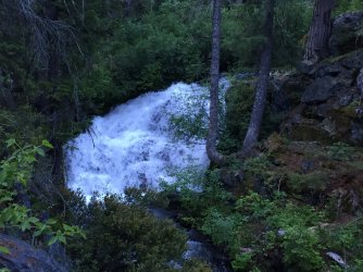
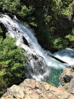
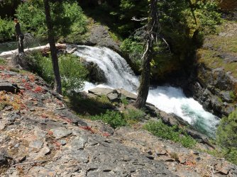
After several miles Thompson Peak finally comes into view: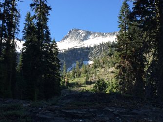
Around another bend and Grizzly Falls shows itself:
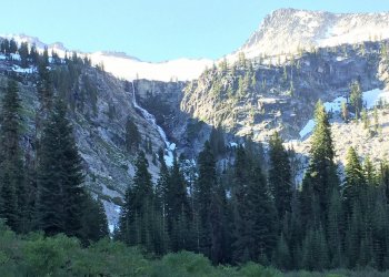
I first made my way across the snowfield towards the base of the Falls:
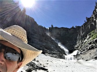
Then started the steep scramble up towards the top of the Falls. The route entered a narrow crack that was still flowing with snowmelt:
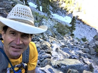
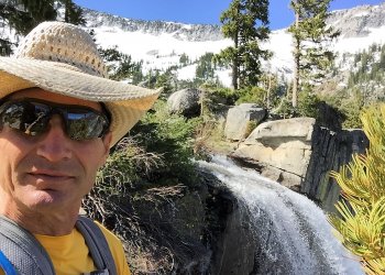
Once the upper ledge was reached I traversed over towards the top of the Falls:
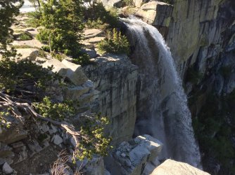
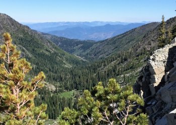
From here there was an expansive view back down the drainage over Grizzly Meadow:
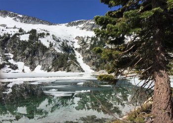
And when you turn around this is the view of Grizzly Lake :
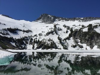
The outlet of the lake is only about 30' from the edge of the falls:
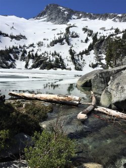
The multiple cascades feeding the lake created a wonderful symphony in this beautiful granite bowl:
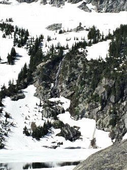
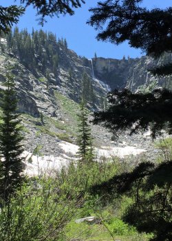
After soaking it all in and enjoying an early lunch it was time to head for home. One last look back through the trees:
The hike back was mostly uneventful. About mid-way back I came around a blind corner and met another hiker who was headed up the trail. He was the first person I'd seen all day and I jumped like I'd seen Bigfoot himself! The hike up and out of the Grizzly drainage was hot and steep, but I was able to stay on the trail and avoided all the brush and deadfalls I'd had to navigate in the morning.
Once back at my truck my GPS readout said I'd covered 16 miles and the hike took me 9.5 hours.
Timing this hike can be a bit tricky. I did it on June 30th of 2017. The lower parts of Grizzly Falls were still buried in a blanket of snow and the ice was just beginning to release its grip on Grizzly Lake. But the summer heat that can be brutal down in the lower elevations of the Central Valley had already begun to make its way up into the high country. The steep climb out of the Grizzly Creek drainage was a sweaty affair.
The hike is listed at 14 miles round trip with 5400’ of elevation change. I wanted to complete it as a day hike, so that meant getting an early start. I left home in the Bay Area after lunch, headed up the I-5 to Mount Shasta, then hung a left and headed about 60 miles towards the coast. The last 10 miles wound their way up a dirt Forest Service Road to the China Springs Trailhead, where I spent the night in the back of my truck.
First light comes early in June and I was on the trail by 5:30. The hike begins with a 1200’ climb that snakes its way up and over a ridge that separates the trailhead and the Grizzly Creek drainage. Atop this saddle is an area known as Hunters Camp. Up to this point the trail had been clear and obvious, but here it seemed to disintegrate into a confusing spiderweb. I relied on my GPS to try to navigate through this old burn and was soon entangled in an obstacle course of brush and fallen trees. It was a half mile of misery before I eventually relocated the actual trail.
All of the altitude gained on the hike up to Hunters Camp was quickly surrendered as the trail plunged straight down off the ridgetop into the neighboring drainage. Once you near the bottom of the steep ravine you come to the signed junction with the Grizzly Creek Trail. Here you turn up-canyon and begin the long climb that parallels the creek back towards its headwaters.
Some of the many small cascades along Grizzly Creek:


After several miles Thompson Peak finally comes into view:

Around another bend and Grizzly Falls shows itself:

I first made my way across the snowfield towards the base of the Falls:

Then started the steep scramble up towards the top of the Falls. The route entered a narrow crack that was still flowing with snowmelt:

Once the upper ledge was reached I traversed over towards the top of the Falls:


From here there was an expansive view back down the drainage over Grizzly Meadow:

And when you turn around this is the view of Grizzly Lake :


The outlet of the lake is only about 30' from the edge of the falls:

The multiple cascades feeding the lake created a wonderful symphony in this beautiful granite bowl:

After soaking it all in and enjoying an early lunch it was time to head for home. One last look back through the trees:

The hike back was mostly uneventful. About mid-way back I came around a blind corner and met another hiker who was headed up the trail. He was the first person I'd seen all day and I jumped like I'd seen Bigfoot himself! The hike up and out of the Grizzly drainage was hot and steep, but I was able to stay on the trail and avoided all the brush and deadfalls I'd had to navigate in the morning.
Once back at my truck my GPS readout said I'd covered 16 miles and the hike took me 9.5 hours.
