Hiker Seth
Member
- Joined
- May 15, 2019
- Messages
- 90
I was able to sneak out for one last trip to Northern Maine to get a little foliage action. Was hoping for some moose but they apparently were not interested. This trip would take me in to the center of the park for the first time and I was finally able to check off some backcountry sites that were on my wishlist. I started off on Tuesday 10/8 with a very short afternoon hike to Chimney Pond. Met a lot of day hikers coming out from bagging Katahdin. I'm always amazed by the amount of gear some folks carry for day hikes and today was no exception. My three day kit was probably lighter than most of the packs I saw.
For those that have not been here, Baxter is kind of a unique spot. While it is a state park it has its own set of (strict) rules separate from the rest of the Maine state park system. It was left to the people of Maine by Percival Baxter and he had a lot of covenants that must be adhered to. I think of it as the anti-White mountains. Lots of rules, all trailheads are limited access, and access to all can be taken away depending on weather. Definitely helps it to not get over-used.
View greeting you from the southern gate.
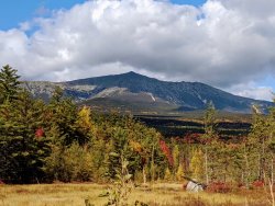
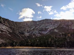
I made a casual entrance at around 14:30 and headed up to Roaring Brook to park and check in with the rangers. Turns out they were all out of the park for training and volunteers were running the stations. Made my way up to Chimney pond and got some nice views of Katahdin as the sun dropped behind the ridge.
Wednesday was a short day with pretty much al the elevation gain I would get from the trip. I am usually a go, go, go kind of backpacker so not rushing out of camp and just crushing miles was a struggle for me but I did the best I could knowing that my day was only around 7 miles total. I ascended Saddle trail and headed for the summit of Katahdin.
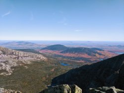
View from the top of Saddle looking East. Chimney Pond where I stayed at the bottom of the photo.
It was a pleasant stroll to the summit and there were many folks day hiking, and several finishing their AT thru hike. One guy was finishing his triple crown. I did my best to try to linger but I could only manage 45 minutes before I had to get up. Ants in my pants.
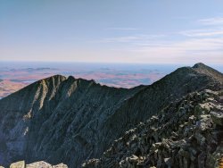
View to Hamlin Peak.
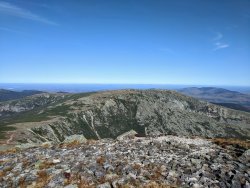
I headed to Hamlin and had lunch with a couple of gentlemen who also were also interested in more than just Katahdin. I then headed out on the Northwest Basin trail and left all people behind. It's fantastic open plateau walking, and I was anxious to see Davis Pond where I would be spending the night.
After you leave Hamlin's summit, take a right and follow this arm of the massif to the end, take another right north, and drop down in to one of the toughest descents in New England to Davis Pond, simple.
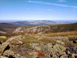
I have no pictures of my trip down. When you aren't navigating old rock slides you are walking in a stream that has greasy black moss and some roots thrown in for good measure. I can't recall a harder trail down with a backpack in NE. The payoff was worth it.
Small solace for getting my butt kicked.
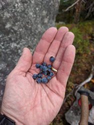
The payoff. Yep, larches in NE.
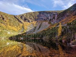
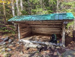
Luxury accommodations for the solo traveller. Was so nice not to carry a shelter. In Baxter you must reserve your campsite so you are guaranteed that you don't have to compete for spots.
My original plan was to spend a third night at another remote spot on my list but family, and other obligations pulled me home. Thursday would be a nice 14 mile stroll out and basically all downhill. The hike started off as it ended the day before, more gnarly, wet descents in ankle deep water and a section where the trail and stream are one. Also all the bog bridges were frosted over so I was given an opportunity to grease off of them too. Lucky.
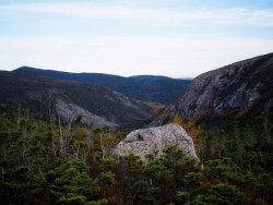
The valley of my descent towards Wassataquoik stream.
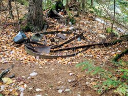
Remnants of logging activity back in the day.
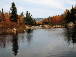
I stopped and had lunch at Russell Pond which I found to be a lot less scenic than I had envisioned (no pics). I left and decided to follow Wassataquoik Stream trail back to my car in hopes that a moose may be lingering in the stream. They weren't. Below is the spot on Wassataquoik stream where you have to wade shin deep, with great views to the Travellers, a set of peaks in the northern end of the park that is well worth a visit.
Poppin
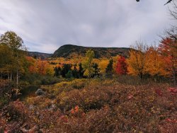
Until next time, Baxter.

For those that have not been here, Baxter is kind of a unique spot. While it is a state park it has its own set of (strict) rules separate from the rest of the Maine state park system. It was left to the people of Maine by Percival Baxter and he had a lot of covenants that must be adhered to. I think of it as the anti-White mountains. Lots of rules, all trailheads are limited access, and access to all can be taken away depending on weather. Definitely helps it to not get over-used.
View greeting you from the southern gate.

I made a casual entrance at around 14:30 and headed up to Roaring Brook to park and check in with the rangers. Turns out they were all out of the park for training and volunteers were running the stations. Made my way up to Chimney pond and got some nice views of Katahdin as the sun dropped behind the ridge.

Wednesday was a short day with pretty much al the elevation gain I would get from the trip. I am usually a go, go, go kind of backpacker so not rushing out of camp and just crushing miles was a struggle for me but I did the best I could knowing that my day was only around 7 miles total. I ascended Saddle trail and headed for the summit of Katahdin.
View from the top of Saddle looking East. Chimney Pond where I stayed at the bottom of the photo.

It was a pleasant stroll to the summit and there were many folks day hiking, and several finishing their AT thru hike. One guy was finishing his triple crown. I did my best to try to linger but I could only manage 45 minutes before I had to get up. Ants in my pants.
View to Hamlin Peak.

I headed to Hamlin and had lunch with a couple of gentlemen who also were also interested in more than just Katahdin. I then headed out on the Northwest Basin trail and left all people behind. It's fantastic open plateau walking, and I was anxious to see Davis Pond where I would be spending the night.
After you leave Hamlin's summit, take a right and follow this arm of the massif to the end, take another right north, and drop down in to one of the toughest descents in New England to Davis Pond, simple.

I have no pictures of my trip down. When you aren't navigating old rock slides you are walking in a stream that has greasy black moss and some roots thrown in for good measure. I can't recall a harder trail down with a backpack in NE. The payoff was worth it.
Small solace for getting my butt kicked.

The payoff. Yep, larches in NE.

Luxury accommodations for the solo traveller. Was so nice not to carry a shelter. In Baxter you must reserve your campsite so you are guaranteed that you don't have to compete for spots.

My original plan was to spend a third night at another remote spot on my list but family, and other obligations pulled me home. Thursday would be a nice 14 mile stroll out and basically all downhill. The hike started off as it ended the day before, more gnarly, wet descents in ankle deep water and a section where the trail and stream are one. Also all the bog bridges were frosted over so I was given an opportunity to grease off of them too. Lucky.
The valley of my descent towards Wassataquoik stream.

Remnants of logging activity back in the day.

I stopped and had lunch at Russell Pond which I found to be a lot less scenic than I had envisioned (no pics). I left and decided to follow Wassataquoik Stream trail back to my car in hopes that a moose may be lingering in the stream. They weren't. Below is the spot on Wassataquoik stream where you have to wade shin deep, with great views to the Travellers, a set of peaks in the northern end of the park that is well worth a visit.

Poppin

Until next time, Baxter.


