BryanG
Member
- Joined
- Jul 22, 2016
- Messages
- 67
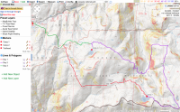
This is a 3-day, 2-night backpacking loop done at the end of June in the Jennie Lakes Wilderness area of Sequoia National Forest. This is the first backpacking trip my girlfriend and I have been on in the Sierra Nevada mountains and we were AMAZED by the diversity and beauty of this area. We had heard, as most people have, about how beautiful the Sierras are but our experiences surpassed our already high expectations.
The website https://jennielakeswilderness.wordpress.com is a very good resource for trip planning and has links to sister sites for other wilderness areas in the Sierras.
Day 1: We would start (and end) at the Big Meadows trailhead located just outside of Kings’ Canyon National Park. We headed out early, around 9:00am, on a Sunday hoping that most people would be packing out from their weekend excursions. We headed about 6.5 miles up and over Poop Out Pass and down to Jennie Lake
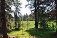
The meadow, named Big Meadow, at the start of the trailhead. There is actually a cabin you can rent from the Forest Service located on the road to the trailhead that has great views of the meadow.
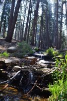
Small Creek located at the Weaver Lake/Jennie Lake trail junction
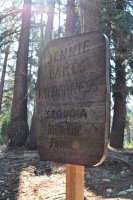
Sign marking the entrance into the actual wilderness area. Apparently the Forest Service has had problems with people stealing these and other signs in the area. A posted sign detailed these thefts and said some trail junction signs might be missing because there were no funds to continually replace them once they were stolen. It is a real shame that a few people would do this and leave fellow hikers in limbo when they come to trail junctions.
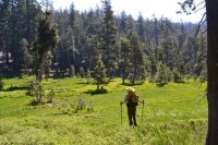
Poison Meadow. Some interesting names for the natural features in this area.
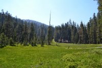
Another picture of Poison Meadow. No wildlife in the meadow except for a deer in the trees as we approached. Maybe it has something to do with the name.
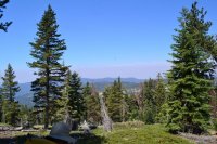
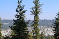
The smoke is from a prescribed burn taking place in the adjacent Sequoia National Park. Although it was clearly visible, we could not smell the smoke at our location.
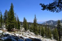
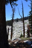
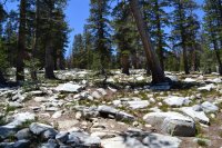
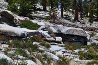
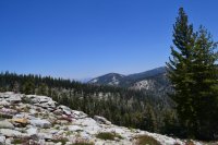
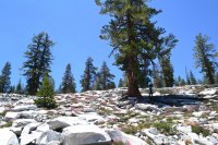
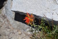
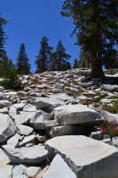
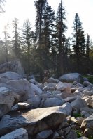
It was a slow and steady climb up to the pass. It was our first time backpacking at elevation so we took many, many breaks. I was amazed about how thin the air was up there! Although I am sure it was exacerbated by the loads we were carrying. Once we reached poop out pass (elevation 9200 ft) the views were spectacular. It was as if granite slabs once enclosed the area and through time and weather the slabs were crushed and cracked, permitting the growth of large pines and the annual blooming of small, elegant wildflowers such that the pass was a spectacular carpet of granite and wildflowers of incredible colors. This was probably my favorite scenery of the trip.
Marmot just off the trail. He was standing there checking us out and eating for a while but when I got my camera out he left so I was only able to snap this photo.
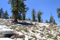
We arrived at our camp at Jennie Lake (elevation 9000 ft) pretty early at about 1:00pm. It is a beautiful lake, crystal clear and plentifully stocked with jumping trout. We set up camp about 100 yards back from the lake and decided to filter water and explore around the lake for the rest of the day. After wondering how the lake obtained its name, I did some post-trip research. From what I could find an explorer in the 1890’s was doing some mountaineering in the region and came upon this lake. He proceeded to name the lake after his wife, Jennie Ellis.
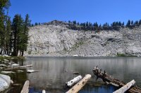
South view of Jennie Lake. The lake backs up to the Kaweah Divide that provides a natural boundary between Sequoia National Park and Sequoia National Forest.
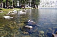
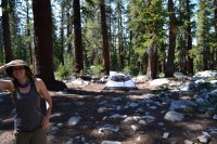
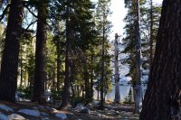
view from camp
DAY 2: We woke up early and had a good breakfast. Our plan for the day was to hike 8.5 miles to Weaver Lake. Our hike started with a short 500-foot climb to JO Pass (elevation 9500 feet) followed by a long downhill hike to Weaver Lake. The downhill section was about 1300 feet in descent over five miles, which doesn’t sound terrible but it was much worse than it sounds. The last two miles or so of the trail consisted of a mild uphill trek to Weaver Lake at about 8700 feet. At times the trail was overgrown with manzanita and fairly well exposed. We did some off-trail exploring early in the hike around JO pass which had some spectacular views of the surrounding areas. We saw some thunder clouds developing late in the afternoon at Weaver Lake and could hear the thunder off in the distance but thankfully they never reached us.
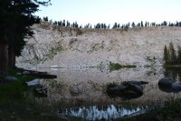
Morning at Jennie Lake
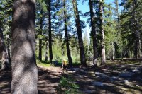
Starting our descent from JO Pass
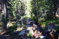
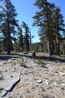
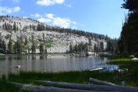
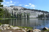
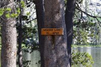
After setting up camp at Weaver we did some exploring of the local area. About 100 feet from our campsite we ran into a young black bear which we initially thought was a cub. This, naturally, scared the crap out of us because we were anticipating the mother being close by. We slowly backed up and then made some noise and the bear took off. We went back with our cameras to see if we could catch anything but the bear was long gone. After our trip we informed the rangers of the encounter. Since the bear had a distinctive U-shaped cut out of one of its ears we thought the bear may be readily identifiable. The rangers were confident that, in fact, this was an orphaned bear that was rescued after a forest fire a year or so ago. They informed us that the bear was rehabilitated in the Sequoia National Park bear rehabilitation facility and recently released back into the wild. I don’t know if the youngster was aware of the large backcountry campsite 200 feet away at the lake.
DAY 3: The hike out to the trailhead was a short 4 miles. I took some videos but no pictures. We had been camping in Kings Canyon National Park and Sequoia National Forest for the previews 10 days and were pretty eager to get back into town and grab some In n Out burgers and animal style fries (a ritual for us after completing a backpacking trip).
Final Thoughts: This was our celebratory trip after graduating from the University of California, Santa Barbara and it was an amazing experience. It exponentially increased our love for backpacking and being out in nature. We love the idea of just being able to show up at the trailhead and start backpacking. No permits, no fees, just park and get out there. We do most of our backpacking in the Santa Barbara backcountry and Big Sur area which also don’t require ahead-of-time permits, which we like. However, from what I understand this is hard to find in the Sierras. Anyways, we had amazing weather on this trip too, not one drop of precipitation and the nights were in the 40’s. The trail was clear, well-marked and easy to follow most of the way. All in all, it was an awesome trip and we look forward to going back and doing a longer trip somewhere in the region.
As this is my first trail report I would be interested to get some feedback if anyone is willing. Any advice, things I should change in the future, more pictures, more detailed descriptions, anything that will enhance these posts are welcomed!

The website https://jennielakeswilderness.wordpress.com is a very good resource for trip planning and has links to sister sites for other wilderness areas in the Sierras.
Day 1: We would start (and end) at the Big Meadows trailhead located just outside of Kings’ Canyon National Park. We headed out early, around 9:00am, on a Sunday hoping that most people would be packing out from their weekend excursions. We headed about 6.5 miles up and over Poop Out Pass and down to Jennie Lake

The meadow, named Big Meadow, at the start of the trailhead. There is actually a cabin you can rent from the Forest Service located on the road to the trailhead that has great views of the meadow.


Small Creek located at the Weaver Lake/Jennie Lake trail junction

Sign marking the entrance into the actual wilderness area. Apparently the Forest Service has had problems with people stealing these and other signs in the area. A posted sign detailed these thefts and said some trail junction signs might be missing because there were no funds to continually replace them once they were stolen. It is a real shame that a few people would do this and leave fellow hikers in limbo when they come to trail junctions.

Poison Meadow. Some interesting names for the natural features in this area.

Another picture of Poison Meadow. No wildlife in the meadow except for a deer in the trees as we approached. Maybe it has something to do with the name.

The smoke is from a prescribed burn taking place in the adjacent Sequoia National Park. Although it was clearly visible, we could not smell the smoke at our location.
It was a slow and steady climb up to the pass. It was our first time backpacking at elevation so we took many, many breaks. I was amazed about how thin the air was up there! Although I am sure it was exacerbated by the loads we were carrying. Once we reached poop out pass (elevation 9200 ft) the views were spectacular. It was as if granite slabs once enclosed the area and through time and weather the slabs were crushed and cracked, permitting the growth of large pines and the annual blooming of small, elegant wildflowers such that the pass was a spectacular carpet of granite and wildflowers of incredible colors. This was probably my favorite scenery of the trip.


Marmot just off the trail. He was standing there checking us out and eating for a while but when I got my camera out he left so I was only able to snap this photo.


We arrived at our camp at Jennie Lake (elevation 9000 ft) pretty early at about 1:00pm. It is a beautiful lake, crystal clear and plentifully stocked with jumping trout. We set up camp about 100 yards back from the lake and decided to filter water and explore around the lake for the rest of the day. After wondering how the lake obtained its name, I did some post-trip research. From what I could find an explorer in the 1890’s was doing some mountaineering in the region and came upon this lake. He proceeded to name the lake after his wife, Jennie Ellis.

South view of Jennie Lake. The lake backs up to the Kaweah Divide that provides a natural boundary between Sequoia National Park and Sequoia National Forest.


view from camp
DAY 2: We woke up early and had a good breakfast. Our plan for the day was to hike 8.5 miles to Weaver Lake. Our hike started with a short 500-foot climb to JO Pass (elevation 9500 feet) followed by a long downhill hike to Weaver Lake. The downhill section was about 1300 feet in descent over five miles, which doesn’t sound terrible but it was much worse than it sounds. The last two miles or so of the trail consisted of a mild uphill trek to Weaver Lake at about 8700 feet. At times the trail was overgrown with manzanita and fairly well exposed. We did some off-trail exploring early in the hike around JO pass which had some spectacular views of the surrounding areas. We saw some thunder clouds developing late in the afternoon at Weaver Lake and could hear the thunder off in the distance but thankfully they never reached us.

Morning at Jennie Lake

Starting our descent from JO Pass


After setting up camp at Weaver we did some exploring of the local area. About 100 feet from our campsite we ran into a young black bear which we initially thought was a cub. This, naturally, scared the crap out of us because we were anticipating the mother being close by. We slowly backed up and then made some noise and the bear took off. We went back with our cameras to see if we could catch anything but the bear was long gone. After our trip we informed the rangers of the encounter. Since the bear had a distinctive U-shaped cut out of one of its ears we thought the bear may be readily identifiable. The rangers were confident that, in fact, this was an orphaned bear that was rescued after a forest fire a year or so ago. They informed us that the bear was rehabilitated in the Sequoia National Park bear rehabilitation facility and recently released back into the wild. I don’t know if the youngster was aware of the large backcountry campsite 200 feet away at the lake.
DAY 3: The hike out to the trailhead was a short 4 miles. I took some videos but no pictures. We had been camping in Kings Canyon National Park and Sequoia National Forest for the previews 10 days and were pretty eager to get back into town and grab some In n Out burgers and animal style fries (a ritual for us after completing a backpacking trip).
Final Thoughts: This was our celebratory trip after graduating from the University of California, Santa Barbara and it was an amazing experience. It exponentially increased our love for backpacking and being out in nature. We love the idea of just being able to show up at the trailhead and start backpacking. No permits, no fees, just park and get out there. We do most of our backpacking in the Santa Barbara backcountry and Big Sur area which also don’t require ahead-of-time permits, which we like. However, from what I understand this is hard to find in the Sierras. Anyways, we had amazing weather on this trip too, not one drop of precipitation and the nights were in the 40’s. The trail was clear, well-marked and easy to follow most of the way. All in all, it was an awesome trip and we look forward to going back and doing a longer trip somewhere in the region.
As this is my first trail report I would be interested to get some feedback if anyone is willing. Any advice, things I should change in the future, more pictures, more detailed descriptions, anything that will enhance these posts are welcomed!
