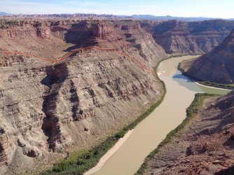
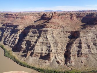
Canyonlands, and some random routes

Magnus

Member
Joined
Jan 25, 2023
Messages
42
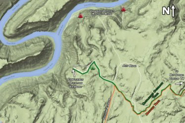
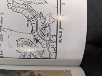
Pardon my horrible picture, but I was looking to see if anyone has ever followed this "Cairned Route" down to the confluence from the needles district. It is very quickly mentioned in Micheal Kelsey's book (pictured below) as well as an alternate route on the Hayduke trail (also pictured below as an "unmarked/dificlute route"). My friend and I have become addicted to packrafting in this area and connecting loops from district to district. We rafted past this route and saw that you could maybe make it, but it looks like a lot of scree and pretty hard route finding.

So I am curious if anyone has ever followed this route.PXL_20230313_210553732.jpgConfluenceOverlookMap-800x535.jpg
 
Magnus,
We descended the route you ask about in 2017 on our Across Utah trip: https://doingmiles.com/2017-04-across-utah/
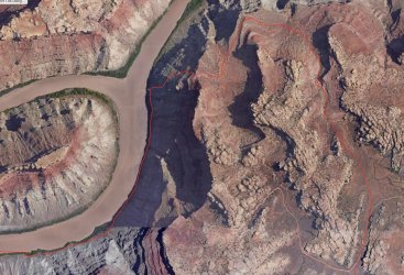
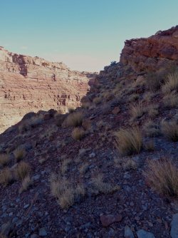
The map is a very rough approximation of the route we took, reconstructed after our trip. There were a very few small cairns when we were there, but we have heard that they were later removed by the Park Service. Whether this is true or not, we do not know. The descent was essentially all Class 2: steep, exposed, and a bit loose in places, but not horrendously so. There appeared to be various options we could have taken and we just followed what we considered the line of least resistance. We descended without ever having to remove our packs. The second image was taken during our descent. When we reached the bank of the river, thick vegetation prevented direct water access for some distance downstream.

James (and Amy)

Screen Shot 2023-06-11 at 9.46.21 AM.jpg2017.04-across-utah-041.jpg
 
Oh wow awesome! I'm hoping to go up this way, do you think it will be easy enough to find where this starts from the bottom?
 
Magnus,
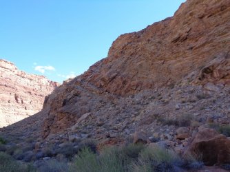
Can't say how easy it might be to find our route start from the river. It may take a bit of trial and error. If advancing up gets too difficult/dangerous, retreat and try another option. I dug around in my files and found a few more images that may help. The first was taken at or near the bottom of the descent looking back toward where we had come down. I believe, but am not certain, that we came down the obvious ramp in the center-left of the image. The other two were taken from across the river on a different trip and show the cliff band we descended. One image is marked with my guess as to where we came down, but buyer beware as we did this six years ago. Please keep in mind that your skill set is likely different than ours so we cannot advise as to whether it would be appropriate for you to try or not.

DSC02086.JPGDSC04518.JPGDSC04516.JPG
 
Last edited:
@James and Amy, your 2nd picture (with the red route) is so cool with the contrast between the green Green and the Colorado. Easy to see why the name after the confluence is Colorado rather than Green!
 
Janice,
I had forgotten about the obvious river color difference in the image; thanks for pointing it out. The Colorado here is full of silt that will drop out when it hits the still waters of Lake Powell and it runs clear leaving the dam. I don't really understand why the Green seems to be carrying so much less.
 
When I did this many years ago I was not able to spot the direct route from the bottom and didn't see any cairns. I was unsure of the location of the route at that time so didn't investigate it too much, but instead just followed the river up to that next gulley to the east (as shown on that second map from my site.) I'd hoped to actually get all the way up that gulley, but there is a dryfall near the top requiring one to contour back to the west. This route was a bit of a scramble near the bottom, but overall fairly easy (just longer than the direct route). So... my advice would be to look for the direct route, but if not located quickly (or it seems too sketchy), don't linger trying to figure it out as the longer route is fairly straight forward and fairly easy.
 
I’ve done this once. Never cared to repeat it. I’ve spent a lot of time looking at crossings to do 4 district trips starting at island in the sky and either looping back or ending in Needles. Shoot me an email if you have questions on other crossings. Dinihill@gmail.com
 
Back
Top