- Joined
- Aug 9, 2007
- Messages
- 12,951
I usually feel pretty lucky just to get out for a night or two of camping in the dead of winter, backpacking has always seemed out of the question. But back toward the end of 2013, I ended up with a new member of the family, a wonderful furry hiking buddy named Sage. I was itching to get out and spend some time on the trail with her, so I started brainstorming what kind of places might be ideal when the weather is nice between storms. At first, the thought of doing the BMT seemed nuts - the trail starts at nearly 7,000 feet! But the thought of those miles upon miles of sandstone just out there baking in the sun made me think there might be something to it.
Things started off interesting right away. @Cody and I met up with @mattvogt7 and Chad just outside of Boulder. First step: go drop a car off at the Escalante town trailhead. When we got there, we found the road and surrounding terrain to be a sloppy, muddy mess. We ended up parking toward the top of the hill before heading back up to the BMT trailhead. We were a little worried about getting Matt's Subaru all the way to the trailhead with the mud, but we pulled it off.
I've started down this trail quite a few times now, but never like this. The first 1.5 miles or so were nasty to hike due to all the snow and mud up on the bench.
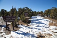
But lucky for us, things dried right up once we made it out into the Sand Creek drainage. We stopped pretty early the first day. We weren't sure where exactly we'd need to camp, so setting up here near sure water made sense. In retrospect, it would have been better to go further and allow more time for the west end. Regardless, it made for a very relaxing afternoon and evening.
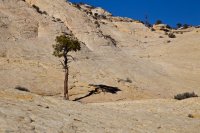
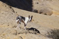
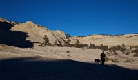
We had three dogs with us on this trip and they had fun. I missed a lot of fun photos of them playing because I didn't have my camera around, but at least I got some nice pics of Sage in her element. She is such a natural born hiker.
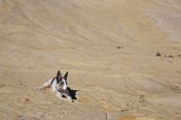
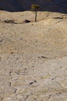
Cody and Cowboy moving back into the sun as the shadow creeps through camp.
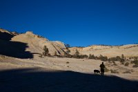
The wind came in after dark, making things quite uncomfortable. Fortunately it wasn't too bad this first night. The wind seemed to calm down later on and temps were really nice for mid January.
Packs loaded, we started the hike up the other side of Sand Creek. We still weren't sure if we'd be able to get in and out of Death Hollow, but it didn't really matter. What a way to spend a few days in January....
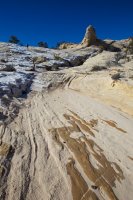
Hello, Death Hollow.
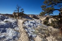
Starting the descent into Death Hollow. Looking good.
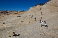
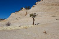
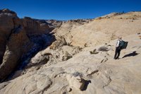
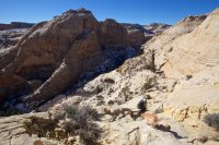
Looking back up one of the steeper sections of the Death Hollow descent. No snow whatsoever.
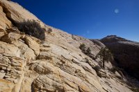
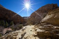
Death Hollow in the winter was a real treat. Lots of snow and ice and beautiful winter light.
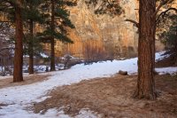
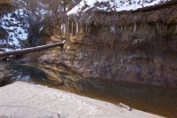
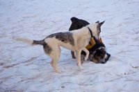
Sage and Cowboy playing in the snow.
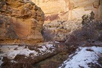
I did a terrible job capturing the subtle, wintery details that we encountered. It was just outstanding down there.
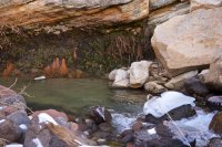
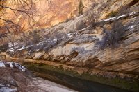
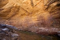
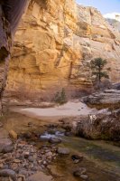
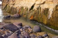
We weren't sure exactly where we would camp that night, but we wanted to be out of the canyon to catch more sun. Water was questionable so we loaded up in Death Hollow and began the steep climb out the west side of the canyon. The west exit looks much less intimidating from the bottom.
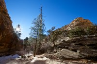
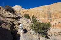
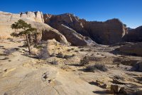
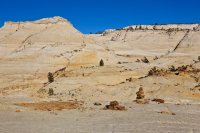
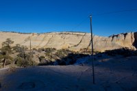
We setup camp at the rim of the canyon with fantastic views all around.
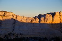
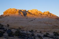
That second night was bitter cold. I was in my 5˚ down bag and I actually had to zip it up! My water bottle was mostly frozen over before I even fell asleep that night.
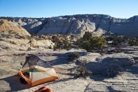
The next day we continued hiking west into the unknown territory of Mamie Creek and Antone Flat. This area is worthy of a trip all in itself. Heading down into Mamie Creek...
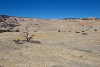
Lots of ice in Mamie Creek - no open water though.
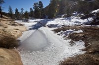
There was so much snow and ice on the west side of Mamie Creek that we lost the trail for a while. We picked up the old telegraph line a few times though. Sage was determined to destroy that wire. Make sure and watch Matt's video to see her trying to tear it up.
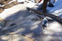
Somewhere NOT on the BMT. I took a pretty good spill here. Snow sure makes slickrock slippery.
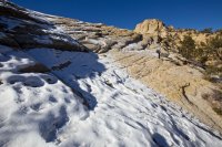
There were so many amazing ice formations along the way.
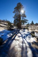
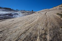
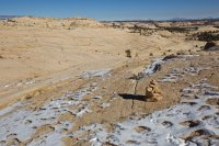
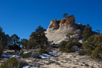
The descent toward Escalante.
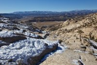
We stopped near a mostly frozen spring(?) and had a break before continuing on. With Escalante and the surrounding farm land in site, I figured we were close. It turns out we still had a long way to go and a TON of downhill. I would never want to hike the BMT west to east.
The private land near Pine Creek was a bit tricky, especially with tons of snow and ice, but we made our way through it and back to the truck. The last half mile or so from the Escalante was a muddy mess, but it was worth it.
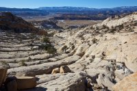
Here is my GPS track from the hike.
View larger map.
And if you haven't already, be sure to check out Matt's trip report.
And definitely watch Matt's video from the trip. This sums it up beautifully.
Featured image for home page:
Things started off interesting right away. @Cody and I met up with @mattvogt7 and Chad just outside of Boulder. First step: go drop a car off at the Escalante town trailhead. When we got there, we found the road and surrounding terrain to be a sloppy, muddy mess. We ended up parking toward the top of the hill before heading back up to the BMT trailhead. We were a little worried about getting Matt's Subaru all the way to the trailhead with the mud, but we pulled it off.
I've started down this trail quite a few times now, but never like this. The first 1.5 miles or so were nasty to hike due to all the snow and mud up on the bench.

But lucky for us, things dried right up once we made it out into the Sand Creek drainage. We stopped pretty early the first day. We weren't sure where exactly we'd need to camp, so setting up here near sure water made sense. In retrospect, it would have been better to go further and allow more time for the west end. Regardless, it made for a very relaxing afternoon and evening.

We had three dogs with us on this trip and they had fun. I missed a lot of fun photos of them playing because I didn't have my camera around, but at least I got some nice pics of Sage in her element. She is such a natural born hiker.


Cody and Cowboy moving back into the sun as the shadow creeps through camp.

The wind came in after dark, making things quite uncomfortable. Fortunately it wasn't too bad this first night. The wind seemed to calm down later on and temps were really nice for mid January.
Packs loaded, we started the hike up the other side of Sand Creek. We still weren't sure if we'd be able to get in and out of Death Hollow, but it didn't really matter. What a way to spend a few days in January....

Hello, Death Hollow.

Starting the descent into Death Hollow. Looking good.


Looking back up one of the steeper sections of the Death Hollow descent. No snow whatsoever.


Death Hollow in the winter was a real treat. Lots of snow and ice and beautiful winter light.


Sage and Cowboy playing in the snow.


I did a terrible job capturing the subtle, wintery details that we encountered. It was just outstanding down there.


We weren't sure exactly where we would camp that night, but we wanted to be out of the canyon to catch more sun. Water was questionable so we loaded up in Death Hollow and began the steep climb out the west side of the canyon. The west exit looks much less intimidating from the bottom.


We setup camp at the rim of the canyon with fantastic views all around.


That second night was bitter cold. I was in my 5˚ down bag and I actually had to zip it up! My water bottle was mostly frozen over before I even fell asleep that night.


The next day we continued hiking west into the unknown territory of Mamie Creek and Antone Flat. This area is worthy of a trip all in itself. Heading down into Mamie Creek...

Lots of ice in Mamie Creek - no open water though.

There was so much snow and ice on the west side of Mamie Creek that we lost the trail for a while. We picked up the old telegraph line a few times though. Sage was determined to destroy that wire. Make sure and watch Matt's video to see her trying to tear it up.

Somewhere NOT on the BMT. I took a pretty good spill here. Snow sure makes slickrock slippery.

There were so many amazing ice formations along the way.


The descent toward Escalante.

We stopped near a mostly frozen spring(?) and had a break before continuing on. With Escalante and the surrounding farm land in site, I figured we were close. It turns out we still had a long way to go and a TON of downhill. I would never want to hike the BMT west to east.
The private land near Pine Creek was a bit tricky, especially with tons of snow and ice, but we made our way through it and back to the truck. The last half mile or so from the Escalante was a muddy mess, but it was worth it.

Here is my GPS track from the hike.
View larger map.
And if you haven't already, be sure to check out Matt's trip report.
And definitely watch Matt's video from the trip. This sums it up beautifully.
Featured image for home page:

