- Joined
- Feb 23, 2012
- Messages
- 655
Hey All --
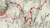
As alluded to in previous threads where I complained some about the new Google Maps, I've been working on a personal mapping project. For a while now I've wanted to share the data I've collected on my long hikes. I keep all of this in Google Earth, but wanted to post it via my website with some options for user customization. I finally found a solution that I'm semi-happy with, so I thought I'd share:
www.AcrossUtah.com/map
There's not much to see at first, but use the side panel to turn on Water Resources, Points of Interest, Obstacles and other categories to see the bulk of content. Note that most of the placemarks are clickable and pop-up more information and in most cases a photo of the location. For instance, the Water placemarks pop-up with more detail on my experience re: reliability.

The map is primarily focused on my treks, so it might not be of use to everyone. But hopefully some will find it helpful for their trip planning across common ground.
It's an on-going process as I add polish with new features and additional content. But, if I waited until I was 'done', I would never get it online. In that light, let me know what you think and definitely ping me if you hit any snags with specific browser/OS set-ups as I haven't really done testing on various platforms.
Thanks,
- Jamal
As alluded to in previous threads where I complained some about the new Google Maps, I've been working on a personal mapping project. For a while now I've wanted to share the data I've collected on my long hikes. I keep all of this in Google Earth, but wanted to post it via my website with some options for user customization. I finally found a solution that I'm semi-happy with, so I thought I'd share:
www.AcrossUtah.com/map
There's not much to see at first, but use the side panel to turn on Water Resources, Points of Interest, Obstacles and other categories to see the bulk of content. Note that most of the placemarks are clickable and pop-up more information and in most cases a photo of the location. For instance, the Water placemarks pop-up with more detail on my experience re: reliability.

The map is primarily focused on my treks, so it might not be of use to everyone. But hopefully some will find it helpful for their trip planning across common ground.
It's an on-going process as I add polish with new features and additional content. But, if I waited until I was 'done', I would never get it online. In that light, let me know what you think and definitely ping me if you hit any snags with specific browser/OS set-ups as I haven't really done testing on various platforms.
Thanks,
- Jamal
