accessing the Dirty Devil from Sam's Mesa

regehr

Member
Joined
Mar 28, 2012
Messages
2,252
I only recently learned that Sam's Mesa Spring (38.196171° -110.386373°) exists and is easy to get to, and I want to incorporate it into a backpacking loop.

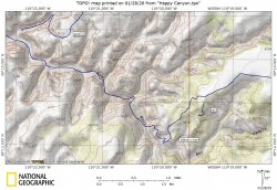
This is super random, but does anyone happen to have experience with the first little side canyon cutting into Sam's Mesa north of Happy Canyon? It looks at least vaguely plausible to me that it would be possible to pick down through the rubble to about 38.154363° -110.376029°, rappel the cliff band, and then walk out to the mining track on the bench above the DD.

Then around to the top of the Happy Canyon narrows on the mining track, a long walk up Happy, and out the cattle trail at French Spring Fork. I've spent some time in upper Happy and the water situation isn't necessarily great, but that is surmountable.

The main thing I'm wondering is whether that side canyon can be made to go. Would love to hear, on the off chance anyone has poked around there.
 
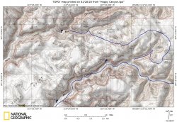
Sams Mesa Box entry.JPGTwin Corral Box entry.JPG

There's a TR on here that details the ones I marked as "good". The "difficult" one is kelsey and folks I've used for info and greatly respect have struggled to find it.
Jammer details the Happy exit via a French Spring side canyon. Looks awesome, plans fell through to do it but really want to!
 
Thanks John!
I've been down and up the French Springs Fork access to upper Happy and it is a neat route!
 
You might be able to with ropes but I'd say there are better loops in the area. Down Happy (south fork for a shorter walk or shuttle on top) and up Hatch is good with a packraft (or walk the mining rd between those two. Not much water in Hatch past the lower part though). In Happy there is a spring near the Pinnacle. TCB/SMB is a great loop (and that upper exit out of SMB isn't really that hard to find IME). Larry/No Man's is good too.
 
Thanks Brendan. I've definitely been eyeing some of these loops. The Happy/Hatch one is a little brutal, it's like 25 walking miles to the top of the narrows from where that old road drops into upper Happy near the Flint Trail switchbacks!
 
wow... then (unless I've made a mistake) it's about 20 miles to the DD by following the mining track on the bench, dropping into Hatch via the Point 4706 route, and down to the river. And then, 22 more miles from the river up Hatch to where a mining track goes up to the Big Ridge, and finally another 7.5 on the road past the Neck back to where the road drops into Happy S Fork. This should all be pretty fast walking but that's likely 2 dry camps.

Gonna have to discuss with my buddy if we're gluttons for punishment at this level. Probably not worth carrying packrafts for a route with this amount of walking.
smart of you to look into this. :lol:So some years back I bought my wife and I Scouts from Alpacka and this was the maiden voyage. I was pretty accustomed to some long days and she was generally up for most stuff, though I had definitely pushed that on a couple trips. I guess I just totally neglected to take the time to look at actual mileage and thought this would be a good one for a 3 day weekend.

Drove to trailhead night before and took a mountain bike as a shuttle. The road up on the Big Ridge was pretty rough and it was late so I dropped it about four miles short of what i had planned, thinking a little more road walking wasn’t so bad.

First day down Happy, which of course was a longer than I had planned (thought we’d get to narrows or river). Camped near the pinnacle, narrows later next morning, on the river late morning.

Nice flows, had a blast made it to mouth of Hatch with some daylight (but had no idea throughout the day what kind of time we’d be making so it was still on the mind).

Thinking we are back on track, enjoyed lower Hatch, which is outstanding and then proceeded to just get rocked :roflmao:. Pretty easy walking but by early afternoon I realized I’d made a terrible mistake. Long story short, made it to rim of the Big Ridge in the dark, left my poor wife to run for the bike and then truck. Ended up being about a 35 mile day just to the bike. Overly optimistic/euphemistic trip report here
 
Last edited:
Thinking we are back on track, enjoyed lower Hatch, which is outstanding and then proceeded to just get rocked :roflmao:. Pretty easy walking but by early afternoon I realized I’d made a terrible mistake. Long story short, made it to rim of the Big Ridge in the dark, left my poor wife to run for the bike and then truck. Ended up being about a 35 mile day just to the bike. Overly optimistic/euphemistic trip report here

aw man, that looks grueling and awesome. I was thinking this looks tough as a 5 day trip!
 
Back
Top