IntrepidXJ
ADVENTR
- Joined
- Jan 17, 2012
- Messages
- 3,479
Saturday & Sunday, August 9-10, 2014
Since Diane and I have been spending a lot of time this summer hiking in the San Juan Mountains I figured it was time to get in a weekend of hiking in the Elk Mountains, before it was too late. We left home bright and early on Saturday morning and drove around the Grand Mesa to Marble where we followed the Crystal River past the Crystal Mill and Devil's Punchbowl towards Schofield Pass. Diane was not a fan of this narrow and rough road, especially when we drove over the sections of large moving rocks. We stopped at the trailhead in Schofield Park so we could start our hike up to West Maroon Pass. Unfortunately, driving over Schofield Pass took a little longer than I remembered, so we arrived later in the morning than I would normally like to start hiking during monsoon season in the mountains. Since we weren't attempting to climb any peaks on this hike we decided to give it a shot and see what the weather would do. Some darker clouds moved into the sky early on during our hike and we got rained on a few times, but there were no thunderstorms nearby. While there were still plenty of flowers along it trail, it was obvious that wildflower season is definitely coming to and end as many of the flowers were wilted and dying. I bet this hike would have been an amazing sight a few weeks ago!
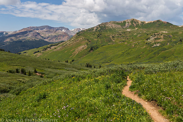
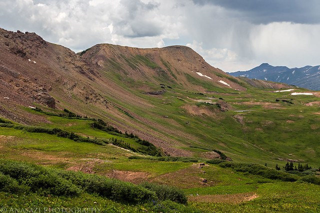
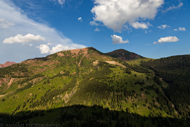
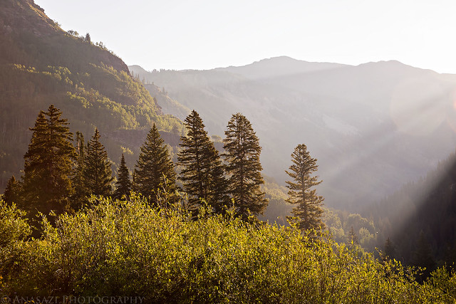
Schofield Park from the trailhead.
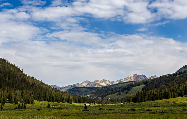
Schofield Park by IntrepidXJ, on Flickr
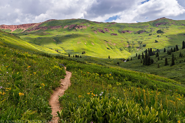
Trail Light by IntrepidXJ, on Flickr
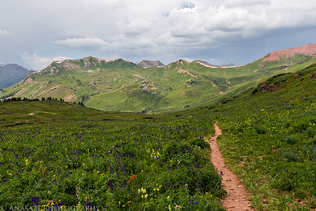
This way to West Maroon Pass.
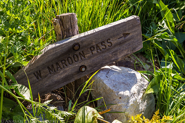
W Maroon Pass by IntrepidXJ, on Flickr
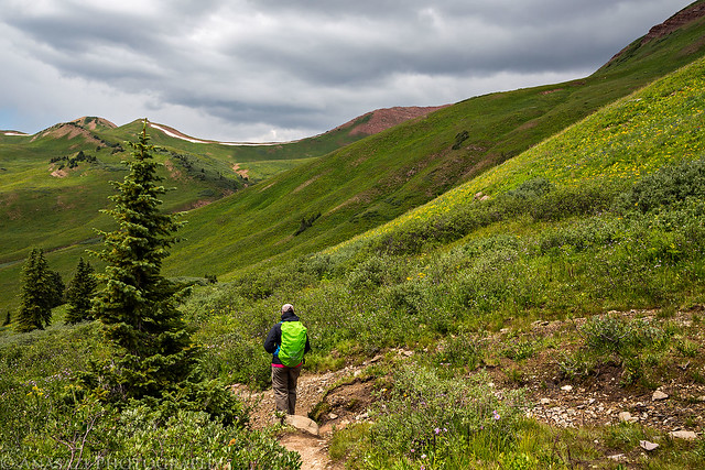
Diane hiking in the rain.
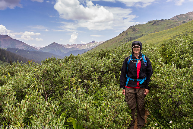
Hiking in the Rain by IntrepidXJ, on Flickr
Trail by IntrepidXJ, on Flickr
The intersection with the trail to Frigid Air Pass. From this point on the trail we passed quite a few backpackers who were hiking the Four Pass Loop. This loop is certainly on my list of future backpacking destinations and this hike was a good introduction to the area.
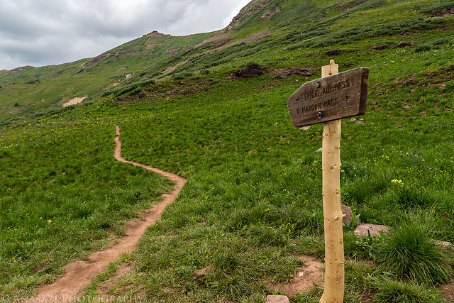
Intersection by IntrepidXJ, on Flickr
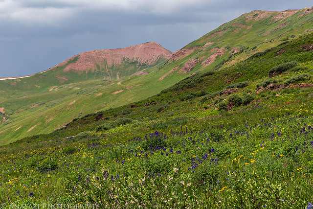
The rocky trail up to West Maroon Pass (12,500 feet). As I neared the pass I heard a very faint distant rumble of thunder, but it wasn't close enough for me to be concerned about. It would be the only thunder I would hear all day.
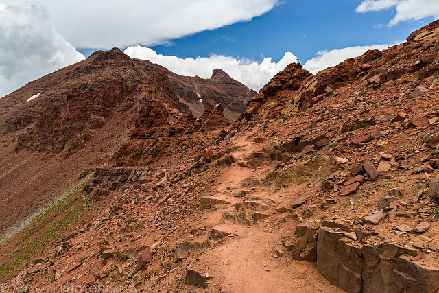
To the Pass by IntrepidXJ, on Flickr
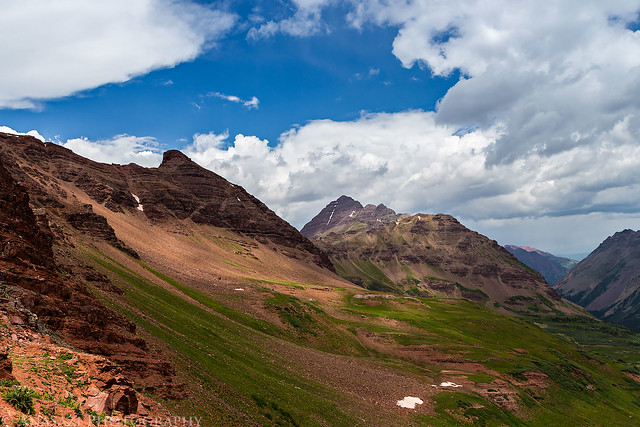
View from the pass over East Maroon Creek with Pyramid Peak (14,018 feet) above.
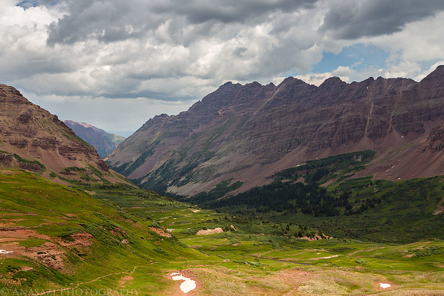
West Maroon by IntrepidXJ, on Flickr
Belleview Mountain (13,323 feet) on the left and Maroon Peak (14,156 feet) in the middle.
Maroon View by IntrepidXJ, on Flickr
A closer look at Maroon Peak.

Maroon by IntrepidXJ, on Flickr
Looing through the notch at the pass before hiking back down the way I came.
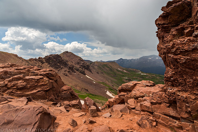
West Maroon Pass by IntrepidXJ, on Flickr
Hiking back down the trail from the pass.
Trail Down by IntrepidXJ, on Flickr
Storms all around. Rain in the distance with light on the hills below.
East Fork by IntrepidXJ, on Flickr
Rain by IntrepidXJ, on Flickr
Still some wildflowers left along the trail, though wilting away quickly. This area probably would have been really a nice a few weeks ago.
Upper Trail by IntrepidXJ, on Flickr
Leftover Wildflowers by IntrepidXJ, on Flickr
Diane hiking ahead of me on the way back down.
Down the Trail by IntrepidXJ, on Flickr
After making it back to the trailhead we drove into Crested Butte and had a late lunch at the The Brick Oven Pizzeria and then headed back to Marble via Kebler Pass and McClure Pass.
Abstract aspens along the Kebler Pass Road.
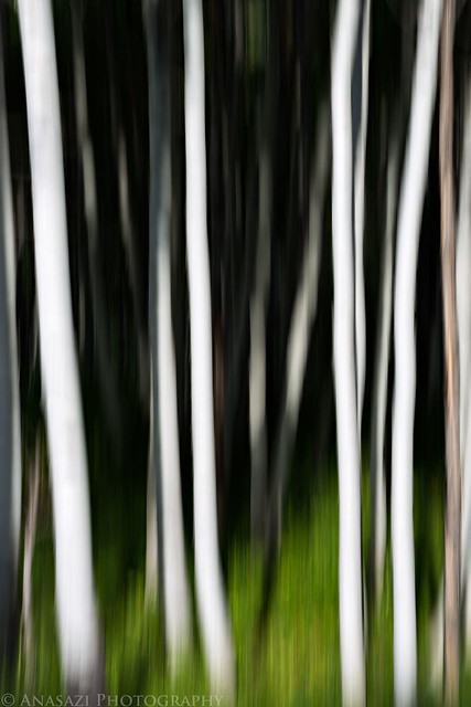
Kebler Aspen by IntrepidXJ, on Flickr
Distant hazy view before dropping down to the North Fork of the Gunnison River below.
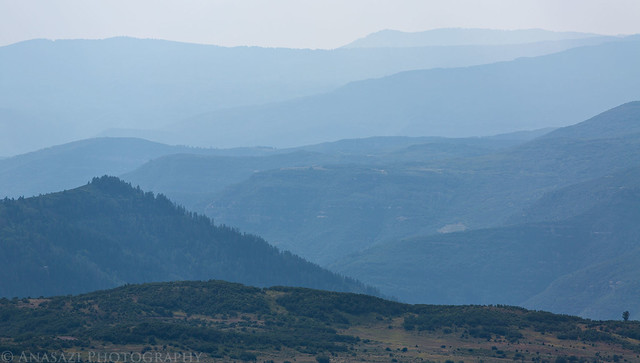
Hazy Blues by IntrepidXJ, on Flickr
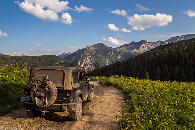
After driving through Marble for the second time of the day, we took the Lost Creek Road to Lead King Basin and found a nice campsite along the North Fork of the Crystal River shortly before sunset.
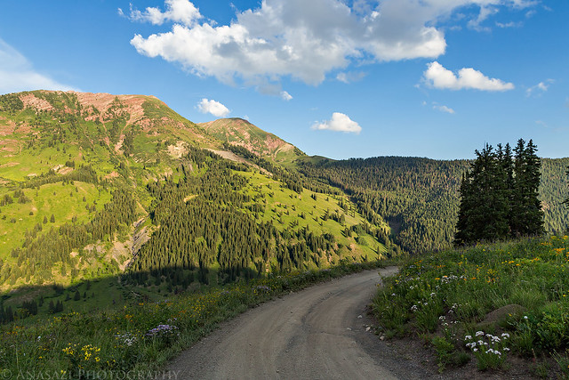
Driving above Silver Creek before descending into Lead King Basin.
Near the Top by IntrepidXJ, on Flickr
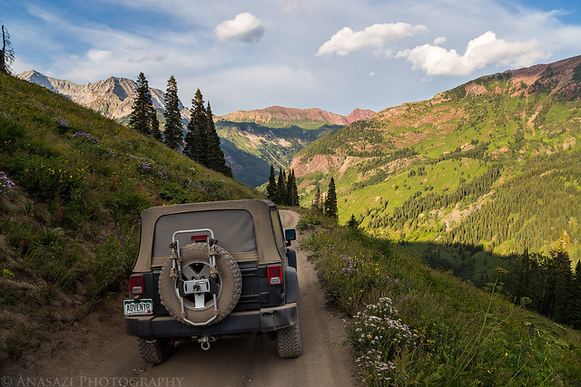
Lead King Basin Road by IntrepidXJ, on Flickr
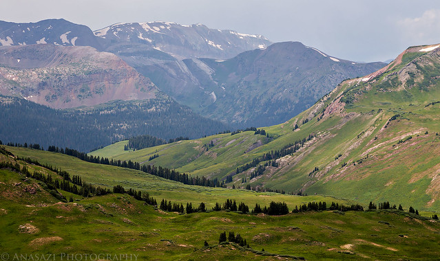
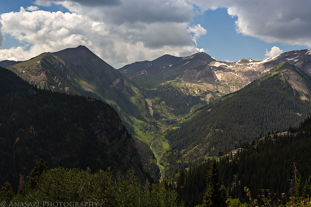
A view across the basin towards two unnamed 12,000+ foot peaks.
Across the Basin by IntrepidXJ, on Flickr
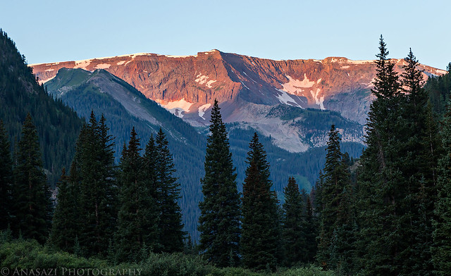
Great views of Snowmass Mountain (14,092 feet) on the left and Hagerman Peak (13,841 feet) on the right.
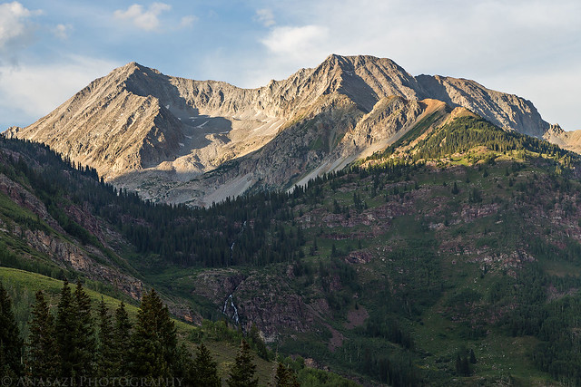
Snowmass Mountain by IntrepidXJ, on Flickr
Driving down one of the many switchbacks into Lead King Basin.
Lead King Switchback by IntrepidXJ, on Flickr
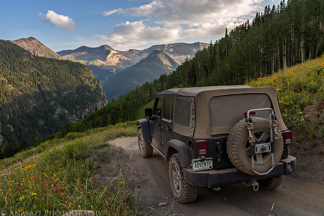
Evening Drive by IntrepidXJ, on Flickr
We found a very nice campsite in the basin right along the creek with Snowmass Mountain in the distance.
Lead King Camp by IntrepidXJ, on Flickr
Sunset over the North Fork and Snowmass Mountain behind our campsite.
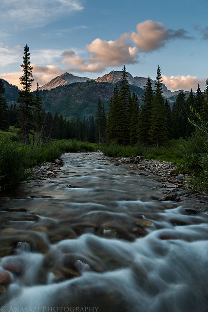
Evening Flow by IntrepidXJ, on Flickr
On Sunday morning we woke up with the sunrise and drove a short distance to the Geneva Lake trailhead. We entered the Maroon Bells - Snowmass Wilderness again and climbed about 1,500 feet to Geneva Lake near the base of Snowmass Mountain. Besides a few backpackers camped around the lake, we didn't see anyone else on the trail this morning.
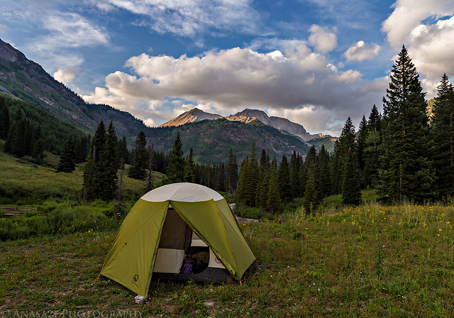
Sunrise view from the door of our tent in the morning.
Morning From Camp by IntrepidXJ, on Flickr
Entering the Maroon Bells - Snowmass Wilderness again.
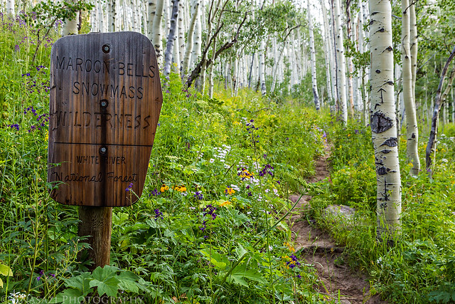
Maroon Bells - Snowmass Wilderness by IntrepidXJ, on Flickr
Early morning sun rays.
Morning Light by IntrepidXJ, on Flickr
This red leaf among all the green really stuck out to me. It reminded me that fall is just around the corner up here.

Red by IntrepidXJ, on Flickr
Still plenty of flowers along this trail, too. Though most of them are wilting away.
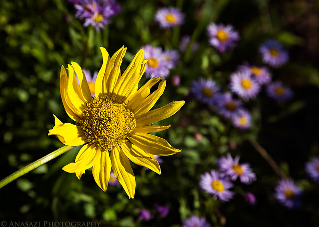
Sunflower by IntrepidXJ, on Flickr
Waterfall through the aspen trees.
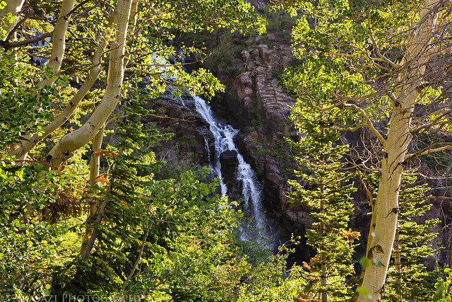
Waterfall by IntrepidXJ, on Flickr
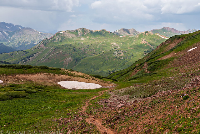
Looking back over the trail into Lead King Basin.
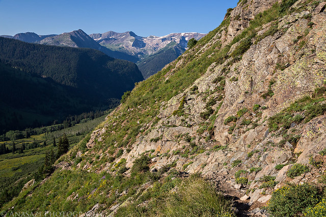
Geneva Lake Trail by IntrepidXJ, on Flickr
The light on this flower along the trail with the shaded rock behind caught my eye.

Mountain Paintbrush by IntrepidXJ, on Flickr
Finally we reached Geneva Lake.
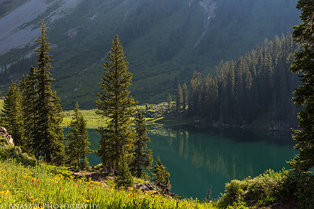
Geneva Lake by IntrepidXJ, on Flickr
Snowmass Mountain towers above Geneva Lake. One day I will have to return to climb this 14er.
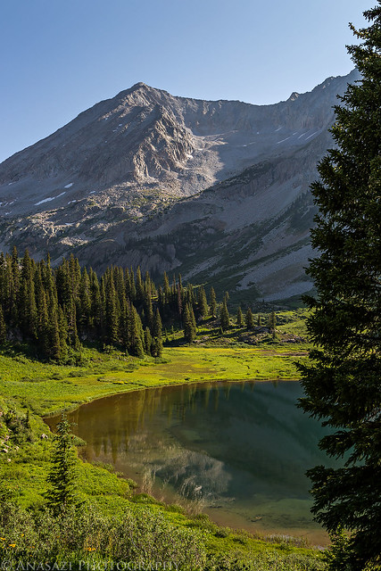
Geneva & Snowmass by IntrepidXJ, on Flickr
Looking back over the lake towards Crystal Peak and Treasure Mountain.
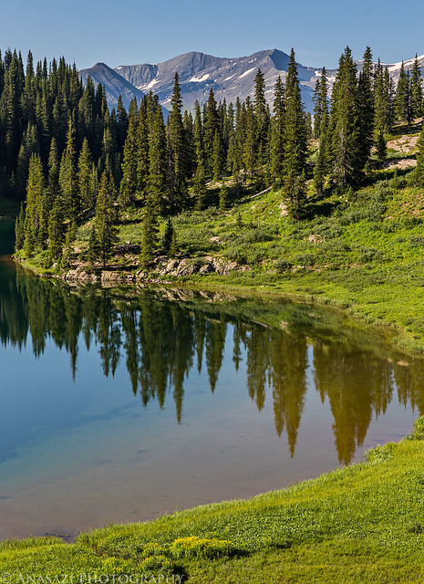
Geneva Reflection by IntrepidXJ, on Flickr
There were some nice columbines left around the lake.
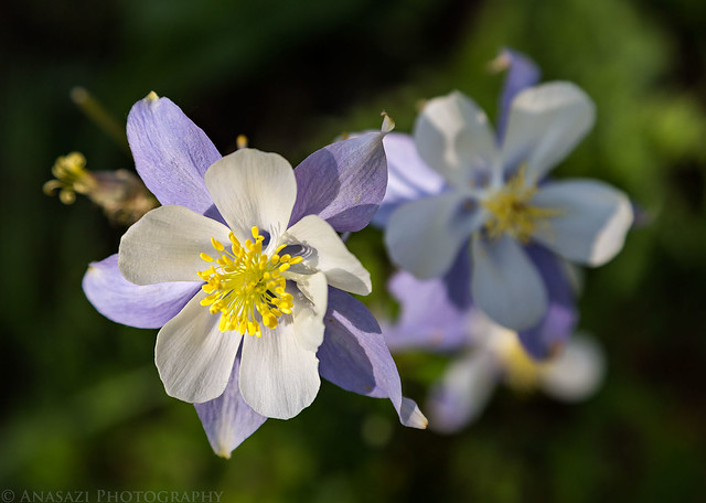
Columbines by IntrepidXJ, on Flickr
A large patch of yellow and purple flowers below Meadow Mountain on our way back down.
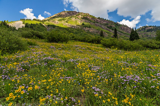
Yellow & Purple by IntrepidXJ, on Flickr
When we returned to the trailhead we drove back to camp and loaded up our gear before driving back through Marble. We decided to head home through Carbondale and Glenwood Springs so that we could eat lunch at White House Pizza. Diane had been here once before and told me it was very good. She was right! It's probably the best pizza I have found so far in western Colorado.
A nice view into Bear Basin from the Lead King Basin Road as we drove back out. Crystal Peak (12,632 feet) is on the left.
Bear Basin by IntrepidXJ, on Flickr
>> West Maroon Pass & Geneva Lake Photo Gallery
>> The Original Trip Report on ADVENTR.CO
Featured image for home page:

Since Diane and I have been spending a lot of time this summer hiking in the San Juan Mountains I figured it was time to get in a weekend of hiking in the Elk Mountains, before it was too late. We left home bright and early on Saturday morning and drove around the Grand Mesa to Marble where we followed the Crystal River past the Crystal Mill and Devil's Punchbowl towards Schofield Pass. Diane was not a fan of this narrow and rough road, especially when we drove over the sections of large moving rocks. We stopped at the trailhead in Schofield Park so we could start our hike up to West Maroon Pass. Unfortunately, driving over Schofield Pass took a little longer than I remembered, so we arrived later in the morning than I would normally like to start hiking during monsoon season in the mountains. Since we weren't attempting to climb any peaks on this hike we decided to give it a shot and see what the weather would do. Some darker clouds moved into the sky early on during our hike and we got rained on a few times, but there were no thunderstorms nearby. While there were still plenty of flowers along it trail, it was obvious that wildflower season is definitely coming to and end as many of the flowers were wilted and dying. I bet this hike would have been an amazing sight a few weeks ago!
Schofield Park from the trailhead.
Schofield Park by IntrepidXJ, on Flickr
Trail Light by IntrepidXJ, on Flickr
This way to West Maroon Pass.
W Maroon Pass by IntrepidXJ, on Flickr
Diane hiking in the rain.
Hiking in the Rain by IntrepidXJ, on Flickr
Trail by IntrepidXJ, on Flickr
The intersection with the trail to Frigid Air Pass. From this point on the trail we passed quite a few backpackers who were hiking the Four Pass Loop. This loop is certainly on my list of future backpacking destinations and this hike was a good introduction to the area.
Intersection by IntrepidXJ, on Flickr
The rocky trail up to West Maroon Pass (12,500 feet). As I neared the pass I heard a very faint distant rumble of thunder, but it wasn't close enough for me to be concerned about. It would be the only thunder I would hear all day.
To the Pass by IntrepidXJ, on Flickr
View from the pass over East Maroon Creek with Pyramid Peak (14,018 feet) above.
West Maroon by IntrepidXJ, on Flickr
Belleview Mountain (13,323 feet) on the left and Maroon Peak (14,156 feet) in the middle.
Maroon View by IntrepidXJ, on Flickr
A closer look at Maroon Peak.
Maroon by IntrepidXJ, on Flickr
Looing through the notch at the pass before hiking back down the way I came.
West Maroon Pass by IntrepidXJ, on Flickr
Hiking back down the trail from the pass.
Trail Down by IntrepidXJ, on Flickr
Storms all around. Rain in the distance with light on the hills below.
East Fork by IntrepidXJ, on Flickr
Rain by IntrepidXJ, on Flickr
Still some wildflowers left along the trail, though wilting away quickly. This area probably would have been really a nice a few weeks ago.
Upper Trail by IntrepidXJ, on Flickr
Leftover Wildflowers by IntrepidXJ, on Flickr
Diane hiking ahead of me on the way back down.
Down the Trail by IntrepidXJ, on Flickr
After making it back to the trailhead we drove into Crested Butte and had a late lunch at the The Brick Oven Pizzeria and then headed back to Marble via Kebler Pass and McClure Pass.
Abstract aspens along the Kebler Pass Road.
Kebler Aspen by IntrepidXJ, on Flickr
Distant hazy view before dropping down to the North Fork of the Gunnison River below.
Hazy Blues by IntrepidXJ, on Flickr
After driving through Marble for the second time of the day, we took the Lost Creek Road to Lead King Basin and found a nice campsite along the North Fork of the Crystal River shortly before sunset.
Driving above Silver Creek before descending into Lead King Basin.
Near the Top by IntrepidXJ, on Flickr
Lead King Basin Road by IntrepidXJ, on Flickr
A view across the basin towards two unnamed 12,000+ foot peaks.
Across the Basin by IntrepidXJ, on Flickr
Great views of Snowmass Mountain (14,092 feet) on the left and Hagerman Peak (13,841 feet) on the right.
Snowmass Mountain by IntrepidXJ, on Flickr
Driving down one of the many switchbacks into Lead King Basin.
Lead King Switchback by IntrepidXJ, on Flickr
Evening Drive by IntrepidXJ, on Flickr
We found a very nice campsite in the basin right along the creek with Snowmass Mountain in the distance.
Lead King Camp by IntrepidXJ, on Flickr
Sunset over the North Fork and Snowmass Mountain behind our campsite.
Evening Flow by IntrepidXJ, on Flickr
On Sunday morning we woke up with the sunrise and drove a short distance to the Geneva Lake trailhead. We entered the Maroon Bells - Snowmass Wilderness again and climbed about 1,500 feet to Geneva Lake near the base of Snowmass Mountain. Besides a few backpackers camped around the lake, we didn't see anyone else on the trail this morning.
Sunrise view from the door of our tent in the morning.
Morning From Camp by IntrepidXJ, on Flickr
Entering the Maroon Bells - Snowmass Wilderness again.
Maroon Bells - Snowmass Wilderness by IntrepidXJ, on Flickr
Early morning sun rays.
Morning Light by IntrepidXJ, on Flickr
This red leaf among all the green really stuck out to me. It reminded me that fall is just around the corner up here.
Red by IntrepidXJ, on Flickr
Still plenty of flowers along this trail, too. Though most of them are wilting away.
Sunflower by IntrepidXJ, on Flickr
Waterfall through the aspen trees.
Waterfall by IntrepidXJ, on Flickr
Looking back over the trail into Lead King Basin.
Geneva Lake Trail by IntrepidXJ, on Flickr
The light on this flower along the trail with the shaded rock behind caught my eye.
Mountain Paintbrush by IntrepidXJ, on Flickr
Finally we reached Geneva Lake.
Geneva Lake by IntrepidXJ, on Flickr
Snowmass Mountain towers above Geneva Lake. One day I will have to return to climb this 14er.
Geneva & Snowmass by IntrepidXJ, on Flickr
Looking back over the lake towards Crystal Peak and Treasure Mountain.
Geneva Reflection by IntrepidXJ, on Flickr
There were some nice columbines left around the lake.
Columbines by IntrepidXJ, on Flickr
A large patch of yellow and purple flowers below Meadow Mountain on our way back down.
Yellow & Purple by IntrepidXJ, on Flickr
When we returned to the trailhead we drove back to camp and loaded up our gear before driving back through Marble. We decided to head home through Carbondale and Glenwood Springs so that we could eat lunch at White House Pizza. Diane had been here once before and told me it was very good. She was right! It's probably the best pizza I have found so far in western Colorado.
A nice view into Bear Basin from the Lead King Basin Road as we drove back out. Crystal Peak (12,632 feet) is on the left.
Bear Basin by IntrepidXJ, on Flickr
>> West Maroon Pass & Geneva Lake Photo Gallery
>> The Original Trip Report on ADVENTR.CO
Featured image for home page: