RyanP
Member
- Joined
- Mar 1, 2015
- Messages
- 742
In March of this year, my son Caleb and I wandered the Maze for six days.
The Maze is a very remote area, and getting there is half of the challenge/adventure. Backpackers typically use one of several approaches to get there:
The basic itinerary was as follows:
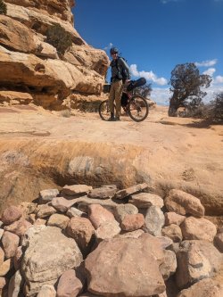
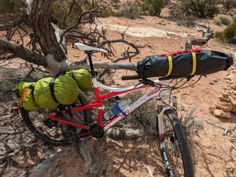
The bike ride was really tough and slow-going. It didn't help that we had a lot of weight on the bikes and the old bikes have very little suspension (also, it was early Spring so we were in poor biking shape!). We were also being extra careful and walking our bikes more than usual because we were in the middle of nowhere and the consequences of a crash are high. Before this trip, I had invested in some bikepacking gear and was excited to do a proper bikepacking trip (here in CO) someday soon. I think that dream died on Day 1 of the Maze trip... When we finally finished the cache/shuttle, we were both happy to get off the bikes and start hiking the canyons. We were very lucky that it snowed several days before our trip, so there were potholes of water all over the place.
The sun was already getting low by the time we started hiking:
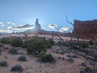
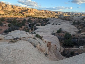
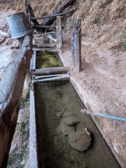
We camped near the old cowboy spring. I just love this area. It's not jaw-dropping spectacular, but it's a unique and magical place.
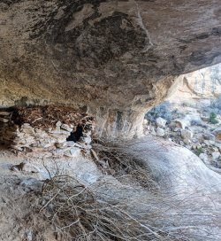
We explored some nice side canyons:
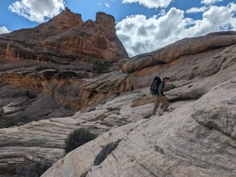
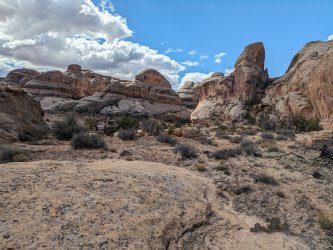
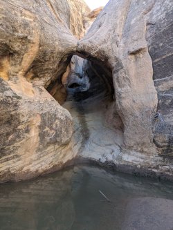
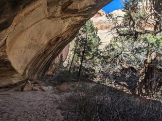
I would have loved to have camped in this alcove (a remote side canyon that very few people see!), but it was early in the day and we wanted to cover more ground:
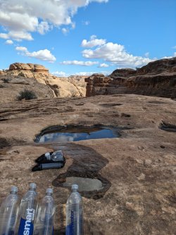
We filtered water from a set of nice potholes high in the slick rock:
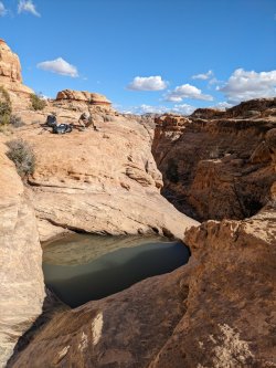
The scenery was awesome in this area!
We wandered a little further up the main canyon and found one of my all-time favorite campsites:
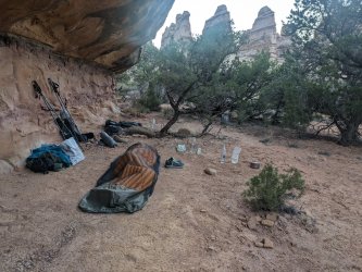
If you're lucky enough to go there after recent precipitation (so there is water in potholes nearby), this really is the best campsite ever. Nice flat spots to sleep, a little overhang to offer modest protection from light rain, absolutely spectacular views of the Fins, and fun terrain to explore all around.
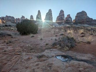
I admit that E's Country has some relatively-mundane areas that you need to hike through to get between the best areas. But the best areas there are superb! We spent some time wandering around an unnamed side canyon that is one of my favorite spots in CNP:
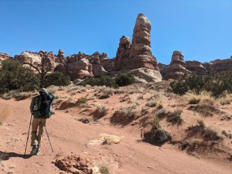
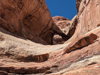
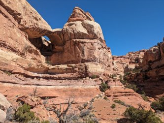
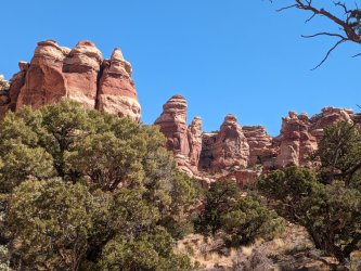
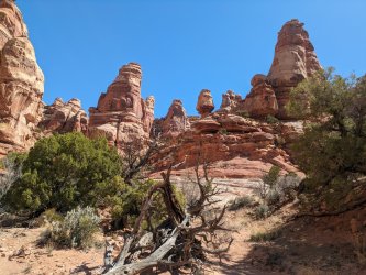
We took the exit out of the main canyon (a surprisingly well-cairned exit, considering that it's not an official trail), and then explored the glorious area above this canyon.
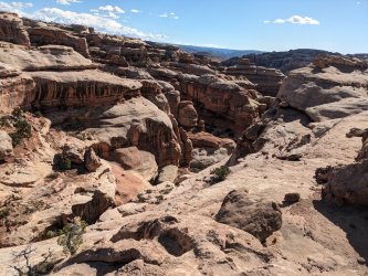
Classic Canyonlands in every way. The photos never do it justice.
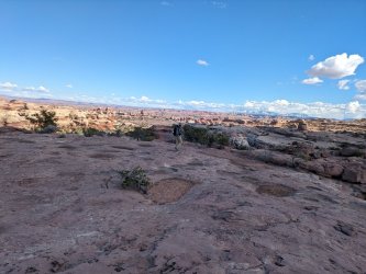
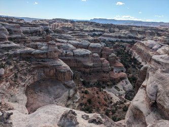
We then joined up with the road, and walked it for a few miles to our food/water cache. Normally I despise the idea of hiking on a road, but the road here is so spectacular that we really enjoyed it.
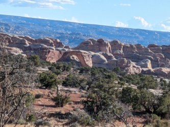
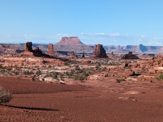
After picking up our cache, we dropped into Trailhead 2 and a canyon that was new to me. The trailhead/canyon entrance was actually tricky to find from the road, and the canyon felt very remote and isolated. Even though it's an official trail on the park maps, it didn't feel like anyone had hiked through that canyon for some time.
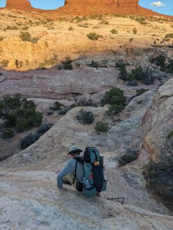
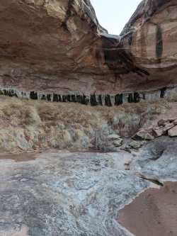
We set up camp high on the slickrock part way down the descent into the canyon. There was tons of water all throughout the canyon. We heard coyotes from camp.
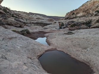
Sadly, we both had bad allergies the next day, and it was pretty hot, so we didn't enjoy it as much as we should have. The canyon itself is not quite as spectacular as some of the others in the region, but it is consistently nice and has a unique, serene character that relatively few people experience. I think if we had been feeling better, we would have enjoyed the canyon much more.
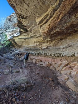
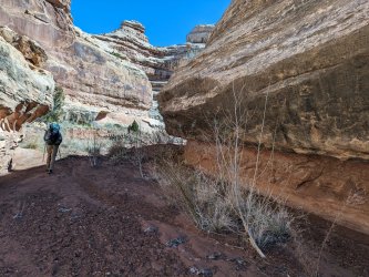
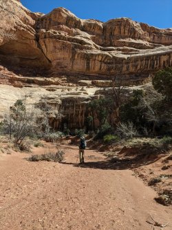
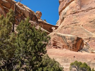
Eventually, some familiar formations came into view.
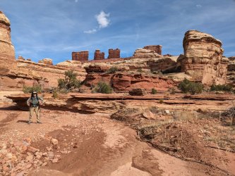
We attempted the Overlook trail but got turned back at (what I believe is) the crux. I wish I'd taken a photo of it; it was sketchier than I expected and we quickly decided to bail on it. We still had a lot of fun on this little side diversion, though.
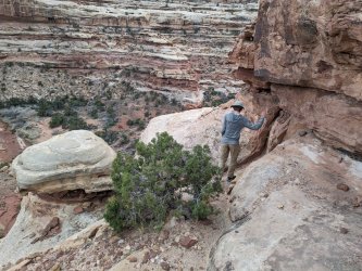
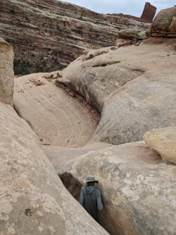
We made the small side trip to see the triple arch; the photos of this make it look cooler than it actually is in person (which is the opposite of all the other site in the region!). Still worthy of the small effort it takes to get there though:
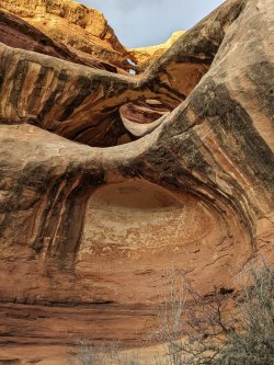
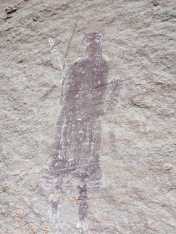
We camped near the mouth of Picto Fk. I was having flashbacks to my first trip to the Maze, when we experienced a severe sandstorm at this campsite. On this evening it was calm and quiet though. The next morning we basked in the glory of one of my favorite works of art:
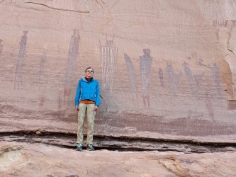
This is, in my opinion, the heart and soul of the Maze, and maybe even of the CO Plateau itself. The setting is so serene and majestic:
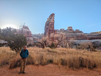
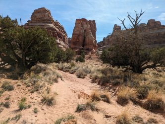
The last time I hiked this section, it was so windy that a rock fell from the cliff wall and hit my sister on the wrist (we were lucky that it didn't cause serious injury!). It was a different experience strolling through on this calm morning:
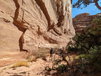
We soon climbed out of the canyon and hiked along the spectacular ridge, which gave nonstop panoramic views for the next couple of miles:
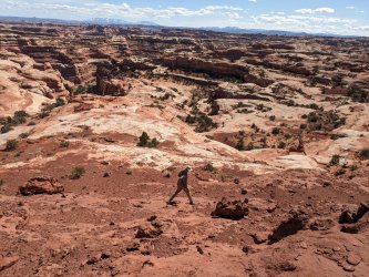
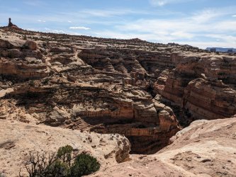
Eventually we got back to the road, and we hiked back to our bikes.
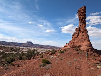
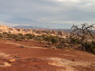
The ride back to the car was a lot easier with such light packs! It was still kind of tough and slow though.
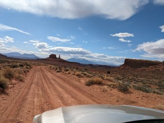
The drive back had some spectacular stretches early on:
I'll be back.
The Maze is a very remote area, and getting there is half of the challenge/adventure. Backpackers typically use one of several approaches to get there:
- truck/jeep--requires a very long and remote drive over challenging jeep roads
- hiking in--requires a full-day approach hike, followed by a difficult scramble down the Maze Overlook trail (I would personally not want to do that, especially with a heavy pack!)
- packraft--requires hiking to the river from the Needles and rafting across
- commercial jet boat--the quickest way to get to the Maze, and a fun tour of the river, but it is very expensive these days and does not offer flexibility in terms of schedule
The basic itinerary was as follows:
- bike a handful of miles to Trailhead 1 with all of the weight (a very heavy load!)
- ditch some of our stuff near Trailhead 1 (temporarily)
- bike North with the lighter load to Trailhead 2. Leave a cache of food and water near Trailhead 2 for the 2nd half of the trip (which would be in the Northern canyons).
- bike or hike back to Trailhead 1, pick up the stuff we left there, and start the hike

The bike ride was really tough and slow-going. It didn't help that we had a lot of weight on the bikes and the old bikes have very little suspension (also, it was early Spring so we were in poor biking shape!). We were also being extra careful and walking our bikes more than usual because we were in the middle of nowhere and the consequences of a crash are high. Before this trip, I had invested in some bikepacking gear and was excited to do a proper bikepacking trip (here in CO) someday soon. I think that dream died on Day 1 of the Maze trip... When we finally finished the cache/shuttle, we were both happy to get off the bikes and start hiking the canyons. We were very lucky that it snowed several days before our trip, so there were potholes of water all over the place.
The sun was already getting low by the time we started hiking:


We camped near the old cowboy spring. I just love this area. It's not jaw-dropping spectacular, but it's a unique and magical place.


We explored some nice side canyons:


I would have loved to have camped in this alcove (a remote side canyon that very few people see!), but it was early in the day and we wanted to cover more ground:

We filtered water from a set of nice potholes high in the slick rock:

The scenery was awesome in this area!

We wandered a little further up the main canyon and found one of my all-time favorite campsites:

If you're lucky enough to go there after recent precipitation (so there is water in potholes nearby), this really is the best campsite ever. Nice flat spots to sleep, a little overhang to offer modest protection from light rain, absolutely spectacular views of the Fins, and fun terrain to explore all around.

I admit that E's Country has some relatively-mundane areas that you need to hike through to get between the best areas. But the best areas there are superb! We spent some time wandering around an unnamed side canyon that is one of my favorite spots in CNP:


We took the exit out of the main canyon (a surprisingly well-cairned exit, considering that it's not an official trail), and then explored the glorious area above this canyon.

Classic Canyonlands in every way. The photos never do it justice.


We then joined up with the road, and walked it for a few miles to our food/water cache. Normally I despise the idea of hiking on a road, but the road here is so spectacular that we really enjoyed it.


After picking up our cache, we dropped into Trailhead 2 and a canyon that was new to me. The trailhead/canyon entrance was actually tricky to find from the road, and the canyon felt very remote and isolated. Even though it's an official trail on the park maps, it didn't feel like anyone had hiked through that canyon for some time.


We set up camp high on the slickrock part way down the descent into the canyon. There was tons of water all throughout the canyon. We heard coyotes from camp.

Sadly, we both had bad allergies the next day, and it was pretty hot, so we didn't enjoy it as much as we should have. The canyon itself is not quite as spectacular as some of the others in the region, but it is consistently nice and has a unique, serene character that relatively few people experience. I think if we had been feeling better, we would have enjoyed the canyon much more.


Eventually, some familiar formations came into view.

We attempted the Overlook trail but got turned back at (what I believe is) the crux. I wish I'd taken a photo of it; it was sketchier than I expected and we quickly decided to bail on it. We still had a lot of fun on this little side diversion, though.


We made the small side trip to see the triple arch; the photos of this make it look cooler than it actually is in person (which is the opposite of all the other site in the region!). Still worthy of the small effort it takes to get there though:

We camped near the mouth of Picto Fk. I was having flashbacks to my first trip to the Maze, when we experienced a severe sandstorm at this campsite. On this evening it was calm and quiet though. The next morning we basked in the glory of one of my favorite works of art:

This is, in my opinion, the heart and soul of the Maze, and maybe even of the CO Plateau itself. The setting is so serene and majestic:


The last time I hiked this section, it was so windy that a rock fell from the cliff wall and hit my sister on the wrist (we were lucky that it didn't cause serious injury!). It was a different experience strolling through on this calm morning:

We soon climbed out of the canyon and hiked along the spectacular ridge, which gave nonstop panoramic views for the next couple of miles:


Eventually we got back to the road, and we hiked back to our bikes.


The ride back to the car was a lot easier with such light packs! It was still kind of tough and slow though.

The drive back had some spectacular stretches early on:

I'll be back.
Attachments
Last edited:

