barl0w
I slay white dragons, adventure, and take photos
- Joined
- Jan 20, 2012
- Messages
- 163
On the 26th, a friend and I hiked Timp, starting at the Timpanooke Trailhead and finished at Aspen Grove. I had never done the "cross-over" as I'll call it, and knew that it would make for a long day. But in the end, it was a great experience and I can't say that I'll ever want to do that again (reason to come below).
We started off by meeting at Aspen Grove to leave a car, and then drove over to Timpanooke TH. The drive only takes 15 mins or so. We were surprised when we arrived to find that an area near the trailhead was actually on fire. I popped my head out the window and asked a fireman if the fire was contained and under control - which he replied "Yes."
We stood around for about 20 minutes to assess whether we thought the fireman was correct. The wind was blowing in the direction of the trail, and we watched a helicopter start to drop water on the fire. When 20 mins had expired, we decided it looked "contained enough" to risk it and start the hike. We started about at 2:15 pm from the Timpanooke TH.
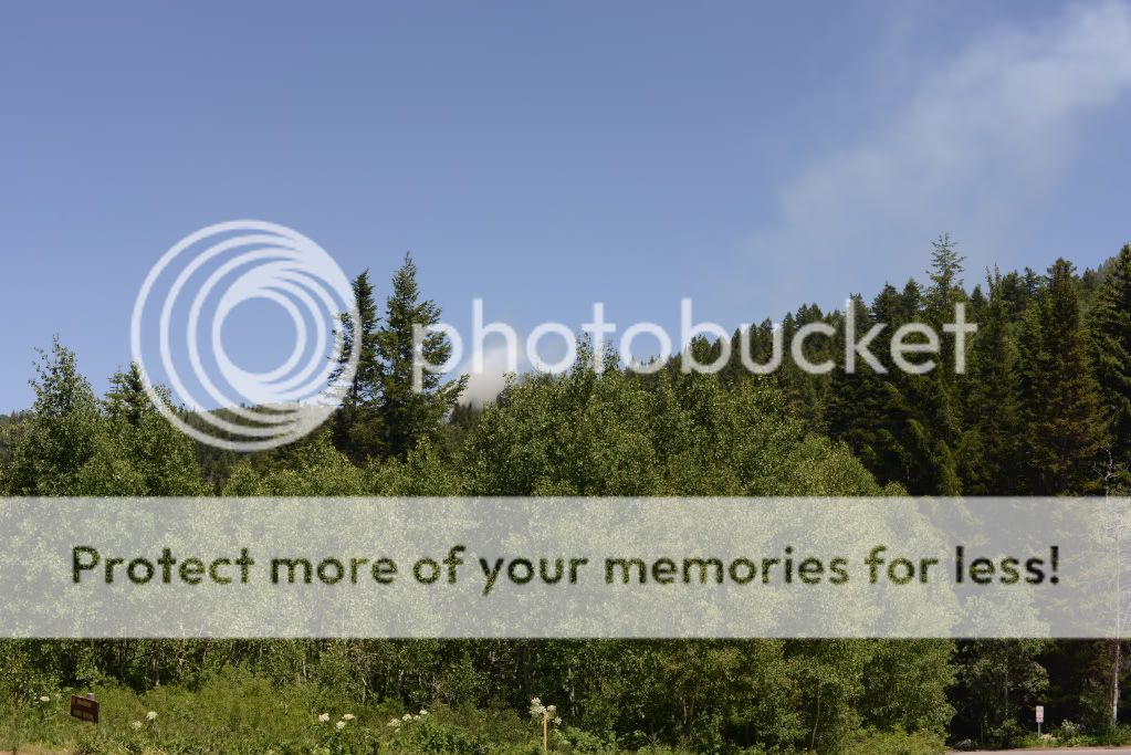
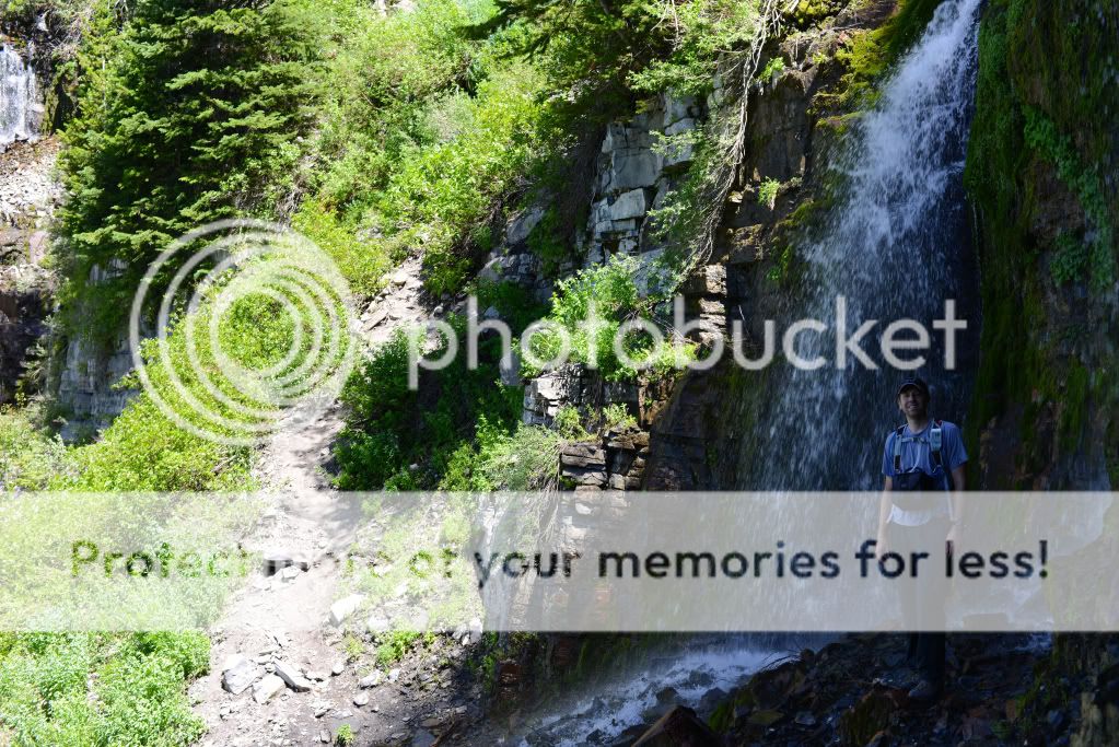
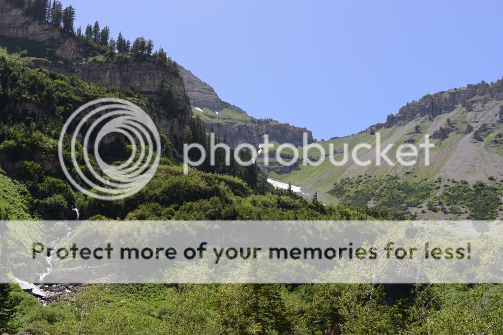
The mountain on way up was as green as ever. I was surprised to see that the small stream in the middle of the meadow had dried up, and when we arrived at Scout Falls that water was not coming from all of the falls anymore - just from the most easterly part (compared to a month ago).
One observation I'll make here about the snow levels and water is that there is not a lot of snow on the trail itself (the whole way up & down). Last year I was hiking even in Sept over 5-10 feet of packed snow covering the trail with waterfalls making large caves below. This year, there is very little snow on the trail until you get to the Timpanogos Basin on the Summit Trail. Despite this, there was (on this day) a lot of water to be found. Your last water-filling (filtering) area is actually right below the Saddle on the Summit Trail at this time. You could fill up below that if you wanted to - at the top of the Giant Staircase, or over near Emerald Lake - but currently there is a good amount of water coming where I mentioned on the Summit Trail. Above that, and you will be left dry.
Parts of Timp Basin (I'll call it Timp Hole #18):
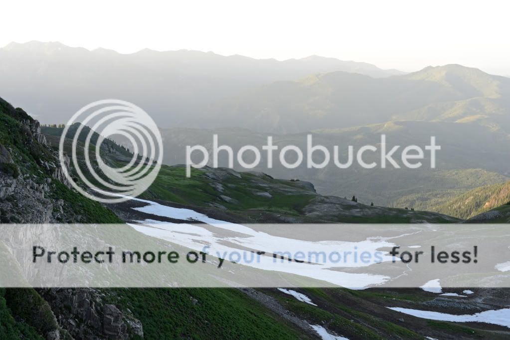
The Saddle from the Basin:
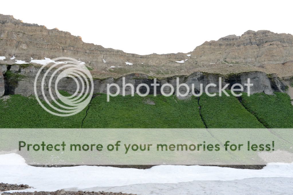
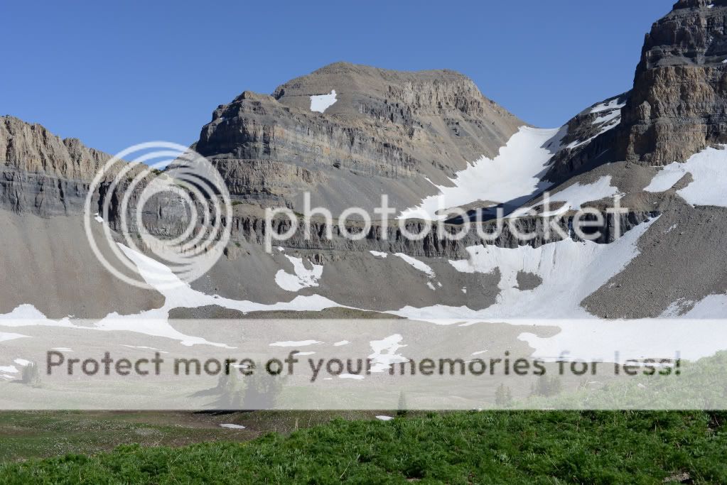
The 2nd Summit (on the left) and the Snow Field (glacier) from the Basin:
Getting from the Timpanooke TH, up the Giant Staircase, and to Timpanogos Basin took us less than 3 hours. To the Saddle 45 mins, and to the Summit, 45 mins. Expect to arrive in less than 5 hours if you keep a pace faster than 1.5 mph.
We looked down along te trail back to the Timpanooke TH, and by the time we reached the Great Staircase, the fire was out, and the helicopter had only made 3 trips. I wonder how much each trip with that thing costs!?
Anyhow, starting from the Timpanooke TH:
Looking up towards Forgotten Peak (north of the main trails):
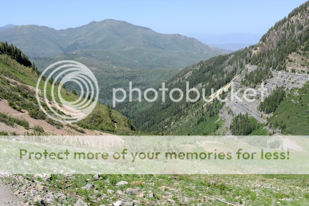
Looking back down from Timpanogos Basin to American Fork Canyon:
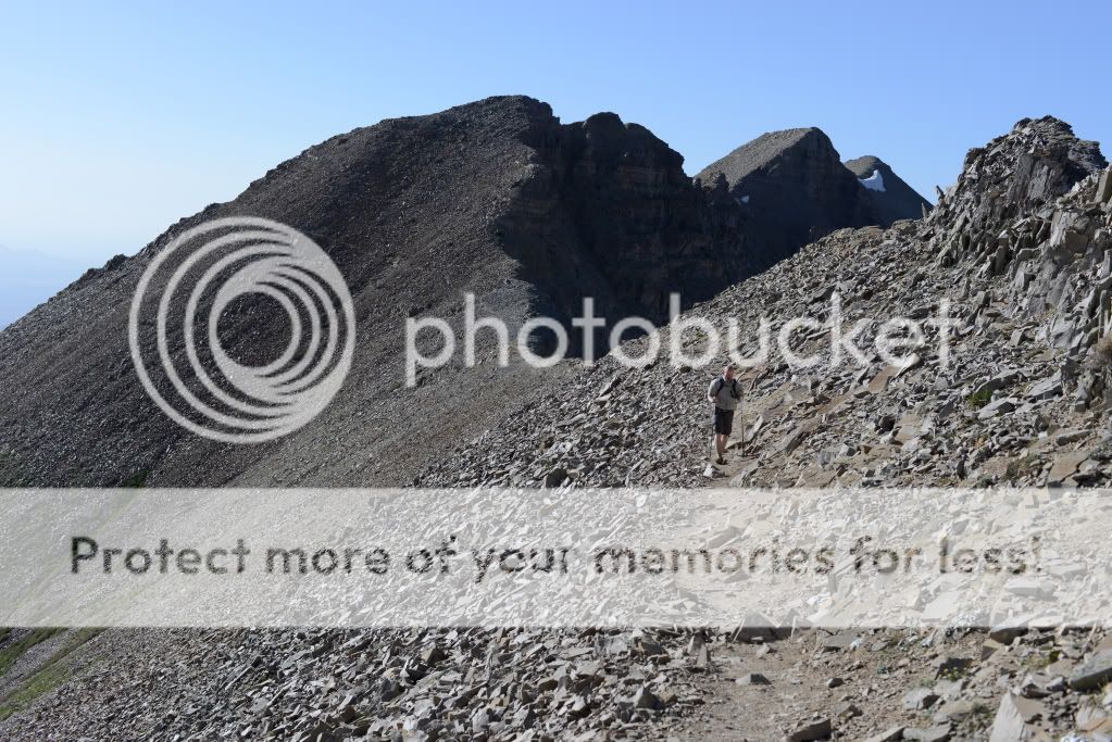
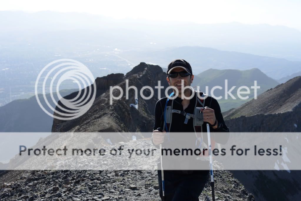
The Saddle is easy to find - it's the big dip in the ridge line just NW of the summit shack. He's looking back at it (the dip just behind my friend):
As soon as we made our way above Timpanogos Basin, the quiet serenity instantly turned to 30-40 mph winds, the temperature of the hot valley could be felt, and I was glad to have trekking poles not only for crossing the short snow fields, but for the trail up to the top with the wind. BTW, as soon as we returned from the summit and got below the ridge, we were back in an extremely quiet and serene hike. The difference was amazing, and the climb on the ridge that day felt like a battle because of the strength of the wind. Good thing we brought our windbreakers to help.
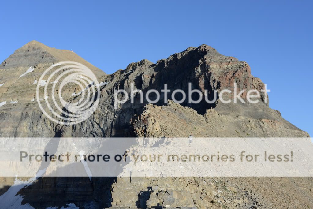
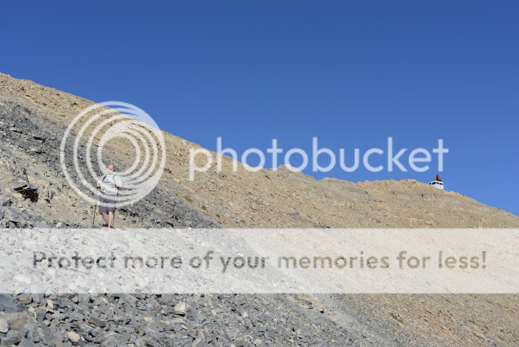
One part that is kinda crazy is "The Stairs" and it reminds me a lot of Walters Wiggles in Zion, except that it's 100x steeper and a bit narrower. It leads you right up over the front ridge onto a back ridge to the summit. Here's a photo of the ridge (upper-right), and you can also see the summit shack on the left on the ridge:
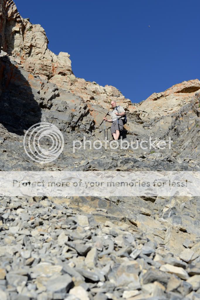
A photo looking up The Stairs (taken while we were descending):
Past The Stairs is a long winding trail to the summit, which is much easier to see from the top than it is to recognize when looking for it from the bottom:
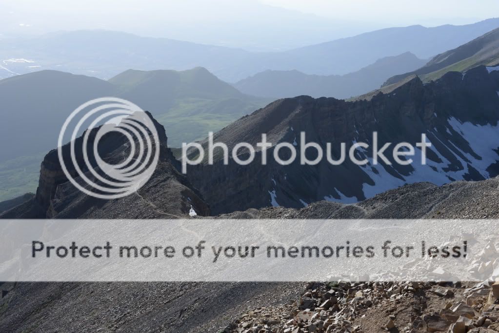
See what I mean?
Here's a windy video at the Summit. I start looking at Spanish Fork Canyon where you can see the fire, and do a 360, covering the valley floor, Salt Lake-area mountains, then you can see Timp Basin, Robert's Horn, Emerald Lake (and if you squint the Timp Shelter), and the "snow field" or glacier which I accidentally called the "ice field" in the video. Then I pan back a bit:
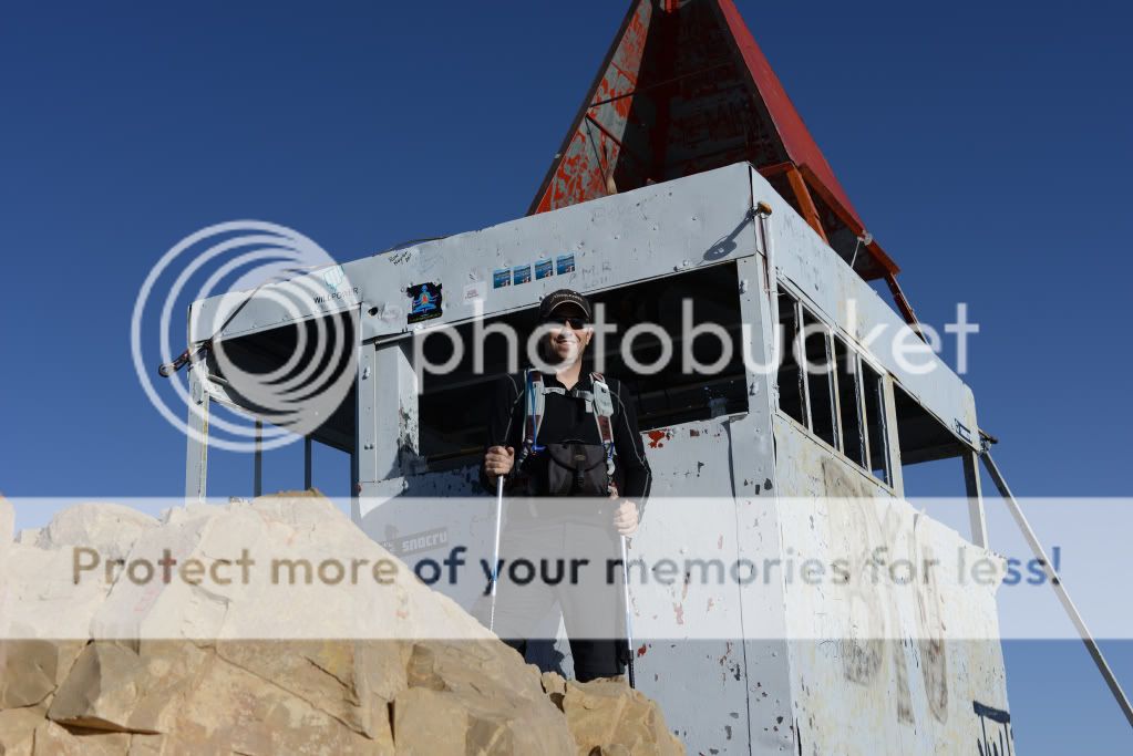
At the Summit:
Looking from the Summit Shack to Emerald Lake (bottom-most lake), and you can see Aspen Grove at the top:
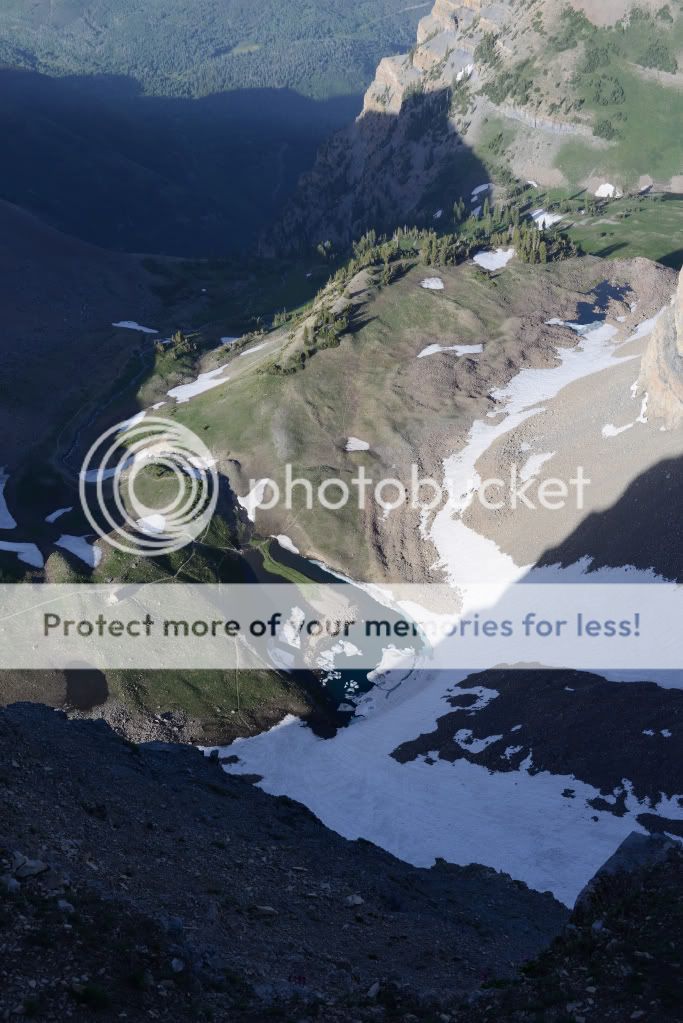
The few times I've been up there, I always wish that I could base jump off the back of the summit shack to Emerald Lake. It's an astounding straight (or almost straight) drop down - or what a rappel that would be if there was a rope long enough!
Well, so once we descended the summit and made our way to the Timp Shelter by Emerald Lake, it was about 9:30 pm (stopped to eat, fill water, call family (AT&T), etc). By then I had realized that we had only seen 1 mountain goat (at the Saddle), a ton of Uinta Ground Squirrels (potgut), and I was bummed that the flowers weren't really blooming yet, or I had missed them (until this point). It was really green and beautiful though, and I was happy with our pace.
Darkness came fast, and since the Aspen Grove trail is super-sketchy, I put away the camera for the rest of the trip. The whole trip took us 9 hrs, 50 minutes which equates to about 15 miles, and an ascent from 7350 ft to 11,700 ft. From Timpanooke TH to the summit, it's about 7 miles.
Here's the hike on a topo map. You can see that I went up Timpanooke to the summit, back down the same way and made my way over to the Timp Shelter next to Emerald Lake. Then I "checked in" a few times on the Aspen Grove trail:
http://gps.motionx.com/maps/f87d1543521beab01781f62a838100d1
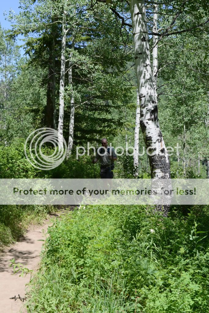
I must say here that I am disappointed in the condition that the Aspen Grove trail is in. Hands-down there is a spot on that trail that you must stay at if you decide to make it an overnighter. The sunrise is just incredible looking over Heber Valley. But the trail itself descending the mountain has many false trails which lead you to dead ends, dangerous waterfall crossings, and people have cut the trail so much that it's just a splintered mess. Oh, and in many places the trail is way overgrown and ungroomed.
My advice is to choose the Timpanooke Trail up/down, and enjoy the scenery. If you do stay overnight, venture out into the Timp Basin far from the main summit trail else you will have people walking by at every hour all night on Fri/Saturdays. FYI - most times, I've seen the mountain goats near Emerald Lake, but I've also seen them other places, so keep an eye out for them. I wonder where they were when I was there. Hardly any sign of the herd.
A final note on animal safety: Take caution because black bears have been reported to be in the area, I've seen moose many times (mainly near the Timpanooke and Aspen Grove trail heads), deer are there, and after I got into my car at Aspen Grove this time around, I saw a very large mountain cat (cougar) in the middle of the road while driving back to our car at Timpanooke TH.
It made for a long hard day, but I love the Timpanogos Wilderness area. Michael Kelsey's book on Timpanogos has me curious of other ways to get to the top, and I plan to explore a bit of that this year with more trip reports to come.
Featured image for home page:

We started off by meeting at Aspen Grove to leave a car, and then drove over to Timpanooke TH. The drive only takes 15 mins or so. We were surprised when we arrived to find that an area near the trailhead was actually on fire. I popped my head out the window and asked a fireman if the fire was contained and under control - which he replied "Yes."
We stood around for about 20 minutes to assess whether we thought the fireman was correct. The wind was blowing in the direction of the trail, and we watched a helicopter start to drop water on the fire. When 20 mins had expired, we decided it looked "contained enough" to risk it and start the hike. We started about at 2:15 pm from the Timpanooke TH.
The mountain on way up was as green as ever. I was surprised to see that the small stream in the middle of the meadow had dried up, and when we arrived at Scout Falls that water was not coming from all of the falls anymore - just from the most easterly part (compared to a month ago).
One observation I'll make here about the snow levels and water is that there is not a lot of snow on the trail itself (the whole way up & down). Last year I was hiking even in Sept over 5-10 feet of packed snow covering the trail with waterfalls making large caves below. This year, there is very little snow on the trail until you get to the Timpanogos Basin on the Summit Trail. Despite this, there was (on this day) a lot of water to be found. Your last water-filling (filtering) area is actually right below the Saddle on the Summit Trail at this time. You could fill up below that if you wanted to - at the top of the Giant Staircase, or over near Emerald Lake - but currently there is a good amount of water coming where I mentioned on the Summit Trail. Above that, and you will be left dry.
Parts of Timp Basin (I'll call it Timp Hole #18):
The Saddle from the Basin:
The 2nd Summit (on the left) and the Snow Field (glacier) from the Basin:
Getting from the Timpanooke TH, up the Giant Staircase, and to Timpanogos Basin took us less than 3 hours. To the Saddle 45 mins, and to the Summit, 45 mins. Expect to arrive in less than 5 hours if you keep a pace faster than 1.5 mph.
We looked down along te trail back to the Timpanooke TH, and by the time we reached the Great Staircase, the fire was out, and the helicopter had only made 3 trips. I wonder how much each trip with that thing costs!?
Anyhow, starting from the Timpanooke TH:
Looking up towards Forgotten Peak (north of the main trails):
Looking back down from Timpanogos Basin to American Fork Canyon:
The Saddle is easy to find - it's the big dip in the ridge line just NW of the summit shack. He's looking back at it (the dip just behind my friend):
As soon as we made our way above Timpanogos Basin, the quiet serenity instantly turned to 30-40 mph winds, the temperature of the hot valley could be felt, and I was glad to have trekking poles not only for crossing the short snow fields, but for the trail up to the top with the wind. BTW, as soon as we returned from the summit and got below the ridge, we were back in an extremely quiet and serene hike. The difference was amazing, and the climb on the ridge that day felt like a battle because of the strength of the wind. Good thing we brought our windbreakers to help.
One part that is kinda crazy is "The Stairs" and it reminds me a lot of Walters Wiggles in Zion, except that it's 100x steeper and a bit narrower. It leads you right up over the front ridge onto a back ridge to the summit. Here's a photo of the ridge (upper-right), and you can also see the summit shack on the left on the ridge:
A photo looking up The Stairs (taken while we were descending):
Past The Stairs is a long winding trail to the summit, which is much easier to see from the top than it is to recognize when looking for it from the bottom:
See what I mean?
Here's a windy video at the Summit. I start looking at Spanish Fork Canyon where you can see the fire, and do a 360, covering the valley floor, Salt Lake-area mountains, then you can see Timp Basin, Robert's Horn, Emerald Lake (and if you squint the Timp Shelter), and the "snow field" or glacier which I accidentally called the "ice field" in the video. Then I pan back a bit:
At the Summit:
Looking from the Summit Shack to Emerald Lake (bottom-most lake), and you can see Aspen Grove at the top:
The few times I've been up there, I always wish that I could base jump off the back of the summit shack to Emerald Lake. It's an astounding straight (or almost straight) drop down - or what a rappel that would be if there was a rope long enough!
Well, so once we descended the summit and made our way to the Timp Shelter by Emerald Lake, it was about 9:30 pm (stopped to eat, fill water, call family (AT&T), etc). By then I had realized that we had only seen 1 mountain goat (at the Saddle), a ton of Uinta Ground Squirrels (potgut), and I was bummed that the flowers weren't really blooming yet, or I had missed them (until this point). It was really green and beautiful though, and I was happy with our pace.
Darkness came fast, and since the Aspen Grove trail is super-sketchy, I put away the camera for the rest of the trip. The whole trip took us 9 hrs, 50 minutes which equates to about 15 miles, and an ascent from 7350 ft to 11,700 ft. From Timpanooke TH to the summit, it's about 7 miles.
Here's the hike on a topo map. You can see that I went up Timpanooke to the summit, back down the same way and made my way over to the Timp Shelter next to Emerald Lake. Then I "checked in" a few times on the Aspen Grove trail:
http://gps.motionx.com/maps/f87d1543521beab01781f62a838100d1
I must say here that I am disappointed in the condition that the Aspen Grove trail is in. Hands-down there is a spot on that trail that you must stay at if you decide to make it an overnighter. The sunrise is just incredible looking over Heber Valley. But the trail itself descending the mountain has many false trails which lead you to dead ends, dangerous waterfall crossings, and people have cut the trail so much that it's just a splintered mess. Oh, and in many places the trail is way overgrown and ungroomed.
My advice is to choose the Timpanooke Trail up/down, and enjoy the scenery. If you do stay overnight, venture out into the Timp Basin far from the main summit trail else you will have people walking by at every hour all night on Fri/Saturdays. FYI - most times, I've seen the mountain goats near Emerald Lake, but I've also seen them other places, so keep an eye out for them. I wonder where they were when I was there. Hardly any sign of the herd.
A final note on animal safety: Take caution because black bears have been reported to be in the area, I've seen moose many times (mainly near the Timpanooke and Aspen Grove trail heads), deer are there, and after I got into my car at Aspen Grove this time around, I saw a very large mountain cat (cougar) in the middle of the road while driving back to our car at Timpanooke TH.
It made for a long hard day, but I love the Timpanogos Wilderness area. Michael Kelsey's book on Timpanogos has me curious of other ways to get to the top, and I plan to explore a bit of that this year with more trip reports to come.
Featured image for home page:


 However, I do think it's best to work your way up to a hike like that.