- Joined
- May 5, 2012
- Messages
- 1,725
The Murdock Fire is fast becoming relevant to those of us who enjoy the western Uintas, especially the upper Duchesne River environs.

Lightning sparked the fire in late August in the Murdock Basin. The USFS opted to manage the fire, as it was in an area with tricky access, a lot of hazards and little in the way of human infrastructure.
The fire crept northward along the Duchesne River gorge. On Wednesday, Sept. 26 the USFS issued a closure order for a large area surrounding the fire, to include Four Lakes Basin, Mirror and and pretty much everything in between.
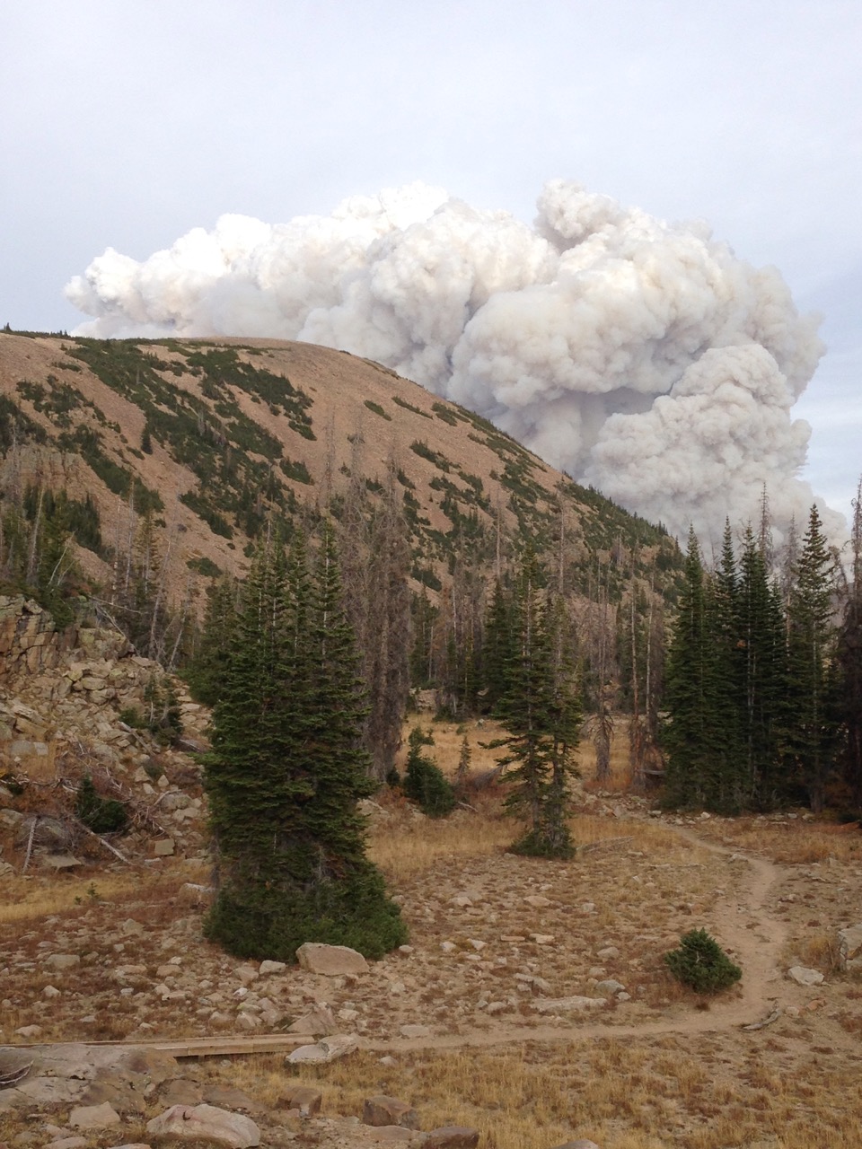
Then, on Saturday Sept. 29, a steady south wind stoked the fire. It made a run to the north, coming within a mile and a half of Blythe Lake and burning to near the west flank of Mt. Agassiz. In doing so, it crossed the Highline Trail around Scudder Lake.
I observed this run from a spot near Butterfly Lake. It was something to behold. Through the afternoon, the towering smoke plume rolled above Hayden Peak, blocking the view of Agassiz.
Earlier in the day, I'd been down around East Fork and Stillwater Fork. Both were thick with smoke.

The Murdock Fire plume from East Fork Bear River, looking south.

No duh, Smokey. You're not helping.

Mt. Beulah, barely visible through the smoke.

Seriously, knock it off. It's not funny.
My vantage point for the fire's run was just south of Butterfly Lake. The column was really something to behold.

The Murdock Fire begins to climb out of the Duchesne River gorge.
The fire at that point was maybe 2-2.5 miles away. Flame fronts were visible and more incredibly, audible.

The Murdock Fire smoke plume from the shore of Bud Lake.
Shooting from the shoreline was a bit disconcerting because I couldn't actually see the position of the flame front. I could tell the fire was east of me, but it was getting closer.

Smoke from the Murdock Fire obscures Mt. Agassiz.
I retreated to a high spot with better visibility and easier access to my car, just in case. The flames were easily visible, then about 1.5 miles away.


It would have been a great spot to view aerial attack, but the heavies weren't flying Murdock. Instead this Gulfstream 690C out of Montana was doing recon.

N840G, registered to Bridger Aviation, flying the unfriendly skies.
The sun went down but the wind stayed up. Pretty eerie. People kept pulling off the highway and stopping to take pictures in near pitch-blackness with their iPhones.

30 sec. exposure, ISO 800, ƒ/6.3
I was only seeing the west flank of the fire. I feared it had pushed hard to the east, possibly making a run toward Naturalist Basin. Thankfully, that proved not to be the case.

The USFS map showing the extent of the Murdock Fire on the morning of Sept. 30, 2018.
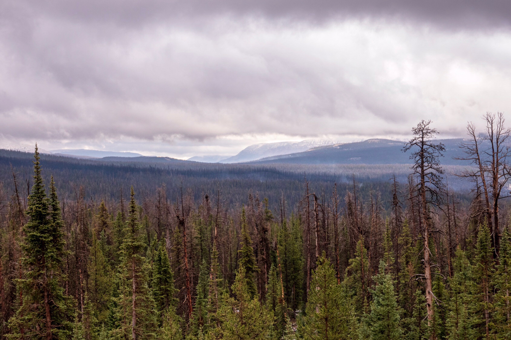
The next morning, the smoke situation appeared much better from the East Fork Bear River area.

Smoke clinging to A-1 and the surrounding environs.
Overnight, fire managers had ordered the closure of SR 150 from the Murdock Basin turnoff to Ruth Lake TH. I drove up with the intent of hiking Kletting, but UHP actually had their roadblock at Sulphur CG. Not a huge deal, better safe than sorry.
This fire appeared dramatic, but it seems to be an overall positive for the forest. That area (like much of the High Uintas) is choked with standing dead and beetle kill. Having hiked through that portion of the Highline just a few months ago, I can say it is badly in need to rejuvenation. I might feel differently if the fire grows to 30,000+ acres, but it's late in the season and tropical moisture is inbound. Time will tell.
Lightning sparked the fire in late August in the Murdock Basin. The USFS opted to manage the fire, as it was in an area with tricky access, a lot of hazards and little in the way of human infrastructure.
The fire crept northward along the Duchesne River gorge. On Wednesday, Sept. 26 the USFS issued a closure order for a large area surrounding the fire, to include Four Lakes Basin, Mirror and and pretty much everything in between.
Then, on Saturday Sept. 29, a steady south wind stoked the fire. It made a run to the north, coming within a mile and a half of Blythe Lake and burning to near the west flank of Mt. Agassiz. In doing so, it crossed the Highline Trail around Scudder Lake.
I observed this run from a spot near Butterfly Lake. It was something to behold. Through the afternoon, the towering smoke plume rolled above Hayden Peak, blocking the view of Agassiz.
Earlier in the day, I'd been down around East Fork and Stillwater Fork. Both were thick with smoke.
The Murdock Fire plume from East Fork Bear River, looking south.
No duh, Smokey. You're not helping.
Mt. Beulah, barely visible through the smoke.
Seriously, knock it off. It's not funny.
My vantage point for the fire's run was just south of Butterfly Lake. The column was really something to behold.
The Murdock Fire begins to climb out of the Duchesne River gorge.
The fire at that point was maybe 2-2.5 miles away. Flame fronts were visible and more incredibly, audible.
The Murdock Fire smoke plume from the shore of Bud Lake.
Shooting from the shoreline was a bit disconcerting because I couldn't actually see the position of the flame front. I could tell the fire was east of me, but it was getting closer.
Smoke from the Murdock Fire obscures Mt. Agassiz.
I retreated to a high spot with better visibility and easier access to my car, just in case. The flames were easily visible, then about 1.5 miles away.
It would have been a great spot to view aerial attack, but the heavies weren't flying Murdock. Instead this Gulfstream 690C out of Montana was doing recon.
N840G, registered to Bridger Aviation, flying the unfriendly skies.
The sun went down but the wind stayed up. Pretty eerie. People kept pulling off the highway and stopping to take pictures in near pitch-blackness with their iPhones.
30 sec. exposure, ISO 800, ƒ/6.3
I was only seeing the west flank of the fire. I feared it had pushed hard to the east, possibly making a run toward Naturalist Basin. Thankfully, that proved not to be the case.
The USFS map showing the extent of the Murdock Fire on the morning of Sept. 30, 2018.
The next morning, the smoke situation appeared much better from the East Fork Bear River area.
Smoke clinging to A-1 and the surrounding environs.
Overnight, fire managers had ordered the closure of SR 150 from the Murdock Basin turnoff to Ruth Lake TH. I drove up with the intent of hiking Kletting, but UHP actually had their roadblock at Sulphur CG. Not a huge deal, better safe than sorry.
This fire appeared dramatic, but it seems to be an overall positive for the forest. That area (like much of the High Uintas) is choked with standing dead and beetle kill. Having hiked through that portion of the Highline just a few months ago, I can say it is badly in need to rejuvenation. I might feel differently if the fire grows to 30,000+ acres, but it's late in the season and tropical moisture is inbound. Time will tell.