The Comb & Butler, Feb. 2012

DAA

Member
Joined
Jun 14, 2012
Messages
715
Day 1, Thur. 2/23

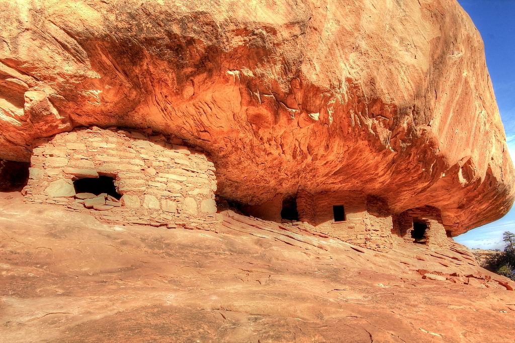
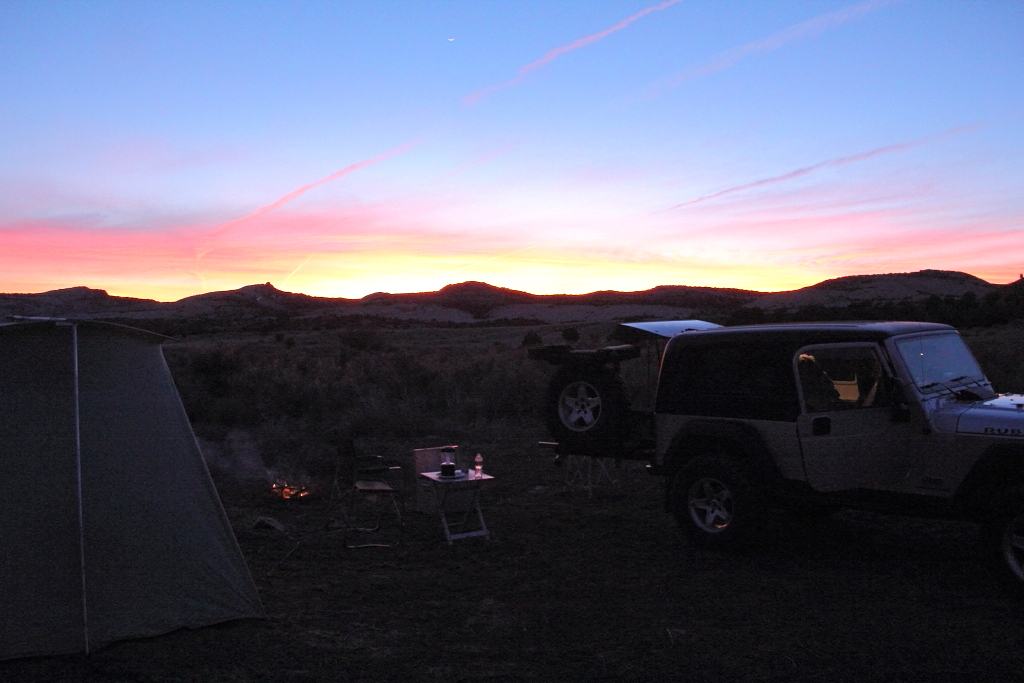
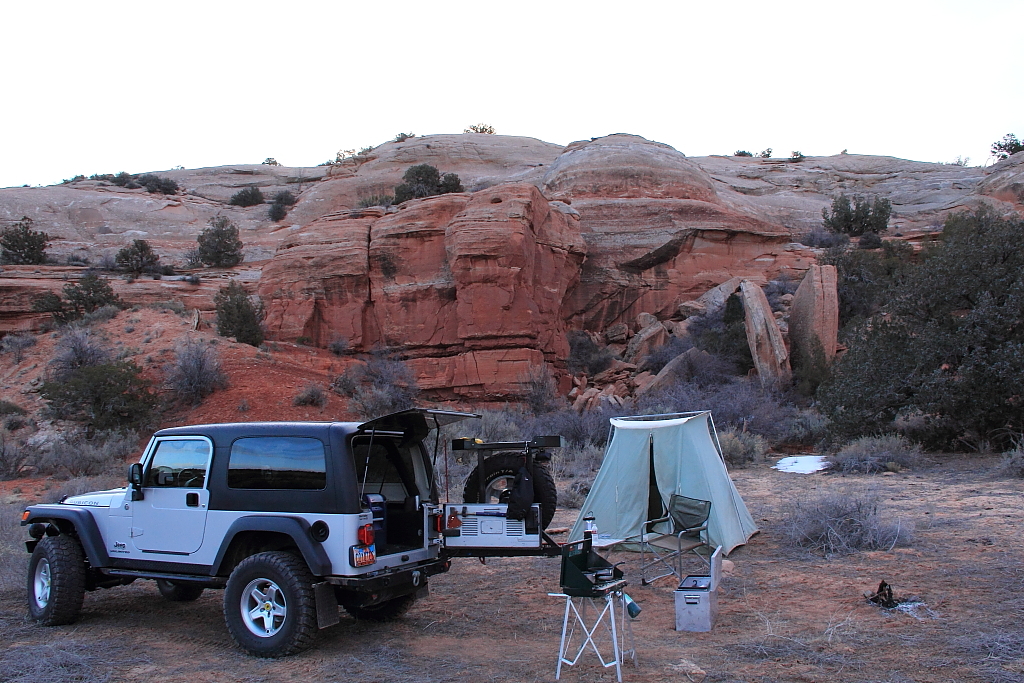
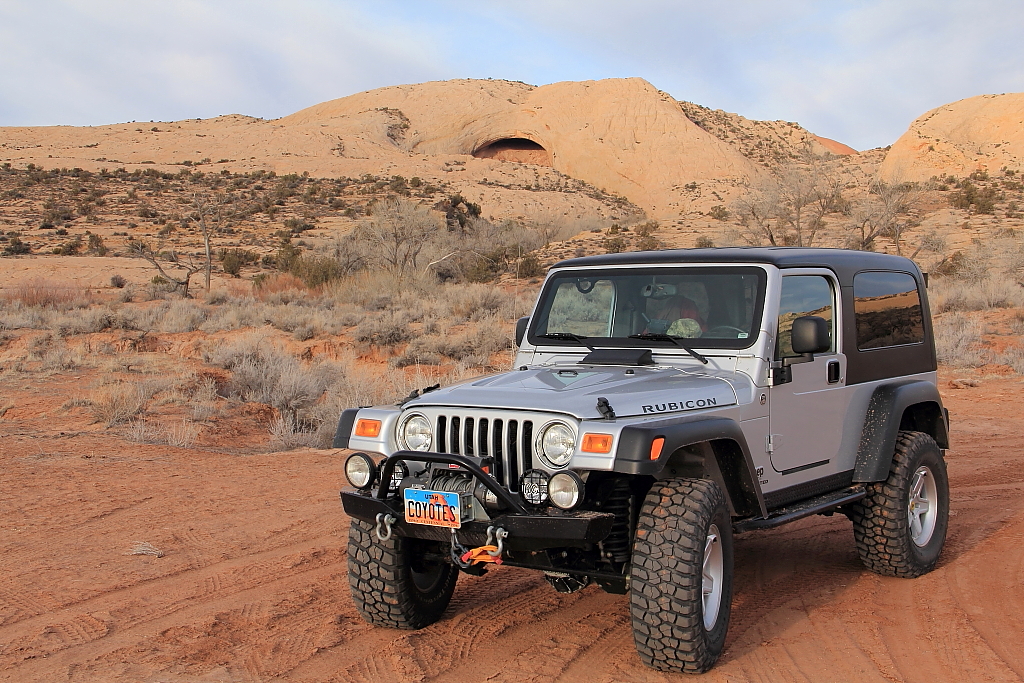
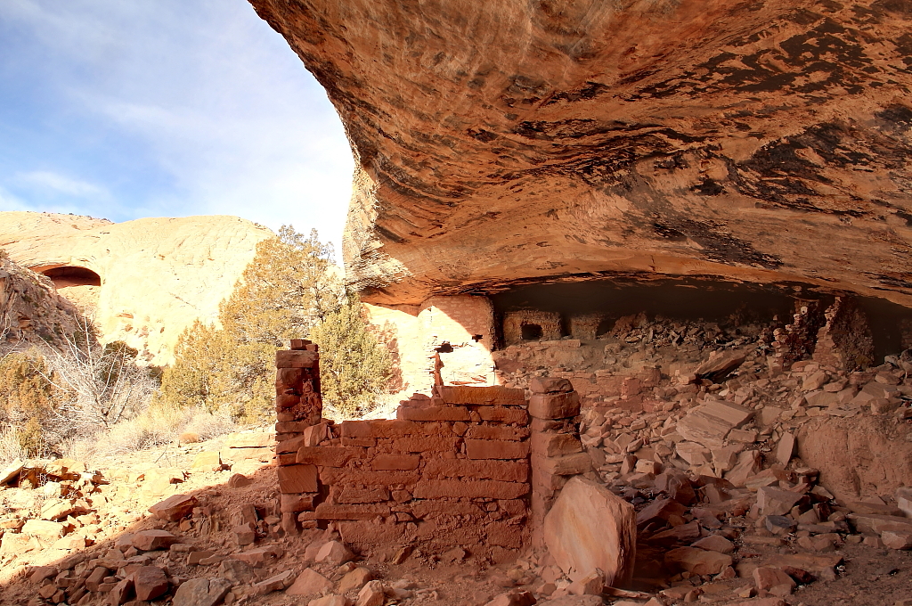
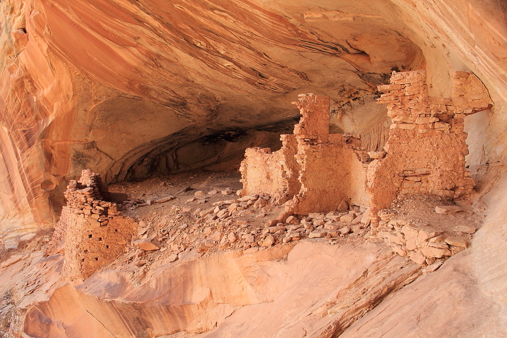
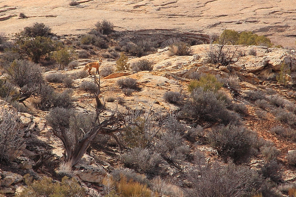
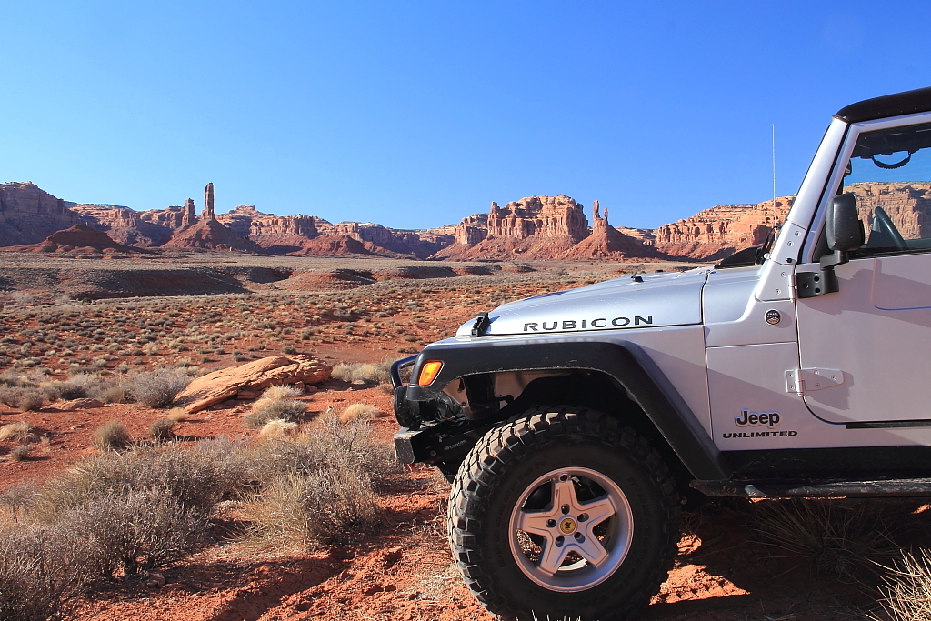
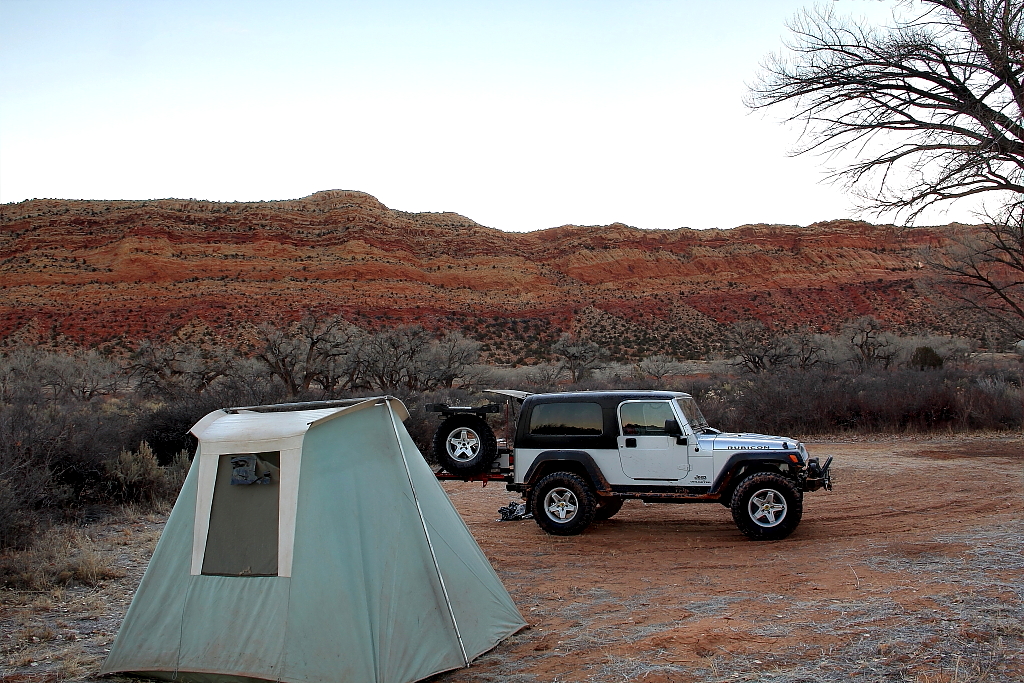
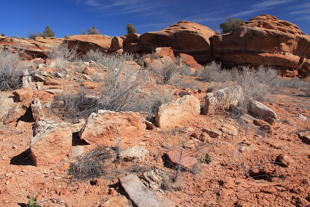
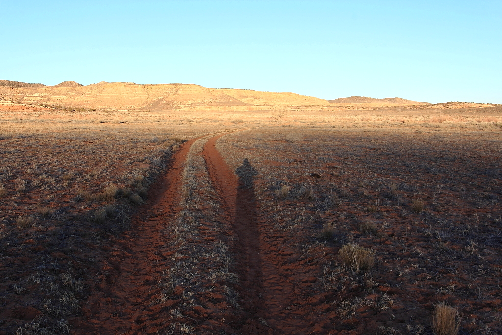
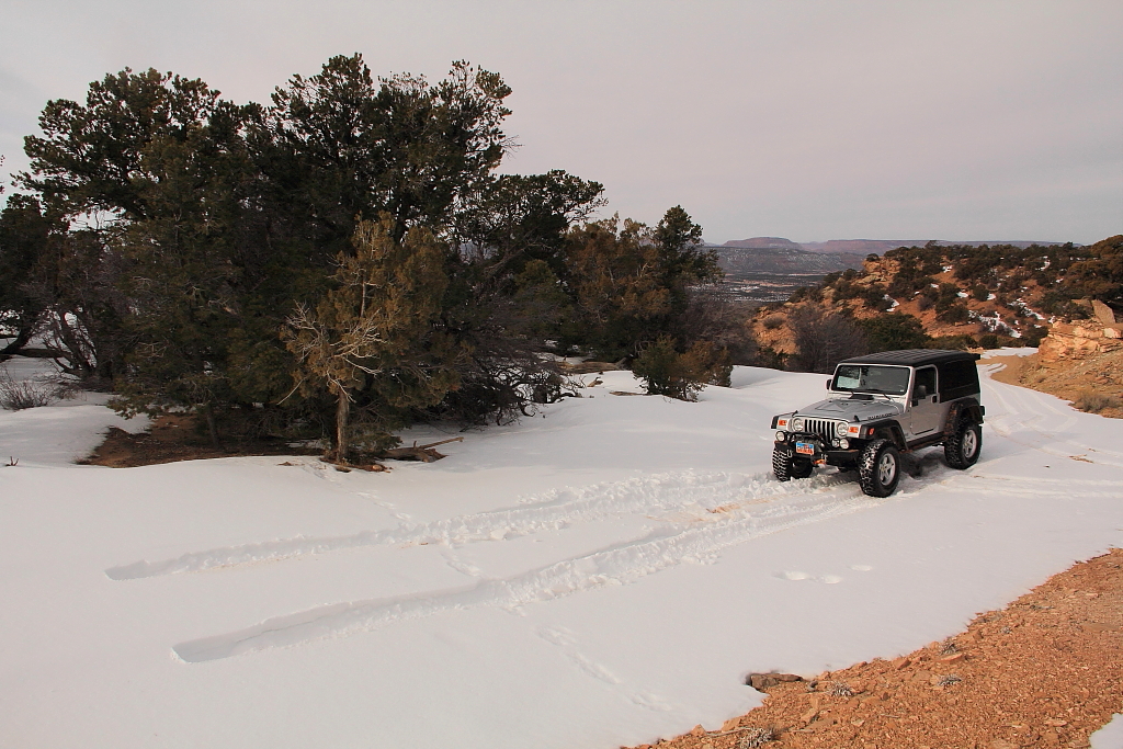
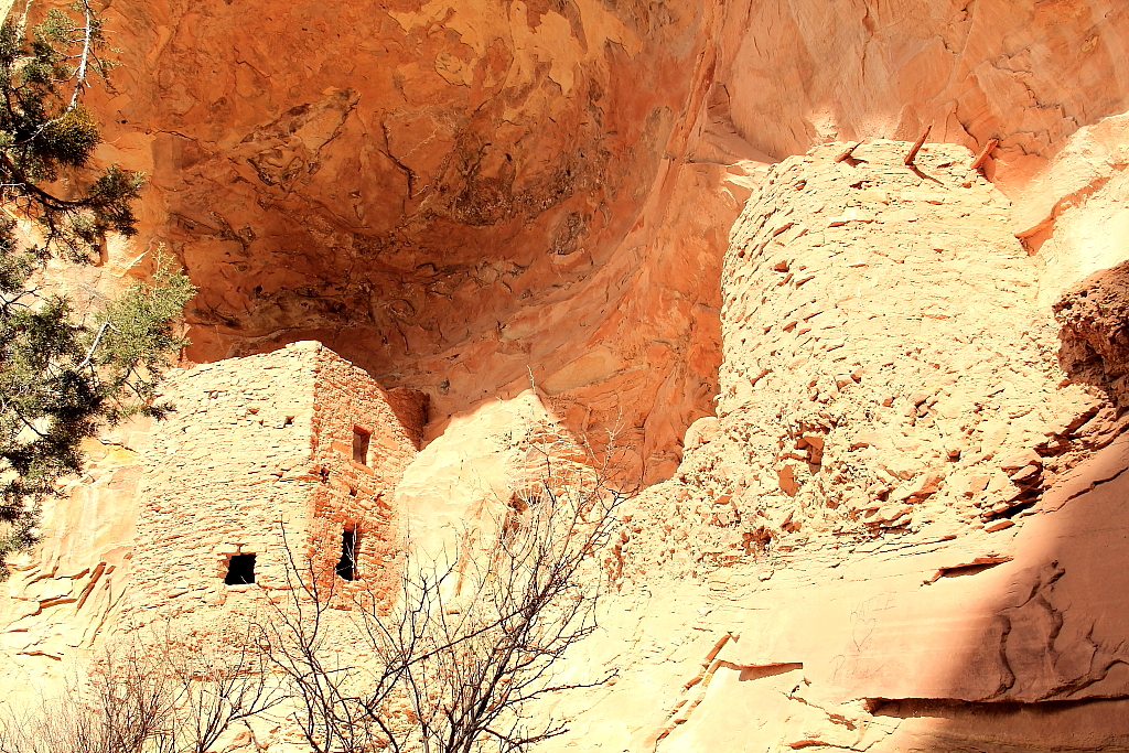
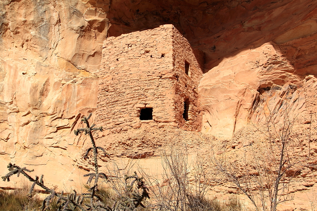
I left my house at 4am on a late February Thur. morning and pointed the hood of the Jeep towards the Comb Ridge-Cedar Mesa area. As usual that time of year and that time of morning, icy roads on the drive from Spanish Fork to Helper made for slow going. But by 10am I had already left Blanding behind and was turning north off of 95 up Cottonwood canyon heading for my first destination in Butler Wash – the Tower House ruins.
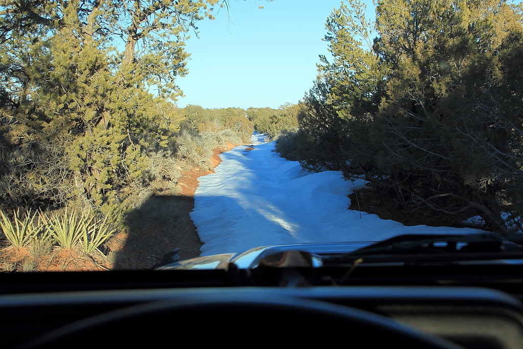
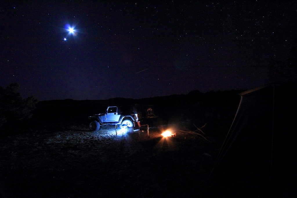
Getting out of the Jeep, I was greeted by a strong cold wind that would be with me the rest of that day and night. It wasn’t bad once down inside the canyons, but up on top it was really blowing hard and not very comfortable. At any rate, the first hike of the day was a short one to Tower House.

IMG_8755W.JPG


IMG_8756W.JPG


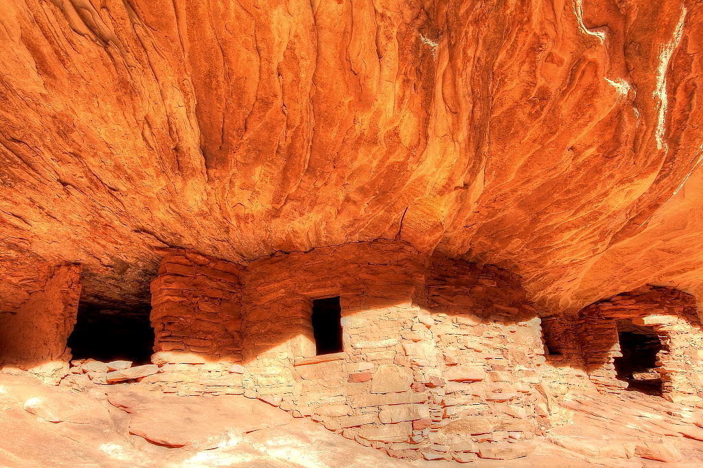
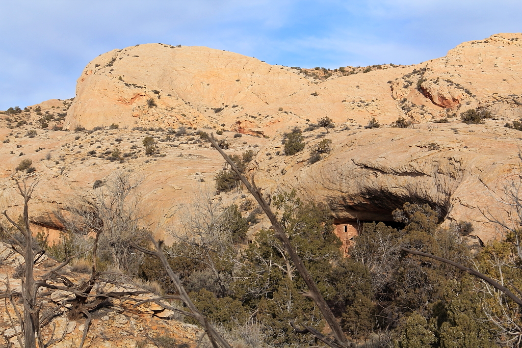
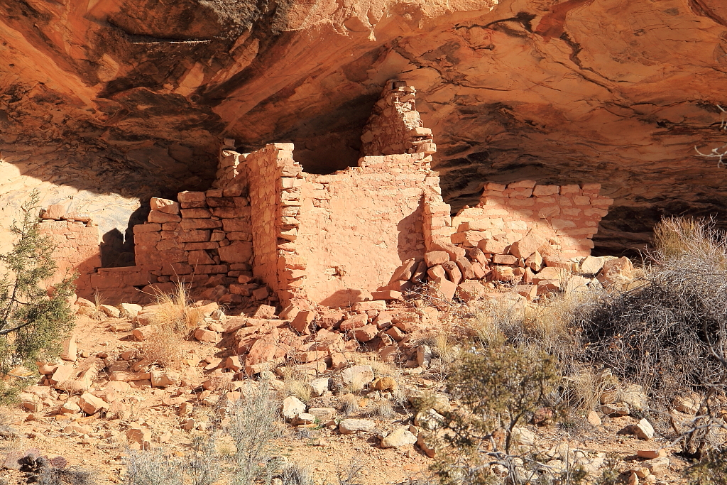
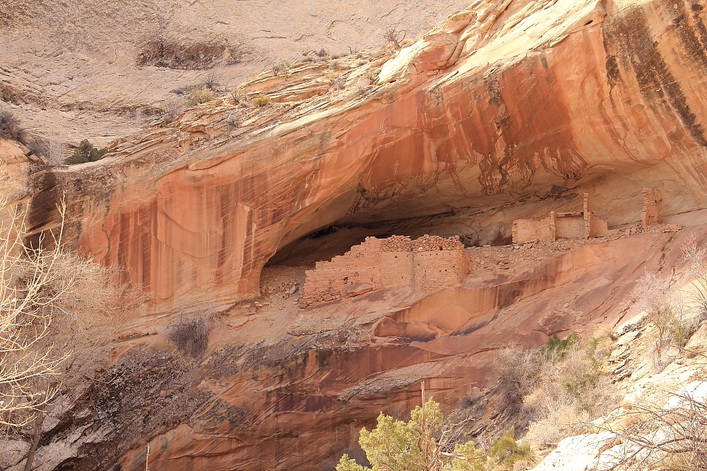
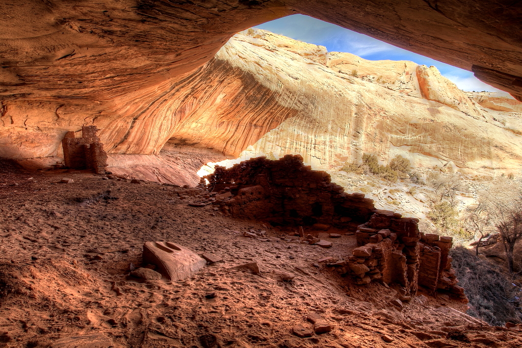
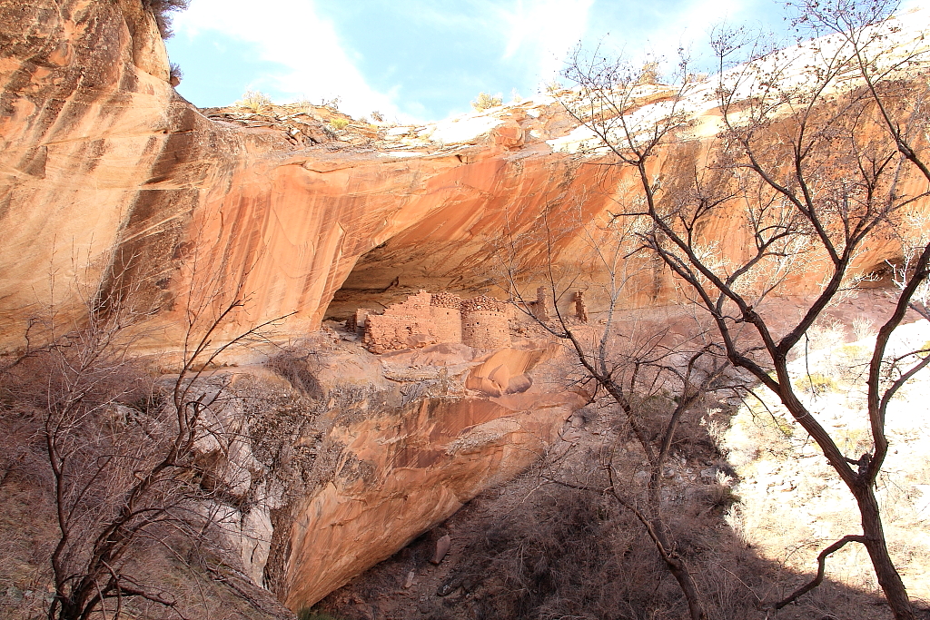
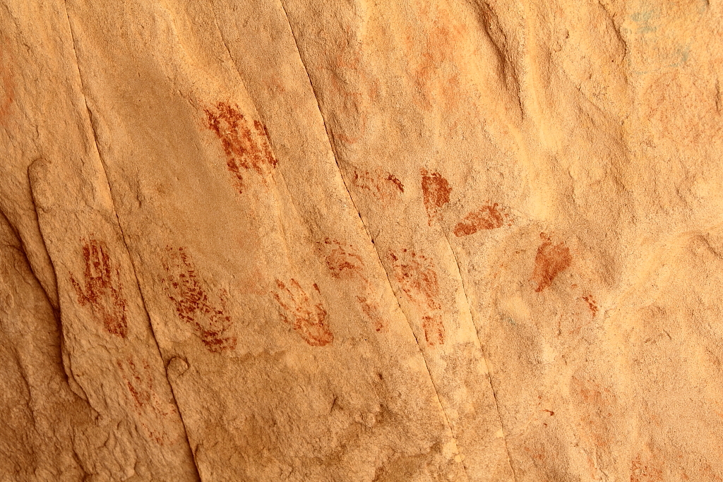
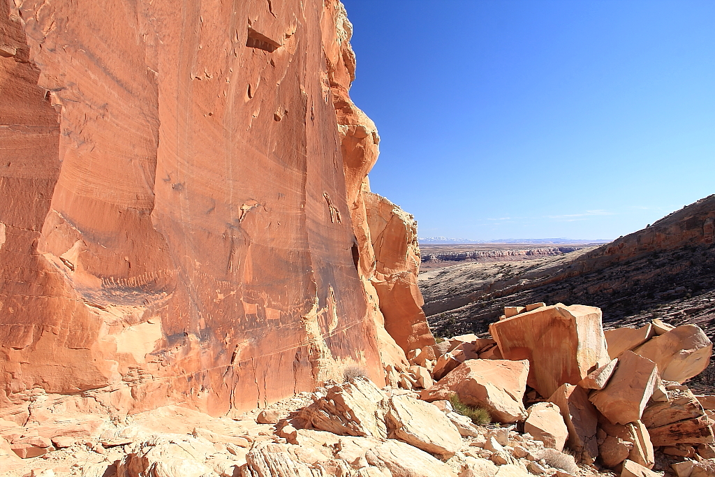
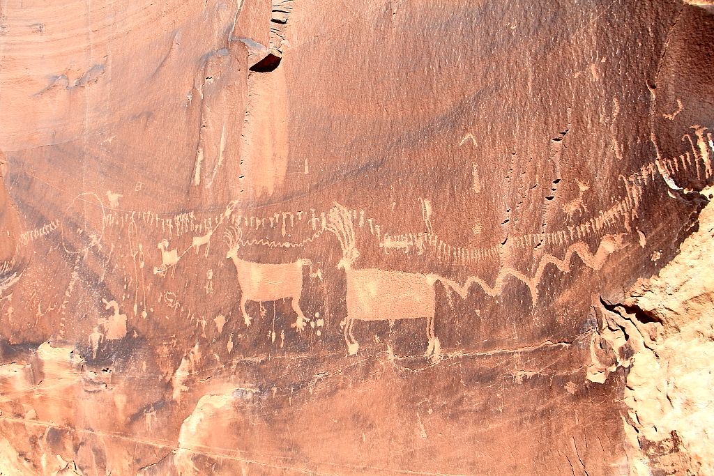
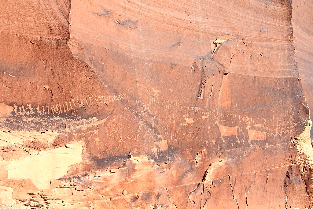
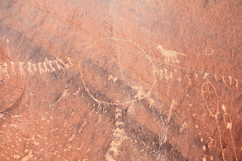
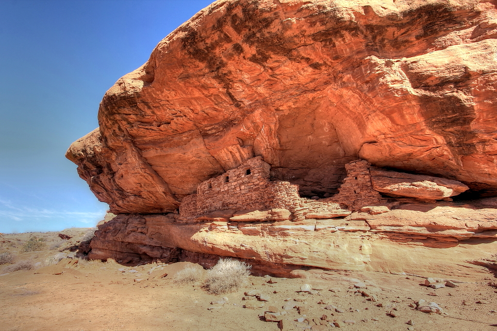
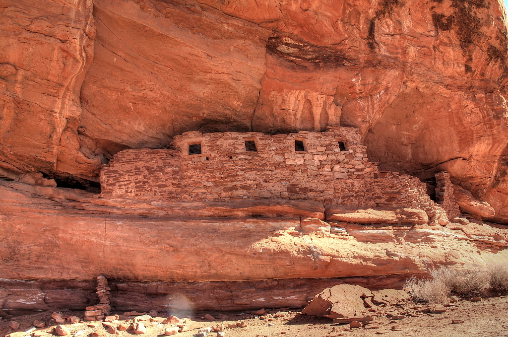
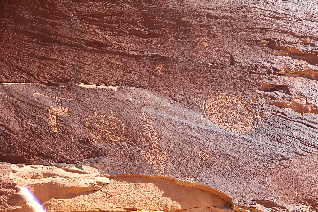
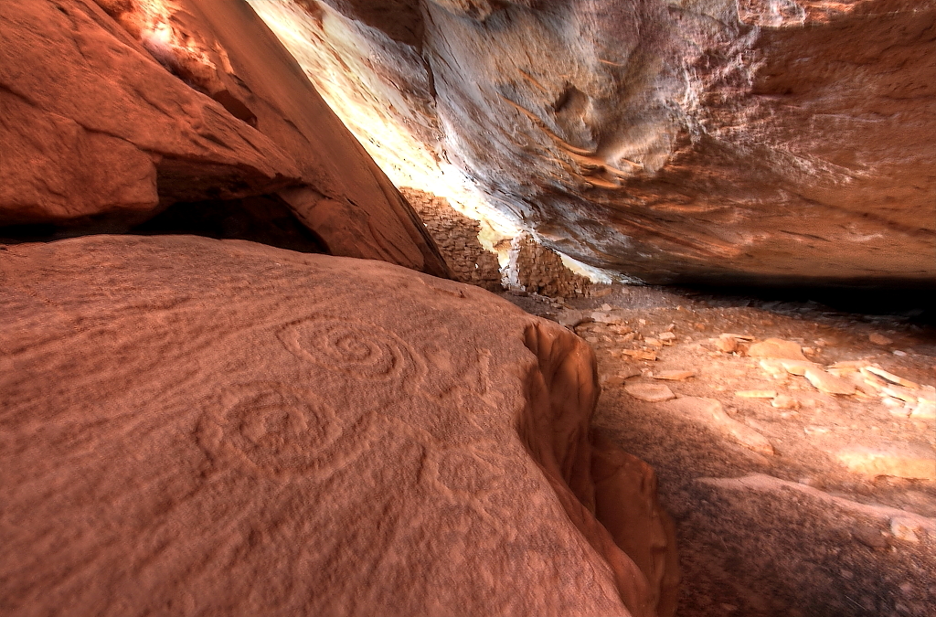
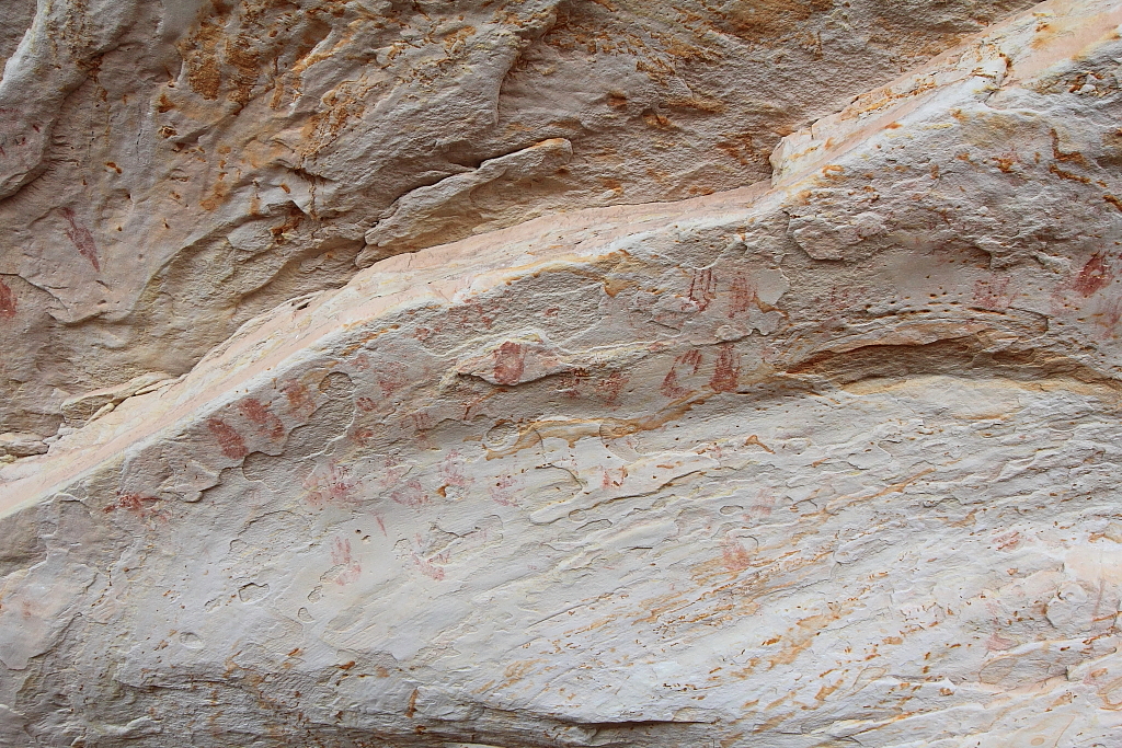
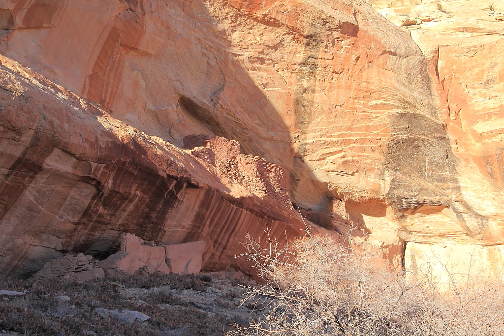
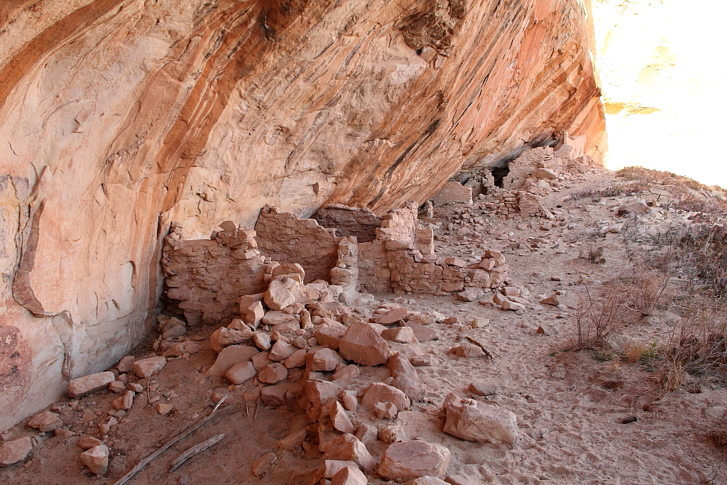
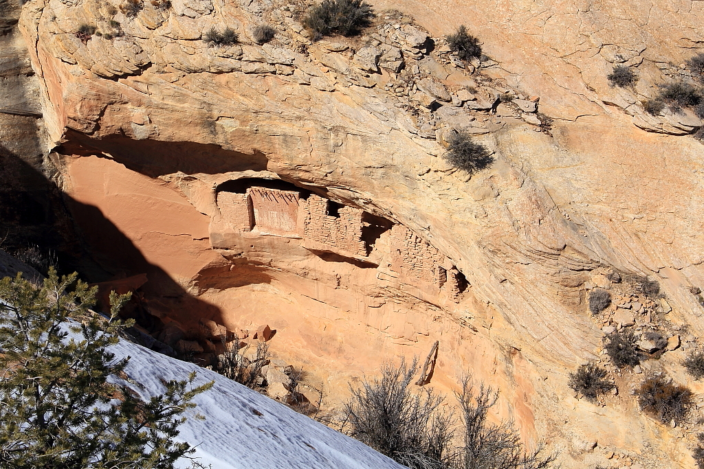
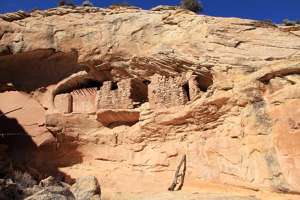
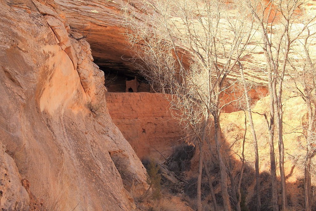
From Tower House, it was back to 95 and a short distance west before pulling over and hiking up Butler Wash again. This time to visit the Target and Ballroom Cave ruins.
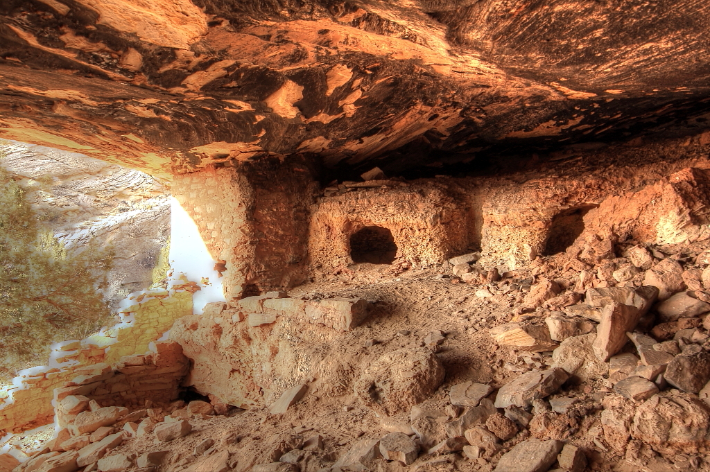
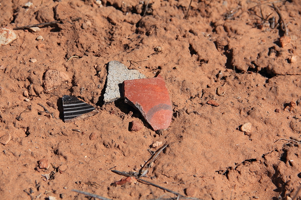
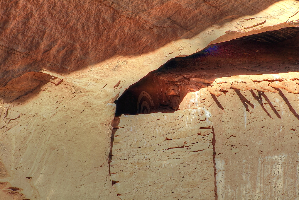
Target ruin

IMG_8798W.JPG


IMG_8818W.JPG


IMG_8835_W.JPG


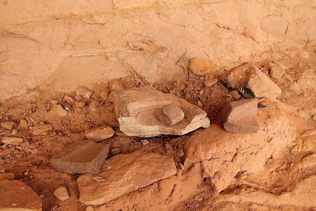
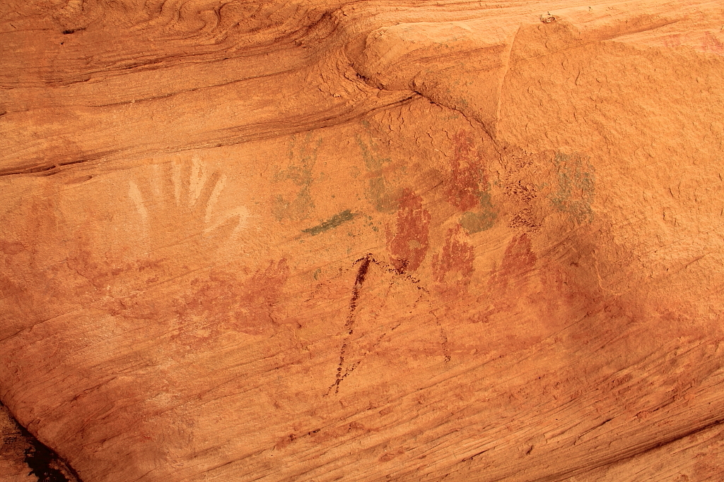
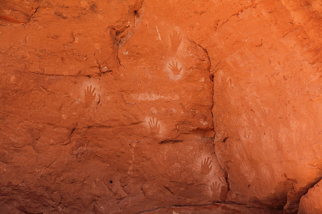
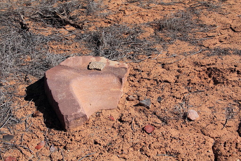
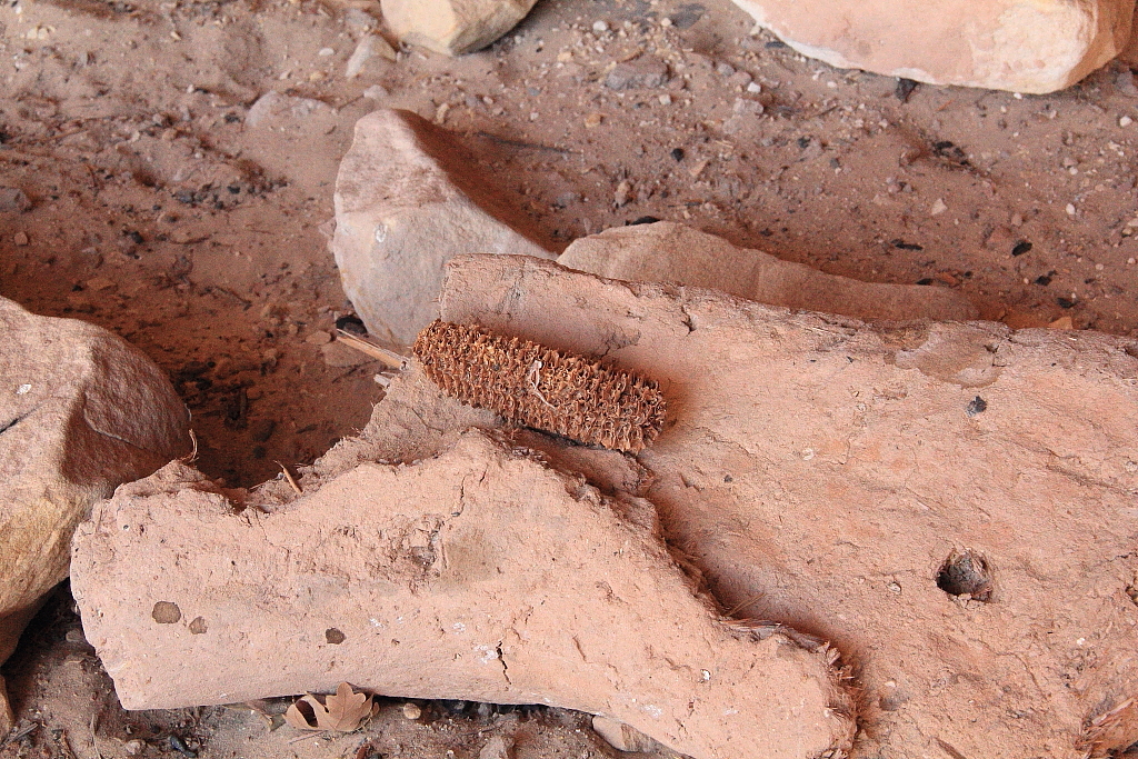
A 700 year old corn cob in a nearby alcove
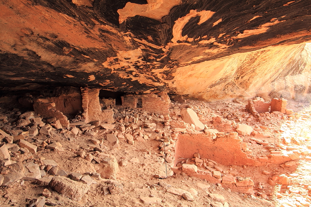
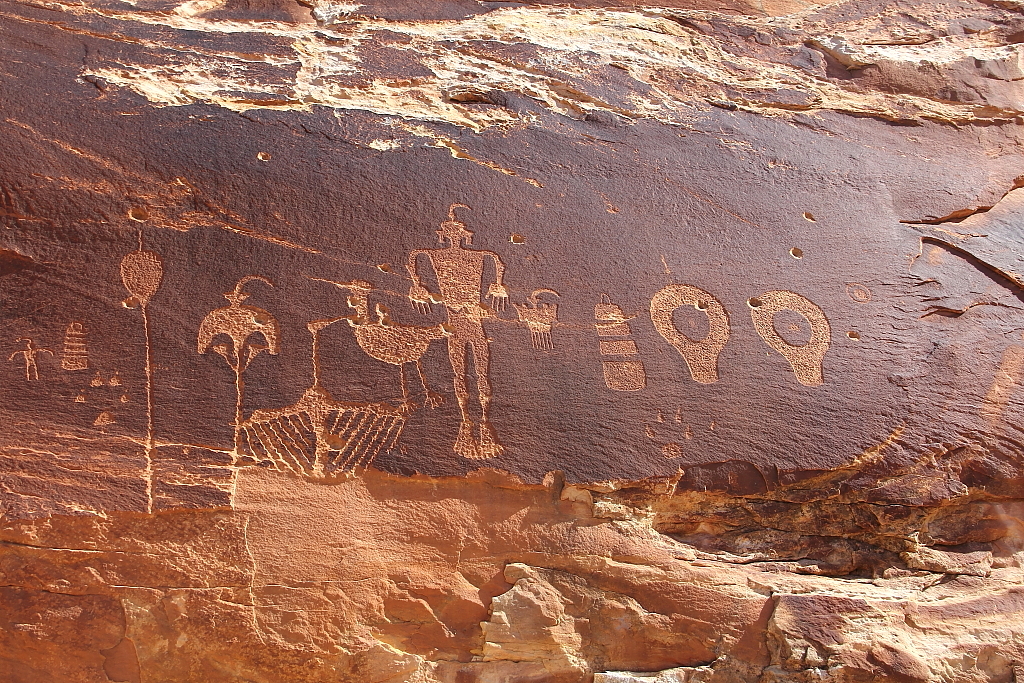
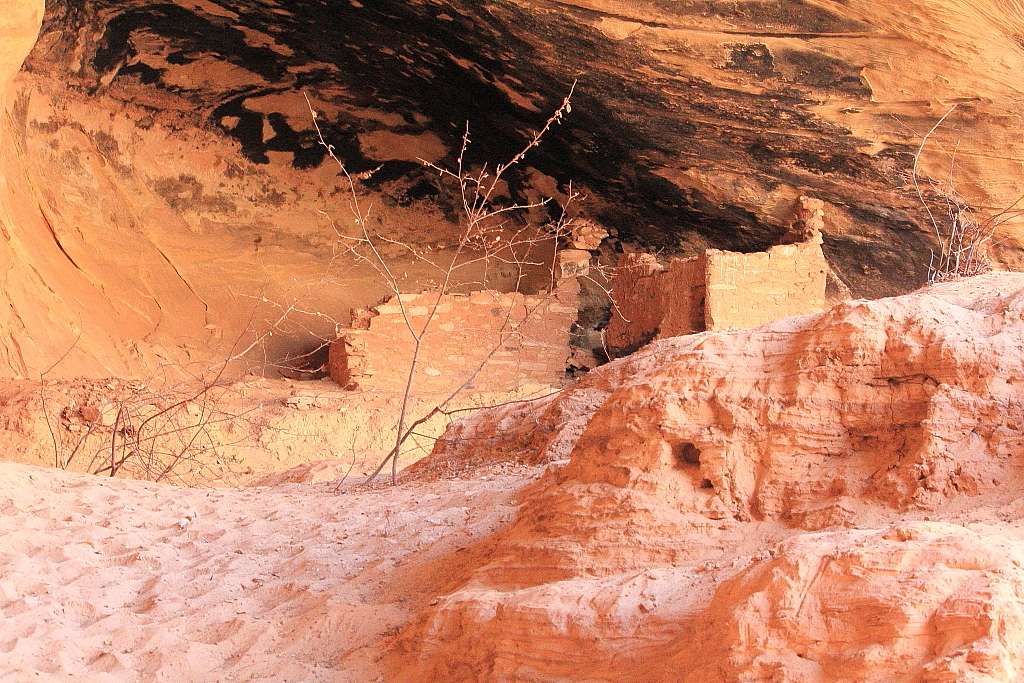
IMG_8826W.JPG


Ballroom Cave

IMG_8841W.JPG


IMG_8853W.JPG


More...

Featured image for home page:
slide.jpg
 
I had a small accident with my camera at Ballroom Cave. I had climbed up on the bench across from the cave to try and get a good picture (failed…). Standing at the top of a tall steep embankment that led down to the partially frozen creek below, I turned to start down and I’ll be go-to-hell if the lens didn’t just fall right off my camera! No idea how or why it had come loose, but it came free and tumbled all the way down 25 feet of the steep embankment and landed in a wet mud puddle far below.

I did the best I could to clean it up once I got back to the Jeep and it worked “okay” for the rest of the trip. But there is a small chip in the front lens, it made dirt grinding noises while focusing and seemed to have trouble getting a focus lock for the rest of the trip. It’s the 18-135 “kit” lens that came with the camera, so I guess it isn’t the end of the world, but it isn’t exactly a thrill either… (note, I’ve never replaced it, still using it 6 months later).

Anyway… Following the Target and Ballroom hike, I headed west on 95 again and pulled off at Mule canyon to make the short hike up to Flaming Roof ruin.

IMG_8872_W.JPG


IMG_8911_W.JPG


From Flaming Roof, with little daylight remaining, I turned back east on 95 and then south down Butler Wash and found a camp spot that was tucked back in and fairly well protected from the still howling wind. It was full dark and dang cold by the time I got camp setup so I started a fire before cooking my dinner of cod fillet and squash with onions.

IMG_8939W.JPG


More…
 
Day 2, Fri. 2/24

Friday dawned clear. And cold! Thermometer in the Jeep said 9 degrees.

IMG_8941W.JPG


After a quick breakfast I packed up camp and started heading south in Butler Wash with no solid destination planned. The first thing to catch my eye though was Fish Mouth cave.

IMG_8946W.JPG


So I pulled over and started hiking. It didn’t take long to spot some ruins in an alcove near the cave.

IMG_8950W.JPG


IMG_8981_W.JPG


IMG_8990W.JPG


IMG_8999W.JPG


I spent some time exploring and found a couple other smaller ruins in the canyon.

IMG_9008W.JPG


After exploring the Fish Mouth area for a couple of hours, it was back to the Jeep and down the wash again. But I didn’t go too far before noting the trail head to Monarch cave and deciding to make that my second hike of the morning.

IMG_9022W.JPG


IMG_9039W.JPG


IMG_9053W.JPG


IMG_9082W.JPG


IMG_9100W.JPG


Handprints were the dominant form of rock art encountered throughout this trip. I found them around every ruin complex I visited. All types of handprints, mostly pictographs but even some petroglyph hand prints. Positives, negatives, red ones, white ones, green ones, solid ones, swirled ones. You name it, I think I saw it, as far as handprint rock art is concerned. These are from the Monarch cave site:

IMG_9038W.JPG


Next, I decided to simply head off cross country towards the complete unknown and see what I could see. I know the locations of many well known ruin sites in the area, but also know that the un-named and less known canyons of the Comb all hold something worth seeing. And I’ve always found a lot of the most memorable experiences come by just striking off cold without knowing what I’ll find.

So, up an unknown canyon I went. But soon found an impassable dry fall blocking my path. So, I backtracked until the sides allowed me to gain the canyon rim, then headed cross country to the next canyon and dropped down into it. On my way down into this canyon I spooked a red fox. He was some distance off by the time I got my camera unlimbered, but responded to my lip squeaks and moans by stopping and coming back a short distance towards me. Still couldn’t get a very good picture, but here ‘tis.

IMG_9101CW.JPG


At the head of this canyon I found a large alcove with ruins, but the ruins were REALLY ruined! Just piles of rubble on the floor, not even a piece of a wall left standing. But, of course, there were the ubiquitous handprints. And this time, even some footprints to go with them!

IMG_9112W.JPG


Interestingly, this loose rock on the floor had handprints too. Not sure, but would guess this is roof fall?

IMG_9108W.JPG


Next up, the Procession Panel! One of the better petroglyph panels in the area. It is named for the line of 179 small marching figures .

IMG_9128W.JPG


IMG_9143W.JPG


IMG_9153W.JPG


The lines of figures all converge on (or emanate from) a circle.

IMG_9144W.JPG


Within the circle are these two small figures known as “lobed circles”.

IMG_9146W.JPG


The lobed circle appears frequently in rock art throughout the area. Usually in pairs. It’s meaning can only be speculated on, but many believe it is a fertility symbol, representing the uterus. Nobody really knows though.

By the time I got back to the Jeep, it had already been a full day. I had no real plans for the rest of the day and decided just to take it easy. But, my plans for the next day, all centered around hiking in Lime and Road canyons from up on the top of Cedar Mesa. So, I decided to make my way up to the head of Lime canyon and make camp.

Of course, I took the scenic route through Valley of The Gods getting to the base of the Moqui dugway.

IMG_9172W.JPG


But things weren’t looking quite so peachy up on Cedar mesa. The road to the head of Lime canyon was a mixture of snow drifts and mud. I stopped about halfway in to take this pic.

IMG_9181W.JPG


Things got worse pretty quickly from there… I hit a spot where a drift at the top of a hill stopped me and I had to hit it three times to break through and continue. Then, I hit another drift at the top of the next hill and tried using speed and momentum to break through in one try. No dice… Forward progress halted. Worse, I couldn’t back up. Stuck. Damninet! Oh well, plenty of trees around and it took only a few minutes to winch myself out. By now it was almost dark and getting pretty cold and I just wanted to get camp setup. But… Every flat spot I could find, was a muddy mucky sloppy yicky mess.

I don’t mind camping in snow. But I HATE putting up camp in a sloppy muddy mess. So, decision time… It was just about full dark already, so I knew I’d be setting up in the dark no matter what. Decided I would MUCH rather do that where there wasn’t ANY mud. So, I drove all the way down off the mesa and pitched camp in some cottonwoods in Comb Wash. And decided I’d just find something around there to do in the morning, rather than hike Lime and Road canyons as previously planned.

Camp Friday night in Comb Wash

IMG_9198W.JPG


IMG_9217W.JPG


Dinner this night was brats roasted over the coals. Delicious!

More…
 
Day 3, Sat. 2/25

Saturday morning I got up to find camp frozen solid. Thermometer in the Jeep read 7 degrees. Brrrrr!

IMG_9219_W.JPG


I wasted no time packing up camp and getting a thermos full of hot coffee prepared. Then I spent the early part of the morning just very slowly putting down Comb Wash, sipping my coffee and Bailieys, smoking a nice Padron ‘64 and just generally loving life!

By the time I got down to the Fish Creek trail head area, I was ready to do some walking. So I did! Headed up lower Fish Creek, nice and slow, taking my time to nose around up each side drainage, passing some small granaries along the way, until I reached some nice ruins.

IMG_9249_W.JPG


IMG_9238_W.JPG


IMG_9244W.JPG


From there I only went a little way further up the canyon before turning around and starting back for the Jeep. Along the way I stumbled across this open mesa top site. Not much left to see of the structure.

IMG_9272W.JPG


But poking around, I noticed some unnatural looking mounds about a hundred yards away. Thinking it might be the midden area I walked over to look. And, sure enough, in the area around a few small mounds I found the ground just basically covered with archaeology. Potsherds and broken metates and flint chips everywhere.

IMG_9277W.JPG


IMG_9276W.JPG


Cool stuff!

Then it was back to the Jeep again and I just spent a few hours put-putting around on the dirt roads, smoking my cigar and just generally taking it easy and loving every second of it. Eventually, I found myself at the hiway near the southern end of Comb Ridge. No plans, so decided to head back over to Butler wash and see what I could see.

First stop in Butler was the Wolfman petroglyph panel. Note the large, extremely well executed lobed circles.

IMG_9292W.JPG


IMG_9288W.JPG


While in the area, I took the time to walk around and view several of the small ruins nearby from across the wash, but didn’t bother trying to access any of them.
Then it was back in the Jeep, slowly moving north again. It was such a beautiful day, I decided that just sitting in the sunshine reading a book sounded nice. So I went looking for a nice place to setup camp early. I explored five or six dead end side roads on the east side of the wash before picking one that looked like the best camp spot.

Put up camp and just sat and read a book for awhile. But, nice as it was, I found myself restless and wanting to get in a short hike before dark. The nearest “named” ruins I knew of were the Split Level ruins, so that is where I headed.

With only about 90 minutes of daylight left as I started up the canyon, I had to hustle. I really wish I would have had more time to spend here though! Beautiful canyon hike, neat looking ruin complex, I’ll definitely be back sometime.

IMG_9328W.JPG


IMG_9335W.JPG


IMG_9314W.JPG


IMG_9313W.JPG


Long shadows heading back to the Jeep.

IMG_9340W.JPG


Back at camp, I got a fire going and then cooked up a huge rib eye steak with fried cabbage for dinner. This last night was much warmer than the previous two had been. So, I lingered late around my small fire, sipping Irish, smoking a cigar, just enjoying the night.

Camp Sat. night

IMG_9351W.JPG


More…
 
Fourth and final day, Sun. 2/26

I slept in late Sunday morning and took my time with breakfast and coffee. It was 8am before I had camp packed up and ready to roll.

IMG_9354W.JPG


Basically, I was just heading home from here. But, I decided to see how far I could get up Maverick Point in the snow, just for grins. I didn’t make it very far, before deciding it wouldn’t be very smart to keep going by myself.

IMG_9359W.JPG


So, I headed down and did the Natural Bridges loop. I was actually thinking I’d hike down to all three bridges and get some good pictures. But, the light was terrible and I knew the pictures would suck so the only one I walked down to was Owachomo. Here are some of the (sucky) pictures.

Sipapu

IMG_9372W.JPG


Kachina

IMG_9386W.JPG


Owachomo

IMG_9434W.JPG


Then it was basically just a long drive home. With a couple brief stops…

Boulder with petroglyphs just off of 95

IMG_9440W.JPG


Grave marker and associated historical marker just off of 95

IMG_9445W.JPG


IMG_9444W.JPG


The sign reads: “Battle of Paiute Pass. On July 15, 1884 a U.S. Calvary Scout Named Joseph S. Wormington and a cowboy named James “Rowdy” Higgins were killed in a battle with Indians at nearby Paiute Pass. These men were part of a posse of cattlemen and sixth cavalry F Troop soldiers from Ft. Lewis CO who were chasing a band of renegade Ute and Paiute Indians led by Mancos Jim. The Indians had stolen 150 head of horses from the round-up grounds in Verdure, Utah. After a 75 mile chase the Utes and Paiutes led the posse and soldiers into an ambush. Two months after the battle, prospectors Cass Hite and Joe Duckett found and buried the remains. The Utes and Paiutes were watching the U.S. government absorb their homelands. They fought back in the only way they knew how. The soldier gave his life in the service of his country. The cowboy did the rough job he was paid to do and a little more. All of them played out their heroic roles in this epoch struggle to settle the Old West.”

The End

IMG_9452_W.JPG


- DAA
 
Awesome. I've been down in that area around the same time of year and it is really nice weather to hike in during the day but bitter cold at night. I guess you can't have everything right...
 
Then I spent the early part of the morning just very slowly putting down Comb Wash, sipping my coffee and Bailieys, smoking a nice Padron ‘64 and just generally loving life!

*sigh* I'm ready for another lazy winter in the desert now. That sounds way NICE. Thanks so much for the awesome report and reminding me of how it feels to just kick back, car camp and explore when everyone else is huddled inside.
 
Similar threads
Thread starter Title Forum Replies Date
balzaccom Comb Ridge and Wash Trip Planning 8
piper01 Wolfman Panel, Comb Ridge/Valley of the Gods Hiking & Camping 3
WasatchWill A Recon Trip Around Comb Ridge Hiking & Camping 6
kansas ruins at Comb Ridge Trip Planning 3
kansas roads along Comb Ridge Trip Planning 6
TheDunedain Comb Ridge March 25-27 2012 Hiking & Camping 5
Seldom Seen Anderson Cedar Mesa and Comb Ridge Hiking & Camping 11
IntrepidXJ Big Man Panel & Lower Comb Wash Hiking & Camping 1
FourisTheNewOne Comb Ridge/Cedar Mesa - May 2008 Hiking & Camping 11
Stephanie B Sixteen Room Ruin and Lower Butler Wash Hiking & Camping 15
kansas Butler Wash Road Trip Planning 0
Tye Dye Twins Backcountry Skiing Butler Fork to Millcreek 12-28 Winter Sports 8
Udink Courthouse and the Butler Hiking & Camping 8
fossana Steve Allen presentation in Durango Feb 22 2024 General Discussion 27
Janice Yellowstone Yurt Camp - Feb. 19-23, 2023 Trip Reports 15
Mikjik86 Video Hiking/Camping San Rafael Swell/Goblin Valley/Horseshoe Canyon - Feb 2019 Hiking & Camping 2
Mikjik86 Good car camping? Stuff to do near Goblin Valley area Feb 24,25,26? Trip Planning 15
K Zion in Mid Feb Suggestions? Trip Planning 6
Dave Cedar Mesa, Feb. 20-22 2014 Hiking & Camping 13
Tyler Yankee Doodle - Feb. 2013 Canyoneering 2
Tyler Boltergeist Canyon Feb. 2013 Canyoneering 2
Tyler Canyonlands NP Horseshoe Canyon Feb. 2008 Hiking & Camping 3
Tyler Red Cliffs National Recreation area Feb. 2010 Hiking & Camping 14
Tyler Coyote Buttes North, Paige, & Bryce Canyon Feb. 2011 Hiking & Camping 12
mattvogt7 Aravaipa Canyon Feb 2012 Backpacking 6

Similar threads

Back
Top