The Amazing Maze, Sept. 2011

xjblue

Member
Joined
Sep 6, 2012
Messages
370
The Best Way

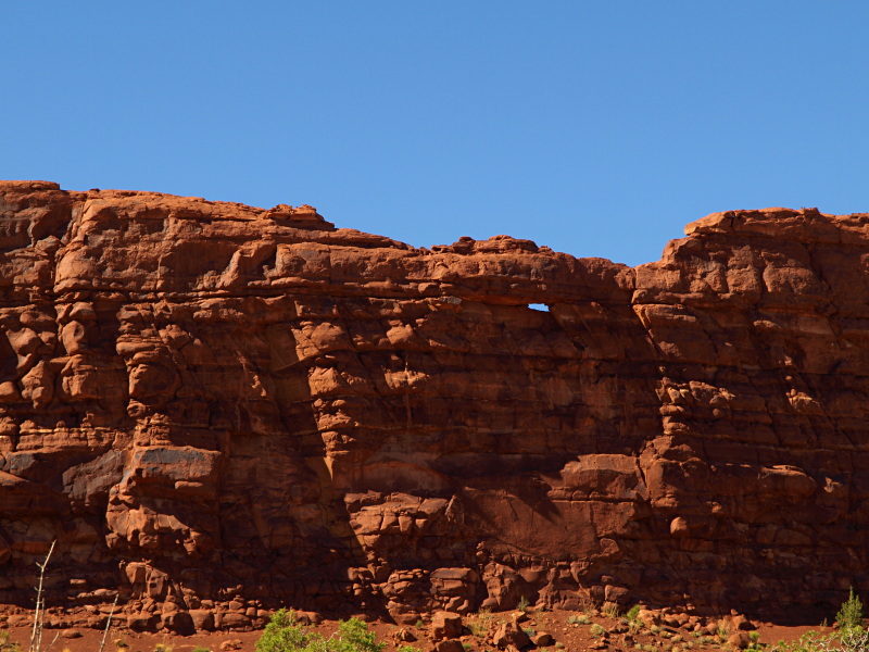
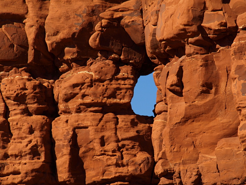
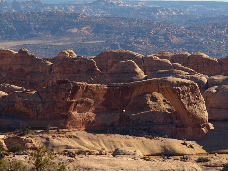
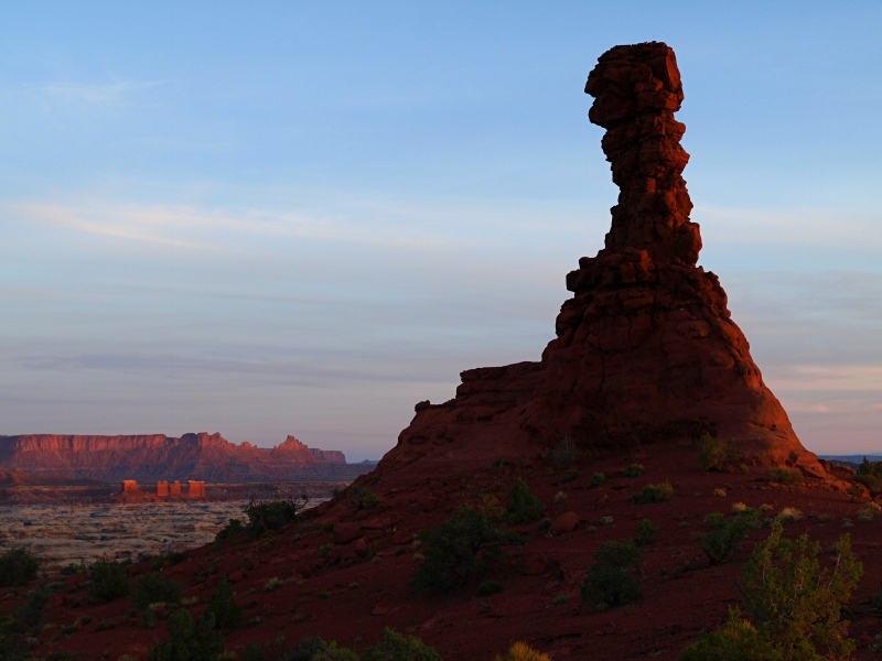
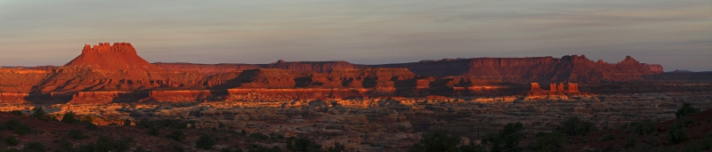
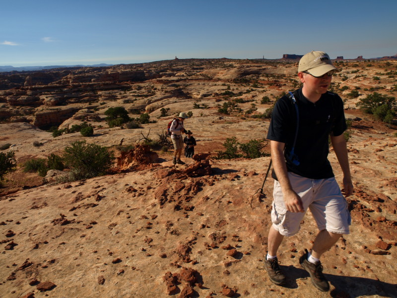
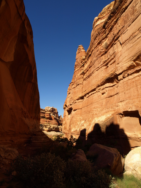
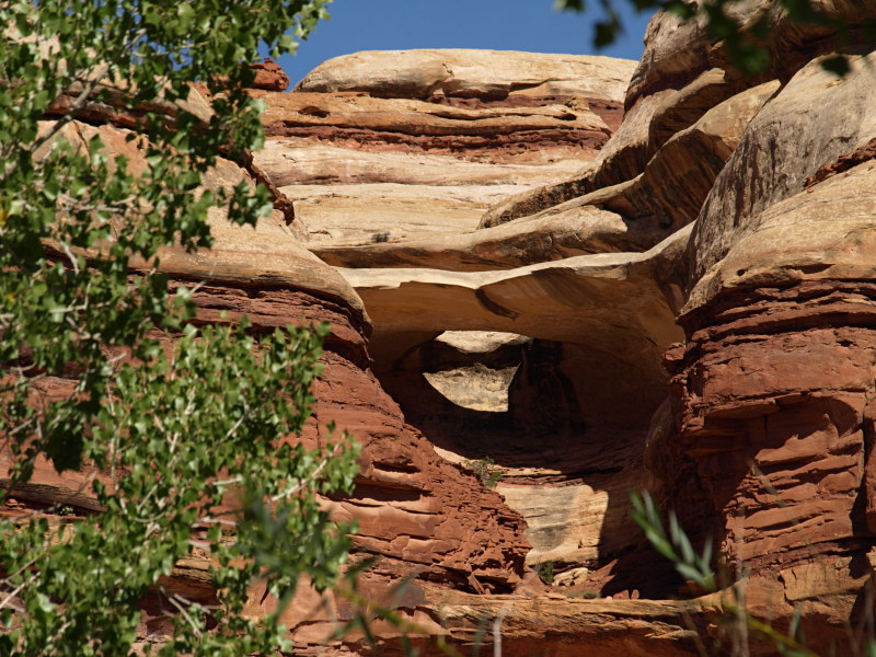
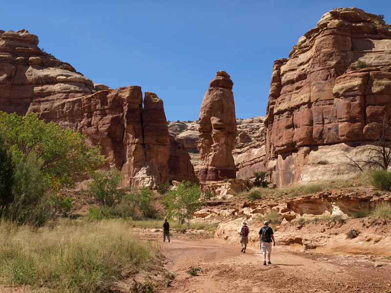
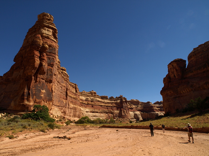
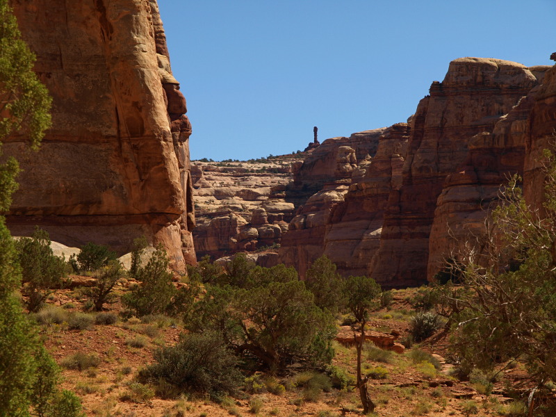
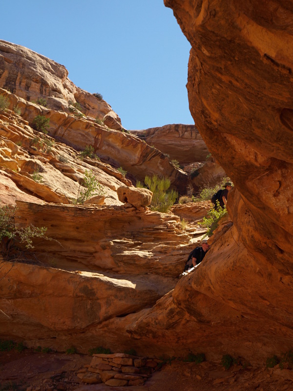
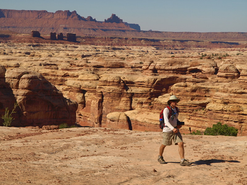
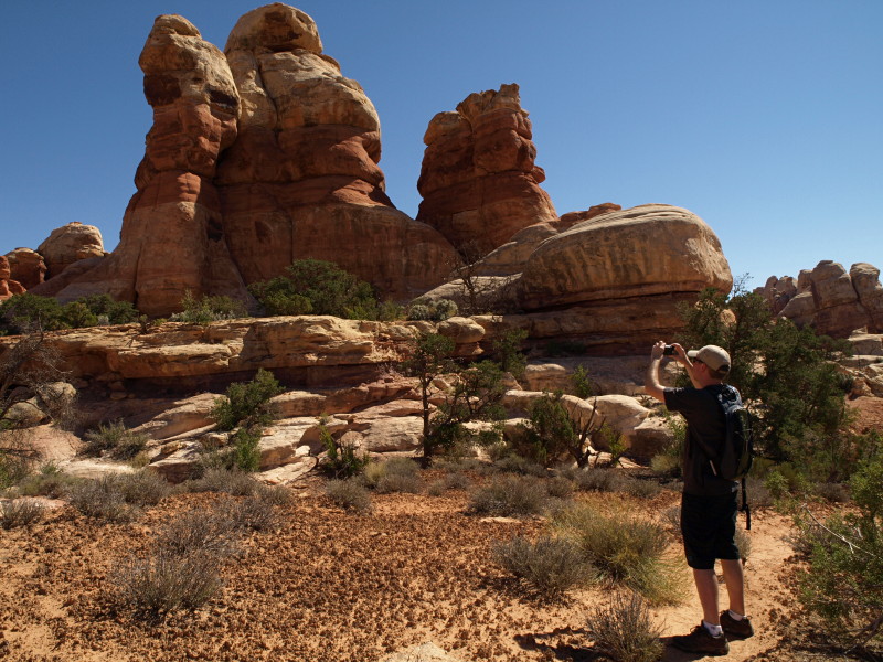
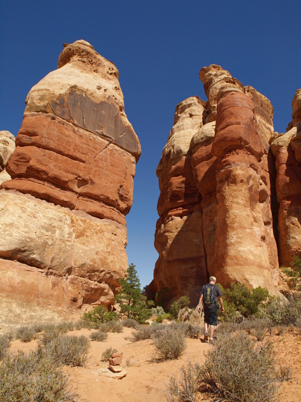
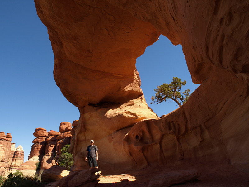
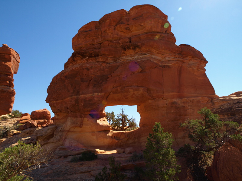
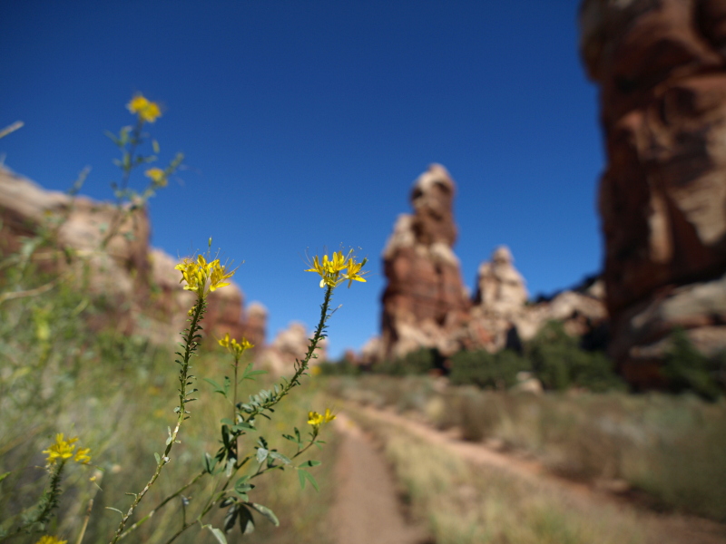
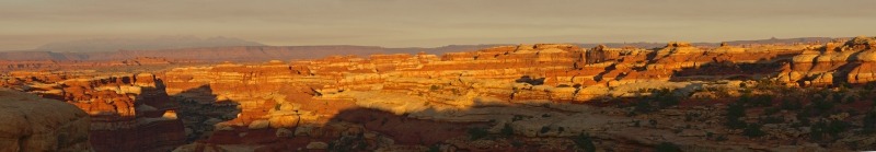
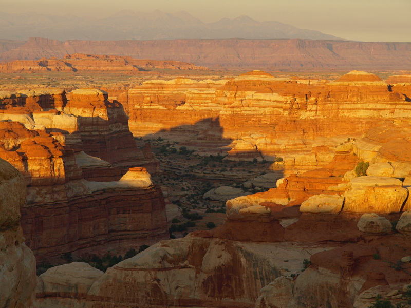
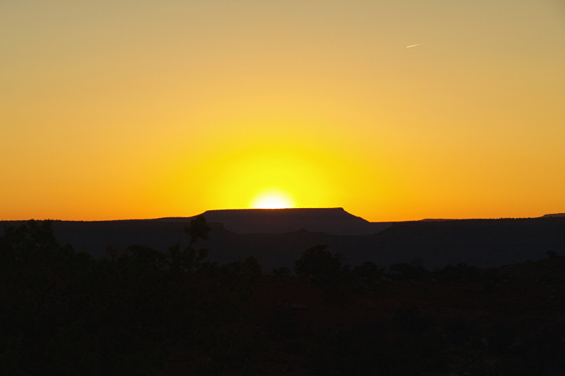
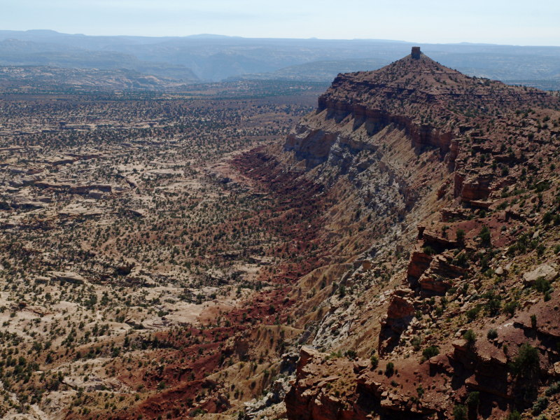
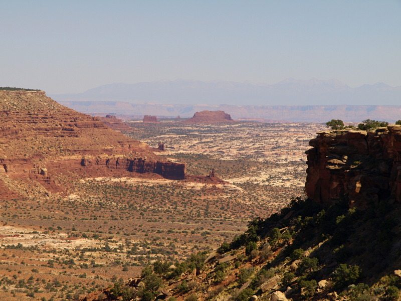
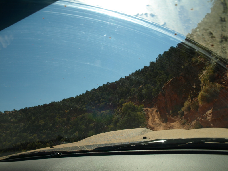
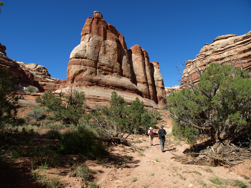
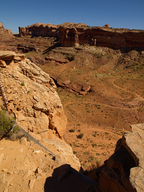
The sun, white hot, rising steadily, arcing toward it's mid day zenith, beating down on four tiny travelers alone in a vast rugged wilderness with a pressing yet so far tolerable heat, sqeazing sweat from their brow's as they plod along through soft sand angling strategically from one diminishing shadow to the next. This sandy floor upon which they traversed lay deep within a pale reddish beige layered labyrinth of stone. Dark shapes fluttered and swooped effortlessly above them, calling in echos to each other before disappearing beyond the stone walls returning a desert silence to the four companions. Working their way in what they hoped was the downstream direction passing intersections to unknown corners deeper and further away after every other bend of their winding course, they trudged onward. The party wondered how many more turns to go and junctions would they pass before it was time to turn up another canyon and begin the long march to a distant camp now miles away and high on the rim above this broken land. One suddenly exclaims matter of factly to his fellows "It's like a maze down here!" eliciting knowing grins and chuckles, for this truly was the best way to experience the amazing Maze of Canyonlands National Park!

Maze0910_048.JPG


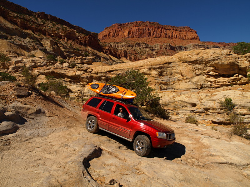
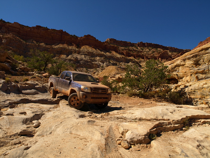
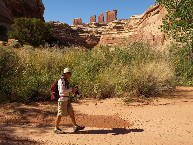
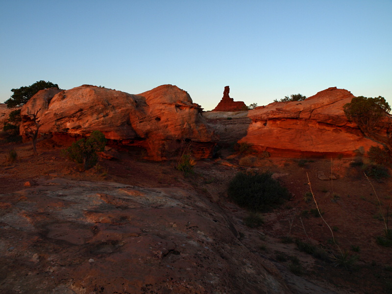
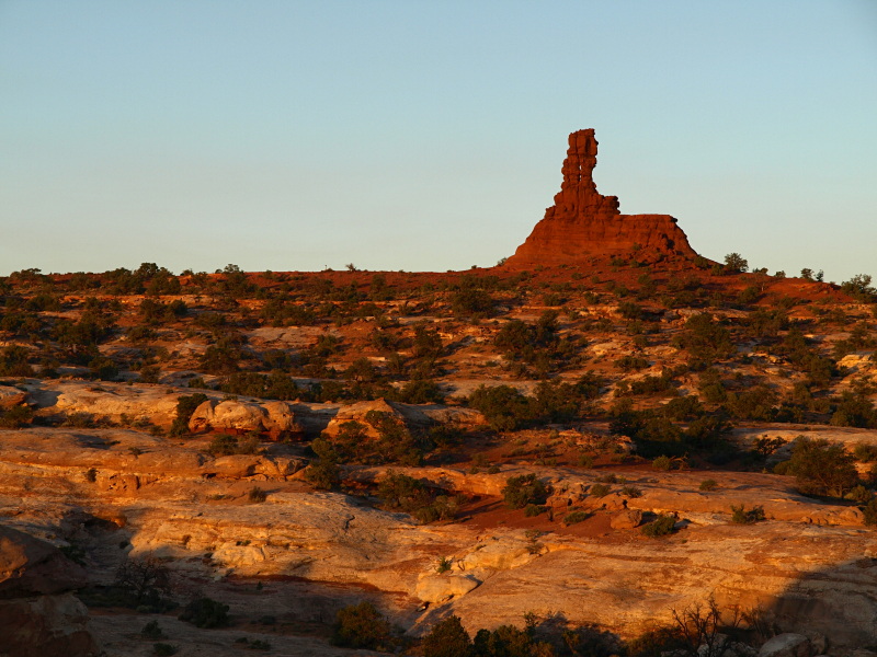
Like many a reported good trip to the Maze this one started for me by first visiting Horseshoe Canyon with my ride, which this time would be one of my two brothers and his 2009 Tacoma sporting a freshly installed Old Man Emu suspension. This was preceded of course by an invitation to Join good friends and fellow explorers Alex and Adam for a three night permitted foray in the Maze proper with the promise of exploring more on foot this time to see the sites seldom seen.

Horseshoe2010_00.JPG


We drove down late Friday night, got some rest "out under the stars", then planned to visit the Great Gallery in Horseshoe Canyon. After the hike we would head for Hans Flat and pick up the permits before meeting up with Alex and Adam for another night of camping prior to embarking for the Maze.

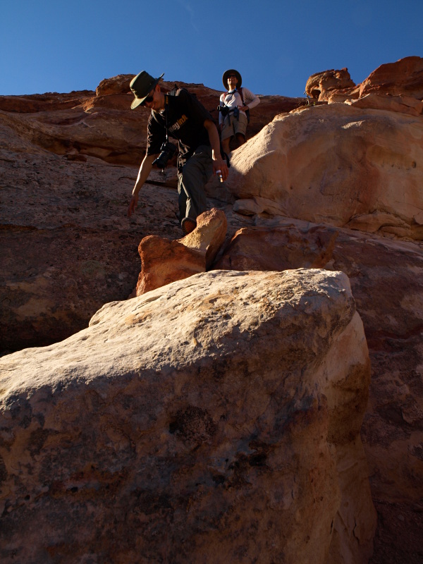
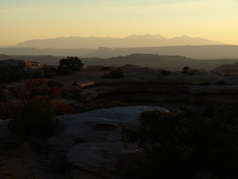
Evidence of the recent rains made for sometimes slippery but generally easier going than the historically soft deep sand of Horseshoe. The sky was somehow naturally polarized, a most brilliant blue above the canyon that morning.

Horseshoe2010_01.JPG


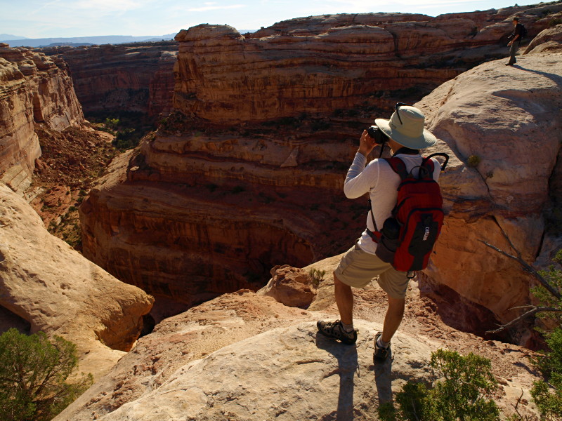
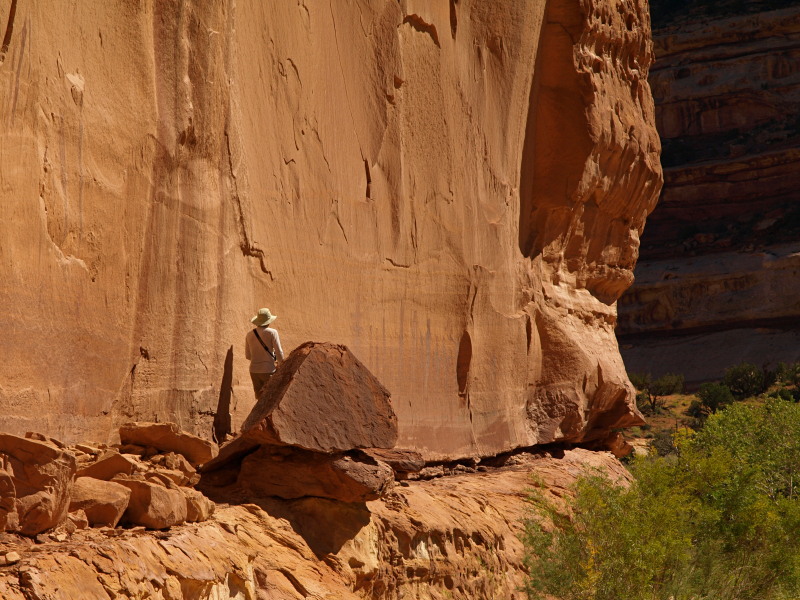
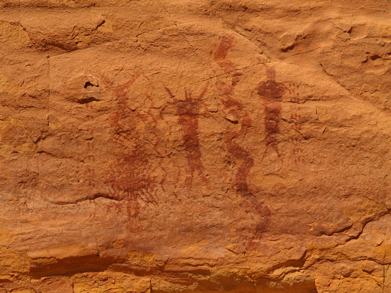
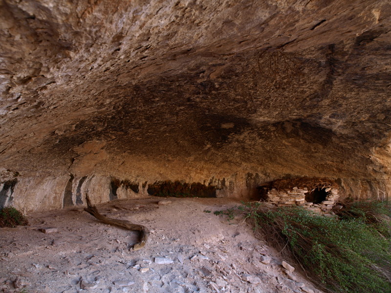
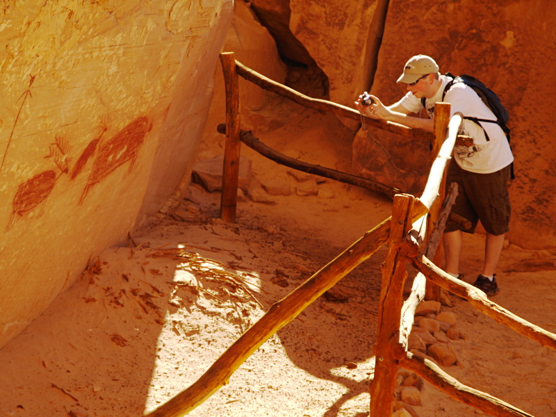
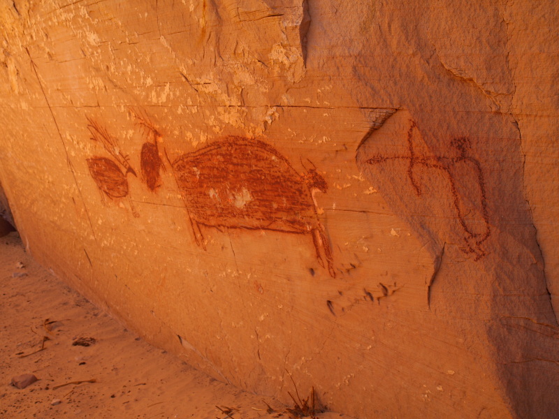
At the Horseshoe Shelter site (excavated), the second advertised panel in the canyon, you have to poke and climb around a little not to miss anything. The panel my brother Brian is photographing also contains hard to see petroglyphs below the pictographs. Lean over a railing and poke your head past a large boulder and discover rows of matate grooves in the stone below.

Horseshoe2010_02.JPG


Maze0910_RA10.JPG


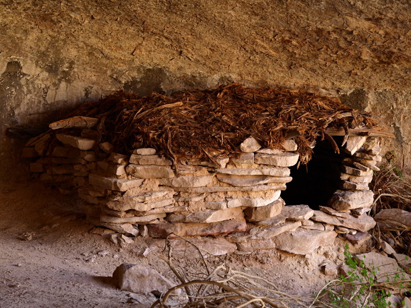
In the ten years since last visiting not only did the hike seem longer and more difficult, also there was extra credit stuff for me to discover.

Horseshoeplus_01.JPG

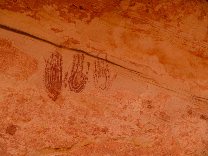
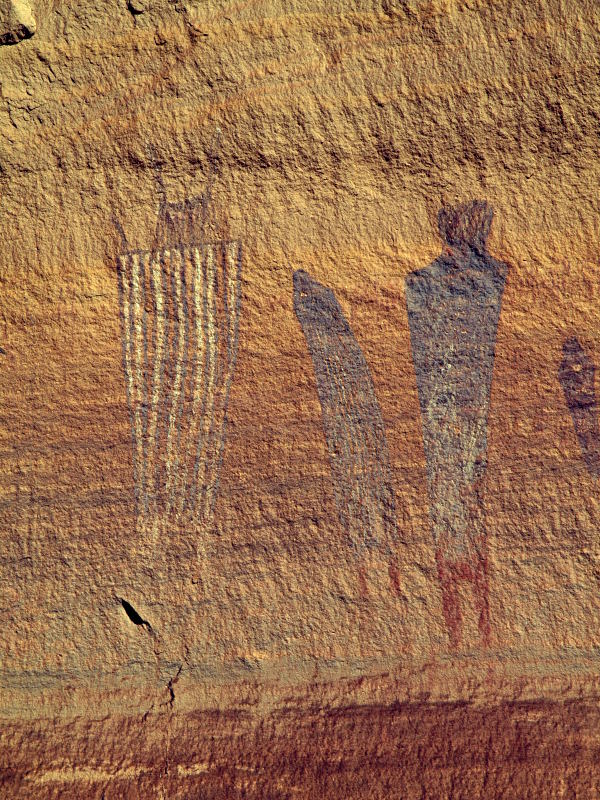
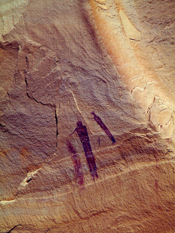
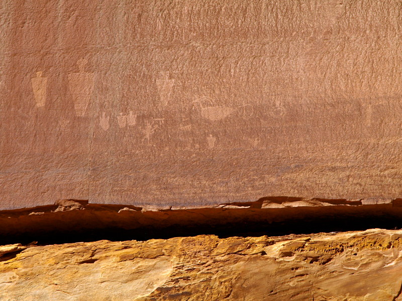
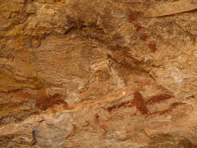
A sample from the "hand-print" panel.
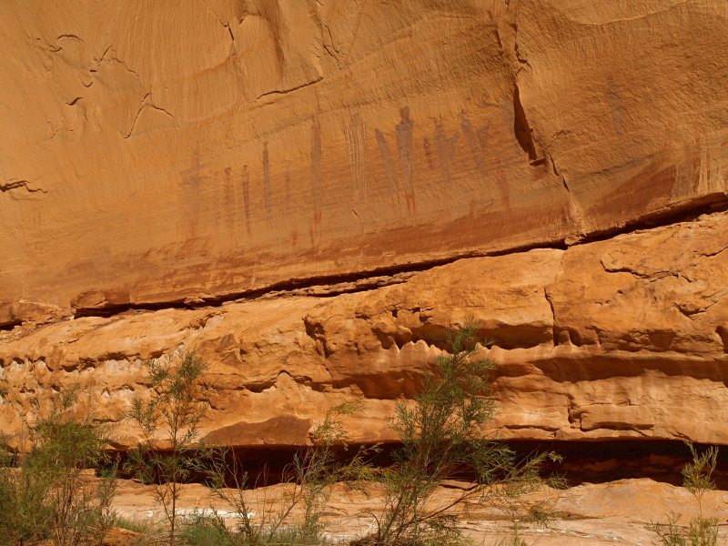
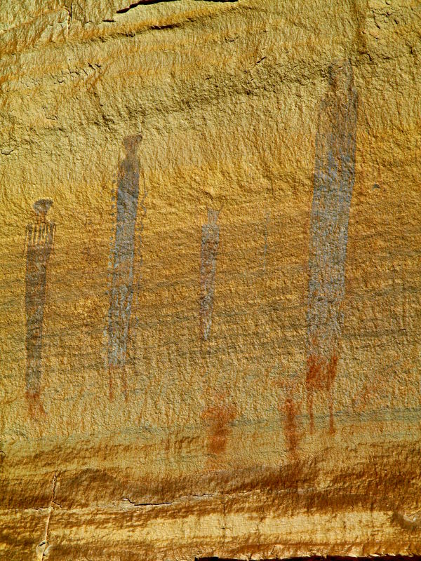
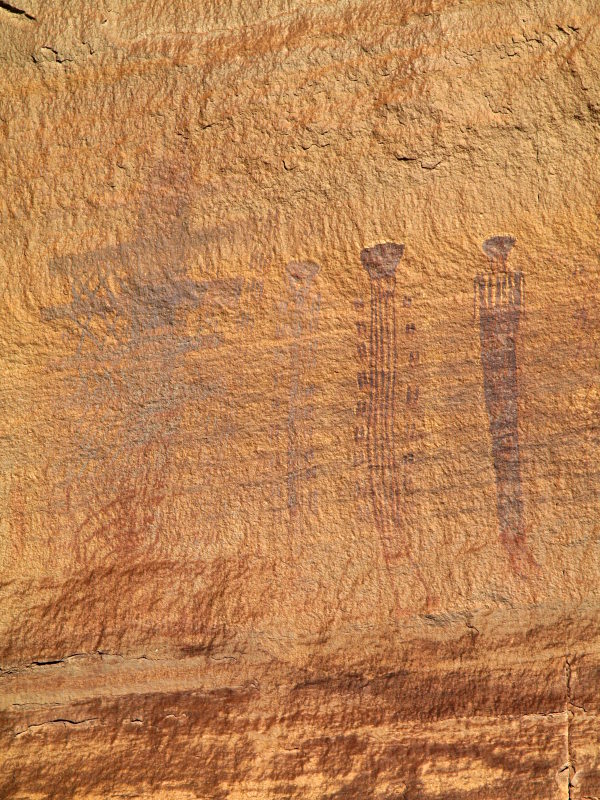
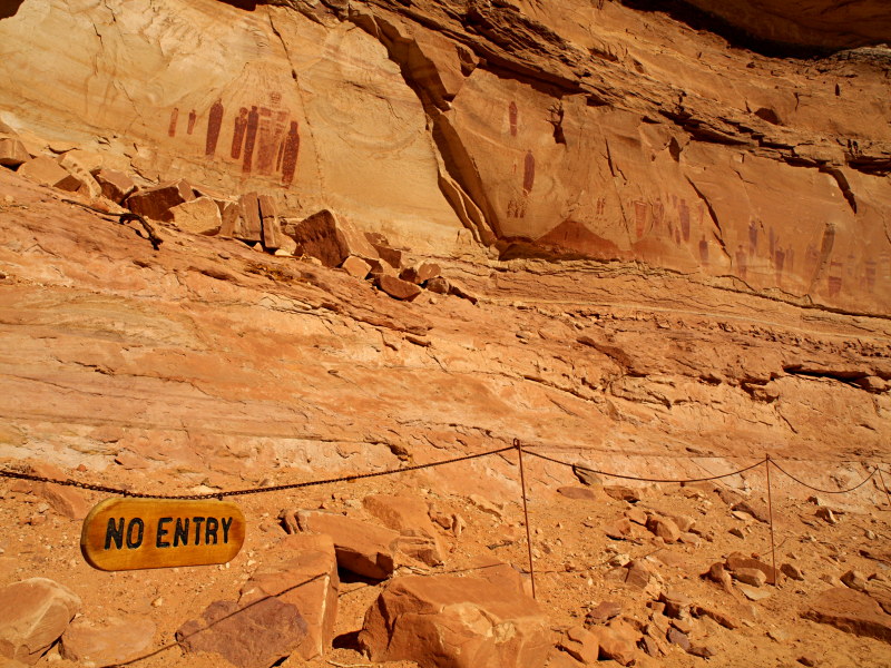
The Great Gallery

Ten years and my memory isn't that good but I had the impression that the fence wasn't there before, not as big and obnoxious as other sites fences, but it keeps you pretty far back, kind of a let down as there are also difficult to see petroglyhs in these panels and a pile of rubble inside the fence blocking view of some graphics to the left. Bring your long lens, and binoculars too if you don't want to mess with the giant binocs in an ammo can. (One can visit closer on the frequent Ranger lead hikes.)

Horseshoe2010_03.JPG


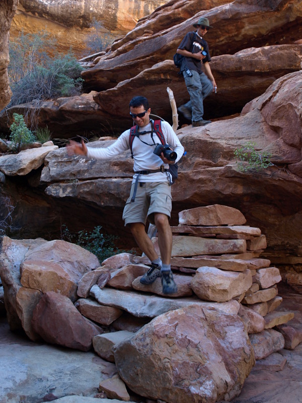
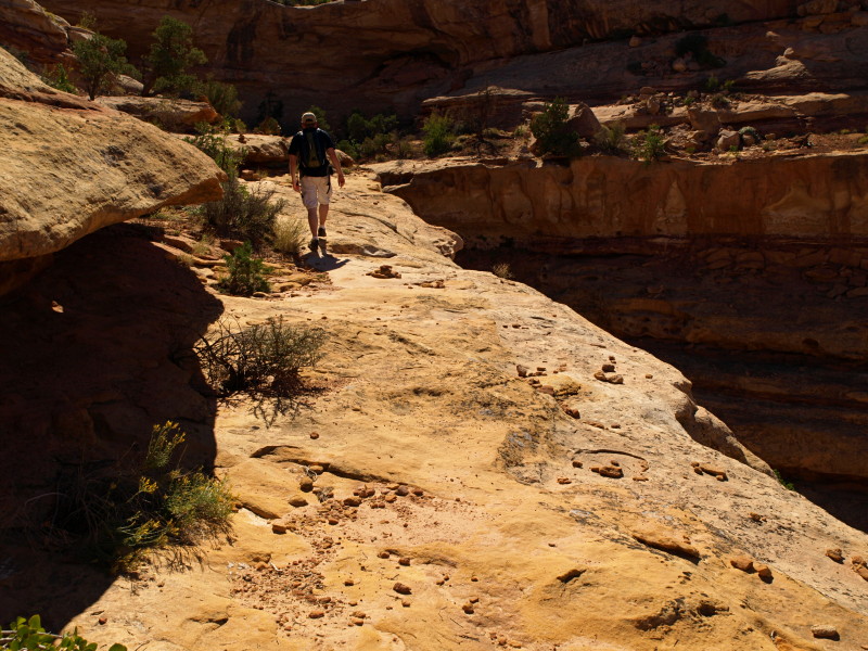
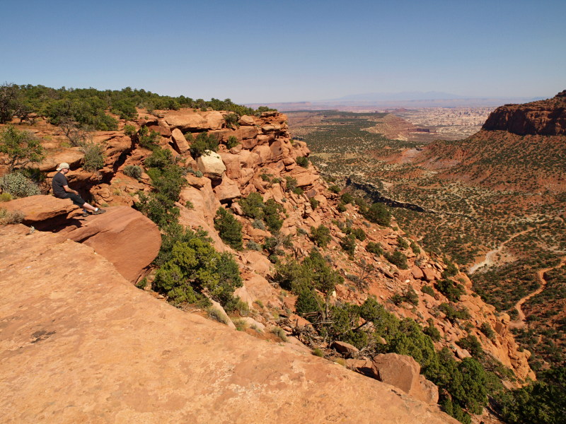
On the return hike we kept to the shade as much as possible.

Horseshoe2010_04BW.JPG


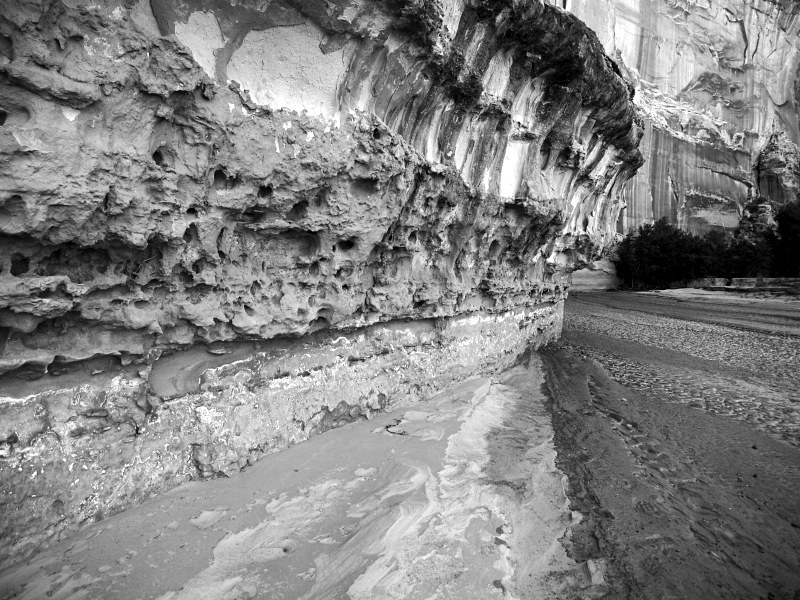
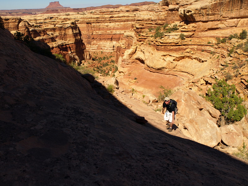
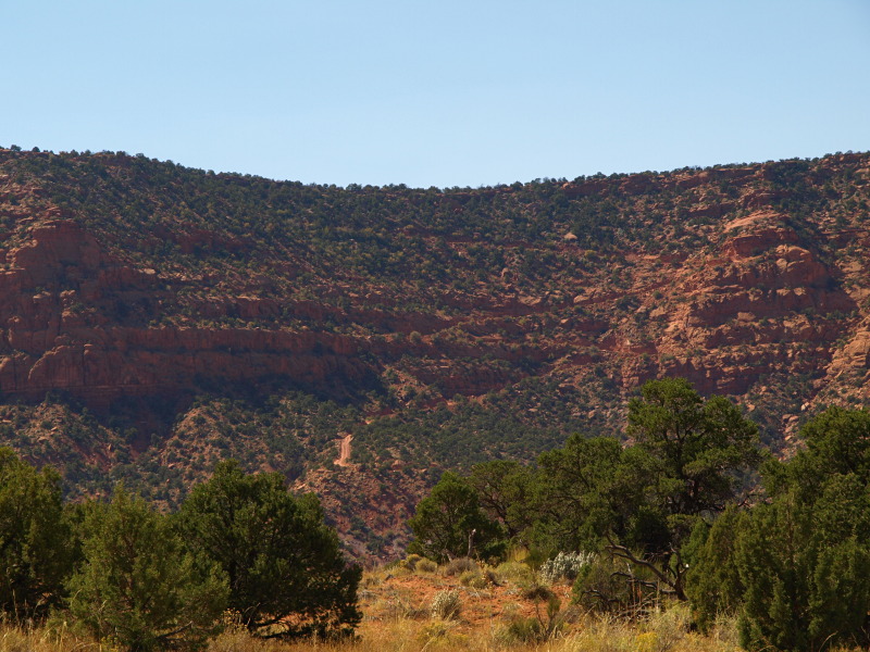
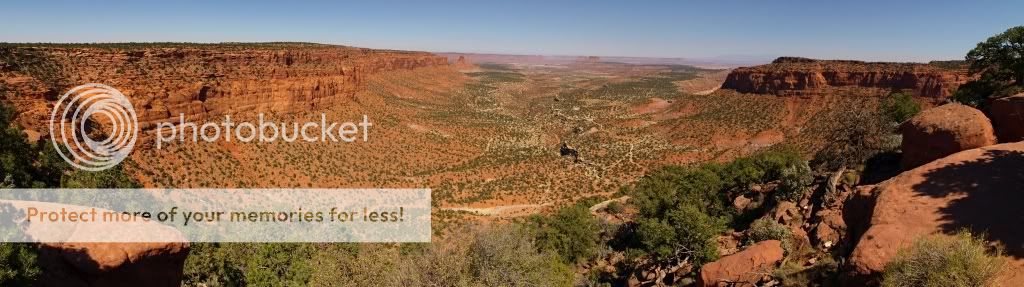
The old road is visible here across the canyon while on the climb back out.
(Put in by Phillips Petroleum in the 1920s, east side seen here drive-able till damaged by flood in the late 1990's)
Horseshoe2010_08.JPG

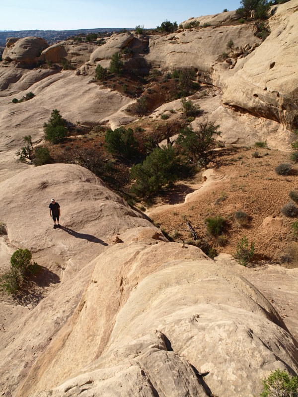
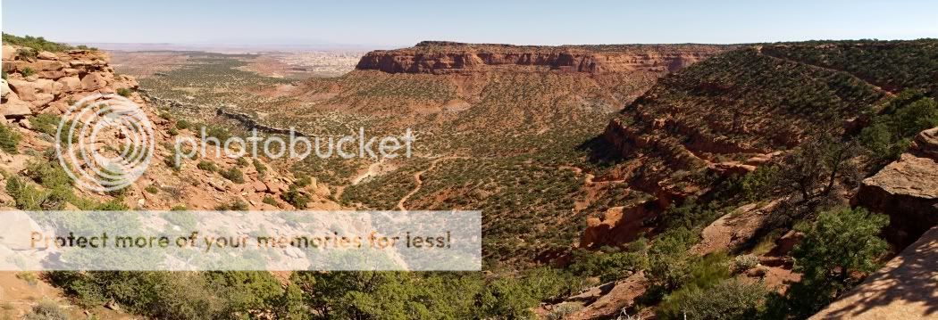
Note the two hikers in the wash bottom for scale.

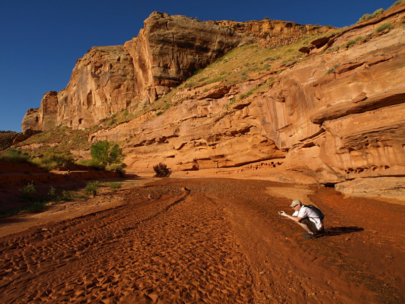
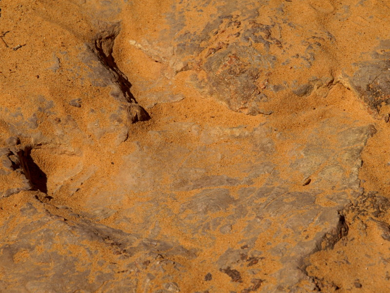
While hiking in and out of the canyon we spotted the easy to miss dinosaur tracks in the bed of the old oil exploration road.

Horseshoe2010_09.JPG


Back at the truck it was already the time we had hoped to Meet Alex and Adam in Hite, now we just wanted to find their camp before sundown. First things first, on to Hans Flat.

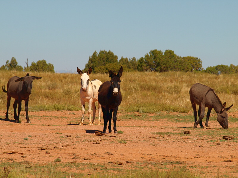
I can't remember where but once read something about the wild burrows and wild horses that can be seen in this part of the country. We had to stop and get photos of these locals hanging out by the side of the road.

Horseshoe2010_10.JPG


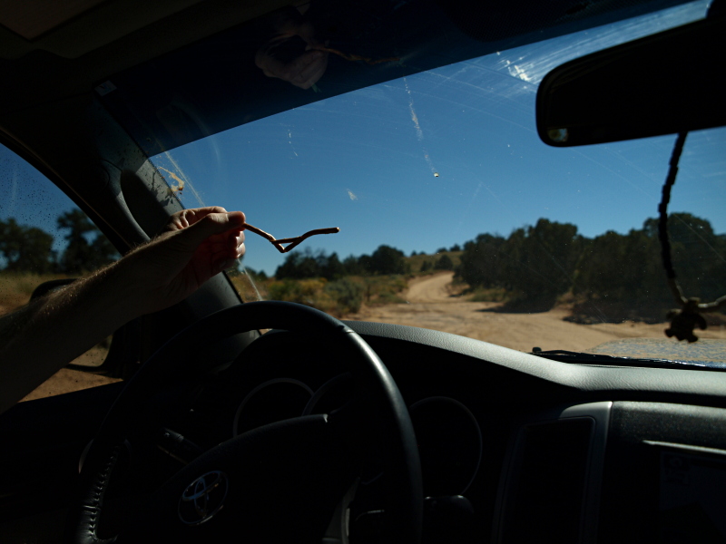
Also had to pause long enough to document the handlebar pretzel!

Maze0910_001.JPG


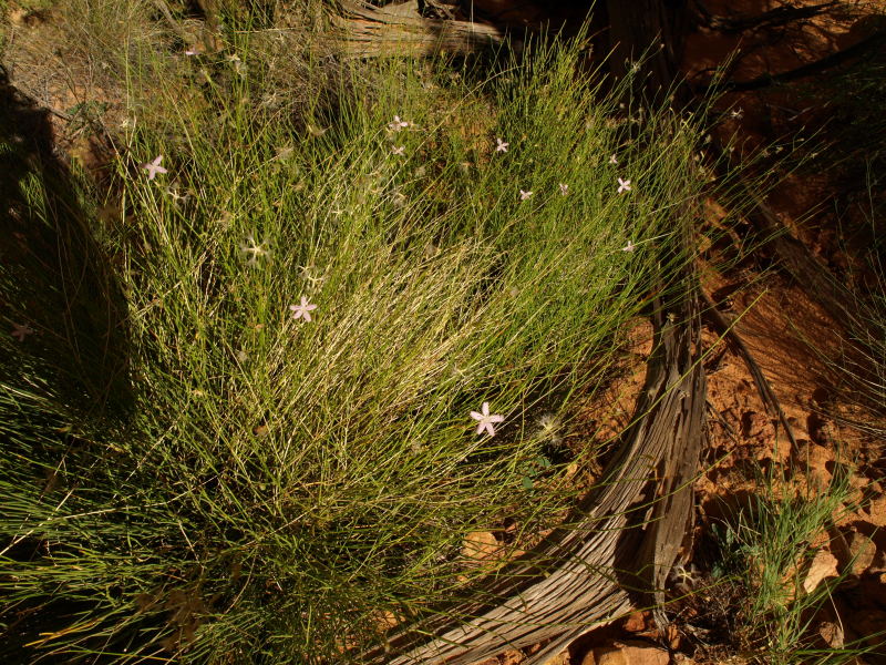
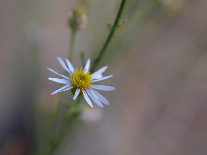
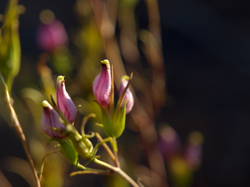
Hans Flat was interesting, it was so quiet, we sort of involuntarily whispered almost and the ranger spoke softly too. I wowed her with tales of crossing all of Southern Utah via dirt roads tracing our route on her maps. She wowed us with tales of college kids from Colorado pushing a vehicle through snowbanks so they could pick up permits then explained how we, like they, could have made arrangement to call in our permit from Hite as we were planning on entering the park that way. The boards on the wall indicating what plants were in flower overflowed with scientific names, confirming what we had already noticed, the high desert was in a healthy late season bloom. We ate lunch on the pick-nick table there before heading for Hanksville.

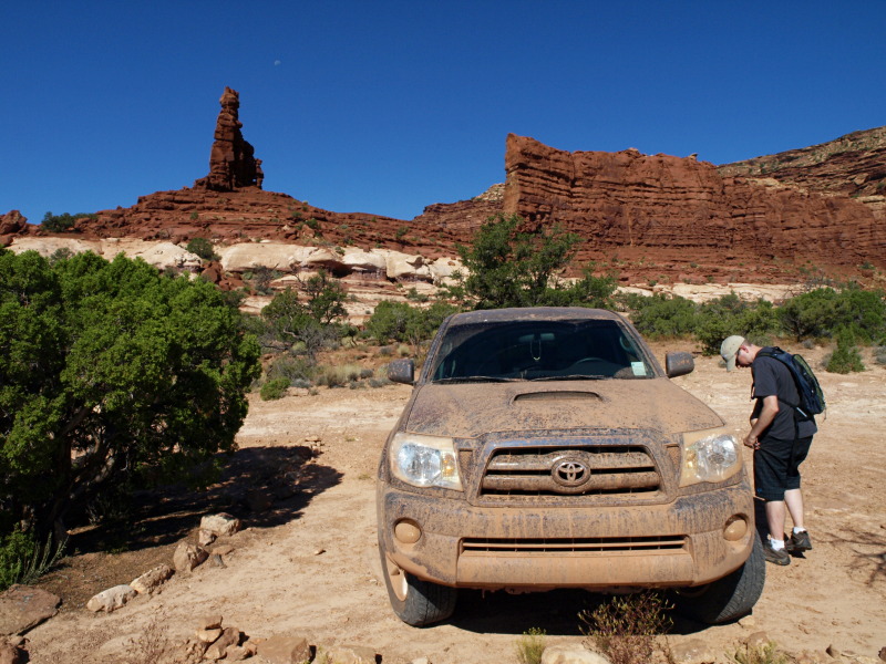
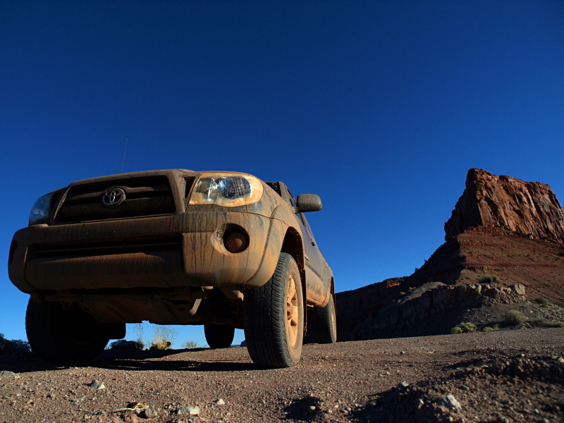
I introduced my brother to the Hanksvilles Hole In The Mountain gas station to top off his tank. Here it's evident he couldn't wait to get his truck dirty in the mud puddles still deep on the road near Hans Flat.

Maze0910_004.JPG


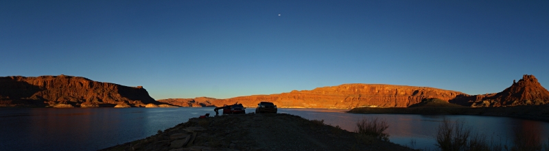
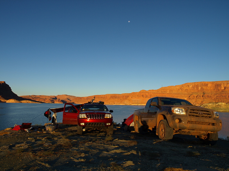
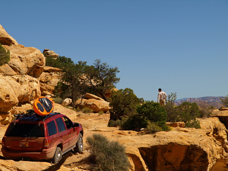
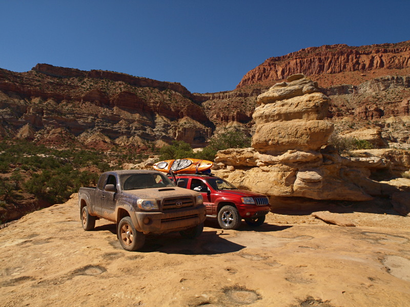
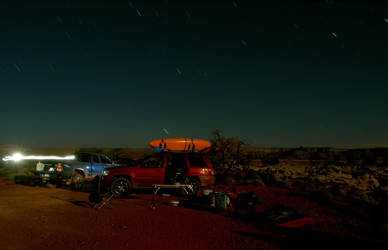
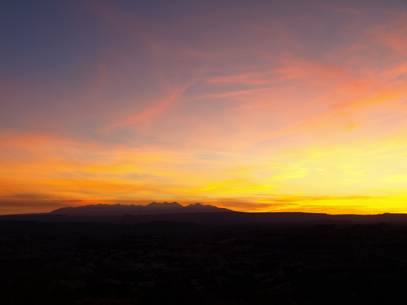
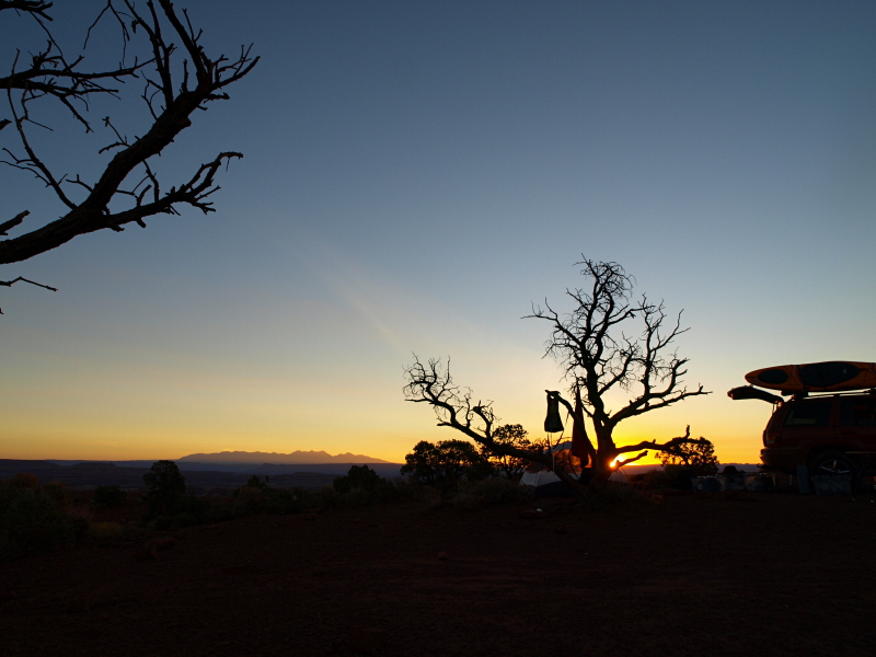
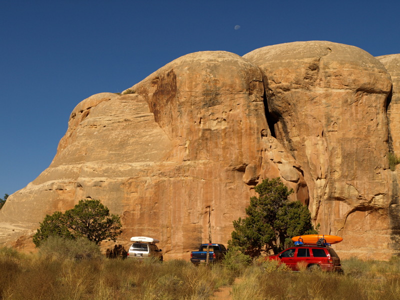
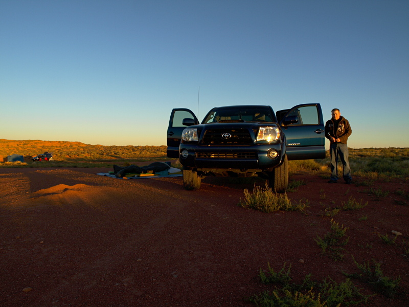
As we approached our intended camp I reached Adam on the GMRS and he guided us in, our usual lakeside spot taken and the area quite crowded. Alex was in his Kayak on the lake waving at us, we set up and enjoyed dinner with sunset.

Alex and Adam told us of checking the kayak in, free and clear of quagga muscles and green lit for putting in the water. Then heading up Piaute Pass first before heading in toward our campsite, they hadn't waited long for us before guessing correctly we would be along later.

Brian opted for a tent this time, the mosquito that hovered from his ear to my ear on a ten minute rotation last night had ruined him for "out under the stars", me too so I took advantage of the tent.

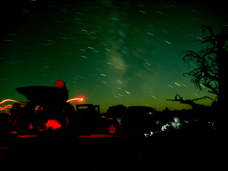
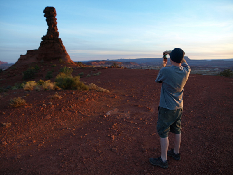
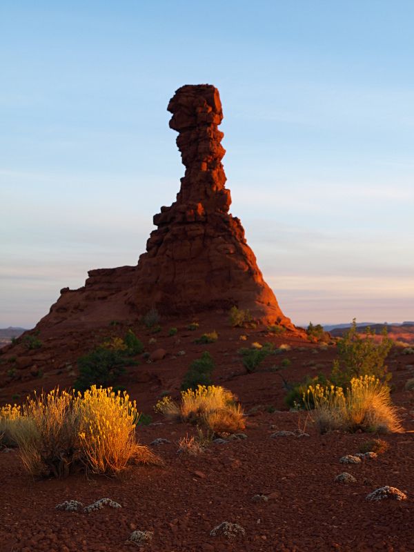
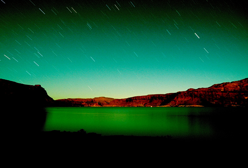
But first with the stars and milky way, out came the tripods and DSLR's, then I discovered my cameras funky color rendering ability during a bright moonrise. Here is an out of the camera jpeg, only rotated and re-sized for web.
Maze0910_005.JPG


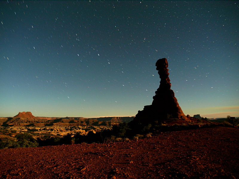
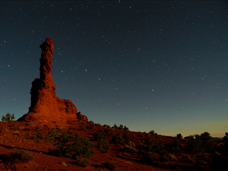
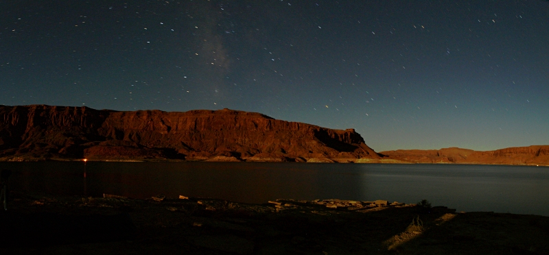
After the moon was up, no color problem.
Maze0910_Pano01A.JPG


So far it was a good start to an adventurous week.

Featured image for home page:
slide.jpg
 
Approach to the Maze

The morning of day two was a leisurely start to another perfect day, I recall discussing that it was too perfect, not enough interesting or stormy clouds for dramatic photography. After a slow breakfast, refreshing dip in the lake, and packing up camp, we would simply head for our camp in the Maze.
There was this odd lady with a couple dogs camped near us, she came over to our camp and said she had been there several days and couldn't remember the way to get back out so would we mind if she followed us on the way out. She ended up following another nearby party who left before we did.

Maze0910_006.JPG

ahh much better

Maze0910_Pano03A.JPG

Sunrise Panoramic, larger version

Maze0910_008.JPG


I recall a pit stop in Hite where I grabbed an engine burrito. The Tacoma engine bay only really had one good spot after trying to stuff it in a few places. My brother decided to follow suit, it would have been his first engine burrito. He threw his burrito on another spot that seemed a little iffy to me, if you still see a burrito on the road from Hite please throw it away for us.
We aired down the tires a little once off the pavement and started the long drive in following Adam and Alex in the kayak adorned WJ. My brother asked me about photography so we stayed occupied discussing all the basics to pass the time. Upon reaching the difficult section of the Doll House road we ran in to the park ranger. In the tradition of meeting odd people started earlier that day, this gun toting ranger seemed unusual. Don't know if it was the remoteness or loneliness of the area or if he is just an unusual guy. He was overly concerned about the road being really difficult ahead in spite of our assurances it wasn't our first time down to the Doll House. Shortly after getting on our way again, well Adam has a funny story to tell about what happened when we heard a loud thunk come from the Grand Cherokee ahead of us.

... Right before that "Drop" that got us quiet we passed a Ranger that told us "Take it easy it gets rough right up there." The Ranger said it to us in a way we thought was trying to give us a little scare (Could of been the Kayak on top in the middle of the Maze that had him thinking...) .... So Alex and I passed on and laughed to ourselves sort of Mocking what he said... While laughing Karma hit us in the form of a large drop onto the factory rock rail of Alex's WJ.... BAMMMM... I still remember the look we gave each other. And there was a long moment of silence because we knew we deserved that....

Maze0910_010.JPG


Maze0910_011.JPG


Maze0910_013.JPG


Maze0910_016.JPG


Spotted three natural arches on the way in.

This one was somewhere before Mother And Child Rock.
Maze0910_017.JPG


Another small one in The Wall.
Maze0910_020.JPG


And impressive looking Tibbett Arch in the distance.
Maze0910_021.JPG


Chimney Rock Camp was our spot, before arriving I was worried Chimney Rock wouldn't be as scenic as other campsites. Within the next couple days I would take dozens of photos of our vista including dozens featuring Chimney Rock, it has character. We enjoyed a relaxing evening, veggie burgers hot off a grill, the stars and milky way coming out proceeding another bright moon-rise.

Maze0910_025.JPG

For scale spot my brother in this one.

Maze0910_023.JPG


Maze0910_027.JPG

Another greenish outcome taken just before a bright moonrise.

Maze0910_029.JPG

Tried a couple compositions with the Big Dipper next to Chimney Rock.
ChmnyRck2010_00.JPG


Maze0910_030.JPG

Taken while Alex was showing my brother how to get the most out of his new digicam
walking around lighting things with his strobe, Adam in right foreground trying to sleep
 
Enter the Maze

Day three was the day we spent doing the long loop hike from Chimney Rock to the Harvest Scene in Pictograph fork and back to camp.
Another beautiful, boring sky (except for sunrise), and hot, sunny day.


Maze0910_031.JPG


Maze0910_032.JPG


ChmnyRck2010_00T.JPG


ChmnyRck2010_01.JPG


Maze0910_Pano05A.JPG

Sunrise over the Maze panoramic, larger version

Jsprview2010_01.JPG

taking a break on the rim looking in to Jasper Canyon - closed to hikers :(

Maze0910_036.JPG


Maze0910_038.JPG

Adam on a small trail-side arch

Dropping down in to the labyrinth.
Maze0910_041.JPG


Maze0910_043.JPG


Maze0910_045.JPG


Maze0910_050.JPG


Nice little arch near the mouth of a side-canyon just before Pictograph Fork
Maze0910_Arch03intersection.JPG


Some of the wildflowers along the trail
Maze0910_046.JPG

Slender Wirelettuce,

Maze0910_042.JPG

and some Tansyaster

The lizard on the cairn in Pictograph Fork, Adam hiking ahead radioed back to us to look out for it, but it wanted no closeups.
Maze0910_054.JPG


Day 3 to be continued...
 
I had known my now wife about four months when we went on our first camping trip together ever. She asked me where were we going to go and I said "well, I've been reading on some blogs about some place called The Maze. It sounds really cool."

So we pack up my '99 stock 4Runner and head down to the Hans Flat Ranger Station and say "Hi, we want a permit to camp in The Maze". She looks at us and then walks outside to look at my 4Runner and said, "well, you might make it on some of the roads".
So I had seen these pictures and TR's of the Maze Overlook Campground and The Harvest Scene so I asked if we could go there. She said "I'll let you go there, but don't go on the Teapot Dome Road". Then I get the 45 minute lecture on what happens if anything goes wrong and the answer to pretty much all of them is you either walk out or you die, and they're not going to help you. Then we get the protocol on the Flint Trail, which was pretty funny too.
The ranger said "If it rains then don't go up or down since it gets slicker than goose snot". I asked her how slick is goose snot and she didn't think that was very funny.
So my now wife who has only known me for four months and we go camping for the first time together and the ranger is giving us a lecture on all the different ways we could die. Not a good start.
So we head down the Flint Trail and it as this point I find out my now wife is seriously afraid of heights. So she lies down in the back seat with a pillow over her head the whole ride down. Not joking.
After we get to the bottom of the Flint Trail we had a very enjoyable drive out to the Maze Overlook. We were the only ones there for three days and it was truly stunning. We set up our portapotty on the edge of the mesa to make sure we would always have a good view.
Maze Camp.jpg
Sunrise walk to the portapotty

We hiked down to the Harvest Scene the next day. The scramble was fun although my now wife's fear of heights was a little tricky on the exposed ledges. She was a trooper though even when she was curled up in the fetal position.
harvest scene.jpg
I know this isn't the best quality picture but it was what passed for an inexpensive pocket digital camera in 2003.

We drove out the same way up the Flint Trail. The 5-point turns at the switchbacks are a little disconcerting when you have to go back and forth at the edge of a 500 foot cliff. One slip of the brake pedal and its over pretty quick.

I have never been the way from Hite, so I don't what that way is like. It looks pretty on a map, but nothing around there isn't pretty.
I have been to the Great Gallery about 3 times and while the rock art is unsurpassed, the scenery and awe of the setting is just not like The Maze.
 
The Harvest Scene

These are hard to see with the sun reflecting off the canyon wall
Maze0910_055.JPG


Alex lends some scale to the size of them in this view if you can make them out.
Maze0910_056.JPG


Took some liberties with post production here
Maze0910_Harvest01.JPG


Maze0910_Harvest02.JPG


Maze0910_Harvest03.JPG


Maze0910_Harvest04.JPG


This panel is separated further along the curving wall from the main site.
Maze0910_Harvest06.JPG


Note the panel up on the left. The canyon wall here is a solar energy collector.
Maze0910_057.JPG


We took a long lunch and rest in the shade across canyon from the pictographs. Then continued up-canyon on the return leg of our loop.

The formation you might recognize first if you have missed the panel.
Maze0910_059.JPG


A moderate arch we spotted on the rim of Pictograph Fork.
Maze0910_Arch04PictoFrk.JPG


A petroglyph panel found in Pictograph Fork.
Maze0910_064.JPG


Maze0910_065.JPG


Zoomed in on Chimney Rock in the distance beckoning to us.
Maze0910_067.JPG


The trail back up to Chimney Rock gets steep in spots,
Maze0910_073.JPG


traversing around pour-off after pour-off,
Maze0910_076.JPG


add some steep but easy friction pitches,
Maze0910_077.JPG


then finally back on top.
Maze0910_078.JPG


A long hike, very scenic, and a nice panel of rock art to see. I enjoyed it.
We spent the rest of the day mostly recovering in the shade of the Jeep.
 
Guilty Pleasures

Day Four of this trip welcomed our second sunrise in the Maze. It was time to take it easy but our group developed different motivations of how best to proceed. We all decided to head down to the Dollhouse and check it out again. My brother and I would stay there, park at the Spanish Bottom trail-head and complete a couple of short hikes, then return to camp and stay for the last night of our permit. Alex and Adam opted to head out after taking a look at the Dollhouse campsites, heading for the Lake for one more night so the longer drive home for them would be less taxing, with a kayak on the Jeep I could hardly blame them!

Maze0910_079.JPG


Snake eats lizard.
Maze0910_080.JPG


Alex working the off camera flash, shots as we say our goodbye's and part ways.
Maze0910_081.JPG


Maze0910_082.JPG


An interesting character showed up in that RTT equipped rig, a tall wiry gentleman with long mile eating legs and stories of dozens upon dozens of trips to the Maze behind his belt. He had no love for changes in the park, from an influx of commercial mountain bike outfitter operations to park regulations closing off areas to the public such as Jasper Canyon. Then he was off on his way to the Colorado Overlook.

Our first hike was the Granary trail with it's small ruins and it's overlook of Surprise Valley.

Maze0910_084.JPG

Brian takes an optional narrows around a giant boulder where the trail passes through the Dollhouse formation.

Maze0910_085.JPG


Maze0910_086.JPG


Maze0910_087.JPG


This bright sunny Tuesday was the warmest day of the trip yet, and the first short hike had us feeling the fatigue of the previous day.
So with a perfectly good DVD player in his in dash GPS we fired up the Tacomas A/C and watched a movie. I don't recall which one.
I do recall looking around occasionally like we were cheating or breaking some rule or otherwise doing something resulting in a guilty conscience!
Anyway what a refreshing lunch that made for. Our second hike started soon after the movie, we were earning the wilderness experience again.

Colorado Overlook trail, On the way to Beehive Arch.
Maze0910_088.JPG


Maze0910_092.JPG


Maze0910_Arch08beehive.JPG


Beeplant still in bloom along the road through the Dollhouse.
Maze0910_WF10.JPG


Back in camp a little early we sat in the shade of the truck the rest of the afternoon reading. I flipped through the new wildflower books and old trail guides, Brian devoured my copy of Men Met Along The Trail!

The books show four trails starting out from Chimney Rock, only three of them were marked with cairns. I started out before sunset to find the fourth trail, to Water Canyon, and follow it. This proved to be difficult, guessing at the first couple hundred yards until a lone cairn marked the way followed soon by obvious paths through the cryptobiotic soil. Almost lost the trail over slickrock then did loose it in a dry wash, after backtracking a couple times I guessed it followed the wash, finally finding another cairn near a pour off. Here I just stuck to the rim and found a nice overlook of the head of Water Canyon, noting the trail winding along a narrowing bench below me. A little late for photographing the canyon but there was good light on the broken lands beyond.

Write's Birdbeak growing right in the middle of the seldom used trail.
Maze0910_095.JPG


Maze0910_Pano08A.JPG

Panoramic looking west from the head of Water Canyon, larger verson.

Maze0910_096.JPG


The sun set on another great day in the park, we downed a freeze dried meal reconstituted with water prepped by my jetboil then went to bed early. My brother to his tent and I to my tarp on the ground and sleeping bag under the stars.

Maze0910_097.JPG


Alex later reported a perfect evening at the preferred lakeside campsite and nobody at all around to bother them this time!

...
 
Good To The Last.

One more glorious sunrise from near Chimney Rock camp.
One final breakfast on the trail.
One last time packing camp and loading up the truck.
One remaining hike to some excellent points of interest.
One altitude infused vista filled scenic way to leave the Maze.
One darn fine trip comes to an end.


Sunrise from out on the trail to Shot Canyon.
Maze0910_098.JPG


Maze0910_099.JPG


Maze0910_101.JPG


This is the trail to Earnies Country in the land Under The Ledge.
Maze0910_102.JPG


Cedar Bark Ruin is a small ruin in a small but deep alcove.
Maze0910_104.JPG


This one is fairly unique, as the name implies, the "roof" of unknown but likely historic origin is comprised of Juniper bark.
Maze0910_CdrBrk01.JPG


The alcove seemed void of any potsherds but sits next to a steep drop to the wash below. After leaving I just finished explaining to my brother that any remains might flush down the wash, then feet away from the main trail I looked down and found a small piece of graywear in the sand. My brother didn't believe me, I pointed out the smooth surface on one side, uniform thickness, slight curve, it was still too coincidental for him, told him I'll have to take you to Comb Ridge sometime then I replaced the sherd in the sand and we continued on to the next destination.

Interesting markings on the wall at Lou's Spring.
Maze0910_Loussprng.JPG


Watering trough at Lou's Spring.
Maze0910_107.JPG


Maze0910_108.JPG


Finished with our last hike.
Maze0910_110.JPG


Mother And Child Rock.
Maze0910_112.JPG


I didn't have to get out and spot my brother as we wound our way past the rugged section heading Teapot Canyon, He was getting the hang of it.
Soon we were cruising above all that bumpy bouncy country on the road to the Flint Trail, and looking down on the rough road we had just driven.

Teapot Rock.
Maze0910_113.JPG


View of the land Under The Ledge, home for the last three days.
Maze0910_114.JPG


Flint Trail.
Maze0910_115.JPG


Maze0910_117.JPG


Maze0910_119.JPG


Maze0910_Pano09.jpg


Maze0910_Pano10.jpg


The end
Maze0910_121.JPG


An uneventful drive after a last pit stop at Hans Flat, stopping for dinner in Helper at my favorite food spot on the way home, the Balanced Rock eatery and pub (and antique/consignment shop), finished the trip.

Only a few short months later I returned with Randy intrepidxj and Dave DAA and got to do it all over again.


Details:

Participants;
Alex (engine cook extraordinaire)
Adam ("flying low")
Jared (myself, xjblue)
Brian (my brother)

Vehicles;
2002 Jeep Grand Cherokee WJ, Old Man Emu equipped
2009 Toyota Tacoma, Old Man Emu equipped

Resources;
books
Canyonlands National Park, Favorite Jeep Roads & Hiking Trails, David Day
Non-Technical Canyon Hiking Guide to the Colorado Plateau, 5th ed., Kelsey
Canyon Country Wildflowers, Damian Fagan

maps
Canyon Country Off-Road Vehicle Trail Map - Maze Area, #19, F. A. Barnes
National Geographic, Maze District, Canyonlands N.P., #312
National Geographic, Canyonlands N. P., Maze District, NE Glen Canyon NRA, #246
 
We ought to rectify that Marty!

It's been almost two years since I've been. Actually made three trips to The Maze in 2011, so took an intentional break from it last year. Reading Jared's report here has me horny to go there once more though.

- DAA
 
I'm super jealous.

I haven't been into the Maze yet. I feel as though it's the largest shortcoming in my life. :)
 
Similar threads
Thread starter Title Forum Replies Date
T Amazing Discovery in Utah-Glen Canyon Trip Planning 65
BJett Amazing Appalachians - Backpacking/Packrafting the AT and Nantahala River Backpacking 5
SteveR Amazing Akamina Ridge Hiking & Camping 4
norwegianxplorer Ski Dogs, Norway, fun days off piste ski touring amazing conditions Winter Sports 0
K Amazing Sunrises and Sunsets General Discussion 0
Reef&Ruins Amazing Photos from An Air-Freighter Pilot Photography 0
TJ Sheridan AMAZING Fantasy Canyon - Pics & Film Hiking & Camping 17
Dave Amazing historical resource General Discussion 4
D Four Days in the Maze, April 17-20 2023 Backpacking 7
maisweh Backpacking Maze - Please Critique Trip Planning 11
Desertratgal Backpacking/Packrafting Needles and Maze Districts of Canyonlands Trip Planning 3
RyanP The Plug exit of Pictograph Fork (Maze) Trip Planning 15
regehr maze road has a sand dune Trip Planning 14
JBPHXAZ Crossing Spanish Bottom from Needles to the Maze (and back) Trip Planning 13
RyanP Maze questions---Sweet Alice Canyon, etc Trip Planning 23
TrailScot 10 days in The Maze - April 2019 Backpacking 22
J Family hike in the Maze in June? (Canyonlands / Moab) Am I crazy? Trip Planning 5
Stephanie B Second Journey into The Maze : Deadman's Trail Hiking & Camping 1
Stephanie B Second Journey into The Maze : The Harvest Scene Hiking & Camping 5
Stephanie B Second Journey into The Maze : Lands End Hiking & Camping 0
Stephanie B Second Journey into The Maze : Cowboy Cave Hiking & Camping 2
Stephanie B Second Journey into The Maze : Moonshine Wash Hiking & Camping 11
Stephanie B Second Journey into The Maze : Butterfly Bend and Chaffin Geyser Hiking & Camping 0
Stephanie B Suggestions for Maze Hikes and Range Canyon Intel? Trip Planning 2
U Maze District of Canyonlands question Trip Planning 15
Benjamin Hayden Looking for advice on Maze District, Canyonlands Trip Planning 1
Parma Favorite Maze Campsites General Discussion 1
wesleyS The Maze road conditions Off Road 0
G The Maze! 6-day backpack trip Backpacking 5
ramblinman The Maze in March Backpacking 4
RyanP The Maze Trip Planning 28
Udink Maze II Hiking & Camping 4
b.stark Maze 2017-But seriously, where are Steve's gummy bears? Backpacking 7
frahminator Journey Through The Maze - April 2017 (Day 1 of 5) Backpacking 4
J "Mazing" Six day backpack in Canyonlands Maze Dist. Pt 2. April 13-15, 2017 Backpacking 8
J "Mazing" Six day backpack in Canyonlands Maze Dist. Pt 1. April 10-12, 2017 Backpacking 0
George_Washington_Hayduke Canyonlands Figure 8: Packrafting Loop through the Needles and Maze District Backpacking 3
Nick The Maze III Off Road 28
Udink Maze Overlook to Harvest Scene Hiking & Camping 3
IntrepidXJ Maze Memorial Weekend III Hiking & Camping 6
MVS Jeep Driving in The Maze General Discussion 3
Joey 10 Days in the Maze (video) Backpacking 21
IntrepidXJ Maze Memorial Weekend II Hiking & Camping 7
Joey Enjoying the Maze, April 2015, Part 2 Days 6 - 10 Backpacking 11
Joey Enjoying The Maze, April 2015, Part 1, Days 1-5 Backpacking 13
steve Invite Last-minute Maze Figure 8 packrafting trip this weekend Meet Up (Members Only) 3
Ross Six days in The Maze (with some Arches to warm up) Hiking & Camping 4
Joey Canyonlands's Maze and Fins Loop Backpacking 14
steve Maze help needed: Route into Water Canyon from Chimney Rock? Trip Planning 9
Bob Maze - Canyonlands Backpacking 10

Similar threads

Back
Top