- Joined
- Aug 9, 2007
- Messages
- 12,949
Ndheiner and I decided we needed to start knocking out at least one epic Wind River backpacking trip each summer if we are ever going to have any chance of seeing it all before our knees give out. So this year, we decided on 4 days to the Deep Creek Lakes area east of Wind River Peak.
We drove up to Lander the night before the trip started and then went up and found a decent spot to camp in Townsend Park just a mile or so away from the trailhead. We spent the rest of the evening having drinks and coaching the person who joined us for this trip who will remain unnamed.
The next day we had a rough time getting out of camp in a timely manner so we decided to reverse the direction of our loop. The original plan was to spend day 1 hiking all the way to Deep Creek Lakes via the Popo Agie River. By the way, there was much debate over how to pronounce 'Popo Agie' on this trip. I was thining Popo Ageeee but we ran into some folks who seemed to know a lot about the area who swear to us it's actually pronounced "poposia". Like both words together and no 'g' sound at all. Crazy eh?
Anyway, back to the plan. We were going to do day 1 all the way to Deep Creek, 12+ miles. Then a day spent there, then a day hiking from there to below Stough Creek Lakes via Ice Lakes then the last day from below Stough all the way back out to Worthen Meadows. Roughly a 25+ mile loop without any side trips.
But with our late start, we were concerned about making it the full 12 miles and thought perhaps we should do the loop the other way to give us a possible better half-way spot to camp. So we headed out on the Stough Creek Lakes trail. The trail climbs gently for the first half mile or so before arriving at Roaring Fork Lake. From there it's a long climb to to the top of an unnamed pass at the edge of treeline. A total of about 1700 feet is gained between the trailhead and that pass about 4 miles in.
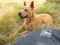
Sonny taking a break in the meadow between the two first steep sections (which aren't really steep thanks to lots of switchbacks).
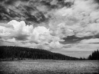
The meadow before the big climb
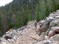
Nate climbing through the many switchbacks up to the pass.
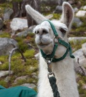
We ran into a family with a full on llama train along the way. They had rented the llamas and come in from the Sweetwater Gap, spent some time at Stough Creek Lakes and were now heading out to Worthen Meadows. We stopped and talked for a bit about it and it made a lot of sense. They were able to bring their young children and everything they needed this way without breaking their backs trying to carry too much gear themselves. I swear the youngest of their kids must have been about 5 and she was guiding her own llama down the trail. Very cool.
After climbing countless switchbacks and 1700 feet of elevation gained we reached the top of the pass and were rewarded with a fantastic view north towards Wind River Peak.
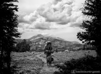
We stopped on the pass for a few minutes before heading down about a mile to the first creek where we captured some water and discussed the plan. We had been moving much slower than usual due to circumstances that I can't or perhaps shouldn't mention on the internet, because of those circumstances (that were beyond my control), I was worried about being able to do the full loop we had planned.
So we decided that we would head into Stough Creek Lakes Basin and see how things felt after the first day. I knew that if we the situation continued to be a problem, it would be a bad idea to keep shooting for Deep Creek Lakes. Worst case, we spend a few relaxing days in Stough Creek. Doesn't sound too bad!
A storm was moving in just as we arrived at Stough Creek Lakes so we moved quickly up into the middle of the basin.
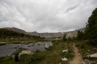
We hurried to get tents setup as the storm started to get rolling but then it broke. We never really had to get into our tents or anything and we were treated with some beautiful light on the peaks of Roaring Fork Mountain.
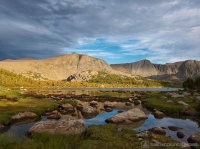
Nate pumping water as the sun set behind camp. I spent the evening catching fish on the tenkara. The fishing was hot for small brook trout.
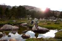
We sat around the candle lantern that night enjoying the evening. We had a couple of deer come into our camp that didn't care at all about us being there. I almost walked right into one of them before they scared the hell out of me. Then after I sat back down, they came back in again, even closer. We were able to sit and watch them as we talked. Later on, another storm moved in which forced us into our tents. It was nice to go to sleep to the sound of rain drops on the fly.
In the morning, we woke up and took a very leisurely pace getting at it. We had decided at this point that we would be staying in Stough Creek Lakes and not moving on to Deep Creek. I walked around the shore and outlet with the tenkara that morning catching fish after fish. It was great fun.
Around noon, we hiked up to the upper lakes in the basin. I kept the tankara out and fished the shore and the streams along the way. It was seriously too much fun catching fish after fish.
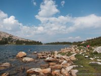
The inlet stream to our lake was the best where the fish were actually quite a bit larger. I caught one beautiful cutthroat out of that stream, the only non-brookie I caught the entire trip.
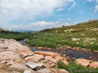
Our first stop was the '8' shaped lake just south of our lake. It was the most beautiful lake that still had trees around it (although I'm not sure about campsites). We had been told the fishing was great there but it totally sucked for me. I busted out about every possible method I had and was only able to catch one, medium sized brook trout. I didn't get any good pictures of that lake due to the light and constantly trying to catch a fish, but it was very pretty.
From there, Nate and I decided to hike up and explore more of the surrounding lakes. We debated between the small lake west of the '8' lake which looked beautiful but has no fish, or the bigger lake south of the '8' lake which looked more likely to hold fish. We decided on the bigger one.
There was no trail but route-finding up to it was easy since it's above tree line.
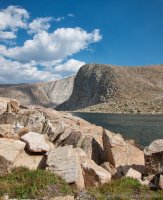
I saw zero sign of fish so we skipped that and Nate went in for a dip.
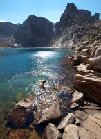
And then I did. It was very, very nice.
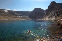
The weather while we were at this lake was the best of the day. It had been pretty windy before but now it was calm and warm so we sat out on our tiny patch of grass and soaked it in.
The view back down into the basin from the upper lake we visited. The lake on the left is the one I refer to as the '8' lake. The lake we were camped at is the one just beyond it in the center.
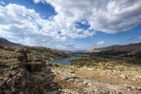
We diverted a little further up into the basin on the hike out. These little puddles had no fish of course but were still pretty.
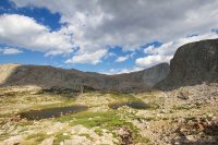
Oh if only we'd had a little more time. The highest lakes in the basin are right up there in that awesome looking cirque. I was told that some nice fish have been caught up there.
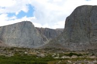
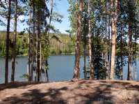
Back at our lake. Our camp was at the far end.
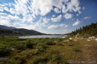
Back at camp, having dinner down by the shore. The skies were shaping up perfectly for an evening of watching the Perseids Meteor Shower.
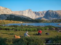
Dark settled in and so did we. And for the first time in a long time, I decided to take some night photos.
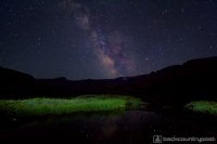
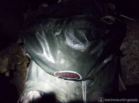
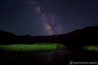
Each time I went to check on my camera, it was soaked. There was so much 'dew' happening that it was almost like a rain storm had moved through. It ruined all of my meteor shots and star trails so all I really got was that milky way shot. Oh well.. it was nice sitting out under the sky watching the stars, photos or not. This is what my backpack looked like when we finally went back up into camp. Soaked!
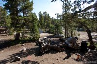
The next morning we tried to get out early but again slacked and didn't get out of camp until 10am. Here's a shot of camp.
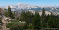
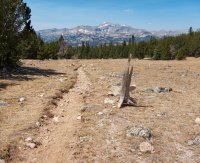
The hike out was a cake walk. 8.5 miles and only 450 of elevation to climb. This is Nate near the top of that climb with Wind River Peak and Lizard Head Peak visible in the distance.
Back on the pass.
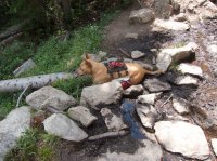
Sonny cooling down in a mud puddle on the way back down the switchbacks. We were able to move a bit faster coming down these.
And quite possibly the best thing about the Worthen Meadows trailhead? Water! Nothing like going for a swim after a long hike. We hung out here and celebrated for an hour or so before heading off. Nate and I drove back through the Louis Lake road which has opened my eyes to a lot of other options in the area. Too bad you still have to drive through Wyoming's emptiness to get to any of it.
This trip, while not at all what we had planned to do, was really nice. Stough was a lot busier than I would normally like and the circumstances that changed our plan proved to be a huge learning experience.
Here's the route we took with my GPS tracks.
[parsehtml]
<iframe src="http://www.mappingsupport.com/p/gmap4.php?q=mymap,214533597045798101523.0004c794061487fe97008&z=13&t=t4" frameborder="0" marginwidth="0" marginheight="0" scrolling="no" width="900" height="900"></iframe><br>
<small>View <a href="http://www.mappingsupport.com/p/gmap4.php?q=mymap,214533597045798101523.0004c794061487fe97008&z=14&t=t4" target="_blank">Stough Creek Lakes Map</a> full sized in a new window.</small><br><br>
[/parsehtml]Featured image for home page:
We drove up to Lander the night before the trip started and then went up and found a decent spot to camp in Townsend Park just a mile or so away from the trailhead. We spent the rest of the evening having drinks and coaching the person who joined us for this trip who will remain unnamed.

The next day we had a rough time getting out of camp in a timely manner so we decided to reverse the direction of our loop. The original plan was to spend day 1 hiking all the way to Deep Creek Lakes via the Popo Agie River. By the way, there was much debate over how to pronounce 'Popo Agie' on this trip. I was thining Popo Ageeee but we ran into some folks who seemed to know a lot about the area who swear to us it's actually pronounced "poposia". Like both words together and no 'g' sound at all. Crazy eh?
Anyway, back to the plan. We were going to do day 1 all the way to Deep Creek, 12+ miles. Then a day spent there, then a day hiking from there to below Stough Creek Lakes via Ice Lakes then the last day from below Stough all the way back out to Worthen Meadows. Roughly a 25+ mile loop without any side trips.
But with our late start, we were concerned about making it the full 12 miles and thought perhaps we should do the loop the other way to give us a possible better half-way spot to camp. So we headed out on the Stough Creek Lakes trail. The trail climbs gently for the first half mile or so before arriving at Roaring Fork Lake. From there it's a long climb to to the top of an unnamed pass at the edge of treeline. A total of about 1700 feet is gained between the trailhead and that pass about 4 miles in.
Sonny taking a break in the meadow between the two first steep sections (which aren't really steep thanks to lots of switchbacks).

The meadow before the big climb

Nate climbing through the many switchbacks up to the pass.

We ran into a family with a full on llama train along the way. They had rented the llamas and come in from the Sweetwater Gap, spent some time at Stough Creek Lakes and were now heading out to Worthen Meadows. We stopped and talked for a bit about it and it made a lot of sense. They were able to bring their young children and everything they needed this way without breaking their backs trying to carry too much gear themselves. I swear the youngest of their kids must have been about 5 and she was guiding her own llama down the trail. Very cool.

After climbing countless switchbacks and 1700 feet of elevation gained we reached the top of the pass and were rewarded with a fantastic view north towards Wind River Peak.

We stopped on the pass for a few minutes before heading down about a mile to the first creek where we captured some water and discussed the plan. We had been moving much slower than usual due to circumstances that I can't or perhaps shouldn't mention on the internet, because of those circumstances (that were beyond my control), I was worried about being able to do the full loop we had planned.
So we decided that we would head into Stough Creek Lakes Basin and see how things felt after the first day. I knew that if we the situation continued to be a problem, it would be a bad idea to keep shooting for Deep Creek Lakes. Worst case, we spend a few relaxing days in Stough Creek. Doesn't sound too bad!
A storm was moving in just as we arrived at Stough Creek Lakes so we moved quickly up into the middle of the basin.

We hurried to get tents setup as the storm started to get rolling but then it broke. We never really had to get into our tents or anything and we were treated with some beautiful light on the peaks of Roaring Fork Mountain.

Nate pumping water as the sun set behind camp. I spent the evening catching fish on the tenkara. The fishing was hot for small brook trout.

We sat around the candle lantern that night enjoying the evening. We had a couple of deer come into our camp that didn't care at all about us being there. I almost walked right into one of them before they scared the hell out of me. Then after I sat back down, they came back in again, even closer. We were able to sit and watch them as we talked. Later on, another storm moved in which forced us into our tents. It was nice to go to sleep to the sound of rain drops on the fly.
In the morning, we woke up and took a very leisurely pace getting at it. We had decided at this point that we would be staying in Stough Creek Lakes and not moving on to Deep Creek. I walked around the shore and outlet with the tenkara that morning catching fish after fish. It was great fun.
Around noon, we hiked up to the upper lakes in the basin. I kept the tankara out and fished the shore and the streams along the way. It was seriously too much fun catching fish after fish.

The inlet stream to our lake was the best where the fish were actually quite a bit larger. I caught one beautiful cutthroat out of that stream, the only non-brookie I caught the entire trip.

Our first stop was the '8' shaped lake just south of our lake. It was the most beautiful lake that still had trees around it (although I'm not sure about campsites). We had been told the fishing was great there but it totally sucked for me. I busted out about every possible method I had and was only able to catch one, medium sized brook trout. I didn't get any good pictures of that lake due to the light and constantly trying to catch a fish, but it was very pretty.
From there, Nate and I decided to hike up and explore more of the surrounding lakes. We debated between the small lake west of the '8' lake which looked beautiful but has no fish, or the bigger lake south of the '8' lake which looked more likely to hold fish. We decided on the bigger one.
There was no trail but route-finding up to it was easy since it's above tree line.

I saw zero sign of fish so we skipped that and Nate went in for a dip.

And then I did. It was very, very nice.

The weather while we were at this lake was the best of the day. It had been pretty windy before but now it was calm and warm so we sat out on our tiny patch of grass and soaked it in.

The view back down into the basin from the upper lake we visited. The lake on the left is the one I refer to as the '8' lake. The lake we were camped at is the one just beyond it in the center.

We diverted a little further up into the basin on the hike out. These little puddles had no fish of course but were still pretty.

Oh if only we'd had a little more time. The highest lakes in the basin are right up there in that awesome looking cirque. I was told that some nice fish have been caught up there.

Back at our lake. Our camp was at the far end.

Back at camp, having dinner down by the shore. The skies were shaping up perfectly for an evening of watching the Perseids Meteor Shower.

Dark settled in and so did we. And for the first time in a long time, I decided to take some night photos.

Each time I went to check on my camera, it was soaked. There was so much 'dew' happening that it was almost like a rain storm had moved through. It ruined all of my meteor shots and star trails so all I really got was that milky way shot. Oh well.. it was nice sitting out under the sky watching the stars, photos or not. This is what my backpack looked like when we finally went back up into camp. Soaked!

The next morning we tried to get out early but again slacked and didn't get out of camp until 10am. Here's a shot of camp.

The hike out was a cake walk. 8.5 miles and only 450 of elevation to climb. This is Nate near the top of that climb with Wind River Peak and Lizard Head Peak visible in the distance.

Back on the pass.

Sonny cooling down in a mud puddle on the way back down the switchbacks. We were able to move a bit faster coming down these.

And quite possibly the best thing about the Worthen Meadows trailhead? Water! Nothing like going for a swim after a long hike. We hung out here and celebrated for an hour or so before heading off. Nate and I drove back through the Louis Lake road which has opened my eyes to a lot of other options in the area. Too bad you still have to drive through Wyoming's emptiness to get to any of it.

This trip, while not at all what we had planned to do, was really nice. Stough was a lot busier than I would normally like and the circumstances that changed our plan proved to be a huge learning experience.
Here's the route we took with my GPS tracks.
[parsehtml]
<iframe src="http://www.mappingsupport.com/p/gmap4.php?q=mymap,214533597045798101523.0004c794061487fe97008&z=13&t=t4" frameborder="0" marginwidth="0" marginheight="0" scrolling="no" width="900" height="900"></iframe><br>
<small>View <a href="http://www.mappingsupport.com/p/gmap4.php?q=mymap,214533597045798101523.0004c794061487fe97008&z=14&t=t4" target="_blank">Stough Creek Lakes Map</a> full sized in a new window.</small><br><br>
[/parsehtml]Featured image for home page:


 Lesson learned... hang the bear bag before you start pounding whiskey.