slc_dan
Desert Rat-Weekend Warrior
- Joined
- Jun 7, 2012
- Messages
- 1,687
Fun with Myself
I scout for a clear opening. A spot hidden, but not trampled. Found, I grab a stick and clear the spot. I’m careful to watch for cacti as I crouch down, and take steady aim. One inch in either direction and it may be lost entirely. The thought of missing flashes through my head. I regain my concentration. The sun gleams over the canyon wall. A bead of sweat dribbles down my forehead, and is caught in my brow. I close one eye and keep my mind on the prize. The shit lands in the hole dug previously. Bullseye. I kick some dirt over the hole, and scuttle back to camp.
***
Thursday night it falls into place. I stuff things into my Kelty 40 liter, filled my water jug and throw the rest of my crap into the trunk of my limping 2001 Civic. 189,000 miles young. Is it time for an oil change yet? No time to think about that. Those zip-ties holding the back bumper on are doing their job. I don’t have time to prepare meals for the night of car-camping, but short inconveniences such as this can’t inhibit the childlike giddiness I have for two nights in the wilderness.Work ticks by. As the bell rings I’m out the door, and driving south. The best way to drive when leaving work. 3 hours pass and I pull into Beaver. I love Beaver. I ordered two burritos from the Roberto’s Mexican truck stop gas station. Dinner and breakfast taken care of. I remember Nick writing about his friend snacking on some cheese curds, I acknowledge and buy a bag with some tortilla chips. Beer and Ice are in the cooler.
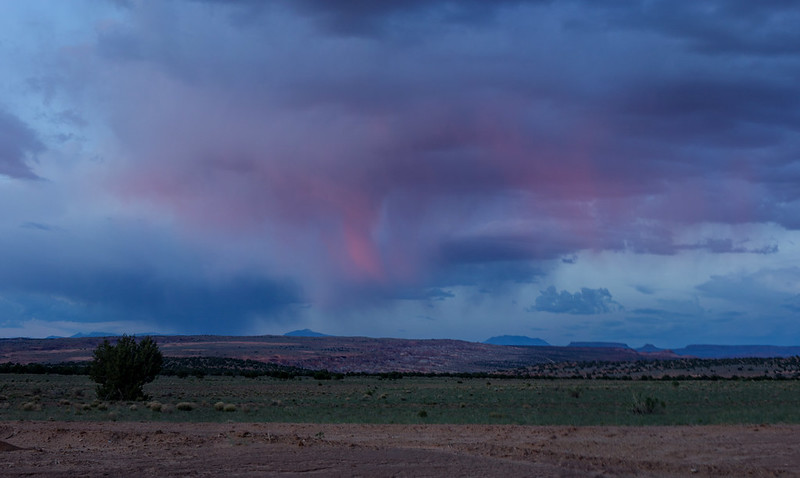
Back on the road, cheese squeaking between my teeth, I stay on the lookout for the Panguitch exit. The drive gets scenic, and quick. The storm system that blows through is juggled by the Laccolith giants of Pine Valley, Henry, Navajo, La Salle, and Abajo. I struggle to keep my eyes on the road, while driving comfortably over the speed limit. Clouds of all types form and provide the evenings entertainment. I slow when entering the small towns, and their friendly cops, scattered along the way.
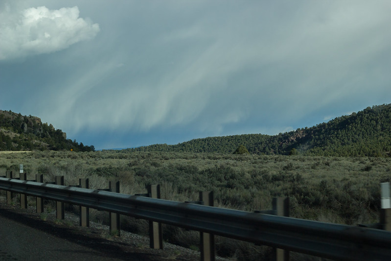
On my way 1 by slc_dan, on Flickr
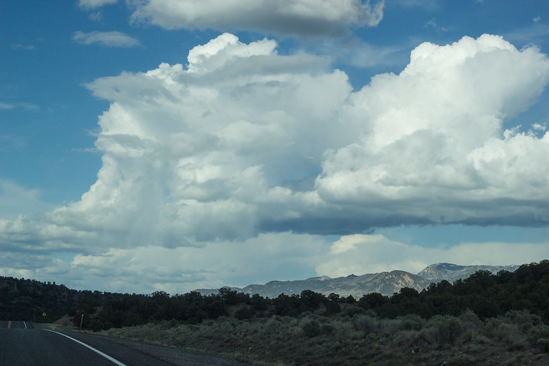
On my way 2 by slc_dan, on Flickr
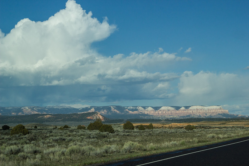
On my way 3 by slc_dan, on Flickr
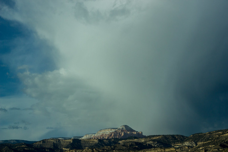
On my way 4 by slc_dan, on Flickr
I pass through Cannonville and recollect the adventure NateGeesaman and I had through Willis Creek, and the Paria. I need to get back there. Damn that smashed up truck in Bull Valley for still eluding me.
A short hour later and I’m driving through Escalante (ess-cal-ant-eeee, as the locals say). A young man is walking through town with a huge backpack. I stop to see if he wants a ride somewhere. He was an Argentine beaming with a spirit that can only come with the type of adventure and sights that he has had over the last month. He flew into Moab 1 month ago and has been hitchhiking around The Plateau since. He’s been well taken care of by the outdoor community. He was now stopping at a friends place in Escalante. He Just needed to stop and buy some beer as a generous house guest should. I drove him two blocks. I like this guy. I’ll never see him again.
I payed for some firewood, and drove southeast towards the Hole in the Rock Road. About 2 miles out, I turn around and pick up the firewood I paid for, waving to the gas station clerk as I do. She returns a smile.
A short period passes and I’m on the road named after Mormon Settlers who were sent down and foolishly blasted through some rock. They should have listened to the Indians, or at least Jacob Hamblin.
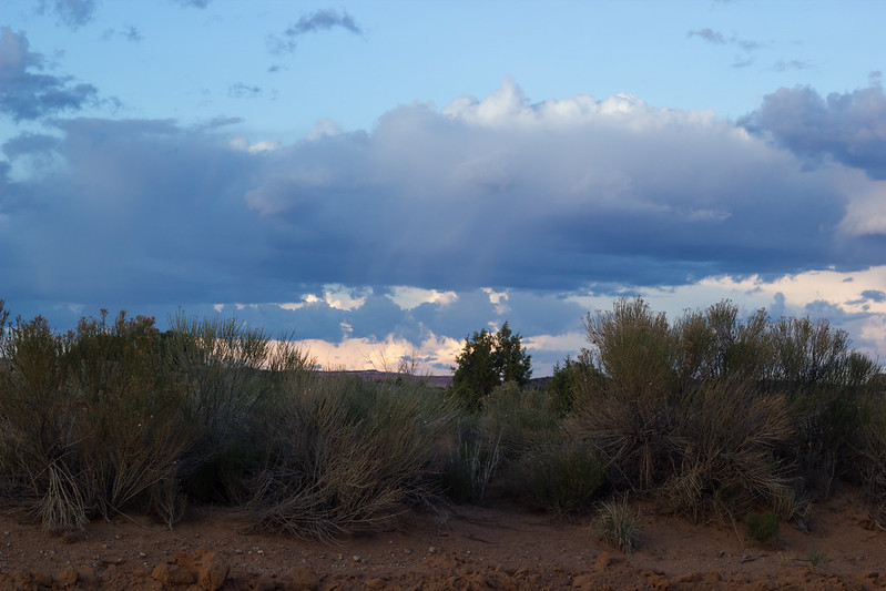
Hole in the Rock Clouds 1 by slc_dan, on Flickr
There are cows here. I have conflicting views on cows in Grand Staircase Escalante National Monument. Bill Cronon tells that the future of land management is about appropriate use, rather than full use, or full protection. What kind of use is this? I have yet to come upon a rotting cow stuck in a slot canyon, but would like to avoid that experience. I don’t eat these animals, but admire their blank stares in my pictures. I’m certain that ranchers are shooting whatever top of the food chain predators that may put their livelihood at risk. I want to see a cat. Intensely.
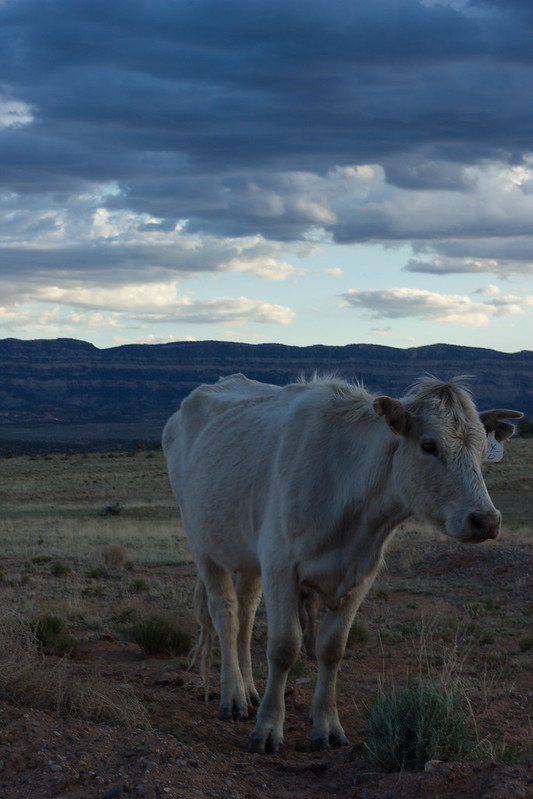
Hole in the Rock Cow by slc_dan, on Flickr
On My Way Pano by slc_dan, on Flickr
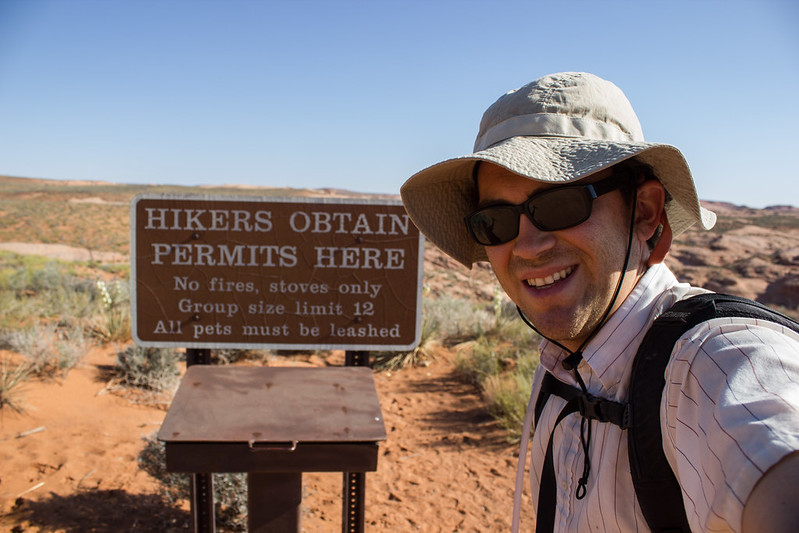
As it gets dark I purposefully drive past the Willow Gulch trail turn off. My Japanese car rumbles while entering the steep up and down of every gulch that comes by. I reach a sign that reads “The Spoon.” I consult my map. Yep, that’s the thing I was searching for, in the dark. I turn around and go back north. I deliberately pass the Willow Gulch turn off again, and see the Sooner Wash sign. Getting a good second view of the beginning of my hike tomorrow, I turn around again and pay closer attention for the correct turn off. On the left it comes. I throw my brights on, as this may, or may not be passable for my dependable driving machine. It is. I pass some campers, and hastily sign in with my plans, and pick up my Official Permit® for the next 48 hours. No decent camping spots on this particular turn off. There was one, but it was occupied. I found a spur between Willow and Sooner Gulch. It will work fine.
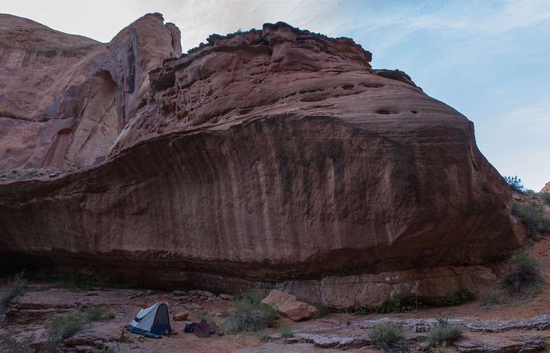
10:30: I set up my tent, and light a fire. This fire is a mere formality. I light one because I can. The flame sparks. I watch the embers slowly melt from the larger logs of pine. I guzzle another Cutthroat while my dinner sits on the engine block. Is this an engine burrito? I ponder. 5 course meal as Abbey would put it. 1 Burrito, 3 beers and some whiskey.
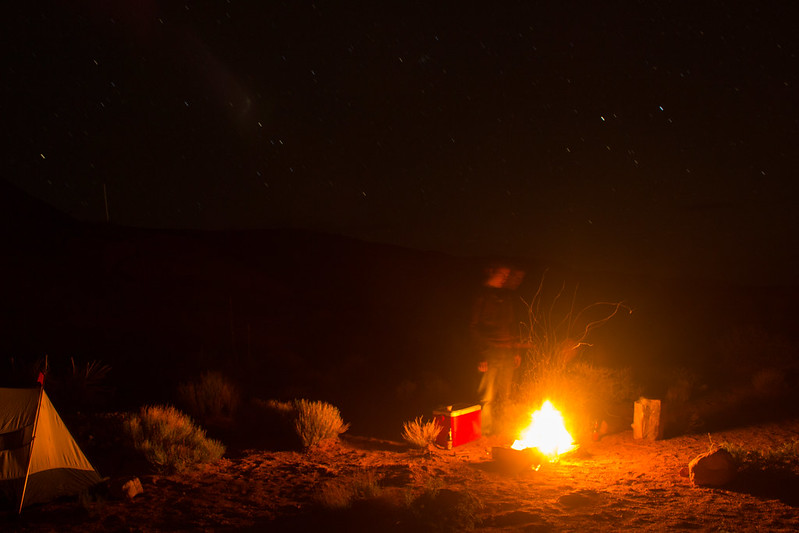
GSENM car camp by slc_dan, on Flickr
I sleep well. I periodically awaken to gaze up at the stars. I long to have the energy, or motivation to arise and attempt some star shots. The idea quickly passes with each awakening and I fall fast asleep. I drive down towards Sooner early. My current profession has me up at 5am everyday, so sleeping in until 6:30 feels like a luxury. At the “trailhead” there was a man my age just getting up. I apologized for intruding, but stated that I was only grabbing my pack and I would be on my way. We talked for a period while I finalized my pack. He’s been out for a month. 9 days in THEE Canyon, amongst other outings. He was a gentleman of the finest caliber. What kind of job/situation do I need to get in order to be able to fill such extravagance? I filled the plastic bladder that would keep me hydrated over the next two days. I’m ready.
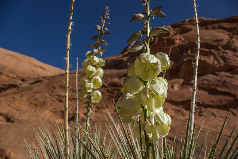
Yucca Bloom Macro 2 by slc_dan, on Flickr
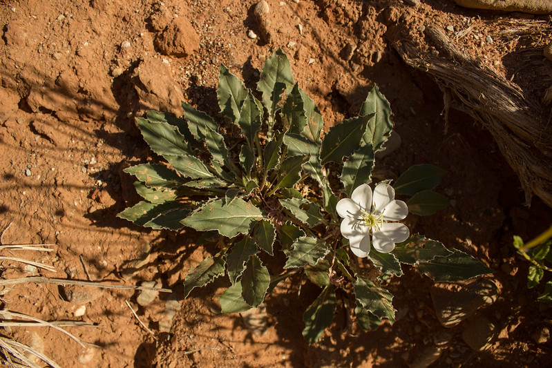
Primrose by slc_dan, on Flickr
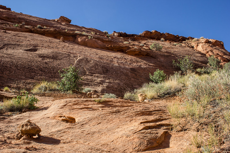
The trail begins wandering down an open, dry wash. After a mile or so I come the large drop of a dry wash. I remember to go right at this junction. “Fun little slot,” may be what Kelsey calls left of this junction, but from pictures I’ve seen it’s above my comfort level, solo, with a pack. Hell, it’s probably above my level with ropes and an experienced guide.
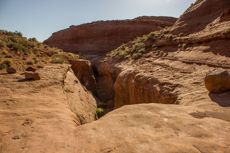
Sooner Gulch Dry Fall by slc_dan, on Flickr
This route leads around the bend, and down a cairned switchback descent. I’ve entered another gulch.
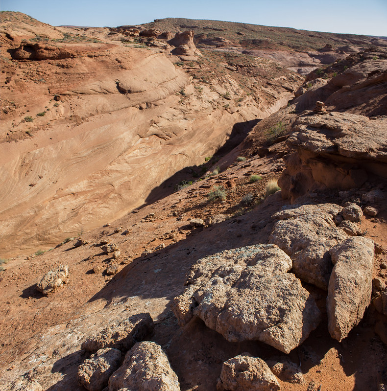
Sooner Descent by slc_dan, on Flickr
Sooner Descent, looking up by slc_dan, on Flickr
Cow Ruins by slc_dan, on Flickr
Just a few hundred yards and it starts entering water. I changed from my lowtop hikers, into a barefoot style shoes with no socks. I decided to try these as my new water shoes. The experiment was worth it, as it was all the benefits of something “amphibious” such as Keen sandals, while none of the small gravel and silt was able to enter the footbed.
Into the Gulch by slc_dan, on Flickr
Seep by slc_dan, on Flickr
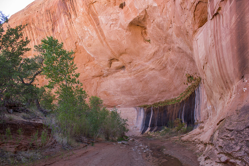
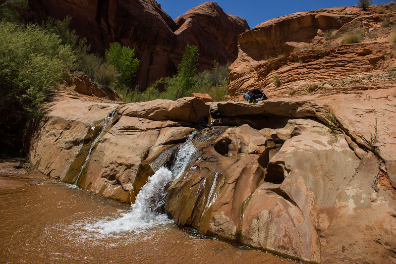
Shortly after the water has began, there is this incredible 5+ star waterfall and swimming hole. There is an bypass of the drop via an obvious muddy trail to the right (right again). Following this leads to the pool.
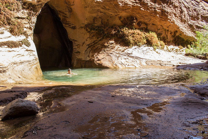
Waterfall Swim by slc_dan, on Flickr
Around the bend
40 mile seep by slc_dan, on Flickr
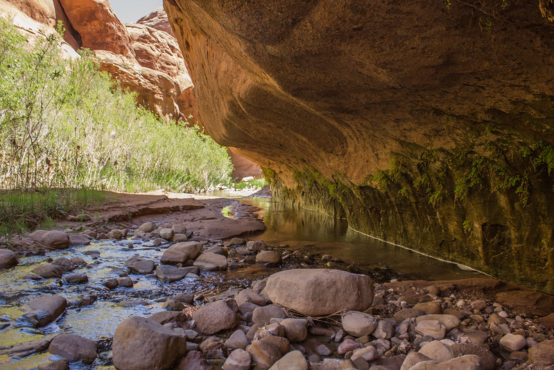
The Canyon from here, to the confluence of 40 mile and Willow is a playground. Slip-n-slides of sandstone, pools, and striped black and green seeps create a true oasis in the desert. Is it still legal to experience this beauty? To have this much fun squirming over boulders, and into water in a narrow slot such as this? I consider the few places like this that still exist. I need to do whatever possible to keep them as such. A few chockstones stop the water from flowing, and create a pool deep enough to warrant a pack shuttle.
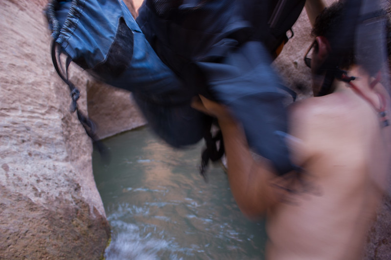
First Shuttle 1 by slc_dan, on Flickr
First Pack Shuttle 2 by slc_dan, on Flickr
First Pack Shuttle 3 by slc_dan, on Flickr
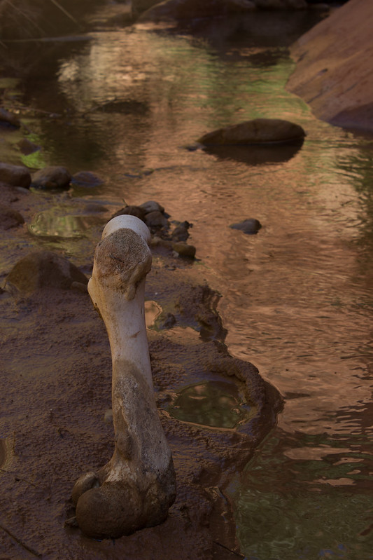
I blow past the entrance/exit of Willow Gulch. I stumbled upon a 4 star chill spot. The memory of a cow femur reminds me to filter the water.
Gulch Tricklefall by slc_dan, on Flickr
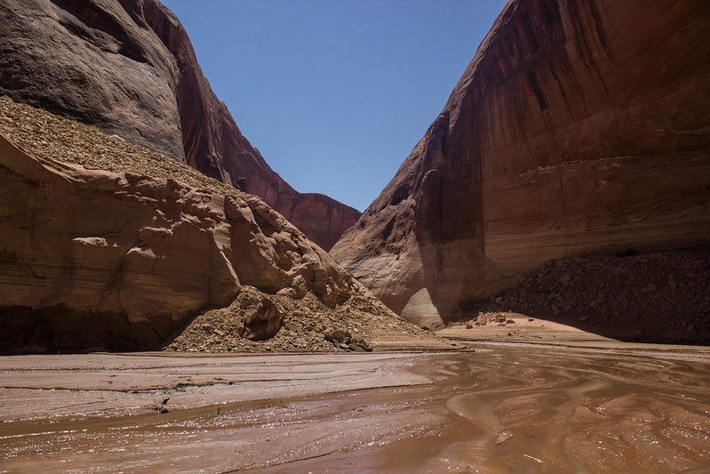
I duck down near the stream to avoid the over growth of tamarisk. The canyon past appears to have been trampled. I start seeing high water lines from Lake-should-have-been-named-after-anyone-other-than-Powell. Each new bend is filled with soda cans, and plastic bags. I gather the first few pieces, but it quickly becomes apparent that it will be too much for myself to carry. I sink in mud up to my waist several times. Short, laborious steps guide me safely to more stable ground. It makes for long travel. I pass another bend, and see a woman squatting up on a hill. I watch a fish jump. Embarrassed, the woman apologizes for flashing me. I brush it off and ask where she is coming from, “Bullfrog.” Marina? I wonder, “We’re just doing a little fishing.” she states. “How long you been walkin?” “Since about 7 this morning,” I answer. I don’t see the boat, but I hear it roar off as I sit and consult my topo map. I wasn’t quite sure I had even gone past the 40 mile/Willow confluence, so now that I’ve hit the lake I understand where I am. I walk up the 30 ft pile of rocks and garbage to snap a picture. I had considered walking this far, but the sinking would have been much easier without the pack.
Remnants of Foul by slc_dan, on Flickr
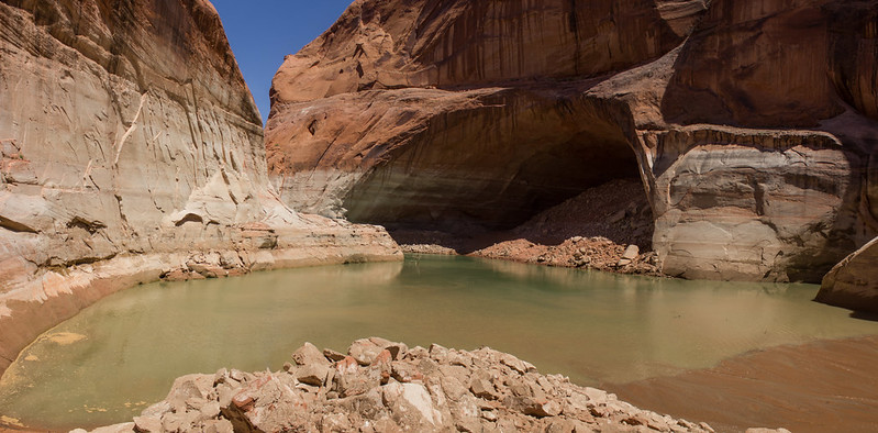
GSENM WIllow Gulch meets Lake Powell by slc_dan, on Flickr
I notice a side canyon that calls my name to the north as I trample past. It’s only a whisper towards a future trip, as I’ve had a full day already, and I’d like to get a bit further before sundown. Having seen this portion already, and wanting to skip more of the sinking, I walk briskly. I keep a better eye on the sink mud, and fair much better. I longingly pass the falls, and reach the confluence. It’s stupid how obvious the split was.
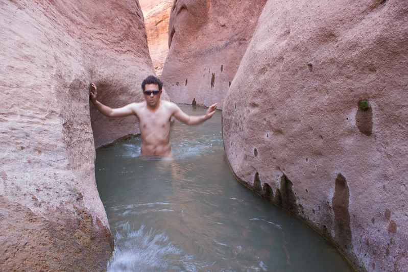
Shortly after the confluence there is another pack shuttle. This one much deeper, up to my shoulders. The mud is composed of fine silt, and I stumble. The wall holds me, and the pack I’m holding above my head from falling. I’m getting tired. I climb over the chockstone, attach my pack and continue. I’m determined to continue quickly. I concentrate on the ground in front of me and walk on. I come around a bend, and look up briefly. Broken bow arch, the giant looks down at me. I drop my pack and lay down on a rock. I realize I’m right on the trail. I don’t care. I’ll be packed up before anyone attempts the walk to Broken Bow. The stream to my side falls down at a short trickle. Besides the mooner at Lake Powell, I’ve seen no-one.
I blow up my air mattress and doze in and out. After sufficient rest I heat some water for tea, and rehydrate a meal. Louisiana beans and rice is great. Simple, spicy, and filling. The tea does nothing that the whiskey can’t counteract. The long warm day has worn on me. I throw some rocks on corners of the tent, pitch it, and throw everything inside. Although I would like to stay up and attempt some star shots with Broken bow, sleep takes over. I need to nap more during the day, stop being so ambitious with routes, run more during regular life, eat better, drink less, drink more caffeine. Anything to stay up later. Alas, I’m done.
Lazy Camp Shot by slc_dan, on Flickr
In the morning I walk up the slog to get a better view of the Broken Bow. Impressive. The patina has worn well, interesting lines exhibit character. I consider how short a period that us humans have played our silly game, in relation to the long, slow erosion that caused this feature. The 5,000 year old structures of Europe I’ve witnessed are single cell organisms in relation to this giant mammal.
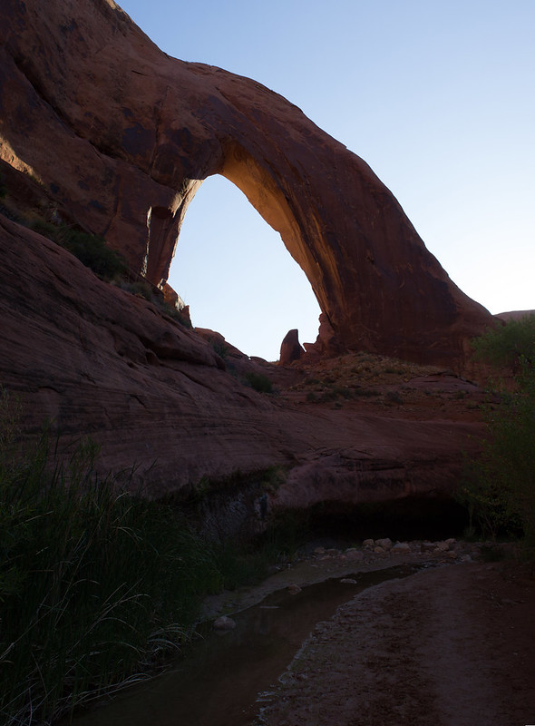
Broken Bow Verto by slc_dan, on Flickr
The exit passed another passable swimmer, a steep slog, and Mortar Board Rock. A suegra of mine received a PHD this weekend. I try and get a few shots for her in the sun blasted sky.
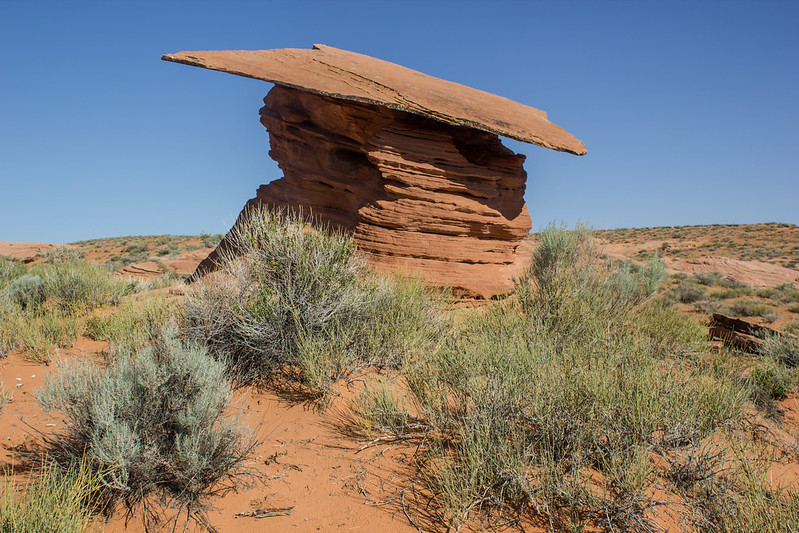
Morter Board by slc_dan, on Flickr
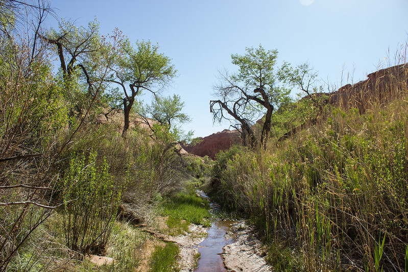
End-Beginning of Willow by slc_dan, on Flickr
There were no cars in the parking lot. I keep walking. The road makes for a quick jaunt. I see the prints of the man I met at the beginning of the hike moving back towards the Hole in the Rock Road. The prints continue on, and I realize he wasn’t able to hitch a ride back to his car either. I keep walking. Not a single car passes. I need to buy a mountain bike. I’m reunited with my car, and a well earned victory beer. I grab the remaining cheese curds out of the cooler. It’s still early, and I’ve got a drive ahead of me. When can I get out here again?
Featured image for home page:

