John Morrow
Member
- Joined
- May 22, 2015
- Messages
- 1,138
Down into the warm still air of the lower Colorado River Corridor, basing out of Katherine Landing in Lake Mead National Recreation Area. Katherine Landing is just a glorified trailer park, but offers some shade, free showers, and free wifi.
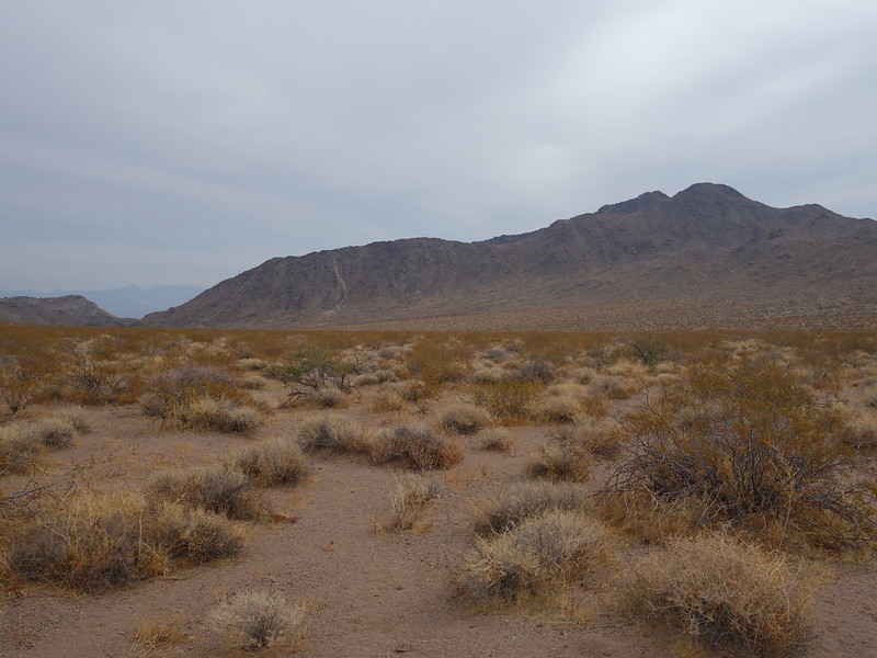
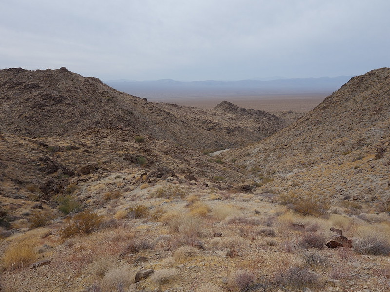
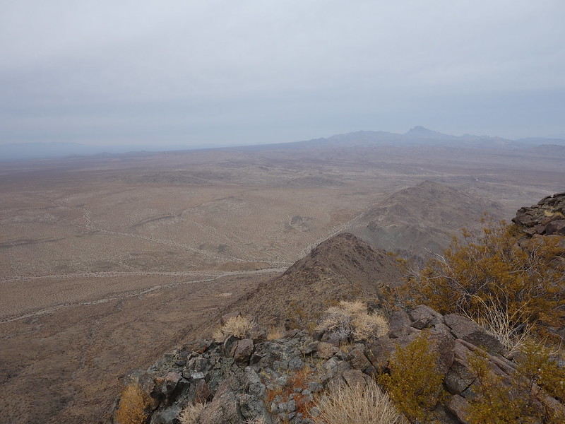
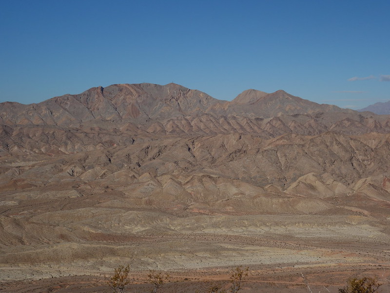
Dead Mountains Wilderness, NV
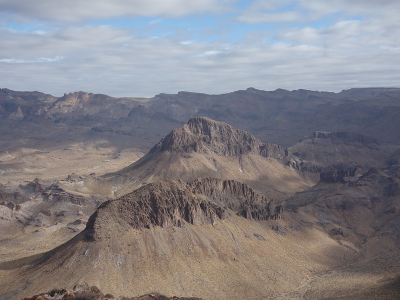
Black Mountains by Oatman, AZ and adjacent to Warm Springs Wilderness
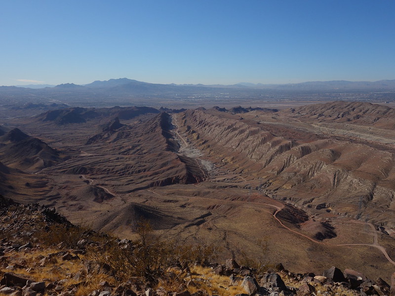
Cottonwood Cove area of Lake Mead National Recreation Area
Lave Butte, Lake Mead North Shore
December 11: a loop connecting a couple summits, a narrow canyon, and a broad canyon with notable petroglyphs.
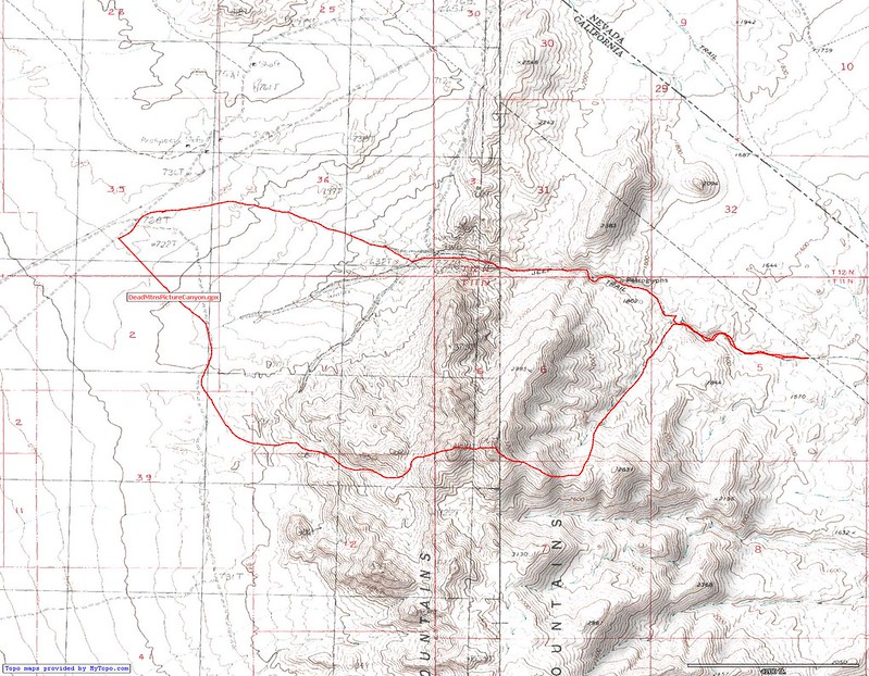
DeadMtnsPictureCanyon by John Morrow, on Flickr
Key notes: the powerline road off US93 is a bladed gravel road OK for standard clearance (hardest part is hwy berm).
I could have went further along the powerlines before parking
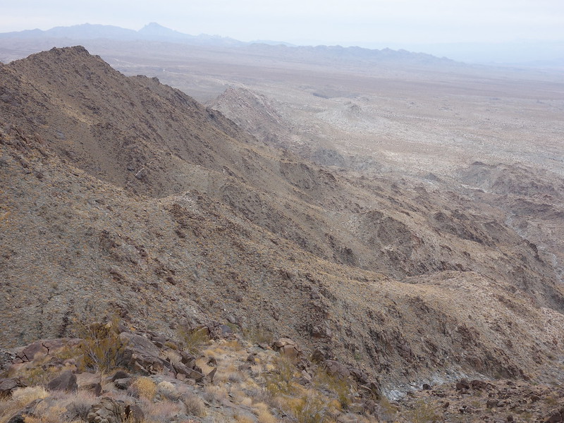
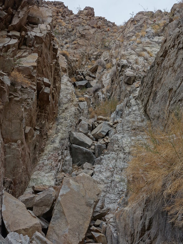
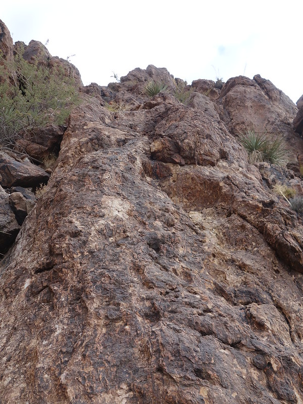
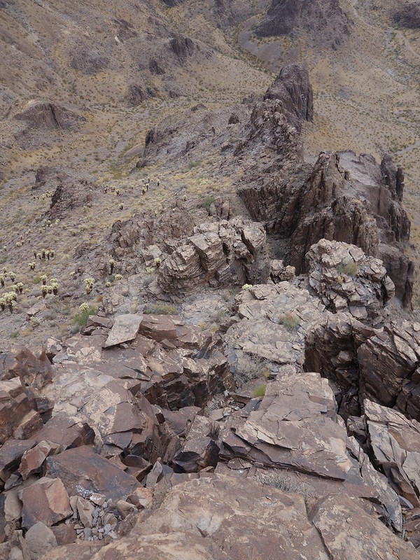
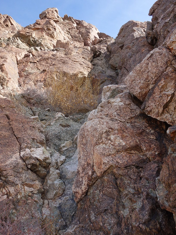
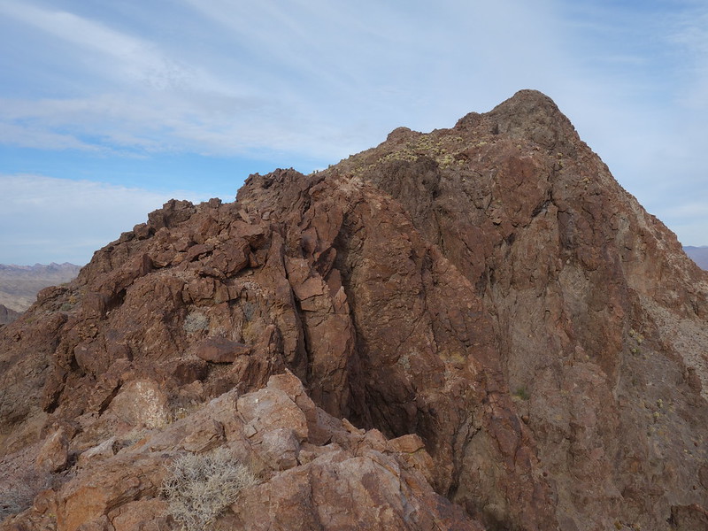
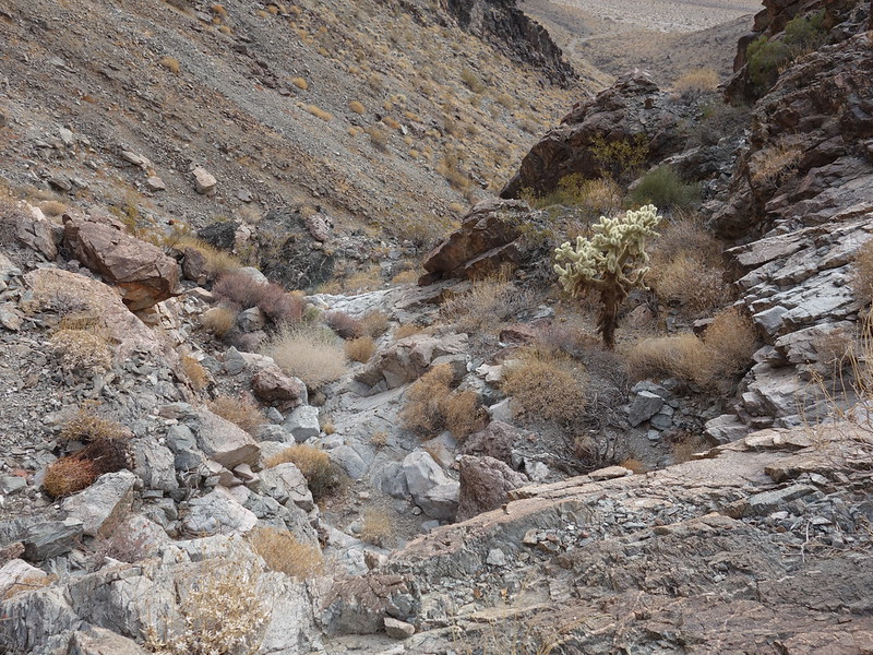
After crosscountry southward I entered a nice easy canyon leading to an easy indistinct west rib of the first summit: Peak 3448'. Class 2 scrambling over to Peak 3467'. Descending the east ridge of 3467' to a north trending rib with excellent scrambling led down to a nice waterpolished granitic canyon and on to Picture Canyon with no more than Class 2 downclimbs of scenic dryfalls.
gray day by John Morrow, on Flickr
up a side canyon by John Morrow, on Flickr
above Picture Canyon by John Morrow, on Flickr
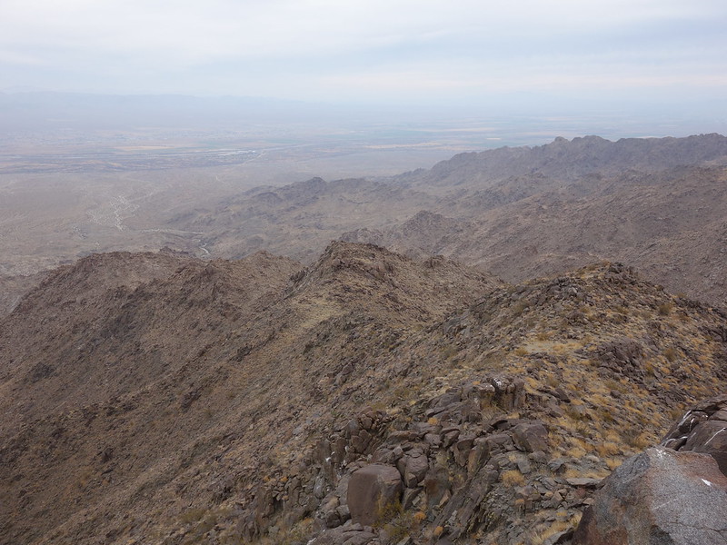
Descend thatta way by John Morrow, on Flickr
hmm, water polished canyon by John Morrow, on Flickr
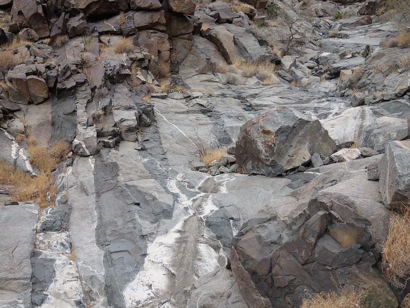
awesome wash bottom by John Morrow, on Flickr
power of water by John Morrow, on Flickr

wide dryfall by John Morrow, on Flickr
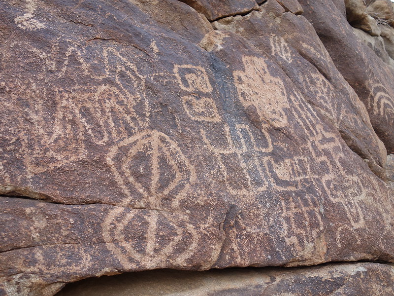
petroglyph sample 3 by John Morrow, on Flickr
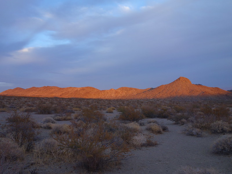
great sunset, heading out by John Morrow, on Flickr
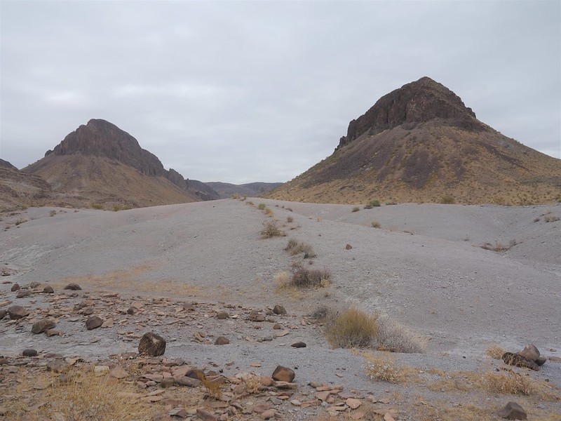
Dec. 12: Boundary Cone, Peak 3360' and Peak 2880' scrambles.
Down to Oatman AZ for a Courtney Purcell classic plus a couple more aesthetic looking mountains.
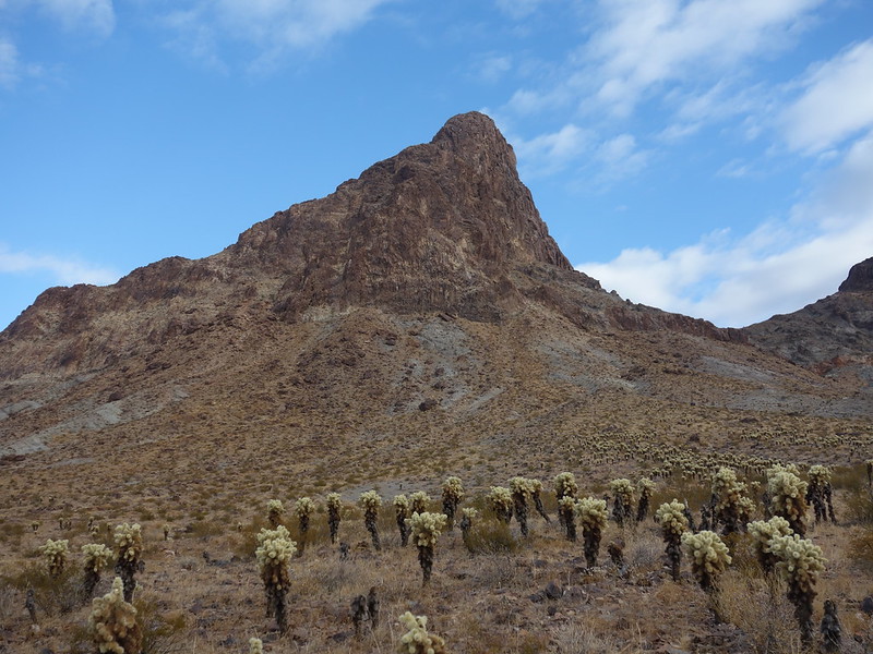
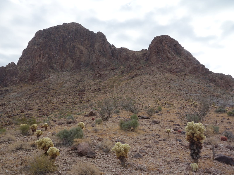
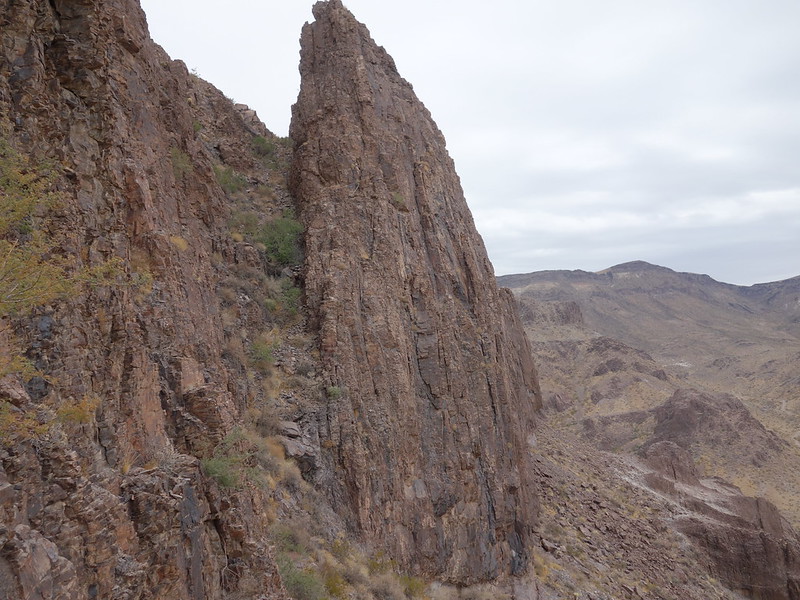
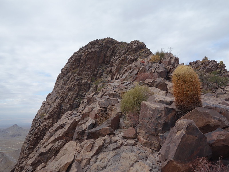
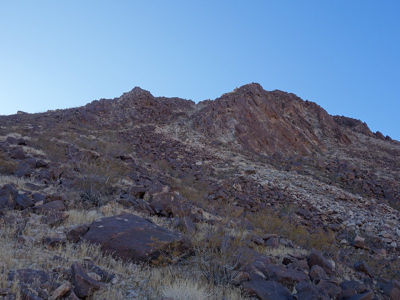
Notes: Boundary Cone is almost continuous Class 2 and 3 and really really fun. With no beta on Peak 3360' I liked the looks of a steep rock gully to gain the knife-edgy and really fun and scenic SE Ridge, Class 3 with maybe a touch of Cl 4. The east slope made a nice easy Class 2 descent. The least unpleasant route up Peak 2880 (surrounded by continuous talus) looked to be a loose and unmemorable W/NW Ridge.
BoundaryCone+2 by John Morrow, on Flickr
South side Boundary Cone by John Morrow, on Flickr
Up to the saddle by John Morrow, on Flickr
great scrambling by John Morrow, on Flickr
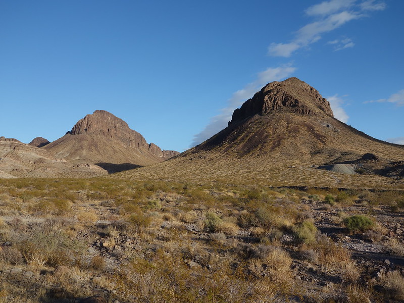
Peaks 3360 and 2880 next by John Morrow, on Flickr
3360 and 2880 by John Morrow, on Flickr
key gully to notch by John Morrow, on Flickr
SE Ridge just great by John Morrow, on Flickr
more of it by John Morrow, on Flickr
the easy east slope descent by John Morrow, on Flickr
3380 and route on skyline by John Morrow, on Flickr
hugged the left edge of slope by John Morrow, on Flickr
parting by John Morrow, on Flickr
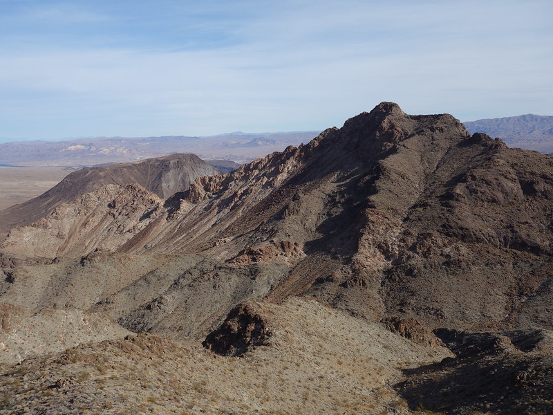
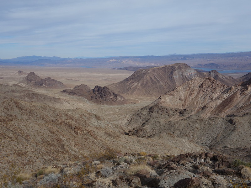
Dec. 13: Lake Mead NRA, Copper Mountains East and West.
These are well known local scrambles in the Cottonwood Cove area above Lake Mojave. They can be kept at Class 2 with visible route finding. I chose some more solid looking ribs to get more scrambling in.
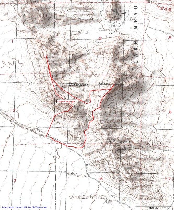
Coppers loop by John Morrow, on Flickr
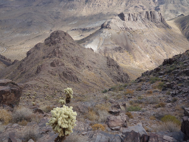
Notes: the SW Buttress I chose to gain the summit ridge of the west peak got very steep and exposed (Class 4), Thus, getting my heart pumping mostly because I always suspect holds to be loose. I varied the east peak by going over to a nice solid low angle western rib to the south ridge, visible in the pics. A Class 4 variation stays right on the very south ridge crest. It can be avoided on the west, and goes over an arch that is not visible until returning the west slope Class 2 route. From near the central saddle, descend (or ascend) the eastern of the two main gullies/washes. It has very nice solid waterpolished wash bottom.
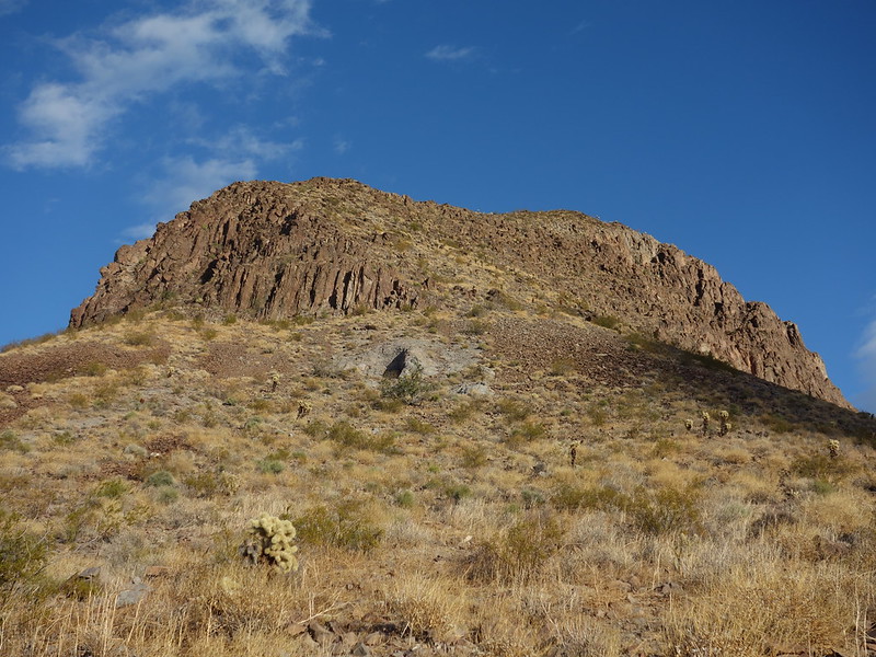
The prominent buttress by John Morrow, on Flickr
fun inside corner by John Morrow, on Flickr
profile of buttress descending right edge by John Morrow, on Flickr
The center right ridge by John Morrow, on Flickr
interesting topography by John Morrow, on Flickr
looking back at summit by John Morrow, on Flickr
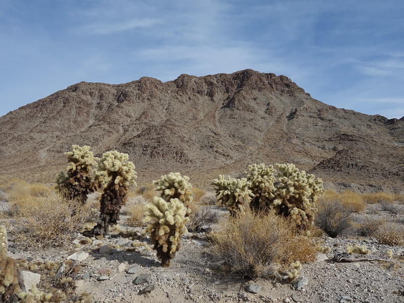
cholla garden by John Morrow, on Flickr
Great polished rock wash exit by John Morrow, on Flickr
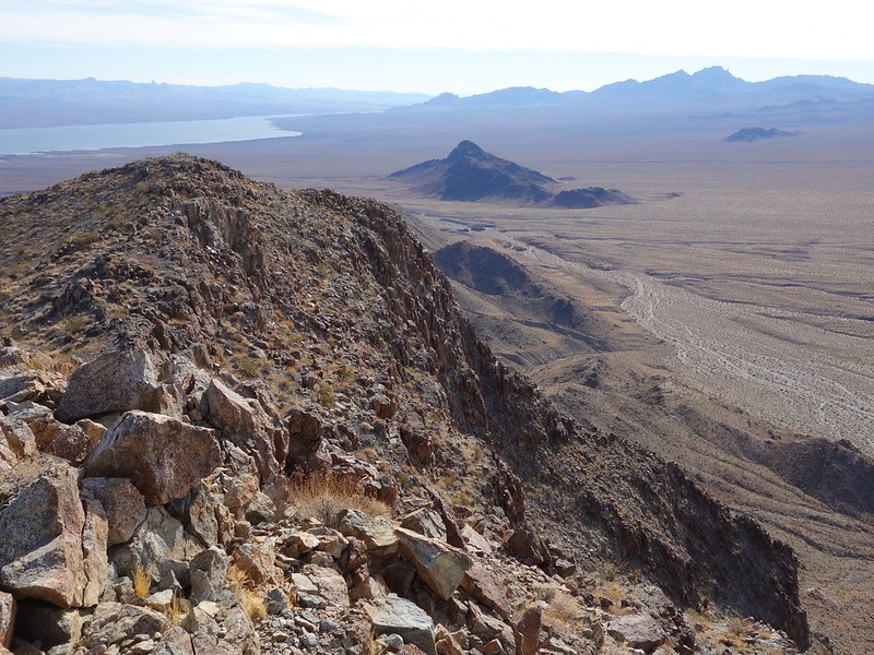
Dec. 14: Lake Mead NRA, the ubiquitous Lava Butte.
Lava Butte is a short pleasant trip up a cone shaped hill, distinctive and visible from many locales along the North Shore of Lake Mead. Any variety of routes up a north/northwest side from a high clearance powerline road off NV-147, Lake Mead Boulevard. I chose a fun and solid rib, a left one of two separated by a pale white gully. An example of one of my several short casual easy days.
Lava Butte NW Ridge (take rib left of gully) by John Morrow, on Flickr

it's a walk after this pitch by John Morrow, on Flickr
Frenchman by John Morrow, on Flickr
wrinkled earth by John Morrow, on Flickr
Dead Mountains Wilderness, NV
Black Mountains by Oatman, AZ and adjacent to Warm Springs Wilderness
Cottonwood Cove area of Lake Mead National Recreation Area
Lave Butte, Lake Mead North Shore
December 11: a loop connecting a couple summits, a narrow canyon, and a broad canyon with notable petroglyphs.
DeadMtnsPictureCanyon by John Morrow, on Flickr
Key notes: the powerline road off US93 is a bladed gravel road OK for standard clearance (hardest part is hwy berm).
I could have went further along the powerlines before parking
After crosscountry southward I entered a nice easy canyon leading to an easy indistinct west rib of the first summit: Peak 3448'. Class 2 scrambling over to Peak 3467'. Descending the east ridge of 3467' to a north trending rib with excellent scrambling led down to a nice waterpolished granitic canyon and on to Picture Canyon with no more than Class 2 downclimbs of scenic dryfalls.
gray day by John Morrow, on Flickr
up a side canyon by John Morrow, on Flickr
above Picture Canyon by John Morrow, on Flickr
Descend thatta way by John Morrow, on Flickr
hmm, water polished canyon by John Morrow, on Flickr
awesome wash bottom by John Morrow, on Flickr
power of water by John Morrow, on Flickr
wide dryfall by John Morrow, on Flickr
petroglyph sample 3 by John Morrow, on Flickr
great sunset, heading out by John Morrow, on Flickr
Dec. 12: Boundary Cone, Peak 3360' and Peak 2880' scrambles.
Down to Oatman AZ for a Courtney Purcell classic plus a couple more aesthetic looking mountains.
Notes: Boundary Cone is almost continuous Class 2 and 3 and really really fun. With no beta on Peak 3360' I liked the looks of a steep rock gully to gain the knife-edgy and really fun and scenic SE Ridge, Class 3 with maybe a touch of Cl 4. The east slope made a nice easy Class 2 descent. The least unpleasant route up Peak 2880 (surrounded by continuous talus) looked to be a loose and unmemorable W/NW Ridge.
BoundaryCone+2 by John Morrow, on Flickr
South side Boundary Cone by John Morrow, on Flickr
Up to the saddle by John Morrow, on Flickr
great scrambling by John Morrow, on Flickr
Peaks 3360 and 2880 next by John Morrow, on Flickr
3360 and 2880 by John Morrow, on Flickr
key gully to notch by John Morrow, on Flickr
SE Ridge just great by John Morrow, on Flickr
more of it by John Morrow, on Flickr
the easy east slope descent by John Morrow, on Flickr
3380 and route on skyline by John Morrow, on Flickr
hugged the left edge of slope by John Morrow, on Flickr
parting by John Morrow, on Flickr
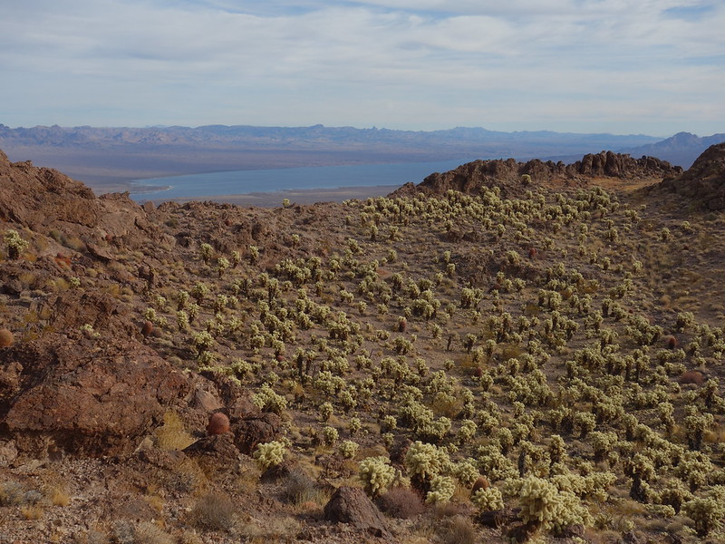
Dec. 13: Lake Mead NRA, Copper Mountains East and West.
These are well known local scrambles in the Cottonwood Cove area above Lake Mojave. They can be kept at Class 2 with visible route finding. I chose some more solid looking ribs to get more scrambling in.
Coppers loop by John Morrow, on Flickr
Notes: the SW Buttress I chose to gain the summit ridge of the west peak got very steep and exposed (Class 4), Thus, getting my heart pumping mostly because I always suspect holds to be loose. I varied the east peak by going over to a nice solid low angle western rib to the south ridge, visible in the pics. A Class 4 variation stays right on the very south ridge crest. It can be avoided on the west, and goes over an arch that is not visible until returning the west slope Class 2 route. From near the central saddle, descend (or ascend) the eastern of the two main gullies/washes. It has very nice solid waterpolished wash bottom.
The prominent buttress by John Morrow, on Flickr
fun inside corner by John Morrow, on Flickr
profile of buttress descending right edge by John Morrow, on Flickr
The center right ridge by John Morrow, on Flickr
interesting topography by John Morrow, on Flickr
looking back at summit by John Morrow, on Flickr
cholla garden by John Morrow, on Flickr
Great polished rock wash exit by John Morrow, on Flickr
Dec. 14: Lake Mead NRA, the ubiquitous Lava Butte.
Lava Butte is a short pleasant trip up a cone shaped hill, distinctive and visible from many locales along the North Shore of Lake Mead. Any variety of routes up a north/northwest side from a high clearance powerline road off NV-147, Lake Mead Boulevard. I chose a fun and solid rib, a left one of two separated by a pale white gully. An example of one of my several short casual easy days.
Lava Butte NW Ridge (take rib left of gully) by John Morrow, on Flickr
it's a walk after this pitch by John Morrow, on Flickr
Frenchman by John Morrow, on Flickr
wrinkled earth by John Morrow, on Flickr