gloo
{insert witty remark here}
- Joined
- Jan 22, 2012
- Messages
- 151
This is one of those trips in retrospect you look back and go what an awesome disaster.. And wonder how you could be such an idiot sometimes. That said, here goes..
Last wed I was invited to do some canyoneering with a friend who I don't know super well. I ended up knowing 2 guys prior to the trip and met one for like 30 seconds at momentum the day before. Probably because I was experienced, more than anyone else going. I was told there would be 4 of us and everyone had done canyons before. When he asked me for suggestions on canyons I mentioned the squeeze since it is the one in the swell (where he wanted to go) that I wanted to do more than any other. After the group swelled to 7 though, I decided that I needed to convince us to do quandary (bypass) since it was a bit shorter and easier. Taking 7 peeps through a 4BIV canyon would not be fun..
We were supposed to meet mid evening, but some of the guys are apparently notorious for being late (warning sign 1) and we weren’t on the road till around 10pm Friday night. Then we hit super nasty traffic in happy valley which delayed us big time. The original plan was to camp at tomsich butte since it has the best camping in the area. Should have changed that to near the TR though. The road to Tomsich butte was absolutely terrible. It took us hours to get down it, I'd never seen this road that bad. Should have gone the mckay flat route but oh well. We got to the butte just before 5am and crashed. Woke up around 9 and broke camp super quick. We were on the trail by 10am. This is another bad sign since I figured it would be 10-12 hours.
We met some guys who did quandary bypass the day before and they said they had 1 swimmer and it wasn't bad. They and a group of 10 did the (direct .. 4BIII route instead of 3biii) canyon yesterday w/out wetsuits So we decided to leave our wetsuits at the car to save some weight.
As we hiked up I learned that there were 2 that had never hit a canyon before so I taught them some basic stuff..locking off, basic knots, etc at the first 12 foot rap. The canyon was absolutely beautiful and it was a great day to be hitting a canyon. Because we were having so much fun though, we totally missed the bypass section. As We were past the first keeper when I realized it. We decided to press on instead of going back. I pushed us hard to get through it quickly, there were a few really gook keepers and I had to do a bunch of lowering for the rest of the guys which led me to do some sketchy downclimbs. At the very last keeper there was about a 30 foot drop into the last pool before I noticed the canyon start to open up. It was steep so I lowered all the guys with my left and and holding on with my right to the edge on the other side. It worked but it was pretty sketchy. I sent them ¼ mile down to the last bit of sun to warm up and I rapped down off a bat hook. We actually made pretty good time till this point. While we all were cold it was only when standing still and wasn't too bad for the most part. We warmed up in the sun and since I figured we'd be ending the canyon soon, I opened my pack to grab my gps and the map...
I had casually tossed one of my nalgene bottles in my dry bag... it leaked. It soaked my down jacket, my wool long tee, ruined the map and since my gps had a crack in the screen rendered that useless. Luckily my camera (which I had lens problems with apparently so pics are basically non existent ...lens contact dirty) was in a second dry bag with my food and my canyon long tee which was completely dry. I had also passed the printed beta off to another guy so that luckily stayed dry. If only I had been able to keep the top map dry,those two together would have made worlds of difference.
We had a few obstacle and some route finding to the bottom of quandary. At that point we were left with just the printed beta giving us appx distance and my watch. I knew roughly how fast I walked so I set a fast pace and figured about 30-35 minutes to our next major landpoint which was about 1.5 miles away. We got there right at 30 minutes. Solid, on track. I was pushing hard to get to ramp canyon – the exit back to the car – before dark. I didn't think we'd be able to find it once we lost light. And we were losing it fast. Our next point was ½ mile down canyon so I figured 10 minutes and we are there. Right at 10 minutes we hit a canyon entering the wash with footprints entering the canyon but not exiting. Solid, still on track. We hiked up it a ways and then we started to have some major group think/ confirmation bias and totally disregarding the beta. Up this canyon was a .. ramp. It literally looked like a boat ramp with a little climbing. Awesome there's our 5.6, but we failed to realize there was no chokestone and it was way more than 20 feet. We hiked this for a while and it got to the point where we realized, this can't be it. It's way to steep and I knew ramp was a slotty and this wasn't. It was just a steep wash.
Unfortunately by this time it was well dark. We had been told there was some wading in ramp and pair that with not knowing where the canyon was anymore and our clothes being wet we went over our options. We could press on and look for it. We could camp the night. We could hike the other way and go up muddy creek which I knew decently well but would be hella long. We finally decided the smart thing to do is just hunker down for the night provided we could find ample firewood.
We found a nice alcove and surprisingly a great abundance of dead wood to make fire with. Unfortunately most of the other guys dry bags had leaked so they were soaked. We used the fire to dry stuff out. Since I had a dry long tee I waited for everyone else and I gave my emergency blanket off to the others to use. The fire was hot, our spot selection was great. I camped on the outside since I finally got my wool and down jacket dry (enough to use). I stuck my feet in my bag, used my trash compactor bag for a blanket on my lets and slept very well.
Next morning I learned one of the guys had a phone with him. So we pulled out his compass and tracking. We hiked back to the major point ½ mile back and measured distance and the canyon we hit was right at ½ mile so my timing was right but then also noticed that this canyon didn't look that major and did a major facepalm. We hiked on for another ½ mile and found our canyon finally. The gps coordinates on the compass lined up with the beta and the canyon looked much more like what I expected. I managed to stay completely dry on the exit hike, but only one other was able to say the same. There was basically one spot where you were getting wet unless you were either stupid enough to do something..stupid or really good at maneuvering around it. Ramp was beautiful and the crux.. a a5.6 scramble proved to take way too much time. I climbed up it with no problem but the others didn't seem to want to handle it even though all these guys were strong climbers, some..at least half..are better than me. I ended up setting an anchor and hauling them up. The one basically unavoidable wet spot was after this (I think). Although this canyon does say its a non tech day hike, if I were ever to do it on its own, I'd take a rope with me for a few spots. we took mkcay flat out instead, and that road was nearly perfect. Made it home late sunday and crashed.
The whole trip, despite all the craziness was super fun and as far as the canyon goes we made great time through it all things considered. everyone there was comfortable on rope (climbers), smart, willing to listen, and all contributed when it came to our stay overnight. And everyone was positive and fun. We laughed about our situation and that's what made our trip worth it. In all, I had a blast and I have another canyon to check off.
not many pics to show off since my 15mm fisheye went bonkers and that's the only lens I took in the canyon, but here are some:
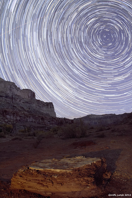
Startrails by Gareth Loosle, on Flickr
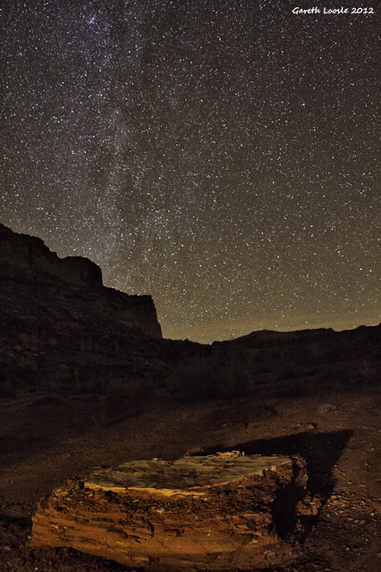
_MG_0272 by
Gareth Loosle, on Flickr

Last wed I was invited to do some canyoneering with a friend who I don't know super well. I ended up knowing 2 guys prior to the trip and met one for like 30 seconds at momentum the day before. Probably because I was experienced, more than anyone else going. I was told there would be 4 of us and everyone had done canyons before. When he asked me for suggestions on canyons I mentioned the squeeze since it is the one in the swell (where he wanted to go) that I wanted to do more than any other. After the group swelled to 7 though, I decided that I needed to convince us to do quandary (bypass) since it was a bit shorter and easier. Taking 7 peeps through a 4BIV canyon would not be fun..
We were supposed to meet mid evening, but some of the guys are apparently notorious for being late (warning sign 1) and we weren’t on the road till around 10pm Friday night. Then we hit super nasty traffic in happy valley which delayed us big time. The original plan was to camp at tomsich butte since it has the best camping in the area. Should have changed that to near the TR though. The road to Tomsich butte was absolutely terrible. It took us hours to get down it, I'd never seen this road that bad. Should have gone the mckay flat route but oh well. We got to the butte just before 5am and crashed. Woke up around 9 and broke camp super quick. We were on the trail by 10am. This is another bad sign since I figured it would be 10-12 hours.
We met some guys who did quandary bypass the day before and they said they had 1 swimmer and it wasn't bad. They and a group of 10 did the (direct .. 4BIII route instead of 3biii) canyon yesterday w/out wetsuits So we decided to leave our wetsuits at the car to save some weight.
As we hiked up I learned that there were 2 that had never hit a canyon before so I taught them some basic stuff..locking off, basic knots, etc at the first 12 foot rap. The canyon was absolutely beautiful and it was a great day to be hitting a canyon. Because we were having so much fun though, we totally missed the bypass section. As We were past the first keeper when I realized it. We decided to press on instead of going back. I pushed us hard to get through it quickly, there were a few really gook keepers and I had to do a bunch of lowering for the rest of the guys which led me to do some sketchy downclimbs. At the very last keeper there was about a 30 foot drop into the last pool before I noticed the canyon start to open up. It was steep so I lowered all the guys with my left and and holding on with my right to the edge on the other side. It worked but it was pretty sketchy. I sent them ¼ mile down to the last bit of sun to warm up and I rapped down off a bat hook. We actually made pretty good time till this point. While we all were cold it was only when standing still and wasn't too bad for the most part. We warmed up in the sun and since I figured we'd be ending the canyon soon, I opened my pack to grab my gps and the map...
I had casually tossed one of my nalgene bottles in my dry bag... it leaked. It soaked my down jacket, my wool long tee, ruined the map and since my gps had a crack in the screen rendered that useless. Luckily my camera (which I had lens problems with apparently so pics are basically non existent ...lens contact dirty) was in a second dry bag with my food and my canyon long tee which was completely dry. I had also passed the printed beta off to another guy so that luckily stayed dry. If only I had been able to keep the top map dry,those two together would have made worlds of difference.
We had a few obstacle and some route finding to the bottom of quandary. At that point we were left with just the printed beta giving us appx distance and my watch. I knew roughly how fast I walked so I set a fast pace and figured about 30-35 minutes to our next major landpoint which was about 1.5 miles away. We got there right at 30 minutes. Solid, on track. I was pushing hard to get to ramp canyon – the exit back to the car – before dark. I didn't think we'd be able to find it once we lost light. And we were losing it fast. Our next point was ½ mile down canyon so I figured 10 minutes and we are there. Right at 10 minutes we hit a canyon entering the wash with footprints entering the canyon but not exiting. Solid, still on track. We hiked up it a ways and then we started to have some major group think/ confirmation bias and totally disregarding the beta. Up this canyon was a .. ramp. It literally looked like a boat ramp with a little climbing. Awesome there's our 5.6, but we failed to realize there was no chokestone and it was way more than 20 feet. We hiked this for a while and it got to the point where we realized, this can't be it. It's way to steep and I knew ramp was a slotty and this wasn't. It was just a steep wash.
Unfortunately by this time it was well dark. We had been told there was some wading in ramp and pair that with not knowing where the canyon was anymore and our clothes being wet we went over our options. We could press on and look for it. We could camp the night. We could hike the other way and go up muddy creek which I knew decently well but would be hella long. We finally decided the smart thing to do is just hunker down for the night provided we could find ample firewood.
We found a nice alcove and surprisingly a great abundance of dead wood to make fire with. Unfortunately most of the other guys dry bags had leaked so they were soaked. We used the fire to dry stuff out. Since I had a dry long tee I waited for everyone else and I gave my emergency blanket off to the others to use. The fire was hot, our spot selection was great. I camped on the outside since I finally got my wool and down jacket dry (enough to use). I stuck my feet in my bag, used my trash compactor bag for a blanket on my lets and slept very well.
Next morning I learned one of the guys had a phone with him. So we pulled out his compass and tracking. We hiked back to the major point ½ mile back and measured distance and the canyon we hit was right at ½ mile so my timing was right but then also noticed that this canyon didn't look that major and did a major facepalm. We hiked on for another ½ mile and found our canyon finally. The gps coordinates on the compass lined up with the beta and the canyon looked much more like what I expected. I managed to stay completely dry on the exit hike, but only one other was able to say the same. There was basically one spot where you were getting wet unless you were either stupid enough to do something..stupid or really good at maneuvering around it. Ramp was beautiful and the crux.. a a5.6 scramble proved to take way too much time. I climbed up it with no problem but the others didn't seem to want to handle it even though all these guys were strong climbers, some..at least half..are better than me. I ended up setting an anchor and hauling them up. The one basically unavoidable wet spot was after this (I think). Although this canyon does say its a non tech day hike, if I were ever to do it on its own, I'd take a rope with me for a few spots. we took mkcay flat out instead, and that road was nearly perfect. Made it home late sunday and crashed.
The whole trip, despite all the craziness was super fun and as far as the canyon goes we made great time through it all things considered. everyone there was comfortable on rope (climbers), smart, willing to listen, and all contributed when it came to our stay overnight. And everyone was positive and fun. We laughed about our situation and that's what made our trip worth it. In all, I had a blast and I have another canyon to check off.
not many pics to show off since my 15mm fisheye went bonkers and that's the only lens I took in the canyon, but here are some:
Startrails by Gareth Loosle, on Flickr
_MG_0272 by
Gareth Loosle, on Flickr