JackBurns
Member
- Joined
- May 14, 2013
- Messages
- 132
My oldest son is studying Geology at Weber right now.
So two weeks ago on his spring break we did a little Geology tour near Delta.
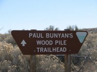
First stop Paul Bunyan's wood pile. No sign on highway 6 for the turn off. I read on another web site that it was between mile marker 125 and 126. Dirt road on the east side of the road. This sign is a couple hundred yards down that dirt road. Lots of cows around and lots of cow pies on the road.
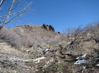
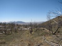 The trail goes up this little gully.
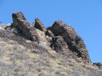
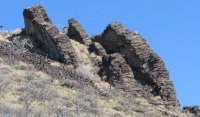
It looks like big stacks of cord wood. But as I understand it's lava that was extruded through fissures.
A fire had come through recently. Most of the trees are dead. This time of year it was pretty bleak.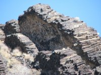 We hiked to the bottom of the hill but did not hike up to the formation. The plan was to camp by Notch Peak so we had to get going.
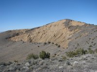 Next stop was Pahvant Butte. http://en.wikipedia.org/wiki/Pahvant_Butte
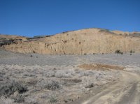
"Pahvant Butte or Pavant Butte is a butte formed by a dormant volcano" "It formed in an active area of volcanism on top of pahoehoe and aa lavas. Originally a subaqueous volcano, it erupted out of the floor of glacial Lake Bonnevilleapproximately 15,500 years ago."
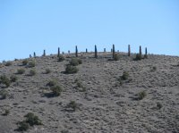
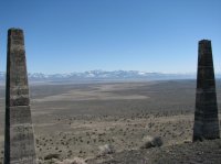
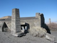
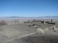
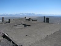
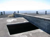
Really a weirdly beautiful place. In the 1920's a guy built a power generator on the southern peak. You can see some of it in the above picture.
Not a lot of info on it. The best way up is on the East side. I climbed the west side in the jeep and it got a little hairy.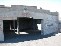
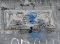
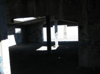
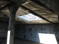
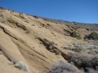
 The tan rock seems to be solidified ash. Pieces of the stuff are much lighter than you would expect.
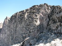
Around on the North side is a feature that they call the "lace curtain"
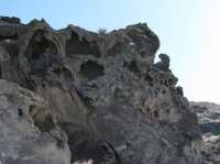
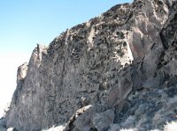
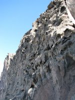
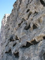
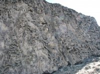
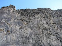
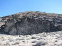
I believe that it is the same stuff just weathered different.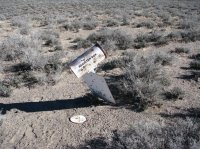
From the Butte we drove across the Clear Lake Waterfowl Management area to highway 257.
When you are in the middle of the Clear lake you would swear that you were driving the dikes on the great salt lake by Farmington. No pictures.
Next we stopped at Sunstone knoll. http://geology.utah.gov/popular/pla...r-sunstones-at-sunstone-knoll-millard-county/
Of note there is no registration book in the mailbox.
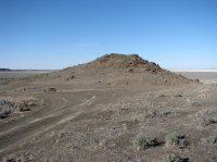
Then a mad dash to Notch Peak before dark.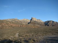
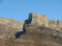
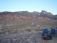 We found a flat spot with an amazing view in all directions.
Steaks on the grill, ranch beans, mashed potatoes, and canned peaches for dessert.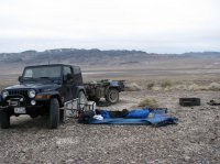
Great stars at night.
Wind picked up and some clouds moved in.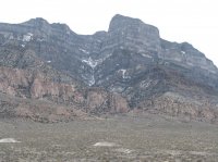
Drove north up Tule Valley. Very desolate.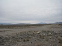
East through Moriah canyon.
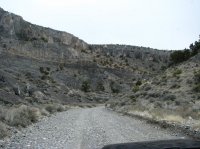
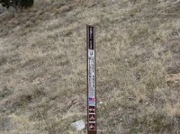
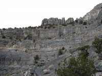
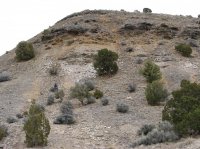 Here we stopped in an outcropping of Wilson shale and collected some very nice trilobites.
The plan was to drive up to Topaz mountain and spend the night. Then hit the Geo beds by Dougway before heading home.
The weather did not cooperate. Cold wind we could deal with that. It was the Rain that started coming in. Judging by the ruts in the road we were in a place that would not be good if it got wet. So we stopped and cooked some dinner and drove home.
One of these days we will finish the loop.
Good trip. So much out there. So much space it's crazy.
Jack
Featured image for home page:
So two weeks ago on his spring break we did a little Geology tour near Delta.

First stop Paul Bunyan's wood pile. No sign on highway 6 for the turn off. I read on another web site that it was between mile marker 125 and 126. Dirt road on the east side of the road. This sign is a couple hundred yards down that dirt road. Lots of cows around and lots of cow pies on the road.

 The trail goes up this little gully.
It looks like big stacks of cord wood. But as I understand it's lava that was extruded through fissures.
A fire had come through recently. Most of the trees are dead. This time of year it was pretty bleak.
 We hiked to the bottom of the hill but did not hike up to the formation. The plan was to camp by Notch Peak so we had to get going.
 Next stop was Pahvant Butte. http://en.wikipedia.org/wiki/Pahvant_Butte

"Pahvant Butte or Pavant Butte is a butte formed by a dormant volcano" "It formed in an active area of volcanism on top of pahoehoe and aa lavas. Originally a subaqueous volcano, it erupted out of the floor of glacial Lake Bonnevilleapproximately 15,500 years ago."
Really a weirdly beautiful place. In the 1920's a guy built a power generator on the southern peak. You can see some of it in the above picture.
Not a lot of info on it. The best way up is on the East side. I climbed the west side in the jeep and it got a little hairy.


 The tan rock seems to be solidified ash. Pieces of the stuff are much lighter than you would expect.

Around on the North side is a feature that they call the "lace curtain"


I believe that it is the same stuff just weathered different.

From the Butte we drove across the Clear Lake Waterfowl Management area to highway 257.
When you are in the middle of the Clear lake you would swear that you were driving the dikes on the great salt lake by Farmington. No pictures.
Next we stopped at Sunstone knoll. http://geology.utah.gov/popular/pla...r-sunstones-at-sunstone-knoll-millard-county/
Of note there is no registration book in the mailbox.

Then a mad dash to Notch Peak before dark.


 We found a flat spot with an amazing view in all directions.
Steaks on the grill, ranch beans, mashed potatoes, and canned peaches for dessert.

Great stars at night.
Wind picked up and some clouds moved in.

Drove north up Tule Valley. Very desolate.

East through Moriah canyon.


 Here we stopped in an outcropping of Wilson shale and collected some very nice trilobites.
The plan was to drive up to Topaz mountain and spend the night. Then hit the Geo beds by Dougway before heading home.
The weather did not cooperate. Cold wind we could deal with that. It was the Rain that started coming in. Judging by the ruts in the road we were in a place that would not be good if it got wet. So we stopped and cooked some dinner and drove home.
One of these days we will finish the loop.
Good trip. So much out there. So much space it's crazy.
Jack
Featured image for home page:

