Miya
Because I am able.
- Joined
- Dec 31, 2017
- Messages
- 1,404
Days: 48 - 68
Miles: 565.4 - 789.1 (+ Mt. Whitney and Kearsarge/Onion Valley side trail)
Zero Days: 4
Heads up, this TR is going to be wordy.
About 25 miles after leaving Tehachapi, I was stepping over a littering of small downed twigs and branches. I heard a loud pop and felt it reverberate through my foot and up my right shin. I wouldn't bother to go to the doctor, so not sure what happened. I have torn a lot of tendons in both of my feet before, so the popping sound was very familiar. However, the pain that would follow and my inability to bend my knee or angle my foot without crying, was new. Wouldn't it have been smarter to go 25 miles back, instead of 60 miles forward? Yes, probably. But I hate repeating miles, I wouldn't go to a doctor anyways, and my determination to not let anything keep me from completing the trail was borderline madness.
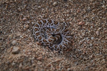
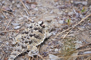
Baby rattler.
Luckily, the next day, the trail was pretty flat. Any sort of incline on trail had me panting and crying. My Tramily and I had planned 20-25 miles every day and for some reason they were patient and didn't ditch me when I could only manage 16 miles the day after I hurt myself. By the end of the day my shin felt like it was going to shatter. Trying to get comfortable in the tent and sleep through the pain was impossible, so I spent my nights just waiting for the dawn and hoping to get closer to town.
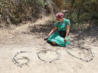
Mile 600.

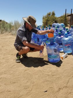
One of the reasons I had hoped for bigger miles was because it was getting hotter and this section was DRY. We were dependent on several water caches. Thank you trail angels! Even though I always showed up to the caches with water, it would have been much more uncomfortable without the caches.
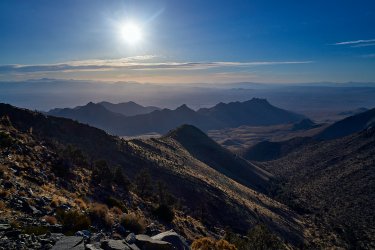
Each day my leg hurt a little less, enough to allow me a couple hours of sleep. I could usually manage my first 15 miles of the day without any tears, but something about this injury did not like doing more than that. The rest of my mileage would bring about a tear for every few steps. I certainly didn't need to be wasting the water and salt!
The heat, the pain, and the lack of sleep saw me slipping into memories of tragedies and regret. My journey on trail, like so many, was one of necessity built off of trauma. Facing these demons, was fine, heck, it was desired. I would be damned if this silly physical pain ended what I set out to do. I simultaneously felt worried this injury would end my trip, while KNOWING that I would not let it. And so I just walked, a bundle of contradicting emotions, fear and confidence.
I hobbled into our last campground, only 0.8 miles from the road we would take to hitch into town the next morning. I skipped out on another trail magic tent and avoided a throng of other hikers. I was able to nod off being comforted by the fact that I had made it to town.
My dad came to visit me in Kernville and he brought my bear canister and ice axe.
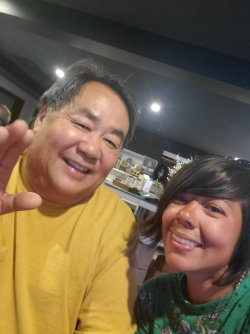
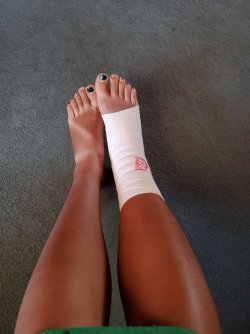
The last thing I wanted was to take another zero in town, especially when I was so close to the end of the desert. My leg wanted rest though, and my Tramily was more than happy to take another break too. Since I don't take over the counter or prescription drugs, I just bought some wrap and tried to keep my ankle and foot iced at all times. It had been fat and swollen the entire stretch, but one night with ice and the swelling went down dramatically.
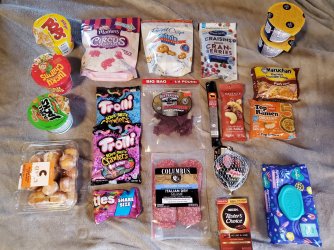
Next resupply was only 50 miles away, I packed more than I would need just in case my leg kept my mileage low.
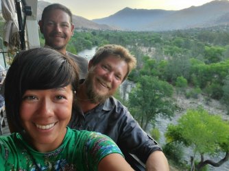
We ate out at a fancy restaurant with an amazing view. I am a foodie.
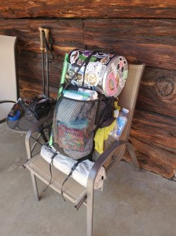
Pack is ready for the Sierra Nevada.
It was getting easier to put on my sock and shoe! I still hobbled like a pirate with a peg leg, but the only real pain was when I walked downhill. Woohoo, I was getting better!...
I had stopped wearing my left knee brace for quite awhile by now. I figured my knee was stronger and I carried it because I had every intention of wearing it in the Sierras, JUST IN CASE. However, the steep switchbacks I encountered on Day 56 busted my knee. I tried putting the brace on after a few switchbacks, but it was too late. I couldn't bend my knee. Now both my legs were injured and I was walking like a pirate with 2 peg legs.
I cried AGAIN! I cried and hiked and felt such fury. I was enraged. "Wasn't I stronger yet?! Why aren't I hiking as fast as the other hikers? I am embarrassing myself!" I spent the day feeling sorry for myself, but I kept walking. I had a couple trail mantras, and literally one of them was "Just keep walking, Miya". It always helped.
I slept with both legs elevated and managed to rest. Lucky for me, it rained the next day, and that is always a huge morale booster!
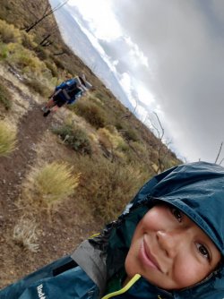
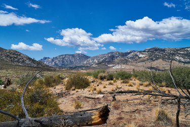
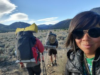
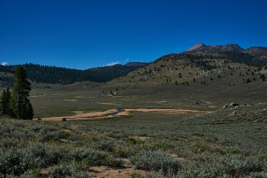
Views were changing.
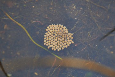
Found this guy in the water. Think it is Abedus indentatus. A male carrying the eggs on its back.
Mile 700 was a huge goal for me. I always felt that if anything would keep me from the Northern Terminus, it would be the desert. It would be the thing I despise so much, the sun. I knew if I could make it through the desert, then nothing would stop me and I WOULD make it to the end. (Funny, I hadn't even been close to experiencing exposure and heat like I would in Northern California). I won't get too sentimental and we don't need to argue over the validity of having spiritual moments on trail, but I feel very strongly that I had one. As I approached mile 700, it started to rain, and when I took the last few steps to those silly rocks, the sky opened up and poured. I dropped to the floor, awkwardly with my injuries, and cried once more. Rain has always been something extremely special to me. If I am in rain, I feel free and I feel safe.
I put on my rain gear, got some photos, and as soon as I walked away, the rain stopped. The sun peaked out, and I choose to believe my grandpa witnessed my accomplishment.
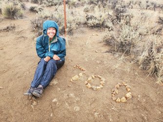
No one was there to clap for me at Kennedy Meadows South, thank goodness.
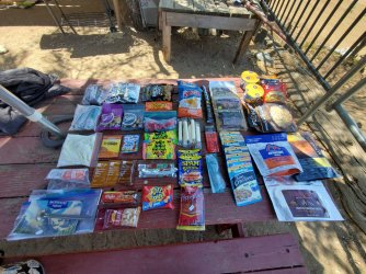
6 Day planned resupply, and I always carry an extra day or two worth of food just in case.
Here we go, into The Sierra Nevada! I knew it was going to be a low snow year, so I was pretty bummed about that. I was hopeful that snow would show up for me though, just like all the rain I got in the desert.
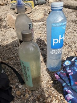
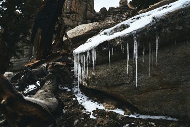
Oops, water freezes up here.
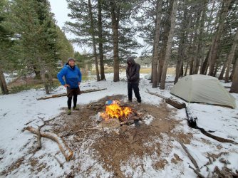
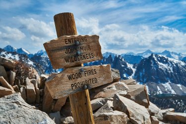
The fire attracted other PCT hikers who came to dry off their spirits and their gear. We did get an upset hiker, saying that fires are unsafe, even though we were under 10,000 feet and there were not any fire restrictions at the time, and we used an existing fire ring.
Peek a boo from my tent.
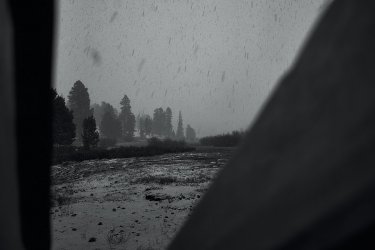
The next morning, all the hikers we had camped around had bailed out at the next junction. More snow was coming. We would have the trail all to ourselves for a couple days!

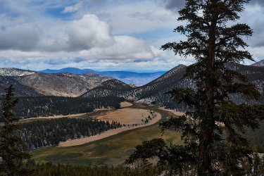
Yay more snow!
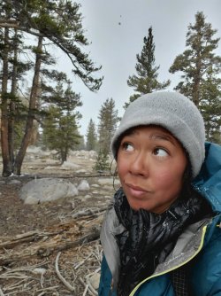
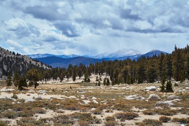
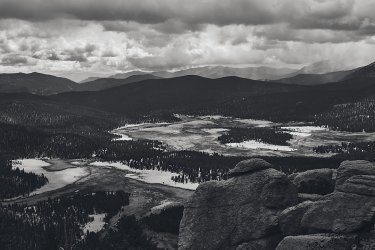
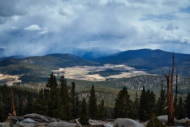
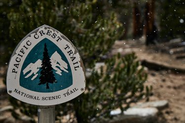
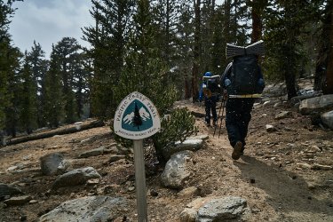
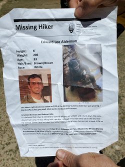
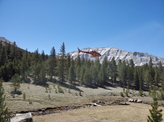
A ranger informed us of a missing person as we were heading up Mt. Whitney. Luckily, they would find him while we were summiting. He had broken his leg during the storm and managed to crawl into some brush next to a lake we passed by. Banged up, but alive.
I had never dreamed of summiting Mt. Whitney, "the highest mountain in the contiguous United States, with an elevation of 14,505 feet". It just wasn't a goal of mine. It is pretty common for PCT hikers to do it, even though it is ~15 non trail miles added to your hike. I figured I would go ahead, just because it was there and I was in good shape to make the attempt. If I was going to summit Mt. Whitney, then it at least had to be at sunrise or sunset. It seems a lot of hikers opt for sunrise, but it was going to time out that we would make it there at sunset. Plus, that is fitting for the Intoxicated Night Ascenders.
We hiked 6 PCT miles and then began the climb of Mt. Whitney.
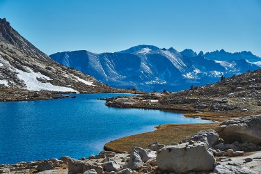
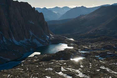
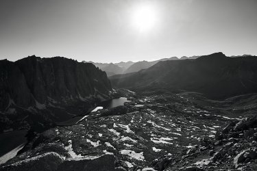
I didn't struggle on the ascent at all. I loved the sketchy snow crossings, and the views were, eh, fine. I don't know why, but I am not a fan of HUGE VAST EXPSANSES? Probably why I like macro so much. I could have made the summit before it got dark, but NightRyder was struggling. He had been patient with me when I hurt my legs, so I would be patient too, and our Tramily would summit together. Seeing the sunset from the side of Mt. Whitney was beautiful too.
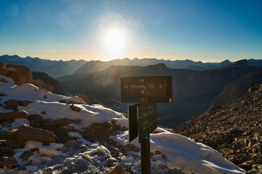
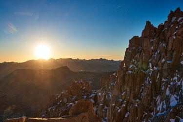
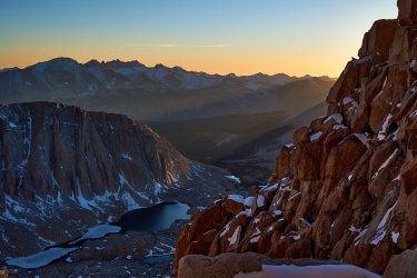
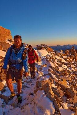
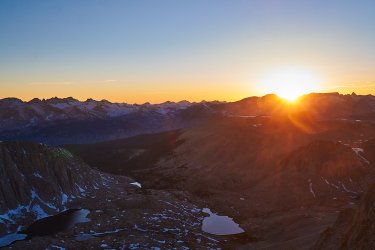
A peak through to the other side. Reminds me of Death Valley.
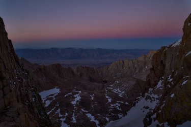
By the time we made it to the top, it was DARK. Wind chill was -5 F. We were all exhausted. We ran to the snow filled hut, that does not have a door, and tried to steer clear of all the yellow snow inside. We HAD to put on warmer gear and we forced ourselves to scarf down any readily available snacks before running back down the snow covered top, peak, summit? This was my first concern that my fingers were frost bitten. As soon as we dipped down out of the wind, I frantically searched for my Hot Hands and my down booties. My fingers were A'OK.
Not your typical summit photo, but hey, we did it and we did it together!
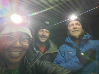
I struggled much more with the descent. By 2:30 AM, we were less than 2 miles from camp and I had been running on empty. I stumbled against a large boulder. I dry heaved, but couldn't take down any food or water. I walked, in what was very similar to a drunken stupor. I remember the boys got ahead of me and I walked to my tent in a trance like state and collapsed. I was finally so exhausted that I could sleep through the pain in my legs.
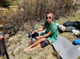
Doing some laundry in my bear canister.
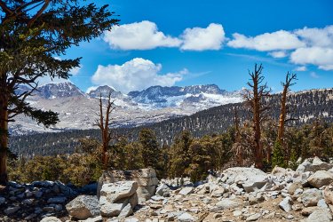
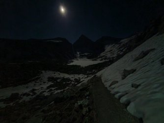
We decided to go ahead and summit Forester Pass at night too, because, eh why not? Every hiker we passed had something to say about it. There was almost no snow on the approach, it was all there waiting for us on the other side. There were definitely some spots where you could have slipped to your death, but I just love snow and had so much fun! It was beautiful descending with an endless sky of stars.
Approaching Forester Pass. It is the little snowy part directly in the middle.

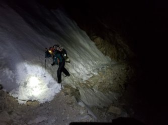
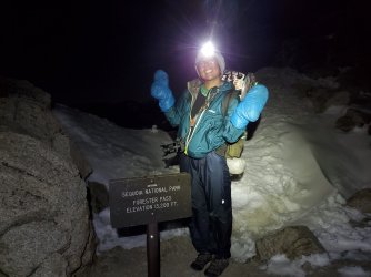
Bad cell phone photo, looking back at Forester once we were through the worst of the snow.
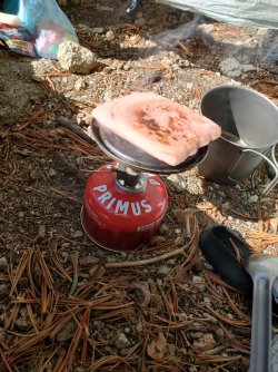
Lunch.
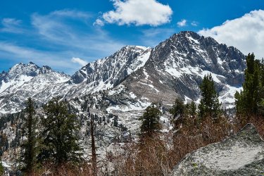
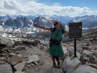
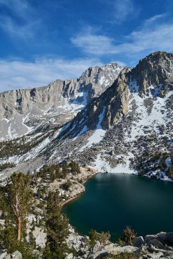
This is on our way to Kearsarge Pass, a 9 mile detour to get to a TH parking lot and get a hitch into town. One of my favorite views!
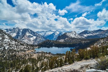
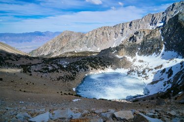
Heading down into civilization (Independence and Bishop).
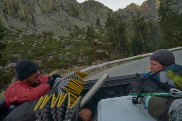
The boys had to ride in the back.
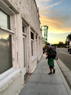
This would be one of my favorite motels/hotels the entire trail. And yes, as a fellow hiker explained to me "You, are like a different shade now!"
Miles: 565.4 - 789.1 (+ Mt. Whitney and Kearsarge/Onion Valley side trail)
Zero Days: 4
Heads up, this TR is going to be wordy.
About 25 miles after leaving Tehachapi, I was stepping over a littering of small downed twigs and branches. I heard a loud pop and felt it reverberate through my foot and up my right shin. I wouldn't bother to go to the doctor, so not sure what happened. I have torn a lot of tendons in both of my feet before, so the popping sound was very familiar. However, the pain that would follow and my inability to bend my knee or angle my foot without crying, was new. Wouldn't it have been smarter to go 25 miles back, instead of 60 miles forward? Yes, probably. But I hate repeating miles, I wouldn't go to a doctor anyways, and my determination to not let anything keep me from completing the trail was borderline madness.

Baby rattler.

Luckily, the next day, the trail was pretty flat. Any sort of incline on trail had me panting and crying. My Tramily and I had planned 20-25 miles every day and for some reason they were patient and didn't ditch me when I could only manage 16 miles the day after I hurt myself. By the end of the day my shin felt like it was going to shatter. Trying to get comfortable in the tent and sleep through the pain was impossible, so I spent my nights just waiting for the dawn and hoping to get closer to town.
Mile 600.


One of the reasons I had hoped for bigger miles was because it was getting hotter and this section was DRY. We were dependent on several water caches. Thank you trail angels! Even though I always showed up to the caches with water, it would have been much more uncomfortable without the caches.


Each day my leg hurt a little less, enough to allow me a couple hours of sleep. I could usually manage my first 15 miles of the day without any tears, but something about this injury did not like doing more than that. The rest of my mileage would bring about a tear for every few steps. I certainly didn't need to be wasting the water and salt!
The heat, the pain, and the lack of sleep saw me slipping into memories of tragedies and regret. My journey on trail, like so many, was one of necessity built off of trauma. Facing these demons, was fine, heck, it was desired. I would be damned if this silly physical pain ended what I set out to do. I simultaneously felt worried this injury would end my trip, while KNOWING that I would not let it. And so I just walked, a bundle of contradicting emotions, fear and confidence.
I hobbled into our last campground, only 0.8 miles from the road we would take to hitch into town the next morning. I skipped out on another trail magic tent and avoided a throng of other hikers. I was able to nod off being comforted by the fact that I had made it to town.
My dad came to visit me in Kernville and he brought my bear canister and ice axe.

The last thing I wanted was to take another zero in town, especially when I was so close to the end of the desert. My leg wanted rest though, and my Tramily was more than happy to take another break too. Since I don't take over the counter or prescription drugs, I just bought some wrap and tried to keep my ankle and foot iced at all times. It had been fat and swollen the entire stretch, but one night with ice and the swelling went down dramatically.

Next resupply was only 50 miles away, I packed more than I would need just in case my leg kept my mileage low.

We ate out at a fancy restaurant with an amazing view. I am a foodie.

Pack is ready for the Sierra Nevada.

It was getting easier to put on my sock and shoe! I still hobbled like a pirate with a peg leg, but the only real pain was when I walked downhill. Woohoo, I was getting better!...
I had stopped wearing my left knee brace for quite awhile by now. I figured my knee was stronger and I carried it because I had every intention of wearing it in the Sierras, JUST IN CASE. However, the steep switchbacks I encountered on Day 56 busted my knee. I tried putting the brace on after a few switchbacks, but it was too late. I couldn't bend my knee. Now both my legs were injured and I was walking like a pirate with 2 peg legs.
I cried AGAIN! I cried and hiked and felt such fury. I was enraged. "Wasn't I stronger yet?! Why aren't I hiking as fast as the other hikers? I am embarrassing myself!" I spent the day feeling sorry for myself, but I kept walking. I had a couple trail mantras, and literally one of them was "Just keep walking, Miya". It always helped.
I slept with both legs elevated and managed to rest. Lucky for me, it rained the next day, and that is always a huge morale booster!


Views were changing.

Found this guy in the water. Think it is Abedus indentatus. A male carrying the eggs on its back.

Mile 700 was a huge goal for me. I always felt that if anything would keep me from the Northern Terminus, it would be the desert. It would be the thing I despise so much, the sun. I knew if I could make it through the desert, then nothing would stop me and I WOULD make it to the end. (Funny, I hadn't even been close to experiencing exposure and heat like I would in Northern California). I won't get too sentimental and we don't need to argue over the validity of having spiritual moments on trail, but I feel very strongly that I had one. As I approached mile 700, it started to rain, and when I took the last few steps to those silly rocks, the sky opened up and poured. I dropped to the floor, awkwardly with my injuries, and cried once more. Rain has always been something extremely special to me. If I am in rain, I feel free and I feel safe.
I put on my rain gear, got some photos, and as soon as I walked away, the rain stopped. The sun peaked out, and I choose to believe my grandpa witnessed my accomplishment.

No one was there to clap for me at Kennedy Meadows South, thank goodness.
6 Day planned resupply, and I always carry an extra day or two worth of food just in case.

Here we go, into The Sierra Nevada! I knew it was going to be a low snow year, so I was pretty bummed about that. I was hopeful that snow would show up for me though, just like all the rain I got in the desert.


Oops, water freezes up here.

The fire attracted other PCT hikers who came to dry off their spirits and their gear. We did get an upset hiker, saying that fires are unsafe, even though we were under 10,000 feet and there were not any fire restrictions at the time, and we used an existing fire ring.

Peek a boo from my tent.

The next morning, all the hikers we had camped around had bailed out at the next junction. More snow was coming. We would have the trail all to ourselves for a couple days!


Yay more snow!


A ranger informed us of a missing person as we were heading up Mt. Whitney. Luckily, they would find him while we were summiting. He had broken his leg during the storm and managed to crawl into some brush next to a lake we passed by. Banged up, but alive.


I had never dreamed of summiting Mt. Whitney, "the highest mountain in the contiguous United States, with an elevation of 14,505 feet". It just wasn't a goal of mine. It is pretty common for PCT hikers to do it, even though it is ~15 non trail miles added to your hike. I figured I would go ahead, just because it was there and I was in good shape to make the attempt. If I was going to summit Mt. Whitney, then it at least had to be at sunrise or sunset. It seems a lot of hikers opt for sunrise, but it was going to time out that we would make it there at sunset. Plus, that is fitting for the Intoxicated Night Ascenders.
We hiked 6 PCT miles and then began the climb of Mt. Whitney.


I didn't struggle on the ascent at all. I loved the sketchy snow crossings, and the views were, eh, fine. I don't know why, but I am not a fan of HUGE VAST EXPSANSES? Probably why I like macro so much. I could have made the summit before it got dark, but NightRyder was struggling. He had been patient with me when I hurt my legs, so I would be patient too, and our Tramily would summit together. Seeing the sunset from the side of Mt. Whitney was beautiful too.


A peak through to the other side. Reminds me of Death Valley.

By the time we made it to the top, it was DARK. Wind chill was -5 F. We were all exhausted. We ran to the snow filled hut, that does not have a door, and tried to steer clear of all the yellow snow inside. We HAD to put on warmer gear and we forced ourselves to scarf down any readily available snacks before running back down the snow covered top, peak, summit? This was my first concern that my fingers were frost bitten. As soon as we dipped down out of the wind, I frantically searched for my Hot Hands and my down booties. My fingers were A'OK.
Not your typical summit photo, but hey, we did it and we did it together!

I struggled much more with the descent. By 2:30 AM, we were less than 2 miles from camp and I had been running on empty. I stumbled against a large boulder. I dry heaved, but couldn't take down any food or water. I walked, in what was very similar to a drunken stupor. I remember the boys got ahead of me and I walked to my tent in a trance like state and collapsed. I was finally so exhausted that I could sleep through the pain in my legs.
Doing some laundry in my bear canister.


We decided to go ahead and summit Forester Pass at night too, because, eh why not? Every hiker we passed had something to say about it. There was almost no snow on the approach, it was all there waiting for us on the other side. There were definitely some spots where you could have slipped to your death, but I just love snow and had so much fun! It was beautiful descending with an endless sky of stars.

Approaching Forester Pass. It is the little snowy part directly in the middle.


Bad cell phone photo, looking back at Forester once we were through the worst of the snow.

Lunch.


This is on our way to Kearsarge Pass, a 9 mile detour to get to a TH parking lot and get a hitch into town. One of my favorite views!


Heading down into civilization (Independence and Bishop).


The boys had to ride in the back.

This would be one of my favorite motels/hotels the entire trail. And yes, as a fellow hiker explained to me "You, are like a different shade now!"

Last edited:
