- Joined
- Feb 15, 2020
- Messages
- 643
With a little bit of luck I found myself with a long weekend available and a beautiful weather window - so I decided to get one more good mountain trip in before settling in for the winter. Still unsure where I'd be going, I made a Meet Up post here on BCP and was fortunate enough to have @Nethos express interest. We considered some other options (including one in Utah I'd still like to try), but the remarkably good weather window made it hard for me to pass up another trip in Wyoming.
I've had a version of this trip drawn up for years, but it never quite managed to hit the top of the list and I'm happy to have changed that finally. I had to cut it down a bit for the available time - and was maybe a bit overambitious anyway - but it was absolutely fantastic. The weather, scenery, and company were all pretty hard to beat - many thanks to @Nethos for accompanying me on this one.
FYI - a lot of the place names in this report are unofficial, but I stuck w/ the names that folks on BCP are most likely to be familiar.
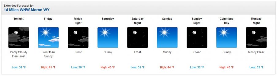
Our weather forecast going in... and thankfully it held! I am very grateful for such a wonderful opportunity.
Day 1: Indian Meadows TH to Ortenburger Lake
After meeting up w/ @Nethos in Denver, we drove up to Pinedale for the night Friday and were able to get on trail at Indian Meadows by mid-morning. The first few miles were fairly innocuous on-trail - the fall colors made even this section very beautiful. Eventually we would leave the trail to traverse Dry Ridge Mountain towards Ortenburger Lake - I really enjoyed this section. The crux of the day would be the final drop to Ortenburger Lake, but it would turn out to be pretty easy.
By the time we got to camp I was feeling uncharacteristically miserable and was very concerned about the remainder of the trip, particularly if I wasn't able to get down enough calories. Thankfully I was able to eat dinner (albeit a bit slowly) and felt better and better from here - by Day 3 I was back to about 100%.
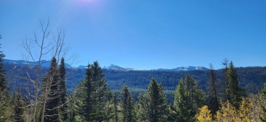
Sun shining at the trailhead.
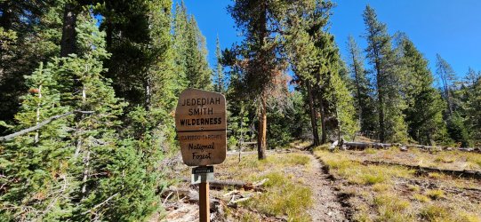
Hit the wilderness boundary about 1 mile in.
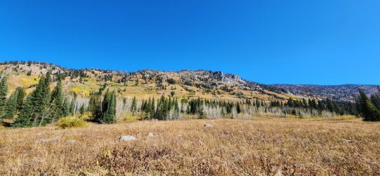
Spent a lot of time scanning hillsides for bears - was really hoping to see a grizzly (or dozen) after getting skunked in the Bob Marshall.
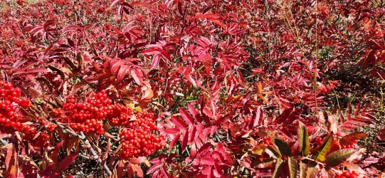
Love the bright reds on the Mountain Ash.
Once we got a bit higher, the moderate snowfall from earlier in the week came into play - fortunately it was fairly minimal and easy to traverse. Added an element to the scenery for sure.
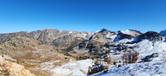
First good look at Grand Teton from Dry Ridge Mountain.
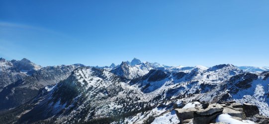
Looking back to the trailhead (and Idaho beyond).
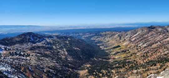
360° from Dry Ridge Mountain.
Looking towards our route.

Almost down to the lake.
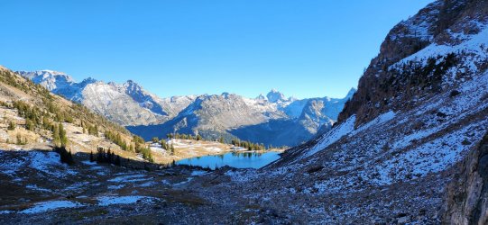
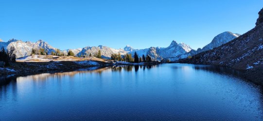
Looking across Ortenburger from the night's camp.
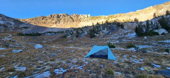
Home, sweet home.
Day 2: Ortenburger Lake to Talus Lake
Our second day was supposed to be our longest, but ended up being our shortest. Between me feeling pretty bad the night previous and the (overly?) ambitious route I had drawn up, it seemed prudent not to push too far. Our weather window through Monday was still solid, but we knew chances were very high that a multi-day snowstorm could be incoming as early as Tuesday. Regardless, our second day was phenomenal - and I was starting to feel considerably better. We started the morning by climbing over Doubtful Pass - an apt descriptor based on our view from Ortenburger Lake. Aside from a few sections of loose scree, it was actually quite straightforward.
I really wanted to get to Talus Lake, so we chose that as our end point for the day. After crossing North Moran Creek we had one more pass to cover before entering the Moose Creek Basin. This section required a fair bit of "micro" navigating through snowfields and boulder fields, but was quite beautiful and "wild". Talus Lake itself is incredibly sheltered and a pretty unique spot - I was happy we chose to camp there.
One last look at Ortenburger Lake.
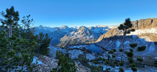
From the top of Doubtful Pass. Nice little inversion happening on the east side of the range.
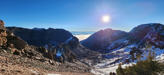
360° from Doubtful Pass.
@Nethos on his way down from the pass. The upper section here was probably the most exposed section of the trip - hard to know if the snow helped or hurt.
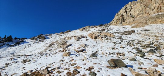
Looking towards our next pass - this one was much more straightforward.

Decent amount of snow on the north side though.
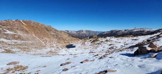
Are those the Absarokas I see?
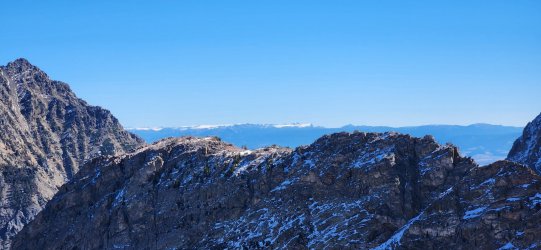
A few beautiful unnamed lakes up above Talus Lake.
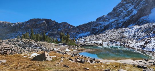
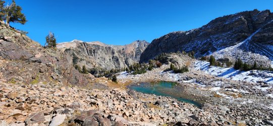
First look at Talus Lake.

Pretty amazing spot to set up camp.
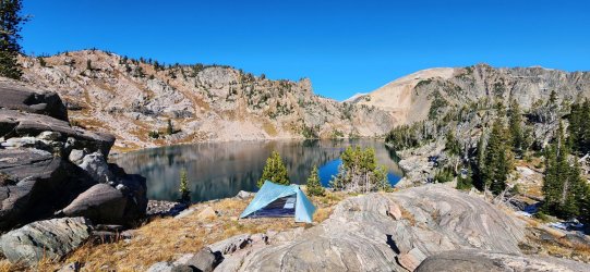
Unnamed lake below Talus Lake - near the top of North Snowshoe Canyon.
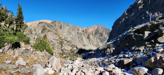
One more angle on the beautiful Talus Lake.

Rolling Thunder Mountain dominated our views to the south.
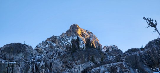
I sometimes wish I had any astrophotography skills at all - this was one of the best nights of stargazing I've had all year.
Day 3: Talus Lake to South Bitch Creek (and Glacier Peak)
Today was a lot of fun - I was feeling close to 100% and the route was stunning. Plus, we got to see two grizzlies - a sow and cub! I believe this was @Nethos' first backcountry grizzly experience, so I was very happy to share that with him. Glacier Peak is a beautiful - and fun - climb with phenomenal views. The first section of our route involved some backtracking, but we followed a slightly lower route that avoided the deeper snow and gave us a new look at the basin.
Reflections on Talus Lake as we depart.
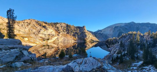
Looking towards Moose Basin. My original route had us going through the basin itself - which I shall return for, but we had great views of the entire drainage for much of the day.

More reflections at another unnamed lake.
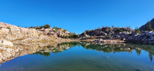
First look at the Glacier Lakes. Beautiful - if very rocky - area.
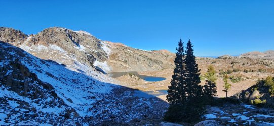
Glacier Peak above the upper Glacier Lake.
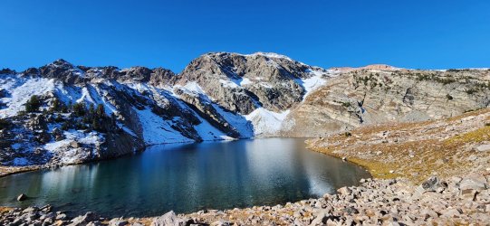
A look at the lower Glacier Lake as we make our way up to the Glacier Peak ridge.
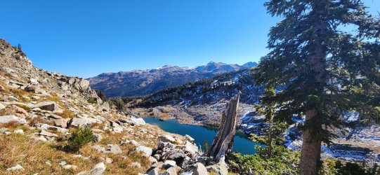
National Park boundary. We dropped our packs here for the ascent of Glacier Peak.

The summit ridge was quite rocky w/ a decent bit of boulder hopping. In other words, it was a lot of fun. Glacier Peak doesn't dominate the skyline like many other high points in the Tetons (that's a pretty high bar after all), but it is a very fun climb with plenty of visual payoff.
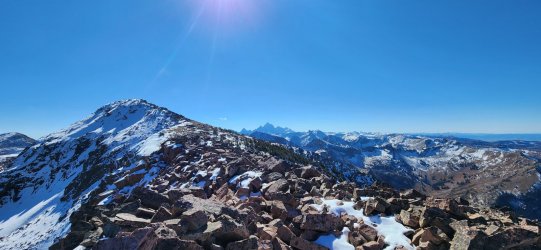
For posterity's sake.

360° from Glacier Peak.
Pretty much the first appearance of clouds on our trip...

On our descent down an unnamed drainage, it really started to feel like we were in someone else's home... specifically a grizzly's - and I was not disappointed. Near the top of the drainage I looked to a hillside above us and spotted a grizzly sow and cub. Based on the sizes, she seemed very healthy and the cub appeared to be a COY. Didn't get much in the way of pictures as they scampered calmly up and away from us.
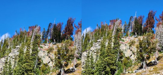
A few additional "Hey, bear!"s were uttered as we descended the canyon - it certainly felt like fertile grizzly land, but no more bears chose to show themselves. The sow and cub would be our only significant wildlife sightings of the trip - but I'm never disappointed when I see a grizzly.
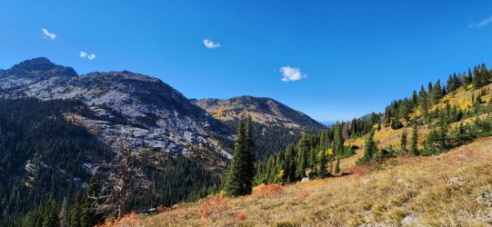
Camp for the night was an unassuming spot along the trail up to Dead Horse Pass - I didn't even think to snap a picture. But with a couple mountain streams babbling nearby and a flat spot to pitch my tent, I slept beautifully.
Day 4: South Bitch Creek to Indian Meadows TH
The final day would be fairly innocuous - just up and over Dead Horse Pass (on trail) and back to the truck. And fortunately the weather held off until we were well off trail - we'd originally thought we might be a bit wet/cold on our way out.
Another beautiful morning.
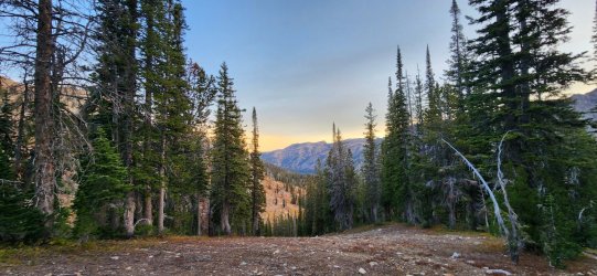
Easy-going morning - the fall colors seemed even more vibrant on our way out.

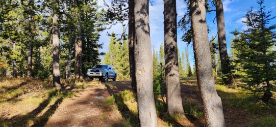
Always happy to find my truck in one piece at the trailhead. And love being the only one there even more.
Just fantastic to squeeze in an October trip when I thought my time in the mountains for 2023 might be about wrapped up. And even better to share it with a new friend in @Nethos! I suspect we will share more trips in the future - he was a wonderful and knowledgeable backcountry companion. Onward and upward!
I've had a version of this trip drawn up for years, but it never quite managed to hit the top of the list and I'm happy to have changed that finally. I had to cut it down a bit for the available time - and was maybe a bit overambitious anyway - but it was absolutely fantastic. The weather, scenery, and company were all pretty hard to beat - many thanks to @Nethos for accompanying me on this one.
FYI - a lot of the place names in this report are unofficial, but I stuck w/ the names that folks on BCP are most likely to be familiar.
Our weather forecast going in... and thankfully it held! I am very grateful for such a wonderful opportunity.
Day 1: Indian Meadows TH to Ortenburger Lake
After meeting up w/ @Nethos in Denver, we drove up to Pinedale for the night Friday and were able to get on trail at Indian Meadows by mid-morning. The first few miles were fairly innocuous on-trail - the fall colors made even this section very beautiful. Eventually we would leave the trail to traverse Dry Ridge Mountain towards Ortenburger Lake - I really enjoyed this section. The crux of the day would be the final drop to Ortenburger Lake, but it would turn out to be pretty easy.
By the time we got to camp I was feeling uncharacteristically miserable and was very concerned about the remainder of the trip, particularly if I wasn't able to get down enough calories. Thankfully I was able to eat dinner (albeit a bit slowly) and felt better and better from here - by Day 3 I was back to about 100%.
Sun shining at the trailhead.
Hit the wilderness boundary about 1 mile in.
Spent a lot of time scanning hillsides for bears - was really hoping to see a grizzly (or dozen) after getting skunked in the Bob Marshall.
Love the bright reds on the Mountain Ash.
Once we got a bit higher, the moderate snowfall from earlier in the week came into play - fortunately it was fairly minimal and easy to traverse. Added an element to the scenery for sure.
First good look at Grand Teton from Dry Ridge Mountain.
Looking back to the trailhead (and Idaho beyond).
360° from Dry Ridge Mountain.
Looking towards our route.
Almost down to the lake.
Looking across Ortenburger from the night's camp.
Home, sweet home.
Day 2: Ortenburger Lake to Talus Lake
Our second day was supposed to be our longest, but ended up being our shortest. Between me feeling pretty bad the night previous and the (overly?) ambitious route I had drawn up, it seemed prudent not to push too far. Our weather window through Monday was still solid, but we knew chances were very high that a multi-day snowstorm could be incoming as early as Tuesday. Regardless, our second day was phenomenal - and I was starting to feel considerably better. We started the morning by climbing over Doubtful Pass - an apt descriptor based on our view from Ortenburger Lake. Aside from a few sections of loose scree, it was actually quite straightforward.
I really wanted to get to Talus Lake, so we chose that as our end point for the day. After crossing North Moran Creek we had one more pass to cover before entering the Moose Creek Basin. This section required a fair bit of "micro" navigating through snowfields and boulder fields, but was quite beautiful and "wild". Talus Lake itself is incredibly sheltered and a pretty unique spot - I was happy we chose to camp there.
One last look at Ortenburger Lake.
From the top of Doubtful Pass. Nice little inversion happening on the east side of the range.
360° from Doubtful Pass.
@Nethos on his way down from the pass. The upper section here was probably the most exposed section of the trip - hard to know if the snow helped or hurt.
Looking towards our next pass - this one was much more straightforward.
Decent amount of snow on the north side though.
Are those the Absarokas I see?
A few beautiful unnamed lakes up above Talus Lake.
First look at Talus Lake.
Pretty amazing spot to set up camp.
Unnamed lake below Talus Lake - near the top of North Snowshoe Canyon.
One more angle on the beautiful Talus Lake.
Rolling Thunder Mountain dominated our views to the south.
I sometimes wish I had any astrophotography skills at all - this was one of the best nights of stargazing I've had all year.
Day 3: Talus Lake to South Bitch Creek (and Glacier Peak)
Today was a lot of fun - I was feeling close to 100% and the route was stunning. Plus, we got to see two grizzlies - a sow and cub! I believe this was @Nethos' first backcountry grizzly experience, so I was very happy to share that with him. Glacier Peak is a beautiful - and fun - climb with phenomenal views. The first section of our route involved some backtracking, but we followed a slightly lower route that avoided the deeper snow and gave us a new look at the basin.
Reflections on Talus Lake as we depart.
Looking towards Moose Basin. My original route had us going through the basin itself - which I shall return for, but we had great views of the entire drainage for much of the day.
More reflections at another unnamed lake.
First look at the Glacier Lakes. Beautiful - if very rocky - area.
Glacier Peak above the upper Glacier Lake.
A look at the lower Glacier Lake as we make our way up to the Glacier Peak ridge.
National Park boundary. We dropped our packs here for the ascent of Glacier Peak.
The summit ridge was quite rocky w/ a decent bit of boulder hopping. In other words, it was a lot of fun. Glacier Peak doesn't dominate the skyline like many other high points in the Tetons (that's a pretty high bar after all), but it is a very fun climb with plenty of visual payoff.
For posterity's sake.
360° from Glacier Peak.
Pretty much the first appearance of clouds on our trip...
On our descent down an unnamed drainage, it really started to feel like we were in someone else's home... specifically a grizzly's - and I was not disappointed. Near the top of the drainage I looked to a hillside above us and spotted a grizzly sow and cub. Based on the sizes, she seemed very healthy and the cub appeared to be a COY. Didn't get much in the way of pictures as they scampered calmly up and away from us.
A few additional "Hey, bear!"s were uttered as we descended the canyon - it certainly felt like fertile grizzly land, but no more bears chose to show themselves. The sow and cub would be our only significant wildlife sightings of the trip - but I'm never disappointed when I see a grizzly.
Camp for the night was an unassuming spot along the trail up to Dead Horse Pass - I didn't even think to snap a picture. But with a couple mountain streams babbling nearby and a flat spot to pitch my tent, I slept beautifully.
Day 4: South Bitch Creek to Indian Meadows TH
The final day would be fairly innocuous - just up and over Dead Horse Pass (on trail) and back to the truck. And fortunately the weather held off until we were well off trail - we'd originally thought we might be a bit wet/cold on our way out.
Another beautiful morning.
Easy-going morning - the fall colors seemed even more vibrant on our way out.
Always happy to find my truck in one piece at the trailhead. And love being the only one there even more.
Just fantastic to squeeze in an October trip when I thought my time in the mountains for 2023 might be about wrapped up. And even better to share it with a new friend in @Nethos! I suspect we will share more trips in the future - he was a wonderful and knowledgeable backcountry companion. Onward and upward!