NateGeesaman
Donkey
- Joined
- Jan 20, 2012
- Messages
- 272
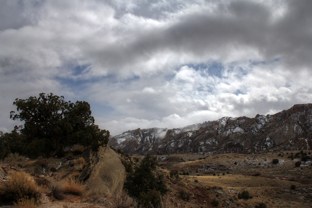
I recently had an awesome overnight trip to the beautiful Capitol Reef National Park with 2 dear old friends of mine. We packed up the car of Friday night with all necessities so we could take off early. We left SLC around 5:30 A.M. so we could arrive before 10:00 A.M. and have a full day to hike before we set up camp. We decided to revisit the Golden Throne trail and enjoy the nice sunny day on a hike with Southern Exposure. The drive to the trail head was as beautiful as ever.
Great Drive 1 C.R.N.P. by NateGeesaman, on Flickr
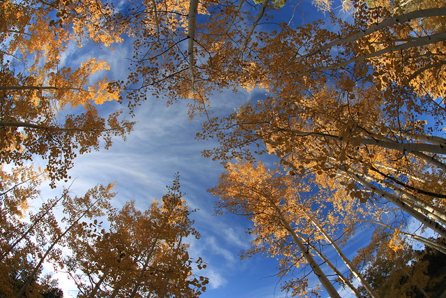
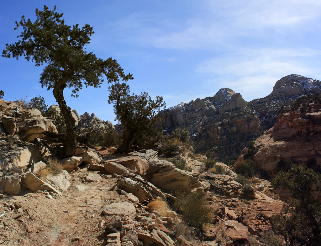
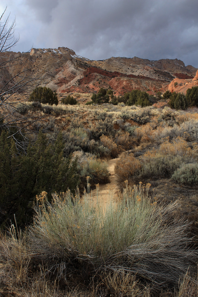
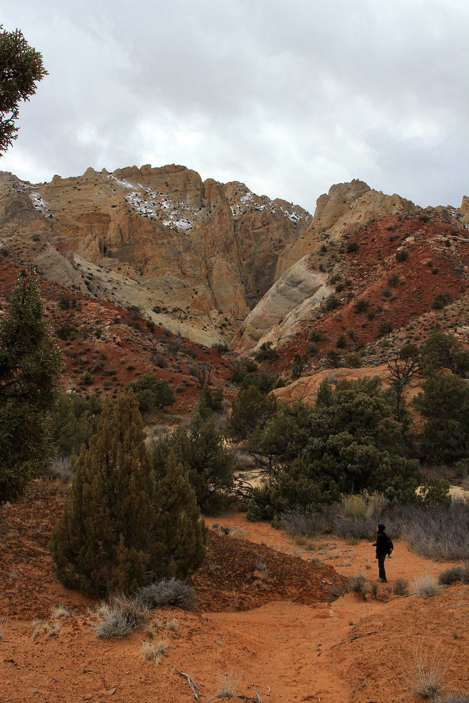
It was 50 degrees and beautiful on the hike.
Desert Garden by NateGeesaman, on Flickr
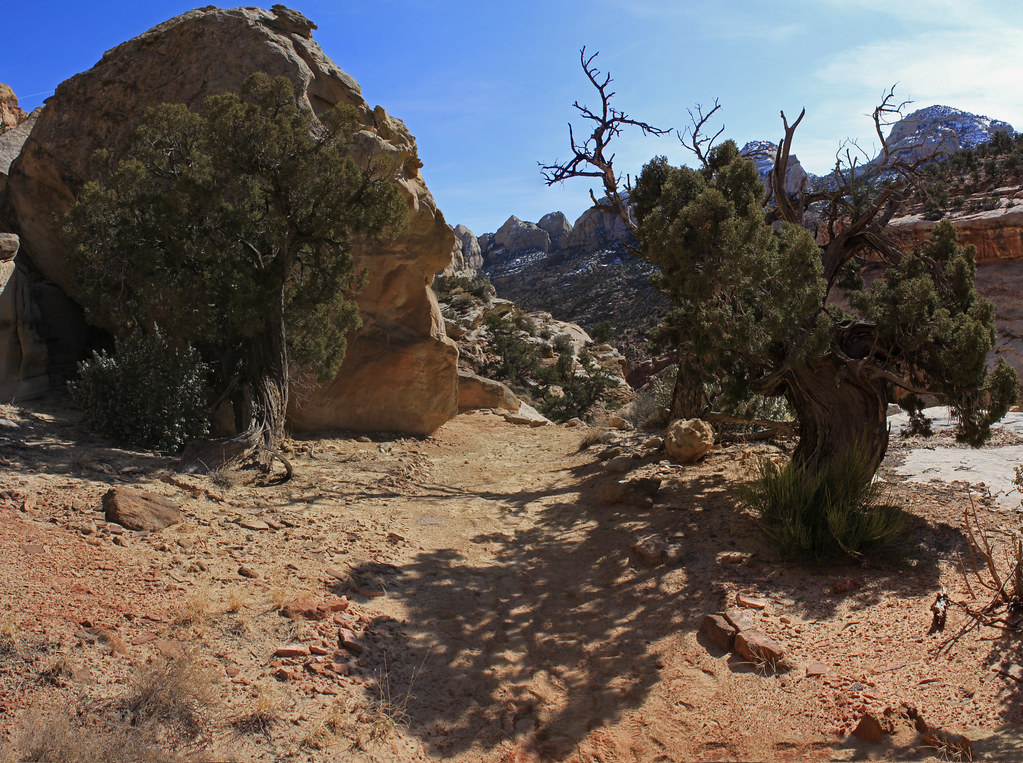
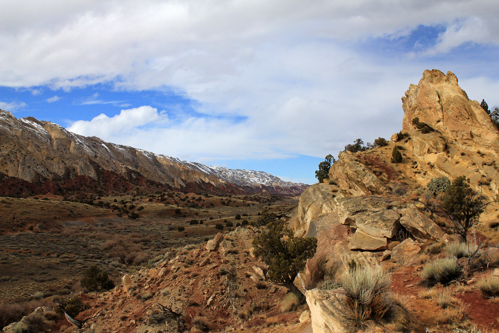
This is one of my favorite vistas along the hike and one I remember vividly from my first time on this hike 9 years ago.
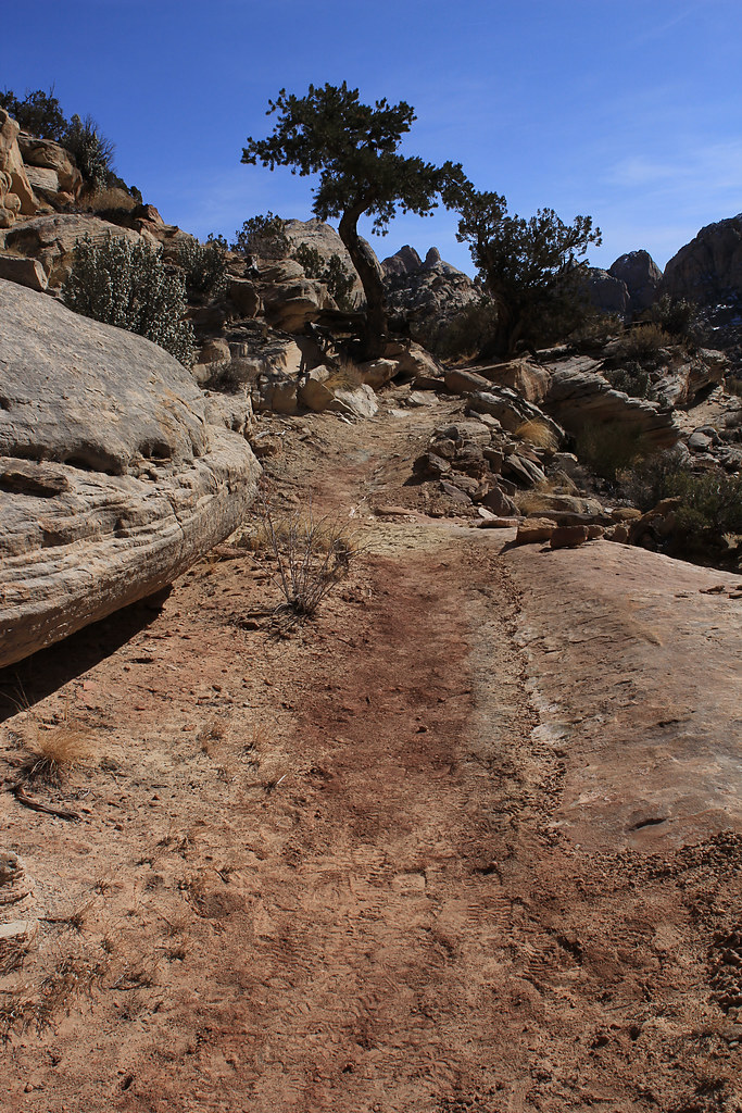
Beautiful Trail G>T> by NateGeesaman, on Flickr
Golden Throne Trail 3 by NateGeesaman, on Flickr
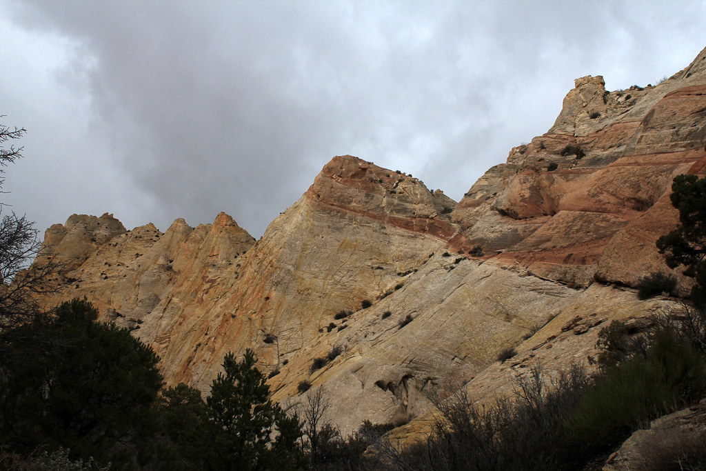
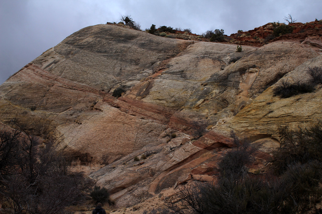
The beautifully unique rock formations of Capitol Reef:
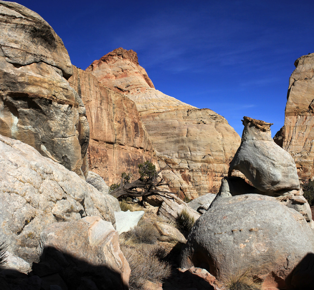
Capitol Reef Smattering by NateGeesaman, on Flickr
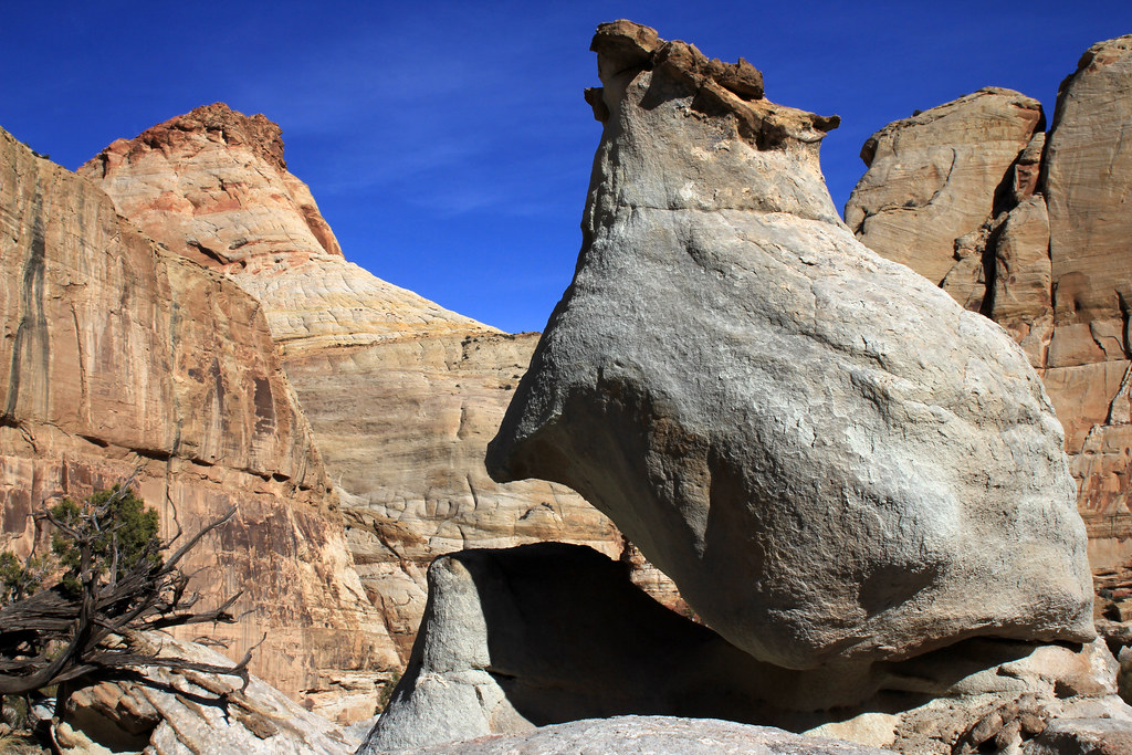
Capitol Smattering Close by NateGeesaman, on Flickr
The grandiose Golden Throne is a superb summit to this hike
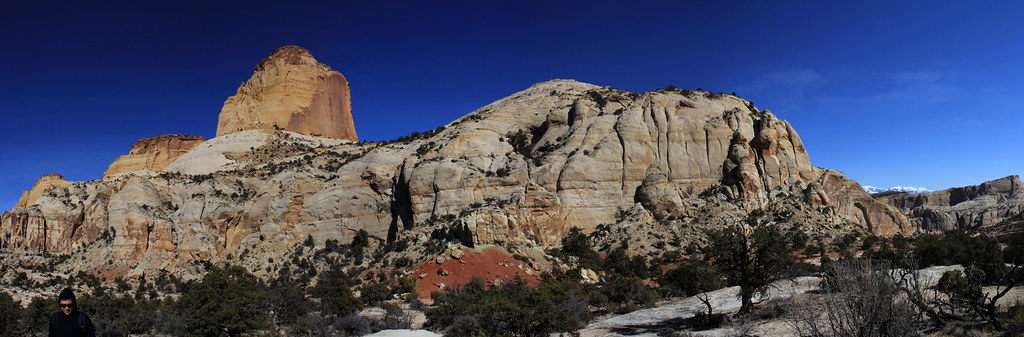
Golden Throne Pano by NateGeesaman, on Flickr
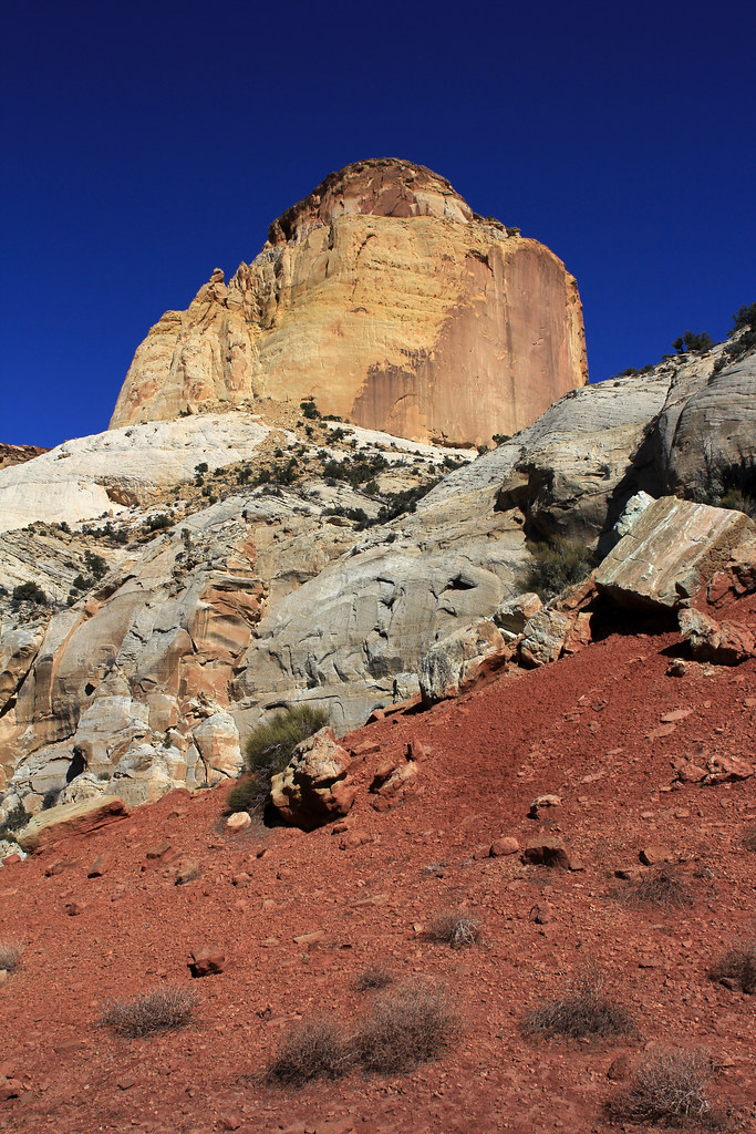
Golden Throne Red Skirt by NateGeesaman, on Flickr
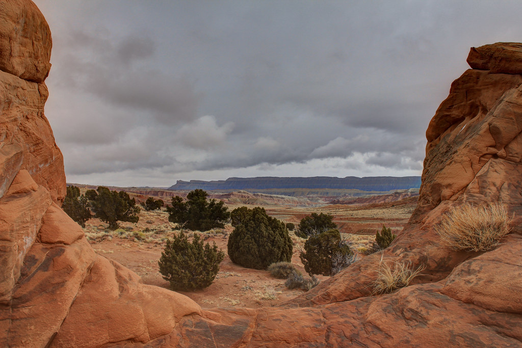
Then it was off to camp at my absolute favorite camping spot smack between the Henry Mountains and Capitol Reef.
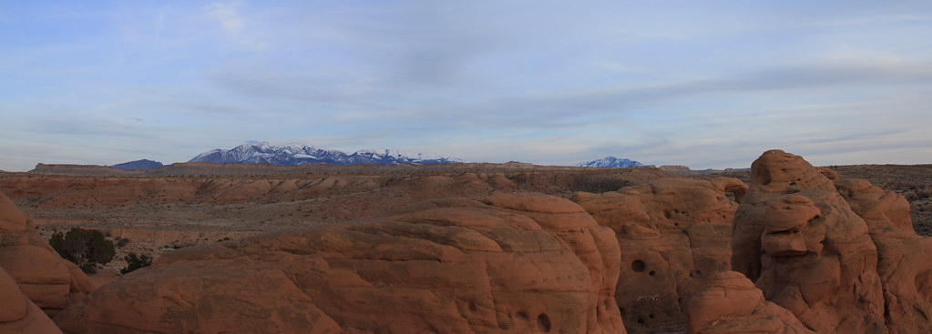
Henry's Pano by NateGeesaman, on Flickr
We only had a brief moment with a clear enough sky to do some star shots.
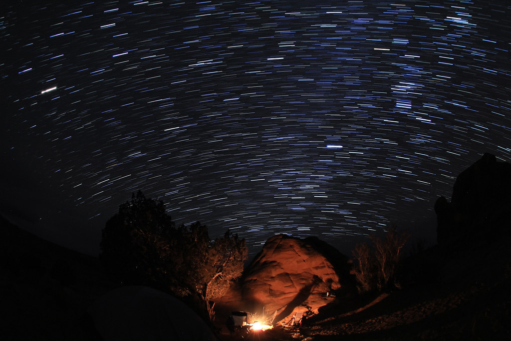
Capitol Reef Camp Trails by NateGeesaman, on Flickr
There was a 50% chance of snow forecast for the next day. We were hoping that the weather would be nice enough for us to embark on the Upper Muley Twist trail, but shortly after I awoke at first light it started to snow. It was snowing hard while we made breakfast, then we had about an hour break from the snow. We made a fire and decided to chill a while and see what the weather did before we headed down to the Muley Twist.
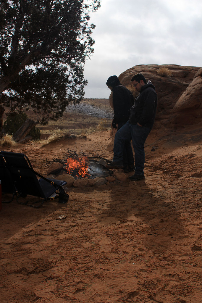
Morning fire by NateGeesaman, on Flickr
Camp site view by NateGeesaman, on Flickr
My new (used) car in this moment:
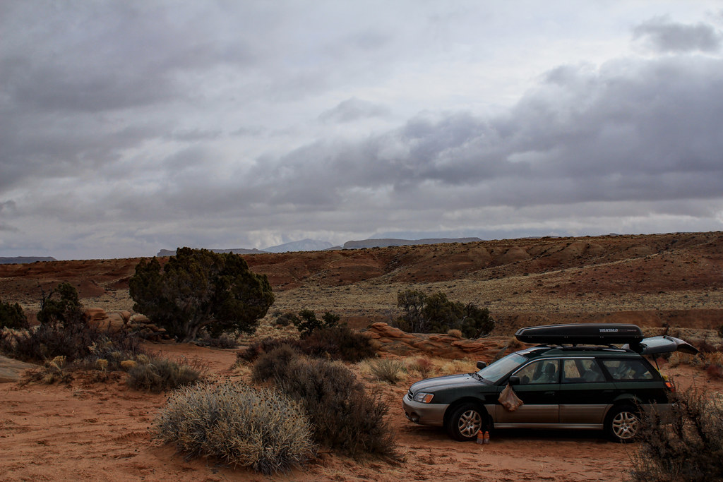
Subie trip #2 by NateGeesaman, on Flickr
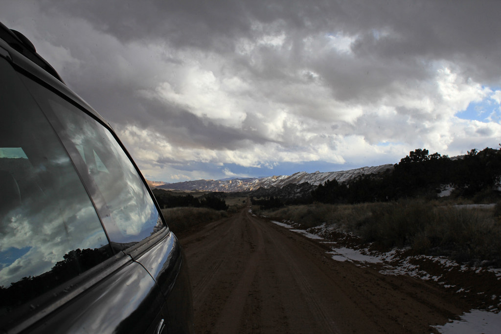
The lull in the storm was over and it started to snow again so we abandoned the warm fire and hoped in the car to get on the road before it got much worse.
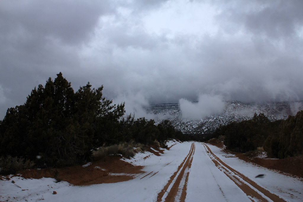
Great Drive 3 C.R.N.P. by NateGeesaman, on Flickr
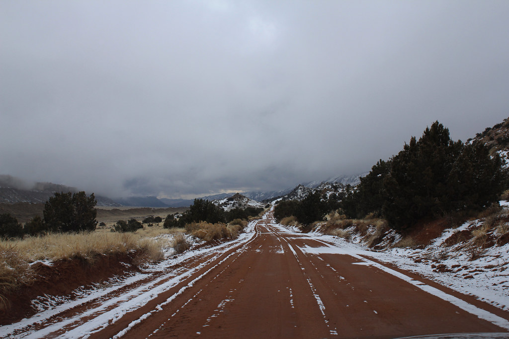
Great Drive 4 C.R.N.P. by NateGeesaman, on Flickr
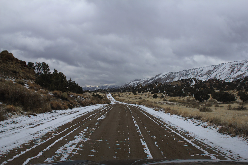
Great Drive 5 C.R.N.P. by NateGeesaman, on Flickr
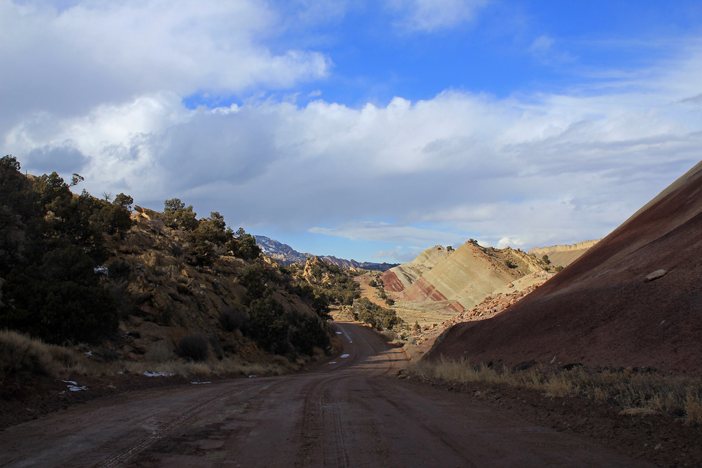
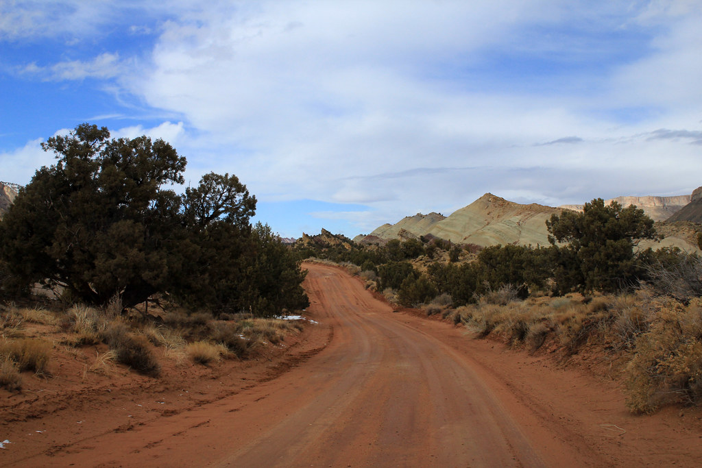
The Burr Trail through Capitol Reef is one of my favorite drives ever and I was sad to hear that plans are in motion to pave this amazing road. The dirt road just makes it feel like you are more connected with the land you are driving through and it makes for great photos.
Just off the road beautiful vistas like this are everywhere along both sides of the road.
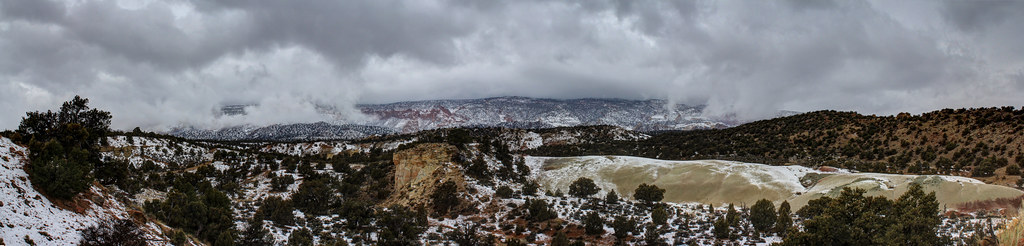
Green Pano by NateGeesaman, on Flickr
waterpocket pano 3 by NateGeesaman, on Flickr
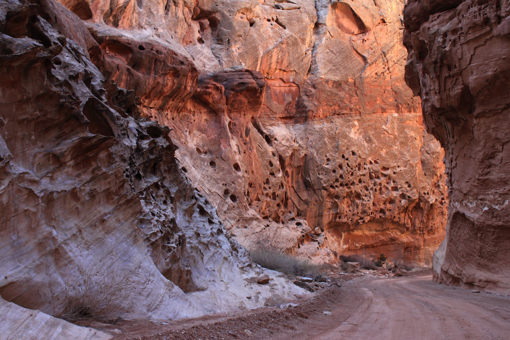
We decided to skip Muley's Twist on account of the nasty weather and headed to Surprise Canyon which is about a half mile south of the Burr Trail Switchbacks. We stopped shortly after the entrance to the slot canyon just in case of a flash flood, but still got to experience a good amount of it's beauty.
Surprise Canyon Trail by NateGeesaman, on Flickr
Surprise Canyon Entrance by NateGeesaman, on Flickr
Surprise Canyon Stripe by NateGeesaman, on Flickr
Surprise Colors by NateGeesaman, on Flickr
At the mouth of Surprise Canyon, when we were discussing whether or not we felt it was safe to continue, we heard a big thunderclap that settled the discussion. So we went back to the car and started the long slow slippery journey back North.
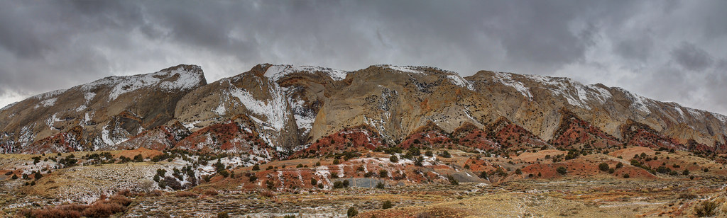
The skies were beginning to clear a bit by the time we got back on the road.
Waterpocket by NateGeesaman, on Flickr
Waterpocket Fold Clouds by NateGeesaman, on Flickr
Great Drive 8 C.R.N.P. by NateGeesaman, on Flickr
Great Drive 7 C.R.N.P. by NateGeesaman, on Flickr
Great Drive 6 C.R.N.P. by NateGeesaman, on Flickr
We could still see the storm edge bulging as it passed over the Waterpocket Fold:
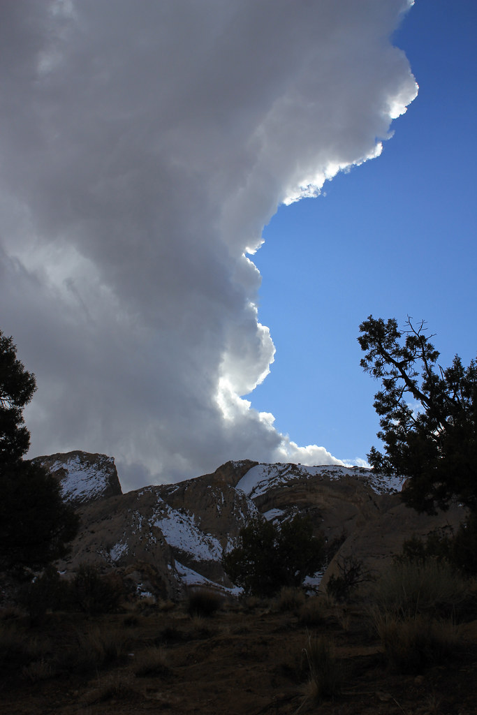
Storm Edge 2 by NateGeesaman, on Flickr
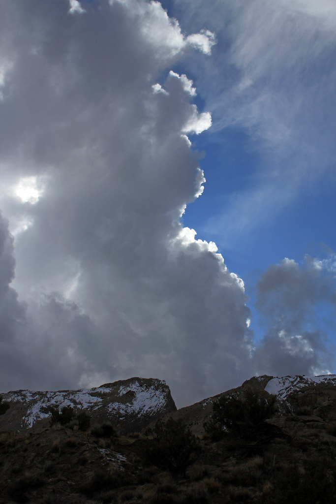
Storm Edge by NateGeesaman, on Flickr
We could see a big hunk of storm that had passed now dominating the Henry Mountains:
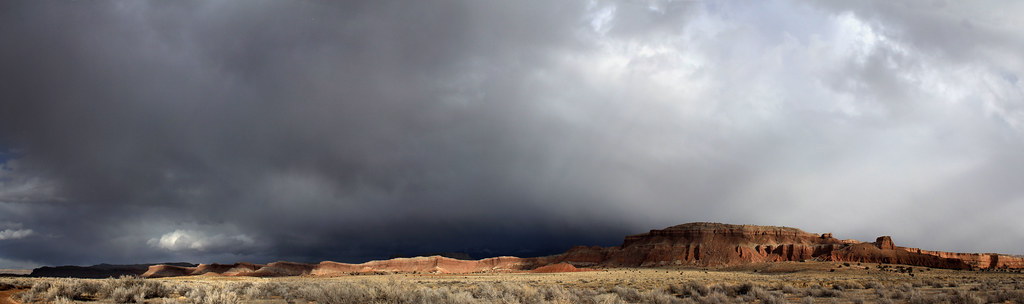
Waterpocket pano 5 by NateGeesaman, on Flickr
After a long day of driving, hiking, and shooting photos we made our way back to the visitors center and readied ourselves for the drive home and said goodbye to this magnificent place.
Here is me all dirty and tired in the visitors center parking lot showing Dan my WTF face (jokingly of course) while he was playing with my camera.
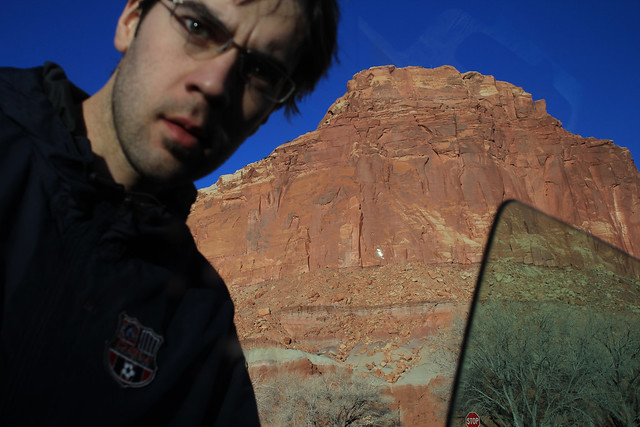
WTF Dan by NateGeesaman, on Flickr
Thanks for looking! Cheers.
Featured imaged for slideshow:

Great Drive 1 C.R.N.P. by NateGeesaman, on Flickr
It was 50 degrees and beautiful on the hike.
Desert Garden by NateGeesaman, on Flickr
This is one of my favorite vistas along the hike and one I remember vividly from my first time on this hike 9 years ago.
Beautiful Trail G>T> by NateGeesaman, on Flickr
Golden Throne Trail 3 by NateGeesaman, on Flickr
The beautifully unique rock formations of Capitol Reef:
Capitol Reef Smattering by NateGeesaman, on Flickr
Capitol Smattering Close by NateGeesaman, on Flickr
The grandiose Golden Throne is a superb summit to this hike
Golden Throne Pano by NateGeesaman, on Flickr
Golden Throne Red Skirt by NateGeesaman, on Flickr
Then it was off to camp at my absolute favorite camping spot smack between the Henry Mountains and Capitol Reef.
Henry's Pano by NateGeesaman, on Flickr
We only had a brief moment with a clear enough sky to do some star shots.
Capitol Reef Camp Trails by NateGeesaman, on Flickr
There was a 50% chance of snow forecast for the next day. We were hoping that the weather would be nice enough for us to embark on the Upper Muley Twist trail, but shortly after I awoke at first light it started to snow. It was snowing hard while we made breakfast, then we had about an hour break from the snow. We made a fire and decided to chill a while and see what the weather did before we headed down to the Muley Twist.
Morning fire by NateGeesaman, on Flickr
Camp site view by NateGeesaman, on Flickr
My new (used) car in this moment:
Subie trip #2 by NateGeesaman, on Flickr
The lull in the storm was over and it started to snow again so we abandoned the warm fire and hoped in the car to get on the road before it got much worse.
Great Drive 3 C.R.N.P. by NateGeesaman, on Flickr
Great Drive 4 C.R.N.P. by NateGeesaman, on Flickr
Great Drive 5 C.R.N.P. by NateGeesaman, on Flickr
The Burr Trail through Capitol Reef is one of my favorite drives ever and I was sad to hear that plans are in motion to pave this amazing road. The dirt road just makes it feel like you are more connected with the land you are driving through and it makes for great photos.
Just off the road beautiful vistas like this are everywhere along both sides of the road.
Green Pano by NateGeesaman, on Flickr
waterpocket pano 3 by NateGeesaman, on Flickr
We decided to skip Muley's Twist on account of the nasty weather and headed to Surprise Canyon which is about a half mile south of the Burr Trail Switchbacks. We stopped shortly after the entrance to the slot canyon just in case of a flash flood, but still got to experience a good amount of it's beauty.
Surprise Canyon Trail by NateGeesaman, on Flickr
Surprise Canyon Entrance by NateGeesaman, on Flickr
Surprise Canyon Stripe by NateGeesaman, on Flickr
Surprise Colors by NateGeesaman, on Flickr
At the mouth of Surprise Canyon, when we were discussing whether or not we felt it was safe to continue, we heard a big thunderclap that settled the discussion. So we went back to the car and started the long slow slippery journey back North.
The skies were beginning to clear a bit by the time we got back on the road.
Waterpocket by NateGeesaman, on Flickr
Waterpocket Fold Clouds by NateGeesaman, on Flickr
Great Drive 8 C.R.N.P. by NateGeesaman, on Flickr
Great Drive 7 C.R.N.P. by NateGeesaman, on Flickr
Great Drive 6 C.R.N.P. by NateGeesaman, on Flickr
We could still see the storm edge bulging as it passed over the Waterpocket Fold:
Storm Edge 2 by NateGeesaman, on Flickr
Storm Edge by NateGeesaman, on Flickr
We could see a big hunk of storm that had passed now dominating the Henry Mountains:
Waterpocket pano 5 by NateGeesaman, on Flickr
After a long day of driving, hiking, and shooting photos we made our way back to the visitors center and readied ourselves for the drive home and said goodbye to this magnificent place.
Here is me all dirty and tired in the visitors center parking lot showing Dan my WTF face (jokingly of course) while he was playing with my camera.
WTF Dan by NateGeesaman, on Flickr
Thanks for looking! Cheers.
Featured imaged for slideshow: