- Joined
- Jun 25, 2012
- Messages
- 4,429
https://mapsengine.google.com/map/edit?mid=zSNtNbul3FcI.kVjp6QgPlFhk
Summitted Hayden Peak for lunch yesterday and thought I would post a short report. Some of you have been asking about this and I've almost lured some of you to go up with me in the past.
This 12,479' peak is one of the most impressive looking in the High Uintas and one of my personal favorites. Being a mlie from the Mirror Lake Highway and non-technical helps a lot. It being only 90 minutes or so from the Salt Lake Valley helps as well. This is probably my sixth time on top.
The entire round trip from the car is just over four miles. The gully ascent/descent is steepish and loose but non-technical. Just watch your footing and be aware of people above or below you. I even waited out a beginner party of 3 in the gully for fear I would knock down loose rocks on them or they on me as I passed. The ridge run is pretty straight forward. You just route-find around alternating sides of the various gendarmes you encounter. The crux is a short chimney, about 10' high with no real exposure. I've even gotten two of dogs through the crux previously. They are mountain savvy canines, have harnesses and these harnesses made it easy to pass dogs up and down to my fellow climbers. I couldn't get my dog up the crux solo but I solo traveled this route this day.
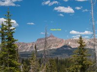
Here's the route imaged from the overlook near Bald Mountain Pass.
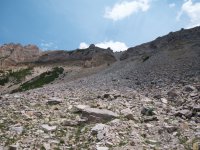
A view up the talus slope and the couloir. This is probably the exertion crux of the climb.
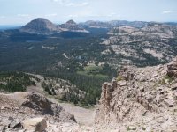
Looking down the couloir from its top. Already higher than Bald Mountain - the peak in the back/left of the frame. The trailhead where my car is parked, the Highline Trailhead, is visible right in the center.
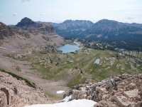
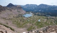
The view from the top of the couloir looking down to the east into Middle Basin and Ryder and McPheters lakes
Another view down the couloir.
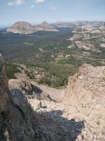
This view is standing on top of the couloir looking at the ridge run to the summit and the various difficulties getting there. The view direction is nearly due north.
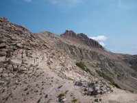
One of the many gendarmes guarding the ridge. Sometimes you go right over the top of them, sometimes to the right and this one a little left of center. There are faint paths you can follow or you can just follow your nose.
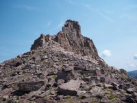
Ciimbing to the right of the final obstacle ascending to the crux chimney.
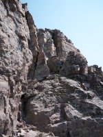
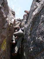
The crux chimney. Not too hard. The crux is probably 10 feet high and there are good handholds in the back of it. Be careful to test them for looseness and pull only down, not out, on them.
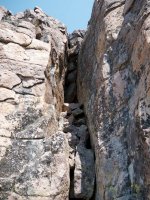
Looking back at the ridge I traversed from the couloir to the final gendarme and crux. It looks more devious and difficult than it is. That's part of what makes it great!
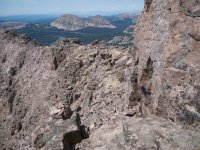
Success. No problem with afternoon bloomers this day.
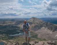
Some new friends I met on top. Wyomins.
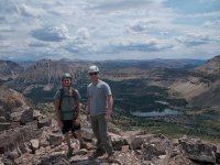
A view of the Wyomins descending the crux to give you a sense of perspective. I am nearly at the bottom in a safe spot in the chimney. Not too tall and not too hard. Again, no real exposure which drops the fear factor WAY down.
So a great day on a great peak. This is called a walk-up by a climber or mountaineer. For everyone else it might be a bit spicy but if you pay attention and play things safe it is well within the capabilities of any adventurous mountain traveler. This is truly an alpine treat!
GPS data:
https://mapsengine.google.com/map/edit?mid=zSNtNbul3FcI.kVjp6QgPlFhk
track.kml
Featured image for home page:
Summitted Hayden Peak for lunch yesterday and thought I would post a short report. Some of you have been asking about this and I've almost lured some of you to go up with me in the past.
This 12,479' peak is one of the most impressive looking in the High Uintas and one of my personal favorites. Being a mlie from the Mirror Lake Highway and non-technical helps a lot. It being only 90 minutes or so from the Salt Lake Valley helps as well. This is probably my sixth time on top.
The entire round trip from the car is just over four miles. The gully ascent/descent is steepish and loose but non-technical. Just watch your footing and be aware of people above or below you. I even waited out a beginner party of 3 in the gully for fear I would knock down loose rocks on them or they on me as I passed. The ridge run is pretty straight forward. You just route-find around alternating sides of the various gendarmes you encounter. The crux is a short chimney, about 10' high with no real exposure. I've even gotten two of dogs through the crux previously. They are mountain savvy canines, have harnesses and these harnesses made it easy to pass dogs up and down to my fellow climbers. I couldn't get my dog up the crux solo but I solo traveled this route this day.
Here's the route imaged from the overlook near Bald Mountain Pass.

A view up the talus slope and the couloir. This is probably the exertion crux of the climb.

Looking down the couloir from its top. Already higher than Bald Mountain - the peak in the back/left of the frame. The trailhead where my car is parked, the Highline Trailhead, is visible right in the center.

The view from the top of the couloir looking down to the east into Middle Basin and Ryder and McPheters lakes

Another view down the couloir.

This view is standing on top of the couloir looking at the ridge run to the summit and the various difficulties getting there. The view direction is nearly due north.

One of the many gendarmes guarding the ridge. Sometimes you go right over the top of them, sometimes to the right and this one a little left of center. There are faint paths you can follow or you can just follow your nose.

Ciimbing to the right of the final obstacle ascending to the crux chimney.

The crux chimney. Not too hard. The crux is probably 10 feet high and there are good handholds in the back of it. Be careful to test them for looseness and pull only down, not out, on them.

Looking back at the ridge I traversed from the couloir to the final gendarme and crux. It looks more devious and difficult than it is. That's part of what makes it great!

Success. No problem with afternoon bloomers this day.

Some new friends I met on top. Wyomins.

A view of the Wyomins descending the crux to give you a sense of perspective. I am nearly at the bottom in a safe spot in the chimney. Not too tall and not too hard. Again, no real exposure which drops the fear factor WAY down.

So a great day on a great peak. This is called a walk-up by a climber or mountaineer. For everyone else it might be a bit spicy but if you pay attention and play things safe it is well within the capabilities of any adventurous mountain traveler. This is truly an alpine treat!
GPS data:
https://mapsengine.google.com/map/edit?mid=zSNtNbul3FcI.kVjp6QgPlFhk
track.kml
Featured image for home page:

Last edited:
