IntrepidXJ
ADVENTR
- Joined
- Jan 17, 2012
- Messages
- 3,487
Mesa County High Point
Thursday, September 4, 2014
Since I had the day off from work I decided to go on a short hike close to home today. While I doubt I'll ever try to complete all the county high points in Colorado, I thought it might be nice to at least climb the highest peak in Mesa County where I reside (and maybe a few of the surrounding counties, eventually). After a little research I found that Leon Peak on the Grand Mesa is the highest point in Mesa County at 11,236 feet and that it was a pretty short hike without too much elevation gain from a nearby campground. It would be a perfect hike to complete in a couple of hours this morning.
I woke up early and left my house well before sunrise to drive up onto the Grand Mesa. It was nice to watch the sun come up as I drove and there were some nice clouds in the sky reflecting off the many lakes and reservoirs that I passed along the way.
Nice clouds above a small lake along the Grand Mesa Scenic and Historic Byway.
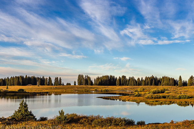
Roadside Reservoir by IntrepidXJ, on Flickr
As I drove along the highway past the Crag Crest, I spotted this patch of aspen trees growing out of the boulders that were starting to turn yellow already. Fall colors are almost here!
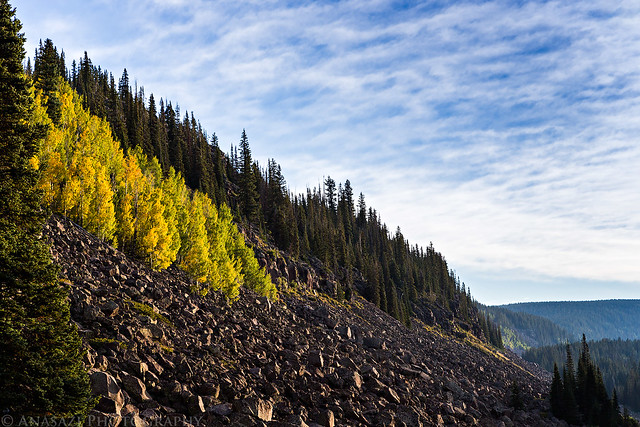
Patch of Color by IntrepidXJ, on Flickr
After turning off the highway at the Visitor's Center, I started following a road I had never driven before into a new area of the Grand Mesa for me. I enjoyed seeing a new part of the Mesa as I drove to the trailhead and realized that I really need to spend more time exploring the Grand Mesa since it's so close to home. The early morning light, clouds and reflections on the calm water of the many lakes I passed were very nice.
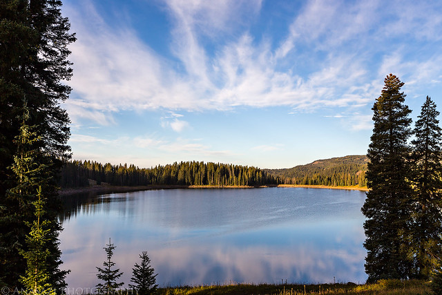
Framed Reflection by IntrepidXJ, on Flickr
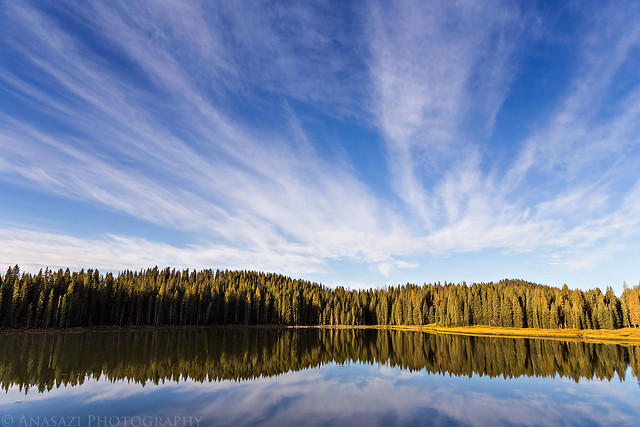
Grand Mesa Reflection by IntrepidXJ, on Flickr
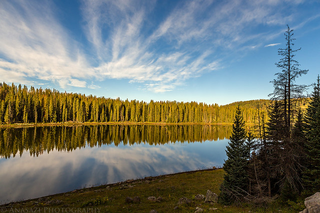
Eggleston Lake by IntrepidXJ, on Flickr
After reaching the Weir and Johnson campground, I parked near the reservoir to start my hike to Leon Peak.
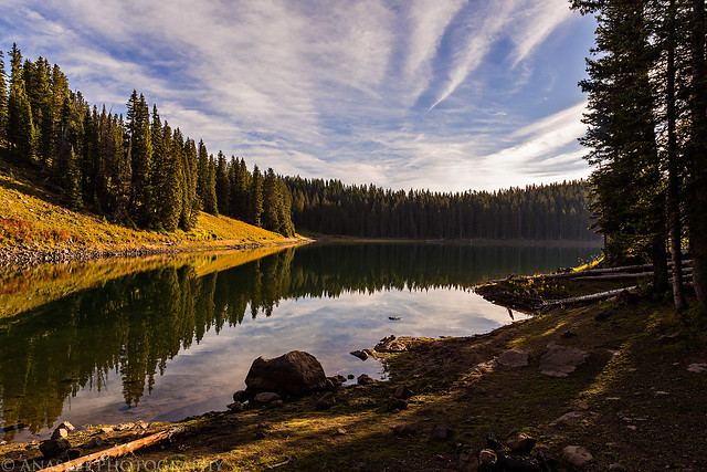
Weir and Johnson Reservoir by IntrepidXJ, on Flickr
I started out by following the Leon Lake trail over the outlet of the reservoir and then followed the fork in the trail that was signed for Sissy Lake.
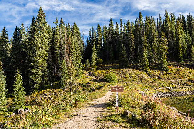
Leon Lake Trail by IntrepidXJ, on Flickr
View of the Sackett Reservoir on the other side of the Weir and Johnson Reservoir.
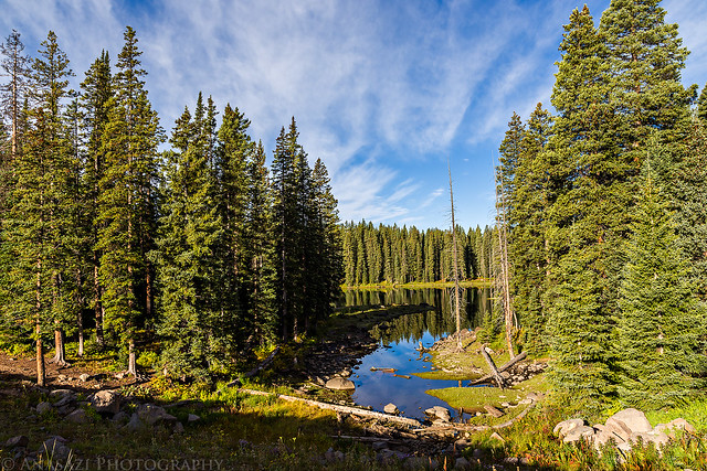
Sackett Reservoir by IntrepidXJ, on Flickr
When I reached Sissy Lake the trail pretty much ended. I was expecting this since it's not a very popular hike. I continued around the lake and climbed up a short distance to the ridge that would take me to Leon Peak. From there I followed the ridge the rest of the way. At first, the hiking along the ridge was easy, but it soon turned more difficult when the ridge turned into a jumble of large volcanic boulders. There was no trail, so I had to pick my way across the large moving boulders. While not very difficult, it did slow me down for the rest of the hike to the summit.
Following the ridge into the large boulder-field.
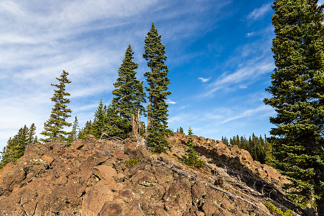
Volcanic Boulders by IntrepidXJ, on Flickr
The last half mile (at least!) to the summit looked like this.
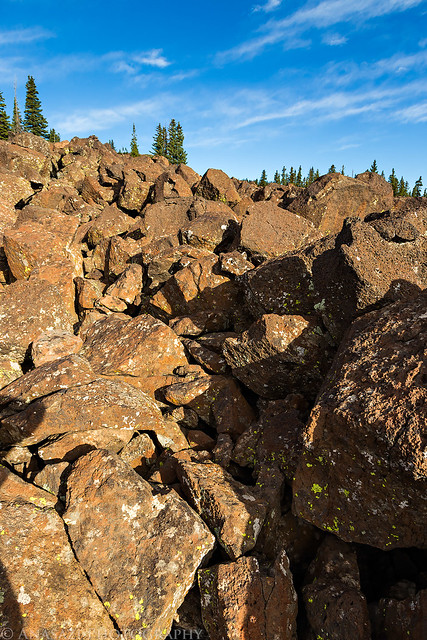
Jumble by IntrepidXJ, on Flickr
Nothing but large boulders to hike across. While not above tree line here, the boulder-field prevents many from growing in this area.
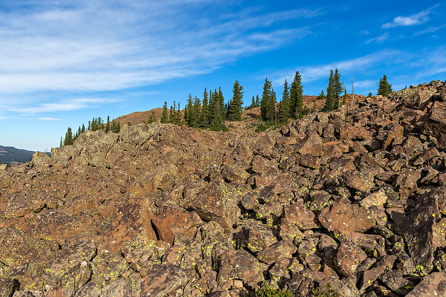
Ridge Hike by IntrepidXJ, on Flickr
There were a few trees that managed to take hold up here, though.
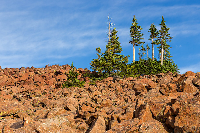
Rocks & Trees by IntrepidXJ, on Flickr
Finally, the summit of Leon Peak comes into view.
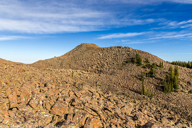
Leon Peak by IntrepidXJ, on Flickr
On top of Leon Peak is this old fire lookout that was built in the early 1900's. It's pretty amazing that it's still standing after all that time in such an inhospitable location.
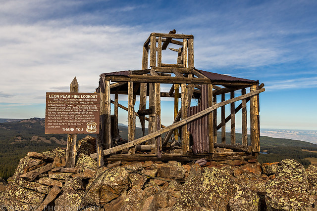
Leon Peak Fire Lookout by IntrepidXJ, on Flickr
"Leon Peak Fire Lookout
Built by Clay Withersteen in 1911 or 1912
Lookout guards were stationed at the Leon Peak Fire Lookout only through the summer of 1915- constant lightning strikes forced abandonment. The excellent mortise and tenon log construction of the frame has withstood furious winds for decades but it may not bear your weight. For the sake of this historic structure and your safety pleased don't climb on it."
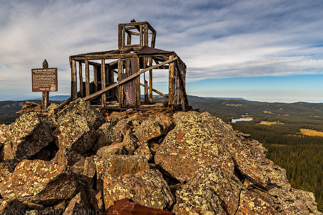
Top by IntrepidXJ, on Flickr
View from the top of Leon Peak.
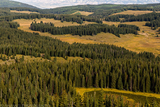
Grand Mesa View by IntrepidXJ, on Flickr
I had to take a shot of the benchmark located near the fire lookout.
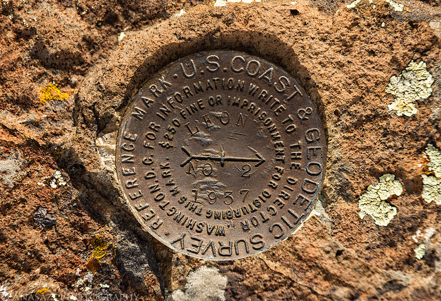
Leon Peak Benchmark by IntrepidXJ, on Flickr
One last view through the old structure before starting my hike back down.
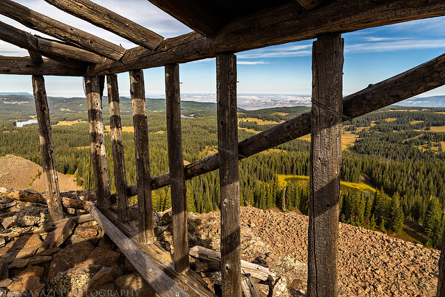
View From the Inside by IntrepidXJ, on Flickr
I spent a little time relaxing on the summit before starting my hike back down. The weather was comfortable and calm while I was up there, but I could tell that a storm was moving in. By the time I left the summit the sky had become overcast with clouds, so I didn't take anymore photos on the way back. The boulders slowed me down on the way down again, but I still made pretty good time back to my Jeep and the drive home was uneventful. By the time I made it home around noon, a storm had moved in that brought some very strong winds and heavy rain, so I'm glad I had started early.
>> Leon Peak Photo Gallery
>> The Original Trip Report on ADVENTR.CO
Featured image for home page:
Thursday, September 4, 2014
Since I had the day off from work I decided to go on a short hike close to home today. While I doubt I'll ever try to complete all the county high points in Colorado, I thought it might be nice to at least climb the highest peak in Mesa County where I reside (and maybe a few of the surrounding counties, eventually). After a little research I found that Leon Peak on the Grand Mesa is the highest point in Mesa County at 11,236 feet and that it was a pretty short hike without too much elevation gain from a nearby campground. It would be a perfect hike to complete in a couple of hours this morning.
I woke up early and left my house well before sunrise to drive up onto the Grand Mesa. It was nice to watch the sun come up as I drove and there were some nice clouds in the sky reflecting off the many lakes and reservoirs that I passed along the way.
Nice clouds above a small lake along the Grand Mesa Scenic and Historic Byway.

Roadside Reservoir by IntrepidXJ, on Flickr
As I drove along the highway past the Crag Crest, I spotted this patch of aspen trees growing out of the boulders that were starting to turn yellow already. Fall colors are almost here!

Patch of Color by IntrepidXJ, on Flickr
After turning off the highway at the Visitor's Center, I started following a road I had never driven before into a new area of the Grand Mesa for me. I enjoyed seeing a new part of the Mesa as I drove to the trailhead and realized that I really need to spend more time exploring the Grand Mesa since it's so close to home. The early morning light, clouds and reflections on the calm water of the many lakes I passed were very nice.

Framed Reflection by IntrepidXJ, on Flickr

Grand Mesa Reflection by IntrepidXJ, on Flickr

Eggleston Lake by IntrepidXJ, on Flickr
After reaching the Weir and Johnson campground, I parked near the reservoir to start my hike to Leon Peak.

Weir and Johnson Reservoir by IntrepidXJ, on Flickr
I started out by following the Leon Lake trail over the outlet of the reservoir and then followed the fork in the trail that was signed for Sissy Lake.

Leon Lake Trail by IntrepidXJ, on Flickr
View of the Sackett Reservoir on the other side of the Weir and Johnson Reservoir.

Sackett Reservoir by IntrepidXJ, on Flickr
When I reached Sissy Lake the trail pretty much ended. I was expecting this since it's not a very popular hike. I continued around the lake and climbed up a short distance to the ridge that would take me to Leon Peak. From there I followed the ridge the rest of the way. At first, the hiking along the ridge was easy, but it soon turned more difficult when the ridge turned into a jumble of large volcanic boulders. There was no trail, so I had to pick my way across the large moving boulders. While not very difficult, it did slow me down for the rest of the hike to the summit.
Following the ridge into the large boulder-field.

Volcanic Boulders by IntrepidXJ, on Flickr
The last half mile (at least!) to the summit looked like this.

Jumble by IntrepidXJ, on Flickr
Nothing but large boulders to hike across. While not above tree line here, the boulder-field prevents many from growing in this area.

Ridge Hike by IntrepidXJ, on Flickr
There were a few trees that managed to take hold up here, though.

Rocks & Trees by IntrepidXJ, on Flickr
Finally, the summit of Leon Peak comes into view.

Leon Peak by IntrepidXJ, on Flickr
On top of Leon Peak is this old fire lookout that was built in the early 1900's. It's pretty amazing that it's still standing after all that time in such an inhospitable location.

Leon Peak Fire Lookout by IntrepidXJ, on Flickr
"Leon Peak Fire Lookout
Built by Clay Withersteen in 1911 or 1912
Lookout guards were stationed at the Leon Peak Fire Lookout only through the summer of 1915- constant lightning strikes forced abandonment. The excellent mortise and tenon log construction of the frame has withstood furious winds for decades but it may not bear your weight. For the sake of this historic structure and your safety pleased don't climb on it."

Top by IntrepidXJ, on Flickr
View from the top of Leon Peak.

Grand Mesa View by IntrepidXJ, on Flickr
I had to take a shot of the benchmark located near the fire lookout.

Leon Peak Benchmark by IntrepidXJ, on Flickr
One last view through the old structure before starting my hike back down.

View From the Inside by IntrepidXJ, on Flickr
I spent a little time relaxing on the summit before starting my hike back down. The weather was comfortable and calm while I was up there, but I could tell that a storm was moving in. By the time I left the summit the sky had become overcast with clouds, so I didn't take anymore photos on the way back. The boulders slowed me down on the way down again, but I still made pretty good time back to my Jeep and the drive home was uneventful. By the time I made it home around noon, a storm had moved in that brought some very strong winds and heavy rain, so I'm glad I had started early.
>> Leon Peak Photo Gallery
>> The Original Trip Report on ADVENTR.CO
Featured image for home page:

Last edited:
